Chelmondiston

Civil Parish in Suffolk Babergh

England

Chelmondiston

Power lines crossing above Lings Lane They look like 11 kV and 33 kV lines.
Power lines crossing above Lings Lane Credit: Robin Webster

Chelmondiston is a civil parish located in the county of Suffolk, England. Situated on the Shotley Peninsula, it lies on the eastern bank of the River Orwell and is approximately 8 miles southeast of the town of Ipswich. The parish covers an area of around 8 square miles and is bordered by the parishes of Shotley, Erwarton, Woolverstone, and Harkstead.

Chelmondiston has a rich history, with evidence of human settlement dating back to the Bronze Age. The village itself is known for its picturesque and traditional English charm, with a mix of historic buildings and residential properties. The heart of the village features a beautiful church, St. Andrew's, which dates back to the 14th century.

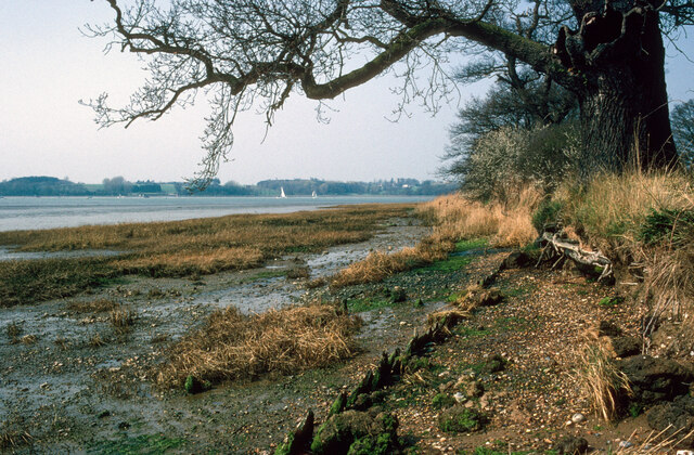
The parish boasts stunning natural landscapes, including areas of outstanding beauty along the River Orwell and the surrounding countryside. It is a popular destination for nature enthusiasts, offering opportunities for walking, cycling, and birdwatching. The nearby Orwell Estuary provides a haven for various bird species and is designated as a Site of Special Scientific Interest (SSSI).

Chelmondiston is a close-knit community with a population of around 1,300 residents. It offers a range of amenities, including a primary school, village hall, local shops, and a public house. The parish also benefits from good transport links, with regular bus services connecting it to nearby towns and villages.

Overall, Chelmondiston is a charming and scenic civil parish in Suffolk, offering a peaceful and idyllic setting for residents and visitors alike.

If you have any feedback on the listing, please let us know in the comments section below.

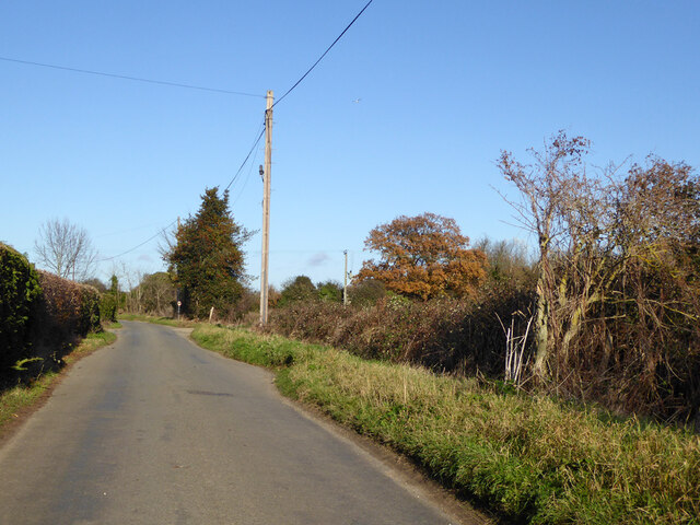
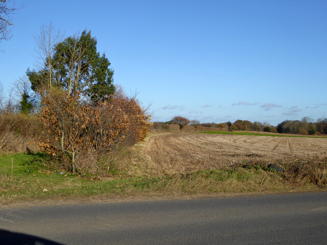
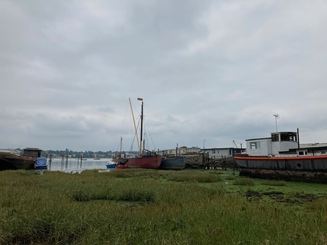
Chelmondiston Images

Images are sourced within 2km of 51.991003/1.2154 or Grid Reference TM2037. Thanks to Geograph Open Source API. All images are credited.

Power lines crossing above Lings Lane They look like 11 kV and 33 kV lines.
Power lines crossing above Lings Lane
They look like 11 kV and 33 kV lines.
Field east of Lings Lane
Power lines crossing above Lings Lane They look like 11 kV and 33 kV lines.
Power lines crossing above Lings Lane
They look like 11 kV and 33 kV lines.
Footpath leaving Lings Lane It follows the near side of the sparse hedge.
Footpath leaving Lings Lane
It follows the near side of the sparse hedge.
Field north of Lings Lane
Footpath leaving Lings Lane
Lings Lane, Chelmondiston Heading north.
Lings Lane, Chelmondiston
Heading north.
B1456 Main Road, Chelmondiston
Field north of B1456
Nacton shore of the River Orwell My mother was born in Nacton and she talked about taking the track to the Orwell. On this occasion my wife and I did the walk in her memory. The damaged tree in the foreground may be the same tree as appears toppled in later images.  Still standing in  <a href="https://www.geograph.org.uk/photo/861632">TM2139 : Hulk on the shore</a>.
Nacton shore of the River Orwell
My mother was born in Nacton and she talked about taking the track to the Orwell. On this occasion my wife and I did the walk in her memory. The damaged tree in the foreground may be the same tree as appears toppled in later images. Still standing in TM2139 : Hulk on the shore.
Wrecks on the foreshore at Pin Mill Compare with <a href="https://www.geograph.org.uk/photo/5917649">TM2138 : Wrecks near Pin Mill</a> taken in 2018
Wrecks on the foreshore at Pin Mill
Compare with TM2138 : Wrecks near Pin Mill taken in 2018
Houseboats and barge "Melissa" at Pin Mill "Melissa" is a steel hulled Thames Barge built by J.G. Fay at Southampton 1899: <span class="nowrap"><a title="https://thamesbarge.org.uk/boats/melissa/" rel="nofollow ugc noopener" href="https://thamesbarge.org.uk/boats/melissa/">Link</a><img style="margin-left:2px;" alt="External link" title="External link - shift click to open in new window" src="https://s1.geograph.org.uk/img/external.png" width="10" height="10"/></span>
Houseboats and barge "Melissa" at Pin Mill
"Melissa" is a steel hulled Thames Barge built by J.G. Fay at Southampton 1899: LinkExternal link
Harry King's boatyard, Pin Mill
View towards Butterman's Bay
A long drive Woolverstone Hall Woolverstone Suffolk.Now a school. More info see <span class="nowrap"><a title="http://en.wikipedia.org/wiki/Woolverstone_Hall" rel="nofollow ugc noopener" href="http://en.wikipedia.org/wiki/Woolverstone_Hall">Link</a><img style="margin-left:2px;" alt="External link" title="External link - shift click to open in new window" src="https://s1.geograph.org.uk/img/external.png" width="10" height="10"/></span>
A long drive
Woolverstone Hall Woolverstone Suffolk.Now a school. More info see LinkExternal link
Farmhouse at Walnut Tree Farm
Entrance To Bylam Farm Entrance to Bylam Farm near to Chelmodiston Suffolk.
Entrance To Bylam Farm
Entrance to Bylam Farm near to Chelmodiston Suffolk.
Farm Pond Old pond at Bylam Farm near to Chelmondiston Suffolk.
Farm Pond
Old pond at Bylam Farm near to Chelmondiston Suffolk.
Show me another place!

Chelmondiston is located at Grid Ref: TM2037 (Lat: 51.991003, Lng: 1.2154)

Administrative County: Suffolk

District: Babergh

Police Authority: Suffolk

What 3 Words

///rigs.encoder.backward. Near Holbrook, Suffolk

Related Wikis

Chelmondiston

Chelmondiston is a small village and civil parish in Suffolk, England located on the Shotley Peninsula, five miles south-east of Ipswich. The hamlet of...
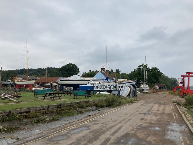
Pin Mill

Pin Mill is a hamlet on the south bank of the tidal River Orwell, on the outskirts of the village of Chelmondiston, on the Shotley peninsula in southern...

Orwell Estuary

Orwell Estuary is a 1,335.7 hectare biological Site of Special Scientific Interest which stretches along the River Orwell and its banks between Felixstowe...

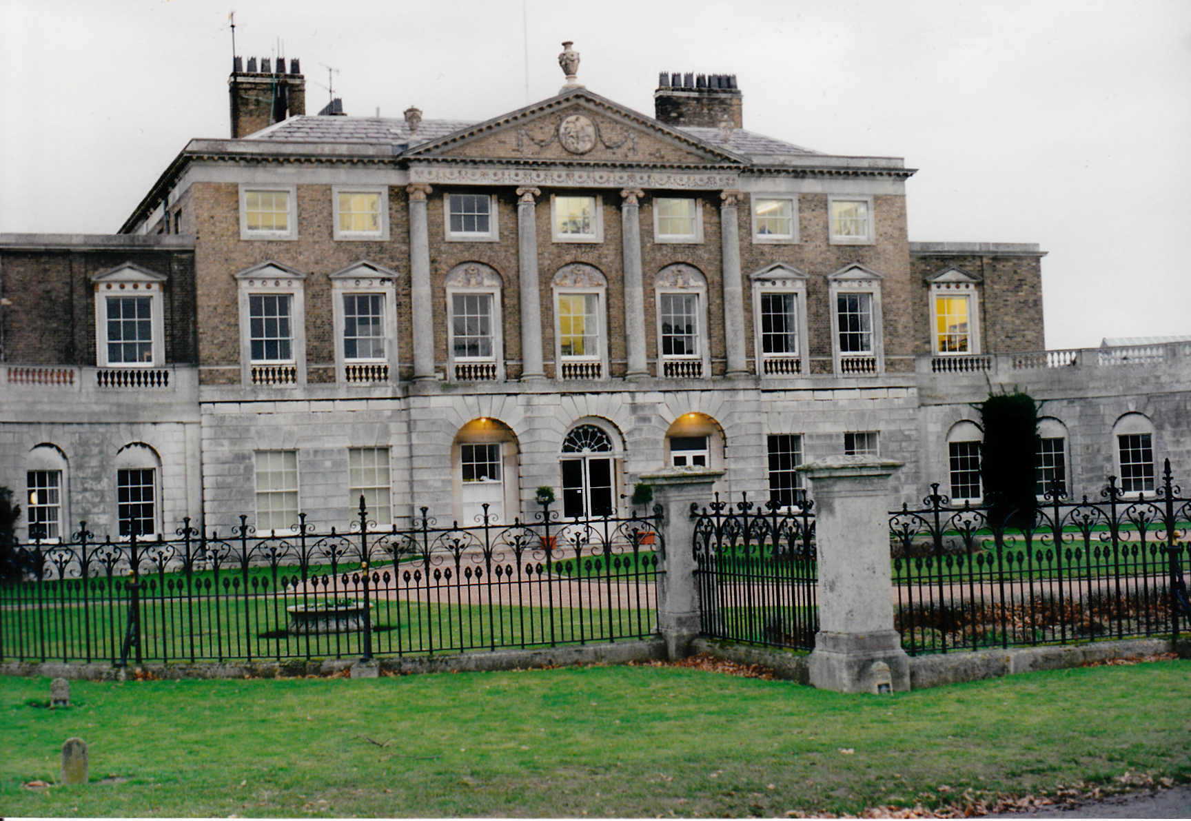
Woolverstone Hall School

In the early 1950s the London County Council obtained use of Woolverstone Hall near Ipswich, Suffolk, and some 50 acres (200,000 m2) of adjoining land...

Nearby Amenities

Located within 500m of 51.991003,1.2154
Chelmondiston
Place: village
Wikidata: Q2158011
Wikipedia: en:Chelmondiston
Lat/Long: 51.989904/1.2087457
Bus Stop
Hill Farm Lane
Bus: yes
Local Ref: adj
Naptan AtcoCode: 390010025
Naptan Bearing: E
Naptan CommonName: Hill Farm Lane
Naptan Landmark: Hill Farm Lane
Naptan NaptanCode: sufadamj
Naptan Street: Main Road
Naptan Verified: no
Public Transport: platform
Source: naptan_import
Lat/Long: 51.9893452/1.2132044
Hill Farm Lane
Local Ref: opp
Naptan AtcoCode: 390010026
Naptan Bearing: W
Naptan BusStopType: CUS
Naptan CommonName: Hill Farm Lane
Naptan Landmark: Hill Farm Lane
Naptan NaptanCode: sufadamp
Naptan Street: Main Road
Naptan Verified: no
Source: naptan_import
Lat/Long: 51.9892999/1.2132158
Bus Stop
Forresters Arms
Bus: yes
Local Ref: adj
Naptan AtcoCode: 390010027
Naptan Bearing: E
Naptan CommonName: Forresters Arms
Naptan Landmark: Forresters Arms
Naptan NaptanCode: sufadamt
Naptan Street: Main Road
Naptan Verified: no
Public Transport: platform
Source: naptan_import
Lat/Long: 51.9894062/1.2113003
Bus Stop
Forresters Arms
Bus: yes
Local Ref: opp
Naptan AtcoCode: 390010028
Naptan Bearing: W
Naptan CommonName: Forresters Arms
Naptan Landmark: Forresters Arms
Naptan NaptanCode: sufadamw
Naptan Street: Main Road
Naptan Verified: no
Public Transport: platform
Source: naptan_import
Lat/Long: 51.9892813/1.2112622
Place Of Worship
Chelmondiston Methodist Church
Denomination: methodist
Religion: christian
Lat/Long: 51.989027/1.2097955
Power: pole
Lat/Long: 51.9866509/1.2170015
Power: pole
Lat/Long: 51.9872802/1.2143542
Power: pole
Lat/Long: 51.9869548/1.2157784
Power: pole
Lat/Long: 51.9881904/1.2147163
Power: pole
Lat/Long: 51.9873199/1.2143729
Hollingsworth's Butchers & Grocers
Shop: butcher
Lat/Long: 51.9893929/1.2090866
Power: pole
Lat/Long: 51.9872703/1.2142662
The data included in this document is from www.openstreetmap.org. The data is made available under ODbL.

Have you been to Chelmondiston?

Leave your review of Chelmondiston below (or comments, questions and feedback).