Chelmorton

Civil Parish in Derbyshire Derbyshire Dales

England

Chelmorton

Green Lane to Chelmorton This green lane leads from Old Coalpit Lane into the village of Chelmorton, across the fields of Farditch farm, behind the sewage works.
Green Lane to Chelmorton Credit: Roger May

Chelmorton is a civil parish located in the county of Derbyshire, England. It is situated in the Peak District National Park and lies approximately 7 miles southeast of the town of Buxton. The parish covers an area of about 3,000 acres and has a population of around 150 people.

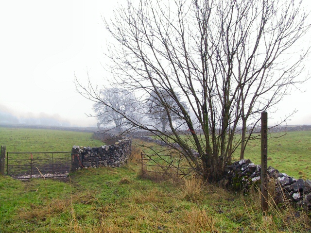
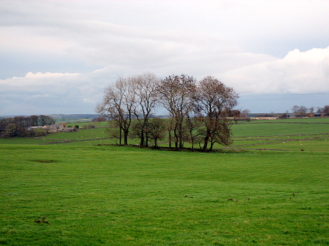
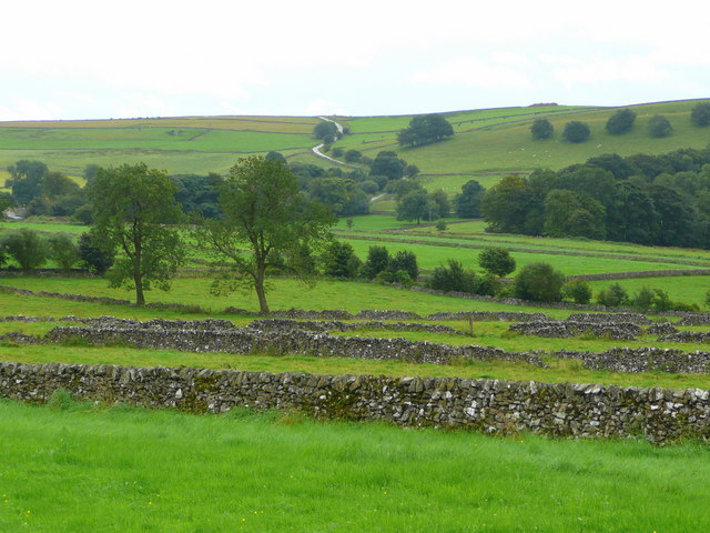
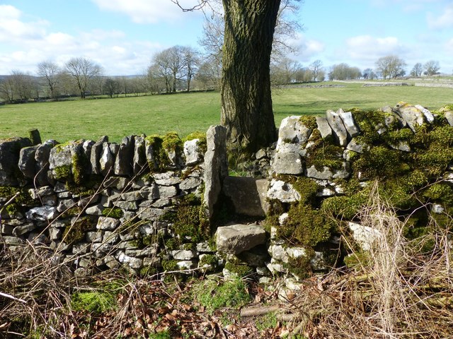
The village of Chelmorton is nestled in a picturesque landscape, surrounded by rolling hills, lush meadows, and scenic countryside. It is known for its charming stone-built cottages, many of which date back to the 17th and 18th centuries, giving the village a traditional and rustic feel.

Chelmorton is home to the Church of St. John the Baptist, a Grade II listed building that dates back to the 13th century. The church is known for its beautiful stained glass windows and medieval features, making it a popular attraction for visitors and history enthusiasts.

The village also has a thriving community spirit, with various local events and activities taking place throughout the year. These include the Chelmorton Open Gardens event, where residents open their gardens to the public, showcasing the natural beauty of the area.

For outdoor enthusiasts, Chelmorton offers plenty of opportunities for exploring the surrounding countryside. There are numerous walking and cycling trails in the area, including the Limestone Way, which passes through the village, providing stunning views of the Peak District.

In summary, Chelmorton is a tranquil and picturesque village in the heart of Derbyshire's Peak District. With its historic charm, stunning natural scenery, and active community, it is a delightful place to visit or call home.

If you have any feedback on the listing, please let us know in the comments section below.

Chelmorton Images

Images are sourced within 2km of 53.227433/-1.868402 or Grid Reference SK0870. Thanks to Geograph Open Source API. All images are credited.

Green Lane to Chelmorton This green lane leads from Old Coalpit Lane into the village of Chelmorton, across the fields of Farditch farm, behind the sewage works.
Green Lane to Chelmorton
This green lane leads from Old Coalpit Lane into the village of Chelmorton, across the fields of Farditch farm, behind the sewage works.
A  fair copse! Large exposed fields on the top of this limestone country are broken up only occasionally by clumps of trees.  This contrasts with the deep valleys cut into this limestone which support extensive areas of woodland.
A fair copse!
Large exposed fields on the top of this limestone country are broken up only occasionally by clumps of trees. This contrasts with the deep valleys cut into this limestone which support extensive areas of woodland.
View south of Common Lane, Chelmorton Looking across the enclosures to Pippenwell Road ascending the hillside beyond.
View south of Common Lane, Chelmorton
Looking across the enclosures to Pippenwell Road ascending the hillside beyond.
Common Lane near Chelmorton
Pasture land off Old Coal Pit Lane (A5270)
Sharp Bend on Old Coal Pit Lane (A5270) Approaching junction with The Ditch.
Sharp Bend on Old Coal Pit Lane (A5270)
Approaching junction with The Ditch.
Fields and walls, in the land west of Chelmorton
Leafy lane near Chelmorton
Sewage treatment works on Old Coalpit Lane
Stile on path nearing Burrs Farm
Public Footpath near Arden Villas Looking towards Burrs Farm on a freezing Saturday in mid December.
Public Footpath near Arden Villas
Looking towards Burrs Farm on a freezing Saturday in mid December.
Public footpath to Chelmorton.
Former lead mine above Bullhay Dale From little-used footpath to north.
Former lead mine above Bullhay Dale
From little-used footpath to north.
Footpath above Bullhay Dale Rather muddy farm track between drystone walls above Bullhay Dale (away to the right). Chelmorton Low (<a href="https://www.geograph.org.uk/gridref/SK1170">SK1170</a>) left background.
Footpath above Bullhay Dale
Rather muddy farm track between drystone walls above Bullhay Dale (away to the right). Chelmorton Low (SK1170) left background.
Footpath to Chelmorton Most of this footpath is along walled green lanes, but at this point it crosses a field diagonally. Chelmorton Low (with the word "England" and a St George's flag picked out in stones) in the background.
Footpath to Chelmorton
Most of this footpath is along walled green lanes, but at this point it crosses a field diagonally. Chelmorton Low (with the word "England" and a St George's flag picked out in stones) in the background.
Footpath near Chelmorton Little-used footpath running parallel to Common Lane, Chelmorton.
Footpath near Chelmorton
Little-used footpath running parallel to Common Lane, Chelmorton.
Caxterway Lane
Caxterway Lane
Village sign west of Chelmorton At the junction of Common Lane with Coalpit Lane. In the distance on Chelmorton Low the name "England" is proudly displayed in limestone rocks. The word is visible for miles around.
Village sign west of Chelmorton
At the junction of Common Lane with Coalpit Lane. In the distance on Chelmorton Low the name "England" is proudly displayed in limestone rocks. The word is visible for miles around.
Show me another place!

Chelmorton is located at Grid Ref: SK0870 (Lat: 53.227433, Lng: -1.868402)

Administrative County: Derbyshire

District: Derbyshire Dales

Police Authority: Derbyshire

What 3 Words

///passively.handed.seats. Near Buxton, Derbyshire

Nearby Locations

Brierlow Dale Chelmorton

Related Wikis

Hindlow railway station

Hindlow railway station was opened for goods in 1833 near to Hindlow near King Sterndale to the south east of Buxton, Derbyshire on the Cromford and High...

Deep Dale

Deep Dale is a short steep-sided gorge near Buxton, Derbyshire, in the Peak District of England. It is distinct from another Deep Dale, near Sheldon, 4...

King Sterndale

King Sterndale is a village and civil parish in Derbyshire, England. It is located in the Peak District, 4 miles east of Buxton. It has a population of...

Chelmorton

Chelmorton is a village and a civil parish in Derbyshire, England. It is in the Derbyshire Dales district and the nearest towns are Buxton to the northwest...

Wye Valley, Derbyshire

The Wye Valley is the limestone valley of the River Wye in the White Peak of Derbyshire, England. The source of the River Wye is west of Buxton on Axe...

Harpur Hill Quarry

Harpur Hill Quarry is a disused limestone quarry on Harpur Hill, Derbyshire, England. Limestone was extracted there from 1835 to 1952 for lime burning...

Dowlow Works

Dowlow Works is a quarry in High Peak, Derbyshire near the village of Earl Sterndale. The quarry has been in operation since 1899, and has extracting permissions...

Dowlow Halt railway station

Dowlow Halt was opened in 1920 between Dowlow (hill now largely quarried away) and Greatlow to the south east of Buxton, Derbyshire on the London and North...

Nearby Amenities

Located within 500m of 53.227433,-1.868402
Brierlow Bar
Is In: Derbyshire, England, UK
Place: hamlet
Lat/Long: 53.2249777/-1.8722444
Barrier: stile
Ele: 327.2119141
Material: wood
Source: survey;gps
Steps: 1
Stile: stepover
Lat/Long: 53.2313873/-1.8680199
Ele: 308.2260742
Lat/Long: 53.2306872/-1.8665674
Ele: 288.5192871
Lat/Long: 53.2287656/-1.8686504
Ele: 286.3563232
Lat/Long: 53.2294492/-1.8679564
Barrier: stile
Ele: 302.9388428
Steps: 2
Stile: stepover
Lat/Long: 53.2290966/-1.8675069
Barrier: stile
Ele: 303.9002686
Material: stone
Source: survey;gps
Steps: 4
Stile: stepover
Lat/Long: 53.2290795/-1.8673983
Barrier: stile
Ele: 316.1569824
Material: stone
Source: survey;bing
Steps: 3
Stile: stepover
Lat/Long: 53.2286987/-1.8649098
Barrier: stile
Ele: 286.1159668
Material: stone
Source: survey;gps
Steps: 2
Stile: stepover
Lat/Long: 53.2294145/-1.8680224
Ele: 304.3808594
Lat/Long: 53.2291161/-1.8674216
Ele: 302.6986084
Lat/Long: 53.2291071/-1.8674506
Barrier: stile
Ele: 311.1099854
Material: stone
Source: survey;gps
Steps: 3
Stile: squeezer
Lat/Long: 53.230216/-1.8685734
Ele: 287.5578613
Lat/Long: 53.2292595/-1.8685954
Barrier: stile
Ele: 287.7982178
Material: stone
Source: survey;gps
Steps: 3
Stile: stepover
Lat/Long: 53.2291333/-1.868567
Barrier: stile
Ele: 319.0408936
Steps: 2
Stile: wall
Lat/Long: 53.2276733/-1.8619366
Barrier: stile
Ele: 318.8005371
Steps: 2
Stile: stepover
Lat/Long: 53.2276263/-1.8618846
Ele: 318.8005371
Lat/Long: 53.2275122/-1.8616933
Ele: 319.0408936
Lat/Long: 53.2275178/-1.8616618
Ele: 319.2812500
Lat/Long: 53.2276765/-1.8619091
Ele: 319.2812500
Lat/Long: 53.2276293/-1.8618835
Ele: 319.0408936
Lat/Long: 53.227536/-1.8615645
Barrier: barrier
Ele: 312
Fixme: What sort of barrier is this? How does this relate to the stile?
Lat/Long: 53.2268105/-1.8610045
Barrier: stile
Material: stone
Source: survey;gps
Stile: stepover
Lat/Long: 53.2268358/-1.860993
Fixme: no stile.
Lat/Long: 53.2237253/-1.8647299
Cafe
Lat/Long: 53.2244848/-1.8716142
Bus Stop
Brierlow Bar, A515 / Bookstore
Bus: yes
Naptan AtcoCode: 1000DBBAG821
Naptan Bearing: NW
Naptan BusStopType: CUS
Naptan CommonName: Bookstore
Naptan Indicator: NW-bound
Naptan Landmark: Bookstore
Naptan LocalityName: Brierlow Bar
Naptan NaptanCode: dbsagdaw
Naptan PlusbusZoneRef: BUXTON
Naptan Street: A515
Public Transport: platform
Source: naptan_import
Lat/Long: 53.2246621/-1.8712487
Bus Stop
Brierlow Bar, A515 / Bookstore
Bus: yes
Naptan AtcoCode: 1000DBBA3863
Naptan Bearing: SE
Naptan BusStopType: CUS
Naptan CommonName: Bookstore
Naptan Indicator: SE-bound
Naptan Landmark: Bookstore
Naptan LocalityName: Brierlow Bar
Naptan NaptanCode: dbsagdat
Naptan PlusbusZoneRef: BUXTON
Naptan Street: A515
Public Transport: platform
Source: naptan_import
Lat/Long: 53.2248559/-1.8711094
Bus Stop
Brierlow Bar, B5053 / Bookstore
Bus: yes
Naptan AtcoCode: 1000DBBB4174
Naptan Bearing: N
Naptan BusStopType: CUS
Naptan CommonName: Bookstore
Naptan Indicator: adj 515
Naptan Landmark: Brierlow Road
Naptan LocalityName: Brierlow Bar
Naptan NaptanCode: dbsgwjdm
Naptan PlusbusZoneRef: BUXTON
Naptan Street: B5053
Public Transport: platform
Source: naptan_import
Lat/Long: 53.2247599/-1.8724899
Bus Stop
Brierlow Bar, B5053 / Bookstore
Bus: yes
Naptan AtcoCode: 1000DBBB4173
Naptan Bearing: S
Naptan BusStopType: CUS
Naptan CommonName: Bookstore
Naptan Indicator: opp 515
Naptan Landmark: Brierlow Road
Naptan LocalityName: Brierlow Bar
Naptan NaptanCode: dbsgwjdj
Naptan PlusbusZoneRef: BUXTON
Naptan Street: B5053
Public Transport: platform
Source: naptan_import
Lat/Long: 53.2247011/-1.8722737
The data included in this document is from www.openstreetmap.org. The data is made available under ODbL.

Have you been to Chelmorton?

Leave your review of Chelmorton below (or comments, questions and feedback).