Chelmorton

Settlement in Derbyshire Derbyshire Dales

England

Chelmorton

Green Lane to Chelmorton This green lane leads from Old Coalpit Lane into the village of Chelmorton, across the fields of Farditch farm, behind the sewage works.
Green Lane to Chelmorton Credit: Roger May

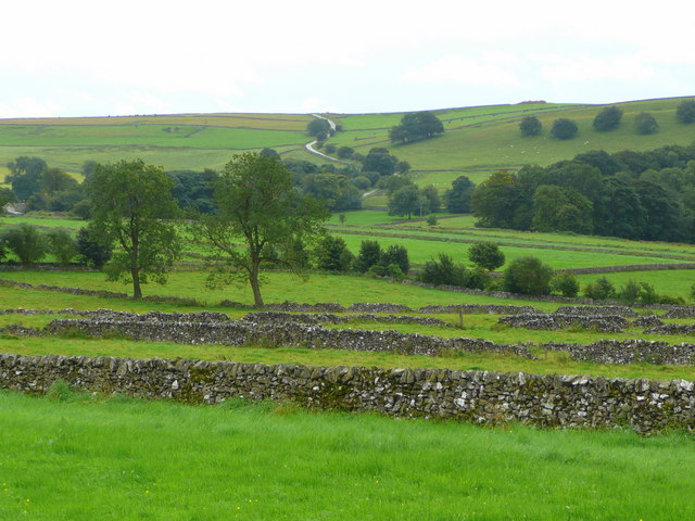
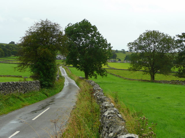
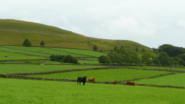
Chelmorton is a small village located in the county of Derbyshire, England. Situated within the Peak District National Park, it is nestled in the heart of the White Peak area, offering picturesque views of rolling hills, lush green valleys, and limestone formations.

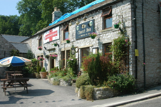
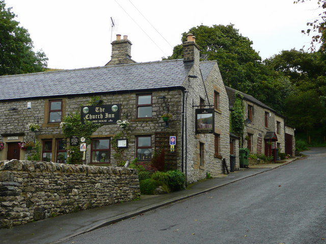
With a population of around 200 residents, Chelmorton is known for its idyllic rural charm and tranquil atmosphere. The village is characterized by its traditional stone-built houses, many of which date back to the 17th and 18th centuries, adding to the area's distinctive charm.

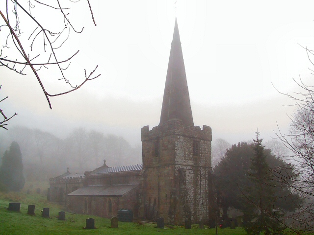
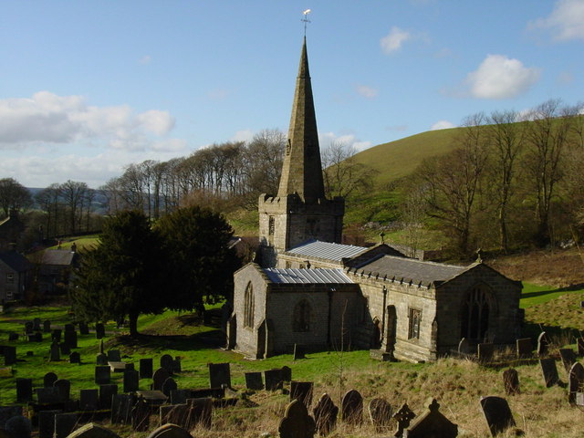
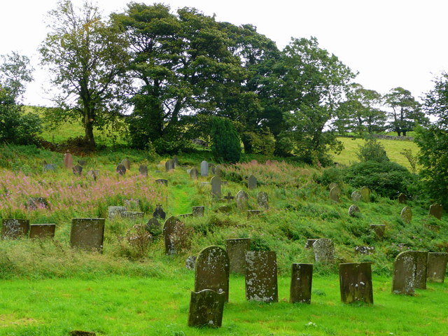
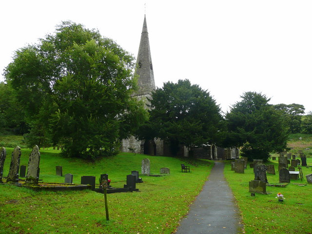
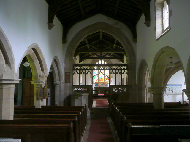
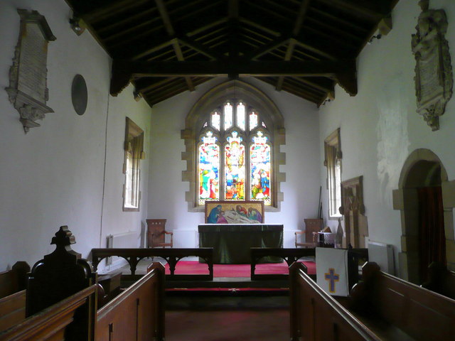
Chelmorton is home to the Church of St. John the Baptist, a Grade I listed building with a rich history dating back to the 12th century. The church's architecture showcases a blend of Norman and Gothic styles, making it an intriguing landmark for history enthusiasts.

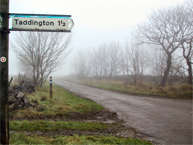
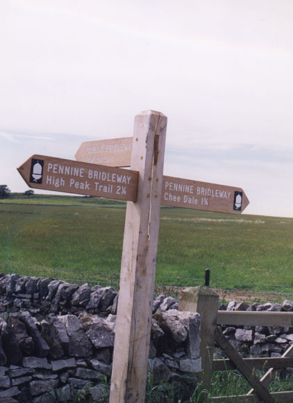
The village is a popular destination for nature lovers and outdoor enthusiasts due to its proximity to various walking and cycling trails. The Limestone Way, a long-distance footpath, passes through Chelmorton, offering stunning views of the surrounding countryside.

Despite its small size, Chelmorton boasts a vibrant community spirit, with regular events and activities taking place throughout the year. These include the annual Chelmorton Well Dressing, a traditional custom where locals decorate wells with intricate floral designs.

Chelmorton's location within the Peak District National Park provides easy access to other nearby attractions such as the spa town of Buxton, the historic village of Eyam, and the famous Chatsworth House. It is also a great base for exploring the natural beauty of the Peak District, with its numerous walking trails, limestone caves, and scenic landscapes.

If you have any feedback on the listing, please let us know in the comments section below.
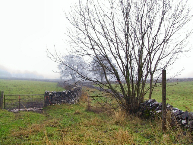
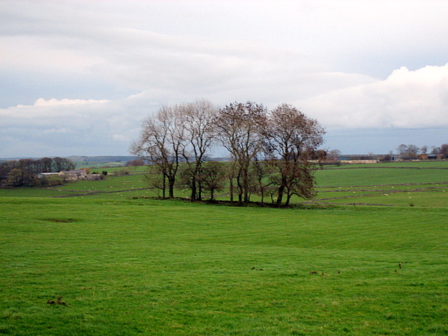
Chelmorton Images

Images are sourced within 2km of 53.222737/-1.836438 or Grid Reference SK1169. Thanks to Geograph Open Source API. All images are credited.

Green Lane to Chelmorton This green lane leads from Old Coalpit Lane into the village of Chelmorton, across the fields of Farditch farm, behind the sewage works.
Green Lane to Chelmorton
This green lane leads from Old Coalpit Lane into the village of Chelmorton, across the fields of Farditch farm, behind the sewage works.
St.John's, Chelmorton St.John the Baptist church at Chelmorton, in the diocese of Derby, just emerging from the morning mist. It stands opposite the Church Inn at the top of the village.
St.John's, Chelmorton
St.John the Baptist church at Chelmorton, in the diocese of Derby, just emerging from the morning mist. It stands opposite the Church Inn at the top of the village.
Pennine Bridleway The Pennine Bridleway carries straight on up Pillwell Lane, whilst Moor Lane takes a right here for Taddington.
Pennine Bridleway
The Pennine Bridleway carries straight on up Pillwell Lane, whilst Moor Lane takes a right here for Taddington.
A  fair copse! Large exposed fields on the top of this limestone country are broken up only occasionally by clumps of trees.  This contrasts with the deep valleys cut into this limestone which support extensive areas of woodland.
A fair copse!
Large exposed fields on the top of this limestone country are broken up only occasionally by clumps of trees. This contrasts with the deep valleys cut into this limestone which support extensive areas of woodland.
Pennine Bridleway Way Marker Way marker on Sough Lane Other Route with Public Access.
Pennine Bridleway Way Marker
Way marker on Sough Lane Other Route with Public Access.
Footpaths everywhere From here are several paths and bridleways,two more can just be seen near the car.
Footpaths everywhere
From here are several paths and bridleways,two more can just be seen near the car.
Fivewells Farm A typical limestone farm of this area
Fivewells Farm
A typical limestone farm of this area
The parish church at Chelmorton
The Church Inn, Chelmorton
View south of Common Lane, Chelmorton Looking across the enclosures to Pippenwell Road ascending the hillside beyond.
View south of Common Lane, Chelmorton
Looking across the enclosures to Pippenwell Road ascending the hillside beyond.
Common Lane, Chelmorton Looking towards the village from Old Coalpit Lane.
Common Lane, Chelmorton
Looking towards the village from Old Coalpit Lane.
Beef pasture Rich grassland of the White Peak; the hill beyond is Chelmorton Low (446m).
Beef pasture
Rich grassland of the White Peak; the hill beyond is Chelmorton Low (446m).
St. John the Baptist's church, Chelmorton The Parish Church of St John the Baptist, one of the highest situated churches in the land, dates partly back to the early 13th century, though its building history is a little complex. It has a broad, low west 13th century tower capped with a 15th century spire. The south arcade is 13th century, but was lengthened by one bay to match the North arcade when that was built. The 4th bay opens into the south transept which has lancet windows and dates back to around the 14th century. 
Of the 15th century are the altered clerestory above the south arcade, the porch, the octagonal font, and the low embattled stone screen with an ogee-arcade and openwork quatrefoils above. 
There is Baroque tablet to George Dale, dated 1683 and in the stone vaulted south porch is a gallery of early sculptures and grave slabs, some of them possibly Saxon in origin. 
Viewed from the steeply sloping churchyard to the south-east.
St. John the Baptist's church, Chelmorton
The Parish Church of St John the Baptist, one of the highest situated churches in the land, dates partly back to the early 13th century, though its building history is a little complex. It has a broad, low west 13th century tower capped with a 15th century spire. The south arcade is 13th century, but was lengthened by one bay to match the North arcade when that was built. The 4th bay opens into the south transept which has lancet windows and dates back to around the 14th century. Of the 15th century are the altered clerestory above the south arcade, the porch, the octagonal font, and the low embattled stone screen with an ogee-arcade and openwork quatrefoils above. There is Baroque tablet to George Dale, dated 1683 and in the stone vaulted south porch is a gallery of early sculptures and grave slabs, some of them possibly Saxon in origin. Viewed from the steeply sloping churchyard to the south-east.
The Church Inn, Chelmorton The inn has been here since 1742 when a certain George Holme opened it as an alehouse called the 'Blacksmith's Arms', but it was renamed the 'Church Inn' in 1884. See; <span class="nowrap"><a title="http://www.thechurchinn.co.uk/" rel="nofollow ugc noopener" href="http://www.thechurchinn.co.uk/">Link</a><img style="margin-left:2px;" alt="External link" title="External link - shift click to open in new window" src="https://s1.geograph.org.uk/img/external.png" width="10" height="10"/></span>
The Church Inn, Chelmorton
The inn has been here since 1742 when a certain George Holme opened it as an alehouse called the 'Blacksmith's Arms', but it was renamed the 'Church Inn' in 1884. See; LinkExternal link
Chelmorton churchyard A delightfully wild, steeply sloping patch of ground from which <a href="https://www.geograph.org.uk/photo/977588">SK1170 : St. John the Baptist's church, Chelmorton</a> was taken.
Chelmorton churchyard
A delightfully wild, steeply sloping patch of ground from which SK1170 : St. John the Baptist's church, Chelmorton was taken.
St. John the Baptist's church, Chelmorton Viewed from the road opposite the Church Inn.
St. John the Baptist's church, Chelmorton
Viewed from the road opposite the Church Inn.
St. John the Baptist's church, Chelmorton, interior Looking east along the nave.
The Parish Church of St John the Baptist, one of the highest situated churches in the land, dates partly back to the early 13th century, though its building history is a little complex. It has a broad, low west 13th century tower capped with a 15th century spire. The south arcade is 13th century, but was lengthened by one bay to match the North arcade when that was built. The 4th bay opens into the south transept which has lancet windows and dates back to around the 14th century. 
Of the 15th century are the altered clerestory above the south arcade, the porch, the octagonal font, and the low embattled stone screen with an ogee-arcade and openwork quatrefoils above. 
There is Baroque tablet to George Dale, dated 1683 and in the stone vaulted south porch is a gallery of early sculptures and grave slabs, some of them possibly Saxon in origin.
St. John the Baptist's church, Chelmorton, interior
Looking east along the nave. The Parish Church of St John the Baptist, one of the highest situated churches in the land, dates partly back to the early 13th century, though its building history is a little complex. It has a broad, low west 13th century tower capped with a 15th century spire. The south arcade is 13th century, but was lengthened by one bay to match the North arcade when that was built. The 4th bay opens into the south transept which has lancet windows and dates back to around the 14th century. Of the 15th century are the altered clerestory above the south arcade, the porch, the octagonal font, and the low embattled stone screen with an ogee-arcade and openwork quatrefoils above. There is Baroque tablet to George Dale, dated 1683 and in the stone vaulted south porch is a gallery of early sculptures and grave slabs, some of them possibly Saxon in origin.
St. John the Baptist's church, Chelmorton, chancel A peaceful place.
St. John the Baptist's church, Chelmorton, chancel
A peaceful place.
Show me another place!

Chelmorton is located at Grid Ref: SK1169 (Lat: 53.222737, Lng: -1.836438)

Administrative County: Derbyshire

District: Derbyshire Dales

Police Authority: Derbyshire

What 3 Words

///stitching.mystified.shredding. Near Buxton, Derbyshire

Nearby Locations

Chelmorton

Related Wikis

Chelmorton

Chelmorton is a village and a civil parish in Derbyshire, England. It is in the Derbyshire Dales district and the nearest towns are Buxton to the northwest...

Dowlow Works

Dowlow Works is a quarry in High Peak, Derbyshire near the village of Earl Sterndale. The quarry has been in operation since 1899, and has extracting permissions...

Dowlow Halt railway station

Dowlow Halt was opened in 1920 between Dowlow (hill now largely quarried away) and Greatlow to the south east of Buxton, Derbyshire on the London and North...

Deep Dale

Deep Dale is a short steep-sided gorge near Buxton, Derbyshire, in the Peak District of England. It is distinct from another Deep Dale, near Sheldon, 4...

Nearby Amenities

Located within 500m of 53.222737,-1.836438
Bench
Ele: 329.6152344
Lat/Long: 53.2265628/-1.8328898
Ele: 327.2119141
Information: board
Tourism: information
Lat/Long: 53.2258756/-1.833555
Bus Stop
Bus: yes
Ele: 332.0185547
Public Transport: platform
Lat/Long: 53.2250085/-1.8345635
Post Box
Ele: 333
Post Box Type: lamp
Ref: SK17 106
Royal Cypher: EIIR
Royal Cypher Wikidata: Q33102113
Lat/Long: 53.224986/-1.8343114
Ele: 336.5848389
Lat/Long: 53.222882/-1.8366956
Ele: 326.0102539
Lat/Long: 53.2232098/-1.8361805
Ele: 323.1264648
Lat/Long: 53.2237312/-1.8356885
Bus Stop
Bus: yes
Ele: 332.4992676
Public Transport: platform
Lat/Long: 53.2243936/-1.8418122
Ele: 332.4992676
Information: board
Tourism: information
Lat/Long: 53.224376/-1.841772
Post Box
Ele: 332.4992676
Lat/Long: 53.2244097/-1.8418444
Bench
Ele: 331.2974854
Lat/Long: 53.2244932/-1.8421448
Barrier: stile
Material: stone
Source: survey;gps
Stile: stepover
Lat/Long: 53.2227713/-1.8366818
Barrier: stile
Material: stone
Source: survey;gps
Stile: stepover
Lat/Long: 53.2201412/-1.8406848
Barrier: entrance
Source: survey;gps
Lat/Long: 53.2211736/-1.8397496
Access: private
Service: driveway
Lat/Long: 53.2243794/-1.8352005
Barrier: stile
Material: stone
Source: survey;gps
Stile: stepover
Lat/Long: 53.2204389/-1.841575
Generator Method: photovoltaic
Generator Output Electricity: yes
Generator Source: solar
Generator Type: solar_photovoltaic_panel
Location: roof
Power: generator
Lat/Long: 53.2239868/-1.8350011
Archaeological Site: tumulus
Heritage: yes
Historic: archaeological_site
Wikidata: Q17651146
Lat/Long: 53.2194927/-1.8383418
The data included in this document is from www.openstreetmap.org. The data is made available under ODbL.

Have you been to Chelmorton?

Leave your review of Chelmorton below (or comments, questions and feedback).