Chawson

Settlement in Worcestershire Wychavon

England

Chawson

Diamond Coffee Bar, at the crossroads Droitwich Many businesses have tried to flourish at this location which is subject to flooding.
Diamond Coffee Bar, at the crossroads Droitwich Credit: Jeff Gogarty

Chawson is a small village located in the county of Worcestershire, England. Situated just north of the city of Worcester, Chawson is part of the larger civil parish of Droitwich Spa. The village is nestled in a picturesque rural setting, surrounded by open fields and rolling countryside.

Chawson has a rich history dating back many centuries. It was mentioned in the Domesday Book of 1086, where it was recorded as "Cavestone". Over the years, it has evolved from a primarily agricultural community into a residential area with a mix of modern and traditional housing.

Despite its small size, Chawson boasts a close-knit community and a range of amenities for its residents. The village has a primary school, Chawson First School, which provides education for young children in the area. Additionally, there is a local pub, The Chawson Barn, where locals and visitors can enjoy a drink or a meal.

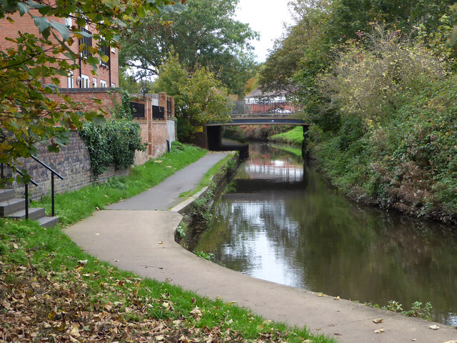
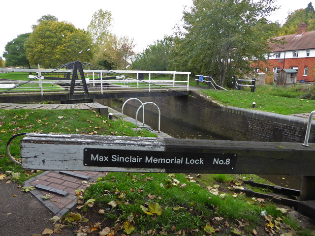
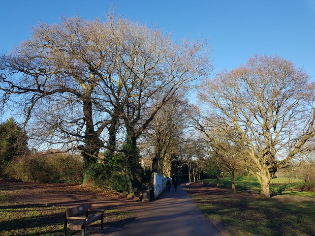
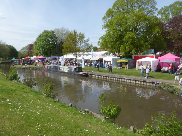
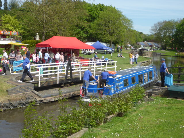
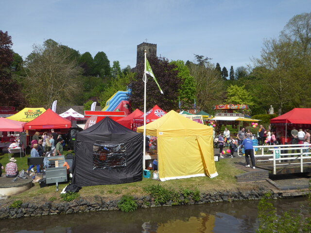
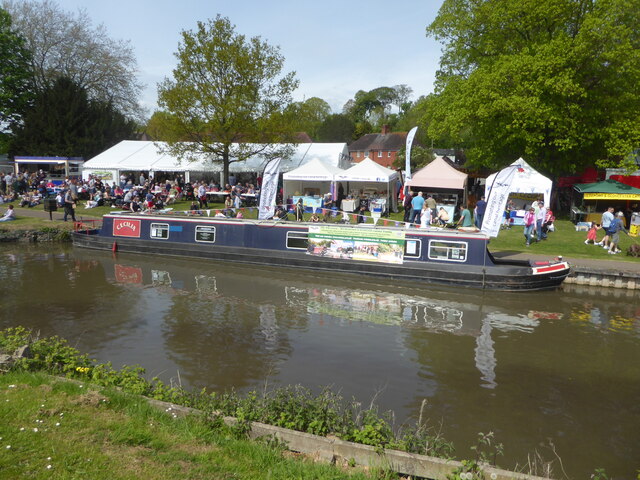
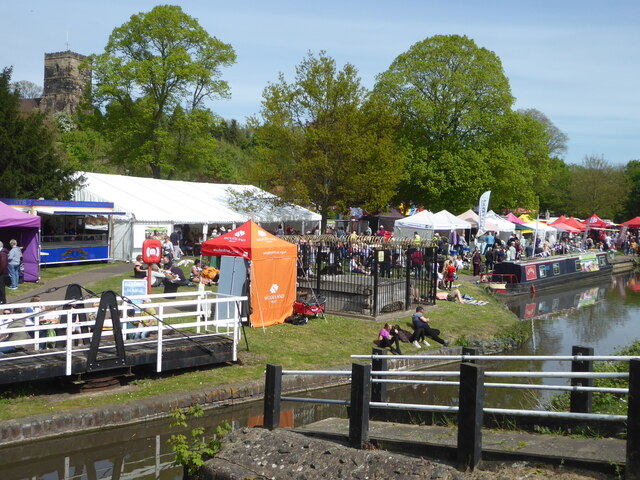
For those seeking outdoor activities, Chawson offers easy access to beautiful countryside walks and cycle routes. The nearby Droitwich Canal provides opportunities for boating and fishing. The village is also within close proximity to the larger town of Droitwich Spa, which offers a wider range of amenities including shops, supermarkets, and leisure facilities.

Overall, Chawson is a charming village that offers a tranquil and idyllic setting for its residents. With its rich history, strong community spirit, and access to beautiful countryside, it is a desirable place to live for those seeking a peaceful and picturesque lifestyle.

If you have any feedback on the listing, please let us know in the comments section below.
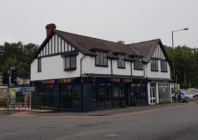
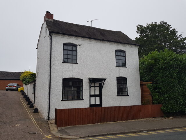
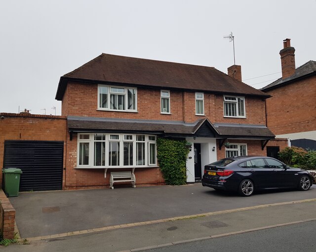
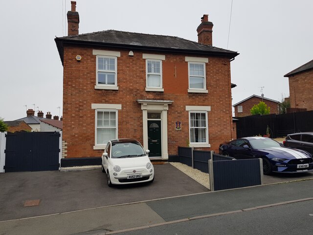
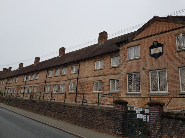
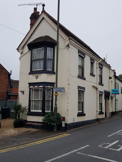
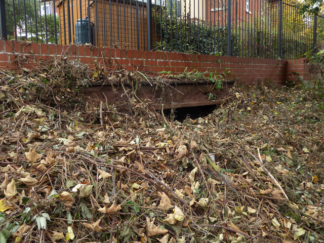
Chawson Images

Images are sourced within 2km of 52.259615/-2.166993 or Grid Reference SO8862. Thanks to Geograph Open Source API. All images are credited.

Diamond Coffee Bar, at the crossroads Droitwich Many businesses have tried to flourish at this location which is subject to flooding.
Diamond Coffee Bar, at the crossroads Droitwich
Many businesses have tried to flourish at this location which is subject to flooding.
2, The Holloway, Droitwich Spa
5 The Holloway, Droitwich Spa This used to be a general store at least up to 2001 when the owner complained of too many roadworks in the road.
5 The Holloway, Droitwich Spa
This used to be a general store at least up to 2001 when the owner complained of too many roadworks in the road.
7 The Holloway, Droitwich Spa Presently a semi-detached house this was formally the Ring O'Bells <a href="https://www.geograph.org.uk/photo/5196358">SO9063 : Ring O' Bells, Droitwich</a> which is still marked in the glass above the door.
7 The Holloway, Droitwich Spa
Presently a semi-detached house this was formally the Ring O'Bells SO9063 : Ring O' Bells, Droitwich which is still marked in the glass above the door.
Coventry Almshouses, The Holloway, Droitwich Spa This is one of the original wings which has recently been repointed with lime mortar. Said to have been founded as a result of a horse race between Henry Coventry and Sir John Pakington of Westwood <a href="https://www.geograph.org.uk/photo/4583125">SO8763 : Westwood House from the drive</a>. The loser was to pay for the building of the property named after the winner. Henry Coventry horse won but John Pakington had no cash spare so promised the income of two farms for the upkeep and Henry Coventry left money the building of the houses in his will.
Coventry Almshouses, The Holloway, Droitwich Spa
This is one of the original wings which has recently been repointed with lime mortar. Said to have been founded as a result of a horse race between Henry Coventry and Sir John Pakington of Westwood SO8763 : Westwood House from the drive. The loser was to pay for the building of the property named after the winner. Henry Coventry horse won but John Pakington had no cash spare so promised the income of two farms for the upkeep and Henry Coventry left money the building of the houses in his will.
1, The Holloway, Droitwich Spa
Largely buried lintel by the Droitwich Junction Canal I believe this is the remains of the bridge that crossed the remnant of the original lock linking the Droitwich Junction Canal to the River Salwarpe. The newly restored canal joins the river further upstream. An earlier view is seen here - <a href="https://www.geograph.org.uk/photo/761976">SO9063 : Droitwich Junction Canal - beginning or end</a>.
Largely buried lintel by the Droitwich Junction Canal
I believe this is the remains of the bridge that crossed the remnant of the original lock linking the Droitwich Junction Canal to the River Salwarpe. The newly restored canal joins the river further upstream. An earlier view is seen here - SO9063 : Droitwich Junction Canal - beginning or end.
The canalised River Salwarpe in Droitwich Approaching bridge No. 8 and the barge lock at the entrance to Vines Park.
The canalised River Salwarpe in Droitwich
Approaching bridge No. 8 and the barge lock at the entrance to Vines Park.
The barge lock, Vines Park, Droitwich Now renamed the Max Sinclair Memorial Lock and numbered in the same sequence as the Droitwich Junction Canal. This lock marks the junction of the Droitwich Barge Canal with the canalised River Salwarpe at the end of the Junction Canal. Although the Junction Canal is a narrow canal, the barge lock was designed to take the larger sailing trows so they could access a works upstream of here on the river.
The barge lock, Vines Park, Droitwich
Now renamed the Max Sinclair Memorial Lock and numbered in the same sequence as the Droitwich Junction Canal. This lock marks the junction of the Droitwich Barge Canal with the canalised River Salwarpe at the end of the Junction Canal. Although the Junction Canal is a narrow canal, the barge lock was designed to take the larger sailing trows so they could access a works upstream of here on the river.
Autumn tree, Lido car park, Droitwich
Winter trees and basketball court, Lido Park, Droitwich
Winter trees, Lido Park, Droitwich Spa
Brantwood Road, Droitwich looking towards the water tower
St Richards Canal Festival, Droitwich To raise money for the hospice.
St Richards Canal Festival, Droitwich
To raise money for the hospice.
St Richards Canal Festival, Droitwich A trip boat passing through one of the swing bridges in Vines Park. The festival is to raise money for the hospice.
St Richards Canal Festival, Droitwich
A trip boat passing through one of the swing bridges in Vines Park. The festival is to raise money for the hospice.
St Richards Canal Festival, Droitwich St Augustine's church is on the hill in the background. The festival was to raise money for the hospice in Worcester and was getting quite crowded.
St Richards Canal Festival, Droitwich
St Augustine's church is on the hill in the background. The festival was to raise money for the hospice in Worcester and was getting quite crowded.
St Richards Canal Festival, Droitwich In Vines Park on the Droitwich Barge Canal. To raise money for the hospice.
St Richards Canal Festival, Droitwich
In Vines Park on the Droitwich Barge Canal. To raise money for the hospice.
St Richards Canal Festival, Droitwich
Show me another place!

Chawson is located at Grid Ref: SO8862 (Lat: 52.259615, Lng: -2.166993)

Administrative County: Worcestershire

District: Wychavon

Police Authority: West Mercia

What 3 Words

///dealings.consoles.alike. Near Droitwich, Worcestershire

Related Wikis

Church of the Sacred Heart and St Catherine of Alexandria

The Church of the Sacred Heart and St Catherine of Alexandria is a Catholic church situated in Droitwich Spa, Worcestershire, England, noted for its remarkable...

Droitwich Spa High School

Droitwich Spa High School is a secondary school and specialist Sports College with academy status in Droitwich Spa, Worcestershire, England. It serves...

Droitwich Spa railway station

Droitwich Spa railway station serves the town of Droitwich Spa in Worcestershire, England. It is located just to the south-west of Droitwich Spa Junction...

Westwood Priory

Westwood Priory (priory of St. Mary) was a priory of Benedictine nuns founded in 1153, near Droitwich, Worcestershire, England. It was a daughter house...

Droitwich Spa

Droitwich Spa (often abbreviated to Droitwich ) is a historic spa town in the Wychavon district in northern Worcestershire, England, on the River Salwarpe...

Salwarpe

Salwarpe is a small village and civil parish in the Wychavon district of Worcestershire, England, less than two miles south west of Droitwich, but in open...

Old Town Hall, Droitwich Spa

The Old Town Hall is a municipal building in St Andrews Street, Droitwich Spa, Worcestershire, England. The structure, which was the headquarters of Droitwich...

Droitwich Spa Lido

The Droitwich Spa Lido is a lido in Droitwich Spa, Worcestershire, England. It is one of the few remaining inland, open-air salt-water swimming pools...

Nearby Amenities

Located within 500m of 52.259615,-2.166993
Bus Stop
Valley Way
Bus: yes
Naptan AtcoCode: 2000G001700
Naptan Bearing: SW
Naptan CommonName: Valley Way
Naptan Crossing: Valley Way
Naptan Indicator: opp
Naptan NaptanCode: wocdgpaw
Naptan PlusbusZoneRef: DRTWCHS
Naptan Street: Ombersley Way
Naptan Verified: no
Public Transport: platform
Source: naptan_import
Lat/Long: 52.261399/-2.1672622
Bus Stop
Chalverton Court
Bus: yes
Naptan AtcoCode: 2000G001800
Naptan Bearing: W
Naptan BusStopType: CUS
Naptan CommonName: Chalverton Court
Naptan Indicator: adj
Naptan NaptanCode: wocdgpda
Naptan Street: New Chawson Lane
Naptan Verified: no
Public Transport: platform
Source: naptan_import
Lat/Long: 52.2592254/-2.1708341
Bus Stop
Blake Avenue
Bus: yes
Naptan AtcoCode: 2000G004900
Naptan Bearing: NW
Naptan CommonName: Blake Avenue
Naptan Crossing: Long Sling
Naptan Indicator: Opp
Naptan NaptanCode: wocdtgmt
Naptan PlusbusZoneRef: DRTWCHS
Naptan Street: Blake Avenue
Naptan Verified: no
Public Transport: platform
Source: naptan_import
Lat/Long: 52.2584719/-2.1633005
Bus Stop
Valley Way
Bus: yes
Naptan AtcoCode: 2000G022500
Naptan Bearing: NE
Naptan CommonName: Valley Way
Naptan Crossing: Valley Way
Naptan Indicator: adj
Naptan NaptanCode: wocdtmpd
Naptan PlusbusZoneRef: DRTWCHS
Naptan Street: Ombersley Way
Naptan Verified: no
Public Transport: platform
Source: naptan_import
Lat/Long: 52.2617302/-2.1670195
Bus Stop
Chawson- Pillar of Salt
Bus: yes
Naptan AtcoCode: 2000G039400
Naptan Bearing: NW
Naptan CommonName: Chawson- Pillar of Salt
Naptan Indicator: Opp
Naptan Landmark: Pillar of Salt Inn
Naptan NaptanCode: wocgjpam
Naptan PlusbusZoneRef: DRTWCHS
Naptan Street: Celvestune ay
Naptan Verified: no
Public Transport: platform
Source: naptan_import
Lat/Long: 52.2561709/-2.166945
Bus Stop
Celvestune Way
Bus: yes
Naptan AtcoCode: 2000G323282
Naptan Bearing: SW
Naptan CommonName: Celvestune Way
Naptan Indicator: adj
Naptan Landmark: Coleford Walk
Naptan NaptanCode: wocgjpmj
Naptan PlusbusZoneRef: DRTWCHS
Naptan Street: Celvestune Way
Naptan Verified: no
Public Transport: platform
Source: naptan_import
Lat/Long: 52.2575509/-2.1668321
Bus Stop
Danube Close
Bus: yes
Naptan AtcoCode: 2000G502714
Naptan Bearing: W
Naptan CommonName: Danube Close
Naptan Indicator: Adj
Naptan Landmark: Danube Close
Naptan NaptanCode: wocdgjda
Naptan PlusbusZoneRef: DRTWCHS
Naptan Street: Celvestune Way
Naptan Verified: no
Public Transport: platform
Source: naptan_import
Lat/Long: 52.255984/-2.1652628
Bus Stop
Pillar of Salt
Bus: yes
Naptan AtcoCode: 2000G502715
Naptan Bearing: E
Naptan CommonName: Pillar of Salt
Naptan Indicator: Adj
Naptan Landmark: Pillar of Salt
Naptan NaptanCode: wocdgjdg
Naptan PlusbusZoneRef: DRTWCHS
Naptan Street: Celvestune Way
Naptan Verified: no
Public Transport: platform
Source: naptan_import
Wheelchair: yes
Lat/Long: 52.2560595/-2.1653867
Bus Stop
Colford Walk
Bus: yes
Naptan AtcoCode: 2000G502716
Naptan Bearing: NE
Naptan CommonName: Colford Walk
Naptan Indicator: adj
Naptan Landmark: Colford Walk
Naptan NaptanCode: wocdgjdj
Naptan PlusbusZoneRef: DRTWCHS
Naptan Street: Celvestune Way
Naptan Verified: no
Public Transport: platform
Source: naptan_import
Lat/Long: 52.2576216/-2.1669748
Bus Stop
Blake Avenue
Bus: yes
Naptan AtcoCode: 2000G502717
Naptan Bearing: SE
Naptan CommonName: Blake Avenue
Naptan Crossing: Long Sling
Naptan Indicator: Adj
Naptan NaptanCode: wocdgdpt
Naptan PlusbusZoneRef: DRTWCHS
Naptan Street: Blake Avenue
Naptan Verified: no
Public Transport: platform
Source: naptan_import
Lat/Long: 52.2585801/-2.1630519
Bus Stop
Blake Avenue
Bus: yes
Naptan AtcoCode: 2000G502720
Naptan Bearing: N
Naptan CommonName: Blake Avenue
Naptan Indicator: Adj
Naptan Landmark: Blake Avenue
Naptan NaptanCode: wocdgdta
Naptan PlusbusZoneRef: DRTWCHS
Naptan Street: Celvestune Way
Naptan Verified: no
Public Transport: platform
Source: naptan_import
Lat/Long: 52.2598373/-2.166359
Bus Stop
Celvestune Way
Bus: yes
Naptan AtcoCode: 2000G502721
Naptan Bearing: N
Naptan CommonName: Celvestune Way
Naptan Indicator: Adj
Naptan Landmark: Bower Hill
Naptan NaptanCode: wocdgdtd
Naptan PlusbusZoneRef: DRTWCHS
Naptan Street: Celvestune Way
Naptan Verified: no
Public Transport: platform
Source: naptan_import
Lat/Long: 52.2604445/-2.1670586
Bus Stop
The Doverdale Arms
Bus: yes
Naptan AtcoCode: 2000G502722
Naptan Bearing: E
Naptan CommonName: The Doverdale Arms
Naptan Indicator: Adj
Naptan Landmark: The Doverdale Arms
Naptan NaptanCode: wocdgdtg
Naptan PlusbusZoneRef: DRTWCHS
Naptan Street: Celvestune Way
Naptan Verified: no
Public Transport: platform
Source: naptan_import
Lat/Long: 52.2621856/-2.1628453
Bus Stop
The Doverdale Arms
Bus: yes
Naptan AtcoCode: 2000G502723
Naptan Bearing: W
Naptan CommonName: The Doverdale Arms
Naptan Indicator: Opp
Naptan Landmark: The Doverdale Arms
Naptan NaptanCode: wocdgdtj
Naptan PlusbusZoneRef: DRTWCHS
Naptan Street: Celvestune Way
Naptan Verified: no
Public Transport: platform
Source: naptan_import
Lat/Long: 52.262067/-2.1634032
Bus Stop
New Chawson Lane
Bus: yes
Naptan AtcoCode: 2000G502732
Naptan Bearing: NW
Naptan CommonName: New Chawson Lane
Naptan Crossing: New Chawson Lane
Naptan Indicator: Adj
Naptan NaptanCode: wocdgdwa
Naptan Street: Ombersley Way
Naptan Verified: no
Public Transport: platform
Source: naptan_import
Lat/Long: 52.2606015/-2.1711788
Noexit: yes
Lat/Long: 52.260098/-2.1723976
Noexit: yes
Lat/Long: 52.2603027/-2.1721499
Turning Circle
Source: bing
Lat/Long: 52.2563983/-2.1691361
Turning Circle
Source: bing
Lat/Long: 52.2576008/-2.1709087
Turning Circle
Source: bing
Lat/Long: 52.2572732/-2.170166
Turning Circle
Source: bing
Lat/Long: 52.256872/-2.1683329
Post Box
Collection Plate: CP7
Collection Times: Mo-Fr 16:30; Sa 11:00
Historic Operator: Royal Mail
Post Box Type: lamp
Ref: WR9 368
Royal Cypher: EIIR
Royal Cypher Wikidata: Q33102113
Lat/Long: 52.2617555/-2.1672473
Post Box
Collection Plate: CP7
Collection Times: Mo-Fr 16:30; Sa 11:00
Historic Operator: Post Office
Post Box Type: lamp
Ref: WR9 127
Royal Cypher: EIIR
Royal Cypher Wikidata: Q33102113
Lat/Long: 52.2597481/-2.172496
Post Box
Note: reference is conjectural
Post Box Type: lamp
Ref: WR9 85
Lat/Long: 52.2571593/-2.167484
Post Box
Note: ref is conjectural
Post Box Mounting: brick_pillar
Post Box Type: wall
Ref: WR9 295
Lat/Long: 52.2588976/-2.1617165
Chawson
Place: suburb
Lat/Long: 52.258908/-2.167364
Chawson Crossing
Crossing Barrier: no
Railway: crossing
Supervised: no
Lat/Long: 52.2589488/-2.1699997
Barrier: bollard
Bollard: fixed
Lat/Long: 52.259184/-2.1722442
Crossing Barrier: no
Railway: crossing
Supervised: no
Lat/Long: 52.2589307/-2.1699585
Parking
Parking: layby
Source: bing
Lat/Long: 52.2567661/-2.1713662
Generator Method: photovoltaic
Generator Output Electricity: yes
Generator Source: solar
Generator Type: solar_photovoltaic_panel
Location: roof
Power: generator
Lat/Long: 52.259173/-2.1618095
Generator Method: photovoltaic
Generator Output Electricity: yes
Generator Source: solar
Generator Type: solar_photovoltaic_panel
Location: roof
Power: generator
Lat/Long: 52.2591927/-2.1617022
Generator Method: photovoltaic
Generator Output Electricity: yes
Generator Source: solar
Generator Type: solar_photovoltaic_panel
Location: roof
Power: generator
Lat/Long: 52.2574622/-2.1617156
Generator Method: photovoltaic
Generator Output Electricity: yes
Generator Source: solar
Generator Type: solar_photovoltaic_panel
Location: roof
Power: generator
Lat/Long: 52.2586033/-2.1638319
Generator Method: photovoltaic
Generator Output Electricity: yes
Generator Source: solar
Generator Type: solar_photovoltaic_panel
Location: roof
Power: generator
Lat/Long: 52.256991/-2.1710444
Generator Method: photovoltaic
Generator Output Electricity: yes
Generator Source: solar
Generator Type: solar_photovoltaic_panel
Location: roof
Power: generator
Lat/Long: 52.2565871/-2.1683326
Generator Method: photovoltaic
Generator Output Electricity: yes
Generator Source: solar
Generator Type: solar_photovoltaic_panel
Location: roof
Power: generator
Lat/Long: 52.2569565/-2.167579
Generator Method: photovoltaic
Generator Output Electricity: yes
Generator Source: solar
Generator Type: solar_photovoltaic_panel
Location: roof
Power: generator
Lat/Long: 52.2593059/-2.167021
Generator Method: photovoltaic
Generator Output Electricity: yes
Generator Source: solar
Generator Type: solar_photovoltaic_panel
Location: roof
Power: generator
Lat/Long: 52.2589628/-2.1662003
Generator Method: photovoltaic
Generator Output Electricity: yes
Generator Source: solar
Generator Type: solar_photovoltaic_panel
Location: roof
Power: generator
Lat/Long: 52.2603517/-2.1622601
Generator Method: photovoltaic
Generator Output Electricity: yes
Generator Source: solar
Generator Type: solar_photovoltaic_panel
Location: roof
Power: generator
Lat/Long: 52.2619228/-2.1611202
Generator Method: photovoltaic
Generator Output Electricity: yes
Generator Source: solar
Generator Type: solar_photovoltaic_panel
Location: roof
Power: generator
Lat/Long: 52.2619474/-2.1612033
Generator Method: photovoltaic
Generator Output Electricity: yes
Generator Source: solar
Generator Type: solar_photovoltaic_panel
Location: roof
Power: generator
Lat/Long: 52.2604913/-2.1598059
Generator Method: photovoltaic
Generator Output Electricity: yes
Generator Source: solar
Generator Type: solar_photovoltaic_panel
Location: roof
Power: generator
Lat/Long: 52.2572816/-2.1651515
Generator Method: photovoltaic
Generator Output Electricity: yes
Generator Source: solar
Generator Type: solar_photovoltaic_panel
Location: roof
Power: generator
Lat/Long: 52.257014/-2.171216
Generator Method: photovoltaic
Generator Output Electricity: yes
Generator Source: solar
Generator Type: solar_photovoltaic_panel
Location: roof
Power: generator
Lat/Long: 52.2573998/-2.1690542
Generator Method: photovoltaic
Generator Output Electricity: yes
Generator Source: solar
Generator Type: solar_photovoltaic_panel
Location: roof
Power: generator
Lat/Long: 52.2591139/-2.1677184
Generator Method: photovoltaic
Generator Output Electricity: yes
Generator Source: solar
Generator Type: solar_photovoltaic_panel
Location: roof
Power: generator
Lat/Long: 52.2590942/-2.1676272
Generator Method: photovoltaic
Generator Output Electricity: yes
Generator Source: solar
Generator Type: solar_photovoltaic_panel
Location: roof
Power: generator
Lat/Long: 52.2586722/-2.1669379
Generator Method: photovoltaic
Generator Output Electricity: yes
Generator Source: solar
Generator Type: solar_photovoltaic_panel
Location: roof
Power: generator
Lat/Long: 52.2586837/-2.1650577
Generator Method: photovoltaic
Generator Output Electricity: yes
Generator Source: solar
Generator Type: solar_photovoltaic_panel
Location: roof
Power: generator
Lat/Long: 52.2587412/-2.1651837
Generator Method: photovoltaic
Generator Output Electricity: yes
Generator Source: solar
Generator Type: solar_photovoltaic_panel
Location: roof
Power: generator
Lat/Long: 52.2587609/-2.165283
Generator Method: photovoltaic
Generator Output Electricity: yes
Generator Solar Modules: 12
Generator Source: solar
Generator Type: solar_photovoltaic_panel
Location: roof
Power: generator
Lat/Long: 52.260199/-2.1661145
Generator Method: photovoltaic
Generator Output Electricity: yes
Generator Solar Modules: 4
Generator Source: solar
Generator Type: solar_photovoltaic_panel
Location: roof
Power: generator
Lat/Long: 52.2606916/-2.1666697
Generator Method: photovoltaic
Generator Output Electricity: yes
Generator Solar Modules: 4
Generator Source: solar
Generator Type: solar_photovoltaic_panel
Location: roof
Power: generator
Lat/Long: 52.2607375/-2.1666053
Generator Method: photovoltaic
Generator Output Electricity: yes
Generator Solar Modules: 4
Generator Source: solar
Generator Type: solar_photovoltaic_panel
Location: roof
Power: generator
Lat/Long: 52.2607523/-2.1665087
Generator Method: photovoltaic
Generator Output Electricity: yes
Generator Solar Modules: 5
Generator Source: solar
Generator Type: solar_photovoltaic_panel
Location: roof
Power: generator
Lat/Long: 52.2609395/-2.1662968
Generator Method: photovoltaic
Generator Output Electricity: yes
Generator Solar Modules: 5
Generator Source: solar
Generator Type: solar_photovoltaic_panel
Location: roof
Power: generator
Lat/Long: 52.261006/-2.1663237
Generator Method: photovoltaic
Generator Output Electricity: yes
Generator Solar Modules: 4
Generator Source: solar
Generator Type: solar_photovoltaic_panel
Location: roof
Power: generator
Lat/Long: 52.2608869/-2.1662244
Generator Method: photovoltaic
Generator Output Electricity: yes
Generator Source: solar
Generator Type: solar_photovoltaic_panel
Location: roof
Power: generator
Lat/Long: 52.2609296/-2.1652052
Generator Method: photovoltaic
Generator Output Electricity: yes
Generator Source: solar
Generator Type: solar_photovoltaic_panel
Location: roof
Power: generator
Lat/Long: 52.2567201/-2.1688584
Generator Method: photovoltaic
Generator Output Electricity: yes
Generator Source: solar
Generator Type: solar_photovoltaic_panel
Location: roof
Power: generator
Lat/Long: 52.2568301/-2.1685874
Generator Method: photovoltaic
Generator Output Electricity: yes
Generator Source: solar
Generator Type: solar_photovoltaic_panel
Location: roof
Power: generator
Lat/Long: 52.2625475/-2.169604
Generator Method: photovoltaic
Generator Output Electricity: yes
Generator Source: solar
Generator Type: solar_photovoltaic_panel
Location: roof
Power: generator
Lat/Long: 52.2632107/-2.1683152
Generator Method: photovoltaic
Generator Output Electricity: yes
Generator Source: solar
Generator Type: solar_photovoltaic_panel
Location: roof
Power: generator
Lat/Long: 52.2629874/-2.1685539
Generator Method: photovoltaic
Generator Output Electricity: yes
Generator Source: solar
Generator Type: solar_photovoltaic_panel
Location: roof
Power: generator
Lat/Long: 52.2630621/-2.1686398
Generator Method: photovoltaic
Generator Output Electricity: yes
Generator Source: solar
Generator Type: solar_photovoltaic_panel
Location: roof
Power: generator
Lat/Long: 52.2625245/-2.1685606
Generator Method: photovoltaic
Generator Output Electricity: yes
Generator Source: solar
Generator Type: solar_photovoltaic_panel
Location: roof
Power: generator
Lat/Long: 52.2622011/-2.1709599
Generator Method: photovoltaic
Generator Output Electricity: yes
Generator Source: solar
Generator Type: solar_photovoltaic_panel
Location: roof
Power: generator
Lat/Long: 52.2619261/-2.1706501
Generator Method: photovoltaic
Generator Output Electricity: yes
Generator Source: solar
Generator Type: solar_photovoltaic_panel
Location: roof
Power: generator
Lat/Long: 52.2617767/-2.1695168
Generator Method: photovoltaic
Generator Output Electricity: yes
Generator Source: solar
Generator Type: solar_photovoltaic_panel
Location: roof
Power: generator
Lat/Long: 52.2617463/-2.1694283
Crossing
Bicycle: yes
Crossing: traffic_signals
Lat/Long: 52.2586911/-2.1657297
Generator Method: photovoltaic
Generator Output Electricity: yes
Generator Source: solar
Generator Type: solar_photovoltaic_panel
Location: roof
Power: generator
Lat/Long: 52.2599544/-2.1723157
Generator Method: photovoltaic
Generator Output Electricity: yes
Generator Source: solar
Generator Type: solar_photovoltaic_panel
Location: roof
Power: generator
Lat/Long: 52.257986/-2.1723479
Generator Method: photovoltaic
Generator Output Electricity: yes
Generator Source: solar
Generator Type: solar_photovoltaic_panel
Location: roof
Power: generator
Lat/Long: 52.2581731/-2.171503
Generator Method: photovoltaic
Generator Output Electricity: yes
Generator Source: solar
Generator Type: solar_photovoltaic_panel
Location: roof
Power: generator
Lat/Long: 52.2579318/-2.172887
Noexit: yes
Lat/Long: 52.2615945/-2.1659126
Generator Method: photovoltaic
Generator Output Electricity: yes
Generator Source: solar
Generator Type: solar_photovoltaic_panel
Location: roof
Power: generator
Lat/Long: 52.2616593/-2.1644957
Generator Method: photovoltaic
Generator Output Electricity: yes
Generator Source: solar
Generator Type: solar_photovoltaic_panel
Location: roof
Power: generator
Lat/Long: 52.2581961/-2.1645695
Generator Method: photovoltaic
Generator Output Electricity: yes
Generator Source: solar
Generator Type: solar_photovoltaic_panel
Location: roof
Power: generator
Lat/Long: 52.2584719/-2.1644273
Generator Method: photovoltaic
Generator Output Electricity: yes
Generator Source: solar
Generator Type: solar_photovoltaic_panel
Location: roof
Power: generator
Lat/Long: 52.2584276/-2.1643201
The data included in this document is from www.openstreetmap.org. The data is made available under ODbL.

Have you been to Chawson?

Leave your review of Chawson below (or comments, questions and feedback).