Droitwich Community Woods

Wood, Forest in Worcestershire Wychavon

England

Droitwich Community Woods

Autumn tree, Lido car park, Droitwich
Autumn tree, Lido car park, Droitwich Credit: Jeff Gogarty

Droitwich Community Woods is a picturesque woodland located in the heart of Worcestershire, England. Spanning over 40 hectares, this natural haven offers a tranquil and serene escape from the hustle and bustle of everyday life. The woods are situated on the outskirts of the historic town of Droitwich Spa, just a short distance from the city of Worcester.

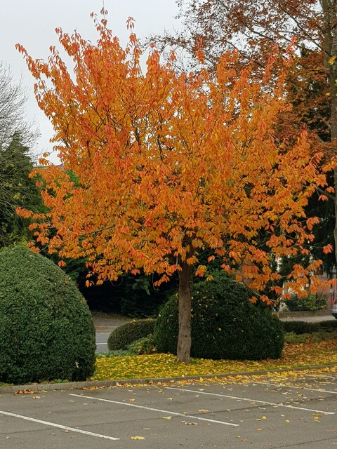
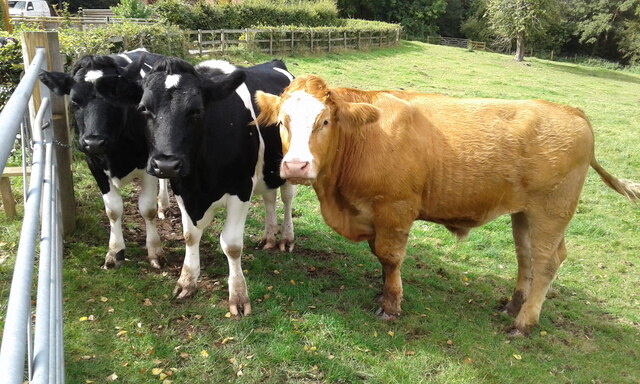
The woodland boasts a diverse range of flora and fauna, making it a haven for nature enthusiasts and wildlife lovers. Ancient trees, including oak, beech, and birch, dominate the landscape, providing a rich habitat for a variety of woodland creatures. Visitors can expect to spot native species such as deer, foxes, badgers, and a multitude of bird species.

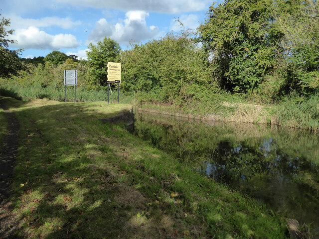
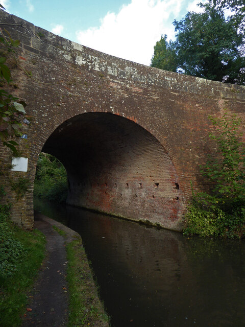
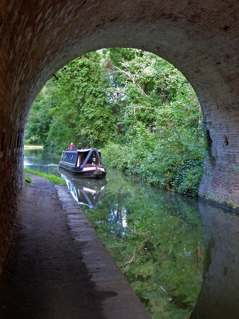
The woods are crisscrossed by a network of well-maintained footpaths, allowing visitors to explore the area at their leisure. These paths wind through dense woodlands, open glades, and alongside babbling brooks, offering a truly immersive experience with nature. A quaint wooden bridge crosses a small stream, adding to the charm and tranquility of the setting.

Droitwich Community Woods also offers a range of recreational activities for all ages. Families can enjoy picnicking in designated areas, while children can let their imaginations run wild in the adventure playground. The woods also feature a dedicated cycle path, providing a safe and enjoyable route for cyclists.

With its stunning natural beauty and diverse ecosystem, Droitwich Community Woods is a hidden gem that offers a peaceful retreat for both locals and tourists alike. Whether you seek solitude, outdoor activities, or simply wish to reconnect with nature, this woodland sanctuary is sure to captivate your senses.

If you have any feedback on the listing, please let us know in the comments section below.

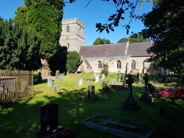
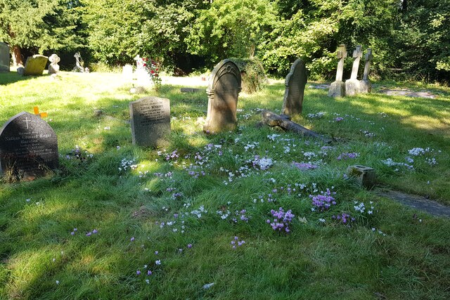
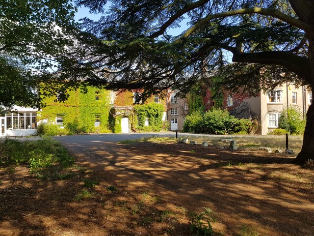
Droitwich Community Woods Images

Images are sourced within 2km of 52.262037/-2.1751175 or Grid Reference SO8862. Thanks to Geograph Open Source API. All images are credited.

Autumn tree, Lido car park, Droitwich
No. 1 Corbett, Avenue, Droitwich A striking building from 1906 in what I think is the arts and Crafts style. Currently used by a chiropractor but it has been used by an architect's practice and as a GP surgery in the past. This building is not listed despite its obvious class.
No. 1 Corbett, Avenue, Droitwich
A striking building from 1906 in what I think is the arts and Crafts style. Currently used by a chiropractor but it has been used by an architect's practice and as a GP surgery in the past. This building is not listed despite its obvious class.
No. 31 High Street, Droitwich This is one part of 31-35 High Street that are collectively Listed Grade II (star). This building has been recently restored to its former appearance and now looks very different to its earlier appearance. This is a mediaeval hall house dating to around 1400 with later extensions.
No. 31 High Street, Droitwich
This is one part of 31-35 High Street that are collectively Listed Grade II (star). This building has been recently restored to its former appearance and now looks very different to its earlier appearance. This is a mediaeval hall house dating to around 1400 with later extensions.
Monument to a family pets, Droitwich Spa The 'Salt King', John Corbett, who developed Droitwich into a spa as well as modernising the salt production is honoured by the town. This monument to the Corbett family pets stood in the grounds of Chateau Impney, the family home. When the Chateau was sold to become an hotel the pet monument was moved to the entrance of the Lido Park.
Monument to a family pets, Droitwich Spa
The 'Salt King', John Corbett, who developed Droitwich into a spa as well as modernising the salt production is honoured by the town. This monument to the Corbett family pets stood in the grounds of Chateau Impney, the family home. When the Chateau was sold to become an hotel the pet monument was moved to the entrance of the Lido Park.
Field with pylon in Martin Hussingtree parish
Droitwich Canal - bridge hole with submerged cill There used to be a swing bridge across this narrowing of the canal but it was removed some years ago and dumped on the far bank. It might still be hidden in the undergrowth.
Droitwich Canal - bridge hole with submerged cill
There used to be a swing bridge across this narrowing of the canal but it was removed some years ago and dumped on the far bank. It might still be hidden in the undergrowth.
Droitwich Barge Canal - bridge No. 7 Salwarpe Bridge carrying Copcut lane over the canal.
Droitwich Barge Canal - bridge No. 7
Salwarpe Bridge carrying Copcut lane over the canal.
Droitwich Barge Canal from under bridge No. 7 Looking toward Droitwich
Droitwich Barge Canal from under bridge No. 7
Looking toward Droitwich
Churchfields Farm - milk sales An old electric milk float converted for self-service milk sales. The farm is noted for its ice cream and is also the home of Droitwich salt made on a small scale in open pans.
Churchfields Farm - milk sales
An old electric milk float converted for self-service milk sales. The farm is noted for its ice cream and is also the home of Droitwich salt made on a small scale in open pans.
Old Boundary Marker on the A38 Worcester Road Parish Boundary Marker against a bridge parapet on the west side of the A38 Worcester Road. On the boundary of Martin Hussingtree and Salwarpe parishes.

Milestone Society National ID: WO_MAHUSA01pb
Old Boundary Marker on the A38 Worcester Road
Parish Boundary Marker against a bridge parapet on the west side of the A38 Worcester Road. On the boundary of Martin Hussingtree and Salwarpe parishes. Milestone Society National ID: WO_MAHUSA01pb
St. Michael & All Angels, Salwarpe
Flowers amongst the graves at Salwarpe This can be compared with the spot in <a href="https://www.geograph.org.uk/photo/5165353">SO8762 : Wild flowers amongst the graves, Salwarpe churchyard</a>.
Flowers amongst the graves at Salwarpe
This can be compared with the spot in SO8762 : Wild flowers amongst the graves, Salwarpe churchyard.
Old Bridge Marker on the A4133 Bridge Marker inscribed in the north parapet of Ward's Bridge, Hadley Brook, on the A4133. On the boundary of Ombersley, Westwood and Salwarpe parishes.

Milestone Society National ID: WO_OMWESA01br
Old Bridge Marker on the A4133
Bridge Marker inscribed in the north parapet of Ward's Bridge, Hadley Brook, on the A4133. On the boundary of Ombersley, Westwood and Salwarpe parishes. Milestone Society National ID: WO_OMWESA01br
St Andrews House Hotel Temporarily closed but re-opening soon.
St Andrews House Hotel
Temporarily closed but re-opening soon.
Locals at Mayhouse Farm Rescued cows at the farm.
Locals at Mayhouse Farm
Rescued cows at the farm.
Autumn trees, Windsor Road, Droitwich
Autumn trees, Newland Road, Droitwich
Jakeman's Hill Farm (1) Between Droitwich and the Hampton Lovett Industrial Estate.
Jakeman's Hill Farm (1)
Between Droitwich and the Hampton Lovett Industrial Estate.
Show me another place!

Droitwich Community Woods is located at Grid Ref: SO8862 (Lat: 52.262037, Lng: -2.1751175)

Administrative County: Worcestershire

District: Wychavon

Police Authority: West Mercia

What 3 Words

///boarding.swooned.ratty. Near Droitwich, Worcestershire

Related Wikis

Droitwich Spa High School

Droitwich Spa High School is a secondary school and specialist Sports College with academy status in Droitwich Spa, Worcestershire, England. It serves...

Salwarpe

Salwarpe is a small village and civil parish in the Wychavon district of Worcestershire, England, less than two miles south west of Droitwich, but in open...

Westwood Priory

Westwood Priory (priory of St. Mary) was a priory of Benedictine nuns founded in 1153, near Droitwich, Worcestershire, England. It was a daughter house...

Droitwich Spa railway station

Droitwich Spa railway station serves the town of Droitwich Spa in Worcestershire, England. It is located just to the south-west of Droitwich Spa Junction...

Church of the Sacred Heart and St Catherine of Alexandria

The Church of the Sacred Heart and St Catherine of Alexandria is a Catholic church situated in Droitwich Spa, Worcestershire, England, noted for its remarkable...

Westwood House

Westwood House is a stately home, near Droitwich, Worcestershire, England. It has been subdivided into twelve self-contained apartments. The house has...

Droitwich Spa

Droitwich Spa (often abbreviated to Droitwich ) is a historic spa town in the Wychavon district in northern Worcestershire, England, on the River Salwarpe...

Old Town Hall, Droitwich Spa

The Old Town Hall is a municipal building in St Andrews Street, Droitwich Spa, Worcestershire, England. The structure, which was the headquarters of Droitwich...

Nearby Amenities

Located within 500m of 52.262037,-2.1751175
Motorway Junction
Lat/Long: 52.2604712/-2.1773895
Motorway Junction
Lat/Long: 52.2651606/-2.1725909
Bus Stop
Chalverton Court
Bus: yes
Naptan AtcoCode: 2000G001800
Naptan Bearing: W
Naptan BusStopType: CUS
Naptan CommonName: Chalverton Court
Naptan Indicator: adj
Naptan NaptanCode: wocdgpda
Naptan Street: New Chawson Lane
Naptan Verified: no
Public Transport: platform
Source: naptan_import
Lat/Long: 52.2592254/-2.1708341
Bus Stop
New Chawson Lane
Bus: yes
Naptan AtcoCode: 2000G502732
Naptan Bearing: NW
Naptan CommonName: New Chawson Lane
Naptan Crossing: New Chawson Lane
Naptan Indicator: Adj
Naptan NaptanCode: wocdgdwa
Naptan Street: Ombersley Way
Naptan Verified: no
Public Transport: platform
Source: naptan_import
Lat/Long: 52.2606015/-2.1711788
Noexit: yes
Lat/Long: 52.260098/-2.1723976
Noexit: yes
Lat/Long: 52.2603027/-2.1721499
Post Box
Collection Plate: CP7
Collection Times: Mo-Fr 16:30; Sa 11:00
Historic Operator: Post Office
Post Box Type: lamp
Ref: WR9 127
Royal Cypher: EIIR
Royal Cypher Wikidata: Q33102113
Lat/Long: 52.2597481/-2.172496
Power: pole
Lat/Long: 52.2601133/-2.1789492
Power: pole
Lat/Long: 52.2640242/-2.1790305
Power: pole
Lat/Long: 52.2629313/-2.1789213
Bench
Lat/Long: 52.2591855/-2.1779779
Location Transition: yes
Power: pole
Lat/Long: 52.2648908/-2.1776893
Power: pole
Lat/Long: 52.2623217/-2.1792443
Power: pole
Lat/Long: 52.2612017/-2.1791139
Power: pole
Lat/Long: 52.2589953/-2.1787789
Chawson Crossing
Crossing Barrier: no
Railway: crossing
Supervised: no
Lat/Long: 52.2589488/-2.1699997
Barrier: bollard
Bollard: fixed
Lat/Long: 52.259184/-2.1722442
Fixme: incompleate
Lat/Long: 52.2599194/-2.1768769
Crossing Barrier: no
Railway: crossing
Supervised: no
Lat/Long: 52.2589307/-2.1699585
Generator Method: photovoltaic
Generator Output Electricity: yes
Generator Source: solar
Generator Type: solar_photovoltaic_panel
Location: roof
Power: generator
Lat/Long: 52.2625475/-2.169604
Generator Method: photovoltaic
Generator Output Electricity: yes
Generator Source: solar
Generator Type: solar_photovoltaic_panel
Location: roof
Power: generator
Lat/Long: 52.2632107/-2.1683152
Generator Method: photovoltaic
Generator Output Electricity: yes
Generator Source: solar
Generator Type: solar_photovoltaic_panel
Location: roof
Power: generator
Lat/Long: 52.2629874/-2.1685539
Generator Method: photovoltaic
Generator Output Electricity: yes
Generator Source: solar
Generator Type: solar_photovoltaic_panel
Location: roof
Power: generator
Lat/Long: 52.2630621/-2.1686398
Generator Method: photovoltaic
Generator Output Electricity: yes
Generator Source: solar
Generator Type: solar_photovoltaic_panel
Location: roof
Power: generator
Lat/Long: 52.2625245/-2.1685606
Generator Method: photovoltaic
Generator Output Electricity: yes
Generator Source: solar
Generator Type: solar_photovoltaic_panel
Location: roof
Power: generator
Lat/Long: 52.2622011/-2.1709599
Generator Method: photovoltaic
Generator Output Electricity: yes
Generator Source: solar
Generator Type: solar_photovoltaic_panel
Location: roof
Power: generator
Lat/Long: 52.2619261/-2.1706501
Generator Method: photovoltaic
Generator Output Electricity: yes
Generator Source: solar
Generator Type: solar_photovoltaic_panel
Location: roof
Power: generator
Lat/Long: 52.2617767/-2.1695168
Generator Method: photovoltaic
Generator Output Electricity: yes
Generator Source: solar
Generator Type: solar_photovoltaic_panel
Location: roof
Power: generator
Lat/Long: 52.2617463/-2.1694283
Generator Method: photovoltaic
Generator Output Electricity: yes
Generator Source: solar
Generator Type: solar_photovoltaic_panel
Location: roof
Power: generator
Lat/Long: 52.2588265/-2.174542
Generator Method: photovoltaic
Generator Output Electricity: yes
Generator Source: solar
Generator Type: solar_photovoltaic_panel
Location: roof
Power: generator
Lat/Long: 52.2599544/-2.1723157
Generator Method: photovoltaic
Generator Output Electricity: yes
Generator Source: solar
Generator Type: solar_photovoltaic_panel
Location: roof
Power: generator
Lat/Long: 52.257986/-2.1723479
Generator Method: photovoltaic
Generator Output Electricity: yes
Generator Source: solar
Generator Type: solar_photovoltaic_panel
Location: roof
Power: generator
Lat/Long: 52.2581731/-2.171503
Generator Method: photovoltaic
Generator Output Electricity: yes
Generator Source: solar
Generator Type: solar_photovoltaic_panel
Location: roof
Power: generator
Lat/Long: 52.2579318/-2.172887
Generator Method: photovoltaic
Generator Output Electricity: yes
Generator Source: solar
Generator Type: solar_photovoltaic_panel
Location: roof
Power: generator
Lat/Long: 52.2657526/-2.1724659
Location Transition: yes
Power: pole
Lat/Long: 52.2586579/-2.1759179
Power: pole
Lat/Long: 52.2577889/-2.1758173
Power: pole
Lat/Long: 52.258657/-2.1763075
Location Transition: yes
Power: pole
Lat/Long: 52.2586509/-2.1777941
Location Transition: yes
Power: pole
Lat/Long: 52.258641/-2.1792982
Barrier: height_restrictor
Lat/Long: 52.2618354/-2.173814
Leisure: picnic_table
Lat/Long: 52.261575/-2.1737911
Leisure: picnic_table
Lat/Long: 52.262895/-2.1741676
Information: board
Tourism: information
Lat/Long: 52.26142/-2.1738972
Information: board
Tourism: information
Lat/Long: 52.2615729/-2.174017
Information: board
Tourism: information
Lat/Long: 52.2617992/-2.173952
The data included in this document is from www.openstreetmap.org. The data is made available under ODbL.

Have you been to Droitwich Community Woods?

Leave your review of Droitwich Community Woods below (or comments, questions and feedback).