Chawson Valley

Settlement in Worcestershire Wychavon

England

Chawson Valley

Autumn tree, Lido car park, Droitwich
Autumn tree, Lido car park, Droitwich Credit: Jeff Gogarty

Chawson Valley is a picturesque area located in Worcestershire, a county in the West Midlands region of England. Nestled between the towns of Droitwich Spa and Worcester, this charming valley offers a tranquil escape from the bustle of urban life.

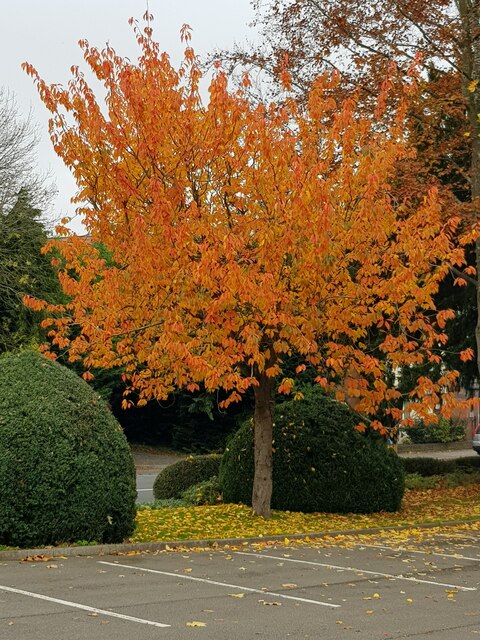
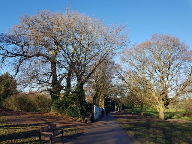
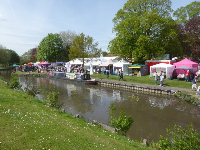
Known for its stunning natural beauty, Chawson Valley is home to lush green fields, rolling hills, and meandering streams. The valley is dotted with a variety of deciduous trees, creating a colorful landscape that changes with the seasons. Walking trails wind through the valley, providing visitors with the opportunity to explore and enjoy the peaceful surroundings.

The valley is also rich in wildlife, with an abundance of bird species, small mammals, and insects. Nature enthusiasts can spot creatures such as deer, foxes, and rabbits while exploring the area. Chawson Valley is a popular destination for birdwatchers, who can observe a diverse range of species including woodpeckers, kingfishers, and herons.

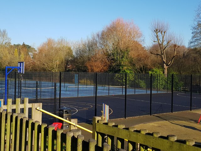
Chawson Valley is not only a haven for nature lovers but also offers recreational facilities for visitors. The valley features a well-maintained park with play areas for children, perfect for family outings. Picnic spots are scattered throughout the valley, providing a serene setting for outdoor meals and relaxation.

Overall, Chawson Valley offers a delightful blend of natural beauty and recreational opportunities. Whether it's a peaceful walk, birdwatching, or simply enjoying a picnic amidst stunning surroundings, this Worcestershire gem is sure to captivate visitors seeking a respite in nature.

If you have any feedback on the listing, please let us know in the comments section below.

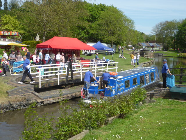
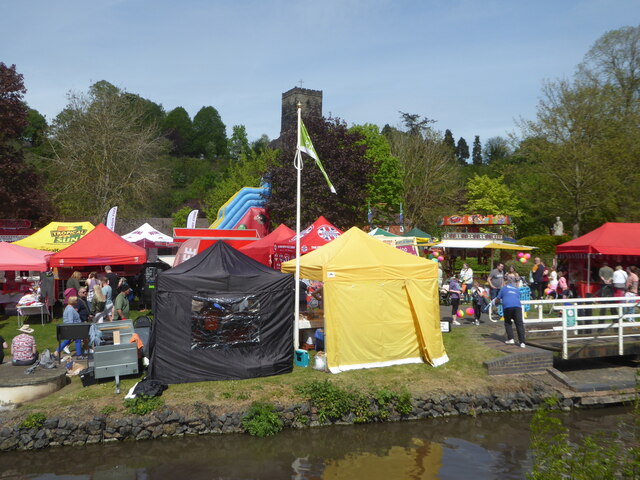
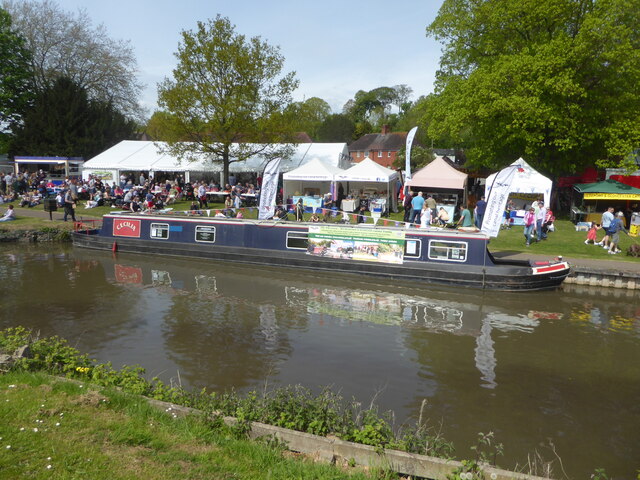
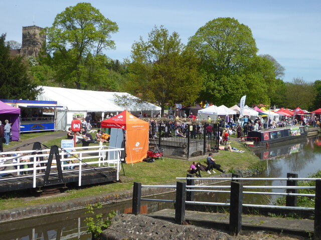
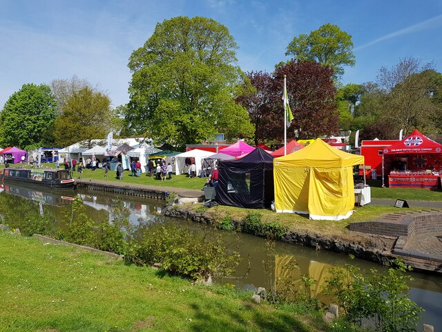
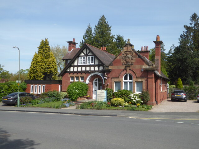
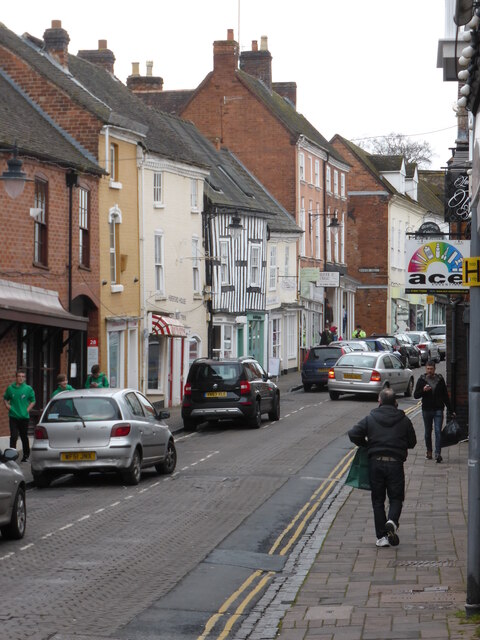
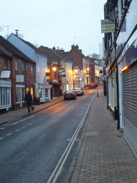
Chawson Valley Images

Images are sourced within 2km of 52.260658/-2.1715518 or Grid Reference SO8862. Thanks to Geograph Open Source API. All images are credited.

Autumn tree, Lido car park, Droitwich
Winter trees and basketball court, Lido Park, Droitwich
Winter trees, Lido Park, Droitwich Spa
Brantwood Road, Droitwich looking towards the water tower
St Richards Canal Festival, Droitwich To raise money for the hospice.
St Richards Canal Festival, Droitwich
To raise money for the hospice.
St Richards Canal Festival, Droitwich A trip boat passing through one of the swing bridges in Vines Park. The festival is to raise money for the hospice.
St Richards Canal Festival, Droitwich
A trip boat passing through one of the swing bridges in Vines Park. The festival is to raise money for the hospice.
St Richards Canal Festival, Droitwich St Augustine's church is on the hill in the background. The festival was to raise money for the hospice in Worcester and was getting quite crowded.
St Richards Canal Festival, Droitwich
St Augustine's church is on the hill in the background. The festival was to raise money for the hospice in Worcester and was getting quite crowded.
St Richards Canal Festival, Droitwich In Vines Park on the Droitwich Barge Canal. To raise money for the hospice.
St Richards Canal Festival, Droitwich
In Vines Park on the Droitwich Barge Canal. To raise money for the hospice.
St Richards Canal Festival, Droitwich
Stalls at St Richard's Canal Festival, Droitwich Spa
No. 1 Corbett, Avenue, Droitwich A striking building from 1906 in what I think is the arts and Crafts style. Currently used by a chiropractor but it has been used by an architect's practice and as a GP surgery in the past. This building is not listed despite its obvious class.
No. 1 Corbett, Avenue, Droitwich
A striking building from 1906 in what I think is the arts and Crafts style. Currently used by a chiropractor but it has been used by an architect's practice and as a GP surgery in the past. This building is not listed despite its obvious class.
Public conveniences, Lido Park, Droitwich There is a café to the left. The open air pool is behind but was closed at that time of year.
Public conveniences, Lido Park, Droitwich
There is a café to the left. The open air pool is behind but was closed at that time of year.
Droitwich Lido - prepared for winter Closed for the season.
Droitwich Lido - prepared for winter
Closed for the season.
Bandstand, Lido Park, Droitwich The subject position is fine but the photographer position and view direction are based on the assumption that the roof in the background is by the bowling green.
Bandstand, Lido Park, Droitwich
The subject position is fine but the photographer position and view direction are based on the assumption that the roof in the background is by the bowling green.
Droitwich High Street Showing signs of subsidence caused by previous brine extraction from under the town.
Droitwich High Street
Showing signs of subsidence caused by previous brine extraction from under the town.
Droitwich High Street at dusk Sorry, it's not pin-sharp.
Droitwich High Street at dusk
Sorry, it's not pin-sharp.
Dovecote at St Peter's Manor, Droitwich A 17th century dovecote with 750 nesting holes. Listed Grade II. Seen from a public path.
Dovecote at St Peter's Manor, Droitwich
A 17th century dovecote with 750 nesting holes. Listed Grade II. Seen from a public path.
No. 31 High Street, Droitwich This is one part of 31-35 High Street that are collectively Listed Grade II (star). This building has been recently restored to its former appearance and now looks very different to its earlier appearance. This is a mediaeval hall house dating to around 1400 with later extensions.
No. 31 High Street, Droitwich
This is one part of 31-35 High Street that are collectively Listed Grade II (star). This building has been recently restored to its former appearance and now looks very different to its earlier appearance. This is a mediaeval hall house dating to around 1400 with later extensions.
Show me another place!

Chawson Valley is located at Grid Ref: SO8862 (Lat: 52.260658, Lng: -2.1715518)

Administrative County: Worcestershire

District: Wychavon

Police Authority: West Merica

What 3 Words

///scarecrow.concerned.fade. Near Droitwich, Worcestershire

Related Wikis

Droitwich Spa High School

Droitwich Spa High School is a secondary school and specialist Sports College with academy status in Droitwich Spa, Worcestershire, England. It serves...

Salwarpe

Salwarpe is a small village and civil parish in the Wychavon district of Worcestershire, England, less than two miles south west of Droitwich, but in open...

Westwood Priory

Westwood Priory (priory of St. Mary) was a priory of Benedictine nuns founded in 1153, near Droitwich, Worcestershire, England. It was a daughter house...

Church of the Sacred Heart and St Catherine of Alexandria

The Church of the Sacred Heart and St Catherine of Alexandria is a Catholic church situated in Droitwich Spa, Worcestershire, England, noted for its remarkable...

Droitwich Spa railway station

Droitwich Spa railway station serves the town of Droitwich Spa in Worcestershire, England. It is located just to the south-west of Droitwich Spa Junction...

Droitwich Spa

Droitwich Spa (often abbreviated to Droitwich ) is a historic spa town in the Wychavon district in northern Worcestershire, England, on the River Salwarpe...

Westwood House

Westwood House is a stately home, near Droitwich, Worcestershire, England. It has been subdivided into twelve self-contained apartments. The house has...

Old Town Hall, Droitwich Spa

The Old Town Hall is a municipal building in St Andrews Street, Droitwich Spa, Worcestershire, England. The structure, which was the headquarters of Droitwich...

Nearby Amenities

Located within 500m of 52.260658,-2.1715518
Motorway Junction
Lat/Long: 52.2604712/-2.1773895
Bus Stop
Valley Way
Bus: yes
Naptan AtcoCode: 2000G001700
Naptan Bearing: SW
Naptan CommonName: Valley Way
Naptan Crossing: Valley Way
Naptan Indicator: opp
Naptan NaptanCode: wocdgpaw
Naptan PlusbusZoneRef: DRTWCHS
Naptan Street: Ombersley Way
Naptan Verified: no
Public Transport: platform
Source: naptan_import
Lat/Long: 52.261399/-2.1672622
Bus Stop
Chalverton Court
Bus: yes
Naptan AtcoCode: 2000G001800
Naptan Bearing: W
Naptan BusStopType: CUS
Naptan CommonName: Chalverton Court
Naptan Indicator: adj
Naptan NaptanCode: wocdgpda
Naptan Street: New Chawson Lane
Naptan Verified: no
Public Transport: platform
Source: naptan_import
Lat/Long: 52.2592254/-2.1708341
Bus Stop
Valley Way
Bus: yes
Naptan AtcoCode: 2000G022500
Naptan Bearing: NE
Naptan CommonName: Valley Way
Naptan Crossing: Valley Way
Naptan Indicator: adj
Naptan NaptanCode: wocdtmpd
Naptan PlusbusZoneRef: DRTWCHS
Naptan Street: Ombersley Way
Naptan Verified: no
Public Transport: platform
Source: naptan_import
Lat/Long: 52.2617302/-2.1670195
Bus Stop
Celvestune Way
Bus: yes
Naptan AtcoCode: 2000G323282
Naptan Bearing: SW
Naptan CommonName: Celvestune Way
Naptan Indicator: adj
Naptan Landmark: Coleford Walk
Naptan NaptanCode: wocgjpmj
Naptan PlusbusZoneRef: DRTWCHS
Naptan Street: Celvestune Way
Naptan Verified: no
Public Transport: platform
Source: naptan_import
Lat/Long: 52.2575509/-2.1668321
Bus Stop
Colford Walk
Bus: yes
Naptan AtcoCode: 2000G502716
Naptan Bearing: NE
Naptan CommonName: Colford Walk
Naptan Indicator: adj
Naptan Landmark: Colford Walk
Naptan NaptanCode: wocdgjdj
Naptan PlusbusZoneRef: DRTWCHS
Naptan Street: Celvestune Way
Naptan Verified: no
Public Transport: platform
Source: naptan_import
Lat/Long: 52.2576216/-2.1669748
Bus Stop
Blake Avenue
Bus: yes
Naptan AtcoCode: 2000G502720
Naptan Bearing: N
Naptan CommonName: Blake Avenue
Naptan Indicator: Adj
Naptan Landmark: Blake Avenue
Naptan NaptanCode: wocdgdta
Naptan PlusbusZoneRef: DRTWCHS
Naptan Street: Celvestune Way
Naptan Verified: no
Public Transport: platform
Source: naptan_import
Lat/Long: 52.2598373/-2.166359
Bus Stop
Celvestune Way
Bus: yes
Naptan AtcoCode: 2000G502721
Naptan Bearing: N
Naptan CommonName: Celvestune Way
Naptan Indicator: Adj
Naptan Landmark: Bower Hill
Naptan NaptanCode: wocdgdtd
Naptan PlusbusZoneRef: DRTWCHS
Naptan Street: Celvestune Way
Naptan Verified: no
Public Transport: platform
Source: naptan_import
Lat/Long: 52.2604445/-2.1670586
Bus Stop
New Chawson Lane
Bus: yes
Naptan AtcoCode: 2000G502732
Naptan Bearing: NW
Naptan CommonName: New Chawson Lane
Naptan Crossing: New Chawson Lane
Naptan Indicator: Adj
Naptan NaptanCode: wocdgdwa
Naptan Street: Ombersley Way
Naptan Verified: no
Public Transport: platform
Source: naptan_import
Lat/Long: 52.2606015/-2.1711788
Noexit: yes
Lat/Long: 52.260098/-2.1723976
Noexit: yes
Lat/Long: 52.2603027/-2.1721499
Turning Circle
Source: bing
Lat/Long: 52.2576008/-2.1709087
Turning Circle
Source: bing
Lat/Long: 52.2572732/-2.170166
Turning Circle
Source: bing
Lat/Long: 52.256872/-2.1683329
Post Box
Collection Plate: CP7
Collection Times: Mo-Fr 16:30; Sa 11:00
Historic Operator: Royal Mail
Post Box Type: lamp
Ref: WR9 368
Royal Cypher: EIIR
Royal Cypher Wikidata: Q33102113
Lat/Long: 52.2617555/-2.1672473
Post Box
Collection Plate: CP7
Collection Times: Mo-Fr 16:30; Sa 11:00
Historic Operator: Post Office
Post Box Type: lamp
Ref: WR9 127
Royal Cypher: EIIR
Royal Cypher Wikidata: Q33102113
Lat/Long: 52.2597481/-2.172496
Post Box
Note: reference is conjectural
Post Box Type: lamp
Ref: WR9 85
Lat/Long: 52.2571593/-2.167484
Bench
Lat/Long: 52.2591855/-2.1779779
Chawson
Place: suburb
Lat/Long: 52.258908/-2.167364
Chawson Crossing
Crossing Barrier: no
Railway: crossing
Supervised: no
Lat/Long: 52.2589488/-2.1699997
Barrier: bollard
Bollard: fixed
Lat/Long: 52.259184/-2.1722442
Fixme: incompleate
Lat/Long: 52.2599194/-2.1768769
Crossing Barrier: no
Railway: crossing
Supervised: no
Lat/Long: 52.2589307/-2.1699585
Parking
Parking: layby
Source: bing
Lat/Long: 52.2567661/-2.1713662
Generator Method: photovoltaic
Generator Output Electricity: yes
Generator Source: solar
Generator Type: solar_photovoltaic_panel
Location: roof
Power: generator
Lat/Long: 52.256991/-2.1710444
Generator Method: photovoltaic
Generator Output Electricity: yes
Generator Source: solar
Generator Type: solar_photovoltaic_panel
Location: roof
Power: generator
Lat/Long: 52.2569565/-2.167579
Generator Method: photovoltaic
Generator Output Electricity: yes
Generator Source: solar
Generator Type: solar_photovoltaic_panel
Location: roof
Power: generator
Lat/Long: 52.2593059/-2.167021
Generator Method: photovoltaic
Generator Output Electricity: yes
Generator Source: solar
Generator Type: solar_photovoltaic_panel
Location: roof
Power: generator
Lat/Long: 52.2589628/-2.1662003
Generator Method: photovoltaic
Generator Output Electricity: yes
Generator Source: solar
Generator Type: solar_photovoltaic_panel
Location: roof
Power: generator
Lat/Long: 52.257014/-2.171216
Generator Method: photovoltaic
Generator Output Electricity: yes
Generator Source: solar
Generator Type: solar_photovoltaic_panel
Location: roof
Power: generator
Lat/Long: 52.2573998/-2.1690542
Generator Method: photovoltaic
Generator Output Electricity: yes
Generator Source: solar
Generator Type: solar_photovoltaic_panel
Location: roof
Power: generator
Lat/Long: 52.2591139/-2.1677184
Generator Method: photovoltaic
Generator Output Electricity: yes
Generator Source: solar
Generator Type: solar_photovoltaic_panel
Location: roof
Power: generator
Lat/Long: 52.2590942/-2.1676272
Generator Method: photovoltaic
Generator Output Electricity: yes
Generator Source: solar
Generator Type: solar_photovoltaic_panel
Location: roof
Power: generator
Lat/Long: 52.2586722/-2.1669379
Generator Method: photovoltaic
Generator Output Electricity: yes
Generator Source: solar
Generator Type: solar_photovoltaic_panel
Location: roof
Power: generator
Lat/Long: 52.2586837/-2.1650577
Generator Method: photovoltaic
Generator Output Electricity: yes
Generator Source: solar
Generator Type: solar_photovoltaic_panel
Location: roof
Power: generator
Lat/Long: 52.2587412/-2.1651837
Generator Method: photovoltaic
Generator Output Electricity: yes
Generator Source: solar
Generator Type: solar_photovoltaic_panel
Location: roof
Power: generator
Lat/Long: 52.2587609/-2.165283
Generator Method: photovoltaic
Generator Output Electricity: yes
Generator Solar Modules: 12
Generator Source: solar
Generator Type: solar_photovoltaic_panel
Location: roof
Power: generator
Lat/Long: 52.260199/-2.1661145
Generator Method: photovoltaic
Generator Output Electricity: yes
Generator Solar Modules: 4
Generator Source: solar
Generator Type: solar_photovoltaic_panel
Location: roof
Power: generator
Lat/Long: 52.2606916/-2.1666697
Generator Method: photovoltaic
Generator Output Electricity: yes
Generator Solar Modules: 4
Generator Source: solar
Generator Type: solar_photovoltaic_panel
Location: roof
Power: generator
Lat/Long: 52.2607375/-2.1666053
Generator Method: photovoltaic
Generator Output Electricity: yes
Generator Solar Modules: 4
Generator Source: solar
Generator Type: solar_photovoltaic_panel
Location: roof
Power: generator
Lat/Long: 52.2607523/-2.1665087
Generator Method: photovoltaic
Generator Output Electricity: yes
Generator Solar Modules: 5
Generator Source: solar
Generator Type: solar_photovoltaic_panel
Location: roof
Power: generator
Lat/Long: 52.2609395/-2.1662968
Generator Method: photovoltaic
Generator Output Electricity: yes
Generator Solar Modules: 5
Generator Source: solar
Generator Type: solar_photovoltaic_panel
Location: roof
Power: generator
Lat/Long: 52.261006/-2.1663237
Generator Method: photovoltaic
Generator Output Electricity: yes
Generator Solar Modules: 4
Generator Source: solar
Generator Type: solar_photovoltaic_panel
Location: roof
Power: generator
Lat/Long: 52.2608869/-2.1662244
Generator Method: photovoltaic
Generator Output Electricity: yes
Generator Source: solar
Generator Type: solar_photovoltaic_panel
Location: roof
Power: generator
Lat/Long: 52.2609296/-2.1652052
Generator Method: photovoltaic
Generator Output Electricity: yes
Generator Source: solar
Generator Type: solar_photovoltaic_panel
Location: roof
Power: generator
Lat/Long: 52.2567201/-2.1688584
Generator Method: photovoltaic
Generator Output Electricity: yes
Generator Source: solar
Generator Type: solar_photovoltaic_panel
Location: roof
Power: generator
Lat/Long: 52.2568301/-2.1685874
Generator Method: photovoltaic
Generator Output Electricity: yes
Generator Source: solar
Generator Type: solar_photovoltaic_panel
Location: roof
Power: generator
Lat/Long: 52.2625475/-2.169604
Generator Method: photovoltaic
Generator Output Electricity: yes
Generator Source: solar
Generator Type: solar_photovoltaic_panel
Location: roof
Power: generator
Lat/Long: 52.2632107/-2.1683152
Generator Method: photovoltaic
Generator Output Electricity: yes
Generator Source: solar
Generator Type: solar_photovoltaic_panel
Location: roof
Power: generator
Lat/Long: 52.2629874/-2.1685539
Generator Method: photovoltaic
Generator Output Electricity: yes
Generator Source: solar
Generator Type: solar_photovoltaic_panel
Location: roof
Power: generator
Lat/Long: 52.2630621/-2.1686398
Generator Method: photovoltaic
Generator Output Electricity: yes
Generator Source: solar
Generator Type: solar_photovoltaic_panel
Location: roof
Power: generator
Lat/Long: 52.2625245/-2.1685606
Generator Method: photovoltaic
Generator Output Electricity: yes
Generator Source: solar
Generator Type: solar_photovoltaic_panel
Location: roof
Power: generator
Lat/Long: 52.2622011/-2.1709599
Generator Method: photovoltaic
Generator Output Electricity: yes
Generator Source: solar
Generator Type: solar_photovoltaic_panel
Location: roof
Power: generator
Lat/Long: 52.2619261/-2.1706501
Generator Method: photovoltaic
Generator Output Electricity: yes
Generator Source: solar
Generator Type: solar_photovoltaic_panel
Location: roof
Power: generator
Lat/Long: 52.2617767/-2.1695168
Generator Method: photovoltaic
Generator Output Electricity: yes
Generator Source: solar
Generator Type: solar_photovoltaic_panel
Location: roof
Power: generator
Lat/Long: 52.2617463/-2.1694283
Crossing
Bicycle: yes
Crossing: traffic_signals
Lat/Long: 52.2586911/-2.1657297
Generator Method: photovoltaic
Generator Output Electricity: yes
Generator Source: solar
Generator Type: solar_photovoltaic_panel
Location: roof
Power: generator
Lat/Long: 52.2588265/-2.174542
Generator Method: photovoltaic
Generator Output Electricity: yes
Generator Source: solar
Generator Type: solar_photovoltaic_panel
Location: roof
Power: generator
Lat/Long: 52.2599544/-2.1723157
Generator Method: photovoltaic
Generator Output Electricity: yes
Generator Source: solar
Generator Type: solar_photovoltaic_panel
Location: roof
Power: generator
Lat/Long: 52.257986/-2.1723479
Generator Method: photovoltaic
Generator Output Electricity: yes
Generator Source: solar
Generator Type: solar_photovoltaic_panel
Location: roof
Power: generator
Lat/Long: 52.2581731/-2.171503
Generator Method: photovoltaic
Generator Output Electricity: yes
Generator Source: solar
Generator Type: solar_photovoltaic_panel
Location: roof
Power: generator
Lat/Long: 52.2579318/-2.172887
Noexit: yes
Lat/Long: 52.2615945/-2.1659126
Generator Method: photovoltaic
Generator Output Electricity: yes
Generator Source: solar
Generator Type: solar_photovoltaic_panel
Location: roof
Power: generator
Lat/Long: 52.2616593/-2.1644957
Location Transition: yes
Power: pole
Lat/Long: 52.2586579/-2.1759179
Chawson Gas Governor
Power: pole
Transformer: distribution
Voltage Primary: 11000
Lat/Long: 52.2570887/-2.1747699
Power: pole
Lat/Long: 52.2577889/-2.1758173
Power: pole
Lat/Long: 52.258657/-2.1763075
Location Transition: yes
Power: pole
Lat/Long: 52.2586509/-2.1777941
Barrier: height_restrictor
Lat/Long: 52.2618354/-2.173814
Leisure: picnic_table
Lat/Long: 52.261575/-2.1737911
Leisure: picnic_table
Lat/Long: 52.262895/-2.1741676
Information: board
Tourism: information
Lat/Long: 52.26142/-2.1738972
Information: board
Tourism: information
Lat/Long: 52.2615729/-2.174017
Information: board
Tourism: information
Lat/Long: 52.2617992/-2.173952
The data included in this document is from www.openstreetmap.org. The data is made available under ODbL.

Have you been to Chawson Valley?

Leave your review of Chawson Valley below (or comments, questions and feedback).