Cheadle Common

Settlement in Staffordshire Staffordshire Moorlands

England

Cheadle Common

Old Milestone, Threapwood Head Cast iron post by the B5032, in parish of ALTON (STAFFORDSHIRE MOORLANDS District), by hedge, on North side of road. Cochrane iron casting, erected by the County Council in the 20th century.

Inscription reads:-
: ALTON 2½ / DENSTONE 4½ / ELLASTONE 6¼ / ASHBOURNE 11 : : ALTON / PARISH : : CHEADLE 2 :
Maker:- Cochrane & Co, Dudley. :

Milestone Society National ID: ST_ABCD11
Old Milestone, Threapwood Head Credit: Ivan Clare

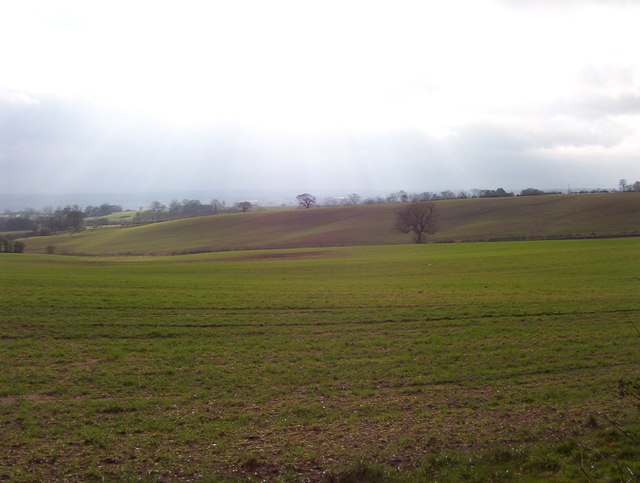
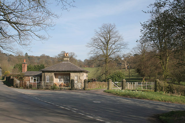
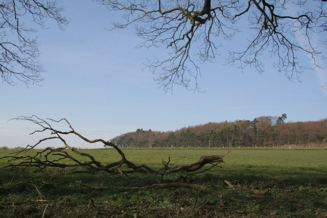
Cheadle Common is a rural area located in Staffordshire, England. Situated approximately 10 miles east of Stoke-on-Trent, it covers an expansive area of picturesque countryside, encompassing fields, woodlands, and meadows. The common is known for its natural beauty, offering a peaceful and idyllic setting for visitors and locals alike.

The common is home to a diverse range of flora and fauna, with an abundance of wildlife species thriving in its natural habitat. Visitors to Cheadle Common can expect to see a variety of bird species, including woodpeckers, thrushes, and owls, as well as mammals such as rabbits, foxes, and deer.

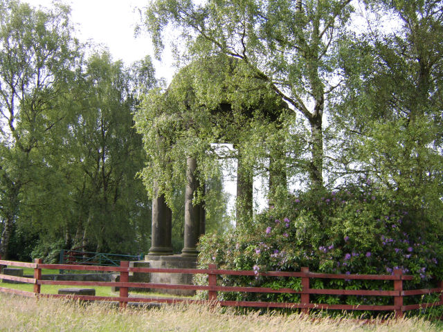
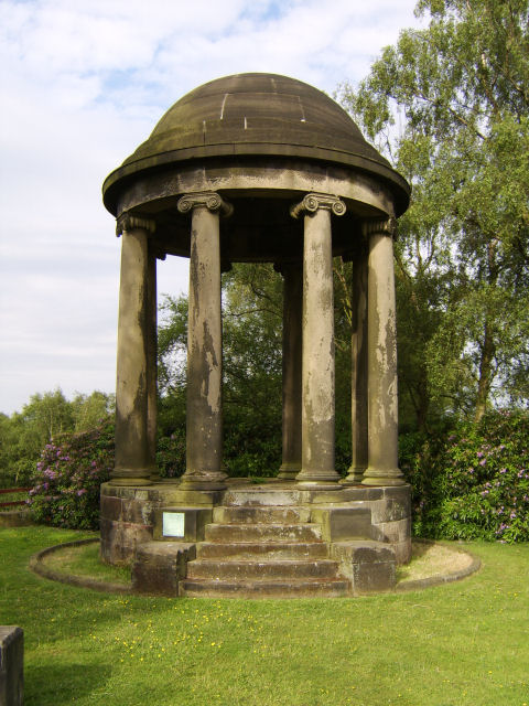
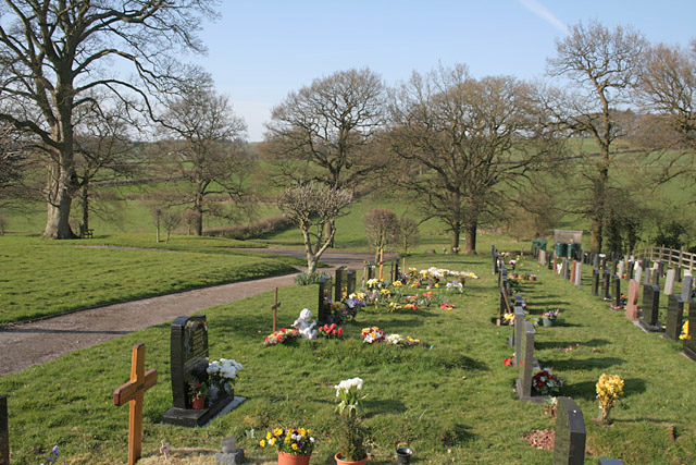
Historically, Cheadle Common has played a significant role in the local community, serving as a gathering place for traditional events and celebrations. It is also home to several ancient burial mounds, providing a glimpse into the area's rich heritage and past civilizations.

The common offers a range of recreational activities for outdoor enthusiasts, including walking, cycling, and horse riding. There are well-maintained footpaths and bridleways that crisscross the area, providing access to the stunning surroundings and allowing visitors to explore the natural wonders of Cheadle Common.

In summary, Cheadle Common in Staffordshire is a beautiful and tranquil rural area, offering an escape from the hustle and bustle of city life. With its diverse wildlife, rich history, and opportunities for outdoor recreation, it is a popular destination for nature lovers and those seeking a peaceful retreat in the heart of the English countryside.

If you have any feedback on the listing, please let us know in the comments section below.

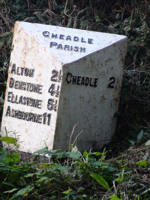
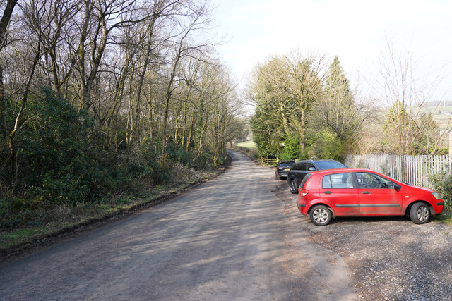
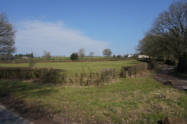
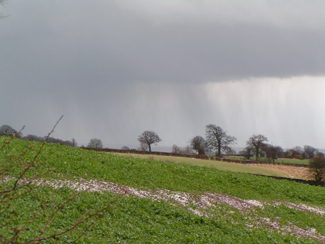
Cheadle Common Images

Images are sourced within 2km of 52.9689/-1.9637172 or Grid Reference SK0241. Thanks to Geograph Open Source API. All images are credited.

Old Milestone, Threapwood Head Cast iron post by the B5032, in parish of ALTON (STAFFORDSHIRE MOORLANDS District), by hedge, on North side of road. Cochrane iron casting, erected by the County Council in the 20th century.

Inscription reads:-
: ALTON 2½ / DENSTONE 4½ / ELLASTONE 6¼ / ASHBOURNE 11 : : ALTON / PARISH : : CHEADLE 2 :
Maker:- Cochrane & Co, Dudley. :

Milestone Society National ID: ST_ABCD11
Old Milestone, Threapwood Head
Cast iron post by the B5032, in parish of ALTON (STAFFORDSHIRE MOORLANDS District), by hedge, on North side of road. Cochrane iron casting, erected by the County Council in the 20th century. Inscription reads:- : ALTON 2½ / DENSTONE 4½ / ELLASTONE 6¼ / ASHBOURNE 11 : : ALTON / PARISH : : CHEADLE 2 : Maker:- Cochrane & Co, Dudley. : Milestone Society National ID: ST_ABCD11
A country lane With several cars parked the lane is quite wide at this point.
A country lane
With several cars parked the lane is quite wide at this point.
Near Winnoth Dale Gently rising land near the dale.
Near Winnoth Dale
Gently rising land near the dale.
Stormy afternoon near Hollington
Sun through the clouds Sun breaks through the cloud onto rolling farmland.  Looking towards Checkley from Hollington-Upper Tean road.
Sun through the clouds
Sun breaks through the cloud onto rolling farmland. Looking towards Checkley from Hollington-Upper Tean road.
Temple near Tean The Temple at Temple Wood Farm near Upper Tean, Staffordshire
Temple near Tean
The Temple at Temple Wood Farm near Upper Tean, Staffordshire
Temple near Tean The Temple at Temple Wood Farm near Upper Tean, Staffordshire
Temple near Tean
The Temple at Temple Wood Farm near Upper Tean, Staffordshire
Temple near Tean Detail of the plaque on the Temple at Temple Wood Farm near Upper Tean, Staffordshire
Temple near Tean
Detail of the plaque on the Temple at Temple Wood Farm near Upper Tean, Staffordshire
Upper Tean Cemetery
Upper Tean Cemetery
The Front Lodge, Heath House, Upper Tean A thoroughly typical entrance to a country mansion.
The Front Lodge, Heath House, Upper Tean
A thoroughly typical entrance to a country mansion.
North Plantation, above Upper Tean
Hollington Road With woods on both sides this is likely wto be quite dark when the trees are in leaf.
Hollington Road
With woods on both sides this is likely wto be quite dark when the trees are in leaf.
Downhill on the Heath House Lane towards Hollington Road and Lodge for Heath House
Paintball Lower Tean Our popular PAY AS YOU PLAY packages make it easy. You pay your game fee up-front, which also acts as your deposit, and then purchase your paintballs as and when you need them on the day.   <span class="nowrap"><a title="http://www.paintballguide.co.uk/paintball-site/index.asp?id=12113&area=Lower" rel="nofollow ugc noopener" href="http://www.paintballguide.co.uk/paintball-site/index.asp?id=12113&area=Lower">Link</a><img style="margin-left:2px;" alt="External link" title="External link - shift click to open in new window" src="https://s1.geograph.org.uk/img/external.png" width="10" height="10"/></span> Tean
Paintball Lower Tean
Our popular PAY AS YOU PLAY packages make it easy. You pay your game fee up-front, which also acts as your deposit, and then purchase your paintballs as and when you need them on the day. LinkExternal link Tean
Across rolling Farmland with Cannock Chase in extreme distance
Footpath heading in a northerly direction from the Hollington Road
Mother & Twins near the Hollington Road
Stable Block at The Heath House The stable block at The Heath House in need of renovation.
The Heath House has been used as a location in a number of professional films but in the 1960s local amateur film maker Bill Townley used the stable area to recreate the exploits of Jack Baskeyfield VC <span class="nowrap"><a title="http://en.wikipedia.org/wiki/John_Baskeyfield" rel="nofollow ugc noopener" href="http://en.wikipedia.org/wiki/John_Baskeyfield">Link</a><img style="margin-left:2px;" alt="External link" title="External link - shift click to open in new window" src="https://s1.geograph.org.uk/img/external.png" width="10" height="10"/></span> who lost his life at the Battle of Arnhem.
A digitised version of the film is available from the Staffordshire Film Archive <span class="nowrap"><a title="http://www.filmarchive.org.uk/products/baskeyfield-vc" rel="nofollow ugc noopener" href="http://www.filmarchive.org.uk/products/baskeyfield-vc">Link</a><img style="margin-left:2px;" alt="External link" title="External link - shift click to open in new window" src="https://s1.geograph.org.uk/img/external.png" width="10" height="10"/></span>
Stable Block at The Heath House
The stable block at The Heath House in need of renovation. The Heath House has been used as a location in a number of professional films but in the 1960s local amateur film maker Bill Townley used the stable area to recreate the exploits of Jack Baskeyfield VC LinkExternal link who lost his life at the Battle of Arnhem. A digitised version of the film is available from the Staffordshire Film Archive LinkExternal link
Show me another place!

Cheadle Common is located at Grid Ref: SK0241 (Lat: 52.9689, Lng: -1.9637172)

Administrative County: Staffordshire

District: Staffordshire Moorlands

Police Authority: Staffordshire

What 3 Words

///willpower.clustered.dice. Near Cheadle, Staffordshire

Related Wikis

Freehay

Freehay is a small village located 2 miles from the centre of Cheadle in Staffordshire, England. The village centre is at the main Freehay Bank (or Church...

Tean Road Sports Ground

Tean Road Sports Ground is a cricket ground in Cheadle, Staffordshire. The ground is located south of the town centre along the Tean Road, which itself...

Moorlands Sixth Form College

The Moorlands Sixth Form College is a Sixth Form College located in Cheadle, a historic market town in Staffordshire, England. The college caters for years...

Painsley Catholic College

Painsley Catholic College is a Roman Catholic secondary school with academy status in Cheadle, Staffordshire, England. The name comes from Painsley Hall...

Nearby Amenities

Located within 500m of 52.9689,-1.9637172
Bus Stop
Village Hall
Bus: yes
Naptan AtcoCode: 3800C807200
Naptan Bearing: N
Naptan CommonName: Village Hall
Naptan Indicator: Adj
Naptan Landmark: Village Hall
Naptan Street: Rakeway Rd
Naptan Verified: no
Public Transport: platform
Source: naptan_import
Lat/Long: 52.9679358/-1.9630882
Bus Stop
Village Hall
Bus: yes
Naptan AtcoCode: 3800C807201
Naptan Bearing: S
Naptan CommonName: Village Hall
Naptan Indicator: Opp
Naptan Landmark: Village Hall
Naptan Street: Rakeway Rd
Naptan Verified: no
Public Transport: platform
Source: naptan_import
Lat/Long: 52.9678638/-1.9628501
Bus Stop
Crossroads
Bus: yes
Naptan AtcoCode: 3800C815300
Naptan Bearing: S
Naptan CommonName: Crossroads
Naptan Indicator: Adj
Naptan Landmark: Crossroads
Naptan Street: Rakeway Rd (S)
Naptan Verified: no
Public Transport: platform
Source: naptan_import
Lat/Long: 52.9714422/-1.9647828
Bus Stop
Crossroads
Bus: yes
Naptan AtcoCode: 3800C815301
Naptan Bearing: N
Naptan CommonName: Crossroads
Naptan Indicator: Adj
Naptan Landmark: Crossroads
Naptan Street: Rakeway Rd (N)
Naptan Verified: no
Public Transport: platform
Source: naptan_import
Lat/Long: 52.9712984/-1.964917
Freehay Village Store
Shop: convenience
Lat/Long: 52.9716204/-1.9648783
Post Box
Post Box Type: wall
Lat/Long: 52.9715921/-1.9649248
Telephone
Defibrillator
Access: yes
Booth: K6
Colour: red
Covered: booth
Defibrillator Location: inside old red telephone box, Freehay
Emergency: defibrillator
Man Made: telephone_box
Lat/Long: 52.9715123/-1.9650373
Claythorpe Watermill
Man Made: watermill
Lat/Long: 52.966807/-1.9614597
Defibrillator
Access: yes
Defibrillator Location: On wall of Methodist Centre
Emergency: defibrillator
Level: 0
Opening Hours: 24/7
Operator: 999
Lat/Long: 52.9667828/-1.9615353
The data included in this document is from www.openstreetmap.org. The data is made available under ODbL.

Have you been to Cheadle Common?

Leave your review of Cheadle Common below (or comments, questions and feedback).