Chawnhill

Settlement in Worcestershire

England

Chawnhill

The Red Lion, Stourbridge
The Red Lion, Stourbridge Credit: Chris Whippet

Chawnhill is a small village located in the county of Worcestershire, England. Situated in the picturesque countryside, it is surrounded by rolling hills and lush green fields. The village is nestled in the heart of the Worcestershire countryside, providing its residents with a tranquil and peaceful environment.

Chawnhill is a tight-knit community with a population of around 500 people. The village is known for its strong sense of community spirit, with residents actively participating in various local events and initiatives. The village hall serves as a hub for social gatherings, hosting events such as community fairs and meetings.

The village boasts a number of amenities, including a local pub, a primary school, and a post office. The pub, known as "The Chawnhill Arms," is a popular spot for locals and visitors alike, offering a warm and friendly atmosphere. The primary school provides education for children in the village and surrounding areas, ensuring a close-knit community feel.

The surrounding countryside offers ample opportunities for outdoor activities, with numerous walking and cycling trails crisscrossing the area. Chawnhill is also located in close proximity to several larger towns, providing residents with easy access to additional amenities and services.

Overall, Chawnhill is a charming village that offers a peaceful and close community for its residents. With its idyllic countryside setting and strong community spirit, it is a desirable place to live for those seeking a quieter pace of life.

If you have any feedback on the listing, please let us know in the comments section below.
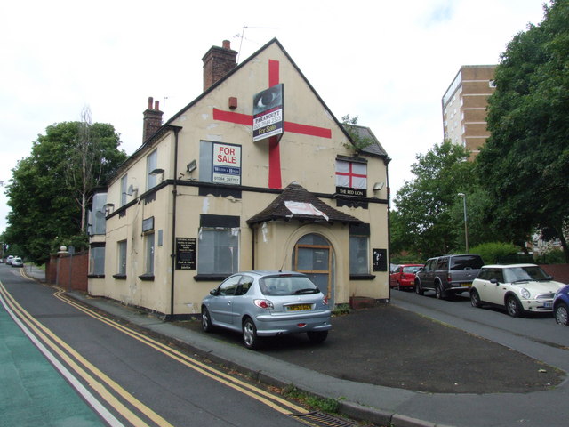
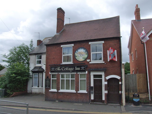
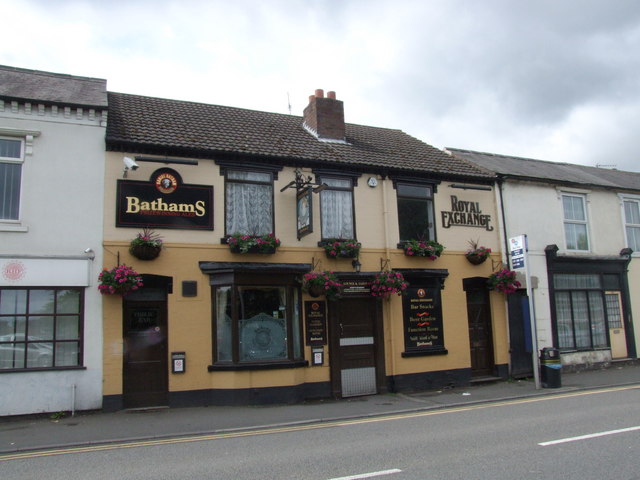
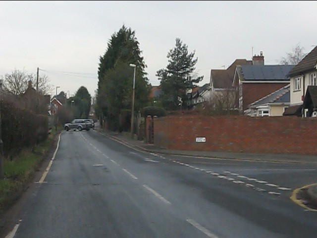
Chawnhill Images

Images are sourced within 2km of 52.444888/-2.1338388 or Grid Reference SO9183. Thanks to Geograph Open Source API. All images are credited.

The Red Lion, Stourbridge
The Cottage Inn, Stourbridge
Royal Exchange, Stourbridge
The former Cottage Inn (1), 49 Enville Street, Stourbridge This pub closed some time ago, and has now been converted into apartments. The former signs above the ground floor windows, and to the left of the left-most window, have been removed, but a plaque remains between the first floor windows. It looks as if there was also a sign on the left wall, which has also been removed. Beyond the pub, the previous buildings have been demolished, and on the site new retirement apartments have been built.

The plaque:- <a href="https://www.geograph.org.uk/photo/2651964">SO8984 : The former Cottage Inn (2) - plaque, 49 Enville Street, Stourbridge</a>.

In June 2011, the pub was photographed by Chris Whippet. It was possibly already closed, but the signage was still there. See:- <a href="https://www.geograph.org.uk/photo/2467446">SO8984 : The Cottage Inn, Stourbridge</a>.
The former Cottage Inn (1), 49 Enville Street, Stourbridge
This pub closed some time ago, and has now been converted into apartments. The former signs above the ground floor windows, and to the left of the left-most window, have been removed, but a plaque remains between the first floor windows. It looks as if there was also a sign on the left wall, which has also been removed. Beyond the pub, the previous buildings have been demolished, and on the site new retirement apartments have been built. The plaque:- SO8984 : The former Cottage Inn (2) - plaque, 49 Enville Street, Stourbridge. In June 2011, the pub was photographed by Chris Whippet. It was possibly already closed, but the signage was still there. See:- SO8984 : The Cottage Inn, Stourbridge.
The former Cottage Inn (2) - plaque, 49 Enville Street, Stourbridge Following the recent conversion of this former pub to apartments, this plaque between the first floor windows on the front wall remains. The colours have faded, but it is still possible to see that the idyllic picture of a thatched cottage bears absolutely no resemblance to the present building!

<a href="https://www.geograph.org.uk/photo/2651917">SO8984 : The former Cottage Inn (1), 49 Enville Street, Stourbridge</a>.
The former Cottage Inn (2) - plaque, 49 Enville Street, Stourbridge
Following the recent conversion of this former pub to apartments, this plaque between the first floor windows on the front wall remains. The colours have faded, but it is still possible to see that the idyllic picture of a thatched cottage bears absolutely no resemblance to the present building! SO8984 : The former Cottage Inn (1), 49 Enville Street, Stourbridge.
The Stourbridge Royal British Legion Club (1), 102-104 Enville Street, Stourbridge The club is located on the corner of Enville Street and Forge Road, with the main entrance from the latter road.

<a href="https://www.geograph.org.uk/photo/2661637">SO8984 : The Stourbridge Royal British Legion Club (2), 102-104 Enville Street, Stourbridge</a>.
The Stourbridge Royal British Legion Club (1), 102-104 Enville Street, Stourbridge
The club is located on the corner of Enville Street and Forge Road, with the main entrance from the latter road. SO8984 : The Stourbridge Royal British Legion Club (2), 102-104 Enville Street, Stourbridge.
The Stourbridge Royal British Legion Club (2), 102-104 Enville Street, Stourbridge Looking at the club from Forge Road, where the main entrance is located.

<a href="https://www.geograph.org.uk/photo/2661605">SO8984 : The Stourbridge Royal British Legion Club (1), 102-104 Enville Street, Stourbridge</a>.
The Stourbridge Royal British Legion Club (2), 102-104 Enville Street, Stourbridge
Looking at the club from Forge Road, where the main entrance is located. SO8984 : The Stourbridge Royal British Legion Club (1), 102-104 Enville Street, Stourbridge.
Scott's Road play space, Scott's Road, Wollaston, Stourbridge Part of the play space, which has recently been improved.

<a href="https://www.geograph.org.uk/photo/2675415">SO8984 : Scott's Road play space notice, Scott's Road, Wollaston, Stourbridge</a>.
<a href="https://www.geograph.org.uk/photo/2675467">SO8984 : Hut in Scott's Road play space, Scott's Road, Wollaston, Stourbridge</a>.
Scott's Road play space, Scott's Road, Wollaston, Stourbridge
Trust Skoda-Stourbridge (1), Enville Street, Stourbridge The Trust Group recently opened this Skoda car dealership in Stourbridge.

<a href="https://www.geograph.org.uk/photo/2675674">SO8984 : Trust Skoda-Stourbridge (2), Enville Street, Stourbridge</a>.
Trust Skoda-Stourbridge (1), Enville Street, Stourbridge
The Trust Group recently opened this Skoda car dealership in Stourbridge. SO8984 : Trust Skoda-Stourbridge (2), Enville Street, Stourbridge.
Trust Skoda-Stourbridge (2), Enville Street, Stourbridge The Skoda dealers in Stourbridge.

<a href="https://www.geograph.org.uk/photo/2675652">SO8984 : Trust Skoda-Stourbridge (1), Enville Street, Stourbridge</a>.
Trust Skoda-Stourbridge (2), Enville Street, Stourbridge
Mini traffic-island
Mini traffic-island
Racecourse Lane, Pedmore
Racecourse Lane at Fairways Avenue
Greyhound Lane
Greyhound Lane
Heath Pool, Mary Stevens Park, Stourbridge
Entrance to Mary Stevens Park, Stourbridge
Entrance to Stourbridge Town Hall and Library Inside the new redevelopment in Stourbridge town centre.
Entrance to Stourbridge Town Hall and Library
Inside the new redevelopment in Stourbridge town centre.
War Memorial (1), Mary Stevens Park, Stourbridge This imposing memorial now commemorates the dead of both World Wars and there is also a name from a much later conflict. Financed by subscriptions from the public, it was erected in 1923 and originally stood outside the public library at the junction of Hagley Road and Church Street. It was moved to the park in 1968 to make way for the inner ring road. 

The memorial was designed by Ernest W Pickford and unveiled on the 25th February 1923 by the Earl of Coventry. The bronze figure at the top is Peace holding out a wreath in one hand and a flag in the other. There are over 500 names inscribed on the memorial, of which 371 relate to the First World War (1914-1918). This does give a sobering indication of the terrible losses in these two conflicts. 

More photos of the memorial:-

<a href="https://www.geograph.org.uk/photo/3846996">SO8983 : War Memorial (2) - detail, Mary Stevens Park, Stourbridge</a>.
<a href="https://www.geograph.org.uk/photo/3846997">SO8983 : War Memorial (3) - detail, Mary Stevens Park, Stourbridge</a>.
<a href="https://www.geograph.org.uk/photo/3846998">SO8983 : War Memorial (4) - detail, Mary Stevens Park, Stourbridge</a>.
<a href="https://www.geograph.org.uk/photo/3847000">SO8983 : War Memorial (5), Mary Stevens Park, Stourbridge</a>.
War Memorial (1), Mary Stevens Park, Stourbridge
This imposing memorial now commemorates the dead of both World Wars and there is also a name from a much later conflict. Financed by subscriptions from the public, it was erected in 1923 and originally stood outside the public library at the junction of Hagley Road and Church Street. It was moved to the park in 1968 to make way for the inner ring road. The memorial was designed by Ernest W Pickford and unveiled on the 25th February 1923 by the Earl of Coventry. The bronze figure at the top is Peace holding out a wreath in one hand and a flag in the other. There are over 500 names inscribed on the memorial, of which 371 relate to the First World War (1914-1918). This does give a sobering indication of the terrible losses in these two conflicts. More photos of the memorial:- SO8983 : War Memorial (2) - detail, Mary Stevens Park, Stourbridge. SO8983 : War Memorial (3) - detail, Mary Stevens Park, Stourbridge. SO8983 : War Memorial (4) - detail, Mary Stevens Park, Stourbridge. SO8983 : War Memorial (5), Mary Stevens Park, Stourbridge.
Show me another place!

Chawnhill is located at Grid Ref: SO9183 (Lat: 52.444888, Lng: -2.1338388)

Unitary Authority: Dudley

Police Authority: West Midlands

What 3 Words

///hosts.brush.major. Near Stourbridge, West Midlands

Nearby Locations

Chawnhill

Related Wikis

Pedmore

Pedmore is a residential suburb of Stourbridge in the West Midlands of England bordering Lye , Wollescote and Oldswinford. It was originally a village...

Stourbridge Junction railway station

Stourbridge Junction is one of two railway stations serving the town of Stourbridge, in the Metropolitan Borough of Dudley in the West Midlands, England...

Stourbridge (UK Parliament constituency)

Stourbridge is a constituency in West Midlands represented in the House of Commons of the UK Parliament since 2019 by Suzanne Webb, a member of the Conservative...

Oldswinford

Oldswinford or Old Swinford is an area south of the centre of Stourbridge, West Midlands, England, which takes its name from a civil parish abolished in...

Nearby Amenities

Located within 500m of 52.444888,-2.1338388
Stourbridge Junction
Naptan AtcoCode: 9100STRBDGJ
Network: National Rail
Network Website: https://www.nationalrail.co.uk/stations/sbj/
Network Wikidata: Q26334
Public Transport: station
Railway: station
Ref Crs: SBJ
Source: NPE
West Midlands Fare Zone: 5
Wikidata: Q2045806
Wikipedia: en:Stourbridge Junction railway station
Lat/Long: 52.4476157/-2.1340314
Post Box
Brand: Royal Mail
Brand Wikidata: Q638098
Brand Wikipedia: en:Royal Mail
Collection Plate: CP1D
Collection Times: Mo-Fr 09:00; Sa 07:00
Drive Through: no
Operator: Royal Mail
Operator Wikidata: Q638098
Post Box Design: type_b
Post Box Type: pillar
Ref: DY8 33D
Royal Cypher: GR
Royal Cypher Wikidata: Q33102273
Source: survey
Lat/Long: 52.4477404/-2.1341433
Bus Stop
Ham Lane / Foley Rd
Bus: yes
Naptan AtcoCode: 43000820401
Naptan Bearing: SW
Naptan BusStopType: MKD
Naptan CommonName: Foley Rd
Naptan Indicator: opp
Naptan NaptanCode: nwmjtgdp
Naptan PlusbusZoneRef: BHAMNWS
Naptan Status: ACT
Naptan StopType: BCT
Naptan Street: HAM LANE
Naptan Towards: Pedmore
Naptan Verified: no
Public Transport: platform
Route Ref: 276;288
Source: WMCA
Lat/Long: 52.4408287/-2.1311568
Bus Stop
Ham Lane / Foley Rd
Bus: yes
Naptan AtcoCode: 43000820402
Naptan Bearing: NE
Naptan BusStopType: MKD
Naptan CommonName: Foley Rd
Naptan Indicator: adj
Naptan NaptanCode: nwmjtgdt
Naptan PlusbusZoneRef: BHAMNWS
Naptan Status: ACT
Naptan StopType: BCT
Naptan Street: HAM LANE
Naptan Towards: Stourbridge
Naptan Verified: no
Public Transport: platform
Route Ref: 276;288
Source: WMCA
Lat/Long: 52.4414042/-2.1310219
Bus Stop
Hagley Rd / Dingle Rd
Bench: no
Bin: no
Bus: yes
Lit: no
Naptan AtcoCode: 43000820501
Naptan Bearing: SE
Naptan BusStopType: MKD
Naptan CommonName: Dingle Rd
Naptan Indicator: adj
Naptan NaptanCode: nwmjtgdw
Naptan PlusbusZoneRef: BHAMNWS
Naptan Status: ACT
Naptan StopType: BCT
Naptan Street: HAGLEY RD
Naptan Towards: Pedmore
Naptan Verified: no
Public Transport: platform
Route Ref: 299;318
Shelter: no
Source: WMCA
Tactile Paving: no
Lat/Long: 52.441651/-2.1353332
Bus Stop
Hagley Rd / Dingle Rd
NaPTANAreaCode: 43000820502
Bench: yes
Bin: no
Bus: yes
Mapillary: 806956463260739
Naptan AtcoCode: 43000820502
Naptan Bearing: NW
Naptan BusStopType: MKD
Naptan CommonName: Dingle Rd
Naptan Indicator: opp
Naptan NaptanCode: nwmjtgja
Naptan PlusbusZoneRef: BHAMNWS
Naptan Status: ACT
Naptan StopType: BCT
Naptan Street: HAGLEY RD
Naptan Towards: Stourbridge
Naptan Verified: no
Public Transport: platform
Route Ref: 298;318
Shelter: yes
Shelter Ref: 408319
Source: WMCA
Survey Date: 2019-08-22
Lat/Long: 52.4417765/-2.1356867
Bus Stop
Hagley Rd / Oakleigh Rd
Bench: no
Bin: no
Bus: yes
Lit: no
Mapillary: 302695581535131
Naptan AtcoCode: 43000821101
Naptan Bearing: NW
Naptan BusStopType: MKD
Naptan CommonName: Oakleigh Rd
Naptan Indicator: adj
Naptan NaptanCode: nwmjtgjm
Naptan PlusbusZoneRef: BHAMNWS
Naptan Status: ACT
Naptan StopType: BCT
Naptan Street: HAGLEY RD
Naptan Towards: Stourbridge
Naptan Verified: no
Public Transport: platform
Route Ref: 298;318
Shelter: no
Source: WMCA
Survey Date: 2019-08-22
Tactile Paving: no
Lat/Long: 52.4449194/-2.1392814
Bus Stop
Hagley Rd / Oakleigh Rd
Bench: no
Bin: no
Bus: yes
Naptan AtcoCode: 43000821102
Naptan Bearing: SE
Naptan BusStopType: MKD
Naptan CommonName: Oakleigh Rd
Naptan Indicator: opp
Naptan NaptanCode: nwmjtgjp
Naptan PlusbusZoneRef: BHAMNWS
Naptan Status: ACT
Naptan StopType: BCT
Naptan Street: HAGLEY RD
Naptan Towards: Pedmore
Naptan Verified: no
Public Transport: platform
Route Ref: 299;318
Shelter: no
Source: WMCA
Lat/Long: 52.4444522/-2.1386521
Bus Stop
Brook Rd / Junction Station
Bus: yes
Naptan AtcoCode: 43000821401
Naptan Bearing: W
Naptan BusStopType: MKD
Naptan CommonName: Junction Station
Naptan Indicator: adj
Naptan Landmark: The Labour in Vain PH
Naptan NaptanCode: nwmjtgmg
Naptan PlusbusZoneRef: BHAMNWS
Naptan Status: ACT
Naptan StopType: BCT
Naptan Street: BROOK RD
Naptan Towards: Stourbridge
Naptan Verified: no
Public Transport: platform
Route Ref: 7;88;142;142A
Source: WMCA
Lat/Long: 52.4487886/-2.1359878
Bus Stop
Brook Rd / Junction Station
Bus: yes
Naptan AtcoCode: 43000821402
Naptan Bearing: E
Naptan BusStopType: MKD
Naptan CommonName: Junction Station
Naptan Indicator: opp
Naptan Landmark: The Labour in Vain PH
Naptan NaptanCode: nwmjtgmj
Naptan PlusbusZoneRef: BHAMNWS
Naptan Status: ACT
Naptan StopType: BCT
Naptan Street: BROOK RD
Naptan Towards: Pedmore
Naptan Verified: no
Public Transport: platform
Route Ref: 7;88;142;142A
Source: WMCA
Lat/Long: 52.4488832/-2.1365313
Bus Stop
Ham Lane / Chawn Park Drive
NaPTANAreaCode: 43000817101
Bus: yes
Naptan AtcoCode: 43000817101
Naptan Bearing: NE
Naptan BusStopType: MKD
Naptan CommonName: Chawn Park Drive
Naptan Indicator: adj
Naptan NaptanCode: nwmjtdpd
Naptan PlusbusZoneRef: BHAMNWS
Naptan Status: ACT
Naptan StopType: BCT
Naptan Street: HAM LANE
Naptan Towards: Stourbridge
Naptan Verified: no
Public Transport: platform
Route Ref: 276;288
Shelter: yes
Shelter Ref: 408323
Source: WMCA
Lat/Long: 52.4443181/-2.1300595
Bus Stop
Ham Lane / Chawn Park Drive
Bus: yes
Naptan AtcoCode: 43000817102
Naptan Bearing: SW
Naptan BusStopType: MKD
Naptan CommonName: Chawn Park Drive
Naptan Indicator: opp
Naptan NaptanCode: nwmjtdpg
Naptan PlusbusZoneRef: BHAMNWS
Naptan Status: ACT
Naptan StopType: BCT
Naptan Street: HAM LANE
Naptan Towards: Pedmore
Naptan Verified: no
Public Transport: platform
Route Ref: 276;288
Source: WMCA
Lat/Long: 52.4443724/-2.1297213
Bus Stop
Ham Lane / Ham Lane
Bus: yes
Naptan AtcoCode: 43008680102
Naptan Bearing: SW
Naptan BusStopType: MKD
Naptan CommonName: Ham Lane
Naptan Indicator: after
Naptan NaptanCode: nwmpmpma
Naptan PlusbusZoneRef: BHAMNWS
Naptan Status: ACT
Naptan StopType: BCT
Naptan Street: HAM LANE
Naptan Towards: Pedmore
Naptan Verified: no
Public Transport: platform
Route Ref: 276;288
Source: WMCA
Lat/Long: 52.4465046/-2.1283146
Bicycle Parking
Covered: yes
Fee: no
Lat/Long: 52.4477512/-2.1344873
Post Box
Postal Code: DY8
Ref: DY8 36
Source: survey
Lat/Long: 52.4487078/-2.1370754
Noexit: yes
Lat/Long: 52.4446598/-2.1291107
Noexit: yes
Source: bing
Lat/Long: 52.4455605/-2.1286522
Turning Circle
Source: bing
Lat/Long: 52.4463474/-2.1269144
Stourbridge Junction
Public Transport: stop_position
Railway: stop
Ref: 1
Train: yes
Lat/Long: 52.4478507/-2.1342462
Pub
The Crown
Addr Housenumber: 208
Addr Postcode: DY8 2JU
Addr Street: Hagley Road
Fhrs Id: 896326
Source Addr: FHRS Open Data
Lat/Long: 52.4438609/-2.1385303
Crossing
Button Operated: yes
Crossing: traffic_signals
Crossing Island: no
Crossing Markings: dots
Tactile Paving: yes
Lat/Long: 52.4436662/-2.1302898
Railway: buffer_stop
Lat/Long: 52.4493749/-2.1343456
Railway: buffer_stop
Lat/Long: 52.4493787/-2.1342727
Stourbridge Junction
Public Transport: stop_position
Railway: stop
Ref: 2
Train: yes
Lat/Long: 52.4478347/-2.134046
Railway: switch
Lat/Long: 52.4481617/-2.1342244
Maxheight: 4.8
Source: bing
Lat/Long: 52.4492506/-2.1336448
Bicycle Parking
The Stourbridge Cycle Hub
Access: permit
Bicycle Parking: shed
Capacity: 28
Covered: yes
Fee: no
Operator: Transport for West Midlands
Lat/Long: 52.4476851/-2.1345899
Source: survey
Tourism: artwork
Lat/Long: 52.4474994/-2.1335844
Fixme: continues
Lat/Long: 52.445245/-2.1387772
Post Box
Source: survey
Lat/Long: 52.4440848/-2.1384929
Post Box
Source: survey
Lat/Long: 52.4424394/-2.1343538
Post Box
Source: survey
Lat/Long: 52.4448366/-2.1310297
Bus Stop
Chawn Hill / Meon Rise
Bus: yes
Naptan AtcoCode: 43008680201
Naptan Bearing: NW
Naptan BusStopType: CUS
Naptan CommonName: Meon Rise
Naptan Indicator: adj
Naptan NaptanCode: nwmwdmwa
Naptan Status: ACT
Naptan StopType: BCT
Naptan Street: CHAWN HILL
Naptan Towards: Stourbridge
Public Transport: platform
Route Ref: 142;288
Source: WMCA
Lat/Long: 52.4476906/-2.129551
Bus Stop
Chawn Hill / Chawn Hill Close
Bus: yes
Naptan AtcoCode: 43008680302
Naptan Bearing: SE
Naptan BusStopType: MKD
Naptan CommonName: Chawn Hill Close
Naptan Indicator: adj
Naptan NaptanCode: nwmwdmwj
Naptan Status: ACT
Naptan StopType: BCT
Naptan Street: CHAWN HILL
Naptan Towards: Wollescote
Public Transport: platform
Route Ref: 142;288
Source: WMCA
Lat/Long: 52.4486141/-2.1317019
Bus Stop
Chawn Hill / Chawn Hill Close
Bus: yes
Naptan AtcoCode: 43008680301
Naptan Bearing: NW
Naptan BusStopType: MKD
Naptan CommonName: Chawn Hill Close
Naptan Indicator: opp
Naptan NaptanCode: nwmwdmwg
Naptan Status: ACT
Naptan StopType: BCT
Naptan Street: CHAWN HILL
Naptan Towards: Stourbridge
Public Transport: platform
Route Ref: 142;288
Source: WMCA
Lat/Long: 52.4486794/-2.1319584
Bus Stop
Chawn Hill / Meon Rise
Bus: yes
Naptan AtcoCode: 43008680202
Naptan Bearing: SE
Naptan BusStopType: MKD
Naptan CommonName: Meon Rise
Naptan Indicator: opp
Naptan NaptanCode: nwmwdmwd
Naptan Status: ACT
Naptan StopType: BCT
Naptan Street: CHAWN HILL
Naptan Towards: Wollescote
Public Transport: platform
Route Ref: 142;288
Source: WMCA
Lat/Long: 52.4477089/-2.1292421
Give Way
Lat/Long: 52.4483168/-2.1336657
Stourbridge Junction
Public Transport: stop_position
Railway: stop
Ref: 3
Train: yes
Lat/Long: 52.447433/-2.1340235
Telephone
Booth: KX100
Covered: booth
Lat/Long: 52.4477152/-2.133893
Bicycle Parking
Bicycle Parking: stands
Capacity: 34
Covered: yes
Lat/Long: 52.4474679/-2.1339449
Bicycle Rental
Church Road
Capacity: 9
Email: support@beryl.cc
Fee: yes
Network: West Midlands Cycle Hire
Network Regional: Starley
Official Name: Church Road
Operator: Beryl
Operator Wikidata: Q106575369
Payment App: yes
Payment Cash: no
Payment Credit Cards: no
Payment Cryptocurrencies: no
Payment Debit Cards: no
Payment Electronic Purses: no
Phone: +44 20 3003 5044
Ref Gbfs: beryl_west_midlands:2707
Ref Wmch: 601
Rental: city_bike;ebike
Source: tfwm/serco
Website: https://beryl.cc/scheme/west-midlands
Lat/Long: 52.448725/-2.1370615
Cafe Presto
Addr City: Stourbridge
Addr Housename: Stourbridge Junction railway station
Addr Postcode: DY8 1NH
Addr Street: Brook Road
Shop: yes
Source: receipt from visit
Lat/Long: 52.4479842/-2.1341816
Stourbridge Middle Junction
Railway: junction
Lat/Long: 52.4484375/-2.134211
Communication Mobile Phone: yes
Man Made: mast
Tower Construction: tube
Tower Type: communication
Lat/Long: 52.4457285/-2.1402053
Traffic Signals
Traffic Signals: crossing
Lat/Long: 52.443632/-2.1303028
Traffic Signals
Traffic Signals: crossing
Lat/Long: 52.4437528/-2.1301345
Crossing
Button Operated: yes
Crossing: traffic_signals
Crossing Island: no
Crossing Markings: dots
Tactile Paving: yes
Lat/Long: 52.4437109/-2.130149
Bus Stop
Stourbridge Junction Rail Station
Bus: yes
Note: Bus Stop is on site and has a flag and shelter with the name on
Public Transport: platform
Lat/Long: 52.4485028/-2.1337994
The data included in this document is from www.openstreetmap.org. The data is made available under ODbL.

Have you been to Chawnhill?

Leave your review of Chawnhill below (or comments, questions and feedback).