Tullos Wood

Wood, Forest in Kincardineshire

Scotland

Tullos Wood

Depot of oil drilling pipes
Depot of oil drilling pipes Credit: Alex McGregor

Tullos Wood is a beautiful woodland located in the county of Kincardineshire in Scotland. Covering an area of approximately 350 acres, it sits on the outskirts of the city of Aberdeen, making it easily accessible to both locals and tourists alike.

The wood is primarily composed of broadleaf trees, with a variety of species including oak, beech, birch, and ash. These trees create a dense and lush canopy, providing a rich habitat for a diverse range of flora and fauna. Visitors to Tullos Wood can expect to see a wide array of wildflowers, ferns, and mosses, as well as various bird species such as woodpeckers, owls, and finches.

The wood is crisscrossed by a network of well-maintained walking paths, allowing visitors to explore its natural wonders at their own pace. These paths lead to various points of interest, including a picturesque pond and a small stream that meanders through the wood, adding to its tranquil ambiance.

Tullos Wood also holds historical significance, with evidence of human activity dating back thousands of years. Archaeological remains, such as stone circles and burial mounds, have been discovered within the wood, providing a glimpse into the area's ancient past.

Overall, Tullos Wood is a haven of natural beauty and tranquility, offering visitors a chance to escape the hustle and bustle of city life and immerse themselves in the wonders of nature. Whether it's a leisurely stroll, birdwatching, or simply enjoying a picnic amidst the trees, Tullos Wood has something to offer for everyone.

If you have any feedback on the listing, please let us know in the comments section below.

Tullos Wood Images

Images are sourced within 2km of 57.126715/-2.0736658 or Grid Reference NJ9503. Thanks to Geograph Open Source API. All images are credited.

Depot of oil drilling pipes
Railway bridge over Palmerston Place, Aberdeen
Aberdeen South Breakwater in heavy seas Waves breaking over the South breakwater.
Aberdeen South Breakwater in heavy seas
Waves breaking over the South breakwater.
Flag of convenience The E R Athina oil support vessel enters Aberdeen harbour.  Its home port is Monrovia (Liberia) but I would be surprised if it has ever been near west Africa (<span class="nowrap"><a title="https://en.wikipedia.org/wiki/Flag_of_convenience" rel="nofollow ugc noopener" href="https://en.wikipedia.org/wiki/Flag_of_convenience">Link</a><img style="margin-left:2px;" alt="External link" title="External link - shift click to open in new window" src="https://s1.geograph.org.uk/img/external.png" width="10" height="10"/></span> ).  Its movements can be tracked here: <span class="nowrap"><a title="http://www.marinetraffic.com/en/ais/details/ships/shipid:3715544/mmsi:636091426/imo:9448528/vessel:E_R_ATHINA" rel="nofollow ugc noopener" href="http://www.marinetraffic.com/en/ais/details/ships/shipid:3715544/mmsi:636091426/imo:9448528/vessel:E_R_ATHINA">Link</a><img style="margin-left:2px;" alt="External link" title="External link - shift click to open in new window" src="https://s1.geograph.org.uk/img/external.png" width="10" height="10"/></span> .
Flag of convenience
The E R Athina oil support vessel enters Aberdeen harbour. Its home port is Monrovia (Liberia) but I would be surprised if it has ever been near west Africa (LinkExternal link ). Its movements can be tracked here: LinkExternal link .
Torry Battery The former gun emplacement that protected Aberdeen harbour until WWII: <span class="nowrap"><a title="https://www.aberdeencity.gov.uk/web/files/LocalHistory/torry_battery.pdf" rel="nofollow ugc noopener" href="https://www.aberdeencity.gov.uk/web/files/LocalHistory/torry_battery.pdf">Link</a><img style="margin-left:2px;" alt="External link" title="External link - shift click to open in new window" src="https://s1.geograph.org.uk/img/external.png" width="10" height="10"/></span> .
Torry Battery
The former gun emplacement that protected Aberdeen harbour until WWII: LinkExternal link .
Entrance to Torry Battery
Edward VIII pillar box... ...at the junction of Gregness Gardens and Girdleness Road.  One of only two to be found in Aberdeen and 136 nationwide.
Edward VIII pillar box...
...at the junction of Gregness Gardens and Girdleness Road. One of only two to be found in Aberdeen and 136 nationwide.
Tullos Primary School The classroom blinds add a nice bit of colour to this iconic 1930s art deco building, but the rusting metal and crumbling mortar are concerning...   B-listed: <span class="nowrap"><a title="http://www.britishlistedbuildings.co.uk/sc-49995-tullos-primary-school-girdleness-road-#.VxNisaT2amQ" rel="nofollow ugc noopener" href="http://www.britishlistedbuildings.co.uk/sc-49995-tullos-primary-school-girdleness-road-#.VxNisaT2amQ">Link</a><img style="margin-left:2px;" alt="External link" title="External link - shift click to open in new window" src="https://s1.geograph.org.uk/img/external.png" width="10" height="10"/></span> .
Tullos Primary School
The classroom blinds add a nice bit of colour to this iconic 1930s art deco building, but the rusting metal and crumbling mortar are concerning... B-listed: LinkExternal link .
Path... ...through Greenbank industrial estate.  The fly tipping and rotting rubbish absolutely everywhere make it look like a third-world slum.  In the background rather 'boxy' 1960s houses on the steep hillside of Balnagask and behind them, Victorian villas in Torry.
Path...
...through Greenbank industrial estate. The fly tipping and rotting rubbish absolutely everywhere make it look like a third-world slum. In the background rather 'boxy' 1960s houses on the steep hillside of Balnagask and behind them, Victorian villas in Torry.
Beech grove... ...on the hillside above Greenbank industrial estate.
Beech grove...
...on the hillside above Greenbank industrial estate.
Baron's Cairn... ...at the top of Tullos Hill: <span class="nowrap"><a title="https://canmore.org.uk/site/20242/barons-cairn-tullos-hill" rel="nofollow ugc noopener" href="https://canmore.org.uk/site/20242/barons-cairn-tullos-hill">Link</a><img style="margin-left:2px;" alt="External link" title="External link - shift click to open in new window" src="https://s1.geograph.org.uk/img/external.png" width="10" height="10"/></span> .  Girdleness Lighthouse is just visible in the distance.
Baron's Cairn...
...at the top of Tullos Hill: LinkExternal link . Girdleness Lighthouse is just visible in the distance.
Nigg Kirk Nigg Kirk was built in 1829 to the design of John Smith to replace the (now ruined) St Fittick's Kirk in Torry.  Compare St Clement's Church: <a title="https://www.geograph.org.uk/photo/3378773" href="https://www.geograph.org.uk/photo/3378773">Link</a> .  As already pointed out by Peter Robinson (<a title="https://www.geograph.org.uk/photo/3065186" href="https://www.geograph.org.uk/photo/3065186">Link</a> ), the windows are fakes, presumably on top of the boarded-up originals.
Nigg Kirk
Nigg Kirk was built in 1829 to the design of John Smith to replace the (now ruined) St Fittick's Kirk in Torry. Compare St Clement's Church: Link . As already pointed out by Peter Robinson (Link ), the windows are fakes, presumably on top of the boarded-up originals.
Amec Foster Wheeler office block An energy consultancy: <span class="nowrap"><a title="http://www.amecfw.com/aboutus/at-a-glance" rel="nofollow ugc noopener" href="http://www.amecfw.com/aboutus/at-a-glance">Link</a><img style="margin-left:2px;" alt="External link" title="External link - shift click to open in new window" src="https://s1.geograph.org.uk/img/external.png" width="10" height="10"/></span> .
Amec Foster Wheeler office block
An energy consultancy: LinkExternal link .
Footdee Gospel Hall In the centre of North Square and dating from ca. 1870, surrounded by communal green space and lots of washing lines!
Footdee Gospel Hall
In the centre of North Square and dating from ca. 1870, surrounded by communal green space and lots of washing lines!
Footdee terrace Footdee (pronounced 'fittie') is a planned fishing village designed by John Smith and one of Aberdeen's most distinctive and attractive districts.
Footdee terrace
Footdee (pronounced 'fittie') is a planned fishing village designed by John Smith and one of Aberdeen's most distinctive and attractive districts.
North Square, Footdee Originally an area for drying and mending fishing nets and thankfully car-free.
North Square, Footdee
Originally an area for drying and mending fishing nets and thankfully car-free.
Footdee cottages... ...on the north side of North Square.
Footdee cottages...
...on the north side of North Square.
Walking the dog in Footdee The single-storey cottage in the foreground is as-built (although originally thatched); those farther back have been extended upwards.
Walking the dog in Footdee
The single-storey cottage in the foreground is as-built (although originally thatched); those farther back have been extended upwards.
Show me another place!

Tullos Wood is located at Grid Ref: NJ9503 (Lat: 57.126715, Lng: -2.0736658)

Unitary Authority: City of Aberdeen

Police Authority: North East

What 3 Words

///terms.urban.drew. Near Aberdeen

Related Wikis

NESS Energy Project

The NESS Energy Project is an incinerator currently under construction in Aberdeen, UK. It is situated in East Tullos Industrial Estate on a site formerly...

Tullos

Tullos is an area of Aberdeen, Scotland. The area takes its name from the Vale of Tullos, which lies between Tullos Hill and Torry Hill. Tullos derived...

Balnagask

Balnagask is an area of Torry, a burgh of Aberdeen in Scotland. Balnagask is said to mean "the village in the hollow" in Gaelic. The Balnagask Estate...
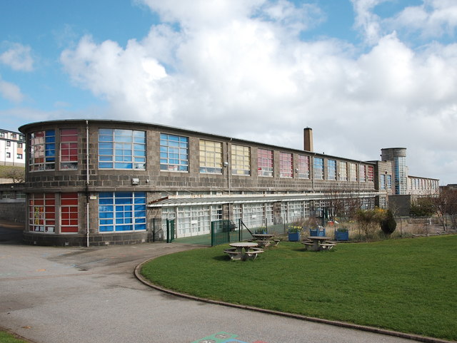
Torry Academy

Torry Academy was a secondary school in Torry, Aberdeen, run by Aberdeen City Council. The original school was built in 1927 and added to in 1947, creating...

Nearby Amenities

Located within 500m of 57.126715,-2.0736658
Railway: switch
Lat/Long: 57.1305023/-2.0756202
Baron's Cairn
Ele: 83
Man Made: cairn
Source: NPE
Lat/Long: 57.1241323/-2.0715922
Railway: switch
Lat/Long: 57.1303377/-2.0763174
Seletar Shipping Ltd
Addr City: Aberdeen
Addr Housename: Steadfast House
Addr Street: Greenwell Road
Building: industrial
Building Levels: 2
Lat/Long: 57.1296463/-2.0769737
Railway: switch
Lat/Long: 57.1299383/-2.0782864
Railway: switch
Lat/Long: 57.1296572/-2.0793913
Railway: buffer_stop
Lat/Long: 57.1299383/-2.0781287
Tullos Hill
Ele: 83
Natural: peak
Lat/Long: 57.1241442/-2.0715086
Tullos Cairn
Man Made: cairn
Lat/Long: 57.1278102/-2.0694058
Noexit: yes
Lat/Long: 57.1230163/-2.0695148
Noexit: yes
Lat/Long: 57.1227887/-2.069957
Noexit: yes
Lat/Long: 57.1227539/-2.070043
Railway: switch
Lat/Long: 57.1299744/-2.0782959
Railway: switch
Lat/Long: 57.1301317/-2.0774424
Railway: switch
Lat/Long: 57.1302395/-2.0768234
Railway: buffer_stop
Lat/Long: 57.129423/-2.0801904
Noexit: yes
Lat/Long: 57.1231379/-2.0691336
Weighbridge
Lat/Long: 57.1262504/-2.0778952
Man Made: chimney
Material: metal
Lat/Long: 57.1266865/-2.0768993
Crossing
Crossing: uncontrolled
Crossing Markings: zebra
Lat/Long: 57.1270341/-2.077585
Weighbridge
Lat/Long: 57.1270231/-2.0777491
The data included in this document is from www.openstreetmap.org. The data is made available under ODbL.

Have you been to Tullos Wood?

Leave your review of Tullos Wood below (or comments, questions and feedback).