Caroline's Well Wood

Wood, Forest in Aberdeenshire

Scotland

Caroline's Well Wood

Path by the River Ythan at Ellon
Path by the River Ythan at Ellon Credit: Gordon Brown

Caroline's Well Wood is a picturesque forest located in Aberdeenshire, Scotland. Covering an area of approximately 100 acres, it is a popular destination for nature lovers and outdoor enthusiasts. The wood is nestled within the tranquil countryside, surrounded by rolling hills and scenic landscapes.

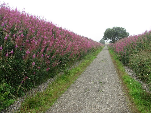
The forest boasts a diverse range of tree species, including oak, birch, and pine, creating a rich tapestry of colors throughout the seasons. It is home to a variety of wildlife, such as red squirrels, deer, and a plethora of bird species, making it a haven for birdwatching enthusiasts. The wood is also known for its vibrant wildflower meadows, which burst into life during the spring and summer months.

Caroline's Well Wood is crisscrossed by a network of well-maintained walking trails, allowing visitors to explore the woodland at their leisure. These paths provide stunning views of the surrounding countryside and lead to a hidden gem within the forest: Caroline's Well. The well is a small, natural spring that has been a local watering hole for centuries, and it adds a touch of magic to the woodland experience.

The wood is easily accessible, with ample parking available nearby, and there are picnic areas and benches scattered throughout, providing the perfect spot to relax and enjoy the serene surroundings. Caroline's Well Wood is a true gem of Aberdeenshire, offering a peaceful retreat for those seeking solace in nature's embrace.

If you have any feedback on the listing, please let us know in the comments section below.

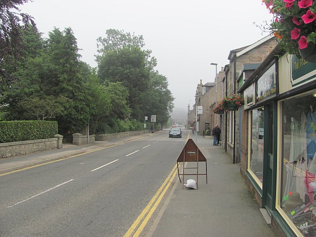
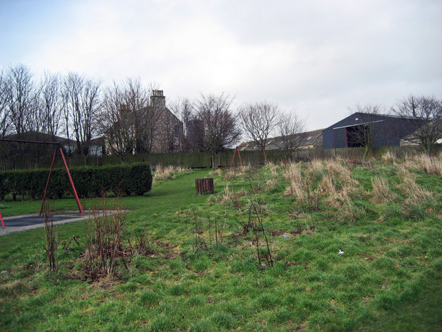
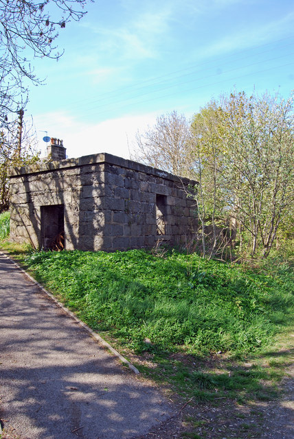
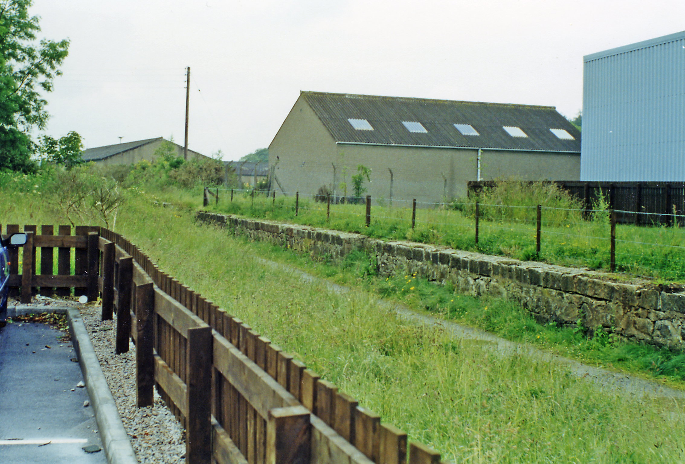
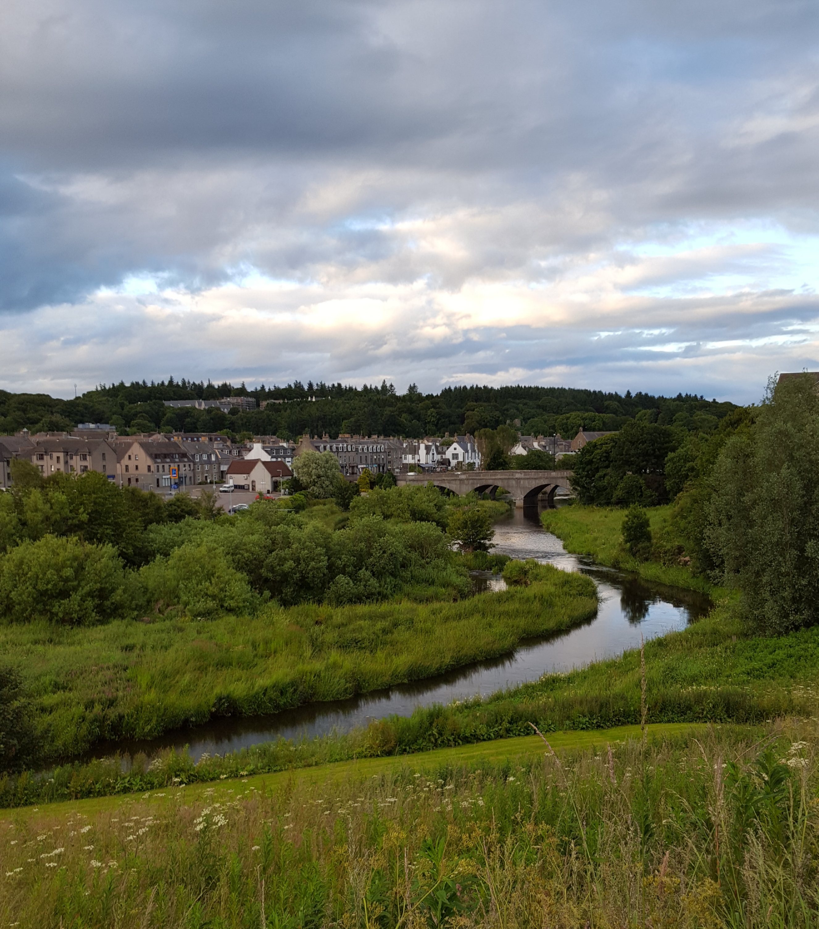
Caroline's Well Wood Images

Images are sourced within 2km of 57.368641/-2.0740852 or Grid Reference NJ9530. Thanks to Geograph Open Source API. All images are credited.

Path by the River Ythan at Ellon
Wonderful display of wisteria at Ellon house
Hillhead of Fechil Trig Pillar The triangulation pillar just visible in the middle of a field of barley at Hillhead of Fechil.
Hillhead of Fechil Trig Pillar
The triangulation pillar just visible in the middle of a field of barley at Hillhead of Fechil.
A920 heading west out of Ellon The A920 heading out of Ellon westwards at Wineburn, viewed from the Formartine & Buchan Way.
A920 heading west out of Ellon
The A920 heading out of Ellon westwards at Wineburn, viewed from the Formartine & Buchan Way.
New office/warehouse, Ellon
Ellon Castle I took the photograph from the parking area near Ellon Health centre.
Ellon Castle
I took the photograph from the parking area near Ellon Health centre.
Western Avenue, Ellon Ellon has expanded as far as the old railway. View from an embankment south of the viaduct.
Western Avenue, Ellon
Ellon has expanded as far as the old railway. View from an embankment south of the viaduct.
Station Road, Ellon B9005.
Station Road, Ellon
B9005.
Castle Road, Ellon A sign warns of red squirrels crossing.
Castle Road, Ellon
A sign warns of red squirrels crossing.
Ellon Station The site of Ellon Station. This was a junction with a branch line running to Boddam. The railway to Fraserburgh and Peterhead is now a cycle path. It closed to passengers in 1965 and freight in 1979.
Ellon Station
The site of Ellon Station. This was a junction with a branch line running to Boddam. The railway to Fraserburgh and Peterhead is now a cycle path. It closed to passengers in 1965 and freight in 1979.
Formartine and Buchan  Way The trackbed of the Formartine and Buchan Railway, now a cycle path passes between a housing estate (left) and a golf course.

The Formartine and Buchan Railway is now a 80km path between Fraserburgh, Peterhead and Aberdeen. The railway closed in 1979 and was last used as part of the North Sea oil development, moving material up to Fraserburgh.
Formartine and Buchan Way
The trackbed of the Formartine and Buchan Railway, now a cycle path passes between a housing estate (left) and a golf course. The Formartine and Buchan Railway is now a 80km path between Fraserburgh, Peterhead and Aberdeen. The railway closed in 1979 and was last used as part of the North Sea oil development, moving material up to Fraserburgh.
Formartine and Buchan  Way The trackbed north of Ellon has a good wide riding surface, for a while. This cutting, like most of the cuttings on the old railway is full of rosebay willowherb.
Formartine and Buchan Way
The trackbed north of Ellon has a good wide riding surface, for a while. This cutting, like most of the cuttings on the old railway is full of rosebay willowherb.
Ellon Academy The New Building of Ellon Academy, Ellon's secondary comprehensive school. It was constructed across the road from the original school building (which remains in use) in 1979 as a result of increasing pupil numbers.
Ellon Academy
The New Building of Ellon Academy, Ellon's secondary comprehensive school. It was constructed across the road from the original school building (which remains in use) in 1979 as a result of increasing pupil numbers.
Auchterellon Farm Looking toward the sheds and house from the adjoining park. The two swing sets have since been removed.
Auchterellon Farm
Looking toward the sheds and house from the adjoining park. The two swing sets have since been removed.
Old Water Tank Though the tank itself is long gone from the top, this granite base remains in situ at the northern end of the down platform at Ellon station. The station itself closed to passengers in 1965 as a result of the Beeching Cuts.
A selection of photos of the station when it was open can be found here: <span class="nowrap"><a title="http://www.railbrit.co.uk/location.php?loc=Ellon" rel="nofollow ugc noopener" href="http://www.railbrit.co.uk/location.php?loc=Ellon">Link</a><img style="margin-left:2px;" alt="External link" title="External link - shift click to open in new window" src="https://s1.geograph.org.uk/img/external.png" width="10" height="10"/></span>
Old Water Tank
Though the tank itself is long gone from the top, this granite base remains in situ at the northern end of the down platform at Ellon station. The station itself closed to passengers in 1965 as a result of the Beeching Cuts. A selection of photos of the station when it was open can be found here: LinkExternal link
McDonald Park Quarry The remains of an old quarry in McDonald Park. The exposed rock is possibly greywacke, there apparently having been similar quarries in the vicinity.
Note also the largest building in the background, which is the clubhouse for the local golf course.
McDonald Park Quarry
The remains of an old quarry in McDonald Park. The exposed rock is possibly greywacke, there apparently having been similar quarries in the vicinity. Note also the largest building in the background, which is the clubhouse for the local golf course.
Ellon, Aul' Brig 1793 bridge (now pedestrianised) spanning the River Ythan.
<span class="nowrap"><a title="http://en.wikipedia.org/wiki/Ellon,_Aberdeenshire" rel="nofollow ugc noopener" href="http://en.wikipedia.org/wiki/Ellon,_Aberdeenshire">Link</a><img style="margin-left:2px;" alt="External link" title="External link - shift click to open in new window" src="https://s1.geograph.org.uk/img/external.png" width="10" height="10"/></span>
Ellon, Aul' Brig
1793 bridge (now pedestrianised) spanning the River Ythan. LinkExternal link
Prowlin' Disused railways are very interesting places for cats. Housing up against the embankment on the approach to the viaduct.
Prowlin'
Disused railways are very interesting places for cats. Housing up against the embankment on the approach to the viaduct.
Show me another place!

Caroline's Well Wood is located at Grid Ref: NJ9530 (Lat: 57.368641, Lng: -2.0740852)

Unitary Authority: Aberdeenshire

Police Authority: North East

What 3 Words

///eradicate.give.prepares. Near Ellon, Aberdeenshire

Related Wikis

Ellon railway station

Ellon railway station was a railway station in Ellon, Aberdeenshire, Scotland. == History == Ellon Railway Station (originally Ellon for Cruden) was situated...

Ellon, Aberdeenshire

Ellon (Scottish Gaelic: Eilean) is a town in Aberdeenshire, Scotland, approximately 16 miles (26 kilometres) north of Aberdeen, lying on the River Ythan...

Ellon United F.C.

Ellon United Football Club is a Scottish football club from the town of Ellon, Aberdeenshire. Members of the Scottish Junior Football Association, they...

Ellon Academy

Ellon Academy is a secondary comprehensive school in the Aberdeenshire town of Ellon. In August 2015, the school moved to its new purpose-built campus...

Nearby Amenities

Located within 500m of 57.368641,-2.0740852
Ellon
Alt Name Gd: Eilean Bhuchain
Name Gd: Eilean
Name Sco: Eilan
Place: town
Population: 10070
Postal Code: AB41
Wikidata: Q1026799
Wikipedia: en:Ellon, Aberdeenshire
Lat/Long: 57.365049/-2.0710305
Stop
Direction: W
Stop: minor
Lat/Long: 57.3657665/-2.0745734
Crossing
Crossing: unmarked
Crossing Island: no
Tactile Paving: yes
Lat/Long: 57.3657626/-2.074635
Crossing
Crossing: unmarked
Crossing Island: yes
Lat/Long: 57.3727412/-2.0711798
Traffic Calming: hump
Lat/Long: 57.372809/-2.0724987
Traffic Calming: hump
Lat/Long: 57.3723829/-2.0714579
Traffic Calming: hump
Lat/Long: 57.3720822/-2.0707979
Traffic Calming: table
Lat/Long: 57.3707304/-2.0699666
Traffic Calming: table
Lat/Long: 57.3706425/-2.0688732
Traffic Calming: table
Lat/Long: 57.3704597/-2.0677418
Traffic Calming: table
Lat/Long: 57.3707036/-2.0669688
Traffic Calming: hump
Lat/Long: 57.3707535/-2.0753343
Cinnamon Fringe
Shop: hairdresser
Lat/Long: 57.3647001/-2.0758219
Traffic Signals
Button Operated: yes
Crossing: traffic_signals
Crossing Ref: puffin
Kerb: lowered
Supervised: no
Tactile Paving: yes
Traffic Signals Direction: both
Traffic Signals Sound: yes
Traffic Signals Vibration: yes
Lat/Long: 57.3643238/-2.0742009
Well
Caroline's Well
Description: Well named after Caroline Hamilton Gordon, resident of Ellon Castle at the start of the 20th century.
Historic: monument
Lat/Long: 57.3696062/-2.0743588
Crossing
Crossing: marked
Lat/Long: 57.3716703/-2.077877
Castlepark
Created By: Potlatch 0.10f
Place: locality
Lat/Long: 57.3674263/-2.0672284
War Memorial
Historic: memorial
Memorial: war_memorial
Lat/Long: 57.3650828/-2.070858
Noexit: yes
Lat/Long: 57.372599/-2.076967
Noexit: yes
Lat/Long: 57.372524/-2.0765586
Ellon Castle
Historic: ruins
Ruins: castle
Lat/Long: 57.3669669/-2.067952
Traffic Calming: table
Lat/Long: 57.3716344/-2.0703981
Traffic Calming: table
Lat/Long: 57.3708801/-2.0704695
Crossing
Crossing: unmarked
Crossing Island: no
Lat/Long: 57.3706689/-2.0706349
Telephone
Booth: KX100
Covered: booth
Source: survey
Lat/Long: 57.3642611/-2.0722685
Traffic Calming: table
Lat/Long: 57.3689663/-2.0667151
Traffic Calming: table
Lat/Long: 57.3687148/-2.0696362
Traffic Calming: table
Lat/Long: 57.3696057/-2.0718891
Give Way
Direction: W
Lat/Long: 57.365291/-2.07124
Generator Method: photovoltaic
Generator Output Electricity: yes
Generator Source: solar
Generator Type: solar_photovoltaic_panel
Location: roof
Power: generator
Lat/Long: 57.3720865/-2.0712155
Generator Method: photovoltaic
Generator Output Electricity: yes
Generator Source: solar
Generator Type: solar_photovoltaic_panel
Location: roof
Power: generator
Lat/Long: 57.3711047/-2.0678541
Generator Method: photovoltaic
Generator Output Electricity: yes
Generator Source: solar
Generator Type: solar_photovoltaic_panel
Location: roof
Power: generator
Lat/Long: 57.3711014/-2.0678226
Generator Method: photovoltaic
Generator Output Electricity: yes
Generator Source: solar
Generator Type: solar_photovoltaic_panel
Location: roof
Power: generator
Lat/Long: 57.3714175/-2.0677408
Generator Method: photovoltaic
Generator Output Electricity: yes
Generator Source: solar
Generator Type: solar_photovoltaic_panel
Location: roof
Power: generator
Lat/Long: 57.37141/-2.0676923
Crossing
Crossing: unmarked
Crossing Island: no
Kerb: lowered
Tactile Paving: no
Lat/Long: 57.3661071/-2.0709096
Crossing
Crossing: marked
Lat/Long: 57.3670494/-2.0706547
Crossing
Crossing: unmarked
Crossing Island: no
Tactile Paving: no
Lat/Long: 57.3654849/-2.0787651
Crossing
Crossing: marked
Lat/Long: 57.3719928/-2.078317
Crossing
Crossing: unmarked
Lat/Long: 57.3667654/-2.0737661
Crossing
Crossing: unmarked
Crossing Island: no
Tactile Paving: yes
Lat/Long: 57.3660678/-2.0743815
Crossing
Crossing: zebra
Crossing Island: no
Tactile Paving: no
Lat/Long: 57.3668653/-2.072112
Crossing
Crossing: unmarked
Crossing Island: no
Kerb: lowered
Tactile Paving: no
Lat/Long: 57.3656454/-2.0710944
Crossing
Crossing: unmarked
Crossing Island: no
Tactile Paving: no
Lat/Long: 57.3658854/-2.0711444
Crossing
Crossing: unmarked
Crossing Island: no
Tactile Paving: no
Lat/Long: 57.3659741/-2.0712184
Crossing
Crossing: marked
Crossing Island: yes
Tactile Paving: no
Lat/Long: 57.3664743/-2.0720341
Crossing
Crossing: unmarked
Kerb: flush
Supervised: no
Tactile Paving: no
Lat/Long: 57.3651355/-2.0741602
Crossing
Crossing: unmarked
Crossing Island: no
Tactile Paving: no
Lat/Long: 57.3654515/-2.0710515
Crossing
Crossing: unmarked
Crossing Island: no
Tactile Paving: yes
Lat/Long: 57.365396/-2.0725016
Noexit: yes
Lat/Long: 57.3666242/-2.0702452
Charging Station
Access: yes
Capacity: 3
Charging Station Output: 22 kW
Fee: yes
Operator: ChargePlace Scotland
Lat/Long: 57.3656954/-2.0728951
Crossing
Crossing: unmarked
Crossing Island: no
Tactile Paving: no
Lat/Long: 57.3652118/-2.071141
Crossing
Crossing: unmarked
Crossing Island: no
Tactile Paving: no
Lat/Long: 57.365125/-2.0712595
Crossing
Crossing: unmarked
Crossing Island: no
Tactile Paving: no
Lat/Long: 57.3651097/-2.0707048
Crossing
Crossing: unmarked
Crossing Island: no
Kerb: lowered
Tactile Paving: no
Lat/Long: 57.3653898/-2.0719262
Crossing
Lat/Long: 57.3653033/-2.0725648
Crossing
Crossing: unmarked
Crossing Island: no
Tactile Paving: yes
Lat/Long: 57.3650736/-2.0740071
Crossing
Crossing: unmarked
Crossing Island: no
Tactile Paving: no
Lat/Long: 57.3650391/-2.0743077
Crossing
Crossing: unmarked
Crossing Island: no
Tactile Paving: yes
Lat/Long: 57.3650254/-2.0745405
Crossing
Crossing: unmarked
Crossing Island: no
Tactile Paving: yes
Lat/Long: 57.365123/-2.0737137
Give Way
Direction: backward
Lat/Long: 57.3721933/-2.078465
Give Way
Direction: 50
Lat/Long: 57.3709903/-2.0767712
Crossing
Crossing: unmarked
Crossing Island: no
Tactile Paving: yes
Lat/Long: 57.3657591/-2.0753416
Stop
Direction: E
Lat/Long: 57.3654868/-2.0787338
Traffic Mirror
Lat/Long: 57.3655002/-2.0781436
Noexit: yes
Lat/Long: 57.3655763/-2.0771751
Crossing
Crossing: unmarked
Crossing Island: no
Tactile Paving: no
Lat/Long: 57.3656045/-2.0767314
Noexit: yes
Lat/Long: 57.3656941/-2.075259
Crossing
Crossing: unmarked
Kerb: flush
Supervised: no
Tactile Paving: no
Lat/Long: 57.3647386/-2.0778619
Crossing
Crossing: unmarked
Kerb: flush
Supervised: no
Tactile Paving: no
Lat/Long: 57.3646349/-2.0771963
Waste Basket
Waste: trash
Lat/Long: 57.3649882/-2.0750102
Stop
Direction: W
Lat/Long: 57.3649345/-2.0750045
Crossing
Crossing: unmarked
Kerb: flush
Supervised: no
Tactile Paving: no
Lat/Long: 57.3649075/-2.07533
Crossing
Crossing: unmarked
Kerb: flush
Supervised: no
Tactile Paving: no
Lat/Long: 57.3647319/-2.0763162
Crossing
Crossing: unmarked
Kerb: flush
Supervised: no
Tactile Paving: no
Lat/Long: 57.3647118/-2.0764364
Crossing
Crossing: unmarked
Kerb: flush
Supervised: no
Tactile Paving: no
Lat/Long: 57.3646527/-2.0768457
Crossing
Crossing: unmarked
Crossing Island: no
Kerb: lowered
Tactile Paving: no
Lat/Long: 57.3657379/-2.0721578
Bus Stop
Long Close
Naptan AtcoCode: 630031271
Naptan Bearing: E
Naptan CommonName: Long Close
Naptan Indicator: opp
Naptan Landmark: Schoolhill Road
Naptan NaptanCode: 23626827
Naptan Street: Station Road
Passenger Information Display: yes
Public Transport: platform
Ref: 23626827
Tactile Paving: yes
Lat/Long: 57.365395/-2.0720895
Waste Basket
Waste: trash
Lat/Long: 57.3654236/-2.0722469
Crossing
Crossing: unmarked
Kerb: lowered
Supervised: no
Tactile Paving: no
Lat/Long: 57.3652493/-2.0735491
Crossing
Crossing: unmarked
Kerb: lowered
Supervised: no
Tactile Paving: yes
Lat/Long: 57.3656716/-2.074532
Crossing
Crossing: unmarked
Kerb: lowered
Supervised: no
Tactile Paving: no
Lat/Long: 57.3655007/-2.0746021
Crossing
Crossing: unmarked
Kerb: lowered
Supervised: no
Tactile Paving: no
Lat/Long: 57.3652266/-2.0736681
Waste Basket
Waste: trash
Lat/Long: 57.3663625/-2.0719359
Crossing
Crossing: unmarked
Kerb: flush
Supervised: no
Tactile Paving: no
Lat/Long: 57.3663921/-2.0718938
Waste Basket
Waste: trash
Lat/Long: 57.3660974/-2.0723897
Give Way
Direction: S
Lat/Long: 57.366423/-2.0719863
Traffic Calming: hump
Lat/Long: 57.3663938/-2.0718978
Crossing
Crossing: unmarked
Crossing Island: no
Kerb: lowered
Tactile Paving: yes
Lat/Long: 57.3653355/-2.0710263
Crossing
Crossing: unmarked
Crossing Island: no
Tactile Paving: yes
Lat/Long: 57.365307/-2.0713127
Crossing
Crossing: unmarked
Crossing Island: no
Kerb: lowered
Tactile Paving: no
Lat/Long: 57.3653823/-2.0716424
Noexit: yes
Lat/Long: 57.3654261/-2.072595
Give Way
Direction: E
Lat/Long: 57.3660665/-2.074315
Grit Bin
Lat/Long: 57.3660994/-2.0735477
Give Way
Direction: E
Lat/Long: 57.3667979/-2.0740449
Colour: #006633
Man Made: street_cabinet
Operator: BT
Street Cabinet: telecom
Lat/Long: 57.3666963/-2.074003
Colour: #006633
Man Made: street_cabinet
Operator: BT
Street Cabinet: telecom
Lat/Long: 57.3666971/-2.0740582
Crossing
Crossing: unmarked
Kerb: lowered
Supervised: no
Tactile Paving: no
Lat/Long: 57.3664454/-2.0742322
Crossing
Crossing: unmarked
Crossing Island: no
Kerb: lowered
Tactile Paving: no
Lat/Long: 57.3652392/-2.0705693
Waste Basket
Waste: trash
Lat/Long: 57.3661093/-2.0715896
Grit Bin
Lat/Long: 57.3666091/-2.0702335
Crossing
Crossing: unmarked
Crossing Island: no
Kerb: lowered
Tactile Paving: no
Lat/Long: 57.3663567/-2.070358
Grit Bin
Lat/Long: 57.3663205/-2.0702635
Noexit: yes
Lat/Long: 57.3666825/-2.0696039
Noexit: yes
Lat/Long: 57.3664151/-2.0709158
Colour: #006633
Man Made: street_cabinet
Operator: Openreach
Operator Wikidata: Q7096543
Utility: telecom
Lat/Long: 57.365854/-2.0711109
Colour: #006633
Man Made: street_cabinet
Operator: Openreach
Operator Wikidata: Q7096543
Utility: telecom
Lat/Long: 57.3658537/-2.0711411
Crossing
Crossing: unmarked
Crossing Island: no
Kerb: lowered
Tactile Paving: no
Lat/Long: 57.36523/-2.0708083
Direction: S
Maxspeed: 48
Traffic Sign: maxspeed
Lat/Long: 57.3655716/-2.0745954
Direction: N
Maxspeed: 32
Traffic Sign: maxspeed
Lat/Long: 57.3655815/-2.0745921
Noexit: yes
Lat/Long: 57.366723/-2.0703777
Noexit: yes
Lat/Long: 57.3665335/-2.0707908
Noexit: yes
Lat/Long: 57.3664579/-2.0709912
Waste Basket
Waste: trash
Lat/Long: 57.3642447/-2.0742243
Waste Basket
Waste: trash
Lat/Long: 57.3643545/-2.0741227
Noexit: yes
Lat/Long: 57.3646927/-2.073876
Atm
Brand: Virgin Money
Opening Hours: 24/7
Operator: Virgin Money
Wheelchair: yes
Lat/Long: 57.3643109/-2.0729281
Crossing
Crossing: unmarked
Kerb: lowered
Supervised: no
Tactile Paving: no
Lat/Long: 57.3645727/-2.0717662
Crossing
Crossing: unmarked
Crossing Island: no
Kerb: lowered
Tactile Paving: no
Lat/Long: 57.365311/-2.0716416
Access: private
Barrier: bollard
Bicycle: yes
Bollard: removable
Foot: yes
Horse: yes
Wheelchair: yes
Lat/Long: 57.365291/-2.0725613
Street Lamp
Lamp Mount: straight_mast
Lamp Type: sodium
Lat/Long: 57.3648043/-2.0731353
Street Lamp
Lamp Mount: straight_mast
Lamp Type: sodium
Lat/Long: 57.3649539/-2.0733179
Bench
Colour: brown
Material: wood
Seats: 2
Lat/Long: 57.3649896/-2.0732272
Crossing
Crossing: unmarked
Crossing Island: no
Kerb: lowered
Tactile Paving: no
Lat/Long: 57.3652577/-2.0701463
Bench
Backrest: yes
Colour: black
Material: plastic
Seats: 2
Lat/Long: 57.3654049/-2.0722733
Bench
Backrest: yes
Colour: black
Material: plastic
Seats: 2
Lat/Long: 57.3654042/-2.0723585
Waste Basket
Waste: trash
Lat/Long: 57.3650169/-2.0712299
Waste Basket
Waste: trash
Lat/Long: 57.3650945/-2.0712567
Waste Basket
Waste: trash
Lat/Long: 57.3653301/-2.0712333
Waste Basket
Waste: trash
Lat/Long: 57.3653529/-2.0713346
Waste Basket
Waste: trash
Lat/Long: 57.3651483/-2.0705971
Barrier: bollard
Bollard: fixed
Material: metal
Lat/Long: 57.3651523/-2.0701009
Barrier: bollard
Bollard: fixed
Material: metal
Lat/Long: 57.3651526/-2.07012
Crossing
Crossing: unmarked
Kerb: lowered
Supervised: no
Tactile Paving: no
Lat/Long: 57.3646467/-2.0713529
Access: no
Barrier: bollard
Bollard: fixed
Material: metal
Vehicle: no
Lat/Long: 57.365076/-2.0720465
Crossing
Crossing: uncontrolled
Crossing Ref: zebra
Kerb: lowered
Supervised: no
Tactile Paving: yes
Lat/Long: 57.3650922/-2.0701209
Crossing
Crossing: unmarked
Crossing Island: no
Kerb: lowered
Supervised: no
Tactile Paving: yes
Lat/Long: 57.364304/-2.0720922
John Ross Chemist
Addr City: Ellon
Addr Housenumber: 37
Addr Postcode: AB41 9AR
Addr Street: Station Road
Fhrs Authority: Aberdeenshire
Fhrs Id: 134152
Fhrs Local Authority Id: 6737
Shop: chemist
Lat/Long: 57.3648209/-2.0752345
Fast Food
Dragon House
Addr City: Ellon
Addr Housenumber: 47
Addr Postcode: AB41 9AR
Addr Street: Station Road
Cuisine: chinese
Fhrs Authority: Aberdeenshire
Fhrs Id: 134184
Fhrs Local Authority Id: 6740
Opening Hours: We-Su 16:30-21:30
Phone: +44 1358 723270
Takeaway: yes
Wheelchair: limited
Lat/Long: 57.3647779/-2.0755014
Bus Stop
Bridge Street
Bench: no
Bin: no
Covered: no
Naptan AtcoCode: 630031261
Naptan Bearing: W
Naptan CommonName: Bridge Street
Naptan Indicator: W-bound
Naptan Landmark: Bridge Street
Naptan NaptanCode: 23628568
Naptan Street: Station Road
Public Transport: platform
Ref: 23628568
Shelter: no
Lat/Long: 57.3646348/-2.0763825
Bus Stop
Bridge Street
Bench: no
Bin: no
Covered: no
Lit: yes
Naptan AtcoCode: 630031262
Naptan Bearing: E
Naptan CommonName: Bridge Street
Naptan Indicator: E-bound
Naptan Landmark: Bridge Street
Naptan NaptanCode: 23627986
Naptan Street: Station Road
Public Transport: platform
Ref: 23627986
Shelter: no
Tactile Paving: no
Lat/Long: 57.3648104/-2.0759017
Bus Stop
Whisky Brae
Bench: no
Bin: no
Lit: yes
Naptan AtcoCode: 630031251
Naptan Bearing: E
Naptan CommonName: Whisky Brae
Naptan Indicator: at
Naptan Landmark: Whisky Brae
Naptan NaptanCode: 23626786
Naptan Street: Station Road
Public Transport: platform
Ref: 23626786
Shelter: no
Tactile Paving: no
Lat/Long: 57.3656765/-2.0801262
Bus Stop
Market Street
Bench: yes
Naptan AtcoCode: 630031132
Naptan Bearing: NE
Naptan CommonName: Market Street
Naptan Indicator: at 28
Naptan Landmark: Market Street
Naptan NaptanCode: 23626825
Naptan Street: Market Street
Passenger Information Display: yes
Public Transport: platform
Ref: 23626825
Shelter: yes
Lat/Long: 57.3643266/-2.0725376
Waste Basket
Waste: trash
Lat/Long: 57.3641987/-2.0738981
Bus Stop
Hopeman Drive
Naptan AtcoCode: 630045642
Naptan Bearing: NW
Naptan CommonName: Hopeman Drive
Naptan Indicator: opp
Naptan Landmark: Hopeman Drive
Naptan NaptanCode: 23629279
Naptan Street: Knockothie Crescent
Public Transport: platform
Ref: 23629279
Shelter: yes
Lat/Long: 57.3724904/-2.0707155
Bus Stop
Hopeman Drive
Naptan AtcoCode: 630045641
Naptan Bearing: SE
Naptan CommonName: Hopeman Drive
Naptan Indicator: at
Naptan Landmark: Hopeman Drive
Naptan NaptanCode: 23629274
Naptan Street: Knockothie Crescent
Public Transport: platform
Ref: 23629274
Shelter: yes
Lat/Long: 57.3725929/-2.0705805
Bus Stop
Knockothie Brae
Naptan AtcoCode: 630031532
Naptan Bearing: NW
Naptan CommonName: Knockothie Brae
Naptan Indicator: NW-bound
Naptan Landmark: Knockothie Brae
Naptan NaptanCode: 23632423
Naptan Street: Golf Road
Public Transport: platform
Ref: 23632423
Lat/Long: 57.3714112/-2.0775451
Bus Stop
Knockothie Brae
Naptan AtcoCode: 630031531
Naptan Bearing: SE
Naptan CommonName: Knockothie Brae
Naptan Indicator: SE-bound
Naptan Landmark: Knockothie Brae
Naptan NaptanCode: 23632398
Naptan Street: Golf Road
Public Transport: platform
Ref: 23632398
Lat/Long: 57.3713439/-2.077246
Bus Stop
Bridge Street
Bench: no
Naptan AtcoCode: 630031351
Naptan Bearing: NW
Naptan CommonName: Bridge Street
Naptan Indicator: at 53
Naptan Landmark: Bridge Street
Naptan NaptanCode: 23626795
Naptan Street: Bridge Street
Public Transport: platform
Ref: 23626795
Shelter: no
Lat/Long: 57.3646108/-2.0746449
Bicycle Parking
Bicycle Parking: stands
Capacity: 6
Covered: no
Lat/Long: 57.3642854/-2.0722204
Bench
Lat/Long: 57.3642724/-2.0723107
Generator Method: photovoltaic
Generator Output Electricity: yes
Generator Source: solar
Generator Type: solar_photovoltaic_panel
Location: roof
Power: generator
Lat/Long: 57.3706718/-2.0724047
Generator Method: photovoltaic
Generator Output Electricity: yes
Generator Source: solar
Generator Type: solar_photovoltaic_panel
Location: roof
Power: generator
Lat/Long: 57.3716435/-2.0707225
Generator Method: photovoltaic
Generator Output Electricity: yes
Generator Source: solar
Generator Type: solar_photovoltaic_panel
Location: roof
Power: generator
Lat/Long: 57.3714894/-2.0701694
Generator Method: photovoltaic
Generator Output Electricity: yes
Generator Source: solar
Generator Type: solar_photovoltaic_panel
Location: roof
Power: generator
Lat/Long: 57.3709045/-2.0707568
Traffic Calming: hump
Lat/Long: 57.3705223/-2.0707775
Generator Method: photovoltaic
Generator Output Electricity: yes
Generator Source: solar
Generator Type: solar_photovoltaic_panel
Location: roof
Power: generator
Lat/Long: 57.3711033/-2.073921
Generator Method: photovoltaic
Generator Output Electricity: yes
Generator Source: solar
Generator Type: solar_photovoltaic_panel
Location: roof
Power: generator
Lat/Long: 57.3717137/-2.0746306
Generator Method: photovoltaic
Generator Output Electricity: yes
Generator Source: solar
Generator Type: solar_photovoltaic_panel
Location: roof
Power: generator
Lat/Long: 57.37207/-2.0724116
Traffic Calming: hump
Lat/Long: 57.3711938/-2.0758006
Generator Method: photovoltaic
Generator Output Electricity: yes
Generator Source: solar
Generator Type: solar_photovoltaic_panel
Location: roof
Power: generator
Lat/Long: 57.3719777/-2.0710448
Generator Method: photovoltaic
Generator Output Electricity: yes
Generator Source: solar
Generator Type: solar_photovoltaic_panel
Location: roof
Power: generator
Lat/Long: 57.3668409/-2.074395
Generator Method: photovoltaic
Generator Output Electricity: yes
Generator Source: solar
Generator Type: solar_photovoltaic_panel
Location: roof
Power: generator
Lat/Long: 57.3668532/-2.0747678
Generator Method: photovoltaic
Generator Output Electricity: yes
Generator Source: solar
Generator Type: solar_photovoltaic_panel
Location: roof
Power: generator
Lat/Long: 57.3668525/-2.0748684
Generator Method: photovoltaic
Generator Output Electricity: yes
Generator Source: solar
Generator Type: solar_photovoltaic_panel
Location: roof
Power: generator
Lat/Long: 57.3668778/-2.0754866
Generator Method: photovoltaic
Generator Output Electricity: yes
Generator Source: solar
Generator Type: solar_photovoltaic_panel
Location: roof
Power: generator
Lat/Long: 57.3668799/-2.0755899
Generator Method: photovoltaic
Generator Output Electricity: yes
Generator Source: solar
Generator Type: solar_photovoltaic_panel
Location: roof
Power: generator
Lat/Long: 57.3668922/-2.0758474
Generator Method: photovoltaic
Generator Output Electricity: yes
Generator Source: solar
Generator Type: solar_photovoltaic_panel
Location: roof
Power: generator
Lat/Long: 57.366932/-2.0769122
Generator Method: photovoltaic
Generator Output Electricity: yes
Generator Source: solar
Generator Type: solar_photovoltaic_panel
Location: roof
Power: generator
Lat/Long: 57.3669414/-2.0772743
Generator Method: photovoltaic
Generator Output Electricity: yes
Generator Source: solar
Generator Type: solar_photovoltaic_panel
Location: roof
Power: generator
Lat/Long: 57.3665314/-2.078661
Generator Method: photovoltaic
Generator Output Electricity: yes
Generator Source: solar
Generator Type: solar_photovoltaic_panel
Location: roof
Power: generator
Lat/Long: 57.3670528/-2.0784679
Addr City: Ellon
Addr Country: GB
Addr Postcode: AB41 9JX
Addr Street: Castle Place
Entrance: home
Lat/Long: 57.3693273/-2.0710897
Addr City: Ellon
Addr Country: GB
Addr Postcode: AB41 9JU
Addr Street: Kennedy Place
Entrance: home
Lat/Long: 57.3693334/-2.0709289
Addr City: Ellon
Addr Country: GB
Addr Postcode: AB41 9JG
Addr Street: Blench Drive
Entrance: home
Lat/Long: 57.368774/-2.0694476
Addr City: Ellon
Addr Country: GB
Addr Postcode: AB41 9JR
Addr Street: Firhill Square
Entrance: home
Lat/Long: 57.3688311/-2.0695402
Addr City: Ellon
Addr Country: GB
Addr Postcode: AB41 9JN
Addr Street: Scotsfir Crescent
Entrance: home
Lat/Long: 57.368578/-2.0694564
Addr City: Ellon
Addr Country: GB
Addr Postcode: AB41 9JG
Addr Street: Blench Drive
Entrance: home
Lat/Long: 57.3686502/-2.0693646
Addr City: Ellon
Addr Country: GB
Addr Postcode: AB41 9JG
Addr Street: Blench Drive
Entrance: home
Lat/Long: 57.3686834/-2.0681256
Addr City: Ellon
Addr Country: GB
Addr Postcode: AB41 9JQ
Addr Street: Firhill Street
Entrance: home
Lat/Long: 57.3686517/-2.0680048
Addr City: Ellon
Addr Country: GB
Addr Postcode: AB41 9JL
Addr Street: Castle Meadow
Entrance: home
Lat/Long: 57.369067/-2.0669446
Addr City: Ellon
Addr Country: GB
Addr Postcode: AB41 9JG
Addr Street: Blench Drive
Entrance: home
Lat/Long: 57.3689865/-2.0670135
Addr City: Ellon
Addr Country: GB
Addr Postcode: AB41 9JN
Addr Street: Scotsfir Crescent
Entrance: home
Lat/Long: 57.3682576/-2.0675139
Addr City: Ellon
Addr Country: GB
Addr Postcode: AB41 9JQ
Addr Street: Firhill Street
Entrance: home
Lat/Long: 57.3683061/-2.0676228
Noexit: yes
Lat/Long: 57.3679756/-2.0666488
Addr City: Ellon
Addr Country: GB
Addr Postcode: AB41 9LB
Addr Street: Carolines Wynd
Entrance: home
Lat/Long: 57.3693582/-2.0731601
Addr City: Ellon
Addr Country: GB
Addr Postcode: AB41 9LE
Addr Street: Woodlands Place
Entrance: home
Lat/Long: 57.3694338/-2.0731225
Addr City: Ellon
Addr Country: GB
Addr Postcode: AB41 9LD
Addr Street: Carolines Place
Entrance: home
Lat/Long: 57.3701371/-2.0729319
Addr City: Ellon
Addr Country: GB
Addr Postcode: AB41 9LE
Addr Street: Woodlands Place
Entrance: home
Lat/Long: 57.3695242/-2.0732979
Addr City: Ellon
Addr Country: GB
Addr Postcode: AB41 9LB
Addr Street: Carolines Wynd
Entrance: home
Lat/Long: 57.369554/-2.0734394
Addr City: Ellon
Addr Country: GB
Addr Postcode: AB41 9LB
Addr Street: Carolines Wynd
Entrance: home
Lat/Long: 57.3701854/-2.0730728
Addr City: Ellon
Addr Country: GB
Addr Postcode: AB41 9LB
Addr Street: Carolines Wynd
Entrance: home
Lat/Long: 57.370172/-2.0718711
Addr City: Ellon
Addr Country: GB
Addr Postcode: AB41 8BQ
Addr Street: Woodlands Edge
Entrance: home
Lat/Long: 57.3701171/-2.0717834
Addr City: Ellon
Addr Country: GB
Addr Postcode: AB41 8BQ
Addr Street: Woodlands Edge
Entrance: home
Lat/Long: 57.3697536/-2.0719645
Addr City: Ellon
Addr Country: GB
Addr Postcode: AB41 9LE
Addr Street: Woodlands Place
Entrance: home
Lat/Long: 57.3697193/-2.0721148
Generator Method: photovoltaic
Generator Output Electricity: yes
Generator Source: solar
Generator Type: solar_photovoltaic_panel
Power: generator
Lat/Long: 57.3651514/-2.0793182
Generator Method: photovoltaic
Generator Output Electricity: yes
Generator Source: solar
Generator Type: solar_photovoltaic_panel
Power: generator
Lat/Long: 57.364392/-2.0754384
Parking
Ellon Castle Gardens Disabled Parking
Access: customers
Capacity: 2
Capacity Disabled: 2
Fee: no
Operator: Ellon Castle Gardens
Operator Type: community
Parking: surface
Surface: gravel
Lat/Long: 57.3658985/-2.0697062
Clock
Display: sundial
Lat/Long: 57.366459/-2.0681369
Noexit: yes
Lat/Long: 57.3644081/-2.0715286
The data included in this document is from www.openstreetmap.org. The data is made available under ODbL.

Have you been to Caroline's Well Wood?

Leave your review of Caroline's Well Wood below (or comments, questions and feedback).