Tullos

Settlement in Kincardineshire

Scotland

Tullos

Aberdeen station An HST (a high-speed train) in the livery of Virgin Trains forming the 14:52 
to London King's Cross (arr. 22:16) is ready to depart.  For an earlier HST colour scheme at Aberdeen, see: <a title="https://www.geograph.org.uk/photo/3345124" href="https://www.geograph.org.uk/photo/3345124">Link</a>.  A number of new office blocks are apparent behind the train.
Aberdeen station Credit: Bill Harrison

Tullos is a small rural village located in the northeast of Scotland, within the county of Kincardineshire. Situated approximately 5 miles south of the town of Aberdeen, Tullos is surrounded by picturesque countryside and offers a tranquil setting for its residents.

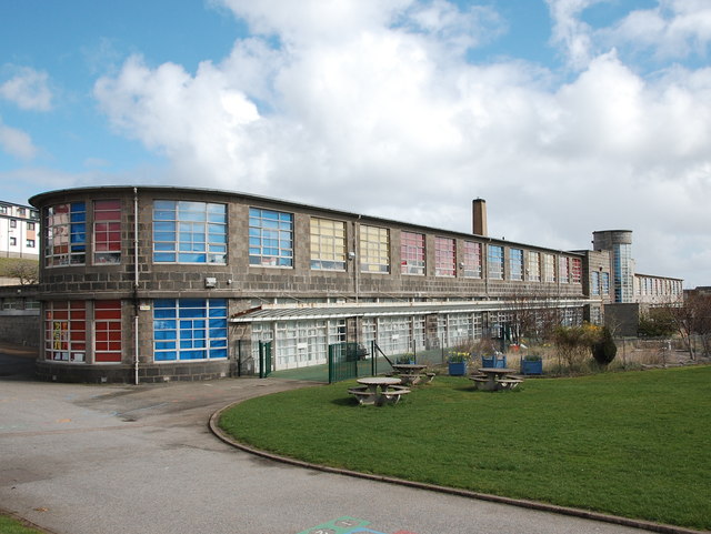
The village is characterized by its charming and traditional architecture, with many stone-built houses and cottages that reflect its historical significance. Tullos has a close-knit community, and residents often engage in various social activities and community events. The local primary school plays a vital role in the village, providing education for the children of Tullos and the surrounding areas.

Tullos is well-connected to other parts of the region through road networks, with the A90 running nearby, providing easy access to Aberdeen and other nearby towns. The village is also served by public transportation, allowing residents to commute to work or explore the wider area.

The surrounding countryside offers numerous opportunities for outdoor activities, such as hiking, cycling, and birdwatching. Tullos is also in close proximity to the beautiful coastline, allowing residents and visitors to enjoy coastal walks and stunning views of the North Sea.

Although Tullos itself may be relatively small, it benefits from its close proximity to Aberdeen, where residents can access a wide range of amenities, including shopping centers, restaurants, and cultural attractions.

Overall, Tullos provides a peaceful and idyllic place to live, combining the tranquility of rural living with easy access to nearby urban areas.

If you have any feedback on the listing, please let us know in the comments section below.
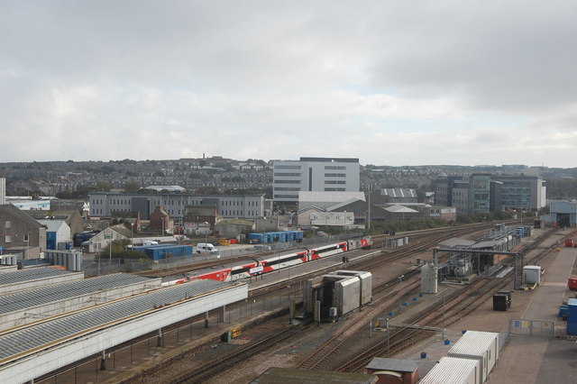
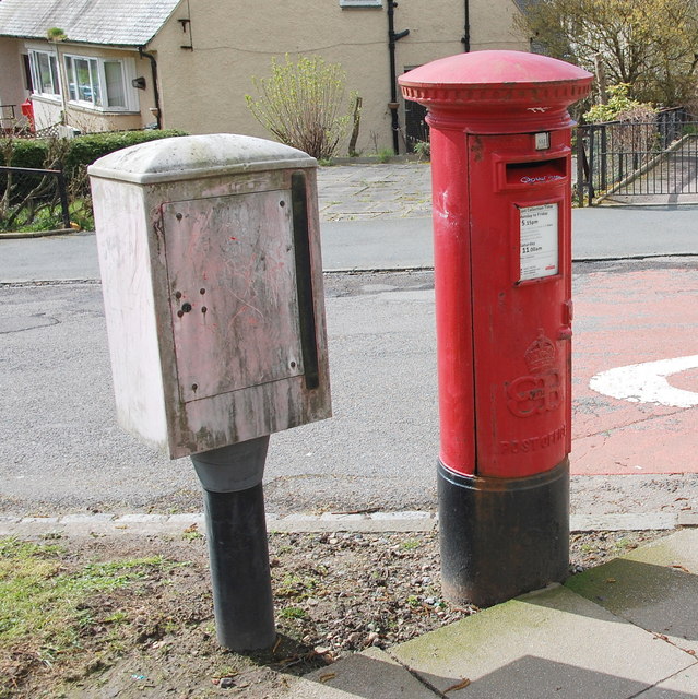
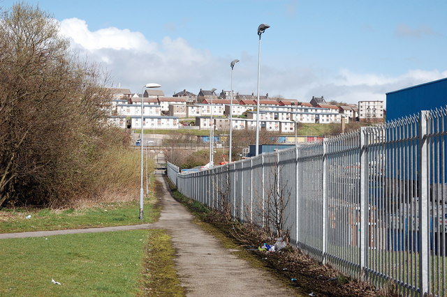
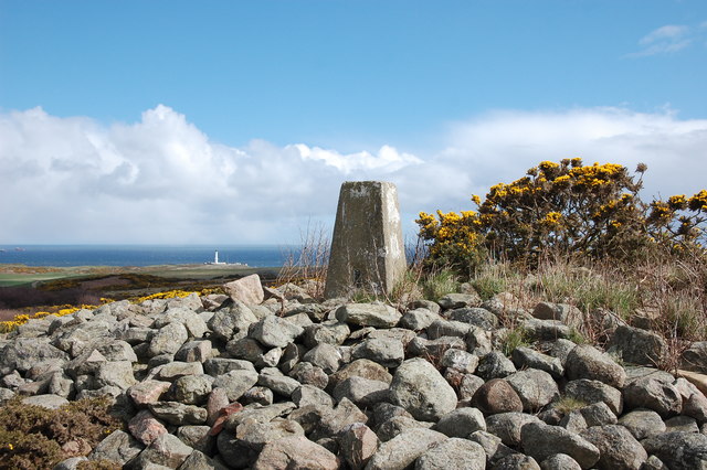
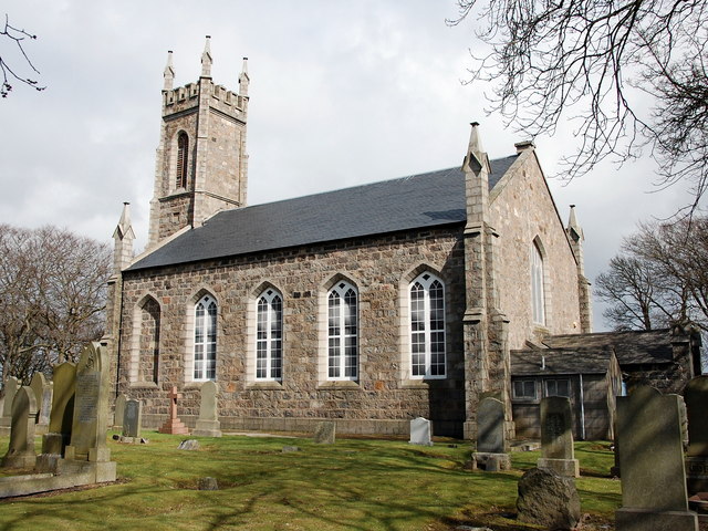
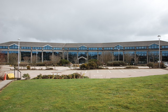
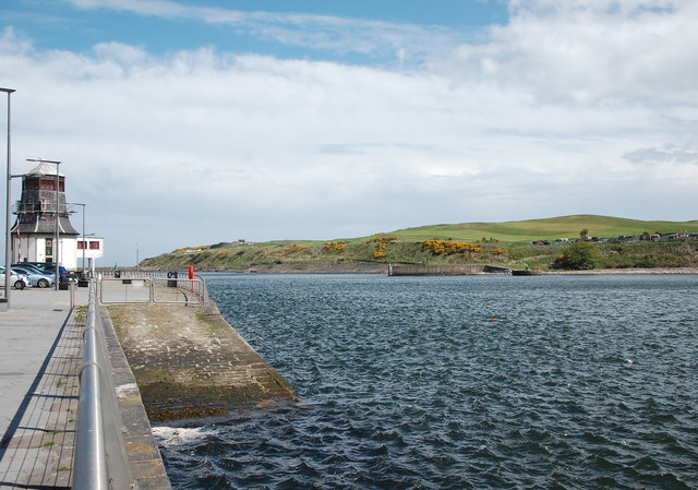
Tullos Images

Images are sourced within 2km of 57.126341/-2.0831128 or Grid Reference NJ9503. Thanks to Geograph Open Source API. All images are credited.

Aberdeen station An HST (a high-speed train) in the livery of Virgin Trains forming the 14:52 
to London King's Cross (arr. 22:16) is ready to depart.  For an earlier HST colour scheme at Aberdeen, see: <a title="https://www.geograph.org.uk/photo/3345124" href="https://www.geograph.org.uk/photo/3345124">Link</a>.  A number of new office blocks are apparent behind the train.
Aberdeen station
An HST (a high-speed train) in the livery of Virgin Trains forming the 14:52 to London King's Cross (arr. 22:16) is ready to depart. For an earlier HST colour scheme at Aberdeen, see: Link. A number of new office blocks are apparent behind the train.
Depot of oil drilling pipes
Railway bridge over Palmerston Place, Aberdeen
FS Pisces at Albert Quay, Aberdeen A Uk-registered oil supply vessel operated by Fletcher Shipping and built in 1992 at the Brattvaag yard in Norway.
FS Pisces at Albert Quay, Aberdeen
A Uk-registered oil supply vessel operated by Fletcher Shipping and built in 1992 at the Brattvaag yard in Norway.
Flag of convenience The E R Athina oil support vessel enters Aberdeen harbour.  Its home port is Monrovia (Liberia) but I would be surprised if it has ever been near west Africa (<span class="nowrap"><a title="https://en.wikipedia.org/wiki/Flag_of_convenience" rel="nofollow ugc noopener" href="https://en.wikipedia.org/wiki/Flag_of_convenience">Link</a><img style="margin-left:2px;" alt="External link" title="External link - shift click to open in new window" src="https://s1.geograph.org.uk/img/external.png" width="10" height="10"/></span> ).  Its movements can be tracked here: <span class="nowrap"><a title="http://www.marinetraffic.com/en/ais/details/ships/shipid:3715544/mmsi:636091426/imo:9448528/vessel:E_R_ATHINA" rel="nofollow ugc noopener" href="http://www.marinetraffic.com/en/ais/details/ships/shipid:3715544/mmsi:636091426/imo:9448528/vessel:E_R_ATHINA">Link</a><img style="margin-left:2px;" alt="External link" title="External link - shift click to open in new window" src="https://s1.geograph.org.uk/img/external.png" width="10" height="10"/></span> .
Flag of convenience
The E R Athina oil support vessel enters Aberdeen harbour. Its home port is Monrovia (Liberia) but I would be surprised if it has ever been near west Africa (LinkExternal link ). Its movements can be tracked here: LinkExternal link .
Edward VIII pillar box... ...at the junction of Gregness Gardens and Girdleness Road.  One of only two to be found in Aberdeen and 136 nationwide.
Edward VIII pillar box...
...at the junction of Gregness Gardens and Girdleness Road. One of only two to be found in Aberdeen and 136 nationwide.
Tullos Primary School The classroom blinds add a nice bit of colour to this iconic 1930s art deco building, but the rusting metal and crumbling mortar are concerning...   B-listed: <span class="nowrap"><a title="http://www.britishlistedbuildings.co.uk/sc-49995-tullos-primary-school-girdleness-road-#.VxNisaT2amQ" rel="nofollow ugc noopener" href="http://www.britishlistedbuildings.co.uk/sc-49995-tullos-primary-school-girdleness-road-#.VxNisaT2amQ">Link</a><img style="margin-left:2px;" alt="External link" title="External link - shift click to open in new window" src="https://s1.geograph.org.uk/img/external.png" width="10" height="10"/></span> .
Tullos Primary School
The classroom blinds add a nice bit of colour to this iconic 1930s art deco building, but the rusting metal and crumbling mortar are concerning... B-listed: LinkExternal link .
Path... ...through Greenbank industrial estate.  The fly tipping and rotting rubbish absolutely everywhere make it look like a third-world slum.  In the background rather 'boxy' 1960s houses on the steep hillside of Balnagask and behind them, Victorian villas in Torry.
Path...
...through Greenbank industrial estate. The fly tipping and rotting rubbish absolutely everywhere make it look like a third-world slum. In the background rather 'boxy' 1960s houses on the steep hillside of Balnagask and behind them, Victorian villas in Torry.
Beech grove... ...on the hillside above Greenbank industrial estate.
Beech grove...
...on the hillside above Greenbank industrial estate.
Baron's Cairn... ...at the top of Tullos Hill: <span class="nowrap"><a title="https://canmore.org.uk/site/20242/barons-cairn-tullos-hill" rel="nofollow ugc noopener" href="https://canmore.org.uk/site/20242/barons-cairn-tullos-hill">Link</a><img style="margin-left:2px;" alt="External link" title="External link - shift click to open in new window" src="https://s1.geograph.org.uk/img/external.png" width="10" height="10"/></span> .  Girdleness Lighthouse is just visible in the distance.
Baron's Cairn...
...at the top of Tullos Hill: LinkExternal link . Girdleness Lighthouse is just visible in the distance.
Nigg Kirk Nigg Kirk was built in 1829 to the design of John Smith to replace the (now ruined) St Fittick's Kirk in Torry.  Compare St Clement's Church: <a title="https://www.geograph.org.uk/photo/3378773" href="https://www.geograph.org.uk/photo/3378773">Link</a> .  As already pointed out by Peter Robinson (<a title="https://www.geograph.org.uk/photo/3065186" href="https://www.geograph.org.uk/photo/3065186">Link</a> ), the windows are fakes, presumably on top of the boarded-up originals.
Nigg Kirk
Nigg Kirk was built in 1829 to the design of John Smith to replace the (now ruined) St Fittick's Kirk in Torry. Compare St Clement's Church: Link . As already pointed out by Peter Robinson (Link ), the windows are fakes, presumably on top of the boarded-up originals.
Amec Foster Wheeler office block An energy consultancy: <span class="nowrap"><a title="http://www.amecfw.com/aboutus/at-a-glance" rel="nofollow ugc noopener" href="http://www.amecfw.com/aboutus/at-a-glance">Link</a><img style="margin-left:2px;" alt="External link" title="External link - shift click to open in new window" src="https://s1.geograph.org.uk/img/external.png" width="10" height="10"/></span> .
Amec Foster Wheeler office block
An energy consultancy: LinkExternal link .
The Dee meets the sea Mouth of the River Dee. To the left, the former harbourmaster's tower. On the south bank, the gateway of Torry Battery can just be made out as well as a plethora of gorse.
The Dee meets the sea
Mouth of the River Dee. To the left, the former harbourmaster's tower. On the south bank, the gateway of Torry Battery can just be made out as well as a plethora of gorse.
Looking upstream River Don From a bus crossing George VI Bridge; via B9077.
Looking upstream River Don
From a bus crossing George VI Bridge; via B9077.
Departing from Aberdeen Leaving the Victoria Dock on the MV Hjaltland, Aberdeen to Lerwick ferry.
Departing from Aberdeen
Leaving the Victoria Dock on the MV Hjaltland, Aberdeen to Lerwick ferry.
Sea cadets training in Aberdeen Harbour
The Roundhouse at Footdee, Aberdeen, UK The roundhouse (former navigation control centre for Aberdeen Harbour) at Footdee, in Aberdeen city.
The Roundhouse at Footdee, Aberdeen, UK
The roundhouse (former navigation control centre for Aberdeen Harbour) at Footdee, in Aberdeen city.
Silos, Aberdeen Harbour Note the pilot boat passing in the harbour.
Silos, Aberdeen Harbour
Note the pilot boat passing in the harbour.
Show me another place!

Tullos is located at Grid Ref: NJ9503 (Lat: 57.126341, Lng: -2.0831128)

Unitary Authority: City of Aberdeen

Police Authority: North East

What 3 Words

///crisis.pram.freed. Near Aberdeen

Related Wikis

Tullos

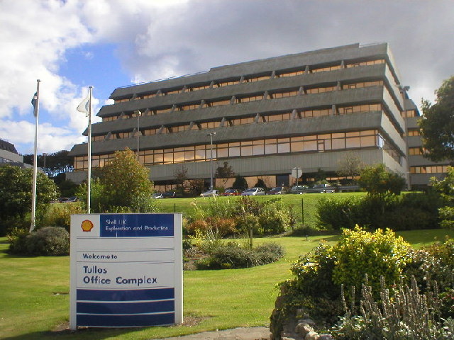
Tullos is an area of Aberdeen, Scotland. The area takes its name from the Vale of Tullos, which lies between Tullos Hill and Torry Hill. Tullos derived...

NESS Energy Project

The NESS Energy Project is an incinerator currently under construction in Aberdeen, UK. It is situated in East Tullos Industrial Estate on a site formerly...

Original 106 (radio station)

Original 106 is an Independent Local Radio station owned by DC Thomson and broadcasting to Aberdeenshire and the cities of Aberdeen, Dundee and Perth in...

Banks O' Dee F.C.

Banks o' Dee Football Club is a Scottish football club from the city of Aberdeen that plays in the Scottish Highland Football League. Their home ground...

Nearby Amenities

Located within 500m of 57.126341,-2.0831128
Traffic Signals
Traffic Signals: signal
Traffic Signals Direction: both
Lat/Long: 57.1247978/-2.0898622
Traffic Signals
Traffic Signals: signal
Traffic Signals Direction: both
Lat/Long: 57.1248123/-2.0897124
Railway: switch
Lat/Long: 57.1282514/-2.0901468
Post Box
Collection Times: Mo-Fr 09:00; Sa 07:00
Operator: Royal Mail
Operator Wikidata: Q638098
Post Box Type: pillar
Ref: AB11 175D
Royal Cypher: EVIIIR
Royal Cypher Wikidata: Q33102195
Lat/Long: 57.1306797/-2.0833221
Bus Stop
Gregness Gardens
Bus: yes
Naptan AtcoCode: 639004042
Naptan CommonName: Gregness Gardens
Naptan Indicator: at
Naptan NaptanCode: 23232846
Naptan Verified: no
Public Transport: platform
Shelter: yes
Lat/Long: 57.1307483/-2.082917
Post Box
Collection Times: Mo-Fr 18:00; Sa 11:00
Operator: Royal Mail
Operator Wikidata: Q638098
Post Box Type: meter
Ref: AB12 901P
Lat/Long: 57.1272518/-2.0901348
Tullos
Name En: Tullos
Name Gd: Tulach
Place: suburb
Wikidata: Q7852222
Wikipedia: en:Tullos
Lat/Long: 57.1255842/-2.086455
Passing Place
Lat/Long: 57.128761/-2.0872
Railway: switch
Lat/Long: 57.1299383/-2.0782864
Railway: switch
Lat/Long: 57.1296572/-2.0793913
Railway: switch
Lat/Long: 57.1281677/-2.0876856
Bus Stop
Greenbank Road
Bench: yes
Bin: yes
Bus: yes
Lit: yes
Naptan AtcoCode: 639006052
Naptan CommonName: Greenbank Road
Naptan Indicator: opp
Naptan NaptanCode: 23232747
Naptan Verified: no
Public Transport: platform
Shelter: yes
Tactile Paving: no
Lat/Long: 57.1252413/-2.0902785
Bus Stop
Greenbank Road
Bench: no
Bin: no
Bus: yes
Lit: yes
Naptan AtcoCode: 639006051
Naptan CommonName: Greenbank Road
Naptan Indicator: at
Naptan NaptanCode: 23236752
Naptan Verified: no
Public Transport: platform
Shelter: no
Tactile Paving: no
Lat/Long: 57.1245591/-2.0894841
Bus Stop
Craigshaw Road
Bench: yes
Bin: no
Bus: yes
Lit: yes
Naptan AtcoCode: 639003071
Naptan CommonName: Craigshaw Road
Naptan Indicator: opp
Naptan NaptanCode: 23232756
Naptan Verified: no
Public Transport: platform
Shelter: yes
Tactile Paving: no
Lat/Long: 57.1261664/-2.0903964
Bus Stop
Gregness Gardens
Bus: yes
Naptan AtcoCode: 639004041
Naptan CommonName: Gregness Gardens
Naptan Indicator: opp
Naptan NaptanCode: 23232849
Naptan Verified: no
Public Transport: platform
Lat/Long: 57.1308064/-2.0835689
Bus Stop
Kirkhill Lane
Bus: yes
Naptan AtcoCode: 639004023
Naptan CommonName: Kirkhill Lane
Naptan Indicator: at
Naptan NaptanCode: 23232835
Naptan Verified: no
Public Transport: platform
Lat/Long: 57.1302736/-2.0858213
Post Box
Collection Times: Mo-Fr 18:00; Sa 11:00
Operator: Royal Mail
Operator Wikidata: Q638098
Post Box Design: type_m
Post Box Type: lamp
Ref: AB12 585
Royal Cypher: scottish_crown
Lat/Long: 57.1272456/-2.0901623
Post Box
Collection Times: Mo-Fr 09:00; Sa 07:00
Operator: Royal Mail
Operator Wikidata: Q638098
Post Box Type: pillar
Ref: AB12 68D
Royal Cypher: scottish_crown
Lat/Long: 57.1250147/-2.0881616
Colour: green
Man Made: street_cabinet
Operator: Cityfibre
Ref: AB2.PN2.SN10
Telecom Medium: fibre
Utility: telecom
Lat/Long: 57.1303896/-2.0822281
Access: private
Barrier: lift_gate
Lat/Long: 57.1223776/-2.0870322
Railway: switch
Lat/Long: 57.1299744/-2.0782959
Railway: switch
Lat/Long: 57.1295182/-2.0809042
Railway: switch
Lat/Long: 57.1282485/-2.0886626
Railway: switch
Lat/Long: 57.1282426/-2.0889697
Railway: switch
Lat/Long: 57.1283296/-2.0879334
Railway: switch
Lat/Long: 57.1293534/-2.0821173
Railway: switch
Lat/Long: 57.128548/-2.0868191
Railway: switch
Lat/Long: 57.1286477/-2.0862659
Railway: switch
Lat/Long: 57.128501/-2.0874401
Railway: switch
Lat/Long: 57.1287653/-2.0858182
Railway: buffer_stop
Lat/Long: 57.1293214/-2.082923
Railway: buffer_stop
Lat/Long: 57.1293616/-2.0829679
Railway: switch
Lat/Long: 57.1291951/-2.0815813
Railway: buffer_stop
Lat/Long: 57.129423/-2.0801904
Man Made: mast
Tower Construction: tube
Tower Type: lighting
Lat/Long: 57.1291312/-2.0834746
Arnold Clark
Branch: Aberdeen
Brand: Arnold Clark
Brand Wikidata: Q29344371
Shop: car
Lat/Long: 57.1241561/-2.0887958
Lexus Aberdeen (Service Only)
Brand: Lexus
Brand Wikidata: Q35919
Shop: car_repair
Lat/Long: 57.1242641/-2.0882418
Direction: both
Surface: asphalt
Traffic Calming: cushion
Lat/Long: 57.1304388/-2.0825502
Direction: both
Surface: asphalt
Traffic Calming: cushion
Lat/Long: 57.13035/-2.0830223
Direction: both
Surface: asphalt
Traffic Calming: cushion
Lat/Long: 57.130687/-2.0827125
Crossing
Crossing: uncontrolled
Crossing Island: yes
Tactile Paving: yes
Lat/Long: 57.1299904/-2.0879616
Grit Bin
Lat/Long: 57.1292771/-2.0880716
Direction: both
Surface: asphalt
Traffic Calming: cushion
Lat/Long: 57.1306054/-2.0831725
Grit Bin
Lat/Long: 57.1304373/-2.0826817
Generator Method: photovoltaic
Generator Output Electricity: yes
Generator Source: solar
Generator Type: solar_photovoltaic_panel
Location: roof
Power: generator
Lat/Long: 57.1304111/-2.0862356
Man Made: mast
Tower Construction: tube
Tower Type: lighting
Lat/Long: 57.1284694/-2.0840221
Crossing
Crossing: uncontrolled
Crossing Island: yes
Crossing Markings: no
Tactile Paving: yes
Lat/Long: 57.1271228/-2.090938
Grit Bin
Lat/Long: 57.1275142/-2.089344
Generator Method: photovoltaic
Generator Output Electricity: yes
Generator Source: solar
Generator Type: solar_photovoltaic_panel
Location: roof
Power: generator
Lat/Long: 57.129766/-2.0827451
Crossing
Crossing: unmarked
Crossing Island: no
Crossing Markings: no
Tactile Paving: yes
Lat/Long: 57.1264879/-2.0858687
Weighbridge
Lat/Long: 57.1262504/-2.0778952
Power: transformer
Lat/Long: 57.1277643/-2.0894179
Power: transformer
Lat/Long: 57.1277969/-2.089191
Man Made: chimney
Material: metal
Lat/Long: 57.1266865/-2.0768993
Crossing
Crossing: uncontrolled
Crossing Markings: zebra
Lat/Long: 57.1270341/-2.077585
Weighbridge
Lat/Long: 57.1270231/-2.0777491
Man Made: satellite_dish
Operator: STV
Lat/Long: 57.1255757/-2.0906455
Fast Food
McDonald's
Addr Housename: Craigshaw Business Park
Addr Postcode: AB12 3QH
Addr Street: Craigshaw Road
Addr Unit: Unit 1
Brand: McDonald's
Brand Wikidata: Q38076
Cuisine: burger
Fhrs Id: 1658141
Takeaway: yes
Website: https://www.mcdonalds.com/gb/en-gb/location/aberdeen/aberdeen---craigshaw-road/craigshaw-road/8261701.html
Lat/Long: 57.1263029/-2.0914015
Give Way
Lat/Long: 57.1223682/-2.0866969
Crossing
Crossing: uncontrolled
Crossing Island: no
Crossing Markings: zebra
Kerb: lowered
Surface: asphalt
Tactile Paving: no
Traffic Calming: hump
Lat/Long: 57.1223834/-2.0869115
Give Way
Direction: backward
Lat/Long: 57.1266261/-2.09109
Give Way
Direction: backward
Lat/Long: 57.1274097/-2.0898827
Give Way
Direction: forward
Lat/Long: 57.1270988/-2.0910397
Give Way
Direction: backward
Lat/Long: 57.1251105/-2.0878297
Give Way
Direction: forward
Lat/Long: 57.1251944/-2.0878582
The data included in this document is from www.openstreetmap.org. The data is made available under ODbL.

Have you been to Tullos?

Leave your review of Tullos below (or comments, questions and feedback).