Cat Cairn

Heritage Site in Kincardineshire

Scotland

Cat Cairn

Depot of oil drilling pipes
Depot of oil drilling pipes Credit: Alex McGregor

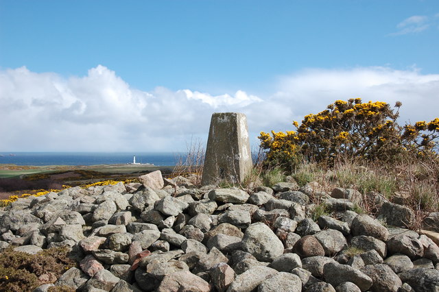
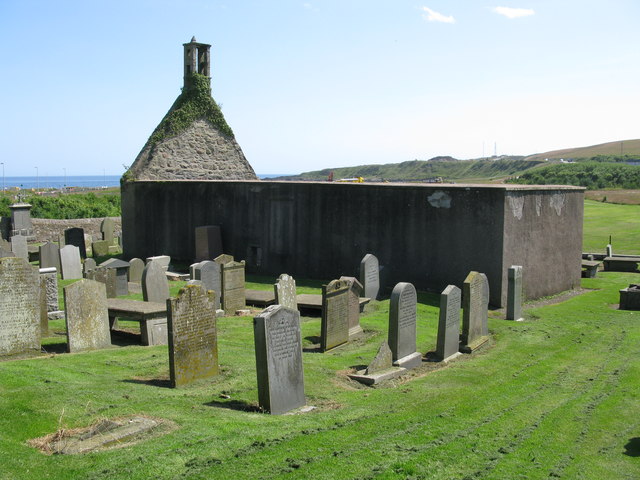
Cat Cairn is a historic heritage site located in Kincardineshire, Scotland. It is an ancient burial site that dates back to the Neolithic period around 4000 BC. The cairn is situated on a hilltop overlooking the North Sea, offering stunning views of the surrounding landscape.

The Cat Cairn gets its name from the Pictish symbol carved into one of the standing stones found at the site, which resembles a cat. The cairn itself is a large circular mound made of stones and earth, measuring approximately 20 meters in diameter. It is believed to have been a communal burial site used by the local community during the Neolithic era.

Excavations carried out at Cat Cairn in the 19th century revealed numerous artifacts and human remains, indicating its significance as a burial ground. Archaeologists also discovered pottery fragments, stone tools, and animal bones, providing insights into the daily life and practices of the people who lived in the area thousands of years ago.

Today, Cat Cairn is a protected heritage site, attracting visitors interested in exploring Scotland's ancient history. The site is easily accessible, with a designated parking area and a short walk to the cairn itself. Interpretive panels provide information about the site's history and significance, enhancing the visitor experience.

Visiting Cat Cairn offers a unique opportunity to step back in time and appreciate the rich cultural heritage of the region. Its location amidst the picturesque Scottish countryside makes it a captivating destination for history enthusiasts and nature lovers alike.

If you have any feedback on the listing, please let us know in the comments section below.
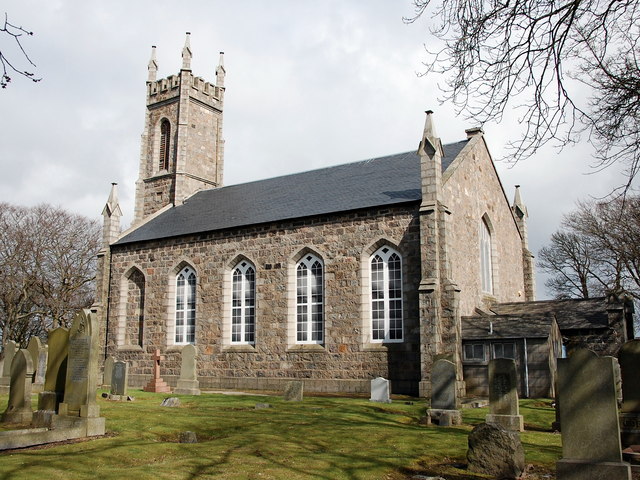
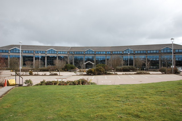
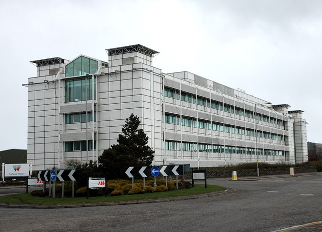
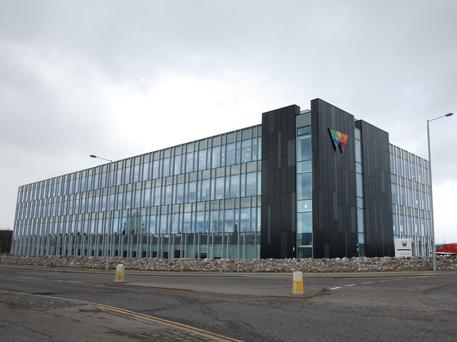
Cat Cairn Images

Images are sourced within 2km of 57.122/-2.073 or Grid Reference NJ9503. Thanks to Geograph Open Source API. All images are credited.

Depot of oil drilling pipes
Edward VIII pillar box... ...at the junction of Gregness Gardens and Girdleness Road.  One of only two to be found in Aberdeen and 136 nationwide.
Edward VIII pillar box...
...at the junction of Gregness Gardens and Girdleness Road. One of only two to be found in Aberdeen and 136 nationwide.
Tullos Primary School The classroom blinds add a nice bit of colour to this iconic 1930s art deco building, but the rusting metal and crumbling mortar are concerning...   B-listed: <span class="nowrap"><a title="http://www.britishlistedbuildings.co.uk/sc-49995-tullos-primary-school-girdleness-road-#.VxNisaT2amQ" rel="nofollow ugc noopener" href="http://www.britishlistedbuildings.co.uk/sc-49995-tullos-primary-school-girdleness-road-#.VxNisaT2amQ">Link</a><img style="margin-left:2px;" alt="External link" title="External link - shift click to open in new window" src="https://s1.geograph.org.uk/img/external.png" width="10" height="10"/></span> .
Tullos Primary School
The classroom blinds add a nice bit of colour to this iconic 1930s art deco building, but the rusting metal and crumbling mortar are concerning... B-listed: LinkExternal link .
Path... ...through Greenbank industrial estate.  The fly tipping and rotting rubbish absolutely everywhere make it look like a third-world slum.  In the background rather 'boxy' 1960s houses on the steep hillside of Balnagask and behind them, Victorian villas in Torry.
Path...
...through Greenbank industrial estate. The fly tipping and rotting rubbish absolutely everywhere make it look like a third-world slum. In the background rather 'boxy' 1960s houses on the steep hillside of Balnagask and behind them, Victorian villas in Torry.
Beech grove... ...on the hillside above Greenbank industrial estate.
Beech grove...
...on the hillside above Greenbank industrial estate.
Baron's Cairn... ...at the top of Tullos Hill: <span class="nowrap"><a title="https://canmore.org.uk/site/20242/barons-cairn-tullos-hill" rel="nofollow ugc noopener" href="https://canmore.org.uk/site/20242/barons-cairn-tullos-hill">Link</a><img style="margin-left:2px;" alt="External link" title="External link - shift click to open in new window" src="https://s1.geograph.org.uk/img/external.png" width="10" height="10"/></span> .  Girdleness Lighthouse is just visible in the distance.
Baron's Cairn...
...at the top of Tullos Hill: LinkExternal link . Girdleness Lighthouse is just visible in the distance.
Nigg Kirk Nigg Kirk was built in 1829 to the design of John Smith to replace the (now ruined) St Fittick's Kirk in Torry.  Compare St Clement's Church: <a title="https://www.geograph.org.uk/photo/3378773" href="https://www.geograph.org.uk/photo/3378773">Link</a> .  As already pointed out by Peter Robinson (<a title="https://www.geograph.org.uk/photo/3065186" href="https://www.geograph.org.uk/photo/3065186">Link</a> ), the windows are fakes, presumably on top of the boarded-up originals.
Nigg Kirk
Nigg Kirk was built in 1829 to the design of John Smith to replace the (now ruined) St Fittick's Kirk in Torry. Compare St Clement's Church: Link . As already pointed out by Peter Robinson (Link ), the windows are fakes, presumably on top of the boarded-up originals.
Amec Foster Wheeler office block An energy consultancy: <span class="nowrap"><a title="http://www.amecfw.com/aboutus/at-a-glance" rel="nofollow ugc noopener" href="http://www.amecfw.com/aboutus/at-a-glance">Link</a><img style="margin-left:2px;" alt="External link" title="External link - shift click to open in new window" src="https://s1.geograph.org.uk/img/external.png" width="10" height="10"/></span> .
Amec Foster Wheeler office block
An energy consultancy: LinkExternal link .
Oil company office, Altens industrial estate
Wood Group offices, Altens industrial estate
East Leading Light, Sinclair Road, Torry, Aberdeen Harbour Also known as Torry 1, the East Leading Light is an octagonal light tower built in 1842 of riveted iron. It forms a pair with the West Leading Light (Torry 2) of almost identical construction, also from 1842, about 250 yards to the west.
The ship to the right of the tower is the offshore supply ship 'Highland Chieftain'.
East Leading Light, Sinclair Road, Torry, Aberdeen Harbour
Also known as Torry 1, the East Leading Light is an octagonal light tower built in 1842 of riveted iron. It forms a pair with the West Leading Light (Torry 2) of almost identical construction, also from 1842, about 250 yards to the west. The ship to the right of the tower is the offshore supply ship 'Highland Chieftain'.
St Fittick's Church, Aberdeen The church was consecrated in 1242 and the ruins we see today probably contain elements of that earlier church as well as evidence of later 17th and 18th century rebuilding. None of the gravestones are earlier than the 17th century. St Fittick's Church was last used in 1829.
St Fittick's Church, Aberdeen
The church was consecrated in 1242 and the ruins we see today probably contain elements of that earlier church as well as evidence of later 17th and 18th century rebuilding. None of the gravestones are earlier than the 17th century. St Fittick's Church was last used in 1829.
Road Bridge at Rare Breeds Farm The bridge carries a minor road across the railway between Aberdeen and Stonehaven railway stations. Someone seems to believe this is a peace bridge!
Road Bridge at Rare Breeds Farm
The bridge carries a minor road across the railway between Aberdeen and Stonehaven railway stations. Someone seems to believe this is a peace bridge!
Tesco, Aberdeen South On Wellington Road, A956.
Tesco, Aberdeen South
On Wellington Road, A956.
Ferryhill Motive Power Depot, Aberdeen British Rail Class 24 number 5128 stands outside Ferryhill MPD. Brush Class 47 number 1971 stands behind.
Ferryhill Motive Power Depot, Aberdeen
British Rail Class 24 number 5128 stands outside Ferryhill MPD. Brush Class 47 number 1971 stands behind.
Ferryhill Motive Power Depot, Aberdeen British Rail Class 40 No. 40056 and Class 47 No. 47458 outside the engine shed.
Ferryhill Motive Power Depot, Aberdeen
British Rail Class 40 No. 40056 and Class 47 No. 47458 outside the engine shed.
Shunters, Ferryhill Motive Power Depot, Aberdeen British Rail Class 06 0-4-0 shunter No. 06006, and Class 08 shunter No. 08515 at Ferryhill.
Shunters, Ferryhill Motive Power Depot, Aberdeen
British Rail Class 06 0-4-0 shunter No. 06006, and Class 08 shunter No. 08515 at Ferryhill.
Railway crane at Ferryhill Motive Power Depot, Aberdeen With an unidentified Class 08 shunter.
Railway crane at Ferryhill Motive Power Depot, Aberdeen
With an unidentified Class 08 shunter.
Show me another place!

Cat Cairn is located at Grid Ref: NJ9503 (Lat: 57.122, Lng: -2.073)

Unitary Authority: City of Aberdeen

Police Authority: North East

What 3 Words

///sings.patio.turned. Near Cove, Aberdeen

Related Wikis

Tullos

Tullos is an area of Aberdeen, Scotland. The area takes its name from the Vale of Tullos, which lies between Tullos Hill and Torry Hill. Tullos derived...

NESS Energy Project

The NESS Energy Project is an incinerator currently under construction in Aberdeen, UK. It is situated in East Tullos Industrial Estate on a site formerly...

Doonies Farm

Doonies Rare Breeds Farm was a farm in Aberdeen, Scotland. Doonies Farm had one of Scotland's largest collections of rare and endangered farm animal breeds...

Altens

Altens is a district in Aberdeen, on the north-east coast of Scotland.Altens is home to a large industrial estate, alongside a similar estate in neighbouring...

Original 106 (radio station)

Original 106 is an Independent Local Radio station owned by DC Thomson and broadcasting to Aberdeenshire and the cities of Aberdeen, Dundee and Perth in...

Balnagask

Balnagask is an area of Torry, a burgh of Aberdeen in Scotland. Balnagask is said to mean "the village in the hollow" in Gaelic. The Balnagask Estate...

Torry Academy

Torry Academy was a secondary school in Torry, Aberdeen, run by Aberdeen City Council. The original school was built in 1927 and added to in 1947, creating...

Banks O' Dee F.C.

Banks o' Dee Football Club is a Scottish football club from the city of Aberdeen that plays in the Scottish Highland Football League. Their home ground...

Nearby Amenities

Located within 500m of 57.122,-2.073
Street Lamp
Lat/Long: 57.1202248/-2.0747376
Direction: both
Traffic Calming: bump
Lat/Long: 57.1214493/-2.0703213
Baron's Cairn
Ele: 83
Man Made: cairn
Source: NPE
Lat/Long: 57.1241323/-2.0715922
Bus Stop
Peterseat Drive
Bus: yes
Naptan AtcoCode: 639009051
Naptan CommonName: Peterseat Drive
Naptan Indicator: adj
Naptan NaptanCode: 23237386
Naptan Verified: no
Public Transport: platform
Lat/Long: 57.1192512/-2.0740803
Tullos Hill
Ele: 83
Natural: peak
Lat/Long: 57.1241442/-2.0715086
Noexit: yes
Lat/Long: 57.1230163/-2.0695148
Noexit: yes
Lat/Long: 57.1227887/-2.069957
Noexit: yes
Lat/Long: 57.1227539/-2.070043
Noexit: yes
Lat/Long: 57.1216871/-2.0711784
Noexit: yes
Lat/Long: 57.1231379/-2.0691336
Noexit: yes
Lat/Long: 57.1232167/-2.0675092
Noexit: yes
Lat/Long: 57.1232193/-2.0674402
Man Made: mast
Tower Construction: tube
Tower Type: lighting
Lat/Long: 57.1199998/-2.0722961
Man Made: mast
Tower Construction: tube
Tower Type: lighting
Lat/Long: 57.121041/-2.0716678
Man Made: mast
Tower Construction: tube
Tower Type: lighting
Lat/Long: 57.1193322/-2.0684592
Man Made: mast
Tower Construction: tube
Tower Type: lighting
Lat/Long: 57.1203675/-2.0681079
Man Made: mast
Tower Construction: tube
Tower Type: lighting
Lat/Long: 57.1206507/-2.0694745
Man Made: mast
Tower Construction: tube
Tower Type: lighting
Lat/Long: 57.1208939/-2.0706774
Direction: both
Traffic Calming: bump
Lat/Long: 57.1215781/-2.0710479
Give Way
Direction: backward
Lat/Long: 57.1227525/-2.0660044
Give Way
Direction: backward
Lat/Long: 57.1191819/-2.0768283
Give Way
Direction: backward
Lat/Long: 57.1194838/-2.076228
Give Way
Direction: backward
Lat/Long: 57.1195113/-2.0735239
The data included in this document is from www.openstreetmap.org. The data is made available under ODbL.

Have you been to Cat Cairn?

Leave your review of Cat Cairn below (or comments, questions and feedback).