Back Strip

Wood, Forest in Roxburghshire

Scotland

Back Strip

Old milestone Travelling southwards, turning left over the Cessford Burn, then right, this milestone is just to the left in the very small lane, part of a cycle route leading to the B6401 west of Morebattle.   The cottages at the west side of the burn can be seen in the distance.
Old milestone Credit: Chris Minto

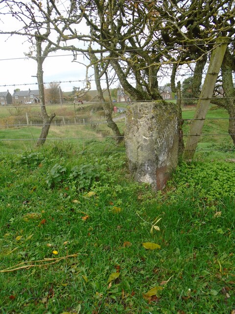
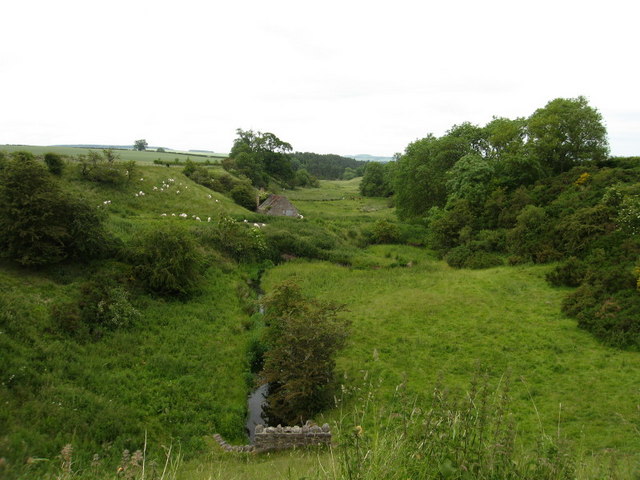
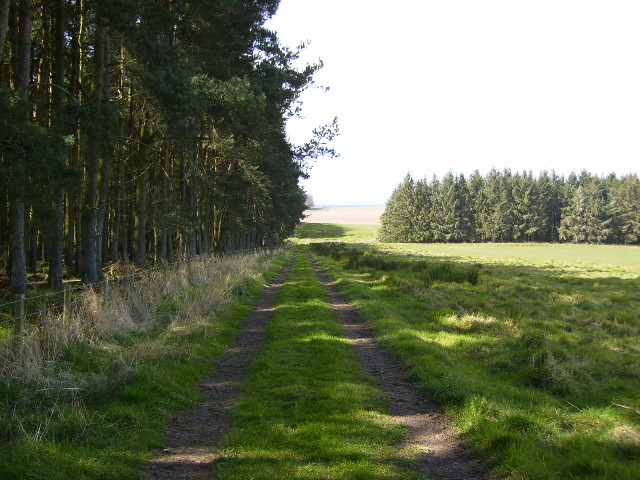
Back Strip is a small wooded area located in Roxburghshire, a historic county in the Scottish Borders region of Scotland. This forested region is situated in the southeastern part of the county and covers an approximate area of 200 acres. The woodland is predominantly composed of a variety of native tree species, including oak, birch, beech, and pine.

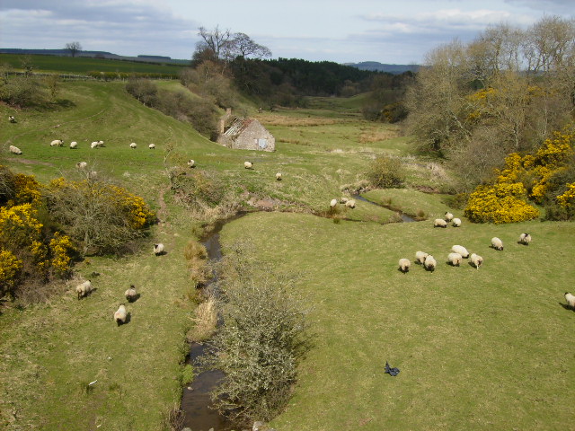
The area is known for its rich biodiversity and serves as a habitat for numerous wildlife species. It is home to a diverse range of bird species such as woodpeckers, owls, and various songbirds. Mammals such as red squirrels, foxes, and deer can also be found in the forest, making it a popular spot for nature enthusiasts and wildlife photographers.

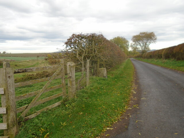
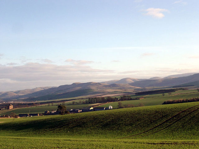
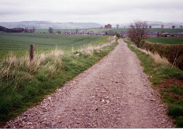
Back Strip offers a tranquil and picturesque setting, attracting visitors who seek a peaceful retreat in the midst of nature. There are several well-maintained walking trails that wind through the forest, allowing visitors to explore and appreciate the natural beauty of the surroundings. These trails offer opportunities for birdwatching, photography, or simply enjoying a leisurely stroll amidst the lush greenery.

The woodland also has historical significance, as it was once part of an ancient hunting ground. The remnants of old hunting lodges and gamekeeper's cottages can still be found scattered in the area, providing glimpses into the region's past.

Overall, Back Strip in Roxburghshire is a haven for nature lovers, offering a serene and captivating experience with its diverse flora and fauna, scenic trails, and echoes of history.

If you have any feedback on the listing, please let us know in the comments section below.

Back Strip Images

Images are sourced within 2km of 55.515338/-2.4473049 or Grid Reference NT7124. Thanks to Geograph Open Source API. All images are credited.

Old milestone Travelling southwards, turning left over the Cessford Burn, then right, this milestone is just to the left in the very small lane, part of a cycle route leading to the B6401 west of Morebattle.   The cottages at the west side of the burn can be seen in the distance.
Old milestone
Travelling southwards, turning left over the Cessford Burn, then right, this milestone is just to the left in the very small lane, part of a cycle route leading to the B6401 west of Morebattle. The cottages at the west side of the burn can be seen in the distance.
Old milestone Looking north along the lane leading to the castle on the east side of the Cessford Burn.   This may have been the original line of this route with a track leading northwards from the right-hand bend beyond the castle and crossing the Cessford Burn nearly a mile further north than the current bridge.
Old milestone
Looking north along the lane leading to the castle on the east side of the Cessford Burn. This may have been the original line of this route with a track leading northwards from the right-hand bend beyond the castle and crossing the Cessford Burn nearly a mile further north than the current bridge.
Fields near Cessford Cessford and the Cheviots behind.
Fields near Cessford
Cessford and the Cheviots behind.
St Cuthbert's Way looking east towards Cessford Cessford is a small hamlet with an old castle that can be seen to the left of the end of the track.
St Cuthbert's Way looking east towards Cessford
Cessford is a small hamlet with an old castle that can be seen to the left of the end of the track.
Cessford Burn Runs through the village of Cessford to join Kale Water approximately 2 km to the northeast. The building is presumably the one small unroofed building depicted on the 1st edition of the OS 6-inch map (1863).
Cessford Burn
Runs through the village of Cessford to join Kale Water approximately 2 km to the northeast. The building is presumably the one small unroofed building depicted on the 1st edition of the OS 6-inch map (1863).
Cessford Castle Early frosty morning image of Cessford Castle.
Cessford Castle
Early frosty morning image of Cessford Castle.
The jetty at Wooden Loch near Eckfordmoss
Looking down the unclassified road from Eckford that joins up with the A698 after 0.5km
House and farm buildings at Brownrigg
An overgrown track leads to arable fields at Eckfordmoss
Barn at Brownrigg - on the St.Cuthbert's Way long distance footpath
Footbridge near Fox Covert on the St.Cuthbert's Way
The B6401 road near Marlefield
A short tarmac section of St.Cuthbert's Way long distance footpath The long distance footpath comes towards the photographer. This is the Crailing road. The ldf then exits to the right of picture and returns to tracks at Brownrigg 100m away.
A short tarmac section of St.Cuthbert's Way long distance footpath
The long distance footpath comes towards the photographer. This is the Crailing road. The ldf then exits to the right of picture and returns to tracks at Brownrigg 100m away.
Pile of stones Taken from the nearby fields and dumped here by machine to assist in getting better crops.
Pile of stones
Taken from the nearby fields and dumped here by machine to assist in getting better crops.
St.Cuthberts Way alongside Long Plantation near Cessford This recent new section of the St.Cuthbert's Way was only put into use after a divert in April 2003.
St.Cuthberts Way alongside Long Plantation near Cessford
This recent new section of the St.Cuthbert's Way was only put into use after a divert in April 2003.
Cessford Burn and valley This picture near Cessford Castle, was taken on the long road section of the St Cuthbert's Way that runs from Cessford to Morebattle. There are plans in hand once agreement is reached with landowners and funding is available, to re-route this section of the path onto private lands. 
<span class="nowrap"><a title="https://www.stcuthbertsway.info/" rel="nofollow ugc noopener" href="https://www.stcuthbertsway.info/">Link</a><img style="margin-left:2px;" alt="External link" title="External link - shift click to open in new window" src="https://s1.geograph.org.uk/img/external.png" width="10" height="10"/></span>
Cessford Burn and valley
This picture near Cessford Castle, was taken on the long road section of the St Cuthbert's Way that runs from Cessford to Morebattle. There are plans in hand once agreement is reached with landowners and funding is available, to re-route this section of the path onto private lands. LinkExternal link
Tarmac track through farm buildings at Easter Wooden
Show me another place!

Back Strip is located at Grid Ref: NT7124 (Lat: 55.515338, Lng: -2.4473049)

Unitary Authority: The Scottish Borders

Police Authority: The Lothians and Scottish Borders

What 3 Words

///thorax.shrimps.sized. Near Jedburgh, Scottish Borders

Related Wikis

Eckford, Scottish Borders

Eckford is a small village located between the larger towns of Kelso and Jedburgh in the Scottish Borders. The village is in close proximity to both the...

Cessford, Scottish Borders

Cessford is a hamlet and former barony about a mile south of the B6401 road, in the Scottish Borders area of Scotland. The placename is from Gaelic 'ceis...
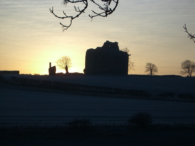
Cessford Castle

Cessford Castle is a large ruined mid-15th century L-plan castle near the village of Cessford, midway Jedburgh and Kelso, in the historic county of Roxburghshire...

Kale Water

The Kale Water is a 20 miles (32 km) long tributary of the River Teviot in the Scottish Borders area of Scotland. Its feeder burns in the Cheviot Hills...

Cessford Burn

Cessford Burn is a small stream which eventually runs to meet the Kale Water and then joins the River Teviot, finally entering the River Tweed at Kelso...

Kalemouth

Kalemouth is a place in the Scottish Borders area of Scotland, where the Kale Water joins the River Teviot, near to Eckford, Cessford, Crailing, Kelso...

Crailinghall

Crailinghall is a village near Oxnam in the Scottish Borders area of Scotland, in the former Roxburghshire. Crailinghall is on the route of the St. Cuthbert...

Crailing

Crailing is a village on the A698, in Teviotdale, 4m east of Jedburgh in the Scottish Borders area of Scotland, in the historic county of Roxburghshire...

Nearby Amenities

Located within 500m of 55.515338,-2.4473049
Wooden Hill
Natural: peak
Lat/Long: 55.5177269/-2.4480964
Barrier: stile
Material: wood
Stile: stepover
Lat/Long: 55.5197957/-2.4479022
Bench
Backrest: yes
Colour: brown
Material: wood
Seats: 4
Lat/Long: 55.5198262/-2.4478735
The data included in this document is from www.openstreetmap.org. The data is made available under ODbL.

Have you been to Back Strip?

Leave your review of Back Strip below (or comments, questions and feedback).