South Bank Wood

Wood, Forest in East Lothian

Scotland

South Bank Wood

Black Knowe Plantation A small wood on steep ground.
Black Knowe Plantation Credit: Richard Webb

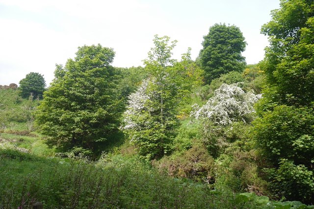
South Bank Wood is a picturesque forest located in East Lothian, Scotland. Situated on the southern bank of the River Tyne, it covers an area of approximately 100 acres and is renowned for its natural beauty and rich biodiversity.

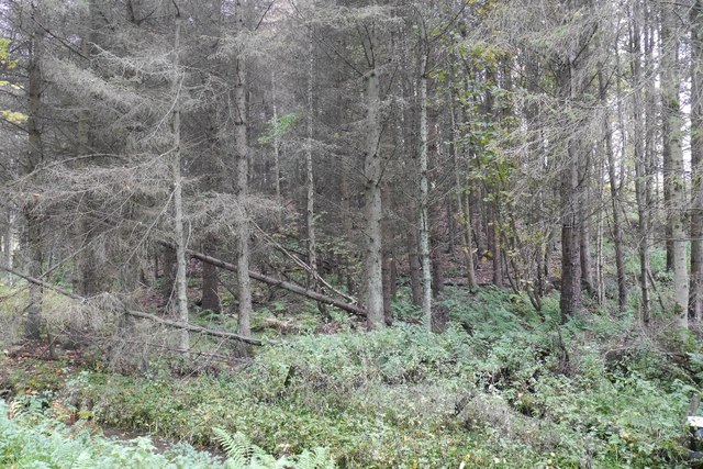
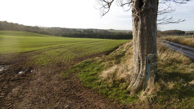
The wood is predominantly composed of native broadleaf trees, including oak, birch, and beech, which create a dense canopy that provides shelter and habitats for a wide range of wildlife. The forest floor is covered with a carpet of ferns, wildflowers, and mosses, adding to the enchanting atmosphere of the wood.

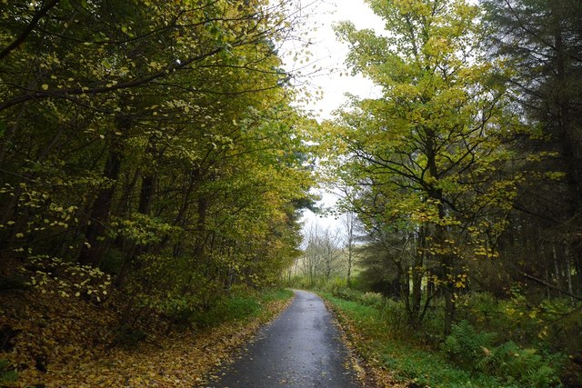
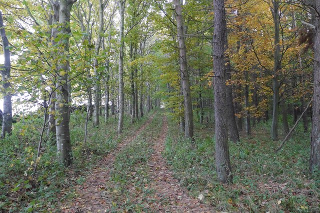
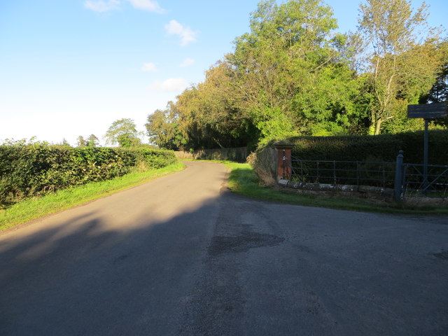
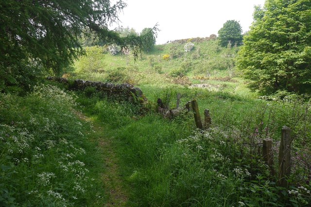
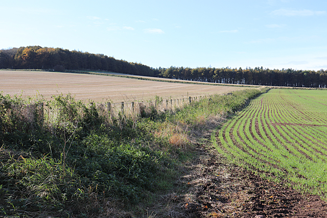
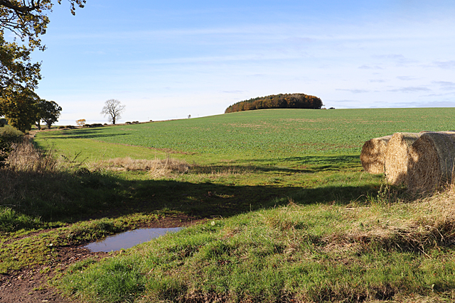
A network of well-maintained paths and trails crisscrosses South Bank Wood, allowing visitors to explore the area on foot or by bike. The paths wind through the tall trees, offering glimpses of the river and providing a peaceful and serene escape from the bustling nearby towns.

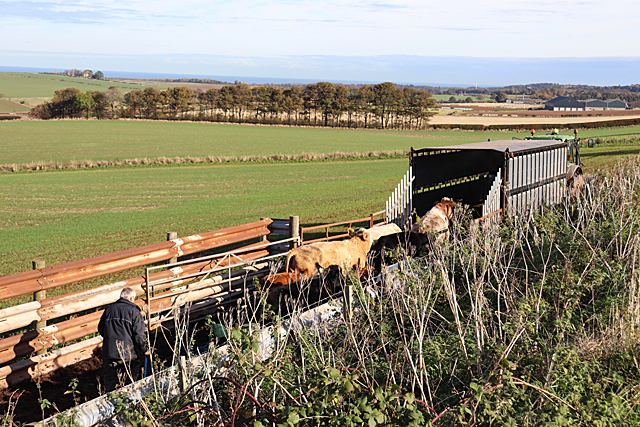
The wood is home to a variety of bird species, including woodpeckers, owls, and thrushes, making it a popular spot for birdwatchers. Squirrels can also be spotted darting among the trees, and if you're lucky, you might even catch a glimpse of a red deer or a fox.

South Bank Wood is managed by the local council, who strive to maintain its natural beauty while ensuring it remains accessible to the public. The wood is open year-round, and visitors are encouraged to take their litter home and respect the wildlife and natural environment.

Overall, South Bank Wood offers a tranquil and captivating experience for nature lovers and outdoor enthusiasts, providing a peaceful retreat in the heart of East Lothian.

If you have any feedback on the listing, please let us know in the comments section below.

South Bank Wood Images

Images are sourced within 2km of 55.946996/-2.6403613 or Grid Reference NT6072. Thanks to Geograph Open Source API. All images are credited.

Black Knowe Plantation A small wood on steep ground.
Black Knowe Plantation
A small wood on steep ground.
Woodland lane, East Lothian Between two woods on steep slopes.
Woodland lane, East Lothian
Between two woods on steep slopes.
Cottages at Luggate
Cottages at Luggate
Track on Lawhead Hill Near the summit.
Track on Lawhead Hill
Near the summit.
Stubble, Lawhead Hill View northwards from the edge of Lawhead Plantation towards Traprain Law.
Stubble, Lawhead Hill
View northwards from the edge of Lawhead Plantation towards Traprain Law.
Ordnance Survey Flush Bracket 673 This can be found on the wall of North Lodge - a private dwelling - at the entrance to the Whittingehame Estate.
For more detail see : <span class="nowrap"><a title="http://www.bench-marks.org.uk/bm23" rel="nofollow ugc noopener" href="http://www.bench-marks.org.uk/bm23">Link</a><img style="margin-left:2px;" alt="External link" title="External link - shift click to open in new window" src="https://s1.geograph.org.uk/img/external.png" width="10" height="10"/></span>
Ordnance Survey Flush Bracket 673
This can be found on the wall of North Lodge - a private dwelling - at the entrance to the Whittingehame Estate. For more detail see : LinkExternal link
Road at North Lodge Looking northward from the entrance to the Whittingehame Estate.
Road at North Lodge
Looking northward from the entrance to the Whittingehame Estate.
Winter arable, near Stoneypath Tower Cereals getting established near Garvald.
Winter arable, near Stoneypath Tower
Cereals getting established near Garvald.
Beside the Papana Water Taken from the delightful path between Garvald and Stoneypath Tower.
Beside the Papana Water
Taken from the delightful path between Garvald and Stoneypath Tower.
Stoneypath Tower to Garvald path A lovely path along and over the Papana Water.
Stoneypath Tower to Garvald path
A lovely path along and over the Papana Water.
Fields at Luggate, near Stenton
Winter Cereal The cereal crop is well through although it is only October.
Winter Cereal
The cereal crop is well through although it is only October.
Loading the Float These two cattlemen were struggling to persuade half a dozen cattle to get into the trailer. The mature cows were docile enough, but there was a half-grown calf refusing to co-operate, and while the men tried to get it to go into the trailer, the cows kept on coming back out to watch! They did eventually succeed, of course.
Loading the Float
These two cattlemen were struggling to persuade half a dozen cattle to get into the trailer. The mature cows were docile enough, but there was a half-grown calf refusing to co-operate, and while the men tried to get it to go into the trailer, the cows kept on coming back out to watch! They did eventually succeed, of course.
Stubble Field This harvested field has been cleared of straw bales and will soon be ploughed and re-planted with next year's crop. Traprain Law is in the background.
Stubble Field
This harvested field has been cleared of straw bales and will soon be ploughed and re-planted with next year's crop. Traprain Law is in the background.
Field Boundary A recently harvested field on the left, and a re-sown one with the shoots of next year's crop on the right.
Field Boundary
A recently harvested field on the left, and a re-sown one with the shoots of next year's crop on the right.
Lawhead Hill The plantation above the field is Lawhead Plantation.
Lawhead Hill
The plantation above the field is Lawhead Plantation.
Field at Papple A field ready for ploughing at Papple. On the far side of the field is <a href="https://www.geograph.org.uk/photo/6304388">NT5972 : Papple Steading</a>.
Field at Papple
A field ready for ploughing at Papple. On the far side of the field is NT5972 : Papple Steading.
Papple Steading There is no shortage of interesting steadings in East Lothian, but Papple is unusually striking. It is described as Germanic in style, with a steep pyramid over the archway which is the access to the courtyard, stables, cattle courts and ancillary buildings. It is a Category B Listed Building, and it is in course of being redeveloped as a heritage centre telling the story of the agricultural revolution of the 18th and 19th centuries.
Papple Steading
There is no shortage of interesting steadings in East Lothian, but Papple is unusually striking. It is described as Germanic in style, with a steep pyramid over the archway which is the access to the courtyard, stables, cattle courts and ancillary buildings. It is a Category B Listed Building, and it is in course of being redeveloped as a heritage centre telling the story of the agricultural revolution of the 18th and 19th centuries.
Show me another place!

South Bank Wood is located at Grid Ref: NT6072 (Lat: 55.946996, Lng: -2.6403613)

Unitary Authority: East Lothian

Police Authority: The Lothians and Scottish Borders

What 3 Words

///apples.frail.member. Near East Linton, East Lothian

Related Wikis

Whittingehame Tower

Whittingehame Tower, or Whittingehame Castle, is a fifteenth-century tower house about 2.5 miles (4.0 km) south of East Linton, on the west bank of Whittinghame...

Whittingehame

Whittingehame is a parish with a small village in East Lothian, Scotland, about halfway between Haddington and Dunbar, and near East Linton. The area is...

Stoneypath Tower

Stoneypath Tower, is an L-plan tower house dating from the late sixteenth century, about 3.5 miles (5.6 km) south of East Linton, and east of the Whittinghame...

Garvald, East Lothian

Garvald is a village south-east of Haddington in East Lothian, Scotland. It lies on the Papana Water south of the B6370, east of Gifford. The combined...

Stenton

Stenton (Scots: Staneton) is a parish and village in East Lothian, Scotland. It is bounded on the north by parts of the parishes of Prestonkirk and Dunbar...
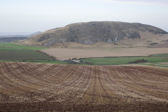
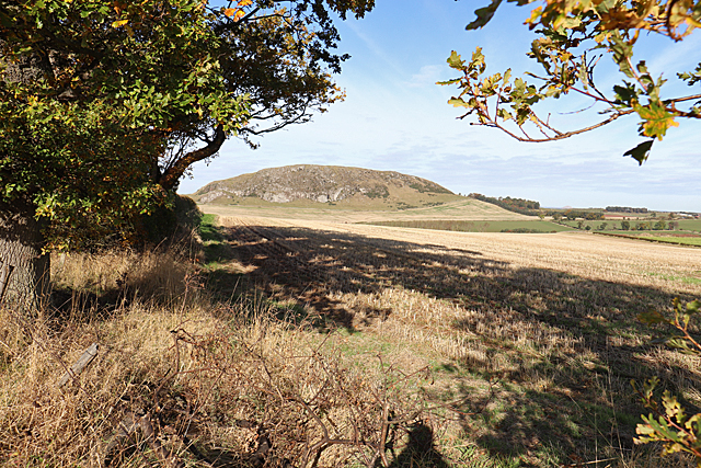
Traprain Law

Traprain Law is a hill 6 km (4 mi) east of Haddington, East Lothian, Scotland. It is the site of a hill fort or possibly oppidum, which covered at its...

Pressmennan Lake

Pressmennan Lake is a lake in East Lothian in Scotland. It is an artificial reservoir constructed in 1819 by a Mr Nesbit who dammed the streams flowing...

Sancta Maria Abbey, Nunraw

Nunraw Abbey or Sancta Maria Abbey, Nunraw is a working Trappist (Ordo Cisterciensis Strictioris Observantiae) monastery. It was the first Cistercian house...

Nearby Amenities

Located within 500m of 55.946996,-2.6403613
Power: pole
Lat/Long: 55.9426304/-2.6418543
Power: pole
Lat/Long: 55.9429576/-2.6406181
Power: pole
Lat/Long: 55.9432848/-2.639395
Power: pole
Lat/Long: 55.9435886/-2.6382157
The data included in this document is from www.openstreetmap.org. The data is made available under ODbL.

Have you been to South Bank Wood?

Leave your review of South Bank Wood below (or comments, questions and feedback).