Round Green Plantation

Wood, Forest in Kincardineshire

Scotland

Round Green Plantation

Falls on the North Esk river At this point the North Esk plunges down a series of small falls, the river being confined between rocks of the Gannochy Conglomerate Formation of the Devonian period. This would indicate that the Highland Boundary fault has not yet been reached as one follows the river upstream, as here we are still on sedimentary rocks rather than metamorphic. Standing here I was lucky enough to see a salmon trying to leap the falls, but wasn't quick enough with the camera.
Falls on the North Esk river Credit: Gordon Hatton

Round Green Plantation is a sprawling wood and forest located in the picturesque region of Kincardineshire, Scotland. This expansive plantation covers a vast area of approximately 500 acres, making it a significant natural landmark in the area.

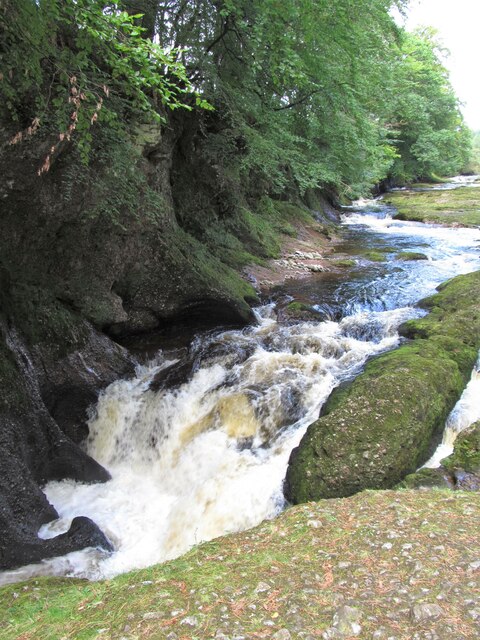
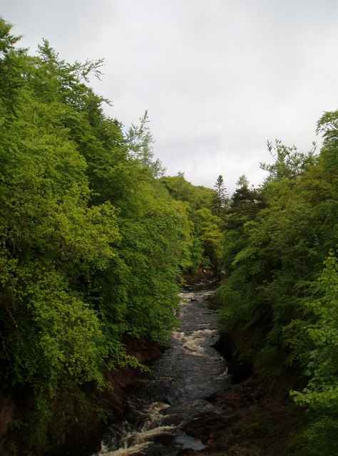
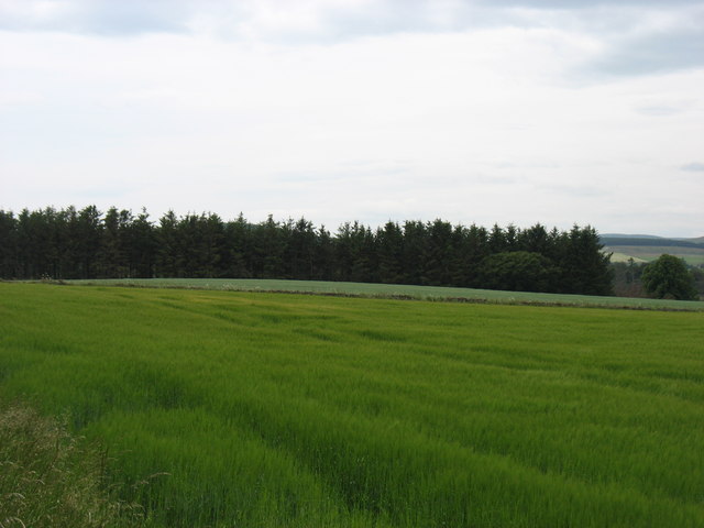
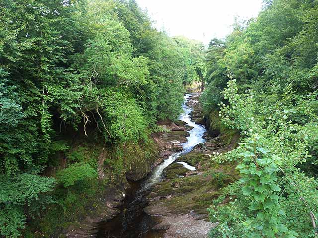
The plantation predominantly consists of various species of trees, including oak, beech, and coniferous trees, which create a diverse and captivating landscape. The dense vegetation provides a sanctuary for an array of wildlife, making it a popular spot for nature enthusiasts and birdwatchers.

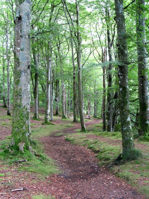
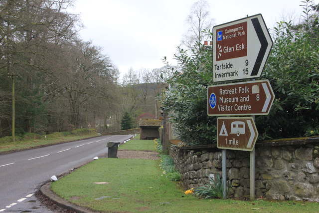
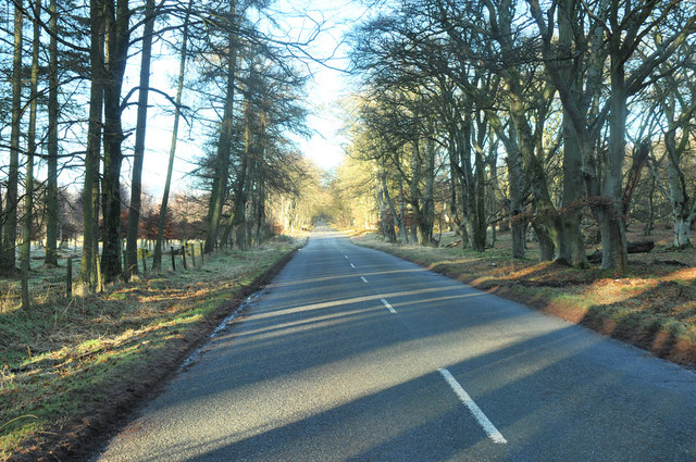
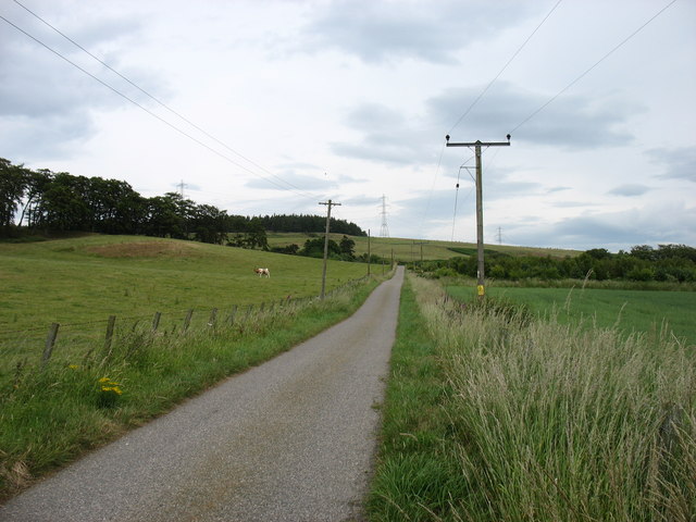
The woodland is crisscrossed by well-maintained trails, allowing visitors to explore the plantation at their own pace. These trails offer breathtaking vistas of the surrounding countryside, with panoramic views of rolling hills and meandering rivers.

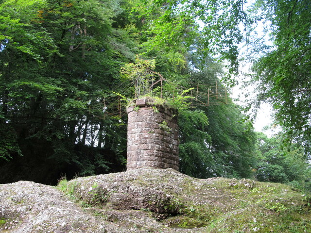
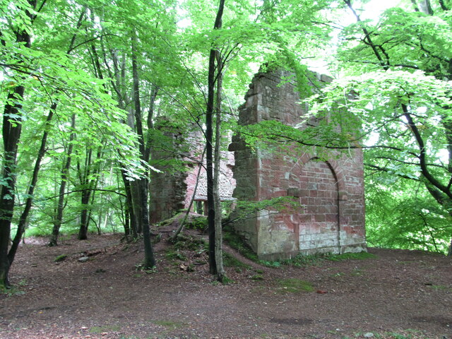
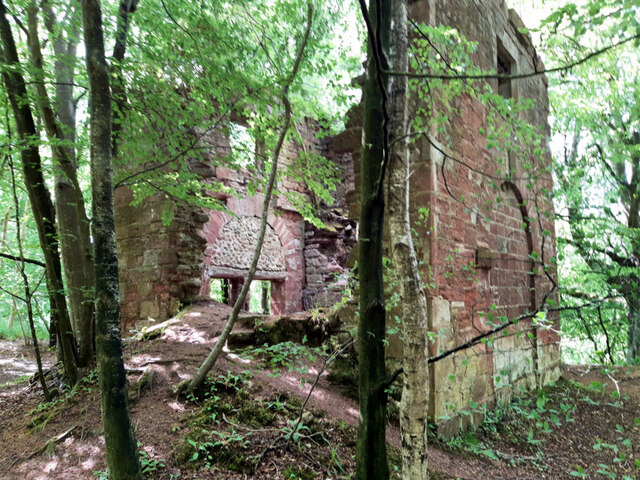
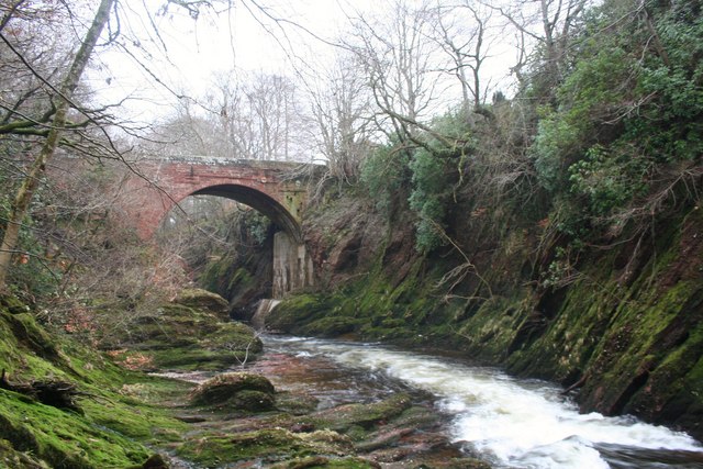
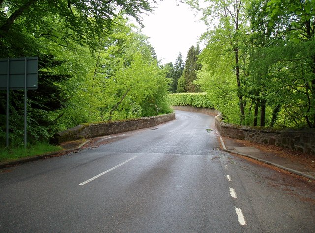
Round Green Plantation is also home to a number of historic features, including remnants of an old lime kiln and a stone arch bridge. These architectural remnants serve as a reminder of the area's rich history and add a touch of charm to the overall ambiance of the plantation.

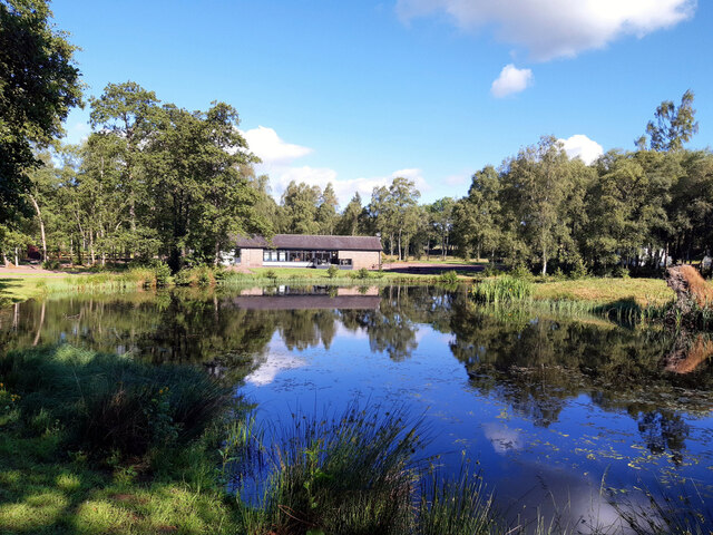
Visitors to Round Green Plantation can partake in a variety of activities, such as hiking, cycling, and picnicking. The tranquil atmosphere and beautiful surroundings make it an ideal location for relaxation and outdoor recreation.

Overall, Round Green Plantation in Kincardineshire is a natural gem, offering a unique blend of scenic beauty, wildlife diversity, and historical significance. It is a must-visit destination for those seeking a peaceful retreat amidst nature's splendor.

If you have any feedback on the listing, please let us know in the comments section below.

Round Green Plantation Images

Images are sourced within 2km of 56.839562/-2.6557715 or Grid Reference NO6072. Thanks to Geograph Open Source API. All images are credited.

Falls on the North Esk river At this point the North Esk plunges down a series of small falls, the river being confined between rocks of the Gannochy Conglomerate Formation of the Devonian period. This would indicate that the Highland Boundary fault has not yet been reached as one follows the river upstream, as here we are still on sedimentary rocks rather than metamorphic. Standing here I was lucky enough to see a salmon trying to leap the falls, but wasn't quick enough with the camera.
Falls on the North Esk river
At this point the North Esk plunges down a series of small falls, the river being confined between rocks of the Gannochy Conglomerate Formation of the Devonian period. This would indicate that the Highland Boundary fault has not yet been reached as one follows the river upstream, as here we are still on sedimentary rocks rather than metamorphic. Standing here I was lucky enough to see a salmon trying to leap the falls, but wasn't quick enough with the camera.
Remains of old footbridge over the North Esk Not much remains of this old bridge apart from some rather rusty old framework, the decking having disappeared long ago. I'm sure in decades past I must have crossed Highland bridges in a similar state to this! The sandstone central pier stands on a local conglomerate rock of the Devonian period.
Remains of old footbridge over the North Esk
Not much remains of this old bridge apart from some rather rusty old framework, the decking having disappeared long ago. I'm sure in decades past I must have crossed Highland bridges in a similar state to this! The sandstone central pier stands on a local conglomerate rock of the Devonian period.
Narrow river channel at the Rocks of Solitude A short way downstream at Edzell, the North Esk is quite a wide river, but here it is confined to the narrowest of channels as it squeezes through a rocky gorge. Walking along the riverside paths one can observe that the Highland Boundary fault has been crossed as metamorphic rocks of the Ordovician period replace sedimentary rocks of the Devonian, the latter being evident at the next set of falls a half mile downstream.
Narrow river channel at the Rocks of Solitude
A short way downstream at Edzell, the North Esk is quite a wide river, but here it is confined to the narrowest of channels as it squeezes through a rocky gorge. Walking along the riverside paths one can observe that the Highland Boundary fault has been crossed as metamorphic rocks of the Ordovician period replace sedimentary rocks of the Devonian, the latter being evident at the next set of falls a half mile downstream.
Dark waters at the Rocks of Solitude The deep dark waters of the North Esk as it squeezes through the confines of a gorge.
Dark waters at the Rocks of Solitude
The deep dark waters of the North Esk as it squeezes through the confines of a gorge.
Lake at Glenesk Caravan Site
Arnhall Quarry Extensive area of shallow quarrying near Gannochy. Extracting sands and gravels from glacial deposits at the end of Glen Esk.
Arnhall Quarry
Extensive area of shallow quarrying near Gannochy. Extracting sands and gravels from glacial deposits at the end of Glen Esk.
Gannochy Tower An 18th century folly in woodland above the River North Esk. Grade 'C' listed. Not sure if it was built as a romantic ruin, or whether it fell apart.
Gannochy Tower
An 18th century folly in woodland above the River North Esk. Grade 'C' listed. Not sure if it was built as a romantic ruin, or whether it fell apart.
Woodland path near Gannochy Bridge This path follows the left bank of the River North Esk and begins as a very pleasant woodland route. Further on towards Edzell the path is narrow and close by a fence before dropping suddenly and very steeply down a 15m bank to the waterside. Don't say I didn't warn you. The path on the right bank of the river is excellent all the way.
Woodland path near Gannochy Bridge
This path follows the left bank of the River North Esk and begins as a very pleasant woodland route. Further on towards Edzell the path is narrow and close by a fence before dropping suddenly and very steeply down a 15m bank to the waterside. Don't say I didn't warn you. The path on the right bank of the river is excellent all the way.
Old ruins by the road Difficult to see but there are a few old buildings at this layby
Old ruins by the road
Difficult to see but there are a few old buildings at this layby
Gannochy Tower Remains of a folly tower, built in the later 18th century. It is now a shell, has tall storeys with a high keyblocked arch at the east and a blind arch at the west, and is constructed from courses with slate cherry cocking.
<span class="nowrap"><a title="https://online.aberdeenshire.gov.uk/smrpub/master/detail.aspx?Authority=ASH&refno=NO67SW0116" rel="nofollow ugc noopener" href="https://online.aberdeenshire.gov.uk/smrpub/master/detail.aspx?Authority=ASH&refno=NO67SW0116">Link</a><img style="margin-left:2px;" alt="External link" title="External link - shift click to open in new window" src="https://s1.geograph.org.uk/img/external.png" width="10" height="10"/></span>
Gannochy Tower
Remains of a folly tower, built in the later 18th century. It is now a shell, has tall storeys with a high keyblocked arch at the east and a blind arch at the west, and is constructed from courses with slate cherry cocking. LinkExternal link
Gannochy Bridge Ganochy Bridge from the bed of the North Esk.
Gannochy Bridge
Ganochy Bridge from the bed of the North Esk.
Glen Esk road junction near Edzell
Road past Saltire Wood
The North Esk at Gannochy
Gannochy Bridge On the border of Aberdeenshire (at this point previously Kincardineshire) and Angus.
Gannochy Bridge
On the border of Aberdeenshire (at this point previously Kincardineshire) and Angus.
The road to Kirkton of Balfour
Fields and woods south of Kirkton of Balfour
River North Esk Looking downstream from Gannochy Bridge.
River North Esk
Looking downstream from Gannochy Bridge.
Show me another place!

Round Green Plantation is located at Grid Ref: NO6072 (Lat: 56.839562, Lng: -2.6557715)

Unitary Authority: Aberdeenshire

Police Authority: North East

What 3 Words

///universe.masterful.telephone. Near Laurencekirk, Aberdeenshire

Nearby Locations

Round Green Plantation

Related Wikis

Edzell Woods

Edzell Woods is a village in the Kincardine and Mearns area of Aberdeenshire, Scotland. It is 4 miles (6.4 km) from Edzell by road, but only one mile...

Edzell Castle

Edzell Castle is a ruined 16th-century castle, with an early-17th-century walled garden. It is located close to Edzell, and is around 5 miles (8 km) north...

Edzell

Edzell (; Scots: Aigle; Scottish Gaelic: Eigill) is a village in Angus, Scotland. It is 5 miles (8 km) north of Brechin, by the River North Esk. Edzell...

Inglis Memorial Hall

The Inglis Memorial Hall is a municipal structure in the High Street in Edzell, Angus, Scotland, which for much of the 20th century served as Edzell Parish...

Nearby Amenities

Located within 500m of 56.839562,-2.6557715
Power: pole
Lat/Long: 56.8385134/-2.6479525
Power: pole
Lat/Long: 56.8378567/-2.6485127
Power: pole
Lat/Long: 56.8371874/-2.6490982
The data included in this document is from www.openstreetmap.org. The data is made available under ODbL.

Have you been to Round Green Plantation?

Leave your review of Round Green Plantation below (or comments, questions and feedback).