Mountlehoy Wood

Wood, Forest in East Lothian

Scotland

Mountlehoy Wood

Black Knowe Plantation A small wood on steep ground.
Black Knowe Plantation Credit: Richard Webb

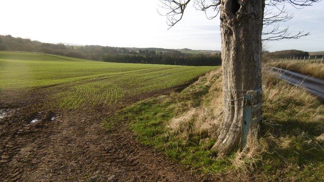
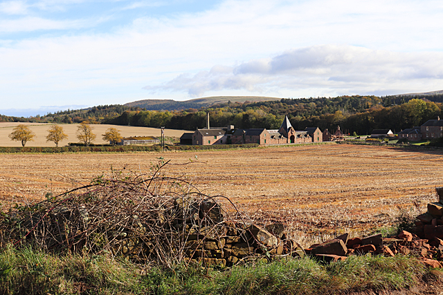
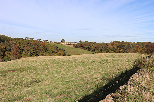
Mountlehoy Wood is a picturesque woodland located in East Lothian, Scotland. Covering an area of approximately 20 hectares, this enchanting forest offers a tranquil escape from the bustling city life. The wood is situated near the village of Gifford and is easily accessible by road.

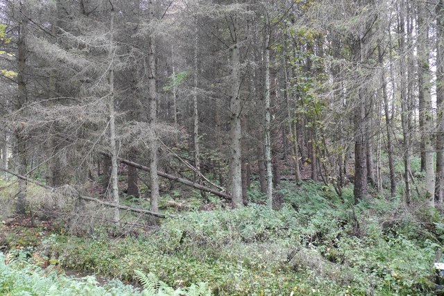
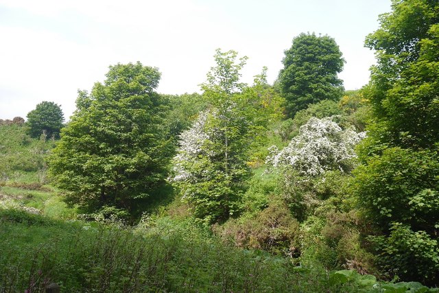
Upon entering Mountlehoy Wood, visitors are greeted by a diverse range of flora and fauna. The wood is predominantly composed of native broadleaf trees, such as oak, beech, and birch, which provide a stunning display of colors throughout the seasons. The forest floor is adorned with a carpet of bluebells in the spring, creating a magical atmosphere.

The wood is a haven for wildlife enthusiasts, as it is home to a variety of animal species. Red squirrels can be spotted darting between the branches, while woodpeckers can be heard drumming their distinctive rhythm. The wood also provides a habitat for deer, foxes, and a wide range of bird species.

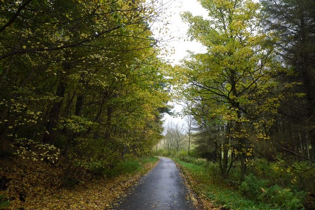
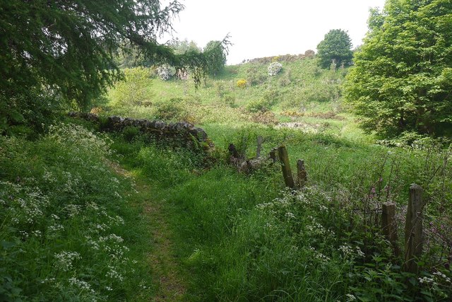
Several well-maintained trails wind their way through Mountlehoy Wood, allowing visitors to explore its natural beauty at their own pace. These paths are suitable for walkers of all abilities and offer breathtaking views of the surrounding countryside.

In addition to its natural beauty, Mountlehoy Wood also holds historical significance. The wood was once part of the estate of the nearby Yester House, a grand mansion dating back to the 18th century. Ruins of an old icehouse can still be found within the woodland, serving as a reminder of its past.

Overall, Mountlehoy Wood is a captivating destination that offers a perfect blend of natural splendor and historical charm. Whether it's a leisurely stroll or a chance to immerse oneself in nature, this woodland is a must-visit for anyone seeking solace in East Lothian.

If you have any feedback on the listing, please let us know in the comments section below.

Mountlehoy Wood Images

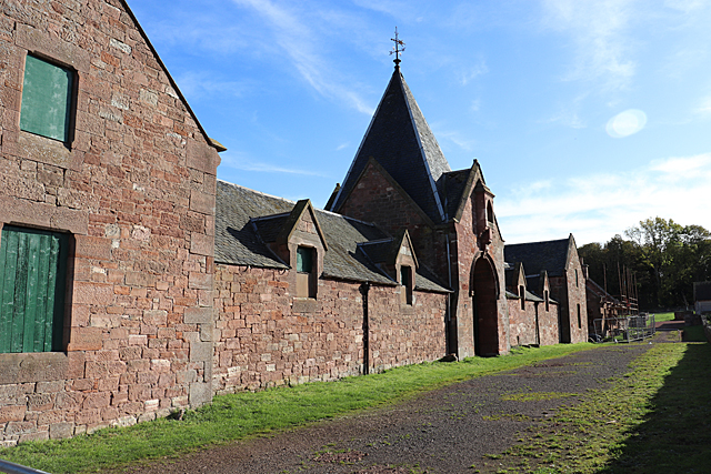
Images are sourced within 2km of 55.941784/-2.6352162 or Grid Reference NT6072. Thanks to Geograph Open Source API. All images are credited.

Black Knowe Plantation A small wood on steep ground.
Black Knowe Plantation
A small wood on steep ground.
Woodland lane, East Lothian Between two woods on steep slopes.
Woodland lane, East Lothian
Between two woods on steep slopes.
Ordnance Survey Flush Bracket 673 This can be found on the wall of North Lodge - a private dwelling - at the entrance to the Whittingehame Estate.
For more detail see : <span class="nowrap"><a title="http://www.bench-marks.org.uk/bm23" rel="nofollow ugc noopener" href="http://www.bench-marks.org.uk/bm23">Link</a><img style="margin-left:2px;" alt="External link" title="External link - shift click to open in new window" src="https://s1.geograph.org.uk/img/external.png" width="10" height="10"/></span>
Ordnance Survey Flush Bracket 673
This can be found on the wall of North Lodge - a private dwelling - at the entrance to the Whittingehame Estate. For more detail see : LinkExternal link
Road at North Lodge Looking northward from the entrance to the Whittingehame Estate.
Road at North Lodge
Looking northward from the entrance to the Whittingehame Estate.
Winter arable, near Stoneypath Tower Cereals getting established near Garvald.
Winter arable, near Stoneypath Tower
Cereals getting established near Garvald.
Beside the Papana Water Taken from the delightful path between Garvald and Stoneypath Tower.
Beside the Papana Water
Taken from the delightful path between Garvald and Stoneypath Tower.
Stoneypath Tower to Garvald path A lovely path along and over the Papana Water.
Stoneypath Tower to Garvald path
A lovely path along and over the Papana Water.
Garvald to Stoneypath path Littered with leaves after a recent gale.
Garvald to Stoneypath path
Littered with leaves after a recent gale.
Field at Papple A field ready for ploughing at Papple. On the far side of the field is <a href="https://www.geograph.org.uk/photo/6304388">NT5972 : Papple Steading</a>.
Field at Papple
A field ready for ploughing at Papple. On the far side of the field is NT5972 : Papple Steading.
Papple Steading There is no shortage of interesting steadings in East Lothian, but Papple is unusually striking. It is described as Germanic in style, with a steep pyramid over the archway which is the access to the courtyard, stables, cattle courts and ancillary buildings. It is a Category B Listed Building, and it is in course of being redeveloped as a heritage centre telling the story of the agricultural revolution of the 18th and 19th centuries.
Papple Steading
There is no shortage of interesting steadings in East Lothian, but Papple is unusually striking. It is described as Germanic in style, with a steep pyramid over the archway which is the access to the courtyard, stables, cattle courts and ancillary buildings. It is a Category B Listed Building, and it is in course of being redeveloped as a heritage centre telling the story of the agricultural revolution of the 18th and 19th centuries.
Arable Land at Papple The buildings are at Papple Farm, in the next square.
Arable Land at Papple
The buildings are at Papple Farm, in the next square.
Old-style Signpost Rural East Lothian has plenty of the old style of signpost, as here at Papple.
Old-style Signpost
Rural East Lothian has plenty of the old style of signpost, as here at Papple.
West Lodge Judging by the assorted building materials lying around, the lodge is being treated to some welcome refurbishment. I do hope the caravan isn't permanent.
West Lodge
Judging by the assorted building materials lying around, the lodge is being treated to some welcome refurbishment. I do hope the caravan isn't permanent.
Black Knowe Plantation The undulating ground here is almost certainly the result of glacial deposition and meltwater channels.
Black Knowe Plantation
The undulating ground here is almost certainly the result of glacial deposition and meltwater channels.
Near Papple The landforms are due to glacial action during the last Ice Age, and in particular of meltwater channels which now form almost dry valleys.
Near Papple
The landforms are due to glacial action during the last Ice Age, and in particular of meltwater channels which now form almost dry valleys.
Old Stables The building dates from about 1820, and belonged to the nearby manse. It is Category B listed. Pity about the road sign for Stenton, which evidently has not lasted as long as the building it is on.
Old Stables
The building dates from about 1820, and belonged to the nearby manse. It is Category B listed. Pity about the road sign for Stenton, which evidently has not lasted as long as the building it is on.
Former Manse Delighted to find an elegant Georgian building with no cars in front of it, I just had time to photograph it before the owner arrived, opened the gates and drove in! She was understandably curious to know why I was photographing her house, so I explained. I went on to visit the kirk next door, and when I came back there was a second car, so I can count myeslf very fortunate to have been there at exactly the right moment. The house dates from 1820 and is Category B listed.
Former Manse
Delighted to find an elegant Georgian building with no cars in front of it, I just had time to photograph it before the owner arrived, opened the gates and drove in! She was understandably curious to know why I was photographing her house, so I explained. I went on to visit the kirk next door, and when I came back there was a second car, so I can count myeslf very fortunate to have been there at exactly the right moment. The house dates from 1820 and is Category B listed.
Show me another place!

Mountlehoy Wood is located at Grid Ref: NT6072 (Lat: 55.941784, Lng: -2.6352162)

Unitary Authority: East Lothian

Police Authority: The Lothians and Scottish Borders

What 3 Words

///starlight.collapsed.risk. Near East Linton, East Lothian

Related Wikis

Whittingehame Tower

Whittingehame Tower, or Whittingehame Castle, is a fifteenth-century tower house about 2.5 miles (4.0 km) south of East Linton, on the west bank of Whittinghame...

Stoneypath Tower

Stoneypath Tower, is an L-plan tower house dating from the late sixteenth century, about 3.5 miles (5.6 km) south of East Linton, and east of the Whittinghame...

Whittingehame

Whittingehame is a parish with a small village in East Lothian, Scotland, about halfway between Haddington and Dunbar, and near East Linton. The area is...

Garvald, East Lothian

Garvald is a village south-east of Haddington in East Lothian, Scotland. It lies on the Papana Water south of the B6370, east of Gifford. The combined...

Nearby Amenities

Located within 500m of 55.941784,-2.6352162
Power: pole
Lat/Long: 55.9423008/-2.6430555
Power: pole
Lat/Long: 55.9426304/-2.6418543
Power: pole
Lat/Long: 55.9429576/-2.6406181
Power: pole
Lat/Long: 55.9432848/-2.639395
Power: pole
Lat/Long: 55.9435886/-2.6382157
The data included in this document is from www.openstreetmap.org. The data is made available under ODbL.

Have you been to Mountlehoy Wood?

Leave your review of Mountlehoy Wood below (or comments, questions and feedback).