Yarrowbank Plantation

Wood, Forest in East Lothian

Scotland

Yarrowbank Plantation

Ordnance Survey Flush Bracket 673 This can be found on the wall of North Lodge - a private dwelling - at the entrance to the Whittingehame Estate.
For more detail see : <span class="nowrap"><a title="http://www.bench-marks.org.uk/bm23" rel="nofollow ugc noopener" href="http://www.bench-marks.org.uk/bm23">Link</a><img style="margin-left:2px;" alt="External link" title="External link - shift click to open in new window" src="https://s1.geograph.org.uk/img/external.png" width="10" height="10"/></span>
Ordnance Survey Flush Bracket 673 Credit: Peter Wood

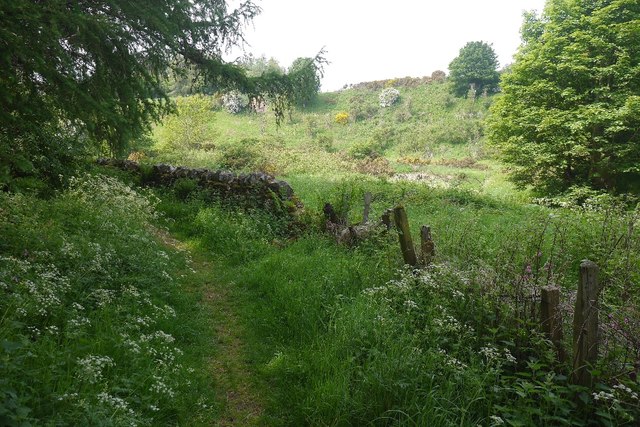
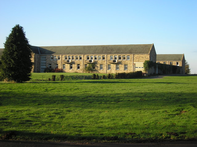
Yarrowbank Plantation is a picturesque woodland located in East Lothian, Scotland. Covering an area of approximately 150 acres, the plantation is renowned for its stunning natural beauty and diverse range of flora and fauna.

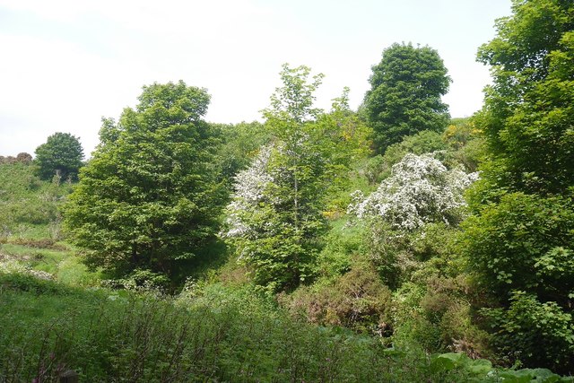
Situated just a few miles outside the historic town of Haddington, Yarrowbank Plantation offers a tranquil escape from the hustle and bustle of everyday life. The woodland is characterized by a mixture of mature trees, including oak, beech, and Scots pine, which provide a canopy of shade and shelter for the abundant wildlife that call this area home.

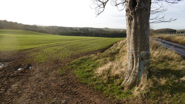
Visitors to Yarrowbank Plantation can enjoy a leisurely stroll along the well-maintained paths that meander through the woods. These paths offer stunning views of the surrounding countryside and provide an opportunity to observe the rich biodiversity of the area. Nature enthusiasts will be delighted to spot various bird species, such as woodpeckers and owls, as well as small mammals like squirrels and rabbits.

Yarrowbank Plantation is a popular destination for outdoor activities such as hiking, nature walks, and birdwatching. The plantation is also equipped with picnic areas, making it an ideal spot for a family day out or a peaceful picnic amidst nature.

Managed by the local forestry commission, Yarrowbank Plantation is a well-preserved woodland that showcases the natural beauty of East Lothian. Its accessibility, diverse ecosystem, and peaceful ambiance make it a must-visit destination for nature lovers and those seeking a tranquil retreat.

If you have any feedback on the listing, please let us know in the comments section below.

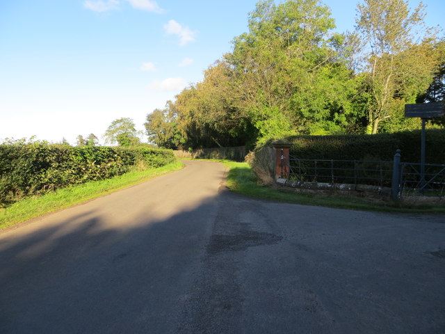
Yarrowbank Plantation Images

Images are sourced within 2km of 55.942873/-2.6313756 or Grid Reference NT6072. Thanks to Geograph Open Source API. All images are credited.

Ordnance Survey Flush Bracket 673 This can be found on the wall of North Lodge - a private dwelling - at the entrance to the Whittingehame Estate.
For more detail see : <span class="nowrap"><a title="http://www.bench-marks.org.uk/bm23" rel="nofollow ugc noopener" href="http://www.bench-marks.org.uk/bm23">Link</a><img style="margin-left:2px;" alt="External link" title="External link - shift click to open in new window" src="https://s1.geograph.org.uk/img/external.png" width="10" height="10"/></span>
Ordnance Survey Flush Bracket 673
This can be found on the wall of North Lodge - a private dwelling - at the entrance to the Whittingehame Estate. For more detail see : LinkExternal link
Road at North Lodge Looking northward from the entrance to the Whittingehame Estate.
Road at North Lodge
Looking northward from the entrance to the Whittingehame Estate.
Winter arable, near Stoneypath Tower Cereals getting established near Garvald.
Winter arable, near Stoneypath Tower
Cereals getting established near Garvald.
Beside the Papana Water Taken from the delightful path between Garvald and Stoneypath Tower.
Beside the Papana Water
Taken from the delightful path between Garvald and Stoneypath Tower.
Stoneypath Tower to Garvald path A lovely path along and over the Papana Water.
Stoneypath Tower to Garvald path
A lovely path along and over the Papana Water.
Garvald to Stoneypath path Littered with leaves after a recent gale.
Garvald to Stoneypath path
Littered with leaves after a recent gale.
Field at Papple A field ready for ploughing at Papple. On the far side of the field is <a href="https://www.geograph.org.uk/photo/6304388">NT5972 : Papple Steading</a>.
Field at Papple
A field ready for ploughing at Papple. On the far side of the field is NT5972 : Papple Steading.
Papple Steading There is no shortage of interesting steadings in East Lothian, but Papple is unusually striking. It is described as Germanic in style, with a steep pyramid over the archway which is the access to the courtyard, stables, cattle courts and ancillary buildings. It is a Category B Listed Building, and it is in course of being redeveloped as a heritage centre telling the story of the agricultural revolution of the 18th and 19th centuries.
Papple Steading
There is no shortage of interesting steadings in East Lothian, but Papple is unusually striking. It is described as Germanic in style, with a steep pyramid over the archway which is the access to the courtyard, stables, cattle courts and ancillary buildings. It is a Category B Listed Building, and it is in course of being redeveloped as a heritage centre telling the story of the agricultural revolution of the 18th and 19th centuries.
Arable Land at Papple The buildings are at Papple Farm, in the next square.
Arable Land at Papple
The buildings are at Papple Farm, in the next square.
Old-style Signpost Rural East Lothian has plenty of the old style of signpost, as here at Papple.
Old-style Signpost
Rural East Lothian has plenty of the old style of signpost, as here at Papple.
West Lodge Judging by the assorted building materials lying around, the lodge is being treated to some welcome refurbishment. I do hope the caravan isn't permanent.
West Lodge
Judging by the assorted building materials lying around, the lodge is being treated to some welcome refurbishment. I do hope the caravan isn't permanent.
Black Knowe Plantation The undulating ground here is almost certainly the result of glacial deposition and meltwater channels.
Black Knowe Plantation
The undulating ground here is almost certainly the result of glacial deposition and meltwater channels.
Near Papple The landforms are due to glacial action during the last Ice Age, and in particular of meltwater channels which now form almost dry valleys.
Near Papple
The landforms are due to glacial action during the last Ice Age, and in particular of meltwater channels which now form almost dry valleys.
Woodland edge, Whittingehame Edge of the woods around Whittingehame House.
Woodland edge, Whittingehame
Edge of the woods around Whittingehame House.
Cut timber. Whittingehame's wood awaiting a trip to the sawmill. In a welcome shelterbelt.
Cut timber.
Whittingehame's wood awaiting a trip to the sawmill. In a welcome shelterbelt.
Roadside oaks. Near Papple. A pair of oaks in the hedgerow. The foreground contains round bales which will never be used.
Roadside oaks.
Near Papple. A pair of oaks in the hedgerow. The foreground contains round bales which will never be used.
Stoneypath Tower I think the tower is now completely restored, taken while cycling past towards Garvald, a pleasant wee village nearby
Stoneypath Tower
I think the tower is now completely restored, taken while cycling past towards Garvald, a pleasant wee village nearby
Show me another place!

Yarrowbank Plantation is located at Grid Ref: NT6072 (Lat: 55.942873, Lng: -2.6313756)

Unitary Authority: East Lothian

Police Authority: The Lothians and Scottish Borders

What 3 Words

///duties.detail.thousands. Near East Linton, East Lothian

Related Wikis

Whittingehame Tower

Whittingehame Tower, or Whittingehame Castle, is a fifteenth-century tower house about 2.5 miles (4.0 km) south of East Linton, on the west bank of Whittinghame...

Whittingehame

Whittingehame is a parish with a small village in East Lothian, Scotland, about halfway between Haddington and Dunbar, and near East Linton. The area is...

Stoneypath Tower

Stoneypath Tower, is an L-plan tower house dating from the late sixteenth century, about 3.5 miles (5.6 km) south of East Linton, and east of the Whittinghame...

Garvald, East Lothian

Garvald is a village south-east of Haddington in East Lothian, Scotland. It lies on the Papana Water south of the B6370, east of Gifford. The combined...

Pressmennan Lake

Pressmennan Lake is a lake in East Lothian in Scotland. It is an artificial reservoir constructed in 1819 by a Mr Nesbit who dammed the streams flowing...

Stenton

Stenton (Scots: Staneton) is a parish and village in East Lothian, Scotland. It is bounded on the north by parts of the parishes of Prestonkirk and Dunbar...

Sancta Maria Abbey, Nunraw

Nunraw Abbey or Sancta Maria Abbey, Nunraw is a working Trappist (Ordo Cisterciensis Strictioris Observantiae) monastery. It was the first Cistercian house...

Traprain Law

Traprain Law is a hill 6 km (4 mi) east of Haddington, East Lothian, Scotland. It is the site of a hill fort or possibly oppidum, which covered at its...

Nearby Amenities

Located within 500m of 55.942873,-2.6313756
Power: pole
Lat/Long: 55.9435886/-2.6382157
The data included in this document is from www.openstreetmap.org. The data is made available under ODbL.

Have you been to Yarrowbank Plantation?

Leave your review of Yarrowbank Plantation below (or comments, questions and feedback).