Jean's Wood

Wood, Forest in Roxburghshire

Scotland

Jean's Wood

Dawn at the summit of Eildon Mid Hill The trig point and toposcope are silhouetted against a colourful sky about 15 minutes before sunrise.
Dawn at the summit of Eildon Mid Hill Credit: Walter Baxter

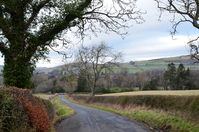
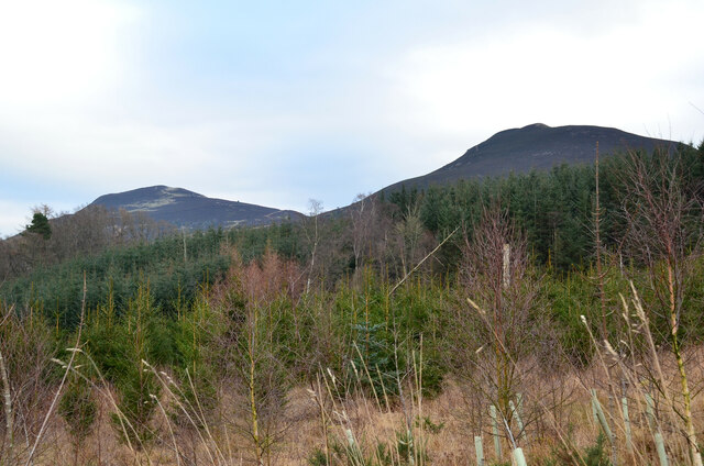
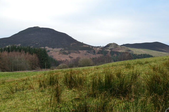
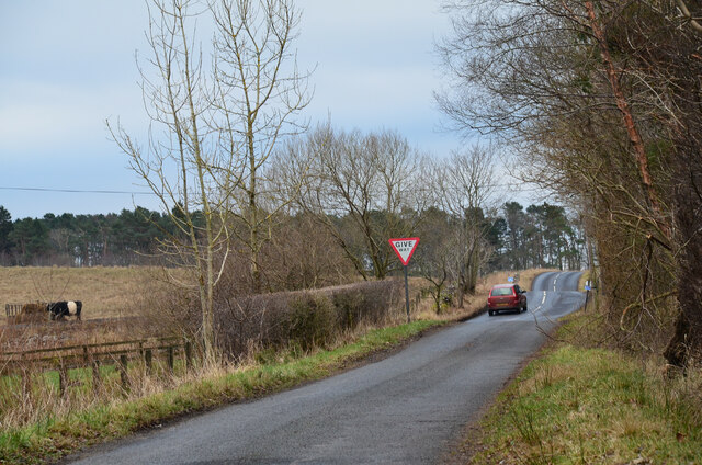
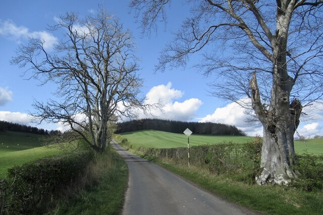
Jean's Wood is a picturesque forest located in Roxburghshire, Scotland. Covering an area of approximately 100 acres, the wood is nestled in the heart of the beautiful Scottish Borders region. The wood is easily accessible, situated just off the A68 road, making it a popular destination for locals and visitors alike.

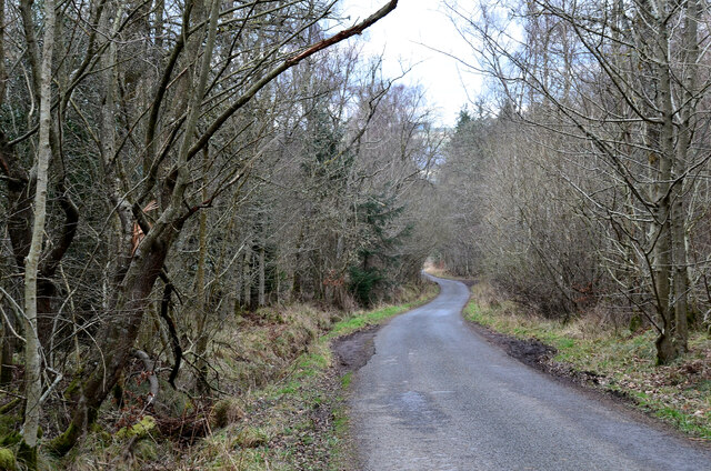
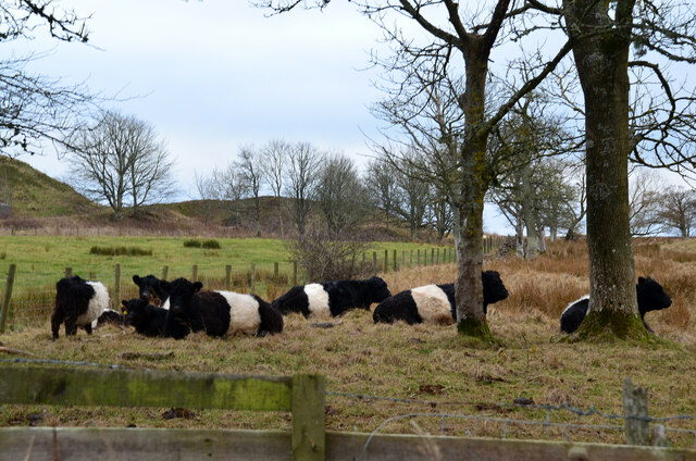
Jean's Wood is characterized by its diverse range of tree species, including oak, beech, birch, and pine. These majestic trees create a dense canopy that provides a haven for a variety of wildlife. Visitors can expect to spot red squirrels, roe deer, and a wide array of bird species such as woodpeckers, thrushes, and owls.

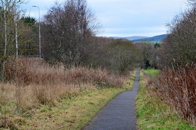
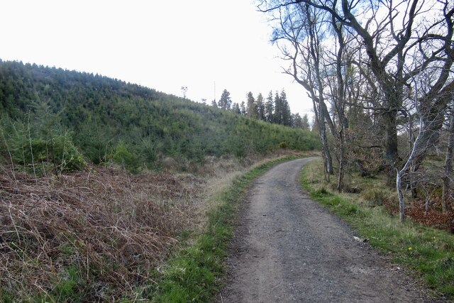
The wood offers several walking trails, each providing a unique experience for nature enthusiasts. The paths wind through the forest, offering opportunities to explore the wood's hidden corners and encounter its natural beauty up close. Along the way, visitors may stumble upon tranquil streams, wildflowers, and even the occasional waterfall.

For those looking to immerse themselves in the peaceful ambiance of Jean's Wood, there are several designated picnic areas where visitors can relax and enjoy a packed lunch amidst the serene surroundings. Additionally, the wood is equipped with well-maintained facilities, including car parking, toilets, and information boards, ensuring a comfortable experience for all.

Jean's Wood is a cherished natural gem in Roxburghshire, offering a tranquil escape from the hustle and bustle of everyday life. Whether it's a leisurely stroll, birdwatching, or simply basking in the beauty of nature, the wood has something to offer for everyone.

If you have any feedback on the listing, please let us know in the comments section below.
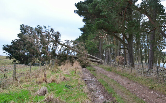
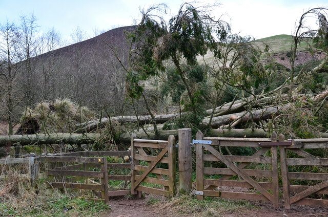
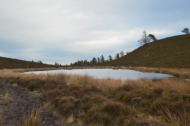
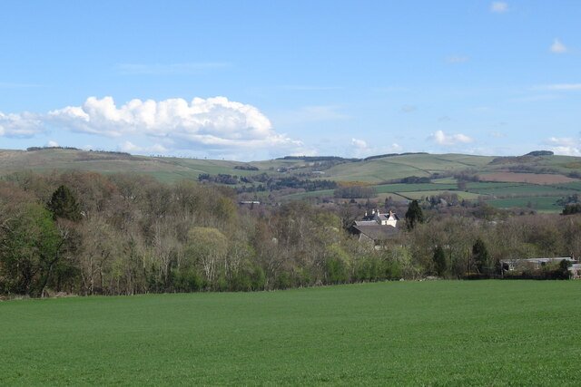
Jean's Wood Images

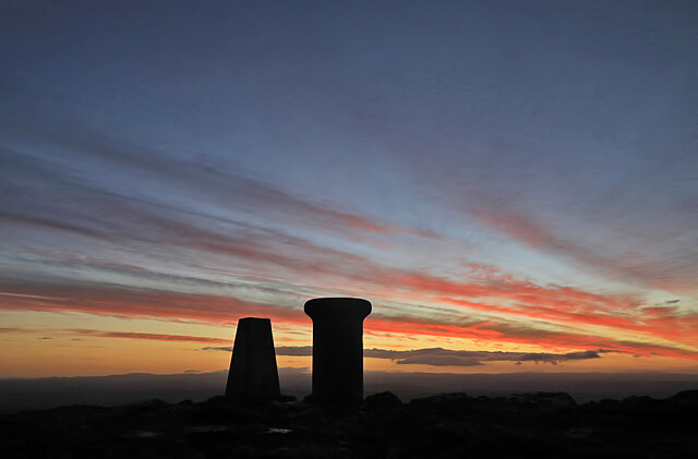
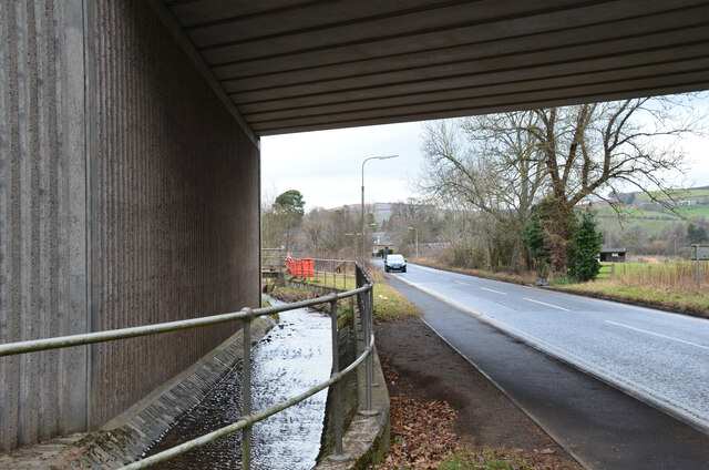
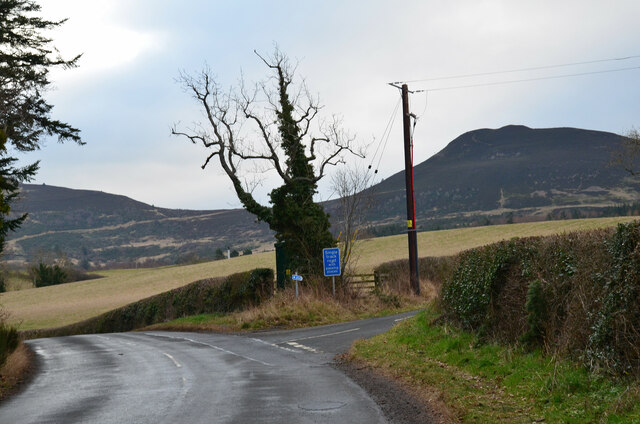
Images are sourced within 2km of 55.585231/-2.7455391 or Grid Reference NT5332. Thanks to Geograph Open Source API. All images are credited.

Dawn at the summit of Eildon Mid Hill The trig point and toposcope are silhouetted against a colourful sky about 15 minutes before sunrise.
Dawn at the summit of Eildon Mid Hill
The trig point and toposcope are silhouetted against a colourful sky about 15 minutes before sunrise.
Cyclepath alongside Melrose By-Pass A path by the A6091 east of the Borders General Hospital.
Cyclepath alongside Melrose By-Pass
A path by the A6091 east of the Borders General Hospital.
Underpass near Borders General Hospital The underpass carries the Dingleton road and the Huntly Burn below the A6091 Melrose By-Pass.
Underpass near Borders General Hospital
The underpass carries the Dingleton road and the Huntly Burn below the A6091 Melrose By-Pass.
Road junction near Borders General Hospital Junction for a minor road, single track with passing places, with the road between Darnick and Dingleton. Eildon Mid Hill is to the right.
Road junction near Borders General Hospital
Junction for a minor road, single track with passing places, with the road between Darnick and Dingleton. Eildon Mid Hill is to the right.
Minor road near Dingleton A single-track road through farmland and plantations west of Dingleton.
Minor road near Dingleton
A single-track road through farmland and plantations west of Dingleton.
Minor road through plantations, Dingleton A single-track road west of Dingleton.
Minor road through plantations, Dingleton
A single-track road west of Dingleton.
Eildon Hills from plantations near Dingleton Eildon Hill North (L) and Eildon Mid Hill seen from a minor road west of Dingleton.
Eildon Hills from plantations near Dingleton
Eildon Hill North (L) and Eildon Mid Hill seen from a minor road west of Dingleton.
Eildon Hills from the west Eildon Mid Hill (L), Little Hill (centre) and Wester Hill (R) seen from the single-track road west of Dingleton.
Eildon Hills from the west
Eildon Mid Hill (L), Little Hill (centre) and Wester Hill (R) seen from the single-track road west of Dingleton.
Road junction near Bowdenmoor Reservoir The single-track road meets the B6359 road from Dingleton.
Road junction near Bowdenmoor Reservoir
The single-track road meets the B6359 road from Dingleton.
Belted Galloway cattle, Bowdenmoor Distinctive black and white cattle by the B6359.
Belted Galloway cattle, Bowdenmoor
Distinctive black and white cattle by the B6359.
Bowden Loch This former reservoir is a fishery and it had attracted a number of anglers and walkers on this Sunday afternoon. Eildon Mid Hill dominates the skyline with Little Hill to the right.
Bowden Loch
This former reservoir is a fishery and it had attracted a number of anglers and walkers on this Sunday afternoon. Eildon Mid Hill dominates the skyline with Little Hill to the right.
Fallen trees at Bowden Loch Two Scots pines across the track, aftermath of Storm Arwen's northerly gales in November last year.
Fallen trees at Bowden Loch
Two Scots pines across the track, aftermath of Storm Arwen's northerly gales in November last year.
More fallen trees at Bowden Loch Two more Scots pines near the loch shore, brought down in Storm Arwen in November last year.
More fallen trees at Bowden Loch
Two more Scots pines near the loch shore, brought down in Storm Arwen in November last year.
Fallen trees at east end of Bowden Loch More Scots pines brought down here in Storm Arwen last November. Fortunately there was enough room to squeeze past to the right to gain the open hillside.
Fallen trees at east end of Bowden Loch
More Scots pines brought down here in Storm Arwen last November. Fortunately there was enough room to squeeze past to the right to gain the open hillside.
Lochan below Eildon Mid Hill A lochan on the col between Mid Hill and Wester Hill, not shown on the 1:25,000 map. The path skirts its northern edge.
Lochan below Eildon Mid Hill
A lochan on the col between Mid Hill and Wester Hill, not shown on the 1:25,000 map. The path skirts its northern edge.
View over the Tweed Towards the hills north of Melrose.
View over the Tweed
Towards the hills north of Melrose.
Road to Cauldshiels Loch
Road, Cauldshiels Towards the loch past young trees.
Road, Cauldshiels
Towards the loch past young trees.
Show me another place!

Jean's Wood is located at Grid Ref: NT5332 (Lat: 55.585231, Lng: -2.7455391)

Unitary Authority: The Scottish Borders

Police Authority: The Lothians and Scottish Borders

What 3 Words

///hikes.removers.swinging. Near Melrose, Scottish Borders

Related Wikis

Borders General Hospital

Borders General Hospital (BGH) is a district general hospital on the outskirts of Melrose, Scotland. It is managed by NHS Borders. == History == The hospital...

Dingleton Hospital

Dingleton Hospital was a mental health facility in Melrose, Scotland. The former boiler house is a Category B listed building. == History == The hospital...

Darnick

Darnick is a village near Melrose in the Scottish Borders area of Scotland, in the former Roxburghshire. The name was first recorded in 1124, and has changed...

Melrose, Scottish Borders

Melrose (Scottish Gaelic: Maolros, "bald moor") is a town and civil parish in the Scottish Borders, historically in Roxburghshire. It lies within the Eildon...

Nearby Amenities

Located within 500m of 55.585231,-2.7455391
Power: tower
Lat/Long: 55.5857128/-2.7465351
Power: tower
Lat/Long: 55.5878945/-2.748082
Power: tower
Lat/Long: 55.5821075/-2.7439791
Power: tower
Lat/Long: 55.5840895/-2.7453842
Power: pole
Lat/Long: 55.58858/-2.7476825
Power: pole
Lat/Long: 55.5863275/-2.7461045
Power: pole
Lat/Long: 55.5841109/-2.7447531
Power: pole
Lat/Long: 55.5835115/-2.7445006
Power: pole
Lat/Long: 55.5818194/-2.7433126
Power: pole
Lat/Long: 55.5811778/-2.7428545
Power: pole
Lat/Long: 55.589226/-2.7481098
Power: pole
Lat/Long: 55.587771/-2.7471333
Power: pole
Lat/Long: 55.5870482/-2.7466181
Power: pole
Lat/Long: 55.584913/-2.745106
Power: pole
Lat/Long: 55.5856374/-2.7456174
Power: pole
Lat/Long: 55.5826143/-2.7438707
The data included in this document is from www.openstreetmap.org. The data is made available under ODbL.

Have you been to Jean's Wood?

Leave your review of Jean's Wood below (or comments, questions and feedback).