Ploughman's Strip

Wood, Forest in Peeblesshire

Scotland

Ploughman's Strip

Angle in the wall, Mill Rig On the ridge with Lee Burn Head in view.
Angle in the wall, Mill Rig Credit: Jim Barton

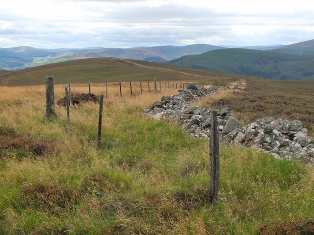
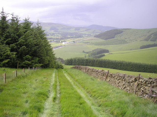
Ploughman's Strip is a picturesque woodland located in Peeblesshire, Scotland. Covering an area of approximately 50 acres, this forested area is known for its natural beauty and tranquil atmosphere. The woodland is situated on the outskirts of the town of Peebles, making it easily accessible for both locals and visitors.

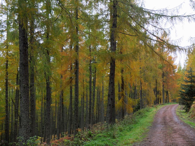
The forest is predominantly made up of native Scottish tree species, including oak, birch, and Scots pine. These towering trees provide a dense canopy, creating a cool and shaded environment even on the hottest of days. The forest floor is covered in a thick carpet of moss and ferns, adding to the enchanting ambiance.

Ploughman's Strip is also home to a variety of wildlife, making it a popular spot for nature enthusiasts and birdwatchers. Visitors may catch a glimpse of red squirrels, roe deer, or even a shy fox. The forest is also a habitat for a diverse range of bird species, including woodpeckers, owls, and various songbirds.

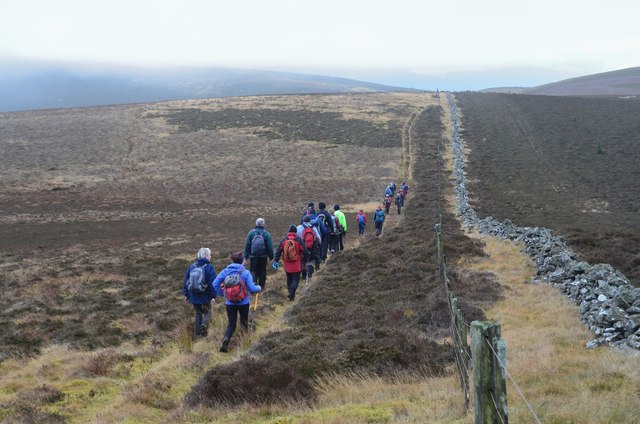
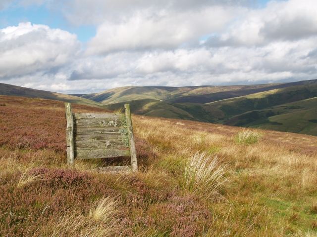
A network of well-maintained walking trails meanders through the woodland, allowing visitors to explore the area at their leisure. These paths lead to hidden glens, babbling brooks, and small waterfalls, providing ample opportunities for peaceful reflection and relaxation.

Ploughman's Strip is not only a haven for nature lovers but also for those seeking outdoor recreational activities. The forest offers excellent opportunities for hiking, mountain biking, and horseback riding, with trails suitable for all skill levels. It is truly a place where people can connect with nature and find solace in the tranquility of the Scottish countryside.

If you have any feedback on the listing, please let us know in the comments section below.

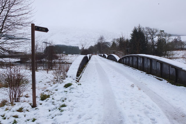
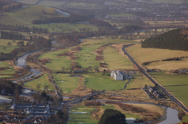
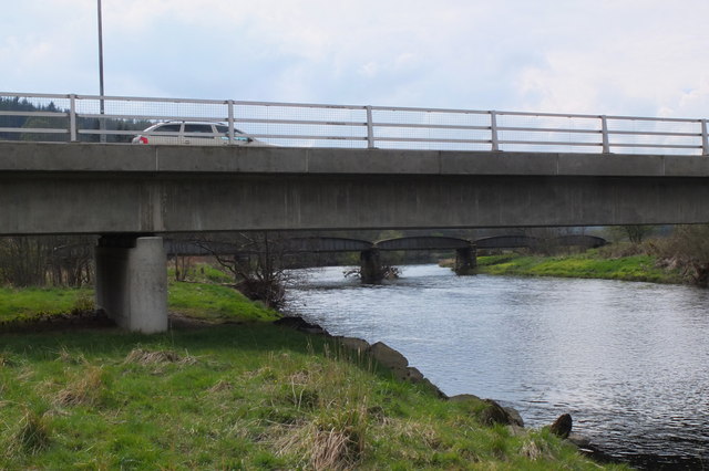
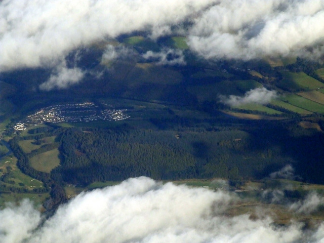
Ploughman's Strip Images

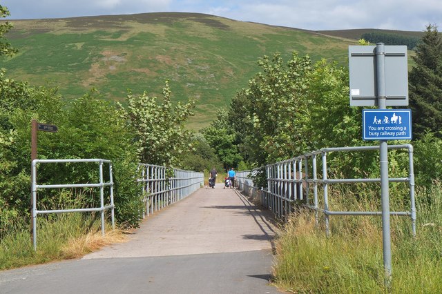
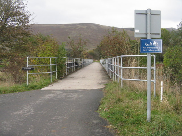
Images are sourced within 2km of 55.633375/-3.0902181 or Grid Reference NT3138. Thanks to Geograph Open Source API. All images are credited.

Angle in the wall, Mill Rig On the ridge with Lee Burn Head in view.
Angle in the wall, Mill Rig
On the ridge with Lee Burn Head in view.
All clear on Mill Rig Walkers en route to Innerleithen enjoying the views again, having dropped below cloud base on the ridge walk from Peebles. Compare with <a href="https://www.geograph.org.uk/photo/6018821">NT3141 : Descending Clog Knowe</a>.
All clear on Mill Rig
Walkers en route to Innerleithen enjoying the views again, having dropped below cloud base on the ridge walk from Peebles. Compare with NT3141 : Descending Clog Knowe.
Grouse Butt, Mill Rig This seem to have been here for some time and is now quite rickerty.
Grouse Butt, Mill Rig
This seem to have been here for some time and is now quite rickerty.
On Mill Rig
On Mill Rig
Old railway bridge, Cardrona The bridge over the Tweed, looking back to Cardrona and the site of the former station. The line is now a path and cycleway to Peebles. The golf course surrounds the nearby hotel and extends E along the riverside.
Old railway bridge, Cardrona
The bridge over the Tweed, looking back to Cardrona and the site of the former station. The line is now a path and cycleway to Peebles. The golf course surrounds the nearby hotel and extends E along the riverside.
Cardrona from Lee Burn Head On the right is the A72 to Peebles passing the Macdonald Cardrona Hotel with its associated golf course, the old railway line crosses the Tweed to follow its E bank and in the foreground are some houses at Cardrona with the 62 bus at the stop outside the old railway station, now the village shop. The houses at the SE side of Peebles are in view in the distance.
Cardrona from Lee Burn Head
On the right is the A72 to Peebles passing the Macdonald Cardrona Hotel with its associated golf course, the old railway line crosses the Tweed to follow its E bank and in the foreground are some houses at Cardrona with the 62 bus at the stop outside the old railway station, now the village shop. The houses at the SE side of Peebles are in view in the distance.
Bridges over the Tweed at Cardrona The road bridge links the village with the A72 and the old railway bridge beyond is now used for the Cardrona to Peebles path and cycleway.
Bridges over the Tweed at Cardrona
The road bridge links the village with the A72 and the old railway bridge beyond is now used for the Cardrona to Peebles path and cycleway.
Cardrona from the air Viewed over the wooded Cardrona Hill from a Prague bound flight from Edinburgh.
Cardrona from the air
Viewed over the wooded Cardrona Hill from a Prague bound flight from Edinburgh.
Larches in Cardrona Forest Larches in this area have been selected as sources of seed for new plantings, as described by foresters in an interesting walk around the forest as part of Tweed Valley Forest Festival.
Larches in Cardrona Forest
Larches in this area have been selected as sources of seed for new plantings, as described by foresters in an interesting walk around the forest as part of Tweed Valley Forest Festival.
Cardrona Bridges crossing the Tweed Bridge carrying the slip road from the A72 serving the village of Cardrona and the old railway bridge carrying the defunct Peebles - Innerleithen line.
Cardrona Bridges crossing the Tweed
Bridge carrying the slip road from the A72 serving the village of Cardrona and the old railway bridge carrying the defunct Peebles - Innerleithen line.
Not such a twee bridge across the Tweed After the Peebles to Galashiels railway closed in 1962, a local landowner purchased a stretch of the trackbed including Cardrona Station, which he used as a hay store, and this bridge across the River Tweed as an access between his fields either side of the river.  A couple of decades later, planning permission was obtained for the present hotel, golf course and new village.  The station was refurbished as a cafe and village shop and the river bridge continued as an access between two halves of the golf course. It seems ironic that the bridge once carried heavy trains but rather lighter cars had to keep 20 metres apart.  More recently the bridge has also become a formal part of the Peebles to Innerleithen cycleway
Not such a twee bridge across the Tweed
After the Peebles to Galashiels railway closed in 1962, a local landowner purchased a stretch of the trackbed including Cardrona Station, which he used as a hay store, and this bridge across the River Tweed as an access between his fields either side of the river. A couple of decades later, planning permission was obtained for the present hotel, golf course and new village. The station was refurbished as a cafe and village shop and the river bridge continued as an access between two halves of the golf course. It seems ironic that the bridge once carried heavy trains but rather lighter cars had to keep 20 metres apart. More recently the bridge has also become a formal part of the Peebles to Innerleithen cycleway
Misty hillsides near Cardrona on Christmas Day A thin layer of mist was creeping over some of the ridges amongst the plantations in the Tweed valley; below is the A72 road to Innerleithen and Galashiels. The viewpoint is Janet's (or Jenny's) Brae above Peebles.
Misty hillsides near Cardrona on Christmas Day
A thin layer of mist was creeping over some of the ridges amongst the plantations in the Tweed valley; below is the A72 road to Innerleithen and Galashiels. The viewpoint is Janet's (or Jenny's) Brae above Peebles.
Peebles Show comes to Cardrona The annual Peebles agricultural show moved to Nether Horsburgh this year as the usual venue at Hay Lodge Park has been unavailable because of work on drainage improvement. A temporary 30mph speed limit was set up near the show entrance on the A72, with shuttle buses from Peebles and free parking in the field.
Peebles Show comes to Cardrona
The annual Peebles agricultural show moved to Nether Horsburgh this year as the usual venue at Hay Lodge Park has been unavailable because of work on drainage improvement. A temporary 30mph speed limit was set up near the show entrance on the A72, with shuttle buses from Peebles and free parking in the field.
Highland cattle at Peebles Show Two Highland cows and a calf on their best behaviour in the show ring. In the background is the Macdonald Cardrona Hotel. This year the show was located at Nether Horsburgh since the usual venue at Hay Lodge Park in Peebles was undergoing drainage work.
Highland cattle at Peebles Show
Two Highland cows and a calf on their best behaviour in the show ring. In the background is the Macdonald Cardrona Hotel. This year the show was located at Nether Horsburgh since the usual venue at Hay Lodge Park in Peebles was undergoing drainage work.
Gymnastics on horseback, Peebles Show A gymnastic display by several youngsters on a horse trained to walk or canter in a circle on a lunge rein. This activity is known as horse vaulting and is a recognised equestrian discipline - see <span class="nowrap"><a title="http://en.wikipedia.org/wiki/Equestrian_vaulting" rel="nofollow ugc noopener" href="http://en.wikipedia.org/wiki/Equestrian_vaulting">Link</a><img style="margin-left:2px;" alt="External link" title="External link - shift click to open in new window" src="https://s1.geograph.org.uk/img/external.png" width="10" height="10"/></span>.
Gymnastics on horseback, Peebles Show
A gymnastic display by several youngsters on a horse trained to walk or canter in a circle on a lunge rein. This activity is known as horse vaulting and is a recognised equestrian discipline - see LinkExternal link.
Former railway bridge over the Tweed, Cardrona The bridge is now used by the walkway and cycle path to Innerleithen, and by golfers heading for the part of the course E of the hotel.
Former railway bridge over the Tweed, Cardrona
The bridge is now used by the walkway and cycle path to Innerleithen, and by golfers heading for the part of the course E of the hotel.
Footpath over the River Tweed The Innerleithen-Peebles railway path uses the old railway bridge over the river. Looking to Cardrona Village and shop.
Footpath over the River Tweed
The Innerleithen-Peebles railway path uses the old railway bridge over the river. Looking to Cardrona Village and shop.
River Tweed at Horsbrugh Ford
Show me another place!

Ploughman's Strip is located at Grid Ref: NT3138 (Lat: 55.633375, Lng: -3.0902181)

Unitary Authority: The Scottish Borders

Police Authority: The Lothians and Scottish Borders

What 3 Words

///divisible.arranger.radiating. Near Innerleithen, Scottish Borders

Related Wikis

Cardrona, Scottish Borders

Cardrona is a village on the A72 and B7062, between Peebles and Innerleithen, in the Scottish Borders area of Scotland. Places nearby include Glentress...

Cardrona railway station

Cardrona railway station served the village of Cardrona, Scottish Borders, Scotland from 1864 to 1962 on the Peebles Railway. == History == The station...

Nether Horsburgh Castle

Nether Horsburgh Castle is a ruined tower house near Cardrona, in the Scottish Borders, in the former county of Peebleshire. It is situated at the back...

Cardrona Forest

The Cardrona Forest is a forest in the Scottish Borders area of Scotland, on the B7062, near Peebles. OS Grid Reference: NT292385. Cardrona Forest consists...

Nearby Amenities

Located within 500m of 55.633375,-3.0902181
Glenormiston
Place: hamlet
Lat/Long: 55.6313823/-3.0883175
Generator Method: photovoltaic
Generator Output Electricity: yes
Generator Source: solar
Generator Type: solar_photovoltaic_panel
Power: generator
Lat/Long: 55.6305906/-3.0881835
The data included in this document is from www.openstreetmap.org. The data is made available under ODbL.

Have you been to Ploughman's Strip?

Leave your review of Ploughman's Strip below (or comments, questions and feedback).