Chester Strip

Wood, Forest in Peeblesshire

Scotland

Chester Strip

Glass Burn The Glass Burn descends moorland slopes towards Glen. A plantation containing western hemlock has recently been felled. Paths meet before a pass through the ridgeline nick. From there you can descend through Cardrona Forest, or contour beneath Birks Hill to pick up the drove road to Peebles.
Glass Burn Credit: Richard Webb

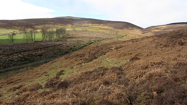
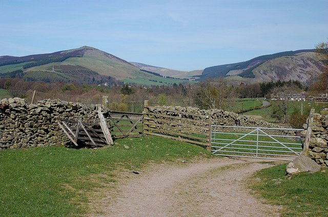
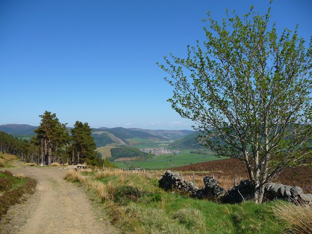
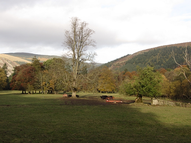
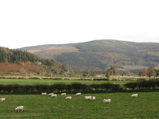
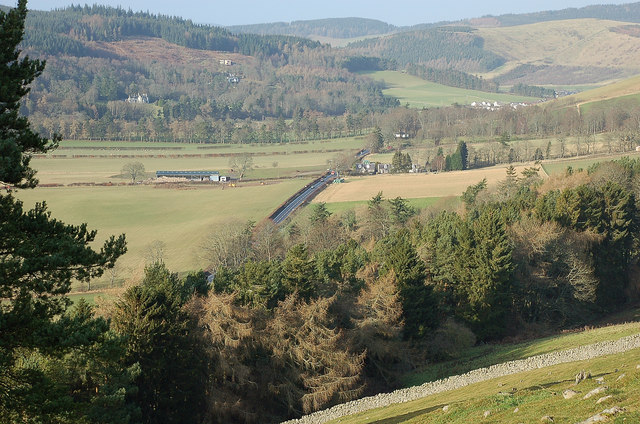
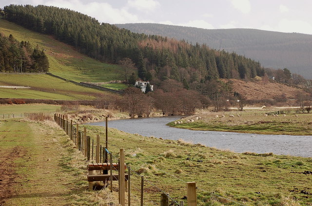
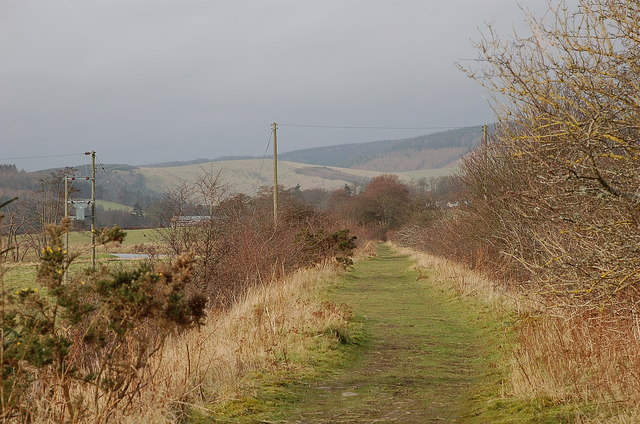
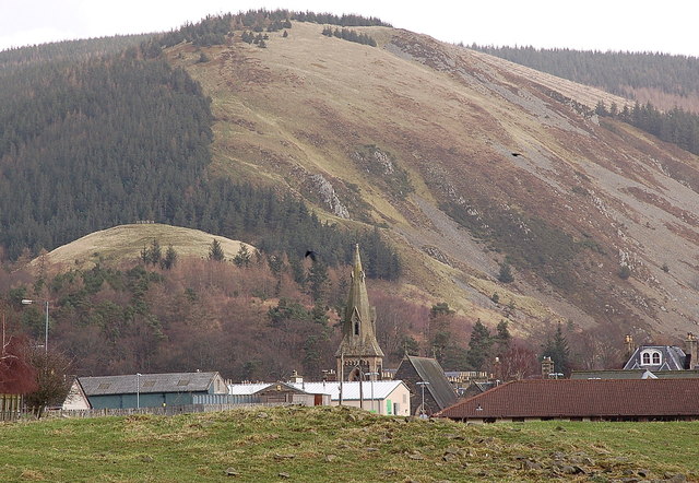
Chester Strip, located in the county of Peeblesshire, Scotland, is a small but enchanting wood known for its picturesque beauty and serene atmosphere. Nestled amidst the rolling hills and lush greenery, this forested area offers a tranquil escape for nature enthusiasts and explorers alike.

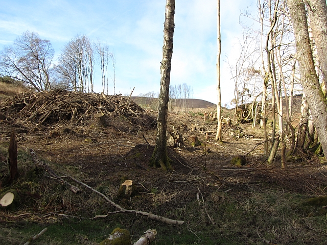
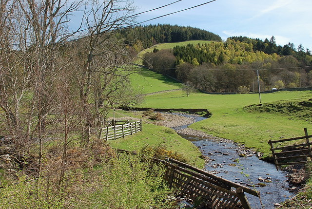
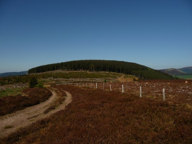
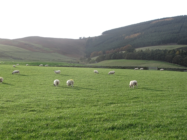
Covering an area of approximately 100 acres, Chester Strip is characterized by its dense woodland, dominated by a variety of native tree species such as oak, birch, and pine. The forest floor is adorned with a rich carpet of moss, ferns, and wildflowers, adding to the area's natural charm and biodiversity.

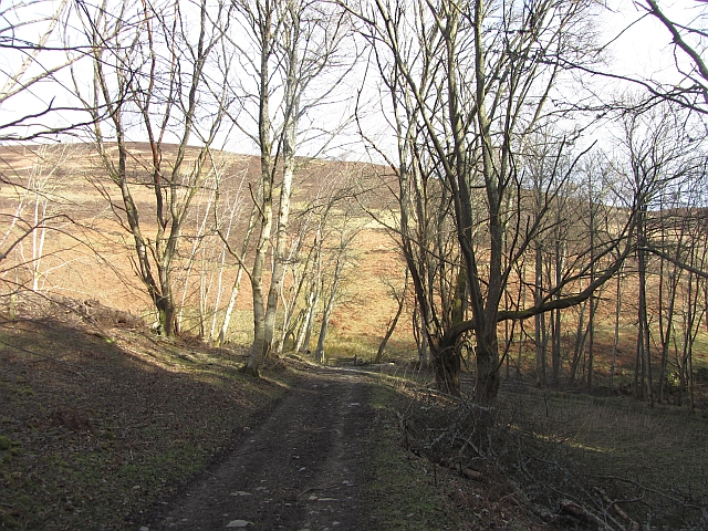
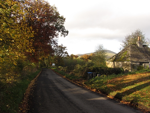
The wood is crisscrossed by a network of well-maintained walking trails, allowing visitors to immerse themselves in the serene surroundings and discover the hidden treasures of the forest. As one traverses the paths, they may encounter a variety of wildlife, including deer, squirrels, and an array of bird species, making it a perfect spot for birdwatching enthusiasts.

Chester Strip also boasts a small, meandering river that runs through its heart, adding to the tranquility and providing a refreshing ambiance. The river supports a diverse ecosystem, with fish, amphibians, and various aquatic insects inhabiting its waters.

Visitors to Chester Strip can enjoy a range of outdoor activities, including hiking, picnicking, and photography. The forest is particularly popular during the autumn months when the vibrant hues of red, orange, and gold transform the landscape into a breathtaking spectacle.

In conclusion, Chester Strip in Peeblesshire is a captivating wood that offers a serene and idyllic retreat for those seeking solace amidst nature's embrace. Its lush greenery, diverse wildlife, and scenic trails make it a must-visit destination for nature lovers and adventurers alike.

If you have any feedback on the listing, please let us know in the comments section below.

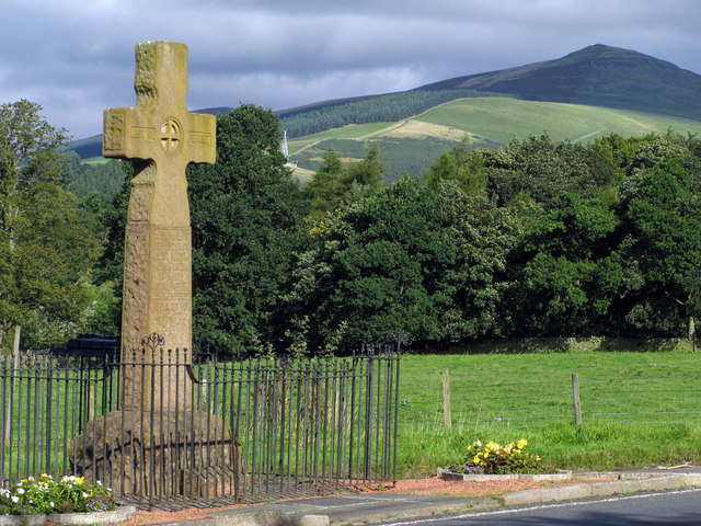
Chester Strip Images

Images are sourced within 2km of 55.604681/-3.0894377 or Grid Reference NT3135. Thanks to Geograph Open Source API. All images are credited.

Glass Burn The Glass Burn descends moorland slopes towards Glen. A plantation containing western hemlock has recently been felled. Paths meet before a pass through the ridgeline nick. From there you can descend through Cardrona Forest, or contour beneath Birks Hill to pick up the drove road to Peebles.
Glass Burn
The Glass Burn descends moorland slopes towards Glen. A plantation containing western hemlock has recently been felled. Paths meet before a pass through the ridgeline nick. From there you can descend through Cardrona Forest, or contour beneath Birks Hill to pick up the drove road to Peebles.
Woodland track An estate road at The Glen. Ongoing paths run over the hill to Tweeddale.
Woodland track
An estate road at The Glen. Ongoing paths run over the hill to Tweeddale.
Felled woodland, Birks A recently (2012) felled block of conifers on the Glen Estate.
Felled woodland, Birks
A recently (2012) felled block of conifers on the Glen Estate.
Road junction, Cardrona Forest A junction above the Glenpeggy Burn.
Road junction, Cardrona Forest
A junction above the Glenpeggy Burn.
Track approaching Damhead farm The track from Damhead Rig passes through the farmyard. The buildings at Traquair village are in the middle distance.
Track approaching Damhead farm
The track from Damhead Rig passes through the farmyard. The buildings at Traquair village are in the middle distance.
Fingland Burn Seen from the road bridge, with Shaw Hill in the background.
Fingland Burn
Seen from the road bridge, with Shaw Hill in the background.
Traquair Kirk Looking to the west.
Traquair Kirk
Looking to the west.
Wallace's Hill At an altitude of 460 metres Wallace's Hill is in Cardrona Forest.  The name presumably refers to the exploits of the great Scottish patriot Sir William Wallace,(1270 - 1305) who was active in the area. There are many interesting walks in the forest which is  owned by the Forestry Commission
Wallace's Hill
At an altitude of 460 metres Wallace's Hill is in Cardrona Forest. The name presumably refers to the exploits of the great Scottish patriot Sir William Wallace,(1270 - 1305) who was active in the area. There are many interesting walks in the forest which is owned by the Forestry Commission
Forest walk Forest walk in Cardrona Forest with view over Tweed Valley to Peebles some 4 or 5 miles distant. Cardrona Forest which is owned by the Forestry Commission has many fine forest walks. It is also a haven for a great variety of wildlife including the recent welcome return of nesting Ospreys.
Forest walk
Forest walk in Cardrona Forest with view over Tweed Valley to Peebles some 4 or 5 miles distant. Cardrona Forest which is owned by the Forestry Commission has many fine forest walks. It is also a haven for a great variety of wildlife including the recent welcome return of nesting Ospreys.
War memorial at Traquair The solid looking memorial stands at a road junction; Lee Pen is the prominent hill beyond.
War memorial at Traquair
The solid looking memorial stands at a road junction; Lee Pen is the prominent hill beyond.
Gardener's Acre Parkland, grazed by cattle, Traquair.
Gardener's Acre
Parkland, grazed by cattle, Traquair.
B7062, Traquair Outside the famous shut gate - The Steekit Yetts  <a href="https://www.geograph.org.uk/photo/4678">NT3235 : The Steekit Yetts</a>. This road is a quiet and narrow alternative to the A72 on the other side of the Tweed.
B7062, Traquair
Outside the famous shut gate - The Steekit Yetts NT3235 : The Steekit Yetts. This road is a quiet and narrow alternative to the A72 on the other side of the Tweed.
Sheep below Grieston Hill Good grazing in Tweeddale.
Sheep below Grieston Hill
Good grazing in Tweeddale.
Sheep in Tweeddale Grazing the floodplain at Howford.
Sheep in Tweeddale
Grazing the floodplain at Howford.
Northwest from Caerlee Hill The A72 heading up towards Peebles along the Tweed Valley with the wooded slopes above Cardrona ahead and Glentress Forest beyond.
Northwest from Caerlee Hill
The A72 heading up towards Peebles along the Tweed Valley with the wooded slopes above Cardrona ahead and Glentress Forest beyond.
The Tweed near Howford A bend in the river below Caerlee Hill just outside Innerleithen, seen from the old railway line.
The Tweed near Howford
A bend in the river below Caerlee Hill just outside Innerleithen, seen from the old railway line.
Trackbed of North British line west of Innerleithen The old line is now passable on foot apart from a missing bridge over the Tweed at Cardrona - there are plans to replace this to complete the link between Peebles and Innerleithen.
Trackbed of North British line west of Innerleithen
The old line is now passable on foot apart from a missing bridge over the Tweed at Cardrona - there are plans to replace this to complete the link between Peebles and Innerleithen.
Innerleithen roofscape The spire of St James' Catholic Church, the Health Centre (R) and Cooperative store (white building centre) are in view from the old railway line. The steep wooded slopes of Pirn Craig provide the background.
Innerleithen roofscape
The spire of St James' Catholic Church, the Health Centre (R) and Cooperative store (white building centre) are in view from the old railway line. The steep wooded slopes of Pirn Craig provide the background.
Show me another place!

Chester Strip is located at Grid Ref: NT3135 (Lat: 55.604681, Lng: -3.0894377)

Unitary Authority: The Scottish Borders

Police Authority: The Lothians and Scottish Borders

What 3 Words

///skies.detective.figs. Near Innerleithen, Scottish Borders

Nearby Locations

Chester Strip Chester Hill

Related Wikis

Traquair

Traquair (Scottish Gaelic: Cille Bhrìghde) is a small village and civil parish in the Scottish Borders; until 1975 it was in the county of Peeblesshire...

Sir Walter Scott Way

The Sir Walter Scott Way is a 92-mile (148 km) long-distance footpath in the Scottish Borders. The route broadly follows the waymarked Southern Upland...

Quair Water

The Quair Water is a tributary of the River Tweed in the Scottish Borders area of Scotland. Its name is related to Traquair. == Etymology == The name Quair...

Traquair House

Traquair House, approximately 7 miles southeast of Peebles, is claimed to be the oldest continually inhabited house in Scotland. Whilst not strictly a...

Have you been to Chester Strip?

Leave your review of Chester Strip below (or comments, questions and feedback).