Spectacle Strip

Wood, Forest in Peeblesshire
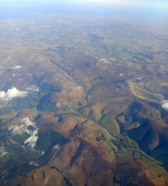
Scotland

Spectacle Strip

Angle in the wall, Mill Rig On the ridge with Lee Burn Head in view.
Angle in the wall, Mill Rig Credit: Jim Barton

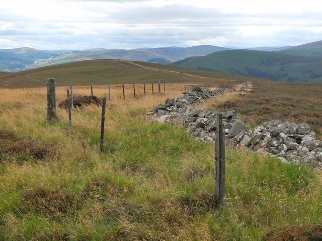
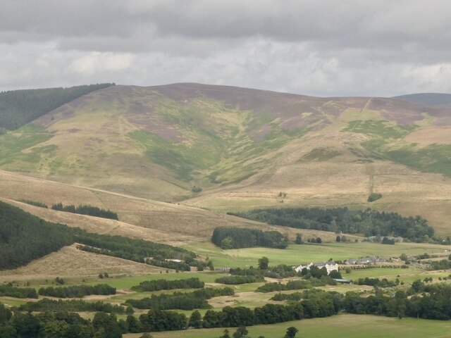
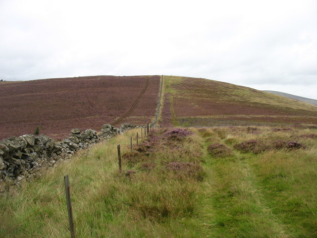
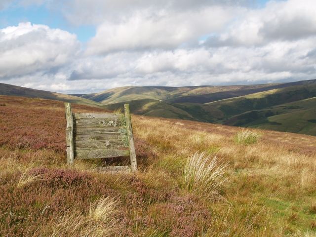
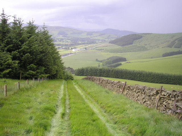
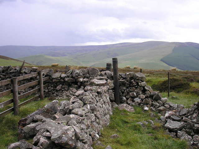
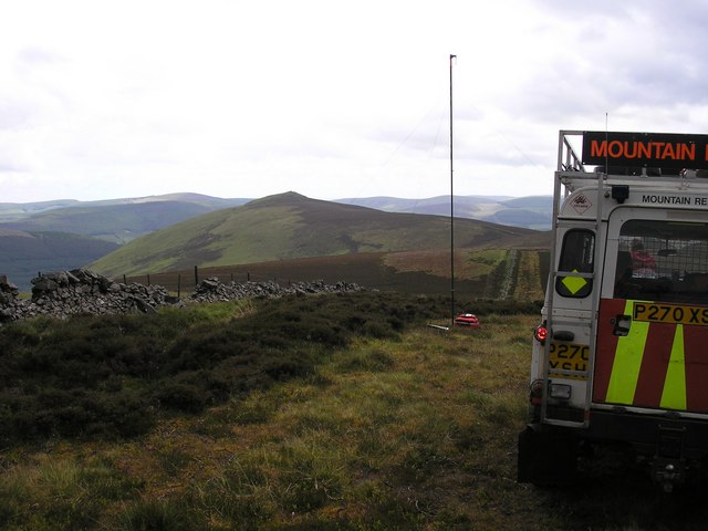
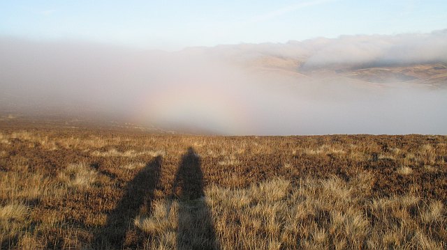
Spectacle Strip is a picturesque wood located in Peeblesshire, Scotland. Nestled amidst the rolling hills and lush greenery, this forested area is a haven for nature enthusiasts and outdoor adventurers. The wood gets its unique name from its peculiar shape, which resembles a pair of spectacles when viewed from above.

Covering an area of approximately 100 acres, Spectacle Strip is characterized by a diverse range of tree species, including oak, beech, birch, and pine. The wood boasts a rich and vibrant ecosystem, providing a habitat for various wildlife such as deer, foxes, badgers, and a wide variety of bird species. Walking through the forest, visitors can enjoy the soothing sounds of chirping birds and the gentle rustling of leaves underfoot.

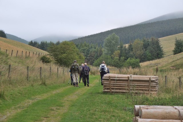
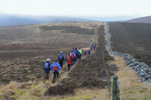
Several well-maintained trails wind their way through Spectacle Strip, offering visitors the opportunity to explore the wood at their own pace. These paths provide access to the heart of the forest, where visitors can immerse themselves in the tranquility of nature. The wood also features a small picnic area, allowing visitors to relax and enjoy a meal amidst the scenic surroundings.

Spectacle Strip is a popular destination for nature walks, birdwatching, and photography. Its idyllic setting and abundant wildlife make it a favorite spot for nature lovers and photographers seeking to capture the beauty of the Scottish countryside. Whether one seeks solitude or a leisurely stroll with family and friends, Spectacle Strip offers a peaceful retreat in the heart of Peeblesshire.

If you have any feedback on the listing, please let us know in the comments section below.

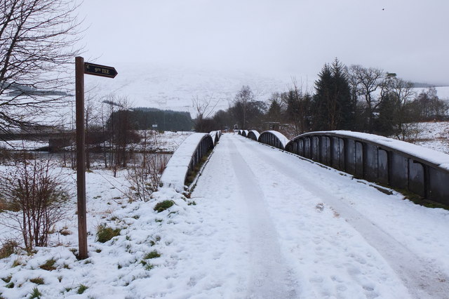
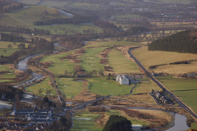
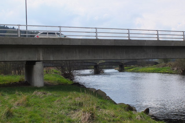
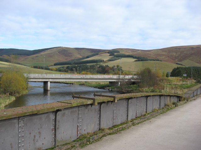
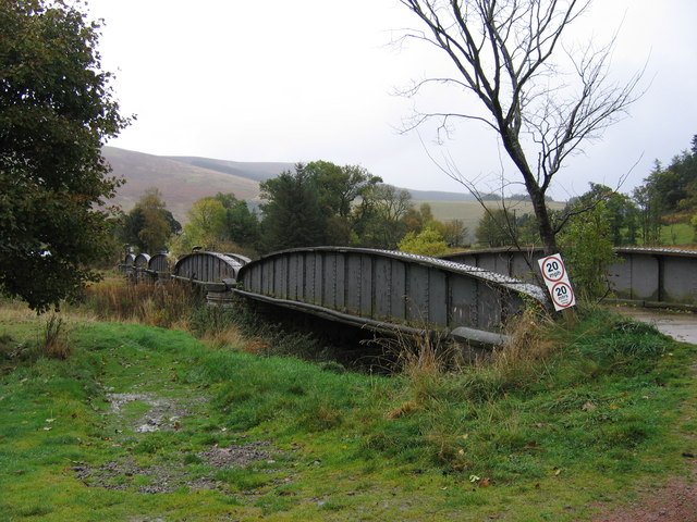
Spectacle Strip Images

Images are sourced within 2km of 55.63536/-3.0882717 or Grid Reference NT3138. Thanks to Geograph Open Source API. All images are credited.

Angle in the wall, Mill Rig On the ridge with Lee Burn Head in view.
Angle in the wall, Mill Rig
On the ridge with Lee Burn Head in view.
Black Knowe Hill above the Cardrona Hotel.
Black Knowe
Hill above the Cardrona Hotel.
Mouse Dean Head from the air The course of Leithen Water can be clearly seen in the foreground. East Lothian, the Firth of Forth and the North Sea are in the distance.

Taken by mobile phone, from a Prague bound flight from Edinburgh.
Mouse Dean Head from the air
The course of Leithen Water can be clearly seen in the foreground. East Lothian, the Firth of Forth and the North Sea are in the distance. Taken by mobile phone, from a Prague bound flight from Edinburgh.
Track by the Hope Burn Bundles of fence posts by the track on the way up by Hope Burn towards the plantations of Glentress Forest.
Track by the Hope Burn
Bundles of fence posts by the track on the way up by Hope Burn towards the plantations of Glentress Forest.
Climbing to Black Knowe
All clear on Mill Rig Walkers en route to Innerleithen enjoying the views again, having dropped below cloud base on the ridge walk from Peebles. Compare with <a href="https://www.geograph.org.uk/photo/6018821">NT3141 : Descending Clog Knowe</a>.
All clear on Mill Rig
Walkers en route to Innerleithen enjoying the views again, having dropped below cloud base on the ridge walk from Peebles. Compare with NT3141 : Descending Clog Knowe.
Muirburn smoke A view from Pirn Craig across the Leithen Water valley to smoke above Mouse Dean with the turbines of Bowbeat windfarm on the skyline.
Muirburn smoke
A view from Pirn Craig across the Leithen Water valley to smoke above Mouse Dean with the turbines of Bowbeat windfarm on the skyline.
Summit, Mill Rig A rather cluttered summit with three walls meeting, and a number of fences and gates.  Looking towards the distant summit of Lee Pen.
Summit, Mill Rig
A rather cluttered summit with three walls meeting, and a number of fences and gates. Looking towards the distant summit of Lee Pen.
Grouse Butt, Mill Rig This seem to have been here for some time and is now quite rickerty.
Grouse Butt, Mill Rig
This seem to have been here for some time and is now quite rickerty.
On Mill Rig
On Mill Rig
The Summit of Mill Rig, spot height 486m
On the Summit of Mill Rig looking to Lee Pen The mast in the photo is a mobile radio repeater, this enables the mountain rescue to talk from one valley into another.
On the Summit of Mill Rig looking to Lee Pen
The mast in the photo is a mobile radio repeater, this enables the mountain rescue to talk from one valley into another.
Cloud forming on Mill Rig A sunny day changed to low lying cloud with another layer of fog at glen level in just a few minutes. Unfortunately the ground was not steep enough for a Brocken spectre to form, but we did get the glory.
Cloud forming on Mill Rig
A sunny day changed to low lying cloud with another layer of fog at glen level in just a few minutes. Unfortunately the ground was not steep enough for a Brocken spectre to form, but we did get the glory.
Old railway bridge, Cardrona The bridge over the Tweed, looking back to Cardrona and the site of the former station. The line is now a path and cycleway to Peebles. The golf course surrounds the nearby hotel and extends E along the riverside.
Old railway bridge, Cardrona
The bridge over the Tweed, looking back to Cardrona and the site of the former station. The line is now a path and cycleway to Peebles. The golf course surrounds the nearby hotel and extends E along the riverside.
Cardrona from Lee Burn Head On the right is the A72 to Peebles passing the Macdonald Cardrona Hotel with its associated golf course, the old railway line crosses the Tweed to follow its E bank and in the foreground are some houses at Cardrona with the 62 bus at the stop outside the old railway station, now the village shop. The houses at the SE side of Peebles are in view in the distance.
Cardrona from Lee Burn Head
On the right is the A72 to Peebles passing the Macdonald Cardrona Hotel with its associated golf course, the old railway line crosses the Tweed to follow its E bank and in the foreground are some houses at Cardrona with the 62 bus at the stop outside the old railway station, now the village shop. The houses at the SE side of Peebles are in view in the distance.
Bridges over the Tweed at Cardrona The road bridge links the village with the A72 and the old railway bridge beyond is now used for the Cardrona to Peebles path and cycleway.
Bridges over the Tweed at Cardrona
The road bridge links the village with the A72 and the old railway bridge beyond is now used for the Cardrona to Peebles path and cycleway.
Cardrona Bridges crossing the Tweed Bridge carrying the slip road from the A72 serving the village of Cardrona and the old railway bridge carrying the defunct Peebles - Innerleithen line.
Cardrona Bridges crossing the Tweed
Bridge carrying the slip road from the A72 serving the village of Cardrona and the old railway bridge carrying the defunct Peebles - Innerleithen line.
Not such a twee bridge across the Tweed After the Peebles to Galashiels railway closed in 1962, a local landowner purchased a stretch of the trackbed including Cardrona Station, which he used as a hay store, and this bridge across the River Tweed as an access between his fields either side of the river.  A couple of decades later, planning permission was obtained for the present hotel, golf course and new village.  The station was refurbished as a cafe and village shop and the river bridge continued as an access between two halves of the golf course. It seems ironic that the bridge once carried heavy trains but rather lighter cars had to keep 20 metres apart.  More recently the bridge has also become a formal part of the Peebles to Innerleithen cycleway
Not such a twee bridge across the Tweed
After the Peebles to Galashiels railway closed in 1962, a local landowner purchased a stretch of the trackbed including Cardrona Station, which he used as a hay store, and this bridge across the River Tweed as an access between his fields either side of the river. A couple of decades later, planning permission was obtained for the present hotel, golf course and new village. The station was refurbished as a cafe and village shop and the river bridge continued as an access between two halves of the golf course. It seems ironic that the bridge once carried heavy trains but rather lighter cars had to keep 20 metres apart. More recently the bridge has also become a formal part of the Peebles to Innerleithen cycleway
Show me another place!

Spectacle Strip is located at Grid Ref: NT3138 (Lat: 55.63536, Lng: -3.0882717)

Unitary Authority: The Scottish Borders

Police Authority: The Lothians and Scottish Borders

What 3 Words

///wizards.manliness.confident. Near Innerleithen, Scottish Borders

Related Wikis

Cardrona, Scottish Borders

Cardrona is a village on the A72 and B7062, between Peebles and Innerleithen, in the Scottish Borders area of Scotland. Places nearby include Glentress...

Nether Horsburgh Castle

Nether Horsburgh Castle is a ruined tower house near Cardrona, in the Scottish Borders, in the former county of Peebleshire. It is situated at the back...

Cardrona railway station

Cardrona railway station served the village of Cardrona, Scottish Borders, Scotland from 1864 to 1962 on the Peebles Railway. == History == The station...

Cardrona Forest

The Cardrona Forest is a forest in the Scottish Borders area of Scotland, on the B7062, near Peebles. OS Grid Reference: NT292385. Cardrona Forest consists...

Vale of Leithen F.C.

Vale of Leithen Football Club are a football club based in the town of Innerleithen, Scotland. They play in the East of Scotland League First Division...

Kirkburn, Scottish Borders

Kirkburn is a village on the B7062, close to Peebles and the River Tweed, in the Scottish Borders area of Scotland, at the edge of the Cardrona Forest...

Robert Smail's Printing Works

Robert Smail's Printing Works is a fully functional Victorian era letterpress printing works in the small Scottish Borders town of Innerleithen, now preserved...

Leithen Water

Leithen Water (Scottish Gaelic: Leitheann / Abhainn Leitheinn) is a tributary of the River Tweed in Scotland. It rises in the Moorfoot Hills and joins...

Nearby Amenities

Located within 500m of 55.63536,-3.0882717
Glenormiston
Place: hamlet
Lat/Long: 55.6313823/-3.0883175
The data included in this document is from www.openstreetmap.org. The data is made available under ODbL.

Have you been to Spectacle Strip?

Leave your review of Spectacle Strip below (or comments, questions and feedback).