Carlecotes

Settlement in Yorkshire

England

Carlecotes

Temporary bridge on the TPT diversion at Dunford Bridge This is a temporary bridge on the Trans Pennine Trail diversion at Dunford Bridge. It came into use in late 2021 and will remain until seven electricity pylons have been removed. The cable will be buried under the TPT.
Temporary bridge on the TPT diversion at Dunford Bridge Credit: Dave Pickersgill

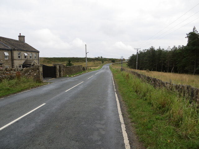
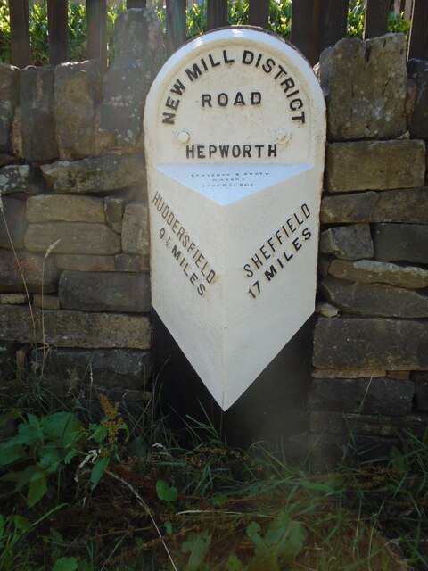
Carlecotes is a small village located in the Holme Valley, within the county of Yorkshire, England. Situated amidst picturesque countryside, it is part of the civil parish of Holme Valley and falls under the jurisdiction of the metropolitan borough of Kirklees. The village is approximately 15 miles southwest of Huddersfield and 20 miles northeast of Sheffield.

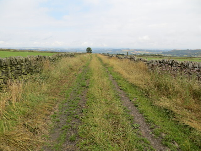
Carlecotes is characterized by its tranquil and idyllic setting, surrounded by rolling hills and lush green fields. The village itself is relatively small, with a population of around 200 residents. It is primarily a residential area, with a few scattered farms and rural businesses.

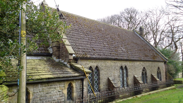
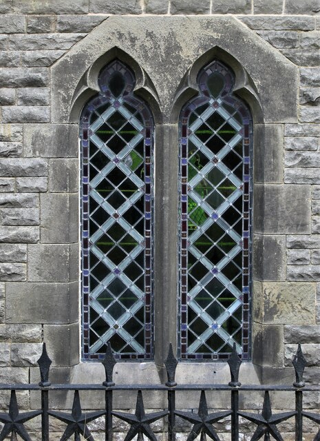
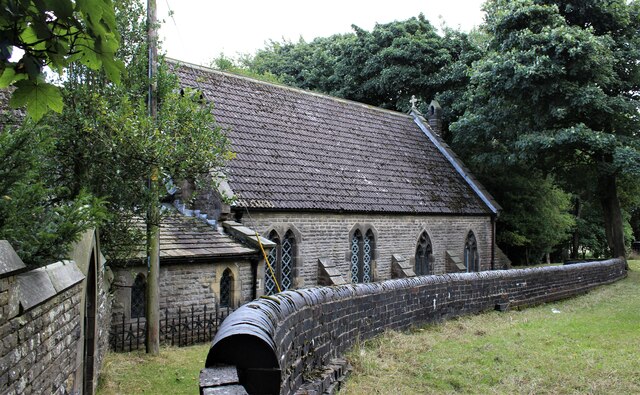
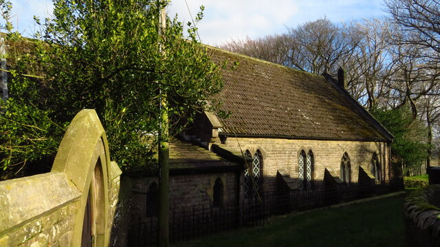
The village is notable for its charming stone-built houses and traditional architecture, which adds to its rustic appeal. The local community is close-knit and friendly, with a strong sense of community spirit. The village has a small church, St. Michael and All Angels, which serves as a center for religious activities and community gatherings.

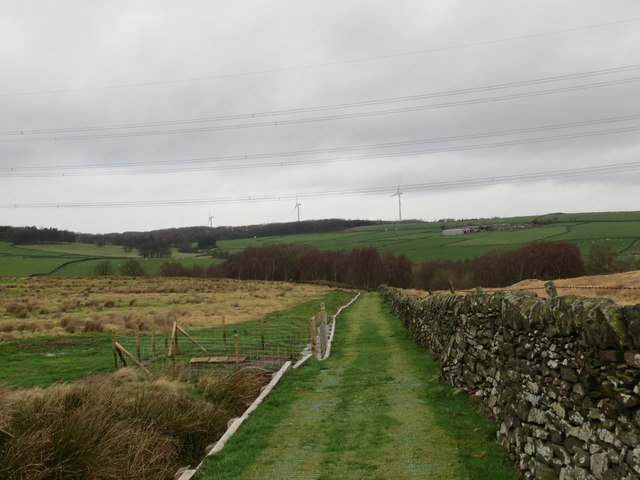
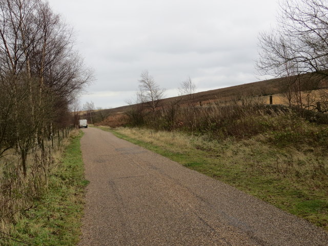
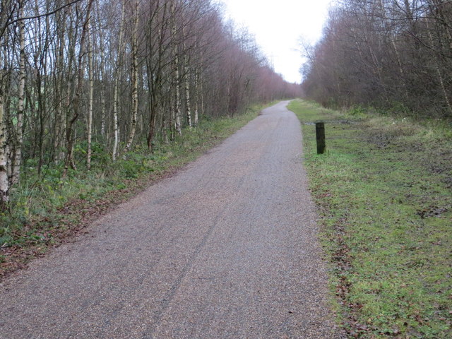
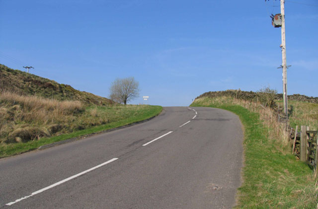
Carlecotes is a popular destination for nature lovers and outdoor enthusiasts, offering numerous opportunities for walking, hiking, and exploring the surrounding countryside. The nearby Peak District National Park provides stunning landscapes and a range of outdoor activities, including cycling, horse riding, and birdwatching.

Although Carlecotes is a relatively quiet and peaceful village, it benefits from its close proximity to larger towns and cities. This allows residents to access a wider range of amenities, such as schools, shops, and healthcare facilities, within a short driving distance.

If you have any feedback on the listing, please let us know in the comments section below.
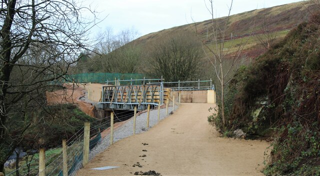
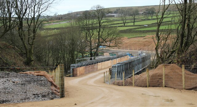
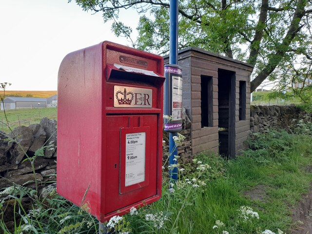
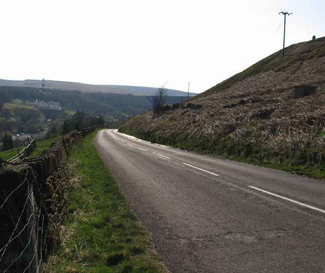
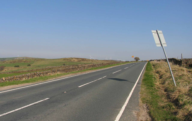
Carlecotes Images

Images are sourced within 2km of 53.527413/-1.735976 or Grid Reference SE1703. Thanks to Geograph Open Source API. All images are credited.

Temporary bridge on the TPT diversion at Dunford Bridge This is a temporary bridge on the Trans Pennine Trail diversion at Dunford Bridge. It came into use in late 2021 and will remain until seven electricity pylons have been removed. The cable will be buried under the TPT.
Temporary bridge on the TPT diversion at Dunford Bridge
This is a temporary bridge on the Trans Pennine Trail diversion at Dunford Bridge. It came into use in late 2021 and will remain until seven electricity pylons have been removed. The cable will be buried under the TPT.
Bridge on the Trans Pennine Trail diversion This is a new (permanent) bridge on the Trans Pennine Trail diversion at Dunford Bridge. It came into use in late 2021. The diversion will remain until seven electricity pylons have been removed. The cable will be buried under the TPT.
Bridge on the Trans Pennine Trail diversion
This is a new (permanent) bridge on the Trans Pennine Trail diversion at Dunford Bridge. It came into use in late 2021. The diversion will remain until seven electricity pylons have been removed. The cable will be buried under the TPT.
Post Box at Townhead S36 698. Royal Mail list this box as 'Townhead'.
Post Box at Townhead
S36 698. Royal Mail list this box as 'Townhead'.
Wall enclosed track near Law Head Looking north-westward. Use by the Barnsley Boundary Walk.
Wall enclosed track near Law Head
Looking north-westward. Use by the Barnsley Boundary Walk.
Bedding Edge Road at Law Bottom Cottage Looking north-eastward.
Bedding Edge Road at Law Bottom Cottage
Looking north-eastward.
Church of St Ann At Carlecotes Hall
Church of St Ann
At Carlecotes Hall
Old milestone This, once sad looking, sunken milestone at Crow Edge had, in 2017 been dug out and the wall behind it repaired.   It is one of the 615 milestones erected in 1893/94 by the family firm of Gill and Frank Stead of Mirfield for the newly-formed West Riding County Council.  Over half are still to be found by the roadside all over the old West Riding.   This one has been smartly painted in a similar pattern to several others in this part of Yorkshire.
Old milestone
This, once sad looking, sunken milestone at Crow Edge had, in 2017 been dug out and the wall behind it repaired. It is one of the 615 milestones erected in 1893/94 by the family firm of Gill and Frank Stead of Mirfield for the newly-formed West Riding County Council. Over half are still to be found by the roadside all over the old West Riding. This one has been smartly painted in a similar pattern to several others in this part of Yorkshire.
St Ann's Church, Carlecotes
Old milestone The remains of a West Riding CC milestone from 1893/94.   It lost its attachment sometime during the last quarter of the 20C.   Legends-lhs-HUDDERSFILD/10½ MILES/HOLMFIRTH/5 MILES.   Rhs-SHEFFIELD/16 MILES.   Top-NEW MILL DISTRICT/ROAD/THURLSTONE.   It is on the A616 just south of the crossroads with the B6106.   Although damaged it is Grade II listed 1151099.
Old milestone
The remains of a West Riding CC milestone from 1893/94. It lost its attachment sometime during the last quarter of the 20C. Legends-lhs-HUDDERSFILD/10½ MILES/HOLMFIRTH/5 MILES. Rhs-SHEFFIELD/16 MILES. Top-NEW MILL DISTRICT/ROAD/THURLSTONE. It is on the A616 just south of the crossroads with the B6106. Although damaged it is Grade II listed 1151099.
Shell and auger drilling Geotechnical investigation for a new raw water pipeline to Langsett
Shell and auger drilling
Geotechnical investigation for a new raw water pipeline to Langsett
The Newly Surfaced Path across Reddishaw Knoll Looking north-westward.
The Newly Surfaced Path across Reddishaw Knoll
Looking north-westward.
The Trans Pennine Trail near Rolly Holme Looking eastward along the former railway line.
The Trans Pennine Trail near Rolly Holme
Looking eastward along the former railway line.
The Trans Pennine Trail to the south of Townhead Looking eastward along the disused railway line.
The Trans Pennine Trail to the south of Townhead
Looking eastward along the disused railway line.
Windle Edge The junction of Windle Edge with Dunford Road and Brook Hill Lane is just out of sight over the brow of the hill.
Windle Edge
The junction of Windle Edge with Dunford Road and Brook Hill Lane is just out of sight over the brow of the hill.
Windle Edge towards Dunford Bridge Windle Edge is a steep hill down to Dunford Bridge.
Windle Edge towards Dunford Bridge
Windle Edge is a steep hill down to Dunford Bridge.
B6106 towards Penistone
Show me another place!

Carlecotes is located at Grid Ref: SE1703 (Lat: 53.527413, Lng: -1.735976)

Division: West Riding

Unitary Authority: Barnsley

Police Authority: South Yorkshire

What 3 Words

///skip.imprints.coached. Near Holmfirth, West Yorkshire

Related Wikis

Carlecotes

Carlecotes is a village in the metropolitan borough of Barnsley in South Yorkshire, England. Carlecotes is within Dunford civil parish. The village is...

Dunford

Dunford is a civil parish in the Metropolitan Borough of Barnsley, 14.5 miles (23.3 km) northwest of Sheffield in South Yorkshire, England. It lies in...

Dunford Bridge

Dunford Bridge is a remote hamlet in the civil parish of Dunford, lying northwest of Sheffield in South Yorkshire, England, 1.3 miles (2 km) from the...

Crow Edge

Crow Edge is a hamlet in Dunford civil parish, situated on the A616, two miles southeast of Hepworth, West Yorkshire in the metropolitan borough of Barnsley...

Nearby Amenities

Located within 500m of 53.527413,-1.735976
Bus Stop
Brook Hill Lane/Cliff Lane
Naptan AtcoCode: 370050986
Naptan Bearing: E
Naptan CommonName: Brook Hill Lane/Cliff Lane
Naptan Indicator: 50986
Naptan Landmark: 50986
Naptan PlusbusZoneRef: ROTHCEN
Naptan Street: Brook Hill Lane
Naptan Verified: no
Source: naptan_import
Lat/Long: 53.5247722/-1.7376087
Bus Stop
Brook Hill Lane/Home Farm
Alt Name: Brook Hill Lane/Home Farm
Naptan AltCommonName: Brook Hill Lane/Home Farm
Naptan AtcoCode: 370050987
Naptan Bearing: SW
Naptan CommonName: Brook Hill Lane/Home Farm
Naptan Indicator: 50987
Naptan Landmark: HOME FARM
Naptan PlusbusZoneRef: ROTHCEN
Naptan Street: Brook Hill Lane
Naptan Verified: no
Source: naptan_import
Lat/Long: 53.5255788/-1.7344651
Bus Stop
Brook Hill Lane
Alt Name: Brook Hill Lane
Naptan AltCommonName: Brook Hill Lane
Naptan AtcoCode: 370050988
Naptan Bearing: SE
Naptan CommonName: Brook Hill Lane
Naptan Indicator: 50988
Naptan Landmark: 50988
Naptan PlusbusZoneRef: ROTHCEN
Naptan Street: Brook Hill Lane
Naptan Verified: no
Source: naptan_import
Lat/Long: 53.5278603/-1.7336848
Bus Stop
Brook Hill Lane
Alt Name: Brook Hill Lane
Naptan AltCommonName: Brook Hill Lane
Naptan AtcoCode: 370055418
Naptan Bearing: NW
Naptan CommonName: Brook Hill Lane
Naptan Indicator: 55418
Naptan Landmark: OUTSIDE PHONE BOX
Naptan PlusbusZoneRef: ROTHCEN
Naptan Street: Brook Hill Lane
Naptan Verified: no
Source: naptan_import
Lat/Long: 53.5276894/-1.7337127
Brook Hill Lane/Cliff Lane
Naptan AtcoCode: 370055496
Naptan Bearing: W
Naptan BusStopType: CUS
Naptan CommonName: Brook Hill Lane/Cliff Lane
Naptan Indicator: 55496
Naptan Landmark: FLIGHT HILL
Naptan PlusbusZoneRef: ROTHCEN
Naptan Street: Brook Hill Lane
Naptan Verified: no
Source: naptan_import
Lat/Long: 53.5246558/-1.7377527
Brook Hill Lane/Home Farm
Naptan AtcoCode: 370055497
Naptan Bearing: NE
Naptan BusStopType: CUS
Naptan CommonName: Brook Hill Lane/Home Farm
Naptan Indicator: 55497
Naptan Landmark: HOME FARM
Naptan PlusbusZoneRef: ROTHCEN
Naptan Street: Brook Hill Lane
Naptan Verified: no
Source: naptan_import
Lat/Long: 53.5256689/-1.7345852
Carlecotes
Place: hamlet
Wikidata: Q5041146
Lat/Long: 53.5260564/-1.7333868
Give Way
Direction: backward
Lat/Long: 53.5300905/-1.7321404
Topping Moor
Place: locality
Lat/Long: 53.529746/-1.7379964
Power: pole
Lat/Long: 53.5239703/-1.7408195
Power: pole
Lat/Long: 53.5239564/-1.7394231
Power: pole
Lat/Long: 53.523887/-1.7386105
Post Box
Collection Plate Date: 2017-07-19
Collection Times: Mo-Fr 16:00; Sa 09:00
Operator: Royal Mail
Post Box Type: lamp
Ref: S36 415
Royal Cypher: EIIR
Royal Cypher Wikidata: Q33102113
Source: survey
Lat/Long: 53.5277488/-1.7337563
Telephone
Booth: K6
Covered: booth
Man Made: telephone_box
Lat/Long: 53.5277682/-1.7337729
Barrier: stile
Note: The top stones of the wall have been removed.
Lat/Long: 53.5302634/-1.7321193
Marker: aerial
Lat/Long: 53.5300254/-1.7322048
Barrier: stile
Step Count: 3
Stile: stepover
Lat/Long: 53.526122/-1.7334432
Barrier: stile
Step Count: 3
Stile: stepover
Lat/Long: 53.5255485/-1.7312829
Post Box
Post Box Type: wall
Ref: S81 11
Royal Cypher: EIIR
Lat/Long: 53.5242001/-1.7385607
Barrier: stile
Step Count: 3
Stile: stepover
Lat/Long: 53.5236237/-1.7400408
The data included in this document is from www.openstreetmap.org. The data is made available under ODbL.

Have you been to Carlecotes?

Leave your review of Carlecotes below (or comments, questions and feedback).