Carleen

Settlement in Cornwall

England

Carleen

The lane from Balwest This well-surfaced lane is classified as a footpath. It seems obvious that this was the lane serving the quarries on Tregonning Hill and should, at the least, be a bridleway. Cornwall Council have now (2021) raised a Definitive Map Modification Order (DMMO) to change its status.
The lane from Balwest Credit: David Medcalf

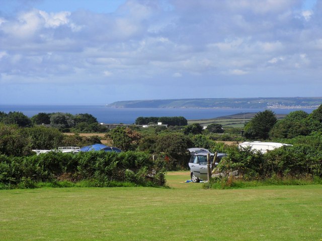
Carleen is a small village located in the civil parish of Breage, in the county of Cornwall, England. Situated approximately 3 miles northwest of Helston, Carleen is a rural settlement surrounded by countryside and farmland. The village is part of the beautiful and picturesque region known as West Cornwall, which is renowned for its stunning landscapes and coastline.

Carleen is a close-knit community with a population of around 300 residents. The village retains its traditional charm, with a scattering of stone cottages and farmhouses lining its narrow lanes. The local economy is predominantly based on agriculture, with farming and horticulture playing a significant role in the community's livelihood.

Although small in size, Carleen benefits from its proximity to larger towns nearby. The bustling market town of Helston offers a range of amenities, including shops, supermarkets, schools, and healthcare facilities, all of which are easily accessible to Carleen's residents.

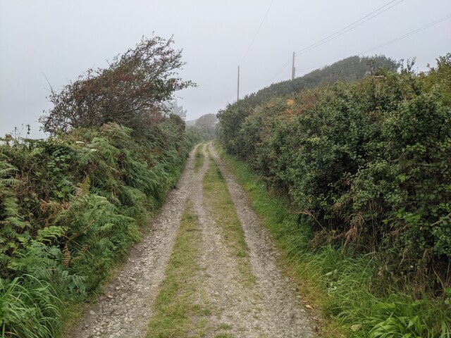
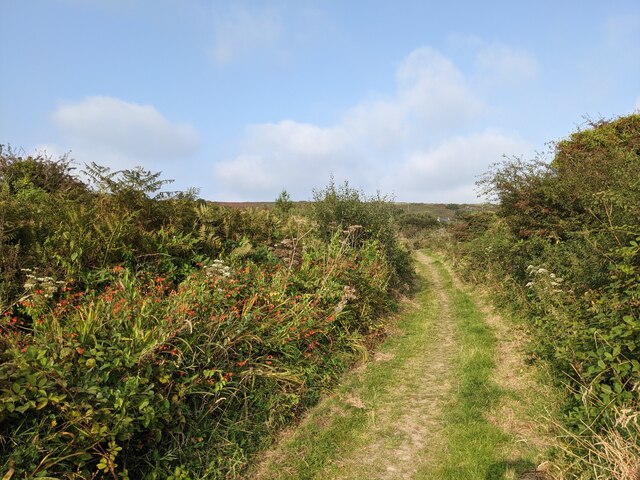
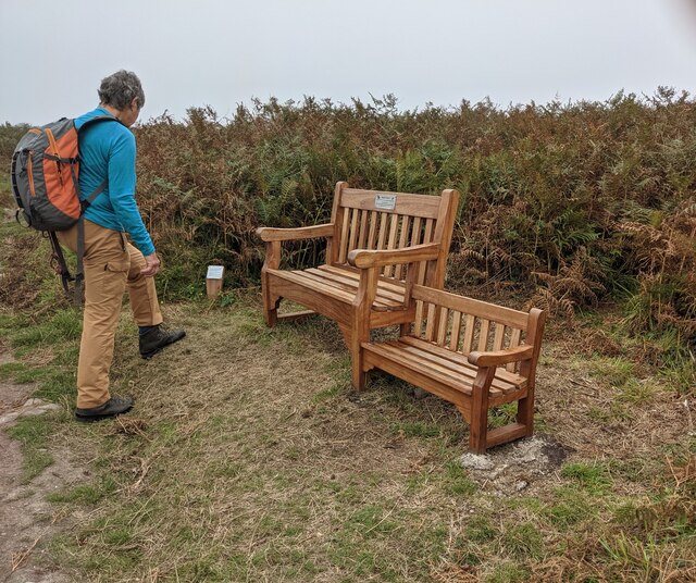
The surrounding area provides ample opportunities for outdoor activities and exploration. Just a short drive away, visitors can enjoy the stunning coastline, with beautiful beaches and coastal paths to discover. The nearby Loe Pool, the largest natural freshwater lake in Cornwall, is a popular spot for walking, birdwatching, and fishing.

Carleen offers a peaceful and idyllic countryside setting, providing its residents with a close community spirit and a tranquil way of life.

If you have any feedback on the listing, please let us know in the comments section below.
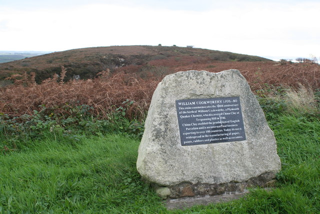
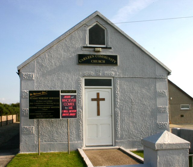
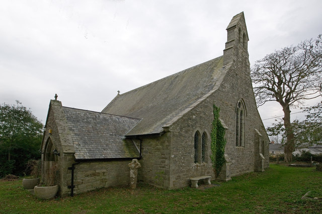
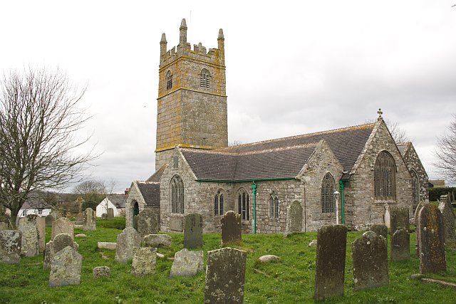
Carleen Images

Images are sourced within 2km of 50.122959/-5.335141 or Grid Reference SW6130. Thanks to Geograph Open Source API. All images are credited.

The lane from Balwest This well-surfaced lane is classified as a footpath. It seems obvious that this was the lane serving the quarries on Tregonning Hill and should, at the least, be a bridleway. Cornwall Council have now (2021) raised a Definitive Map Modification Order (DMMO) to change its status.
The lane from Balwest
This well-surfaced lane is classified as a footpath. It seems obvious that this was the lane serving the quarries on Tregonning Hill and should, at the least, be a bridleway. Cornwall Council have now (2021) raised a Definitive Map Modification Order (DMMO) to change its status.
Bridleway near the clay pit pool The pool is only a few yards to the left, but completely hidden by vegetation.
Bridleway near the clay pit pool
The pool is only a few yards to the left, but completely hidden by vegetation.
A rather touching memorial bench on Tregonning Hill
Mount's Bay from Tremorvu Camp Site A lovely view from an isolated camp site during the height of summer in Cornwall.
Mount's Bay from Tremorvu Camp Site
A lovely view from an isolated camp site during the height of summer in Cornwall.
William Cookworthy memorial on Tregonning Hill Just behind the memorial can be seen the quarry face where china clay was first excavated in Britain for the use in the manufacture of porcelain. See <a href="https://www.geograph.org.uk/photo/2662025">SW6029 : Quarry on Tregonning Hill</a>.
William Cookworthy memorial on Tregonning Hill
Just behind the memorial can be seen the quarry face where china clay was first excavated in Britain for the use in the manufacture of porcelain. See SW6029 : Quarry on Tregonning Hill.
Path up Tregonning Hill, Balwest After the path leaves the tarmac lane from Balwest.
Path up Tregonning Hill, Balwest
After the path leaves the tarmac lane from Balwest.
Junction of paths, Tregonning Hill Behind me is the path from Balwest, ahead is the path to Tregonning, and to the left is the path to the top of Tregonning Hill.
Junction of paths, Tregonning Hill
Behind me is the path from Balwest, ahead is the path to Tregonning, and to the left is the path to the top of Tregonning Hill.
Down the steps on Tregonning Hill The path to the top of the hill goes down a few steps before going up again to the top.
Down the steps on Tregonning Hill
The path to the top of the hill goes down a few steps before going up again to the top.
Road from Ashton to Balwest at Tresoweshill Looking north-westward.
Road from Ashton to Balwest at Tresoweshill
Looking north-westward.
Big seat, little seat
Rope railings on path near Ashton memorial cross
The Preaching Pit on Tregonning Hill I believe services are still held here on occasion.
The Preaching Pit on Tregonning Hill
I believe services are still held here on occasion.
The story of The Preaching Pit A plaque on the path to the pit.
The story of The Preaching Pit
A plaque on the path to the pit.
The path to The Preaching Pit Almost overgrown in late summer.
The path to The Preaching Pit
Almost overgrown in late summer.
The flat ridge of Tregonning Hill
An old quarry on Tregonning Hill The vegetation has grown in the last ten years. See: <a title="https://www.geograph.org.uk/photo/2662025" href="https://www.geograph.org.uk/photo/2662025">Link</a>
An old quarry on Tregonning Hill
The vegetation has grown in the last ten years. See: Link
Memorial stone for William Cookworthy Placed in 2005 to mark the 300th anniversary of the birth of William Cookworthy who discovered China Clay on Tregonning Hill.  See: <span class="nowrap"><a title="http://www.cornwall-calling.co.uk/famous-cornish-people/cookworthy.htm" rel="nofollow ugc noopener" href="http://www.cornwall-calling.co.uk/famous-cornish-people/cookworthy.htm">Link</a><img style="margin-left:2px;" alt="External link" title="External link - shift click to open in new window" src="https://s1.geograph.org.uk/img/external.png" width="10" height="10"/></span>
Memorial stone for William Cookworthy
Placed in 2005 to mark the 300th anniversary of the birth of William Cookworthy who discovered China Clay on Tregonning Hill. See: LinkExternal link
Higher Lane, Ashton
Higher Lane, Ashton
Show me another place!

Carleen is located at Grid Ref: SW6130 (Lat: 50.122959, Lng: -5.335141)

Unitary Authority: Cornwall

Police Authority: Devon and Cornwall

What 3 Words

///lasted.youthful.bypasses. Near Germoe, Cornwall

Related Wikis

Polladras

Polladras is a hamlet in west Cornwall, England, United Kingdom. It is situated one mile south of Godolphin Cross and three miles (5 km) northwest of Helston...

Carleen

Carleen is a village in the parish of Breage, Cornwall, England, about 1.5 miles (2.4 km) north of the village of Breage on the road to Godolphin Cross...

Wheal Vor

Wheal Vor was a metalliferous mine about 2 miles (3.2 km) north west of Helston and 1 mile (1.6 km) north of the village of Breage in the west of Cornwall...

Broadlane

Broadlane is a hamlet in the parish of Breage, Cornwall, England. == References ==

Wheal Metal

Wheal Metal is a tin-mining sett in west Cornwall, England, UK. Whilst not as famous as neighbouring Wheal Vor, it was thus described by the Mining Journal...

Godolphin Cross

Godolphin Cross (Cornish: Krows Hirlan) is a village in the former Kerrier District of west Cornwall, England. It is in the civil parish of Breage, midway...

Great Wheal Fortune

Wheal Fortune or Great Wheal Fortune is the site of a mine in the civil parishes of Breage and Sithney in west Cornwall. Part of the disused mine was designated...

Sithney

Sithney (Cornish: Merthersydhni) is a village and civil parish in the West of Cornwall, England, United Kingdom. Sithney is north of Porthleven. The population...

Nearby Amenities

Located within 500m of 50.122959,-5.335141
Carleen
Is In: Cornwall, England, UK
Is In Country: England
Is In Country Code: GB
Is In County: Cornwall
Place: hamlet
Lat/Long: 50.1235337/-5.3365398
Bus Stop
Hill View
Naptan AtcoCode: 0800COD40859
Naptan Bearing: W
Naptan CommonName: Hill View
Naptan Indicator: Opp
Naptan NaptanCode: corajdga
Naptan Street: Unclassified
Naptan Verified: no
Source: naptan_import
Lat/Long: 50.1237413/-5.3346626
Bus Stop
Bus Shelter
Naptan AtcoCode: 0800COD40860
Naptan Bearing: E
Naptan CommonName: Bus Shelter
Naptan NaptanCode: corajdgd
Naptan Street: Unclassified
Naptan Verified: no
Source: naptan_import
Lat/Long: 50.123858/-5.3346707
Boslowen B&B
Source: survey
Tourism: guest_house
Lat/Long: 50.1187146/-5.335187
Generator Method: photovoltaic
Generator Output Electricity: small_installation
Generator Source: solar
Generator Type: solar_photovoltaic_panel
Location: roof
Power: generator
Source: bing
Lat/Long: 50.1226719/-5.3308985
Generator Method: photovoltaic
Generator Output Electricity: small_installation
Generator Source: solar
Generator Type: solar_photovoltaic_panel
Location: roof
Power: generator
Source: bing
Lat/Long: 50.1228576/-5.336924
Generator Method: photovoltaic
Generator Output Electricity: small_installation
Generator Source: solar
Generator Type: solar_photovoltaic_panel
Location: roof
Power: generator
Source: bing
Lat/Long: 50.1228241/-5.33703
Generator Method: photovoltaic
Generator Output Electricity: small_installation
Generator Source: solar
Generator Type: solar_photovoltaic_panel
Location: roof
Power: generator
Source: bing
Lat/Long: 50.1231826/-5.3370327
Post Box
Brand: Royal Mail
Brand Wikidata: Q638098
Collection Times: Mo-Fr 09:00; Sa 07:00; Su off
Drive Through: no
Operator: Royal Mail
Operator Wikidata: Q638098
Post Box Mounting: pier
Post Box Type: lamp
Ref: TR13 23D
Royal Cypher: EIIR
Royal Cypher Wikidata: Q33102113
Source: survey;streetlevel imagery;aerial imagery
Lat/Long: 50.1237885/-5.3343965
Entrance: yes
Lat/Long: 50.1217689/-5.3365459
Defibrillator
Access: yes
Defibrillator Location: outside Carleen Village Hall
Emergency: defibrillator
Indoor: no
Ref GB The Circuit: 5AAC3803-F9A5-412C-96EF-B0CB00A0865B
Lat/Long: 50.1217523/-5.336507
Public Bookcase
Booth: K6
Disused Amenity: telephone
Man Made: telephone_box
Public Bookcase Type: phone_box
Lat/Long: 50.1219491/-5.3368082
Give Way
Direction: forward
Lat/Long: 50.1222432/-5.3369173
Give Way
Direction: forward
Lat/Long: 50.1228095/-5.3377743
Give Way
Direction: backward
Lat/Long: 50.1227883/-5.3378471
The data included in this document is from www.openstreetmap.org. The data is made available under ODbL.

Have you been to Carleen?

Leave your review of Carleen below (or comments, questions and feedback).