The Belt

Wood, Forest in Ayrshire

Scotland

The Belt

The RAF Monument at Turnberry This war memorial commemorates British and Commonwealth airmen who had trained at Turnberry's School of Aerial Gunnery and Fighting.  It is located on one of the golf courses. The airmen were buried at nearby Dunure Cemetery <a href="https://www.geograph.org.uk/photo/4562042">NS2515 : War Graves at Dunure Cemetery</a>
The RAF Monument at Turnberry Credit: Mary and Angus Hogg

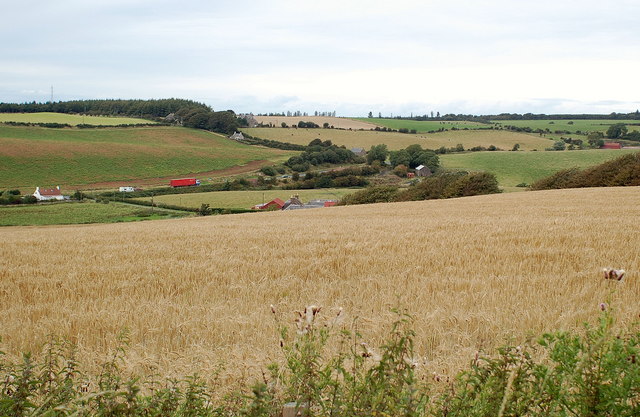
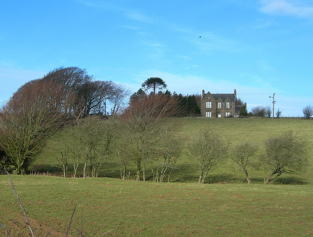
The Belt, Ayrshire is a sprawling wood located in the southwestern part of Scotland. Covering a vast area, it is a significant forest that attracts nature enthusiasts and outdoor adventurers alike. The Belt boasts a rich biodiversity, with an impressive array of flora and fauna that call this forest their home.

The woodland is predominantly composed of mixed deciduous trees, creating a beautiful tapestry of colors during the autumn months. Species such as oak, birch, beech, and ash can be found throughout the forest, providing a stunning backdrop for visitors. The forest floor is carpeted with a variety of wildflowers, further enhancing the beauty of the surroundings.

The Belt is crisscrossed by numerous walking trails that allow visitors to explore the forest at their own pace. These trails range from easy strolls to more challenging hikes, catering to people of all fitness levels. The forest also offers opportunities for birdwatching, with several species of birds, including woodpeckers and owls, making their presence known.

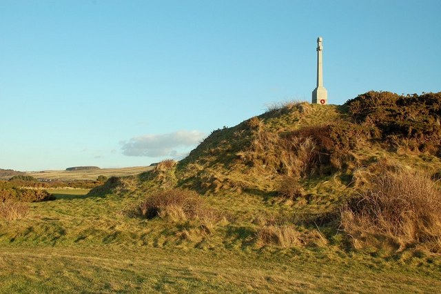
In addition to its natural allure, The Belt has historical significance as well. It is believed that the forest has been inhabited for centuries, with archaeological remains and ancient structures scattered throughout the area. Exploring these remnants provides a glimpse into the region's past and adds an extra layer of intrigue to the forest experience.

Overall, The Belt, Ayrshire is a captivating wood that combines natural beauty, outdoor activities, and historical value. With its diverse ecosystem and well-maintained trails, it is an ideal destination for nature lovers seeking tranquility and adventure in the heart of Scotland.

If you have any feedback on the listing, please let us know in the comments section below.

The Belt Images

Images are sourced within 2km of 55.323406/-4.8084423 or Grid Reference NS2106. Thanks to Geograph Open Source API. All images are credited.

The RAF Monument at Turnberry This war memorial commemorates British and Commonwealth airmen who had trained at Turnberry's School of Aerial Gunnery and Fighting.  It is located on one of the golf courses. The airmen were buried at nearby Dunure Cemetery <a href="https://www.geograph.org.uk/photo/4562042">NS2515 : War Graves at Dunure Cemetery</a>
The RAF Monument at Turnberry
This war memorial commemorates British and Commonwealth airmen who had trained at Turnberry's School of Aerial Gunnery and Fighting. It is located on one of the golf courses. The airmen were buried at nearby Dunure Cemetery NS2515 : War Graves at Dunure Cemetery
The RAF Monument at Turnberry Details of one of the plaques on the memorial which commemorates airmen who had trained at Turnberry Aerodrome.
The RAF Monument at Turnberry
Details of one of the plaques on the memorial which commemorates airmen who had trained at Turnberry Aerodrome.
Turnberry war memorial Dedicated to "The memory of the officers, non-commissioned officers and men of the Royal Flying Corps, Royal Air Force and the Australian and United States Air Services who gave their lives for their country while serving in The School of Aerial Gunnery & Fighting".
Turnberry war memorial
Dedicated to "The memory of the officers, non-commissioned officers and men of the Royal Flying Corps, Royal Air Force and the Australian and United States Air Services who gave their lives for their country while serving in The School of Aerial Gunnery & Fighting".
War Memorial On Turnberry golf course.
War Memorial
On Turnberry golf course.
Ayrshire Coastal Path Crossing Turnberry golf course.
Ayrshire Coastal Path
Crossing Turnberry golf course.
War Memorial From the Ayrshire Coastal Path.
War Memorial
From the Ayrshire Coastal Path.
Turnberry Hotel
Turnberry Hotel
Maidens, Ayrshire Facing North East
Maidens, Ayrshire
Facing North East
Maidens Beach The trees in the distance are Culzean estate
Maidens Beach
The trees in the distance are Culzean estate
Maidens harbour reborn An amazing story at Maidens harbour.  Tired of neglect, the local community have bought the harbour for £100, raised funds, bought second-hand dredging equipment and set out to dredge the harbour using volunteer labour.  This picture was taken at about half tide and already the results are showing.  The dredging barge may be seen to the right.  Pontoons to follow.
Maidens harbour reborn
An amazing story at Maidens harbour. Tired of neglect, the local community have bought the harbour for £100, raised funds, bought second-hand dredging equipment and set out to dredge the harbour using volunteer labour. This picture was taken at about half tide and already the results are showing. The dredging barge may be seen to the right. Pontoons to follow.
New life at Maidens harbour Newly dredged, boats are still afloat at low tide in this formerly drying harbour.
New life at Maidens harbour
Newly dredged, boats are still afloat at low tide in this formerly drying harbour.
From the Glenhead Road Farmland in South Ayrshire, Arran in the far distance
From the Glenhead Road
Farmland in South Ayrshire, Arran in the far distance
Turnberry Hotel Turnberry Hotel and adjacent farmland, taken from PS Waverley
Turnberry Hotel
Turnberry Hotel and adjacent farmland, taken from PS Waverley
Minnybae Farm Looking towards Minnybae and A77
Minnybae Farm
Looking towards Minnybae and A77
Turnberry Golf Course Looking South along the disused WW2 runway at Turnberry
Turnberry Golf Course
Looking South along the disused WW2 runway at Turnberry
Turnberry Golf Course Looking South West across one of the three golf courses at Turnberry with the Southern Upland Boundary Fault hills in the background
Turnberry Golf Course
Looking South West across one of the three golf courses at Turnberry with the Southern Upland Boundary Fault hills in the background
Hedgehog at Turnberry A young Hedgehog on the disused WW2 runway at Turnberry golf course
Hedgehog at Turnberry
A young Hedgehog on the disused WW2 runway at Turnberry golf course
Towards Barsloan Wood
Show me another place!

The Belt is located at Grid Ref: NS2106 (Lat: 55.323406, Lng: -4.8084423)

Unitary Authority: South Ayrshire

Police Authority: Ayrshire

What 3 Words

///goodnight.breathy.punks. Near Maybole, South Ayrshire

Related Wikis

Maidens railway station

Maidens railway station was a railway station serving the village of Maidens, South Ayrshire, Scotland. The station was part of the Maidens and Dunure...

Maidens, South Ayrshire

Maidens is a village in the Kirkoswald parish of Ayrshire, Scotland. Situated on the coast of the Firth of Clyde at the southern end of Maidenhead Bay...

RAF Turnberry

RAF Turnberry was an airfield in Scotland used by the Royal Flying Corps (RFC) and the Royal Air Force (RAF) during the First World War, and again by...

Battle of Turnberry

The Battle of Turnberry was a battle fought in February 1307 during the Scottish Wars of Independence near Turnberry, Ayrshire, Scotland. King Robert I...

Nearby Amenities

Located within 500m of 55.323406,-4.8084423
Power: pole
Lat/Long: 55.319288/-4.8100376
Power: pole
Lat/Long: 55.3196863/-4.8091257
Power: pole
Lat/Long: 55.3200999/-4.8082271
Power: pole
Lat/Long: 55.3205013/-4.807342
Power: pole
Lat/Long: 55.3209134/-4.8064193
Power: pole
Lat/Long: 55.3213407/-4.8054698
Power: pole
Lat/Long: 55.3217512/-4.8045257
Power: pole
Lat/Long: 55.3221617/-4.8036352
Power: pole
Lat/Long: 55.3223708/-4.8027769
Power: pole
Lat/Long: 55.3226119/-4.8018703
Power: pole
Lat/Long: 55.3229019/-4.8007411
Power: pole
Lat/Long: 55.3222838/-4.8155952
Power: pole
Lat/Long: 55.3228469/-4.8149514
Power: pole
Lat/Long: 55.3234329/-4.8142782
Power: pole
Lat/Long: 55.3240082/-4.8136023
Power: pole
Lat/Long: 55.3244859/-4.8124731
Power: pole
Lat/Long: 55.324936/-4.811368
Power: pole
Lat/Long: 55.3254075/-4.8102736
Power: pole
Lat/Long: 55.3258623/-4.8092008
Power: pole
Lat/Long: 55.326227/-4.8082808
Power: pole
Lat/Long: 55.3266145/-4.8074225
Power: pole
Lat/Long: 55.3269396/-4.8066473
Power: pole
Lat/Long: 55.3272646/-4.805848
Power: pole
Lat/Long: 55.3194428/-4.8120415
Power: pole
Lat/Long: 55.3199264/-4.8128088
Power: pole
Lat/Long: 55.3205161/-4.8138216
Power: pole
Lat/Long: 55.3211017/-4.8147825
Power: pole
Lat/Long: 55.3216578/-4.8156914
Power: pole
Lat/Long: 55.3277462/-4.8093313
Power: pole
Lat/Long: 55.327158/-4.8082123
Power: pole
Lat/Long: 55.3265778/-4.8071381
Power: pole
Lat/Long: 55.3259842/-4.8060569
Power: pole
Lat/Long: 55.3253972/-4.8049662
Power: pole
Lat/Long: 55.3247821/-4.8038353
Power: pole
Lat/Long: 55.3243227/-4.8034104
Power: pole
Lat/Long: 55.3237855/-4.8030468
Power: pole
Lat/Long: 55.3232455/-4.8027116
Power: pole
Lat/Long: 55.3227378/-4.8019986
Power: pole
Lat/Long: 55.3191916/-4.8059317
The data included in this document is from www.openstreetmap.org. The data is made available under ODbL.

Have you been to The Belt?

Leave your review of The Belt below (or comments, questions and feedback).