Dalquhat Brae

Downs, Moorland in Ayrshire

Scotland

Dalquhat Brae

Old sewage outfall pipe, Turnberry Old sewage outfall pipe, Turnberry.
Old sewage outfall pipe, Turnberry Credit: Colin Kinnear

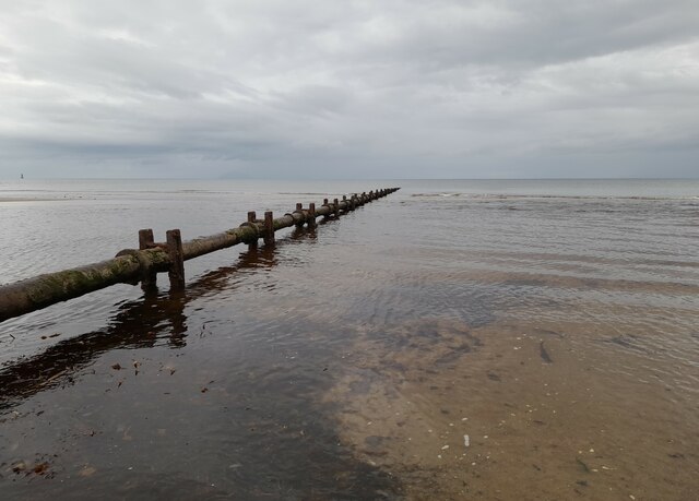
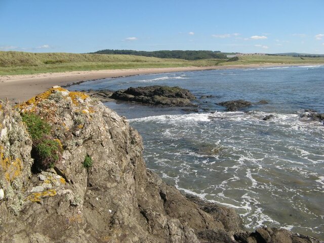
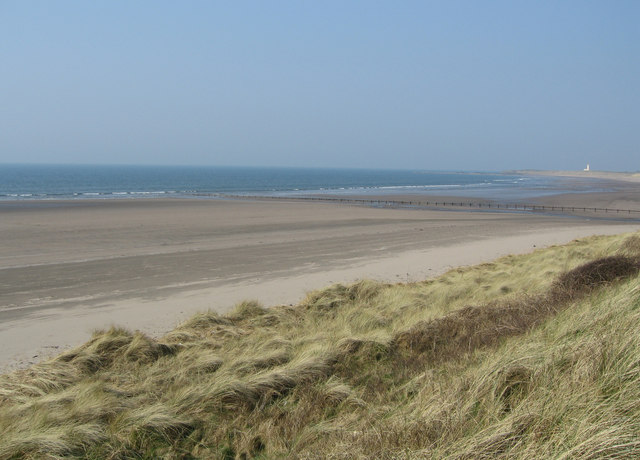
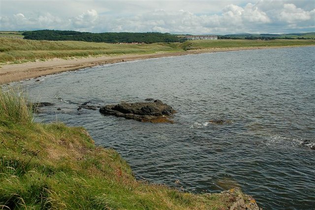
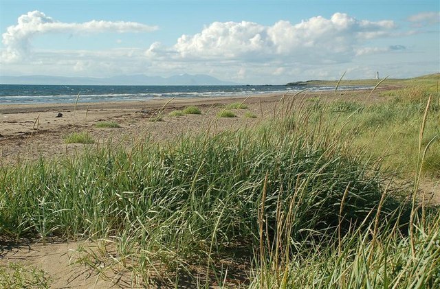
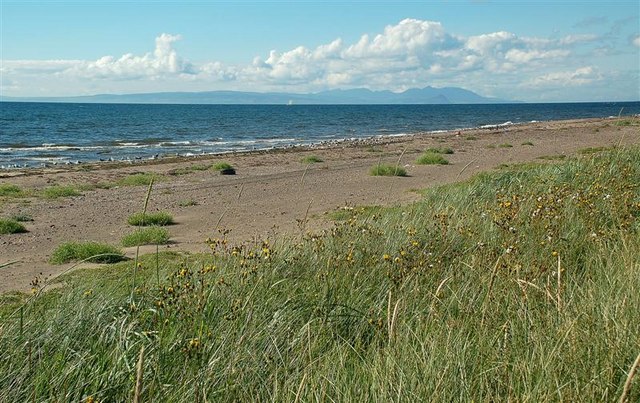
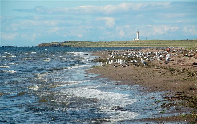
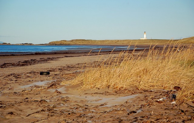
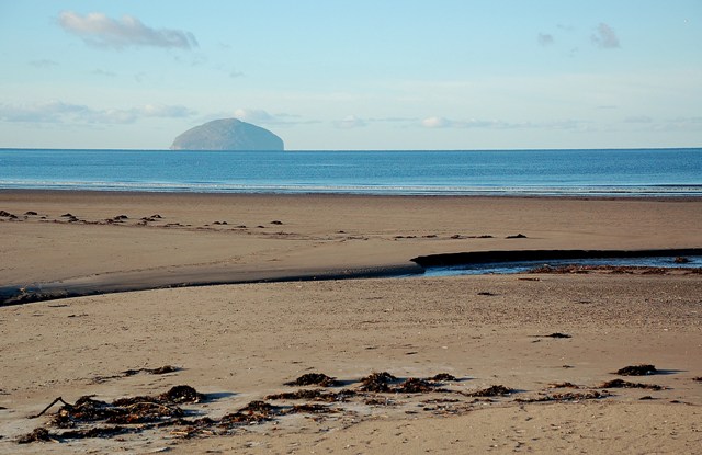
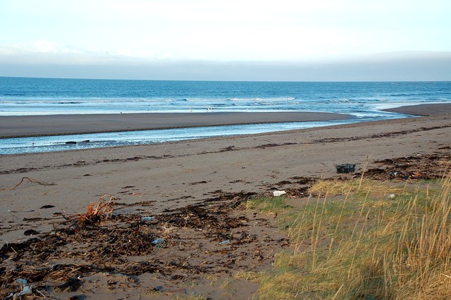
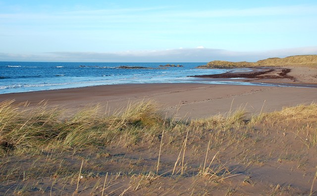
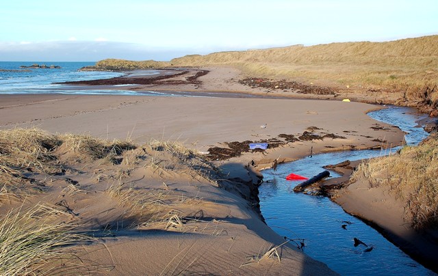
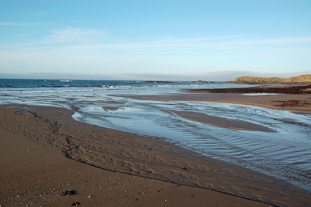
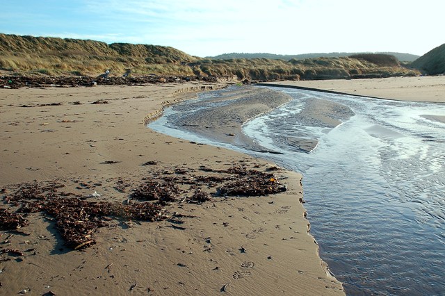
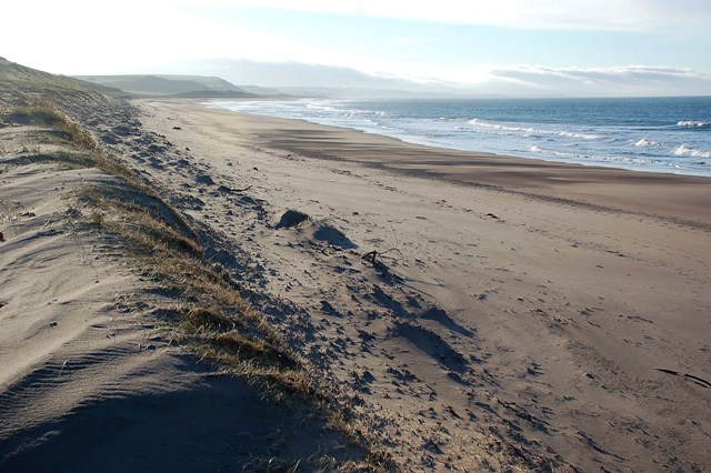
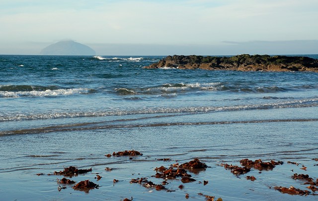
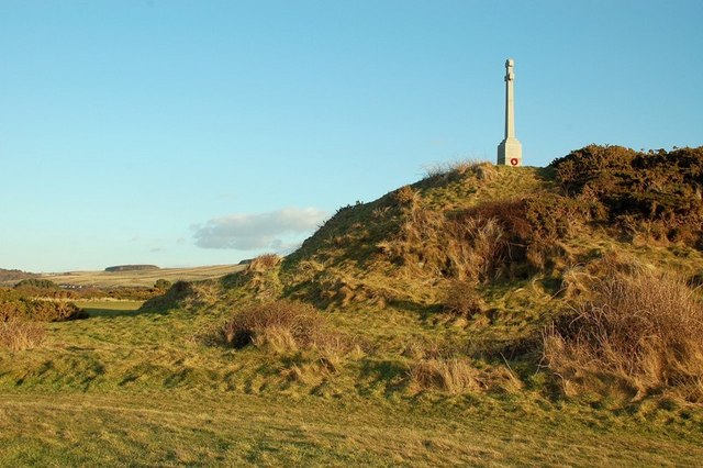
Dalquhat Brae is a picturesque area located in Ayrshire, Scotland. Situated amidst the stunning downs and moorland, it offers breathtaking natural beauty and a serene ambiance. The landscape is characterized by rolling hills, heather-covered moors, and sprawling green fields.

The downs in Dalquhat Brae are a prominent feature, consisting of gentle slopes and undulating terrains. These downlands provide a panoramic view of the surrounding countryside, allowing visitors to enjoy the vast expanse of the Ayrshire region. The downs are covered in a rich variety of vegetation, including grasses, wildflowers, and shrubs, creating a vibrant and colorful landscape.

The moorland of Dalquhat Brae is equally captivating, with its rugged and untamed beauty. The moors are covered in heather, creating a purple-hued carpet that stretches as far as the eye can see. This unique ecosystem supports a diverse range of wildlife, including birds, insects, and small mammals.

The area is a paradise for outdoor enthusiasts, offering ample opportunities for hiking, nature walks, and birdwatching. The tranquil atmosphere and unspoiled surroundings make Dalquhat Brae a perfect escape from the hustle and bustle of everyday life.

In addition to its natural beauty, Dalquhat Brae is also steeped in history. The region is dotted with ancient stone circles, cairns, and historic landmarks, providing a glimpse into its rich past.

Overall, Dalquhat Brae in Ayrshire is a captivating destination that combines stunning natural landscapes with a rich cultural heritage, making it a must-visit location for nature lovers and history enthusiasts alike.

If you have any feedback on the listing, please let us know in the comments section below.

Dalquhat Brae Images

Images are sourced within 2km of 55.317763/-4.8141909 or Grid Reference NS2106. Thanks to Geograph Open Source API. All images are credited.

Old sewage outfall pipe, Turnberry Old sewage outfall pipe, Turnberry.
Old sewage outfall pipe, Turnberry
Old sewage outfall pipe, Turnberry.
Turnberry Bay The wide sweep of the fine bay with its dunes which drop down to admit a small burn to drain through to the sea.
Turnberry Bay
The wide sweep of the fine bay with its dunes which drop down to admit a small burn to drain through to the sea.
Turnberry Dunes Turnberry lighthouse in the distance. Milton Burn outflow in middle distance.
Turnberry Dunes
Turnberry lighthouse in the distance. Milton Burn outflow in middle distance.
Turnberry Bay Viewed from Turnberry Point, with Turnberry Hotel <a href="https://www.geograph.org.uk/gridref/NS2005">NS2005</a> in the background. For a winter view, see <a href="https://www.geograph.org.uk/photo/5273413">NS1906 : Turnberry Bay</a>
Turnberry Bay
Viewed from Turnberry Point, with Turnberry Hotel NS2005 in the background. For a winter view, see NS1906 : Turnberry Bay
A First Look At Turnberry Bay The Explorer map puts the camera position for this view just inside the square.  It's the first view that you see of the northern end of Turnberry Bay, coming down the Milton Burn track.
A First Look At Turnberry Bay
The Explorer map puts the camera position for this view just inside the square. It's the first view that you see of the northern end of Turnberry Bay, coming down the Milton Burn track.
Turnberry Bay View Turnberry Bay viewed from the start of the dunes, looking out towards the island of Arran on a fine August afternoon.
Turnberry Bay View
Turnberry Bay viewed from the start of the dunes, looking out towards the island of Arran on a fine August afternoon.
High Tide A mixed group of gulls and waders on Turnberry beach, shortly after high tide. I didn't go any closer, to avoid disturbance.  Turnberry lighthouse, in <a href="https://www.geograph.org.uk/gridref/NS1907">NS1907</a>, is visible in the background.
High Tide
A mixed group of gulls and waders on Turnberry beach, shortly after high tide. I didn't go any closer, to avoid disturbance. Turnberry lighthouse, in NS1907, is visible in the background.
Milton Burn Mouth Milton Burn enters the Firth of Clyde here in a fast-flowing channel.  Walkers on the Ayrshire Coastal Path can cross over safely on a concrete footbridge, on the left in the middle distance of this shot. It's shown in <a href="https://www.geograph.org.uk/photo/907804">NS2005 : On The Ayrshire Coastal Path</a> along with a warning about the bridge being washed away. There's a better crossing a little further upstream.
Milton Burn Mouth
Milton Burn enters the Firth of Clyde here in a fast-flowing channel. Walkers on the Ayrshire Coastal Path can cross over safely on a concrete footbridge, on the left in the middle distance of this shot. It's shown in NS2005 : On The Ayrshire Coastal Path along with a warning about the bridge being washed away. There's a better crossing a little further upstream.
A Winter View Turnberry Bay, viewed on a frosty December morning.  For a summer view, see <a href="https://www.geograph.org.uk/photo/912498">NS1905 : A First Look At Turnberry Bay</a>.
A Winter View
Turnberry Bay, viewed on a frosty December morning. For a summer view, see NS1905 : A First Look At Turnberry Bay.
Turnberry Beach Viewed where Milton Burn crosses the beach, with Ailsa Craig in the background, on a frosty December morning.
Turnberry Beach
Viewed where Milton Burn crosses the beach, with Ailsa Craig in the background, on a frosty December morning.
Milton Burn At Turnberry - Relocated The course of Milton Burn across Turnberry Beach has moved in response to sea and weather conditions.  It used to flow almost straight out from the land but now flows along the beach to the north before reaching the sea.
Milton Burn At Turnberry - Relocated
The course of Milton Burn across Turnberry Beach has moved in response to sea and weather conditions. It used to flow almost straight out from the land but now flows along the beach to the north before reaching the sea.
Turnberry Bay view The northern end of Turnberry Bay, viewed where Wilson's Burn enters the sea.  Recent winds and tides had covered the beach on the far side with seaweed and debris, in contrast with the clean conditions in the foreground.
Turnberry Bay view
The northern end of Turnberry Bay, viewed where Wilson's Burn enters the sea. Recent winds and tides had covered the beach on the far side with seaweed and debris, in contrast with the clean conditions in the foreground.
Wilson's Burn at Turnberry Bay This small burn flows from the golf course into Turnberry Bay.
Wilson's Burn at Turnberry Bay
This small burn flows from the golf course into Turnberry Bay.
The mouth of Wilson's Burn at Turnberry Bay For the small size of this burn, it produces a lot of water on the beach.  Walkers on the Ayrshire Coastal Path have to cross this one as best they can.  At low tide, it's seldom a problem as the water spreads out well across the beach.
The mouth of Wilson's Burn at Turnberry Bay
For the small size of this burn, it produces a lot of water on the beach. Walkers on the Ayrshire Coastal Path have to cross this one as best they can. At low tide, it's seldom a problem as the water spreads out well across the beach.
Looking up Wilson's  Burn I have happy memories of helping my children play in this burn many years back.  We used to build dams and catch tiny flat fish in the brackish water where the burn reached the beach.  In the summer months, the burn holds less water than shown in this January shot.
Looking up Wilson's Burn
I have happy memories of helping my children play in this burn many years back. We used to build dams and catch tiny flat fish in the brackish water where the burn reached the beach. In the summer months, the burn holds less water than shown in this January shot.
Turnberry Bay View Looking southwards from the edge of the dune system at Turnberry Bay.  The bank of cloud in the far distance is hiding the hills inland from Girvan.
Turnberry Bay View
Looking southwards from the edge of the dune system at Turnberry Bay. The bank of cloud in the far distance is hiding the hills inland from Girvan.
Ailsa Craig view Looking out across the Firth of Clyde near the northern end of Turnberry Bay.  The low cloud was just beginning to clear the summit of Ailsa Craig when this shot was taken.
Ailsa Craig view
Looking out across the Firth of Clyde near the northern end of Turnberry Bay. The low cloud was just beginning to clear the summit of Ailsa Craig when this shot was taken.
The RAF Monument at Turnberry This war memorial commemorates British and Commonwealth airmen who had trained at Turnberry's School of Aerial Gunnery and Fighting.  It is located on one of the golf courses. The airmen were buried at nearby Dunure Cemetery <a href="https://www.geograph.org.uk/photo/4562042">NS2515 : War Graves at Dunure Cemetery</a>
The RAF Monument at Turnberry
This war memorial commemorates British and Commonwealth airmen who had trained at Turnberry's School of Aerial Gunnery and Fighting. It is located on one of the golf courses. The airmen were buried at nearby Dunure Cemetery NS2515 : War Graves at Dunure Cemetery
Show me another place!

Dalquhat Brae is located at Grid Ref: NS2106 (Lat: 55.317763, Lng: -4.8141909)

Unitary Authority: South Ayrshire

Police Authority: Ayrshire

What 3 Words

///pointer.acclaimed.chops. Near Girvan, South Ayrshire

Related Wikis

Turnberry railway station

Turnberry railway station was a railway station serving the Turnberry Golf Course and its associated hotel, South Ayrshire, Scotland. The station was part...

Battle of Turnberry

The Battle of Turnberry was a battle fought in February 1307 during the Scottish Wars of Independence near Turnberry, Ayrshire, Scotland. King Robert I...

1986 Open Championship

The 1986 Open Championship was a men's major golf championship and the 115th Open Championship, held from 17 to 20 July at Turnberry Golf Resort, Scotland...

2002 Women's British Open

The 2002 Women's British Open was held 8–11 August at the Ailsa Course at Turnberry Golf Club in South Ayrshire, Scotland. It was the 26th edition of the...

Related Videos

Ayrshire Walking Trail - Culzean Castle Route - Ghosts and Presidents

This walking trail starts at the camping and carvanning club site but an alternative route can be taken from one of the numerous ...

Redgates Holiday Park Maidens revisited and Elddis Avante 550 update

Another wonderful weekend at Redgates in Maidens and an update on our Elddis Avante 550.

A lot of firsts at Maidens (Scotland)

The firsts: - long trip after the 2021 lockdown in Scotland - visiting Maidens. Lovely small town with lots of routes for hikes - long ...

Nearby Amenities

Located within 500m of 55.317763,-4.8141909
Parking
Lat/Long: 55.3144188/-4.8132676
Power: pole
Lat/Long: 55.3152434/-4.8201576
Power: pole
Lat/Long: 55.315451/-4.8191544
Power: pole
Lat/Long: 55.3156204/-4.8181272
Power: pole
Lat/Long: 55.3161012/-4.8171106
Power: pole
Lat/Long: 55.3165469/-4.8160994
Power: pole
Lat/Long: 55.3169834/-4.8151445
Power: pole
Lat/Long: 55.3174688/-4.8140663
Power: pole
Lat/Long: 55.3179175/-4.8130336
Power: pole
Lat/Long: 55.3183738/-4.812052
Power: pole
Lat/Long: 55.318824/-4.8110408
Power: pole
Lat/Long: 55.319288/-4.8100376
Power: pole
Lat/Long: 55.3196863/-4.8091257
Power: pole
Lat/Long: 55.3200999/-4.8082271
Power: pole
Lat/Long: 55.3162477/-4.8213914
Power: pole
Lat/Long: 55.316785/-4.8214504
Power: pole
Lat/Long: 55.3173024/-4.8214853
Power: pole
Lat/Long: 55.3179877/-4.8215336
Power: pole
Lat/Long: 55.3185417/-4.8207665
Power: pole
Lat/Long: 55.3190804/-4.8199859
Power: pole
Lat/Long: 55.3196451/-4.8192
Power: pole
Lat/Long: 55.3202236/-4.8183927
Power: pole
Lat/Long: 55.3212094/-4.8169719
Power: pole
Lat/Long: 55.3179396/-4.8085145
Power: pole
Lat/Long: 55.3177421/-4.8091188
Power: pole
Lat/Long: 55.3194428/-4.8120415
Power: pole
Lat/Long: 55.3199264/-4.8128088
Power: pole
Lat/Long: 55.3205161/-4.8138216
Power: pole
Lat/Long: 55.3211017/-4.8147825
Power: pole
Lat/Long: 55.3216578/-4.8156914
Power: pole
Lat/Long: 55.3207118/-4.8176891
Power: pole
Lat/Long: 55.3217357/-4.816245
The data included in this document is from www.openstreetmap.org. The data is made available under ODbL.

Have you been to Dalquhat Brae?

Leave your review of Dalquhat Brae below (or comments, questions and feedback).