Bargane Plantation

Wood, Forest in Renfrewshire

Scotland

Bargane Plantation

Kip Water at Bridgend Looking upstream at the bend at Bridgend Cottages.
Kip Water at Bridgend Credit: Thomas Nugent

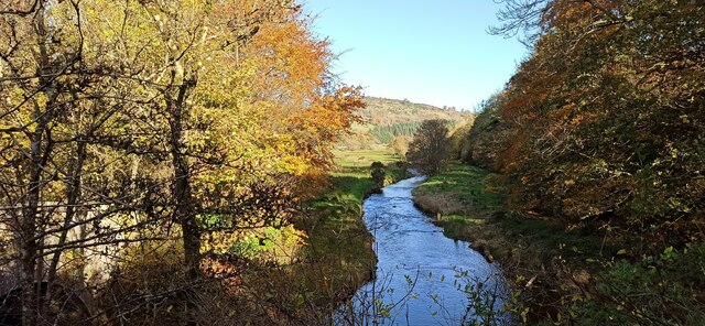
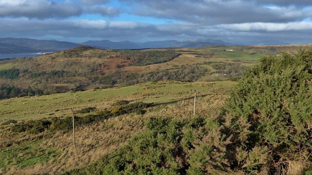
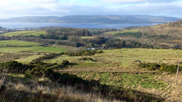
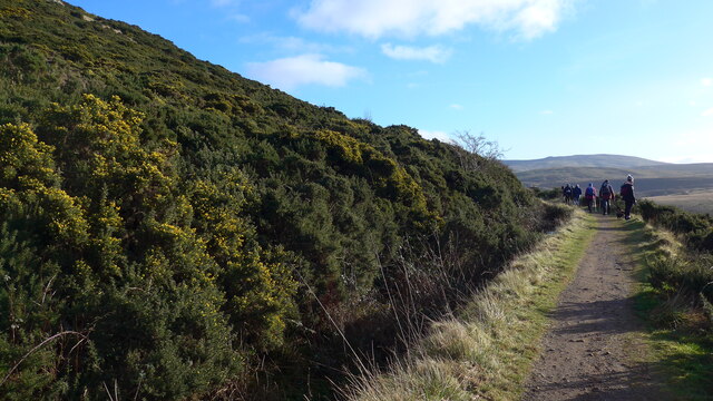
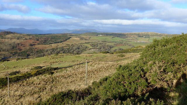
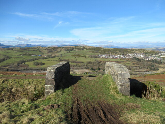
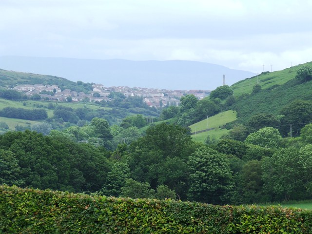
Bargane Plantation is a picturesque woodland area located in Renfrewshire, Scotland. Spread across an expansive area, the plantation is known for its lush greenery, diverse flora, and tranquil atmosphere. It offers a serene escape for nature enthusiasts and those seeking solitude amidst the beauty of the Scottish countryside.

The woodland is primarily composed of various species of trees, including oak, birch, and spruce. These towering trees create a dense canopy, providing shade and shelter for a wide array of wildlife. Visitors can expect to encounter an assortment of bird species, such as woodpeckers, thrushes, and owls, as well as small mammals like squirrels and rabbits.

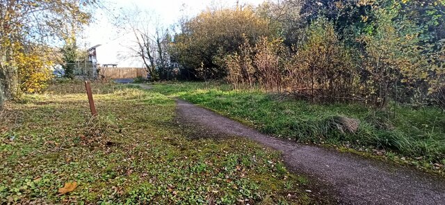
The plantation is well-maintained, with clearly marked paths and trails that wind through the forest. These paths offer visitors the opportunity to explore the woodland at their own pace, taking in the sights, sounds, and scents of the natural surroundings. Additionally, there are designated picnic areas and benches scattered throughout the plantation, allowing visitors to pause and appreciate the beauty of their surroundings.

Bargane Plantation is not only a haven for nature lovers but also serves as an important conservation area. The woodland is actively managed by local authorities to preserve its biodiversity and protect its ecological balance. This involves responsible tree planting, removing invasive species, and ensuring the overall health of the ecosystem.

Overall, Bargane Plantation is a cherished natural gem in Renfrewshire, offering a peaceful retreat for those seeking solace in the embrace of nature. Whether it be for a leisurely walk, birdwatching, or simply unwinding amidst the enchanting forest, this woodland sanctuary is sure to captivate visitors with its beauty and tranquility.

If you have any feedback on the listing, please let us know in the comments section below.

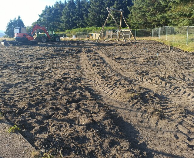
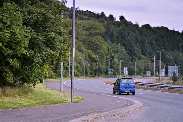
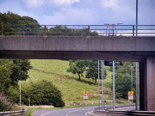
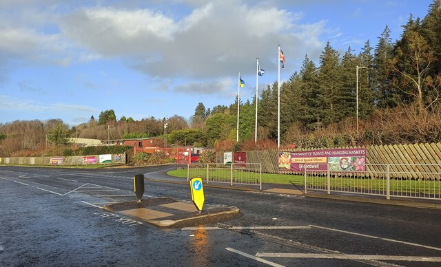
Bargane Plantation Images

Images are sourced within 2km of 55.92548/-4.8518465 or Grid Reference NS2173. Thanks to Geograph Open Source API. All images are credited.

Kip Water at Bridgend Looking upstream at the bend at Bridgend Cottages.
Kip Water at Bridgend
Looking upstream at the bend at Bridgend Cottages.
Inverkip Community Hub At Bridgend at the north end of the village.
Inverkip Community Hub
At Bridgend at the north end of the village.
Painted stones, Inverkip At Inverkip Community Hub <a href="https://www.geograph.org.uk/photo/7666641">NS2172 : Inverkip Community Hub</a>.
Painted stones, Inverkip
At Inverkip Community Hub NS2172 : Inverkip Community Hub.
Former tennis court, Inverkip Undeveloped former Inverkip & Wemyss Bay Sports Club land between Langhouse Road and Kip Park. One of the net posts remains.
Former tennis court, Inverkip
Undeveloped former Inverkip & Wemyss Bay Sports Club land between Langhouse Road and Kip Park. One of the net posts remains.
Santa and snowman yarn bombs On the fence of the astroturf pitch at Inverkip Community Hub.

See also <a href="https://www.geograph.org.uk/photo/7066669">NS2172 : Astroturf pitch at Inverkip</a>.
Santa and snowman yarn bombs
On the fence of the astroturf pitch at Inverkip Community Hub. See also NS2172 : Astroturf pitch at Inverkip.
Astroturf pitch at Inverkip The floodlit facility is at Inverkip Community Hub. Note the yarn bombs on the fence <a href="https://www.geograph.org.uk/photo/7066656">NS2172 : Santa and snowman yarn bombs</a>.
Astroturf pitch at Inverkip
The floodlit facility is at Inverkip Community Hub. Note the yarn bombs on the fence NS2172 : Santa and snowman yarn bombs.
Prescription dispenser at Inverkip Pharmacy A recent addition to the pharmacy and cafe at Kip park. Subscribers to the service are sent a code via SMS which is then entered to the touch-screen panel to dispense the pre-packed prescription.
Prescription dispenser at Inverkip Pharmacy
A recent addition to the pharmacy and cafe at Kip park. Subscribers to the service are sent a code via SMS which is then entered to the touch-screen panel to dispense the pre-packed prescription.
Land below the Greenock Cut Across the Firth of Clyde, housing in Dunoon just visible.
Land below the Greenock Cut
Across the Firth of Clyde, housing in Dunoon just visible.
Looking down on Dunrod from the Greenock Cut The Firth of Clyde showing in the distance.
Looking down on Dunrod from the Greenock Cut
The Firth of Clyde showing in the distance.
On the Greenock Cut path above Majeston
Looking down from the Greenock Cut
Toilets at Lunderston Bay Toilets and cycle facilities at the car park at the bay.
Toilets at Lunderston Bay
Toilets and cycle facilities at the car park at the bay.
Covid-19 advice notice at Lunderston Bay The now familiar advice about social distancing and mask wearing at the bike rack at Lunderston Bay.
Covid-19 advice notice at Lunderston Bay
The now familiar advice about social distancing and mask wearing at the bike rack at Lunderston Bay.
Play park construction site A new play park is under construction at the North end of the Lunderston Bay picnic area. This will replace the now dilapidated one at the South end of the site.
Play park construction site
A new play park is under construction at the North end of the Lunderston Bay picnic area. This will replace the now dilapidated one at the South end of the site.
Inverkip Road (A78) The A78 runs for 42 miles between Greenock and Prestwick. For much of its route, it follows the northern section of the Ayrshire coast. Although it is classified as a primary road throughout its length, the standard varies. Much of the road is single carriageway, both for a short distance through Greenock and a 21-mile stretch between Inverkip and Ardrossan. The rest is dual carriageway; between the Eglinton and Warrix interchanges there are in fact 3 lanes in each direction, and the road is constructed to motorway standard (with full grade separation at junctions) except for a lack of hard shoulders.
Inverkip Road (A78)
The A78 runs for 42 miles between Greenock and Prestwick. For much of its route, it follows the northern section of the Ayrshire coast. Although it is classified as a primary road throughout its length, the standard varies. Much of the road is single carriageway, both for a short distance through Greenock and a 21-mile stretch between Inverkip and Ardrossan. The rest is dual carriageway; between the Eglinton and Warrix interchanges there are in fact 3 lanes in each direction, and the road is constructed to motorway standard (with full grade separation at junctions) except for a lack of hard shoulders.
Bridge over Inverkip Road at Chrisswell The A78 runs for 42 miles between Greenock and Prestwick. For much of its route, it follows the northern section of the Ayrshire coast. Although it is classified as a primary road throughout its length, the standard varies. Much of the road is single carriageway, both for a short distance through Greenock and a 21-mile stretch between Inverkip and Ardrossan. The rest is dual carriageway; between the Eglinton and Warrix interchanges there are in fact 3 lanes in each direction, and the road is constructed to motorway standard (with full grade separation at junctions) except for a lack of hard shoulders.
Bridge over Inverkip Road at Chrisswell
The A78 runs for 42 miles between Greenock and Prestwick. For much of its route, it follows the northern section of the Ayrshire coast. Although it is classified as a primary road throughout its length, the standard varies. Much of the road is single carriageway, both for a short distance through Greenock and a 21-mile stretch between Inverkip and Ardrossan. The rest is dual carriageway; between the Eglinton and Warrix interchanges there are in fact 3 lanes in each direction, and the road is constructed to motorway standard (with full grade separation at junctions) except for a lack of hard shoulders.
Cardwell Nursery and Garden Centre The entrance to the garden centre, on the A770 Cloch Road, between Inverkip and Gourock at Lunderston Bay.
Cardwell Nursery and Garden Centre
The entrance to the garden centre, on the A770 Cloch Road, between Inverkip and Gourock at Lunderston Bay.
Bridge over aqueduct, Greenock Cut The Greenock Cut is a nineteenth-century aqueduct that once transported water from Loch Thom to the industries of Greenock. This is one of numerous small bridges over the aqueduct, with the derelict former IBM site visible below, and the outskirts of Greenock in the middle ground.
Bridge over aqueduct, Greenock Cut
The Greenock Cut is a nineteenth-century aqueduct that once transported water from Loch Thom to the industries of Greenock. This is one of numerous small bridges over the aqueduct, with the derelict former IBM site visible below, and the outskirts of Greenock in the middle ground.
Show me another place!

Bargane Plantation is located at Grid Ref: NS2173 (Lat: 55.92548, Lng: -4.8518465)

Unitary Authority: Inverclyde

Police Authority: Renfrewshire and Inverclyde

What 3 Words

///decrease.thumbnail.socialite. Near Inverkip, Inverclyde

Related Wikis

Spango Valley

Spango Valley is a steep sided valley to the south-west of Greenock, Scotland. It runs approximately south west to north east for around 2.4 km (1.5 mi...
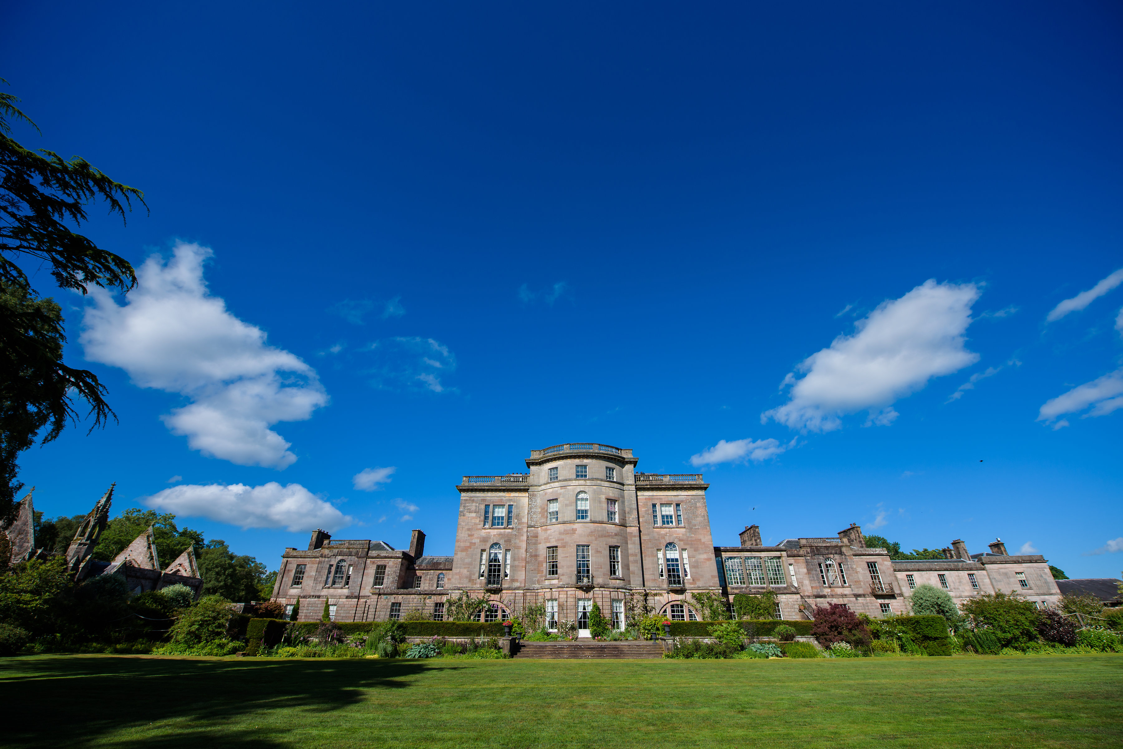
Ardgowan House

Ardgowan House, Castle & Gardens is a Privately owned late 18th-century mansion on the Firth of Clyde near Inverkip, Scotland. Ardgowan is located in Inverclyde...

IBM railway station

IBM railway station (formerly known as IBM Halt) is a currently disused railway station on the Inverclyde Line, 25+1⁄2 miles (41 km) west of Glasgow Central...

Lunderston Bay

Lunderston Bay is located on the east coast of the Firth of Clyde in Inverclyde, by the A770 road approximately midway between the town of Gourock and...

Ardgowan Castle

Ardgowan Castle, originally called Inverkip Castle, is located in the Private Garden of "Ardgowan House, Castle & Gardens" near Inverkip, Scotland. It...

Inverkip

Inverkip (; Scottish Gaelic: Inbhir Chip) is a village and parish in the Inverclyde council area and historic county of Renfrewshire in the west central...

Castle Levan

Castle Levan (also known as Levan Castle) is a fortified tower house in Levan area of Gourock, Inverclyde, Scotland. A building had been on the site from...

Braeside, Greenock

Braeside is a neighbourhood situated on the far west side of Greenock, in Inverclyde, Scotland. It has one primary schools in its vicinity, Aileymill,...

Nearby Amenities

Located within 500m of 55.92548,-4.8518465
The data included in this document is from www.openstreetmap.org. The data is made available under ODbL.

Have you been to Bargane Plantation?

Leave your review of Bargane Plantation below (or comments, questions and feedback).