Bargane Hill

Hill, Mountain in Renfrewshire

Scotland

Bargane Hill

Kip Water at Bridgend Looking upstream at the bend at Bridgend Cottages.
Kip Water at Bridgend Credit: Thomas Nugent

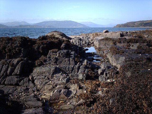
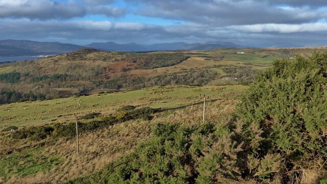
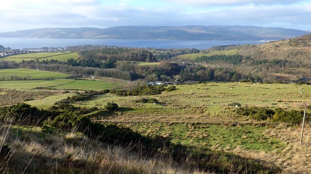
Bargane Hill, located in Renfrewshire, Scotland, is a prominent hill that offers stunning views and is a popular destination for outdoor enthusiasts. With an elevation of approximately 209 meters (686 feet), it is not considered a mountain but rather a hill.

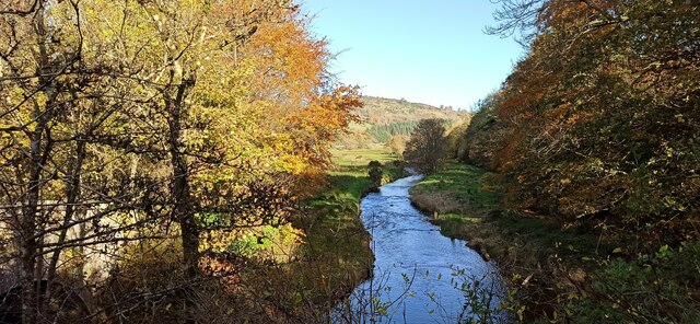
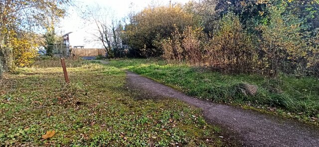
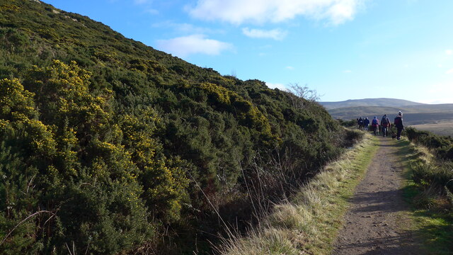
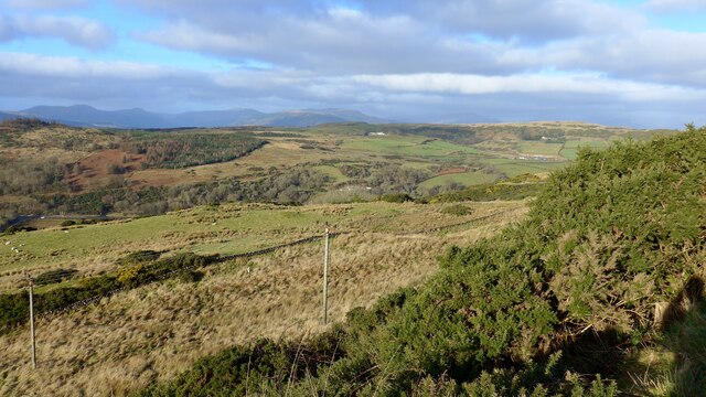
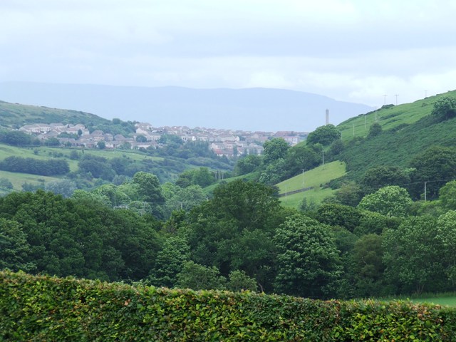
Situated near the village of Kilbarchan, Bargane Hill is easily accessible and attracts visitors from both locals and tourists. The hill is covered in lush greenery, featuring a mix of grasslands, heather, and scattered trees, creating a picturesque landscape. Its gentle slopes make it an ideal spot for walking, hiking, and even picnicking.

The summit of Bargane Hill provides breathtaking panoramic views of the surrounding countryside, including the Renfrewshire hills and the Clyde Valley. On a clear day, visitors may also catch a glimpse of the distant Ben Lomond, a famous mountain located in the Trossachs National Park.

Bargane Hill has historical significance as well. It is believed to have been a site of ancient settlements, with remnants of iron age forts and burial mounds found in the vicinity. These archaeological findings contribute to the hill's cultural and historical value.

Overall, Bargane Hill offers a delightful experience for nature lovers and history enthusiasts alike. Its accessibility, natural beauty, and historical significance make it a must-visit destination in Renfrewshire.

If you have any feedback on the listing, please let us know in the comments section below.
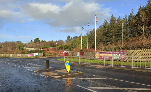
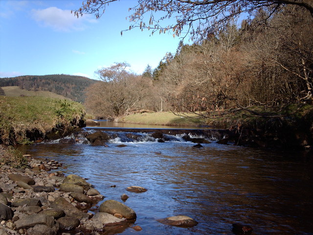
Bargane Hill Images

Images are sourced within 2km of 55.925623/-4.8530577 or Grid Reference NS2173. Thanks to Geograph Open Source API. All images are credited.

Kip Water at Bridgend Looking upstream at the bend at Bridgend Cottages.
Kip Water at Bridgend
Looking upstream at the bend at Bridgend Cottages.
Inverkip Community Hub At Bridgend at the north end of the village.
Inverkip Community Hub
At Bridgend at the north end of the village.
Painted stones, Inverkip At Inverkip Community Hub <a href="https://www.geograph.org.uk/photo/7666641">NS2172 : Inverkip Community Hub</a>.
Painted stones, Inverkip
At Inverkip Community Hub NS2172 : Inverkip Community Hub.
Former tennis court, Inverkip Undeveloped former Inverkip & Wemyss Bay Sports Club land between Langhouse Road and Kip Park. One of the net posts remains.
Former tennis court, Inverkip
Undeveloped former Inverkip & Wemyss Bay Sports Club land between Langhouse Road and Kip Park. One of the net posts remains.
Rock pools Most of this square is under water and the only piece of land is tidal. The Firth of Clyde, Dunoon and Kilmun Hill are in the background.
Rock pools
Most of this square is under water and the only piece of land is tidal. The Firth of Clyde, Dunoon and Kilmun Hill are in the background.
Santa and snowman yarn bombs On the fence of the astroturf pitch at Inverkip Community Hub.

See also <a href="https://www.geograph.org.uk/photo/7066669">NS2172 : Astroturf pitch at Inverkip</a>.
Santa and snowman yarn bombs
On the fence of the astroturf pitch at Inverkip Community Hub. See also NS2172 : Astroturf pitch at Inverkip.
Astroturf pitch at Inverkip The floodlit facility is at Inverkip Community Hub. Note the yarn bombs on the fence <a href="https://www.geograph.org.uk/photo/7066656">NS2172 : Santa and snowman yarn bombs</a>.
Astroturf pitch at Inverkip
The floodlit facility is at Inverkip Community Hub. Note the yarn bombs on the fence NS2172 : Santa and snowman yarn bombs.
Prescription dispenser at Inverkip Pharmacy A recent addition to the pharmacy and cafe at Kip park. Subscribers to the service are sent a code via SMS which is then entered to the touch-screen panel to dispense the pre-packed prescription.
Prescription dispenser at Inverkip Pharmacy
A recent addition to the pharmacy and cafe at Kip park. Subscribers to the service are sent a code via SMS which is then entered to the touch-screen panel to dispense the pre-packed prescription.
Land below the Greenock Cut Across the Firth of Clyde, housing in Dunoon just visible.
Land below the Greenock Cut
Across the Firth of Clyde, housing in Dunoon just visible.
Looking down on Dunrod from the Greenock Cut The Firth of Clyde showing in the distance.
Looking down on Dunrod from the Greenock Cut
The Firth of Clyde showing in the distance.
On the Greenock Cut path above Majeston
Looking down from the Greenock Cut
Toilets at Lunderston Bay Toilets and cycle facilities at the car park at the bay.
Toilets at Lunderston Bay
Toilets and cycle facilities at the car park at the bay.
Covid-19 advice notice at Lunderston Bay The now familiar advice about social distancing and mask wearing at the bike rack at Lunderston Bay.
Covid-19 advice notice at Lunderston Bay
The now familiar advice about social distancing and mask wearing at the bike rack at Lunderston Bay.
Play park construction site A new play park is under construction at the North end of the Lunderston Bay picnic area. This will replace the now dilapidated one at the South end of the site.
Play park construction site
A new play park is under construction at the North end of the Lunderston Bay picnic area. This will replace the now dilapidated one at the South end of the site.
Inverkip Road (A78) The A78 runs for 42 miles between Greenock and Prestwick. For much of its route, it follows the northern section of the Ayrshire coast. Although it is classified as a primary road throughout its length, the standard varies. Much of the road is single carriageway, both for a short distance through Greenock and a 21-mile stretch between Inverkip and Ardrossan. The rest is dual carriageway; between the Eglinton and Warrix interchanges there are in fact 3 lanes in each direction, and the road is constructed to motorway standard (with full grade separation at junctions) except for a lack of hard shoulders.
Inverkip Road (A78)
The A78 runs for 42 miles between Greenock and Prestwick. For much of its route, it follows the northern section of the Ayrshire coast. Although it is classified as a primary road throughout its length, the standard varies. Much of the road is single carriageway, both for a short distance through Greenock and a 21-mile stretch between Inverkip and Ardrossan. The rest is dual carriageway; between the Eglinton and Warrix interchanges there are in fact 3 lanes in each direction, and the road is constructed to motorway standard (with full grade separation at junctions) except for a lack of hard shoulders.
Bridge over Inverkip Road at Chrisswell The A78 runs for 42 miles between Greenock and Prestwick. For much of its route, it follows the northern section of the Ayrshire coast. Although it is classified as a primary road throughout its length, the standard varies. Much of the road is single carriageway, both for a short distance through Greenock and a 21-mile stretch between Inverkip and Ardrossan. The rest is dual carriageway; between the Eglinton and Warrix interchanges there are in fact 3 lanes in each direction, and the road is constructed to motorway standard (with full grade separation at junctions) except for a lack of hard shoulders.
Bridge over Inverkip Road at Chrisswell
The A78 runs for 42 miles between Greenock and Prestwick. For much of its route, it follows the northern section of the Ayrshire coast. Although it is classified as a primary road throughout its length, the standard varies. Much of the road is single carriageway, both for a short distance through Greenock and a 21-mile stretch between Inverkip and Ardrossan. The rest is dual carriageway; between the Eglinton and Warrix interchanges there are in fact 3 lanes in each direction, and the road is constructed to motorway standard (with full grade separation at junctions) except for a lack of hard shoulders.
Cardwell Nursery and Garden Centre The entrance to the garden centre, on the A770 Cloch Road, between Inverkip and Gourock at Lunderston Bay.
Cardwell Nursery and Garden Centre
The entrance to the garden centre, on the A770 Cloch Road, between Inverkip and Gourock at Lunderston Bay.
Show me another place!

Bargane Hill is located at Grid Ref: NS2173 (Lat: 55.925623, Lng: -4.8530577)

Unitary Authority: Inverclyde

Police Authority: Renfrewshire and Inverclyde

What 3 Words

///currently.fiery.flattery. Near Inverkip, Inverclyde

Related Wikis

Nearby Amenities

Located within 500m of 55.925623,-4.8530577
The data included in this document is from www.openstreetmap.org. The data is made available under ODbL.

Have you been to Bargane Hill?

Leave your review of Bargane Hill below (or comments, questions and feedback).