Pot Wood

Wood, Forest in Wigtownshire

Scotland

Pot Wood

The Southern Upland Way near Castle Kennedy
The Southern Upland Way near Castle Kennedy Credit: Dave Kelly

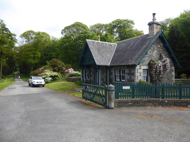
Pot Wood is a picturesque forest located in Wigtownshire, Scotland. Spread over an area of approximately 100 acres, it is known for its lush greenery and diverse flora and fauna. The forest is situated near the village of Wood, making it easily accessible for visitors.

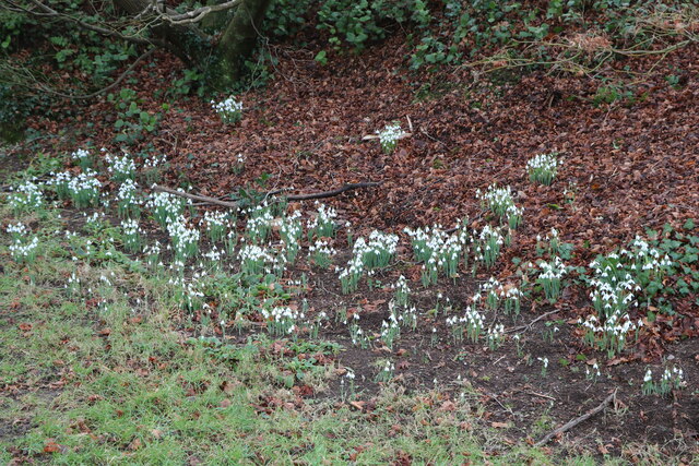
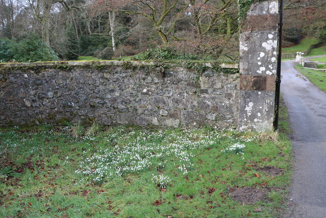
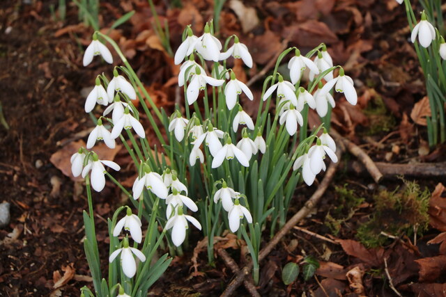
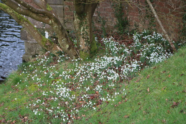
As you enter Pot Wood, you are greeted by a dense canopy of trees, predominantly consisting of oak, birch, and pine. The forest floor is carpeted with a variety of wildflowers, adding vibrant colors to the landscape. The tranquil atmosphere and the soothing sound of birds chirping make it a popular spot for nature enthusiasts and hikers.

Pot Wood is home to a wide range of wildlife, including deer, foxes, badgers, and numerous bird species. Nature lovers can often spot red squirrels darting through the trees or catch a glimpse of elusive woodland creatures. The forest also provides a habitat for many rare and endangered species, making it an important conservation area.

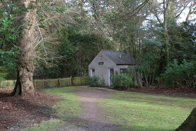
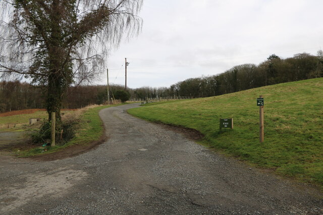
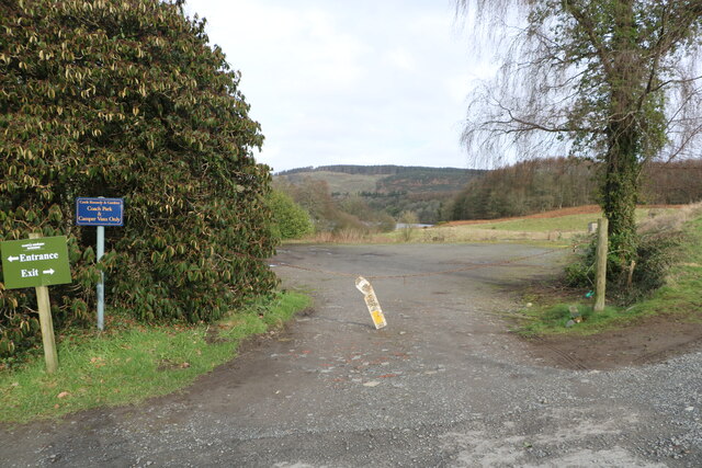
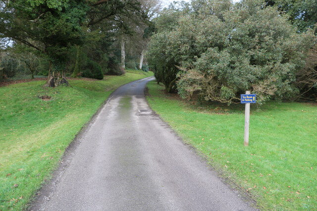
The forest offers several well-marked trails and paths, allowing visitors to explore its beauty at their own pace. These trails cater to different levels of difficulty, making it suitable for both seasoned hikers and families with young children. There are also picnic spots and benches strategically placed throughout the forest, providing a perfect setting to relax and enjoy the surroundings.

Overall, Pot Wood in Wigtownshire is a haven for nature enthusiasts, offering a peaceful retreat amidst its stunning natural beauty. It is a place where one can reconnect with nature, unwind, and appreciate the wonders of the Scottish wilderness.

If you have any feedback on the listing, please let us know in the comments section below.

Pot Wood Images

Images are sourced within 2km of 54.899089/-4.9632166 or Grid Reference NX1060. Thanks to Geograph Open Source API. All images are credited.

The Southern Upland Way near Castle Kennedy
Toilet Block At Castle Kennedy Gardens, located at the car park.
Toilet Block
At Castle Kennedy Gardens, located at the car park.
Castle Ruin At Castle Kennedy Gardens, viewed from the car park in early February (5th).
Castle Ruin
At Castle Kennedy Gardens, viewed from the car park in early February (5th).
Car Park, Castle Kennedy Gardens With view of the old Castle, seen in early February (5th).
Car Park, Castle Kennedy Gardens
With view of the old Castle, seen in early February (5th).
Bridge over Canal At Castle Kennedy Gardens, viewed in early February (5th).
Bridge over Canal
At Castle Kennedy Gardens, viewed in early February (5th).
Canal, Castle Kennedy Gardens From the road bridge, canal leading to the Black Loch, viewed in early February (5th).
Canal, Castle Kennedy Gardens
From the road bridge, canal leading to the Black Loch, viewed in early February (5th).
Canal, Castle Kennedy Gardens From the road bridge, canal leading to the White Loch, viewed in early February (5th).
Canal, Castle Kennedy Gardens
From the road bridge, canal leading to the White Loch, viewed in early February (5th).
Snowdrops, Castle Kennedy Gardens Viewed in early February (5th).
Snowdrops, Castle Kennedy Gardens
Viewed in early February (5th).
Entrance to Castle Kennedy Gardens The bridge through the gate is over the canal. Viewed in early February (5th).
Entrance to Castle Kennedy Gardens
The bridge through the gate is over the canal. Viewed in early February (5th).
Exit Road from Castle Kennedy Gardens This is a new one way system.
Exit Road from Castle Kennedy Gardens
This is a new one way system.
No Entry One Way This was the old way out but now change to a new one way system.
No Entry One Way
This was the old way out but now change to a new one way system.
Coach Park At Castle Kennedy Gardens.
Coach Park
At Castle Kennedy Gardens.
Snowdrops, Castle Kennedy Gardens At the Main Entrance Gate. Viewed in early February (5th).
Snowdrops, Castle Kennedy Gardens
At the Main Entrance Gate. Viewed in early February (5th).
Snowdrops, Castle Kennedy Gardens Viewed in early February (5th).
Snowdrops, Castle Kennedy Gardens
Viewed in early February (5th).
Road Bridge over Canal At Castle Kennedy Gardens, canal links the Black Loch with the White Loch. Viewed in early February (5th).
Road Bridge over Canal
At Castle Kennedy Gardens, canal links the Black Loch with the White Loch. Viewed in early February (5th).
Snowdrops by the Canal At Castle Kennedy Gardens. Viewed in early February (5th).
Snowdrops by the Canal
At Castle Kennedy Gardens. Viewed in early February (5th).
Bridge over the Canal At Castle Kennedy Gardens. Viewed in early February (5th).
Bridge over the Canal
At Castle Kennedy Gardens. Viewed in early February (5th).
Road to the Castle Signs says Tea Room & Parking. Viewed in early February (5th).
Road to the Castle
Signs says Tea Room & Parking. Viewed in early February (5th).
Show me another place!

Pot Wood is located at Grid Ref: NX1060 (Lat: 54.899089, Lng: -4.9632166)

Unitary Authority: Dumfries and Galloway

Police Authority: Dumfries and Galloway

What 3 Words

///dressings.custodial.magical. Near Stranraer, Dumfries & Galloway

Related Wikis

Aird, Dumfries and Galloway

Aird (Gaelic:An Àird) is a village in Dumfries and Galloway, in the southwest of Scotland. It is 2.5 miles (4.0 km) east of Stranraer and 1 mile (1.6 km...
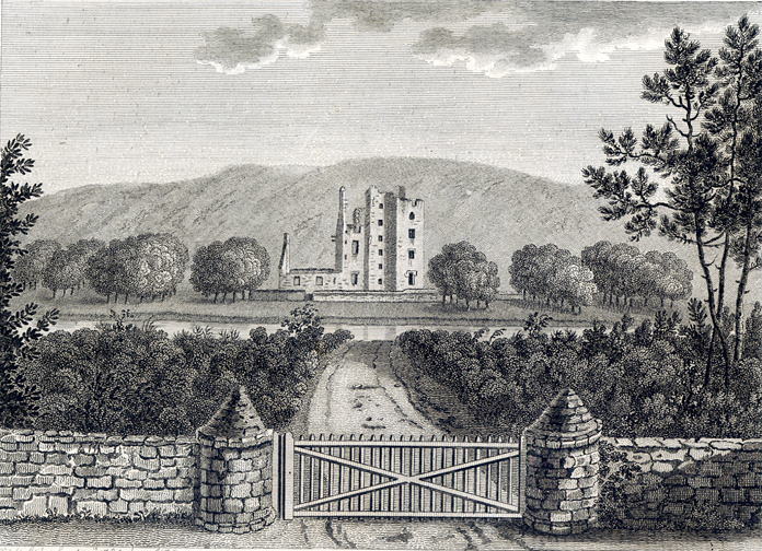
Castle Kennedy

Castle Kennedy is a small village 3 miles (4.8 km) east of Stranraer in Dumfries and Galloway, south-west Scotland. It is on the A75 road, and is within...

Castle Kennedy railway station

Castle Kennedy railway station served the village of Castle Kennedy, Dumfries and Galloway, Scotland from 1861 to 1965 on the Portpatrick and Wigtownshire...

Castle Kennedy (castle)

Castle Kennedy is a ruined 17th-century tower house, about 3 miles (4.8 km) east of Stranraer, Dumfries and Galloway, Scotland, around 0.5 miles (0.80...

Soulseat Abbey

Saulseat or Soulseat Abbey was a Premonstratensian monastic community located in Wigtownshire, Galloway, in the Gaelic-speaking south-west of Scotland...

RAF Castle Kennedy

Royal Air Force Castle Kennedy, or more simply RAF Castle Kennedy, is a former Royal Air Force satellite station located in Castle Kennedy, Dumfries and...

Stair Park

Stair Park is a public park and football stadium in the town of Stranraer, Scotland and is the home of Stranraer F.C. It is owned by Dumfries and Galloway...

Stranraer Town railway station

Stranraer Town railway station, located in Wigtownshire, Scotland, served the town of Stranraer and was a station on the Portpatrick and Wigtownshire Joint...

Nearby Amenities

Located within 500m of 54.899089,-4.9632166
Bus Stop
Village
Bus: yes
Naptan AtcoCode: 680000089333
Naptan Bearing: W
Naptan CommonName: Village
Naptan Indicator: opp Shop
Naptan Landmark: Shop
Naptan NaptanCode: 34234973
Naptan Notes: none
Naptan Street: A75
Naptan Verified: no
Public Transport: platform
Shelter: yes
Source: naptan_import
Lat/Long: 54.8986883/-4.9559499
Power: pole
Lat/Long: 54.9005389/-4.9683349
Power: pole
Lat/Long: 54.900343/-4.9684086
Power: pole
Lat/Long: 54.8998549/-4.9693742
Power: pole
Lat/Long: 54.8993691/-4.9703747
Power: pole
Lat/Long: 54.8975776/-4.9705035
Power: pole
Lat/Long: 54.897531/-4.9574104
Power: pole
Lat/Long: 54.8970864/-4.9582887
Power: pole
Lat/Long: 54.8966468/-4.9592328
Power: pole
Lat/Long: 54.8962234/-4.9601287
Power: pole
Lat/Long: 54.8958424/-4.960252
Power: pole
Lat/Long: 54.8955022/-4.9603149
Power: pole
Lat/Long: 54.8954614/-4.9594098
Power: pole
Lat/Long: 54.8955555/-4.9613223
Power: pole
Lat/Long: 54.8956157/-4.9626821
Power: pole
Lat/Long: 54.8956728/-4.963991
Power: pole
Lat/Long: 54.8957545/-4.9654931
Power: pole
Lat/Long: 54.8958178/-4.9668825
Power: pole
Lat/Long: 54.8958779/-4.9682423
Noexit: yes
Lat/Long: 54.8982724/-4.9560169
Waste Basket
Lat/Long: 54.8986685/-4.9558887
Noexit: yes
Lat/Long: 54.8963534/-4.9571524
Noexit: yes
Lat/Long: 54.8964607/-4.9579343
Blind Johnnie
Cemetery: grave
Historic: memorial
Memorial: grave
Lat/Long: 54.9011004/-4.9647976
Entrance: yes
Lat/Long: 54.9015864/-4.9628397
The data included in this document is from www.openstreetmap.org. The data is made available under ODbL.

Have you been to Pot Wood?

Leave your review of Pot Wood below (or comments, questions and feedback).