Barn Park Plantation

Wood, Forest in Wigtownshire

Scotland

Barn Park Plantation
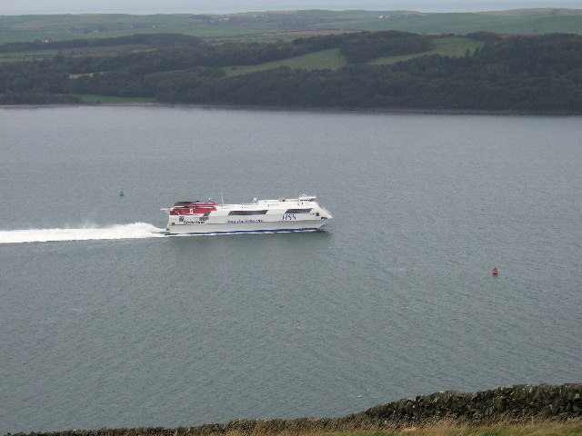
The Stena Voyager HSS on Loch Ryan The Stena Voyager High Speed Service (HSS) Ferry on Lochryan having left Stranraer to travel to Belfast.
The Stena Voyager HSS on Loch Ryan Credit: Colin McDonald

Barn Park Plantation is a picturesque woodland located in Wigtownshire, a historic county in southwestern Scotland. This sprawling forest spans approximately 200 acres and is renowned for its natural beauty and diverse range of plant and animal species.

The plantation is predominantly made up of deciduous trees, including oak, beech, and birch, which provide a stunning display of vibrant colors during the autumn months. These trees create a dense canopy that offers shade and shelter to the many wildlife species that call this woodland home.

Visitors to Barn Park Plantation are treated to a network of well-maintained walking trails that wind their way through the forest, allowing them to explore its hidden corners and discover its hidden treasures. Along the trails, you may encounter various woodland creatures such as red squirrels, roe deer, and a plethora of bird species including woodpeckers and owls.

In addition to its natural beauty, Barn Park Plantation also boasts a rich cultural heritage. The area has been used for timber production for centuries and remnants of old sawmills and charcoal pits can still be found within the woodland. These historical sites offer a glimpse into the area's past and provide an interesting backdrop for nature enthusiasts and history buffs alike.

Overall, Barn Park Plantation in Wigtownshire is a haven for nature lovers, offering breathtaking scenery, diverse wildlife, and a fascinating glimpse into the region's history. Whether you're seeking a peaceful walk in the woods or an opportunity to connect with nature, this woodland is sure to leave a lasting impression.

If you have any feedback on the listing, please let us know in the comments section below.

Barn Park Plantation Images

Images are sourced within 2km of 54.977867/-5.0787348 or Grid Reference NX0369. Thanks to Geograph Open Source API. All images are credited.

The Stena Voyager HSS on Loch Ryan The Stena Voyager High Speed Service (HSS) Ferry on Lochryan having left Stranraer to travel to Belfast.
The Stena Voyager HSS on Loch Ryan
The Stena Voyager High Speed Service (HSS) Ferry on Lochryan having left Stranraer to travel to Belfast.
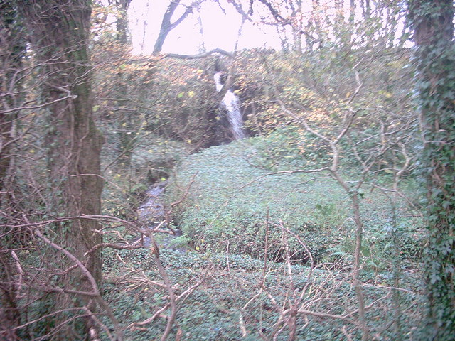
Corsewall Mill Waterfall This waterfall used to power the waterwheel at Corsewall Mill before it was demolished. It is just outside Kirkcolm.
Corsewall Mill Waterfall
This waterfall used to power the waterwheel at Corsewall Mill before it was demolished. It is just outside Kirkcolm.
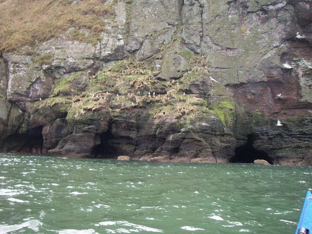
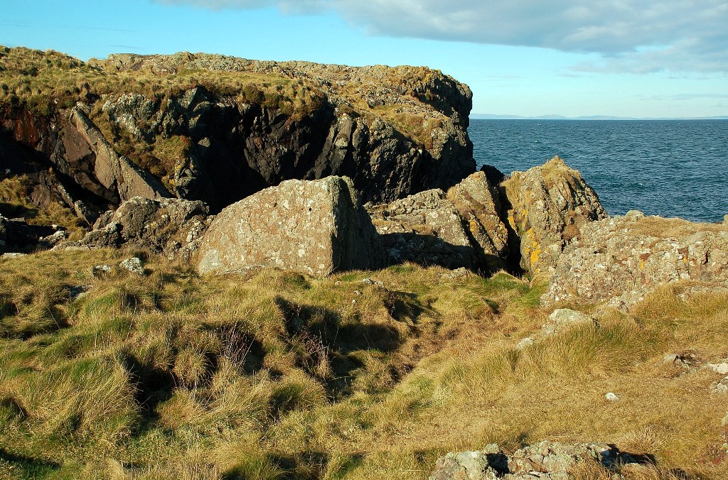
Sea Caves at the foot of Sea Cliff, Loch Ryan
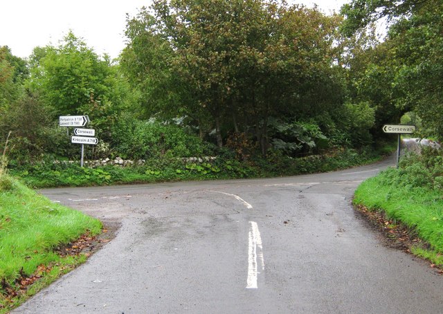
Road junction, near Kirkcolm The road to the right is the A718 to Kirkcolm and the one to the left is a minor one to Corsewall.  The view is taken from the B738.
Road junction, near Kirkcolm
The road to the right is the A718 to Kirkcolm and the one to the left is a minor one to Corsewall. The view is taken from the B738.
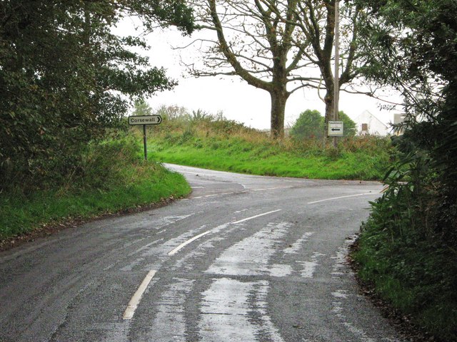
Junction of three roads Turn left for Portpatrick and right for Corsewall.
Junction of three roads
Turn left for Portpatrick and right for Corsewall.
Ruined house beside Loch Ryan
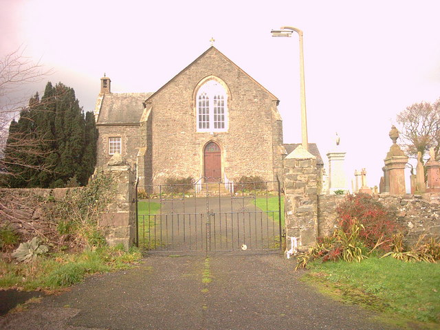
Kirkcolm Church Kirkcolm Church taken from the other side of Church Hill (the road in front of the church). In the grounds is the Kilmorie Cross which was carved in the 10th century.
Kirkcolm Church
Kirkcolm Church taken from the other side of Church Hill (the road in front of the church). In the grounds is the Kilmorie Cross which was carved in the 10th century.
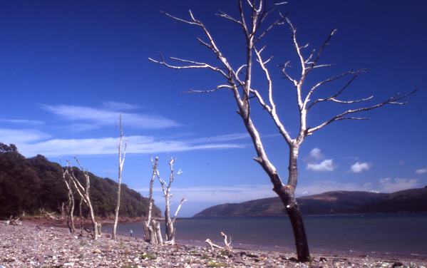
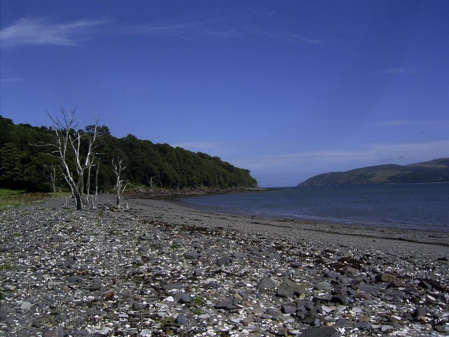
Shore of Loch Ryan Nr Kirkcolm These dead trees on the shore of Loch Ryan make a great photo opportunity. The beach is covered with large shells.
Shore of Loch Ryan Nr Kirkcolm
These dead trees on the shore of Loch Ryan make a great photo opportunity. The beach is covered with large shells.
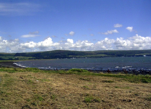
Loch Ryan Shore
Loch Ryan Shore
A P&O Ferry in Lochryan sailing to Larne and silhouetted against the setting sun. This photo was taken between Cairn Point and Old House Point, North of Cairnryan at sunset on 12th April 2007.
A P&O Ferry in Lochryan sailing to Larne and silhouetted against the setting sun.
This photo was taken between Cairn Point and Old House Point, North of Cairnryan at sunset on 12th April 2007.
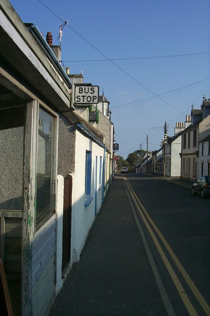
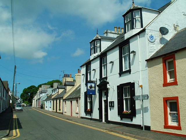
Kircolm Rush Hour Even the bus stop is so laid back it's screwed to the front of the house....
Kircolm Rush Hour
Even the bus stop is so laid back it's screwed to the front of the house....
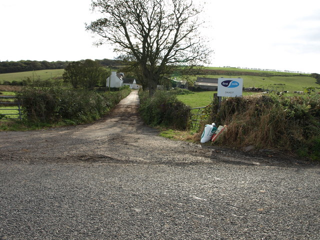
Dalkest Farm, The Rhins
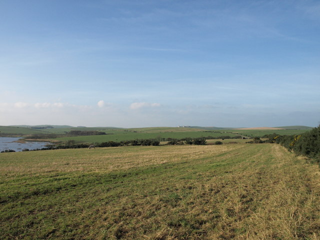
Loch Connell, The Rhins
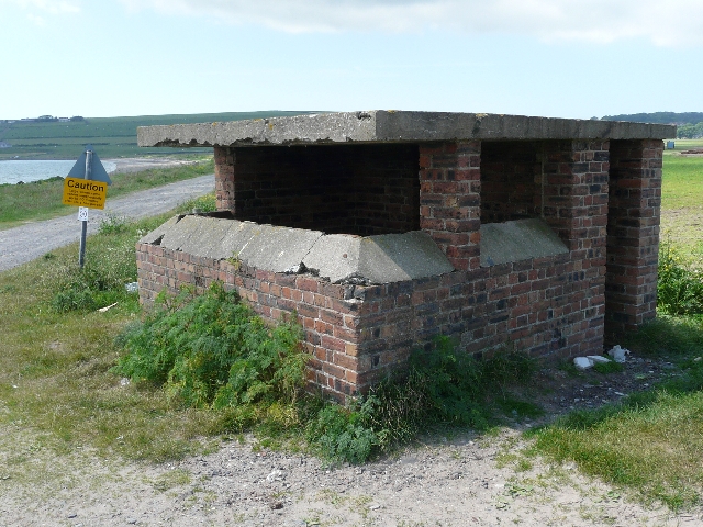
Observation Post Disused lookout on the shore of Loch Ryan, where seaplanes landed during World War II.
Observation Post
Disused lookout on the shore of Loch Ryan, where seaplanes landed during World War II.
Sandbanks in Loch Ryan Showing the wash from a ferry
Sandbanks in Loch Ryan
Showing the wash from a ferry
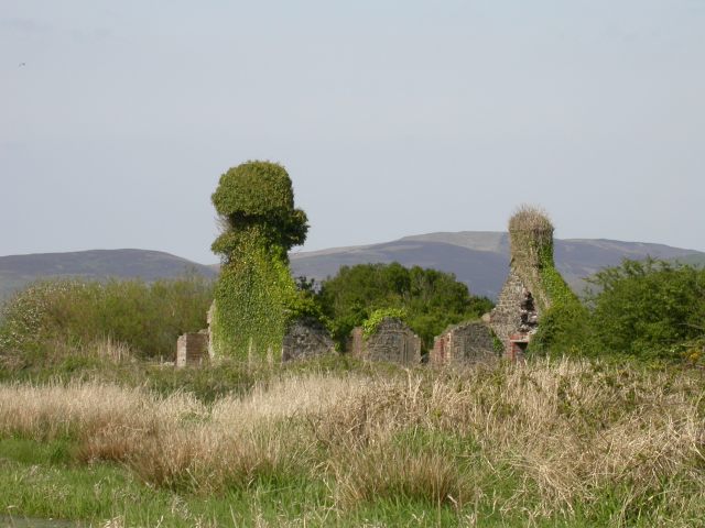
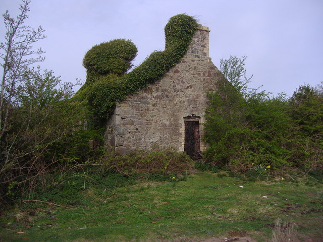
Ruined house on the shores of Loch Ryan This is a ruined house which stands at the end of a track leading from Kirkcolm to the shores of Loch Ryan.
Ruined house on the shores of Loch Ryan
This is a ruined house which stands at the end of a track leading from Kirkcolm to the shores of Loch Ryan.
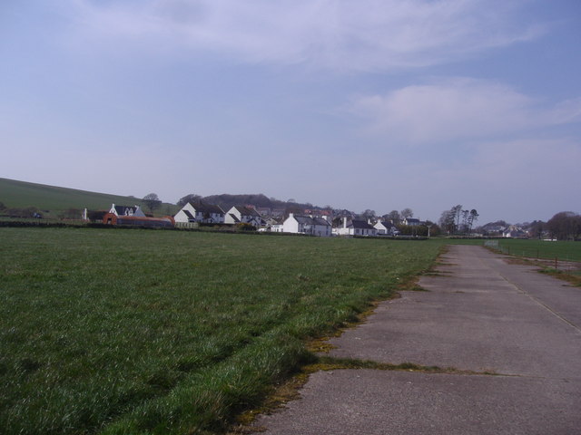
Village of Kirkcolm taken from the disused airfield This view of Kirkcolm shows the outskirts of the village. The view is looking north.
Village of Kirkcolm taken from the disused airfield
This view of Kirkcolm shows the outskirts of the village. The view is looking north.
Show me another place!

Barn Park Plantation is located at Grid Ref: NX0369 (Lat: 54.977867, Lng: -5.0787348)

Unitary Authority: Dumfries and Galloway

Police Authority: Dumfries and Galloway

What 3 Words

///bothered.glossed.looked. Near Cairnryan, Dumfries & Galloway

Related Wikis

Kirkcolm

Kirkcolm (Scots: Kirkcoam) is a village and civil parish on the northern tip of the Rhinns of Galloway peninsula, south-west Scotland. It is in Dumfries...

RAF Wig Bay

Royal Air Force Wig Bay, or more simply RAF Wig Bay, is a former Royal Air Force station near Stranraer, Dumfries and Galloway, Scotland The following...

Loch Ryan

Loch Ryan (Scottish Gaelic: Loch Rìoghaine, pronounced [l̪ˠɔx ˈrˠiː.ɛɲə]) is a Scottish sea loch that acts as an important natural harbour for shipping...

Cairnryan Harbour

Cairnryan Harbour is a roll-on ferry terminal on Loch Ryan in south west Scotland north of Stranraer. In World War II it was developed as an emergency...

Ervie

Ervie is a small village in Dumfries and Galloway, Scotland, in the Rhins of Galloway, just outside Stranraer.

Cairnryan

Cairnryan (Scots: The Cairn; Scottish Gaelic: Càrn Rìoghain or Machair an Sgithich) is a village in the historical county of Wigtownshire, Dumfries and...

Leswalt

Leswalt (Scottish Gaelic: Lios Uillt) is a village and civil parish in Dumfries and Galloway, south-west Scotland. It lies between Portpatrick and Stranraer...

Corsewall Point

Corsewall Point, or Corsill Point, is a headland on the northwest coast of Wigtownshire, Kirkcolm near Stranraer, Dumfries and Galloway, Scotland. A lighthouse...

Nearby Amenities

Located within 500m of 54.977867,-5.0787348
Bowls Club
Naptan AtcoCode: 680000284503
Naptan Bearing: N
Naptan BusStopType: CUS
Naptan CommonName: Bowls Club
Naptan Indicator: opp Club
Naptan Landmark: Bowls Club
Naptan NaptanCode: 34238569
Naptan Notes: None.
Naptan Street: A718
Naptan Verified: no
Source: naptan_import
Lat/Long: 54.9782929/-5.0846223
Bowls Club
Naptan AtcoCode: 680000284504
Naptan Bearing: S
Naptan BusStopType: CUS
Naptan CommonName: Bowls Club
Naptan Indicator: o/s Club
Naptan Landmark: Bowls Club
Naptan NaptanCode: 34238572
Naptan Notes: None
Naptan Street: A718
Naptan Verified: no
Source: naptan_import
Lat/Long: 54.9782981/-5.0844195
Clachan
Naptan AtcoCode: 680004027111
Naptan Bearing: N
Naptan BusStopType: CUS
Naptan CommonName: Clachan
Naptan Indicator: Opp Road End
Naptan NaptanCode: 34238783
Naptan Street: A718
Naptan Verified: no
Source: naptan_import
Lat/Long: 54.9800123/-5.0848949
Clachan
Naptan AtcoCode: 680004027222
Naptan Bearing: S
Naptan BusStopType: CUS
Naptan CommonName: Clachan
Naptan Indicator: Road End
Naptan NaptanCode: 34238784
Naptan Street: A718
Naptan Verified: no
Source: naptan_import
Lat/Long: 54.9800182/-5.0846609
Kirkcolm Village Shop
Shop: convenience
Lat/Long: 54.974141/-5.0813345
Power: pole
Lat/Long: 54.9785573/-5.0852403
Post Office
Kirkcolm Post Office
Addr City: Stranraer
Addr Country: GB
Addr Postcode: DG9 0NW
Addr Village: Kirkcolm
Brand: Post Office
Brand Wikidata: Q1783168
Check Date: 2022-05-27
Check Date Opening Hours: 2022‑05‑27
Contact Website: https://www.postoffice.co.uk/branch-finder/5794714/kirkcolm
Opening Hours: Tu 09:30-10:30
Operator: Kirkcolm Village Shop
Ref Pol Id: 146338
Lat/Long: 54.9741584/-5.0812945
Bus Stop
Kirkcolm
Bench: yes
Bin: yes
Bus: yes
Naptan AtcoCode: 680000284502
Naptan Bearing: NE
Naptan BusStopType: CUS
Naptan CommonName: Shelter
Naptan Indicator: at
Naptan NaptanCode: 34234783
Naptan Street: Main Street
Naptan Verified: no
Public Transport: platform
Shelter: yes
Tactile Paving: no
Lat/Long: 54.9746481/-5.0812523
Blue Peter Hotel
Addr City: Kirkcolm
Addr Housename: Blue Peter Hotel
Addr Housenumber: 23
Addr Postcode: DG9 0NL
Addr Street: Main Street
Fhrs Id: 849257
Phone: +44 1776 853221
Rooms: 3
Tourism: hotel
Website: https://bluepeterhotel.com/
Lat/Long: 54.9743846/-5.0808137
Kirkcolm Bowling Club
Addr City: Kirkcolm
Addr Street: Bowling Green And Pavilion
Club: sport
Contact Facebook: https://www.facebook.com/people/Kirkcolm-bowling-club/100069663862473/
Fhrs Id: 849255
Sport: bowls
Lat/Long: 54.9782307/-5.0838316
Corsewall Estate Garden Cottage
Addr City: Kirkcolm
Addr Housename: Garden Cottage
Addr Street: Corsewall Estate
Check Date: 2023-08-04
Email: enquiries@corsewallestate.com
Internet Access: wlan
Pets: yes
Phone: +44 7980 213339
Reservation: required
Rooms: 3
Tourism: apartment
Website: https://www.corsewallestate.com
Wheelchair: no
Lat/Long: 54.9768335/-5.0782616
Corsewall Estate Stables Cottage
Addr City: Kirkcolm
Addr Housename: Stables Cottage
Addr Street: Corsewall Estate
Check Date: 2023-08-04
Description: Upstairs apartment accessed via steep stairs.
Email: enquiries@corsewallestate.com
Internet Access: wlan
Pets: yes
Phone: +44 7980 213339
Reservation: required
Rooms: 2
Tourism: apartment
Website: https://www.corsewallestate.com
Wheelchair: no
Lat/Long: 54.9772803/-5.0788071
Post Box
Operator: Royal Mail
Post Box Mounting: pier
Post Box Type: lamp
Ref: DG9 26
Royal Cypher: scottish_crown
Lat/Long: 54.9740777/-5.0810809
The data included in this document is from www.openstreetmap.org. The data is made available under ODbL.

Have you been to Barn Park Plantation?

Leave your review of Barn Park Plantation below (or comments, questions and feedback).