Gurllus Grove

Wood, Forest in Monmouthshire

Wales

Gurllus Grove

Tintern Abbey: The car park The car park charges are high but are redeemable against any expenditure at the abbey.
Tintern Abbey: The car park Credit: Michael Garlick

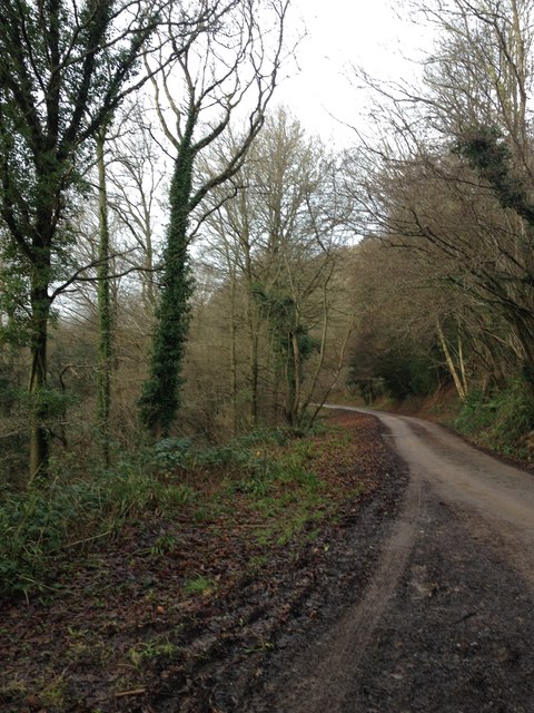
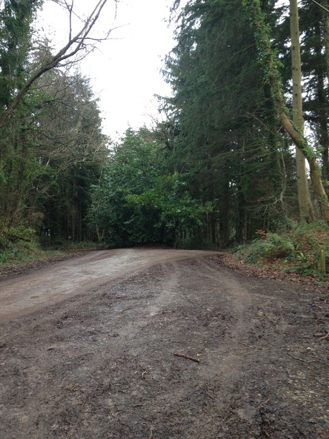
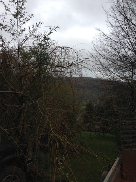
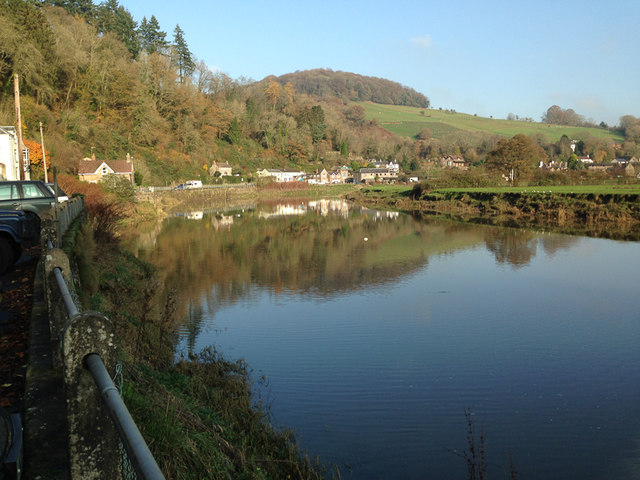
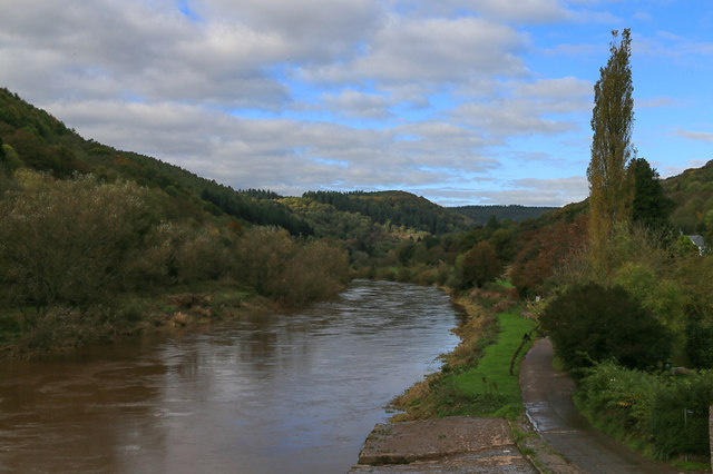
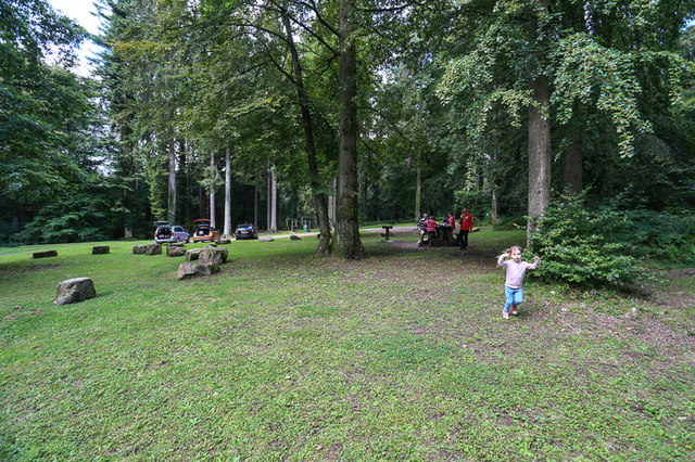
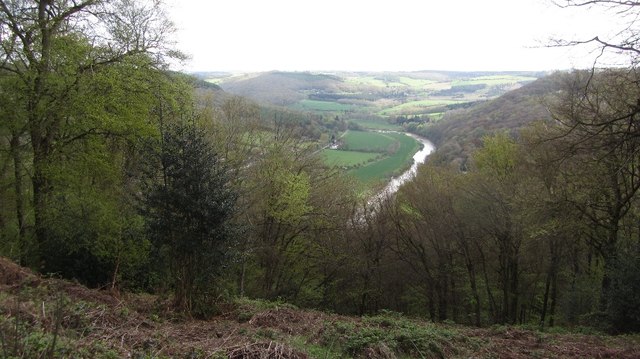
Gurllus Grove is a picturesque wood located in Monmouthshire, Wales. Spread across a vast area, this enchanting forest is known for its serene surroundings and rich biodiversity. It is a popular destination for nature enthusiasts, hikers, and those seeking a peaceful retreat.

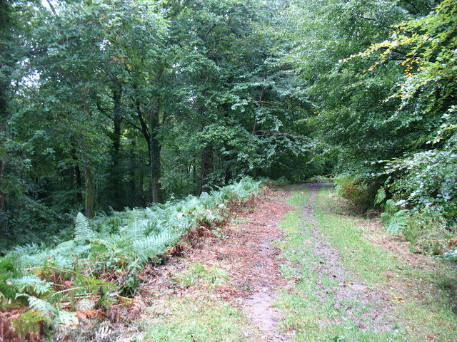
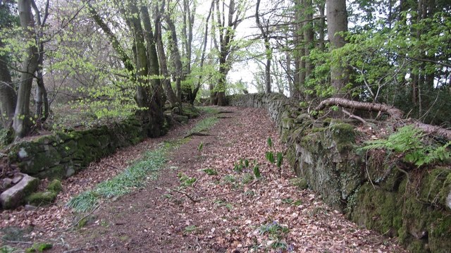
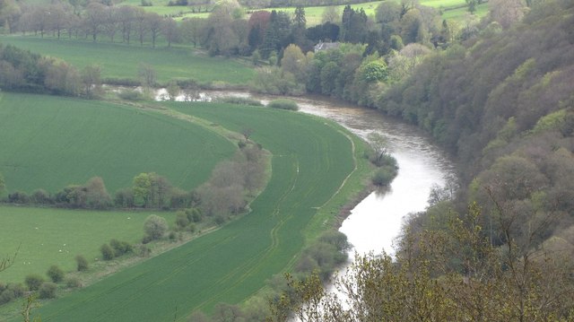
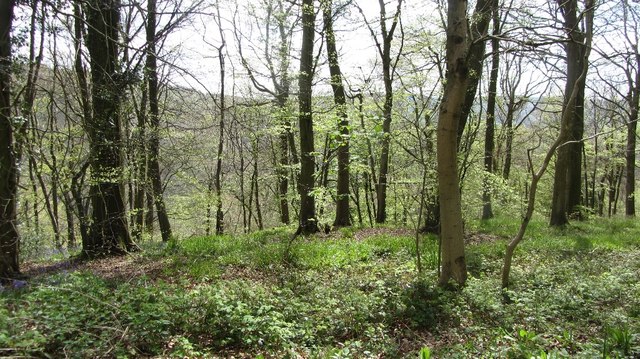
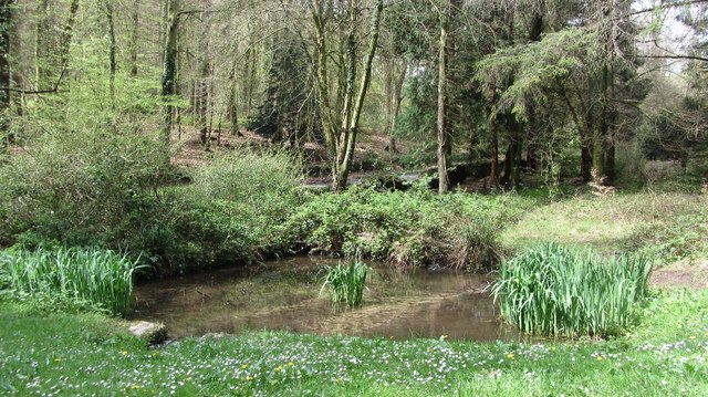
The grove is characterized by its dense canopy of towering trees, predominantly oak and beech, which provide shelter and create a cool, shady atmosphere. The forest floor is covered with a thick carpet of moss and ferns, adding to its magical ambiance. The tranquil stream that meanders through the grove adds to its charm, providing a soothing soundtrack for visitors.

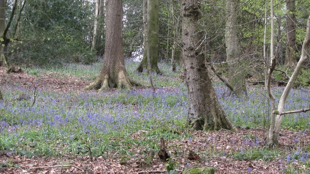
Gurllus Grove is home to a variety of wildlife, including deer, badgers, foxes, and numerous bird species. Birdwatchers will be delighted by the opportunity to spot woodpeckers, owls, and colorful songbirds within the forest's boundaries. The grove also hosts a diverse range of plant species, including bluebells, wild garlic, and wood sorrel, which create a stunning display of colors during the spring and summer months.

Visitors can explore the grove through a network of well-maintained walking trails, which offer various levels of difficulty to cater to different abilities and preferences. These trails provide ample opportunities to discover hidden treasures within the forest, including ancient ruins, hidden caves, and breathtaking viewpoints.

Overall, Gurllus Grove in Monmouthshire is a captivating wood that offers a truly immersive experience in nature. Its serene atmosphere, diverse flora and fauna, and well-designed trails make it a must-visit destination for anyone seeking solace in the natural world.

If you have any feedback on the listing, please let us know in the comments section below.

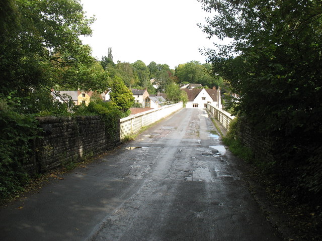
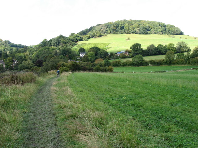
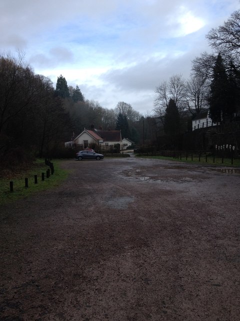
Gurllus Grove Images

Images are sourced within 2km of 51.71238/-2.6931948 or Grid Reference SO5201. Thanks to Geograph Open Source API. All images are credited.

Tintern Abbey: The car park The car park charges are high but are redeemable against any expenditure at the abbey.
Tintern Abbey: The car park
The car park charges are high but are redeemable against any expenditure at the abbey.
The Wye Valley Walk in Coed Beddick Descending towards Brockweir.
The Wye Valley Walk in Coed Beddick
Descending towards Brockweir.
Brockweir Bridge
Brockweir Bridge
Approaching Tintern on the Wye Valley Walk There is a vineyard on the side of the hill.
Approaching Tintern on the Wye Valley Walk
There is a vineyard on the side of the hill.
Lower Wireworks carpark, Tintern
Barbadoes Hill
Barbadoes Hill
Barbadoes Hill
Barbadoes Hill
View from Halewood Cottage, Barbadoes Hill
River Wye at Tintern Very similar to <a href="https://www.geograph.org.uk/photo/3792947">SO5200 : A466 at Tintern</a> but this photo shows the river scenery more than the roadside. Both photos are taken very close to the highly rated second-hand bookshop called Stella Books.
River Wye at Tintern
Very similar to SO5200 : A466 at Tintern but this photo shows the river scenery more than the roadside. Both photos are taken very close to the highly rated second-hand bookshop called Stella Books.
River Wye at Brockweir One year on from <a href="https://www.geograph.org.uk/photo/3090933">SO5301 : Part of the Wye at Brockweir</a>, the scene is very much the same.
River Wye at Brockweir
One year on from SO5301 : Part of the Wye at Brockweir, the scene is very much the same.
Picnic area in Bargain Wood, Llandogo This is the picnic area mentioned in <a href="https://www.geograph.org.uk/photo/494194">SO5202 : Whitestone amenity area</a> which in 2014 had a permanent BBQ. It is so "off-the-beaten-track" that one day in August, at the height of the holiday season, we were the only people there.
Picnic area in Bargain Wood, Llandogo
This is the picnic area mentioned in SO5202 : Whitestone amenity area which in 2014 had a permanent BBQ. It is so "off-the-beaten-track" that one day in August, at the height of the holiday season, we were the only people there.
A track into Buckle Wood
Old road, Cleddon The walls suggest that this was once a more important route than today's path.
Old road, Cleddon
The walls suggest that this was once a more important route than today's path.
A view down the Wye View from the plateau edge in Bargain Wood.
A view down the Wye
View from the plateau edge in Bargain Wood.
River Wye View down from Bargain Wood.
River Wye
View down from Bargain Wood.
Bluebells, Bargain Wood
Bargain Wood Near the steep slope down to the Wye.
Bargain Wood
Near the steep slope down to the Wye.
Pond, Bargain Wood Beside the car park.
Pond, Bargain Wood
Beside the car park.
Show me another place!

Gurllus Grove is located at Grid Ref: SO5201 (Lat: 51.71238, Lng: -2.6931948)

Unitary Authority: Monmouthshire

Police Authority: Gwent

What 3 Words

///soldiers.investor.invoices. Near Tintern, Monmouthshire

Related Wikis

Botany Bay, Monmouthshire

Botany Bay, Monmouthshire is an area in the Wye Valley in Wales, above the village of Tintern. It is the location of a Gwent Scouts camp site covering...

Sylvan House Barn

Sylvan House Barn (grid reference SO534023) is a 0.005-hectare (0.012-acre) stone built barn near the village of St Briavels, in the Forest of Dean, Gloucestershire...

Catbrook

Catbrook (Welsh: Catffrwd) is a village in Monmouthshire, south east Wales, United Kingdom. The population in 2011 was 412. == Location == Catbrook is...

Tintern Wireworks Branch

The Tintern Wireworks Branch was a short branch line on the Wye Valley Railway, crossing the River Wye between Monmouthshire, Wales, and Gloucestershire...

Nearby Amenities

Located within 500m of 51.71238,-2.6931948
Botany Bay
Place: locality
Source: os_opendata
Lat/Long: 51.7154837/-2.6929834
Give Way
Direction: forward
Lat/Long: 51.7145584/-2.6890205
Direction: SSW
Generator Method: photovoltaic
Generator Output Electricity: yes
Generator Solar Modules: 12
Generator Source: solar
Generator Type: solar_photovoltaic_panel
Location: roof
Power: generator
Lat/Long: 51.7114326/-2.6890929
The data included in this document is from www.openstreetmap.org. The data is made available under ODbL.

Have you been to Gurllus Grove?

Leave your review of Gurllus Grove below (or comments, questions and feedback).