Coed Beddick

Wood, Forest in Monmouthshire

Wales

Coed Beddick

Tourist at Tintern Abbey As I was wandering around and about the abbey taking photos this retired couple pulled their car onto the pavement and the wife climbed out and took a few digital photos of the ruins, the husband rummaged in a camera case in the boot and took a few photos with his digital SLR then he climbed back into the car and they went. Tintern done in maybe two minutes. "What is this life, if full of care, we have no time to stand and stare?"...
Tourist at Tintern Abbey Credit: Jeremy Bolwell

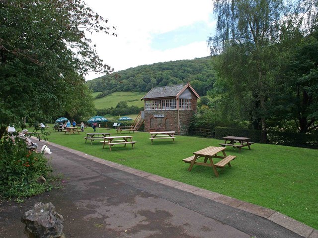
Coed Beddick, located in Monmouthshire, is a picturesque wood and forest area that offers visitors a serene and natural escape. Covering an area of approximately 100 hectares, it is a popular destination for nature lovers and outdoor enthusiasts.

The woodland of Coed Beddick is primarily composed of native broadleaf trees such as oak, beech, and ash, which provide a rich habitat for a variety of flora and fauna. The forest floor is covered with a lush carpet of ferns, bluebells, and other wildflowers, creating a vibrant and colorful landscape during the spring and summer months.

The wood is intersected by several footpaths and trails, allowing visitors to explore its beauty on foot. These paths meander through the dense woodland, offering glimpses of the surrounding countryside and providing opportunities for wildlife spotting. Birdwatchers will be delighted by the presence of various species, including woodpeckers, owls, and buzzards, while lucky visitors may even catch a glimpse of the elusive red squirrels that inhabit the area.

Coed Beddick also boasts a small stream that runs through the forest, adding to its tranquility and providing a peaceful soundtrack for those seeking relaxation. The stream is home to a range of aquatic life, including frogs, newts, and small fish.

Overall, Coed Beddick in Monmouthshire offers a haven of natural beauty and tranquility. Whether one seeks a peaceful walk, wildlife spotting, or simply a place to reconnect with nature, this wood and forest area provides a perfect setting for all these activities.

If you have any feedback on the listing, please let us know in the comments section below.

Coed Beddick Images

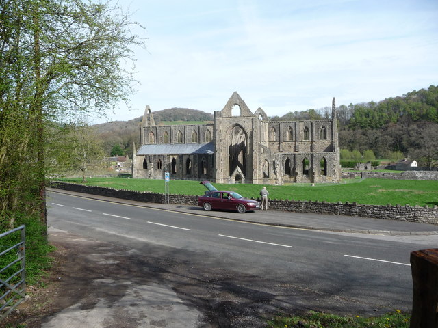
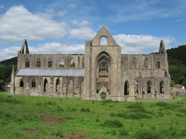
Images are sourced within 2km of 51.711905/-2.6837942 or Grid Reference SO5201. Thanks to Geograph Open Source API. All images are credited.

Tourist at Tintern Abbey As I was wandering around and about the abbey taking photos this retired couple pulled their car onto the pavement and the wife climbed out and took a few digital photos of the ruins, the husband rummaged in a camera case in the boot and took a few photos with his digital SLR then he climbed back into the car and they went. Tintern done in maybe two minutes. "What is this life, if full of care, we have no time to stand and stare?"...
Tourist at Tintern Abbey
As I was wandering around and about the abbey taking photos this retired couple pulled their car onto the pavement and the wife climbed out and took a few digital photos of the ruins, the husband rummaged in a camera case in the boot and took a few photos with his digital SLR then he climbed back into the car and they went. Tintern done in maybe two minutes. "What is this life, if full of care, we have no time to stand and stare?"...
Tintern - 1713 gravestone in St Mary's churchyard "Here lyeth the Body of Samuel ye son of William Mathews who departed this Life June ye 7th 1713 aged 9 Years ..."
Tintern - 1713 gravestone in St Mary's churchyard
"Here lyeth the Body of Samuel ye son of William Mathews who departed this Life June ye 7th 1713 aged 9 Years ..."
Tintern Abbey
Tintern Abbey
Tintern Abbey, east window
The Abbey Hotel at Tintern Commanding a fine view of the Abbey on the opposite side of the main road.
The Abbey Hotel at Tintern
Commanding a fine view of the Abbey on the opposite side of the main road.
Outhouses, Tintern Through a gap in the Abbey walls can be seen what appear to be farm buildings.  The route of the Wye can be made out behind them.
Outhouses, Tintern
Through a gap in the Abbey walls can be seen what appear to be farm buildings. The route of the Wye can be made out behind them.
Tintern Abbey from the Abbey Hotel Looking north across the A466 Wye Valley Road.
Tintern Abbey from the Abbey Hotel
Looking north across the A466 Wye Valley Road.
SW side of Tintern Abbey The ruins of Tintern Abbey, located on the south bank of the River Wye, are a Scheduled Monument and Grade I listed structure (listed as Abbey Church of St Mary (Tintern Abbey)).
See <a title="https://www.geograph.org.uk/photo/784120" href="https://www.geograph.org.uk/photo/784120">Link</a> for another view, a potted history, and a further link.
SW side of Tintern Abbey
The ruins of Tintern Abbey, located on the south bank of the River Wye, are a Scheduled Monument and Grade I listed structure (listed as Abbey Church of St Mary (Tintern Abbey)). See Link for another view, a potted history, and a further link.
Grade II* listed St Anne's House, Tintern St Anne's House, located in Chapel Lane, is set above the A466 about 100 metres west of the ruins of Tintern Abbey. <a title="https://www.geograph.org.uk/photo/3049455" href="https://www.geograph.org.uk/photo/3049455">Link</a> The house, which contains part of a 13th century chapel, was Grade II* listed in  August 1955.
There is an Edward VII postbox <a title="https://www.geograph.org.uk/photo/3049520" href="https://www.geograph.org.uk/photo/3049520">Link</a> set into the wall.
Grade II* listed St Anne's House, Tintern
St Anne's House, located in Chapel Lane, is set above the A466 about 100 metres west of the ruins of Tintern Abbey. Link The house, which contains part of a 13th century chapel, was Grade II* listed in August 1955. There is an Edward VII postbox Link set into the wall.
Edward VII postbox, Tintern Located at the A466 entrance to the Grade II* listed St Anne's House. <a title="https://www.geograph.org.uk/photo/3049510" href="https://www.geograph.org.uk/photo/3049510">Link</a>
The Edward VII monogram dates the postbox to 1901-1910.
Edward VII postbox, Tintern
Located at the A466 entrance to the Grade II* listed St Anne's House. Link The Edward VII monogram dates the postbox to 1901-1910.
The old trackbed of the Wye Valley Railway on the English bank Now a popular walking and cycle route. If a little muddy after the rainy summer.
The old trackbed of the Wye Valley Railway on the English bank
Now a popular walking and cycle route. If a little muddy after the rainy summer.
View through the east window Of Tintern Abbey.  Would have been a better picture on a better day
View through the east window
Of Tintern Abbey. Would have been a better picture on a better day
Tintern Abbey south transept From the corner of the nave and north transept.
Tintern Abbey south transept
From the corner of the nave and north transept.
The Abbey Hotel, Tintern Viewed across the A466, the main road through the village. The hotel is directly opposite the ruins of Tintern Abbey. This view was taken in November 2011. At the early August 2013 date of this submission, the hotel's website was showing "The Abbey Hotel Tintern is now closed until further notice."
The Abbey Hotel, Tintern
Viewed across the A466, the main road through the village. The hotel is directly opposite the ruins of Tintern Abbey. This view was taken in November 2011. At the early August 2013 date of this submission, the hotel's website was showing "The Abbey Hotel Tintern is now closed until further notice."
Entrance to The Abbey Hotel, Tintern Viewed across the A466, the main road through the village. The hotel is directly opposite the ruins of Tintern Abbey. This view was taken in November 2011. At the early August 2013 date of this submission, the hotel's website was showing "The Abbey Hotel Tintern is now closed until further notice."
Entrance to The Abbey Hotel, Tintern
Viewed across the A466, the main road through the village. The hotel is directly opposite the ruins of Tintern Abbey. This view was taken in November 2011. At the early August 2013 date of this submission, the hotel's website was showing "The Abbey Hotel Tintern is now closed until further notice."
Abbey Farm, Tintern The farm buildings are on the east side of the ruins of Tintern Abbey.
Abbey Farm, Tintern
The farm buildings are on the east side of the ruins of Tintern Abbey.
Tintern Abbey Cottage, Tintern Set back from the A466, opposite the ruins of Tintern Abbey, Tintern Abbey Cottage dates from the 18th century. It is now a modern holiday house.
Tintern Abbey Cottage, Tintern
Set back from the A466, opposite the ruins of Tintern Abbey, Tintern Abbey Cottage dates from the 18th century. It is now a modern holiday house.
Cows at Abbey Farm
Cows at Abbey Farm
Show me another place!

Coed Beddick is located at Grid Ref: SO5201 (Lat: 51.711905, Lng: -2.6837942)

Unitary Authority: Monmouthshire

Police Authority: Gwent

What 3 Words

///fittingly.tube.waltz. Near Tintern, Monmouthshire

Related Wikis

Botany Bay, Monmouthshire

Botany Bay, Monmouthshire is an area in the Wye Valley in Wales, above the village of Tintern. It is the location of a Gwent Scouts camp site covering...

Sylvan House Barn

Sylvan House Barn (grid reference SO534023) is a 0.005-hectare (0.012-acre) stone built barn near the village of St Briavels, in the Forest of Dean, Gloucestershire...

Brockweir Halt railway station

Brockweir Halt was a request stop on the former Wye Valley Railway. It was opened to the public on 19 August 1929. It closed in 1959 when passenger services...

Brockweir

Brockweir is a village in Hewelsfield and Brockweir civil parish, in the Forest of Dean District of Gloucestershire, England. The civil parish also includes...

Tintern railway station

Tintern railway station served the village of Tintern on the Wye Valley Railway. It was opened in 1876 and closed for passengers in 1959 and freight in...

Tintern Wireworks Branch

The Tintern Wireworks Branch was a short branch line on the Wye Valley Railway, crossing the River Wye between Monmouthshire, Wales, and Gloucestershire...

The Hudnalls

The Hudnalls (SO533030 & SO540042 & SO545046 ) is a 94.4-hectare (233-acre) biological Site of Special Scientific Interest in Gloucestershire, notified...

Shorn Cliff and Caswell Woods

Shorn Cliff And Caswell Woods (SO540005 & SO540990) is a 69.2-hectare (171-acre) biological Site of Special Scientific Interest in Gloucestershire, notified...

Nearby Amenities

Located within 500m of 51.711905,-2.6837942
Give Way
Direction: forward
Lat/Long: 51.7145584/-2.6890205
Direction: 95
Generator Method: photovoltaic
Generator Output Electricity: yes
Generator Solar Modules: 8
Generator Source: solar
Generator Type: solar_photovoltaic_panel
Location: roof
Power: generator
Lat/Long: 51.7084534/-2.6852265
Direction: 95
Generator Method: photovoltaic
Generator Output Electricity: yes
Generator Solar Modules: 8
Generator Source: solar
Generator Type: solar_photovoltaic_panel
Location: roof
Power: generator
Lat/Long: 51.7085415/-2.6852265
Direction: 85
Generator Method: photovoltaic
Generator Output Electricity: yes
Generator Solar Modules: 10
Generator Source: solar
Generator Type: solar_photovoltaic_panel
Location: roof
Power: generator
Lat/Long: 51.708706/-2.6848161
Direction: 85
Generator Method: photovoltaic
Generator Output Electricity: yes
Generator Solar Modules: 8
Generator Source: solar
Generator Type: solar_photovoltaic_panel
Location: roof
Power: generator
Lat/Long: 51.7086977/-2.6852185
Direction: 85
Generator Method: photovoltaic
Generator Output Electricity: yes
Generator Solar Modules: 10
Generator Source: solar
Generator Type: solar_photovoltaic_panel
Location: roof
Power: generator
Lat/Long: 51.7089287/-2.6852345
Direction: 85
Generator Method: photovoltaic
Generator Output Electricity: yes
Generator Solar Modules: 10
Generator Source: solar
Generator Type: solar_photovoltaic_panel
Location: roof
Power: generator
Lat/Long: 51.7092844/-2.6852614
Direction: 85
Generator Method: photovoltaic
Generator Output Electricity: yes
Generator Solar Modules: 10
Generator Source: solar
Generator Type: solar_photovoltaic_panel
Location: roof
Power: generator
Lat/Long: 51.7091781/-2.685248
Direction: 85
Generator Method: photovoltaic
Generator Output Electricity: yes
Generator Solar Modules: 10
Generator Source: solar
Generator Type: solar_photovoltaic_panel
Location: roof
Power: generator
Lat/Long: 51.7091864/-2.684859
Direction: 105
Generator Method: photovoltaic
Generator Output Electricity: yes
Generator Solar Modules: 10
Generator Source: solar
Generator Type: solar_photovoltaic_panel
Location: roof
Power: generator
Lat/Long: 51.7095071/-2.6848188
Direction: 95
Generator Method: photovoltaic
Generator Output Electricity: yes
Generator Solar Modules: 10
Generator Source: solar
Generator Type: solar_photovoltaic_panel
Location: roof
Power: generator
Lat/Long: 51.7094323/-2.6852828
Direction: 95
Generator Method: photovoltaic
Generator Output Electricity: yes
Generator Solar Modules: 10
Generator Source: solar
Generator Type: solar_photovoltaic_panel
Location: roof
Power: generator
Lat/Long: 51.7095154/-2.6852694
Direction: 95
Generator Method: photovoltaic
Generator Output Electricity: yes
Generator Solar Modules: 10
Generator Source: solar
Generator Type: solar_photovoltaic_panel
Location: roof
Power: generator
Lat/Long: 51.7096717/-2.6852453
Direction: 95
Generator Method: photovoltaic
Generator Output Electricity: yes
Generator Solar Modules: 10
Generator Source: solar
Generator Type: solar_photovoltaic_panel
Location: roof
Power: generator
Lat/Long: 51.7097531/-2.6852319
Direction: SSW
Generator Method: photovoltaic
Generator Output Electricity: yes
Generator Solar Modules: 12
Generator Source: solar
Generator Type: solar_photovoltaic_panel
Location: roof
Power: generator
Lat/Long: 51.7114326/-2.6890929
The data included in this document is from www.openstreetmap.org. The data is made available under ODbL.

Have you been to Coed Beddick?

Leave your review of Coed Beddick below (or comments, questions and feedback).