Wet Wood

Wood, Forest in Monmouthshire

Wales

Wet Wood

Part of the Wye Valley Walk in Limekiln Wood Here the underlying bedrock forms a series of steps.
Part of the Wye Valley Walk in Limekiln Wood Credit: Jeremy Bolwell

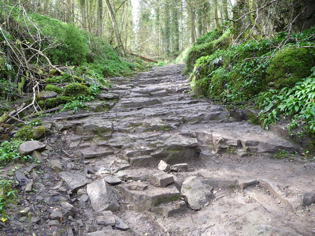
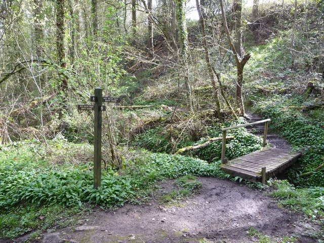
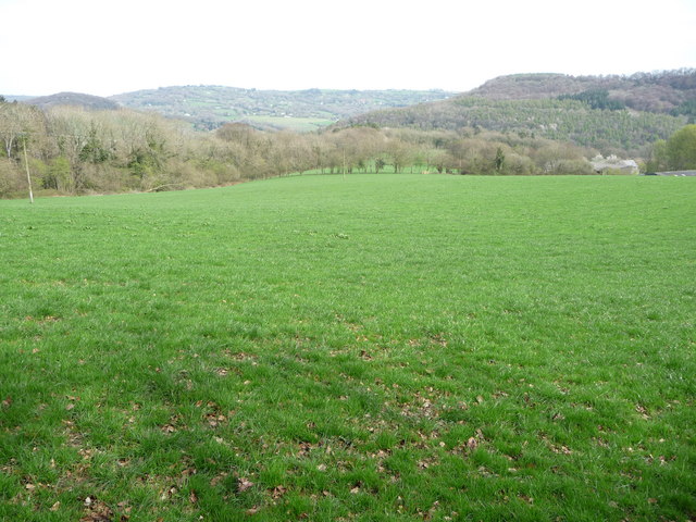
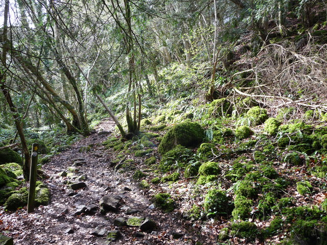
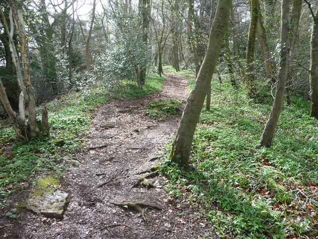
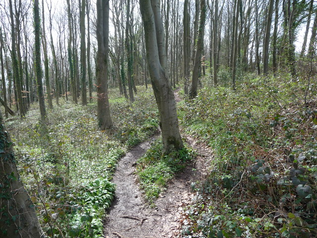
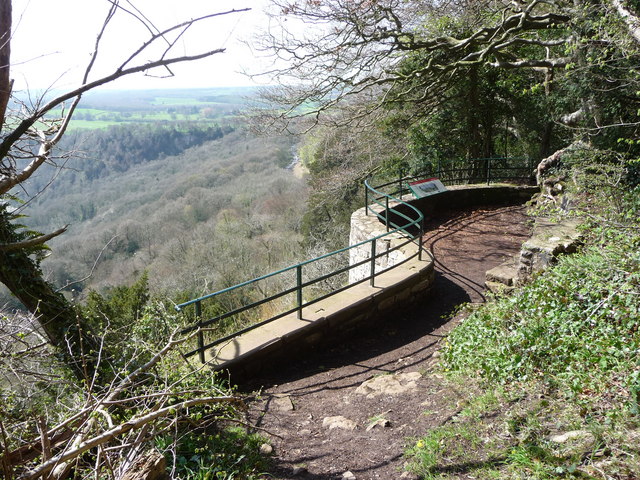
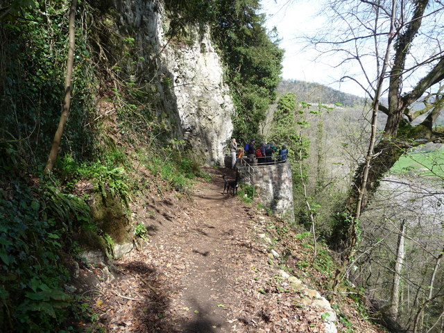
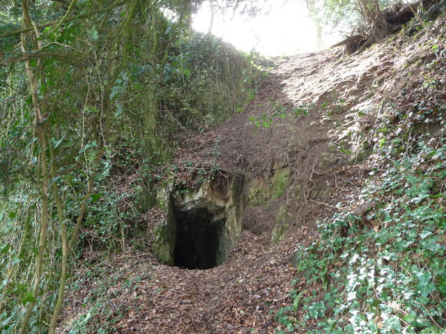
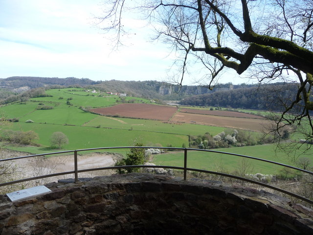
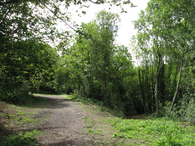
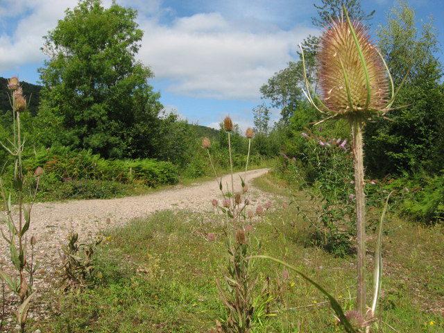
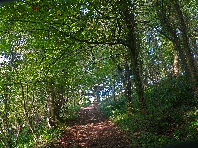
Wet Wood, located in Monmouthshire, is a dense forest known for its lush greenery, diverse wildlife, and serene ambiance. Spanning over a vast area, this woodland is a haven for nature lovers and outdoor enthusiasts alike.

The forest is aptly named due to its high moisture content, which results from the region's frequent rainfall and its proximity to the River Monnow. This damp environment creates the perfect conditions for a thriving ecosystem, with an abundance of mosses, ferns, and other moisture-loving plants covering the forest floor. The moist climate also allows for the growth of impressive trees, including oak, beech, and birch.

Beyond its impressive vegetation, Wet Wood is home to a wide array of wildlife. Birdwatchers can delight in the sight of various species, such as woodpeckers, owls, and thrushes, while lucky visitors may even catch a glimpse of the rare red kite soaring above the treetops. The forest's wetlands attract amphibians like frogs and newts, and its streams teem with fish, providing sustenance for the numerous otters that call this area home.

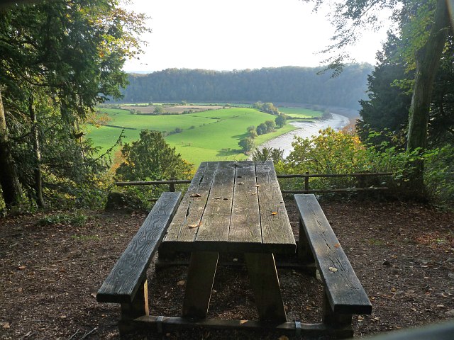
For those seeking outdoor activities, Wet Wood offers a network of well-maintained trails that wind through its enchanting landscapes. Hikers can explore the forest's hidden nooks and crannies, while cyclists can enjoy the challenging terrain of the surrounding hills. Additionally, the forest provides an idyllic setting for picnics, family outings, and even camping adventures, with designated areas offering facilities and amenities.

Overall, Wet Wood in Monmouthshire offers a captivating natural environment, brimming with biodiversity and opportunities for recreation. Whether one seeks solitude, wildlife encounters, or outdoor adventures, this forest is a must-visit destination for nature enthusiasts of all ages.

If you have any feedback on the listing, please let us know in the comments section below.

Wet Wood Images

Images are sourced within 2km of 51.674109/-2.6923065 or Grid Reference ST5297. Thanks to Geograph Open Source API. All images are credited.

Part of the Wye Valley Walk in Limekiln Wood Here the underlying bedrock forms a series of steps.
Part of the Wye Valley Walk in Limekiln Wood
Here the underlying bedrock forms a series of steps.
The Wye Valley Walk in Limekiln Wood Here the path turns south through beautiful woodland.
The Wye Valley Walk in Limekiln Wood
Here the path turns south through beautiful woodland.
On the Wye Valley Walk in April It's early April above the Lower Wye Valley and these woodlands and fields are just about to transform with Spring. To catch them in the moments before that happens is special.
On the Wye Valley Walk in April
It's early April above the Lower Wye Valley and these woodlands and fields are just about to transform with Spring. To catch them in the moments before that happens is special.
The Wye Valley Walk in Black Cliff Wood The Wye Valley Walk here ascends an Iron Age hillfort on the northern edge of Black Cliff wood. Mossy boulders lie in jumbles and slanting saplings compete for sunlight. The wood is humid and clammy, the steep path muddy and slippery. It is easy to imagine the Silures shock at the coming of the Romans to this area and how things would never be the same again.
The Wye Valley Walk in Black Cliff Wood
The Wye Valley Walk here ascends an Iron Age hillfort on the northern edge of Black Cliff wood. Mossy boulders lie in jumbles and slanting saplings compete for sunlight. The wood is humid and clammy, the steep path muddy and slippery. It is easy to imagine the Silures shock at the coming of the Romans to this area and how things would never be the same again.
The Wye Valley Walk in Black Cliff Wood in April After the hillfort summit the walk levels out and you walk through woodland on a twisting path that almost seems to good to be true.
The Wye Valley Walk in Black Cliff Wood in April
After the hillfort summit the walk levels out and you walk through woodland on a twisting path that almost seems to good to be true.
Part of the Wye Valley Walk in Wyndcliff wood If there is one criticism of the WVW in this section it is that you don't get to see much of the River Wye, but, you do get to see varied woodlands, and an  appreciation of the valley's history, geology, ecology and industrial heritage.
Part of the Wye Valley Walk in Wyndcliff wood
If there is one criticism of the WVW in this section it is that you don't get to see much of the River Wye, but, you do get to see varied woodlands, and an appreciation of the valley's history, geology, ecology and industrial heritage.
The Eagle's Nest viewpoint on the Wynd Cliff The information board fitted by the Forestry Commission tells of how this viewpoint got its name and what can be viewed. A beautiful spot that I never tire of revisiting.
The Eagle's Nest viewpoint on the Wynd Cliff
The information board fitted by the Forestry Commission tells of how this viewpoint got its name and what can be viewed. A beautiful spot that I never tire of revisiting.
The Lancaut peninsula from the Eagle's Nest The huge curve in the Wye is a well-known view with Chepstow and the Severn Bridges beyond.
The Lancaut peninsula from the Eagle's Nest
The huge curve in the Wye is a well-known view with Chepstow and the Severn Bridges beyond.
The Eagle's Nest An excellent spot for a rest, a brew and some lunch.
The Eagle's Nest
An excellent spot for a rest, a brew and some lunch.
A group of walkers at the Giant's Cave in the Wye Valley This group of retired walkers were enjoying the viewing platform just outside the Giant's Cave as I approached and was spotted by their little dog. They were a mix of local and not so local fellers who were enjoying their firm friendships, relaxed banter, outdoor exercise and the good weather. Not a bad way to spend some of your retirement.
A group of walkers at the Giant's Cave in the Wye Valley
This group of retired walkers were enjoying the viewing platform just outside the Giant's Cave as I approached and was spotted by their little dog. They were a mix of local and not so local fellers who were enjoying their firm friendships, relaxed banter, outdoor exercise and the good weather. Not a bad way to spend some of your retirement.
The northern entrance to the Giant's Cave on the Wye Valley Walk Yes, you are expected to enter or exit through this aperture. It's easier and more fun than it looks. One of many interesting features on this section of the WVW.
The northern entrance to the Giant's Cave on the Wye Valley Walk
Yes, you are expected to enter or exit through this aperture. It's easier and more fun than it looks. One of many interesting features on this section of the WVW.
View from the Giant's Cave viewing platform The view across the graceful curve of the River Wye onto the Lancaut peninsula and above that up to Wintour's Leap and the great cliffs near Woodcroft.
View from the Giant's Cave viewing platform
The view across the graceful curve of the River Wye onto the Lancaut peninsula and above that up to Wintour's Leap and the great cliffs near Woodcroft.
General view, Chepstow Racecourse
Path along course of Wye Valley Railway near Tintern The railway line carried on straight ahead at this point, through the trees. Walkers now have a choice and can drop down right, or go up to the left.
Path along course of Wye Valley Railway near Tintern
The railway line carried on straight ahead at this point, through the trees. Walkers now have a choice and can drop down right, or go up to the left.
Path junction in woods near River Wye
A picnic table with a view Looking from Lower Wyndcliff Wood across the Wye Valley.
A picnic table with a view
Looking from Lower Wyndcliff Wood across the Wye Valley.
Wye Valley Walk The path from the Upper Wyndcliff car park to the Eagles Nest viewpoint.
Wye Valley Walk
The path from the Upper Wyndcliff car park to the Eagles Nest viewpoint.
The Piercefield, St Arvans viewed from the south Owned by S.A. Brain & Company,the Piercefield is a country pub with dining in the village of St Arvans north of Chepstow. Viewed across the A466.
<a title="https://www.geograph.org.uk/photo/2710488" href="https://www.geograph.org.uk/photo/2710488">Link</a> to a view from another angle.
The Piercefield, St Arvans viewed from the south
Owned by S.A. Brain & Company,the Piercefield is a country pub with dining in the village of St Arvans north of Chepstow. Viewed across the A466. Link to a view from another angle.
Show me another place!

Wet Wood is located at Grid Ref: ST5297 (Lat: 51.674109, Lng: -2.6923065)

Unitary Authority: Monmouthshire

Police Authority: Gwent

What 3 Words

///scrum.teaches.inventors. Near Tintern, Monmouthshire

Related Wikis

Wyndcliffe Court

Wyndcliffe Court, 0.5 miles (0.80 km) north of the village of St. Arvans, Monmouthshire, Wales, is a Grade II* listed country house and gardens in the...

Wyndcliff

The Wyndcliff or Wynd Cliff (historically sometimes spelt Wyndcliffe) is a steep limestone cliff rising above the western bank of the River Wye in Monmouthshire...

St. Arvans

St. Arvans (Welsh: Sain Arfan or Llanarfan) is a village and community (equivalent to a parish) in Monmouthshire, south-east Wales. It is located two miles...

Penterry

Penterry (Welsh: Penteri) is a small rural parish of 479 acres (1.94 km2) in Monmouthshire, Wales. It is located between the villages of St. Arvans and...
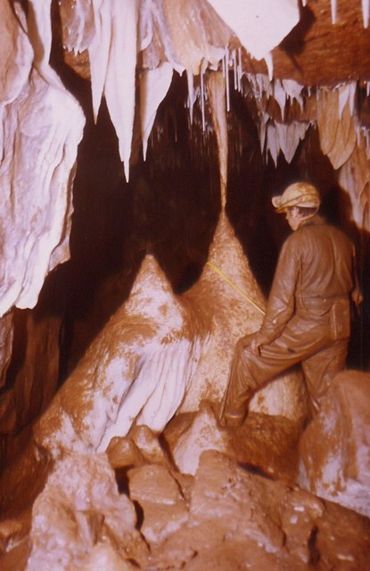
Otter Hole

Otter Hole is perhaps one of the best decorated caves in Britain. Located on the Wales–England border just north of Chepstow, the cave runs from the banks...

Lancaut

Lancaut (Welsh: Llan Cewydd) is a deserted village and former civil parish, now in the parish of Tidenham, in the Forest of Dean district, in Gloucestershire...

Green Gathering

The Green Gathering, formerly known as the Big Green Gathering is a festival with an environmental and social justice focus, including workshops and talks...

Piercefield House

Piercefield House is a largely ruined neo-classical country house near St Arvans, Monmouthshire, Wales, about 1.5 miles (2.4 km) north of the centre of...

Nearby Amenities

Located within 500m of 51.674109,-2.6923065
Power: pole
Lat/Long: 51.6782228/-2.691692
Power: pole
Lat/Long: 51.6777197/-2.6925248
Power: pole
Lat/Long: 51.6771242/-2.6938042
Power: pole
Lat/Long: 51.676592/-2.6949307
Power: pole
Lat/Long: 51.6759367/-2.6963013
Power: pole
Lat/Long: 51.6760182/-2.6974386
Power: pole
Lat/Long: 51.6760897/-2.6984122
Direction: 175
Generator Method: photovoltaic
Generator Output Electricity: yes
Generator Solar Modules: 4
Generator Source: solar
Generator Type: solar_photovoltaic_panel
Location: roof
Power: generator
Lat/Long: 51.6759704/-2.695545
Direction: 175
Generator Method: photovoltaic
Generator Output Electricity: yes
Generator Solar Modules: 5
Generator Source: solar
Generator Type: solar_photovoltaic_panel
Location: roof
Power: generator
Lat/Long: 51.6759716/-2.6954689
Direction: S
Generator Method: photovoltaic
Generator Output Electricity: yes
Generator Solar Modules: 10
Generator Source: solar
Generator Type: solar_photovoltaic_panel
Location: roof
Power: generator
Lat/Long: 51.676123/-2.6956093
Noexit: yes
Lat/Long: 51.6717526/-2.6896965
Bench
Lat/Long: 51.6717541/-2.689744
Direction: 130
Tourism: viewpoint
Lat/Long: 51.6717459/-2.6896594
Barrier: height_restrictor
Maxheight: 6'9"
Lat/Long: 51.672126/-2.6899808
The data included in this document is from www.openstreetmap.org. The data is made available under ODbL.

Have you been to Wet Wood?

Leave your review of Wet Wood below (or comments, questions and feedback).