Mount Wood

Wood, Forest in Flintshire

Wales

Mount Wood

The Kings Head Inn, Bwlchgwyn Standing on the crossroads of Ruthin Road, Fronheulog Hill and Brymbo Road. The last remaining open pub in Bwlchgwyn.
The Kings Head Inn, Bwlchgwyn Credit: Eirian Evans

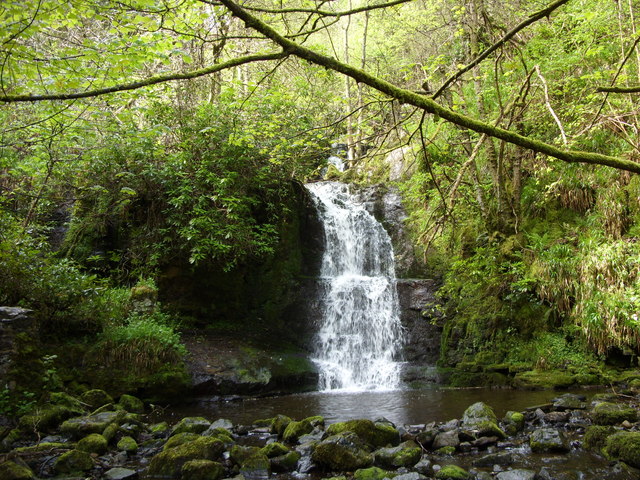
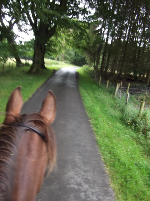
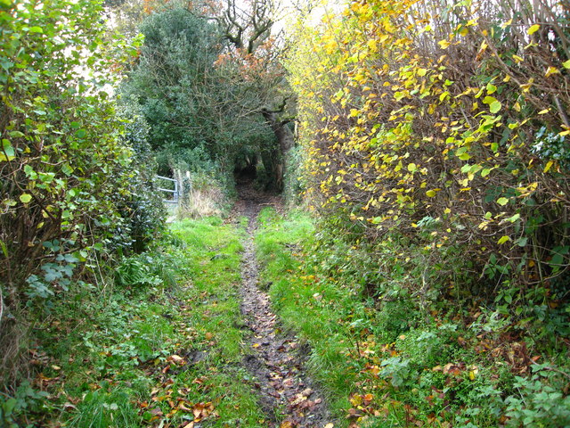
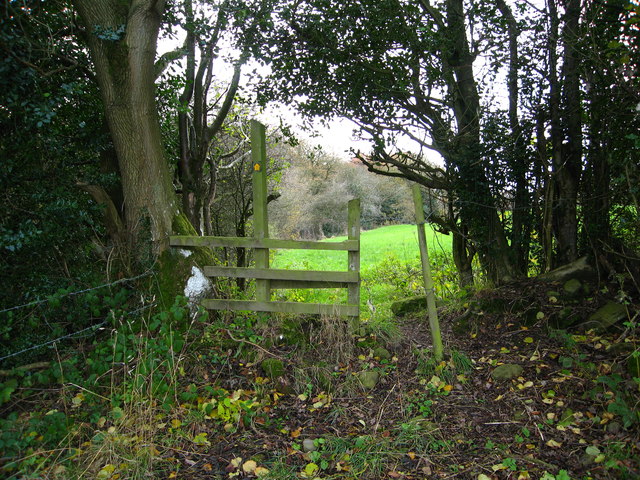
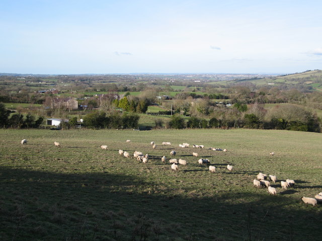
Mount Wood is a prominent natural landmark located in Flintshire, Wales. Situated near the town of Mold, this picturesque forested area covers over 200 acres of land and offers stunning views of the surrounding countryside. The wood is home to a diverse range of tree species, including oak, beech, and pine, creating a rich and vibrant ecosystem that supports a variety of wildlife.

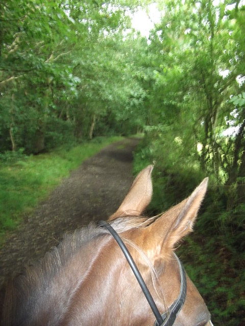
Visitors to Mount Wood can enjoy a network of walking trails that wind through the forest, providing opportunities for hiking, birdwatching, and nature photography. The area is also popular with mountain bikers, who can explore the challenging terrain and exhilarating downhill tracks.

In addition to its recreational opportunities, Mount Wood has historical significance as well. The site was once part of the estate of the nearby Soughton Hall, a grand manor house that dates back to the 18th century. Today, the wood is managed by the local council and is open to the public year-round.

Overall, Mount Wood offers a peaceful and tranquil escape from the hustle and bustle of daily life, making it a popular destination for outdoor enthusiasts and nature lovers alike.

If you have any feedback on the listing, please let us know in the comments section below.

Mount Wood Images

Images are sourced within 2km of 53.086698/-3.1062248 or Grid Reference SJ2654. Thanks to Geograph Open Source API. All images are credited.

The Kings Head Inn, Bwlchgwyn Standing on the crossroads of Ruthin Road, Fronheulog Hill and Brymbo Road. The last remaining open pub in Bwlchgwyn.
The Kings Head Inn, Bwlchgwyn
Standing on the crossroads of Ruthin Road, Fronheulog Hill and Brymbo Road. The last remaining open pub in Bwlchgwyn.
Christ Church, Bwlchgwyn Christ Church was consecrated on 1 October 1879. Originally built as a school in 1867, an application was made between 1876 and 1879 to the Church Authorities , for a grant towards the conversion of the building from a school to a church.
Christ Church, Bwlchgwyn
Christ Church was consecrated on 1 October 1879. Originally built as a school in 1867, an application was made between 1876 and 1879 to the Church Authorities , for a grant towards the conversion of the building from a school to a church.
The Old Police Station, Bwlchgwyn
Capel Nebo, Bwlchgwyn Now converted into a house, this chapel was built in 1852 for the Independents.
Capel Nebo, Bwlchgwyn
Now converted into a house, this chapel was built in 1852 for the Independents.
Westminster Arms, Bwlchgwyn This is another pub which is no longer in business.
Westminster Arms, Bwlchgwyn
This is another pub which is no longer in business.
Concrete structure, Nant y Ffrith This large concrete base is next to the footbridge and has the rough-cast concrete look of a 1930s or 40s industrial building. What was its purpose? Mining? There are mounting bolts and nearby coils of old wire rope. There is a mine level near.
Concrete structure, Nant y Ffrith
This large concrete base is next to the footbridge and has the rough-cast concrete look of a 1930s or 40s industrial building. What was its purpose? Mining? There are mounting bolts and nearby coils of old wire rope. There is a mine level near.
Waterfall, Nant y Ffrith
Leafy bridleway From the Old Smithy near Llanfynydd Flintshire. It's a really nice path.
Leafy bridleway
From the Old Smithy near Llanfynydd Flintshire. It's a really nice path.
Lane going towards Wern Ganol A really quiet lane continuing off the bridleway from The Smithy near Llanfynydd. A pleasant ride with a switched on horse! - ears pricked!
Lane going towards Wern Ganol
A really quiet lane continuing off the bridleway from The Smithy near Llanfynydd. A pleasant ride with a switched on horse! - ears pricked!
Bridleway near Glascoed Hall Heading to Glascoed Road from Ffrith
Bridleway near Glascoed Hall
Heading to Glascoed Road from Ffrith
Stile between grazing fields Beside a woodland strip, on a footpath between Glascoed Road and Cefn Road
Stile between grazing fields
Beside a woodland strip, on a footpath between Glascoed Road and Cefn Road
Mini waterfall on the River Cegidog As it passes through a steep mixed woodland valley
Mini waterfall on the River Cegidog
As it passes through a steep mixed woodland valley
Agricultural building near Cae-rheinallt Farm It is predominantly grazing land in the surrounding area
Agricultural building near Cae-rheinallt Farm
It is predominantly grazing land in the surrounding area
Sheep crossing field towards Cae-rheinallt isaf
Abandoned agricultural roller in field of swedes
Boardwalk over stream heading for footbridge On a footpath near Cae-rheinallt isaf
Boardwalk over stream heading for footbridge
On a footpath near Cae-rheinallt isaf
Group of houses on Rhodfa Glascoed (Glascoed Road) Three well maintained properties, the first one on the left is called Holly Cottage.
Group of houses on Rhodfa Glascoed (Glascoed Road)
Three well maintained properties, the first one on the left is called Holly Cottage.
Closed quarry on the edge of Coed Mawr This worked out Quarry seems to be used by dirt tracking motorbikes.
Closed quarry on the edge of Coed Mawr
This worked out Quarry seems to be used by dirt tracking motorbikes.
Show me another place!

Mount Wood is located at Grid Ref: SJ2654 (Lat: 53.086698, Lng: -3.1062248)

Unitary Authority: Flintshire

Police Authority: North Wales

What 3 Words

///imparts.tailors.deodorant. Near Treuddyn, Flintshire

Related Wikis

North East Wales

North East Wales (Welsh: Gogledd-Ddwyrain Cymru) is an area or region of Wales, commonly defined as a grouping of the principal areas of Denbighshire,...

North East Wales National Park

A national park has been proposed to replace the Clwydian Range and Dee Valley AONB in the north-east of Wales. Proposals for the then Clwydian Range AONB...

Bwlchgwyn

Bwlchgwyn (Welsh: Bwlch-gwyn) is a village in Wrexham County Borough, Wales, on the A525 road, 5 miles (8 km) west of the city of Wrexham and 10 miles...

Gwynfryn, Wrexham

Gwynfryn is a hill-top village in the community of Minera in Wrexham County Borough, Wales. Its name, originally that of the village chapel, is formed...

Nearby Amenities

Located within 500m of 53.086698,-3.1062248
Power: tower
Lat/Long: 53.0830298/-3.1046005
Power: tower
Lat/Long: 53.0853215/-3.1078203
Power: tower
Lat/Long: 53.0880853/-3.1117208
Minera New Mine Adit Level
Direction: 210
Man Made: adit
Lat/Long: 53.087696/-3.0995817
The data included in this document is from www.openstreetmap.org. The data is made available under ODbL.

Have you been to Mount Wood?

Leave your review of Mount Wood below (or comments, questions and feedback).