Hen-feddau Wood
Wood, Forest in Cardiganshire
Wales
Hen-feddau Wood
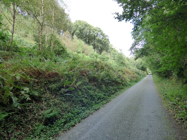
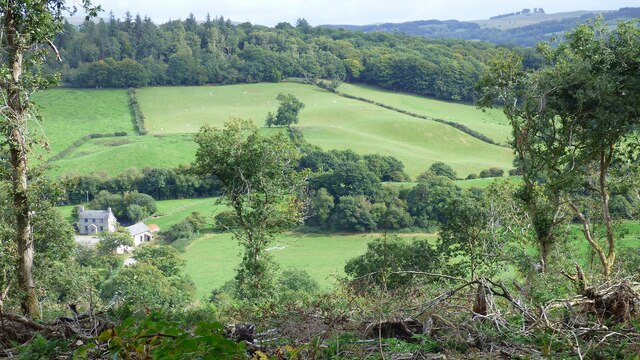
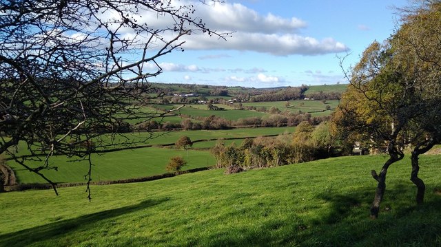
Hen-feddau Wood is a charming woodland located in the county of Cardiganshire, Wales. Spanning across an area of approximately 100 hectares, this ancient forest is a haven for nature enthusiasts and those seeking tranquility amidst the beautiful Welsh countryside.
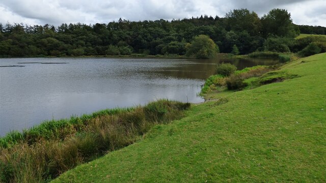
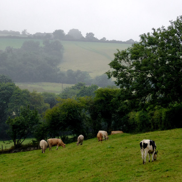
The woodland is characterized by its diverse range of tree species, including oak, birch, beech, and rowan. These trees provide a dense canopy, creating a cool and shaded environment even during the warm summer months. The forest floor is adorned with a carpet of bluebells and wildflowers, adding to the enchanting atmosphere.
Hen-feddau Wood is home to a variety of wildlife, making it an ideal spot for birdwatching and animal spotting. Visitors may catch a glimpse of red kites soaring overhead, or spot elusive woodland creatures such as badgers, foxes, and squirrels. The forest also provides a habitat for a variety of bird species, including woodpeckers and nuthatches.
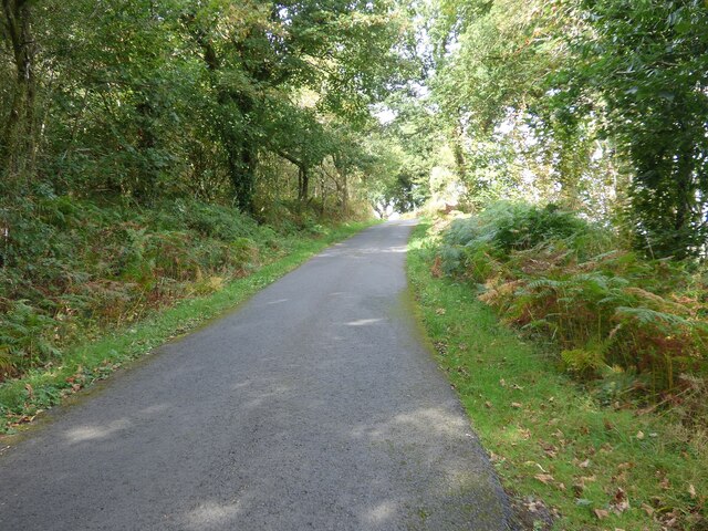
The woodland offers a network of well-maintained footpaths, allowing visitors to explore its natural beauty at their own pace. These paths meander through the forest, leading to picturesque viewpoints and hidden clearings. The peaceful ambience of Hen-feddau Wood makes it a popular spot for leisurely walks, picnics, and family outings.
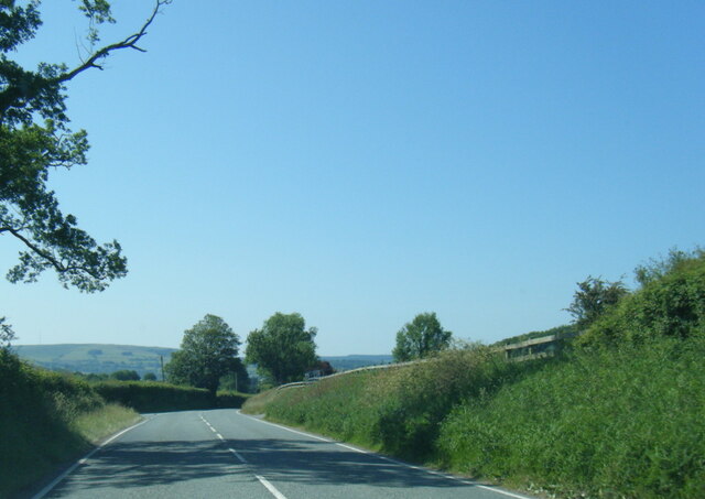
Located in the heart of Cardiganshire, Hen-feddau Wood is easily accessible by car and public transport. The forest is open to the public year-round, with no entrance fees. Visitors are advised to bring sturdy footwear and to respect the natural environment by taking their rubbish with them.
Overall, Hen-feddau Wood offers a captivating escape into nature, providing a serene and picturesque retreat for visitors of all ages.
If you have any feedback on the listing, please let us know in the comments section below.
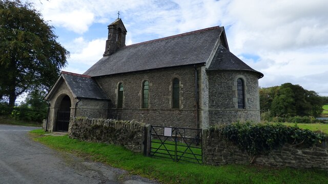
Hen-feddau Wood Images
Images are sourced within 2km of 52.128041/-4.0956474 or Grid Reference SN5649. Thanks to Geograph Open Source API. All images are credited.
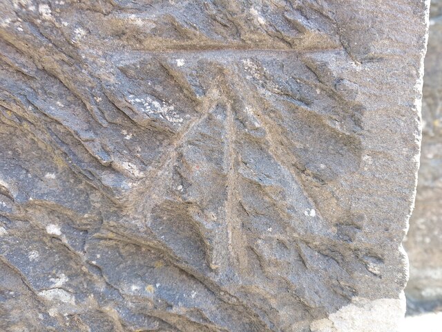
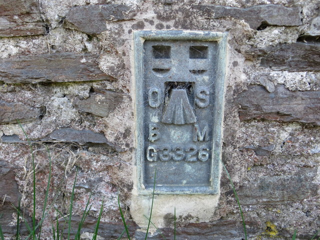
![OSBM Flush Bracket S0451 - Lampeter Town Hall Ordnance Survey Benchmark (OSBM) used for levelling height above Ordnance Datum (OD).
Height (1955): 121.2122m OD (Newlyn). Mark verified by the Ordnance Survey in 1971. Description: FB S0451 E FACE TOWN HALL. 0.9m above ground. 1st Order BM. (Listed as a cut mark in the current OS database)
The bracket was used on the Lampeter to Llandovery secondary line of the Second Geodetic Levelling of England &amp; Wales in 1942. It was levelled with a height of 397.758&#039; above OD (Newlyn). Description: Flush Bracket on SE angle of Town Hall. Abstract A 491: <span class="nowrap"><a title="http://discovery.nationalarchives.gov.uk/details/r/C11178833" rel="nofollow ugc noopener" href="http://discovery.nationalarchives.gov.uk/details/r/C11178833">Link</a><img style="margin-left:2px;" alt="External link" title="External link - shift click to open in new window" src="https://s1.geograph.org.uk/img/external.png" width="10" height="10"/></span> [OS 54/154]
The bracket was used on the Lampeter to Llandovery line (G098) of the Third Geodetic Levelling of England &amp; Wales in 1955. It was levelled with a height of 397.740&#039; above OD (Newlyn). Abstract G 65: <span class="nowrap"><a title="http://discovery.nationalarchives.gov.uk/SearchUI/details?Uri=C11264473" rel="nofollow ugc noopener" href="http://discovery.nationalarchives.gov.uk/SearchUI/details?Uri=C11264473">Link</a><img style="margin-left:2px;" alt="External link" title="External link - shift click to open in new window" src="https://s1.geograph.org.uk/img/external.png" width="10" height="10"/></span> [OS 54/754]
Context: <a href="https://www.geograph.org.uk/photo/7518122">SN5748 : OSBM Flush Bracket S0451 - Lampeter Town Hall</a>](https://s2.geograph.org.uk/geophotos/07/51/81/7518118_ad2f01b7.jpg)
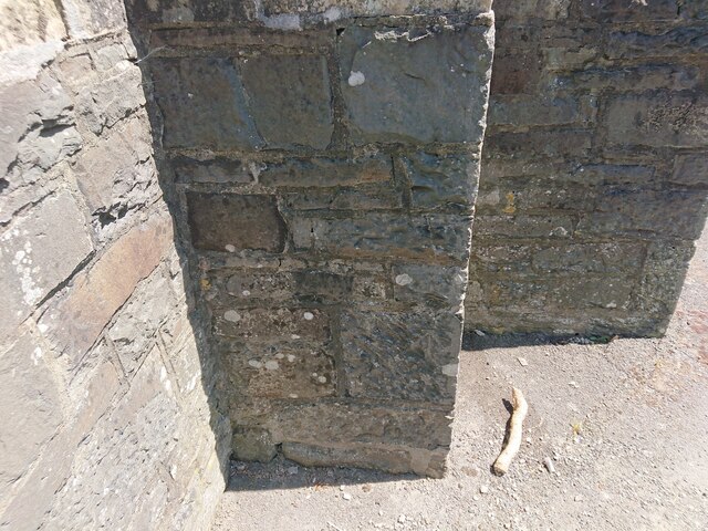
![OSBM Flush Bracket S0451 - Lampeter Town Hall Ordnance Survey Benchmark (OSBM) used for levelling height above Ordnance Datum (OD).
Height (1955): 121.2122m OD (Newlyn). Mark verified by the Ordnance Survey in 1971. Description: FB S0451 E FACE TOWN HALL. 0.9m above ground. 1st Order BM. (Listed as a cut mark in the current OS database)
The bracket was used on the Lampeter to Llandovery secondary line of the Second Geodetic Levelling of England &amp; Wales in 1942. It was levelled with a height of 397.758&#039; above OD (Newlyn). Description: Flush Bracket on SE angle of Town Hall. Abstract A 491: <span class="nowrap"><a title="http://discovery.nationalarchives.gov.uk/details/r/C11178833" rel="nofollow ugc noopener" href="http://discovery.nationalarchives.gov.uk/details/r/C11178833">Link</a><img style="margin-left:2px;" alt="External link" title="External link - shift click to open in new window" src="https://s1.geograph.org.uk/img/external.png" width="10" height="10"/></span> [OS 54/154]
The bracket was used on the Lampeter to Llandovery line (G098) of the Third Geodetic Levelling of England &amp; Wales in 1955. It was levelled with a height of 397.740&#039; above OD (Newlyn). Abstract G 65: <span class="nowrap"><a title="http://discovery.nationalarchives.gov.uk/SearchUI/details?Uri=C11264473" rel="nofollow ugc noopener" href="http://discovery.nationalarchives.gov.uk/SearchUI/details?Uri=C11264473">Link</a><img style="margin-left:2px;" alt="External link" title="External link - shift click to open in new window" src="https://s1.geograph.org.uk/img/external.png" width="10" height="10"/></span> [OS 54/754]
Close-up: <a href="https://www.geograph.org.uk/photo/7518118">SN5748 : OSBM Flush Bracket S0451 - Lampeter Town Hall</a>](https://s2.geograph.org.uk/geophotos/07/51/81/7518122_3a4de3e1.jpg)
Hen-feddau Wood is located at Grid Ref: SN5649 (Lat: 52.128041, Lng: -4.0956474)
Unitary Authority: Ceredigion
Police Authority: Dyfed Powys
What 3 Words
///romantics.unlisted.intrigues. Near Lampeter, Ceredigion
Nearby Locations
Related Wikis

Falcondale Lake
Falcondale Lake is a man-made lake in the hamlet of Falcondale near Lampeter in Ceredigion It was created as part of the landscaping for Falcondale House...
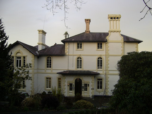
Falcondale House
Falcondale House is a Grade II listed former country house, now the Falcondale Mansion Hotel, which is situated some 1 mile north-west of Lampeter, Ceredigion...

Falcondale
Falcondale (Welsh: Glyn Hebog) is a hamlet in the community of Lampeter, Ceredigion, Wales, and occupies a low bluff overlooking the Nant Creuddyn north...
Silian, Ceredigion
Silian, originally Sulien, is a village in the valley of the River Teifi, Ceredigion, Wales. It is located approximately two miles north-west of Lampeter...

Lampeter
Lampeter (; Welsh: Llanbedr Pont Steffan (formal); Llambed (colloquial)) is a town, community and electoral ward in Ceredigion, Wales, at the confluence...
Maestir
Maestir is a hamlet in the community of Llanwnnen, Ceredigion, Wales, which is 59.9 miles (96.3 km) from Cardiff and 175.5 miles (282.4 km) from London...

A485 road
The A485 is an A road linking Tanerdy near Carmarthen to Llanfarian near Aberystwyth in Wales. Settlements along the route include: Tanerdy Peniel Rhydargaeau...

St Peter's Church, Lampeter
St Peter's Church, Lampeter, is the Church in Wales parish church for the University town of Lampeter. It is a Grade II listed building, and has been described...
Nearby Amenities
Located within 500m of 52.128041,-4.0956474Have you been to Hen-feddau Wood?
Leave your review of Hen-feddau Wood below (or comments, questions and feedback).