Ty-hên Wood

Wood, Forest in Cardiganshire

Wales

Ty-hên Wood

Lane leading past Falcondale Lake
Lane leading past Falcondale Lake Credit: Sandy Gerrard

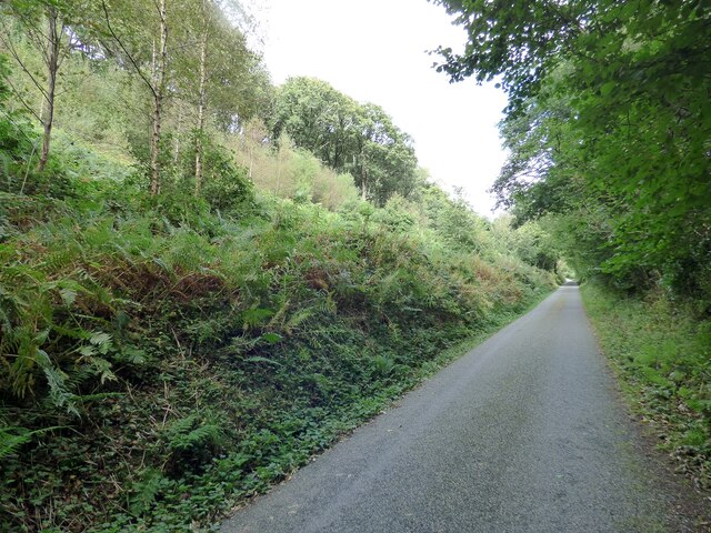
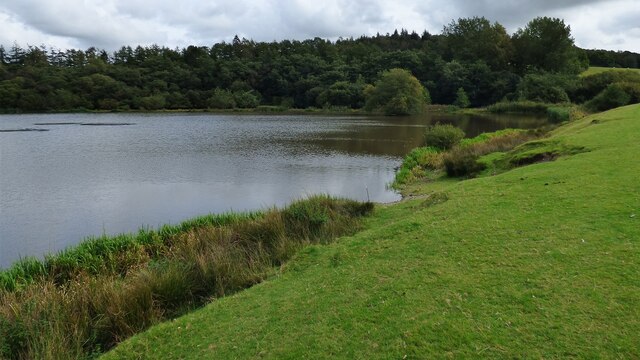
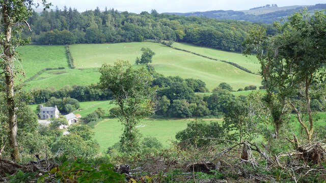
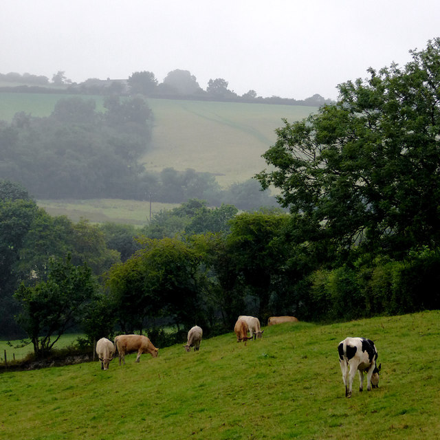
Ty-hên Wood is a picturesque forest located in Cardiganshire, Wales. Spanning over a vast area, it is known for its natural beauty and diverse ecosystem. The wood is predominantly composed of deciduous trees such as oak, beech, and birch, which create a stunning canopy during the summer months.

The forest is home to an array of wildlife, including a multitude of bird species such as woodpeckers, owls, and various songbirds. The dense vegetation and abundant food sources make it an ideal habitat for small mammals like rabbits, squirrels, and hedgehogs. Additionally, the wood provides shelter for larger mammals such as deer and foxes.

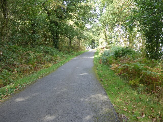
Ty-hên Wood offers a range of recreational activities for visitors to enjoy. Walking trails meander through the forest, offering breathtaking views of the surrounding landscape. Nature enthusiasts can partake in birdwatching or simply take in the peaceful ambiance of the wood. The forest is especially popular during the autumn months when the foliage transforms into a vibrant display of red, orange, and gold.

Conservation efforts are in place to protect the natural beauty of Ty-hên Wood. Local authorities work tirelessly to maintain the delicate balance of the ecosystem and ensure the preservation of the forest's biodiversity. The wood also serves as an educational resource, offering guided tours and workshops on wildlife conservation and sustainable forestry practices.

Overall, Ty-hên Wood is a unique and enchanting destination that showcases the splendor of Wales' natural landscapes. Its beauty, wildlife, and recreational offerings make it a must-visit location for nature enthusiasts and those seeking tranquility amidst the lush greenery.

If you have any feedback on the listing, please let us know in the comments section below.
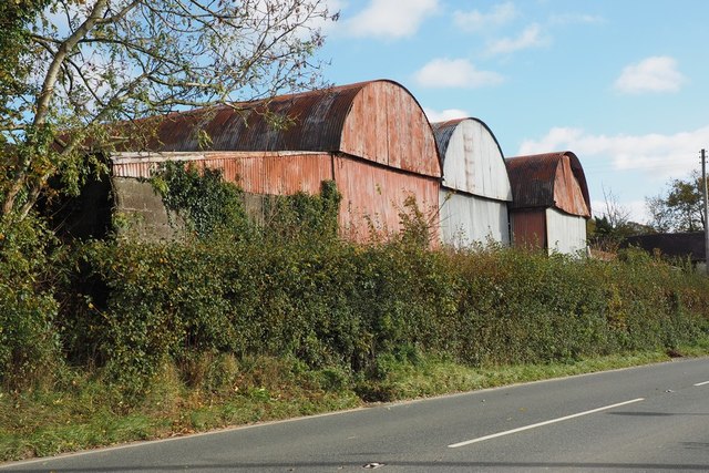
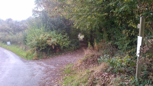
Ty-hên Wood Images

Images are sourced within 2km of 52.124259/-4.1025552 or Grid Reference SN5649. Thanks to Geograph Open Source API. All images are credited.

Lane leading past Falcondale Lake
Road to Lampeter Bowls Club and to tennis courts, Road to sports facilities at Lampeter.
Road to Lampeter Bowls Club and to tennis courts,
Road to sports facilities at Lampeter.
Llanwnen Road, A475 Road just to the south west of Lampeter on a rainy day.
Llanwnen Road, A475
Road just to the south west of Lampeter on a rainy day.
Camping & caravan site, near A475 Campsite outside Lampeter; the parallel hedges, foreground, line a lane to Maesypwll <a href="https://www.geograph.org.uk/photo/7214838">SN5647 : Maesypwll</a>.
Camping & caravan site, near A475
Campsite outside Lampeter; the parallel hedges, foreground, line a lane to Maesypwll SN5647 : Maesypwll.
St Mary's Church, Maestir <span class="nowrap"><a title="https://coflein.gov.uk/cy/safle/310150/" rel="nofollow ugc noopener" href="https://coflein.gov.uk/cy/safle/310150/">Link</a><img style="margin-left:2px;" alt="External link" title="External link - shift click to open in new window" src="https://s1.geograph.org.uk/img/external.png" width="10" height="10"/></span>
St Mary's Church, Maestir
Falcondale Lake
Falcondale Lake
Country Lane North of Lampeter/Llanbedr Pont Stefan
Olwen Farmstead and Fields I had hoped to get a decent photograph of Castell Olwen but sadly the trees completely obscure it from this angle.
Olwen Farmstead and Fields
I had hoped to get a decent photograph of Castell Olwen but sadly the trees completely obscure it from this angle.
Ordnance Survey Benchmark - Lampeter, St. Peter’s Church Ordnance Survey Benchmark (OSBM) used for levelling height above Ordnance Datum (OD).
Height (1972): 136.9200m OD (Newlyn). Mark verified by the Ordnance Survey in 1971. Description: TWR ST PETERS CH W FACE SW ANG. 0.5m above ground. 2nd Order BM.

Context: <a href="https://www.geograph.org.uk/photo/7506634">SN5748 : Ordnance Survey Benchmark - Lampeter, St. Peter’s Church</a>
Ordnance Survey Benchmark - Lampeter, St. Peter’s Church
Ordnance Survey Benchmark (OSBM) used for levelling height above Ordnance Datum (OD). Height (1972): 136.9200m OD (Newlyn). Mark verified by the Ordnance Survey in 1971. Description: TWR ST PETERS CH W FACE SW ANG. 0.5m above ground. 2nd Order BM. Context: SN5748 : Ordnance Survey Benchmark - Lampeter, St. Peter’s Church
Ordnance Survey Benchmark - Lampeter, St. Peter’s Church Ordnance Survey Benchmark (OSBM) used for levelling height above Ordnance Datum (OD).
Height (1972): 136.9200m OD (Newlyn). Mark verified by the Ordnance Survey in 1971. Description: TWR ST PETERS CH W FACE SW ANG. 0.5m above ground. 2nd Order BM.

Close-up: <a href="https://www.geograph.org.uk/photo/7506633">SN5748 : Ordnance Survey Benchmark - Lampeter, St. Peter’s Church</a>
Ordnance Survey Benchmark - Lampeter, St. Peter’s Church
Ordnance Survey Benchmark (OSBM) used for levelling height above Ordnance Datum (OD). Height (1972): 136.9200m OD (Newlyn). Mark verified by the Ordnance Survey in 1971. Description: TWR ST PETERS CH W FACE SW ANG. 0.5m above ground. 2nd Order BM. Close-up: SN5748 : Ordnance Survey Benchmark - Lampeter, St. Peter’s Church
A485 at Lampeter town boundary
A475 Llanwnnen Road
A475 Llanwnnen Road
OSBM Flush Bracket S0451 - Lampeter Town Hall Ordnance Survey Benchmark (OSBM) used for levelling height above Ordnance Datum (OD).  
Height (1955): 121.2122m OD (Newlyn). Mark verified by the Ordnance Survey in 1971. Description: FB S0451 E FACE TOWN HALL. 0.9m above ground. 1st Order BM.  (Listed as a cut mark in the current OS database)

The bracket was used on the Lampeter to Llandovery secondary line of the Second Geodetic Levelling of England & Wales in 1942. It was levelled with a height of 397.758' above OD (Newlyn). Description: Flush Bracket on SE angle of Town Hall. Abstract A 491: <span class="nowrap"><a title="http://discovery.nationalarchives.gov.uk/details/r/C11178833" rel="nofollow ugc noopener" href="http://discovery.nationalarchives.gov.uk/details/r/C11178833">Link</a><img style="margin-left:2px;" alt="External link" title="External link - shift click to open in new window" src="https://s1.geograph.org.uk/img/external.png" width="10" height="10"/></span> [OS 54/154]

The bracket was used on the Lampeter to Llandovery line (G098) of the Third Geodetic Levelling of England & Wales in 1955.  It was levelled with a height of 397.740' above OD (Newlyn).  Abstract G 65: <span class="nowrap"><a title="http://discovery.nationalarchives.gov.uk/SearchUI/details?Uri=C11264473" rel="nofollow ugc noopener" href="http://discovery.nationalarchives.gov.uk/SearchUI/details?Uri=C11264473">Link</a><img style="margin-left:2px;" alt="External link" title="External link - shift click to open in new window" src="https://s1.geograph.org.uk/img/external.png" width="10" height="10"/></span>  [OS 54/754]

Context: <a href="https://www.geograph.org.uk/photo/7518122">SN5748 : OSBM Flush Bracket S0451 - Lampeter Town Hall</a>
OSBM Flush Bracket S0451 - Lampeter Town Hall
Ordnance Survey Benchmark (OSBM) used for levelling height above Ordnance Datum (OD). Height (1955): 121.2122m OD (Newlyn). Mark verified by the Ordnance Survey in 1971. Description: FB S0451 E FACE TOWN HALL. 0.9m above ground. 1st Order BM. (Listed as a cut mark in the current OS database) The bracket was used on the Lampeter to Llandovery secondary line of the Second Geodetic Levelling of England & Wales in 1942. It was levelled with a height of 397.758' above OD (Newlyn). Description: Flush Bracket on SE angle of Town Hall. Abstract A 491: LinkExternal link [OS 54/154] The bracket was used on the Lampeter to Llandovery line (G098) of the Third Geodetic Levelling of England & Wales in 1955. It was levelled with a height of 397.740' above OD (Newlyn). Abstract G 65: LinkExternal link [OS 54/754] Context: SN5748 : OSBM Flush Bracket S0451 - Lampeter Town Hall
OSBM Flush Bracket S0451 - Lampeter Town Hall Ordnance Survey Benchmark (OSBM) used for levelling height above Ordnance Datum (OD).  
Height (1955): 121.2122m OD (Newlyn). Mark verified by the Ordnance Survey in 1971. Description: FB S0451 E FACE TOWN HALL. 0.9m above ground. 1st Order BM.  (Listed as a cut mark in the current OS database)

The bracket was used on the Lampeter to Llandovery secondary line of the Second Geodetic Levelling of England & Wales in 1942. It was levelled with a height of 397.758' above OD (Newlyn). Description: Flush Bracket on SE angle of Town Hall. Abstract A 491: <span class="nowrap"><a title="http://discovery.nationalarchives.gov.uk/details/r/C11178833" rel="nofollow ugc noopener" href="http://discovery.nationalarchives.gov.uk/details/r/C11178833">Link</a><img style="margin-left:2px;" alt="External link" title="External link - shift click to open in new window" src="https://s1.geograph.org.uk/img/external.png" width="10" height="10"/></span> [OS 54/154]

The bracket was used on the Lampeter to Llandovery line (G098) of the Third Geodetic Levelling of England & Wales in 1955.  It was levelled with a height of 397.740' above OD (Newlyn).  Abstract G 65: <span class="nowrap"><a title="http://discovery.nationalarchives.gov.uk/SearchUI/details?Uri=C11264473" rel="nofollow ugc noopener" href="http://discovery.nationalarchives.gov.uk/SearchUI/details?Uri=C11264473">Link</a><img style="margin-left:2px;" alt="External link" title="External link - shift click to open in new window" src="https://s1.geograph.org.uk/img/external.png" width="10" height="10"/></span>  [OS 54/754]

Close-up: <a href="https://www.geograph.org.uk/photo/7518118">SN5748 : OSBM Flush Bracket S0451 - Lampeter Town Hall</a>
OSBM Flush Bracket S0451 - Lampeter Town Hall
Ordnance Survey Benchmark (OSBM) used for levelling height above Ordnance Datum (OD). Height (1955): 121.2122m OD (Newlyn). Mark verified by the Ordnance Survey in 1971. Description: FB S0451 E FACE TOWN HALL. 0.9m above ground. 1st Order BM. (Listed as a cut mark in the current OS database) The bracket was used on the Lampeter to Llandovery secondary line of the Second Geodetic Levelling of England & Wales in 1942. It was levelled with a height of 397.758' above OD (Newlyn). Description: Flush Bracket on SE angle of Town Hall. Abstract A 491: LinkExternal link [OS 54/154] The bracket was used on the Lampeter to Llandovery line (G098) of the Third Geodetic Levelling of England & Wales in 1955. It was levelled with a height of 397.740' above OD (Newlyn). Abstract G 65: LinkExternal link [OS 54/754] Close-up: SN5748 : OSBM Flush Bracket S0451 - Lampeter Town Hall
Grazing north-west of Lampeter, Ceredigion Cattle and the steep hillsides of Cwm Nant Creuddyn on a wet morning.
Grazing north-west of Lampeter, Ceredigion
Cattle and the steep hillsides of Cwm Nant Creuddyn on a wet morning.
Corrugated iron barns at Dderigoch Range of hoop-topped barns with a lean-to at the N end. Adjoins A482 road between Llanbedr Pont Steffan and Felin Fach
Corrugated iron barns at Dderigoch
Range of hoop-topped barns with a lean-to at the N end. Adjoins A482 road between Llanbedr Pont Steffan and Felin Fach
Bridleway east of Silian
Falcondale Drive crosses Nant Creuddyn The long drive to The Falcondale leaves the A475 south of the hotel and crosses this small stream via a narrow iron bridge.
Falcondale Drive crosses Nant Creuddyn
The long drive to The Falcondale leaves the A475 south of the hotel and crosses this small stream via a narrow iron bridge.
Show me another place!

Ty-hên Wood is located at Grid Ref: SN5649 (Lat: 52.124259, Lng: -4.1025552)

Unitary Authority: Ceredigion

Police Authority: Dyfed Powys

What 3 Words

///prepare.provoking.signal. Near Lampeter, Ceredigion

Related Wikis

Falcondale

Falcondale (Welsh: Glyn Hebog) is a hamlet in the community of Lampeter, Ceredigion, Wales, and occupies a low bluff overlooking the Nant Creuddyn north...
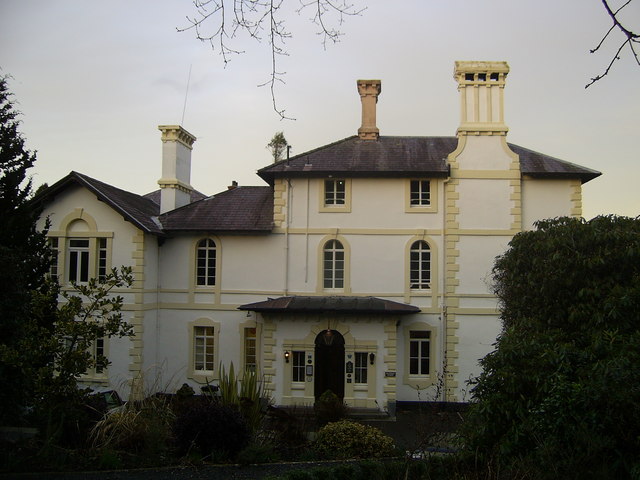
Falcondale House

Falcondale House is a Grade II listed former country house, now the Falcondale Mansion Hotel, which is situated some 1 mile north-west of Lampeter, Ceredigion...

Maestir

Maestir is a hamlet in the community of Llanwnnen, Ceredigion, Wales, which is 59.9 miles (96.3 km) from Cardiff and 175.5 miles (282.4 km) from London...

Falcondale Lake

Falcondale Lake is a man-made lake in the hamlet of Falcondale near Lampeter in Ceredigion It was created as part of the landscaping for Falcondale House...

Lampeter

Lampeter (; Welsh: Llanbedr Pont Steffan (formal); Llambed (colloquial)) is a town, community and electoral ward in Ceredigion, Wales, at the confluence...

Silian, Ceredigion

Silian, originally Sulien, is a village in the valley of the River Teifi, Ceredigion, Wales. It is located approximately two miles north-west of Lampeter...

St Peter's Church, Lampeter

St Peter's Church, Lampeter, is the Church in Wales parish church for the University town of Lampeter. It is a Grade II listed building, and has been described...

Church of Our Lady of Mount Carmel, Lampeter

The Church of Our Lady of Mount Carmel is a Roman Catholic church located in the university town of Lampeter in Ceredigion, Wales. Constructed by the London...

Nearby Amenities

Located within 500m of 52.124259,-4.1025552
Falcondale Farm
Place: farm
Lat/Long: 52.1207817/-4.0997427
Power: pole
Lat/Long: 52.1198727/-4.1030663
Power: pole
Lat/Long: 52.1207809/-4.1024709
Power: pole
Lat/Long: 52.1215105/-4.1019961
Power: pole
Lat/Long: 52.1223323/-4.1014624
Power: pole
Lat/Long: 52.123103/-4.1009474
Power: pole
Lat/Long: 52.1237913/-4.100486
Power: pole
Lat/Long: 52.1243743/-4.1001186
Power: pole
Lat/Long: 52.1251663/-4.0996197
Power: pole
Lat/Long: 52.1261511/-4.100596
Power: pole
Lat/Long: 52.1274667/-4.1019344
Power: pole
Lat/Long: 52.1281814/-4.1026479
Direction: 170
Generator Method: photovoltaic
Generator Output Electricity: yes
Generator Solar Modules: 20
Generator Source: solar
Generator Type: solar_photovoltaic_panel
Location: roof
Power: generator
Lat/Long: 52.1271735/-4.1050995
Direction: 170
Generator Method: photovoltaic
Generator Output Electricity: yes
Generator Solar Modules: 2
Generator Source: solar
Generator Type: solar_photovoltaic_panel
Location: roof
Power: generator
Lat/Long: 52.1268509/-4.1051705
Direction: 170
Generator Method: photovoltaic
Generator Output Electricity: yes
Generator Solar Modules: 6
Generator Source: solar
Generator Type: solar_photovoltaic_panel
Location: roof
Power: generator
Lat/Long: 52.126843/-4.1052324
Direction: 170
Generator Method: photovoltaic
Generator Output Electricity: yes
Generator Solar Modules: 6
Generator Source: solar
Generator Type: solar_photovoltaic_panel
Location: roof
Power: generator
Lat/Long: 52.1268343/-4.1053007
Direction: 170
Generator Method: photovoltaic
Generator Output Electricity: yes
Generator Solar Modules: 2
Generator Source: solar
Generator Type: solar_photovoltaic_panel
Location: roof
Power: generator
Lat/Long: 52.126827/-4.1053583
The data included in this document is from www.openstreetmap.org. The data is made available under ODbL.

Have you been to Ty-hên Wood?

Leave your review of Ty-hên Wood below (or comments, questions and feedback).