West Anstey

Civil Parish in Devon North Devon

England

West Anstey

Exmoor Ponies on Anstey Money Common
Exmoor Ponies on Anstey Money Common Credit: Grant Sherman

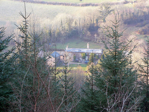
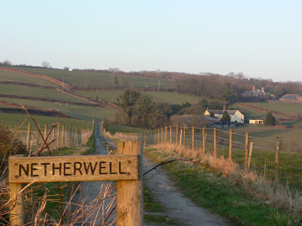
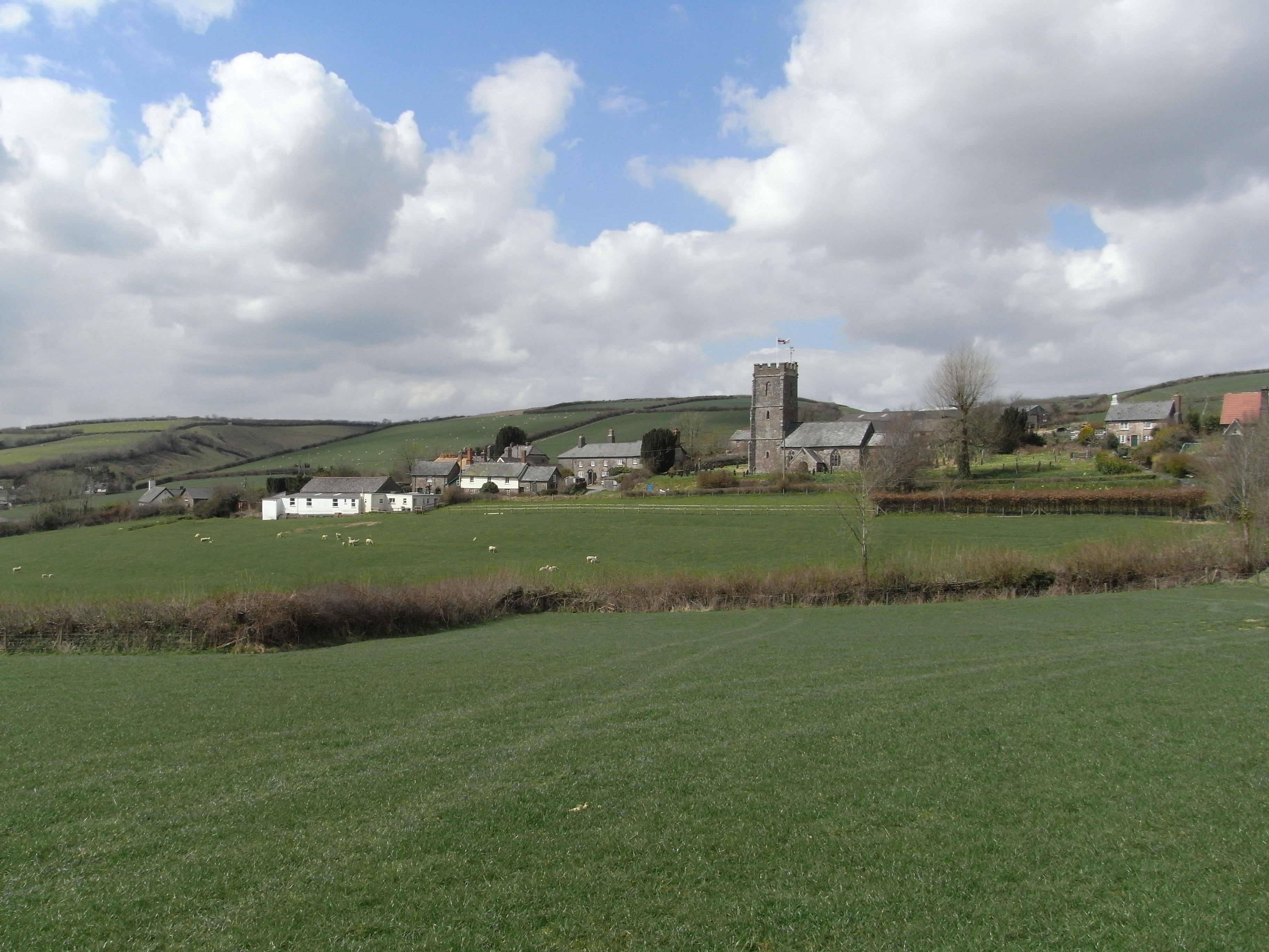
West Anstey is a civil parish located in the county of Devon, England. Situated on the southern edge of Exmoor National Park, it is part of the North Devon district. The village of West Anstey itself is small and rural, with a population of around 150 people.

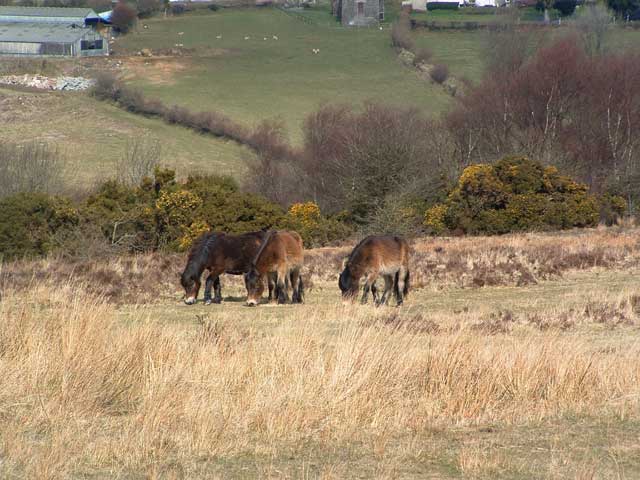
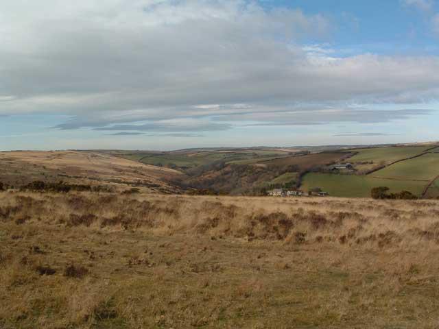
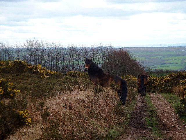
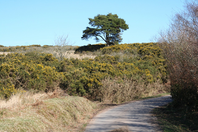
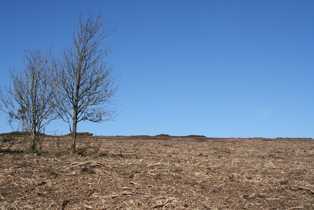
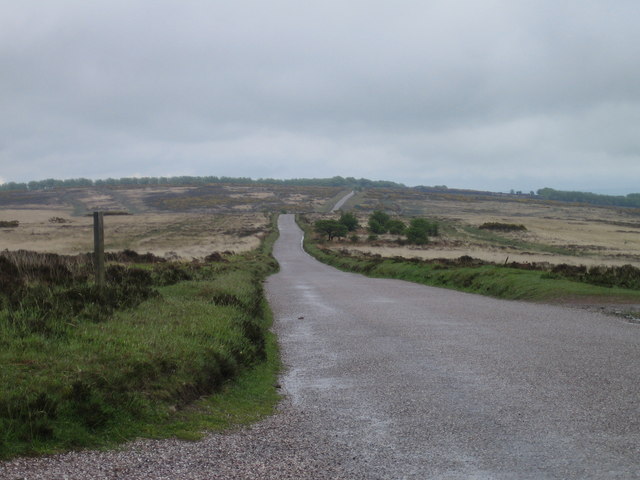
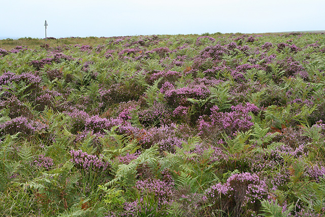
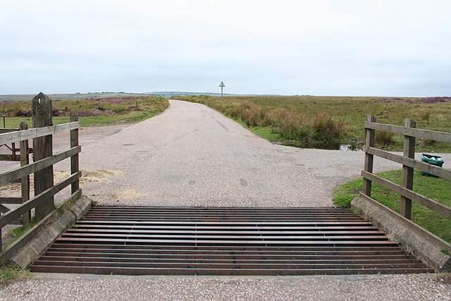
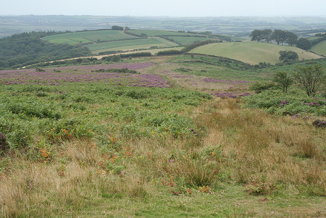
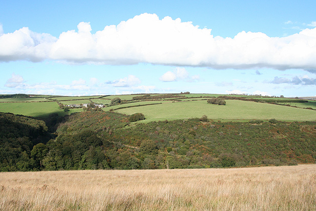
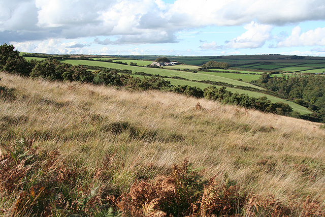
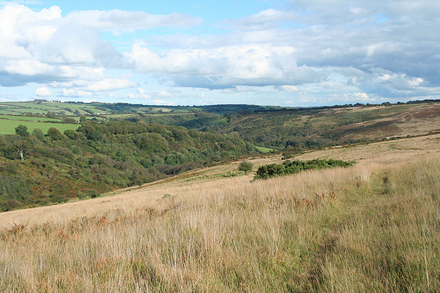
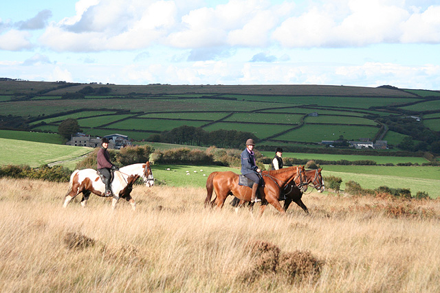
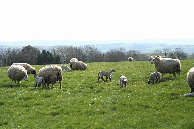
The parish is characterized by its rolling hills, picturesque landscapes, and charming countryside. It is primarily an agricultural community, with the majority of its residents involved in farming and related activities. The fertile land supports a variety of crops, livestock, and dairy farming.

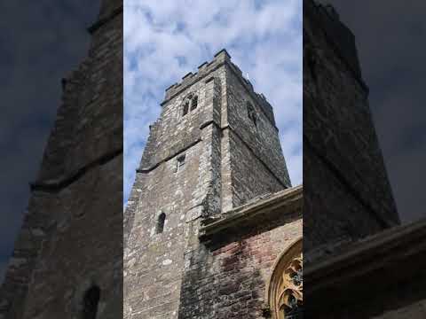
The area boasts several historical landmarks, including St Petrock's Church, a Grade II listed building dating back to the 13th century. The church features a prominent tower and stained glass windows, and it serves as a focal point for the local community.

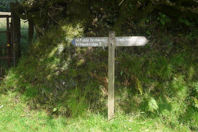
Outdoor enthusiasts are drawn to West Anstey for its abundance of natural beauty. The surrounding countryside offers numerous walking and hiking trails, providing opportunities for exploration and enjoying the stunning scenery.

Despite its small size, the village has a strong sense of community, with regular events and gatherings held throughout the year. These include fairs, festivals, and social gatherings, which bring locals and visitors together.

Overall, West Anstey is a tranquil and idyllic rural parish, offering a peaceful escape from the hustle and bustle of modern life. Its natural beauty, agricultural heritage, and strong community spirit make it an attractive destination for those seeking a quintessential English countryside experience.

If you have any feedback on the listing, please let us know in the comments section below.

West Anstey Images

Images are sourced within 2km of 51.0522/-3.651474 or Grid Reference SS8429. Thanks to Geograph Open Source API. All images are credited.

Exmoor Ponies on Anstey Money Common
Anstey Money Common On the Two Moors Way
Anstey Money Common
On the Two Moors Way
Exmoor ponies on Woodland Common Near Badlake Moor Cross
Exmoor ponies on Woodland Common
Near Badlake Moor Cross
IIMW sculpture by Peter Randall Page See also Granite Song in <a href="https://www.geograph.org.uk/gridref/SX7189">SX7189</a>
IIMW sculpture by Peter Randall Page
See also Granite Song in SX7189
West Anstey: near Woodland Common Looking east
West Anstey: near Woodland Common
Looking east
West Anstey: Woodland Common The common has recently stripped of gorse. Looking north east from a point above Woodland Farm
West Anstey: Woodland Common
The common has recently stripped of gorse. Looking north east from a point above Woodland Farm
West Anstey Common The Ridge Road over West Anstey Common.
West Anstey Common
The Ridge Road over West Anstey Common.
Molland: Brimblecombe Hill Heather and bracken close to the road at Anstey Gate: the road sign on the horizon indicates the location. It warns of a cattle grid at the gate. Looking west
Molland: Brimblecombe Hill
Heather and bracken close to the road at Anstey Gate: the road sign on the horizon indicates the location. It warns of a cattle grid at the gate. Looking west
West Anstey: Anstey Gate Looking west-north-west towards Molland Common
West Anstey: Anstey Gate
Looking west-north-west towards Molland Common
Molland: above Anstey’s Combe Looking south from White Moor
Molland: above Anstey’s Combe
Looking south from White Moor
West Anstey: on West Anstey Common Looking north towards Shircombe Farm. Below the farm, nearer the camera, the Dane’s Brook turns through a right angle to run south-south-west past Lyshwell Wood before resuming a more easterly course. It has a confluence with the Barle near Mounsey Castle.
West Anstey: on West Anstey Common
Looking north towards Shircombe Farm. Below the farm, nearer the camera, the Dane’s Brook turns through a right angle to run south-south-west past Lyshwell Wood before resuming a more easterly course. It has a confluence with the Barle near Mounsey Castle.
West Anstey: towards Lyshwell Farm Looking north west on the edge of the moor towards Exmoor farmland
West Anstey: towards Lyshwell Farm
Looking north west on the edge of the moor towards Exmoor farmland
West Anstey: Anstey Rhiney Moor Looking east-north-east over the Dane’s Brook valley
West Anstey: Anstey Rhiney Moor
Looking east-north-east over the Dane’s Brook valley
West Anstey: riders near Anstey Gate Looking north on West Anstey Common with Lyshwell, left, and Cloggs farms in shadow in the distance
West Anstey: riders near Anstey Gate
Looking north on West Anstey Common with Lyshwell, left, and Cloggs farms in shadow in the distance
West Anstey: ewes and lambs Near Overwell, looking south west
West Anstey: ewes and lambs
Near Overwell, looking south west
Badlake Moor Cross This finger post gives distances on the Two Moors Way.
Badlake Moor Cross
This finger post gives distances on the Two Moors Way.
Brimblecombe Cottage Taken from footpath through Combe Wood
Brimblecombe Cottage
Taken from footpath through Combe Wood
Netherwell Farm The farm surrounded by fields mostly grazed by sheep
Netherwell Farm
The farm surrounded by fields mostly grazed by sheep
Show me another place!

West Anstey is located at Grid Ref: SS8429 (Lat: 51.0522, Lng: -3.651474)

Administrative County: Devon

District: North Devon

Police Authority: Devon & Cornwall

What 3 Words

///greed.petal.pyramid. Near Dulverton, Somerset

Related Wikis

West Anstey

West Anstey is a village and civil parish on the River Yeo, about 5 miles west of Dulverton, in the North Devon district, in the county of Devon, England...

Church of St Giles, Hawkridge

The Anglican Church of St Giles in Hawkridge, Somerset, England was built in the 14th century. It is a Grade II* listed building. == History == The oldest...

Tarr Steps

The Tarr Steps is a clapper bridge across the River Barle in the Exmoor National Park, Somerset, England. They are located in a national nature reserve...

Molland

Molland is a small village, civil parish, dual ecclesiastical parish with Knowstone, located in the foothills of Exmoor in Devon, England. It lies within...

Brewer's Castle

Brewer's Castle is a defended Iron Age settlement in the West Somerset district of Somerset, England. The hill fort is situated approximately 2 miles...

Mounsey Castle

Mounsey Castle is an Iron Age irregular triangular earthwork of 1.75 hectares (4.3 acres) north west of Dulverton, Somerset, England. It has been scheduled...

Oldways End

Oldways End is a hamlet in the civil parish of East Anstey in the North Devon district of Devon, England. Its nearest town is Tiverton, which lies approximately...

East Anstey

East Anstey is a village and civil parish in the North Devon district of Devon, England. The parish is located in an area which has been designated as...

Related Videos

Nearby Amenities

Located within 500m of 51.0522,-3.651474
Memorial to Froude Hancock
Historic: memorial
Lat/Long: 51.0544458/-3.6567896
Historic: boundary_stone
Inscription: Boundary of the Moorland Memorial to Froude Hancock subscribed for by over 500 of his friends
Lat/Long: 51.0540373/-3.6561728
The data included in this document is from www.openstreetmap.org. The data is made available under ODbL.

Have you been to West Anstey?

Leave your review of West Anstey below (or comments, questions and feedback).