Shrewsbury

Civil Parish in Shropshire

England

Shrewsbury

Disused electricity pylon
Disused electricity pylon Credit: Mr M Evison

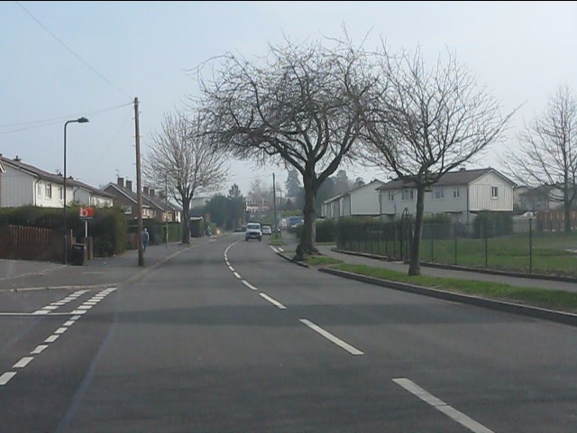
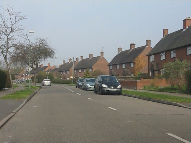
Shrewsbury is a historic town located in the county of Shropshire, in the West Midlands region of England. It is the county town of Shropshire and the largest town in the county. Shrewsbury is situated on the banks of the River Severn and is known for its picturesque setting and well-preserved medieval architecture.

The town has a rich history that dates back to Roman times, and many of its buildings still showcase the various architectural styles from different periods. The town center is characterized by narrow streets, timber-framed buildings, and the iconic Shrewsbury Castle, which was built in the 11th century.

Shrewsbury is also famous for its annual Shrewsbury Flower Show, one of the oldest and largest horticultural events in the country. The show attracts thousands of visitors who come to admire the beautiful floral displays, participate in competitions, and enjoy entertainment and food stalls.

The town has a vibrant cultural scene, with numerous museums, galleries, and theaters, including the Shrewsbury Museum and Art Gallery, which houses a collection of local artifacts and artwork. Shrewsbury is also home to the University Centre Shrewsbury, a higher education institution that offers a range of courses.

In terms of amenities, Shrewsbury has a variety of shops, restaurants, and pubs, providing a range of options for residents and visitors alike. The town also has excellent transport links, with a railway station and access to major road networks, making it easily accessible from other parts of the country.

Overall, Shrewsbury is a charming and culturally rich town with a fascinating history and stunning architecture, making it an attractive destination for tourists and a pleasant place to live.

If you have any feedback on the listing, please let us know in the comments section below.

Shrewsbury Images

Images are sourced within 2km of 52.715851/-2.749647 or Grid Reference SJ4913. Thanks to Geograph Open Source API. All images are credited.

Disused electricity pylon
Electricity Substation Now out of use
Electricity Substation
Now out of use
Removing the Overhead Cables At last the overhead cables have been removed from over these houses
Removing the Overhead Cables
At last the overhead cables have been removed from over these houses
Now out of use pylon
Removing the Overhead Cables
Old animal food storage
Crewe to Shrewsbury Line
Weir on the River Severn in Shrewsbury A splendid weir on a summer's day.
Weir on the River Severn in Shrewsbury
A splendid weir on a summer's day.
The Sentinel in Morrisons Supermarket Morrisons Supermarket was built on part of the site of the Sentinel Waggon Works and this piece of marquetry was installed in the cafe to commemorate this.

Unfortunately part of the work has now been obscured by some of the cafe equipment.
The Sentinel in Morrisons Supermarket
Morrisons Supermarket was built on part of the site of the Sentinel Waggon Works and this piece of marquetry was installed in the cafe to commemorate this. Unfortunately part of the work has now been obscured by some of the cafe equipment.
London Road nearing Shirehall roundabout
Haycock Way
Haycock Way
Southern end of Bage Way
Bage Way - Abbey Foregate bridge
Bage Way - Dark Lane footbridge
Crowmere Road at Grinshill Drive
Crowmere Road
Crowmere Road
Crowmere Road at Clive Road
Clive Road, Monksmoor
Show me another place!

Shrewsbury is located at Grid Ref: SJ4913 (Lat: 52.715851, Lng: -2.749647)

Unitary Authority: Shropshire

Police Authority: West Mercia

What 3 Words

///social.hoot.novel. Near Shrewsbury, Shropshire

Related Wikis

Bagley Brook

The Bagley Brook is a small watercourse that flows into the River Severn at Shrewsbury in Shropshire, England. Its course has been severely altered by...

Bagley, Shrewsbury

Bagley is an area of Shrewsbury, county town of Shropshire. It is part urban, part rural and extends out from the town centre in a northwest direction...

Coton Hill rail crash

The Coton Hill rail crash was a train crash which occurred on 11 January 1965, at Coton Hill, near Shrewsbury in Shropshire, England. It happened when...

Coton Hill, Shropshire

Coton Hill is an historic suburb of the town of Shrewsbury, Shropshire, situated in the ancient parish of St Mary (with a small enclave of the parish of...

Shrewsbury rail accident

The Shrewsbury rail accident occurred on 15 October 1907. An overnight sleeping-car and mail train from Manchester to the West of England derailed on the...

Shrewsbury railway station

Shrewsbury railway station is in Shrewsbury, Shropshire, England. Built in 1848, it was designated a grade II listed building in 1969. The station is 43...
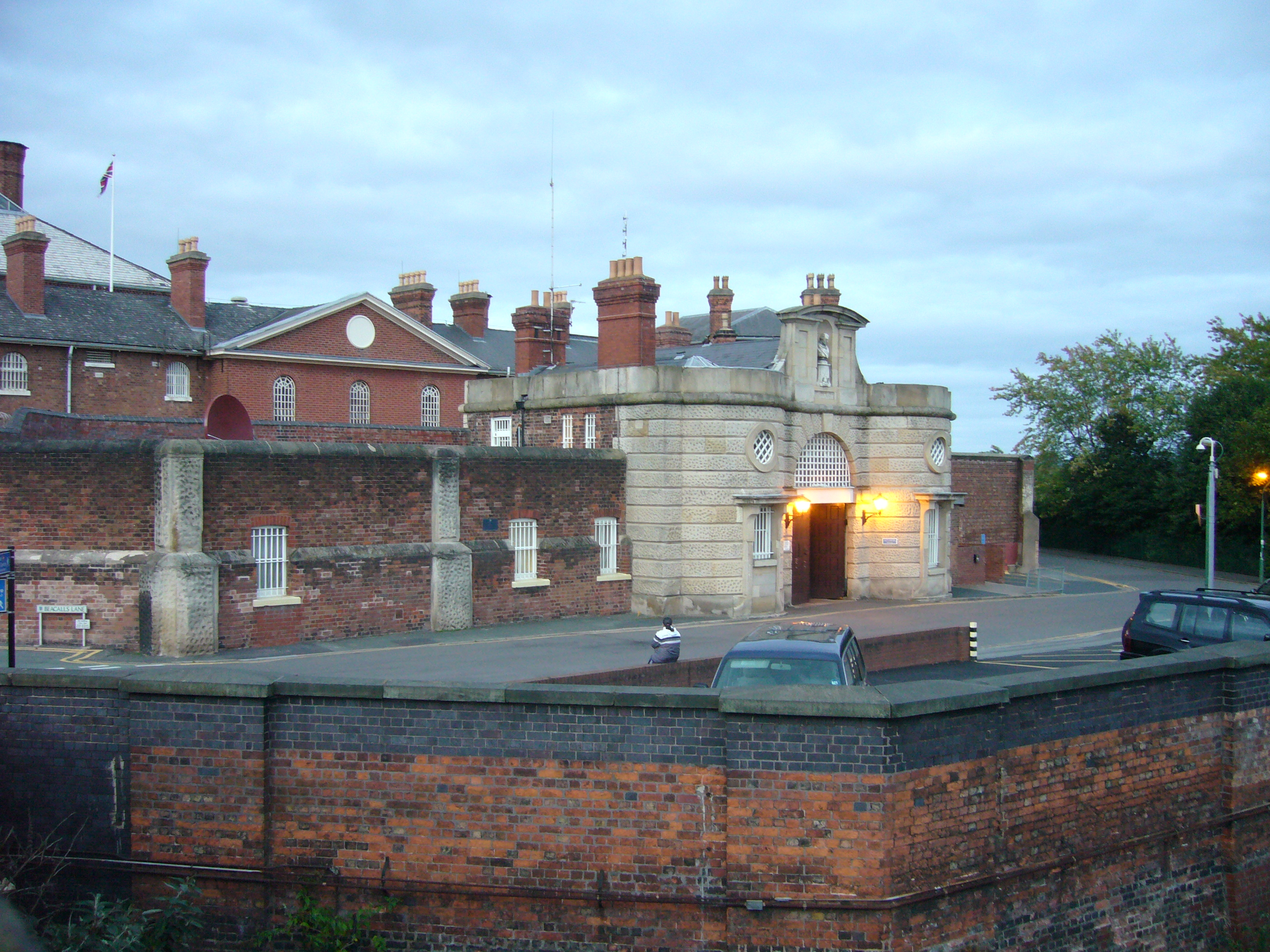
Shrewsbury Prison

HM Prison Shrewsbury was a Category B/C men's prison in Shrewsbury, Shropshire, England. It was decommissioned in March 2013, and is now open to the public...
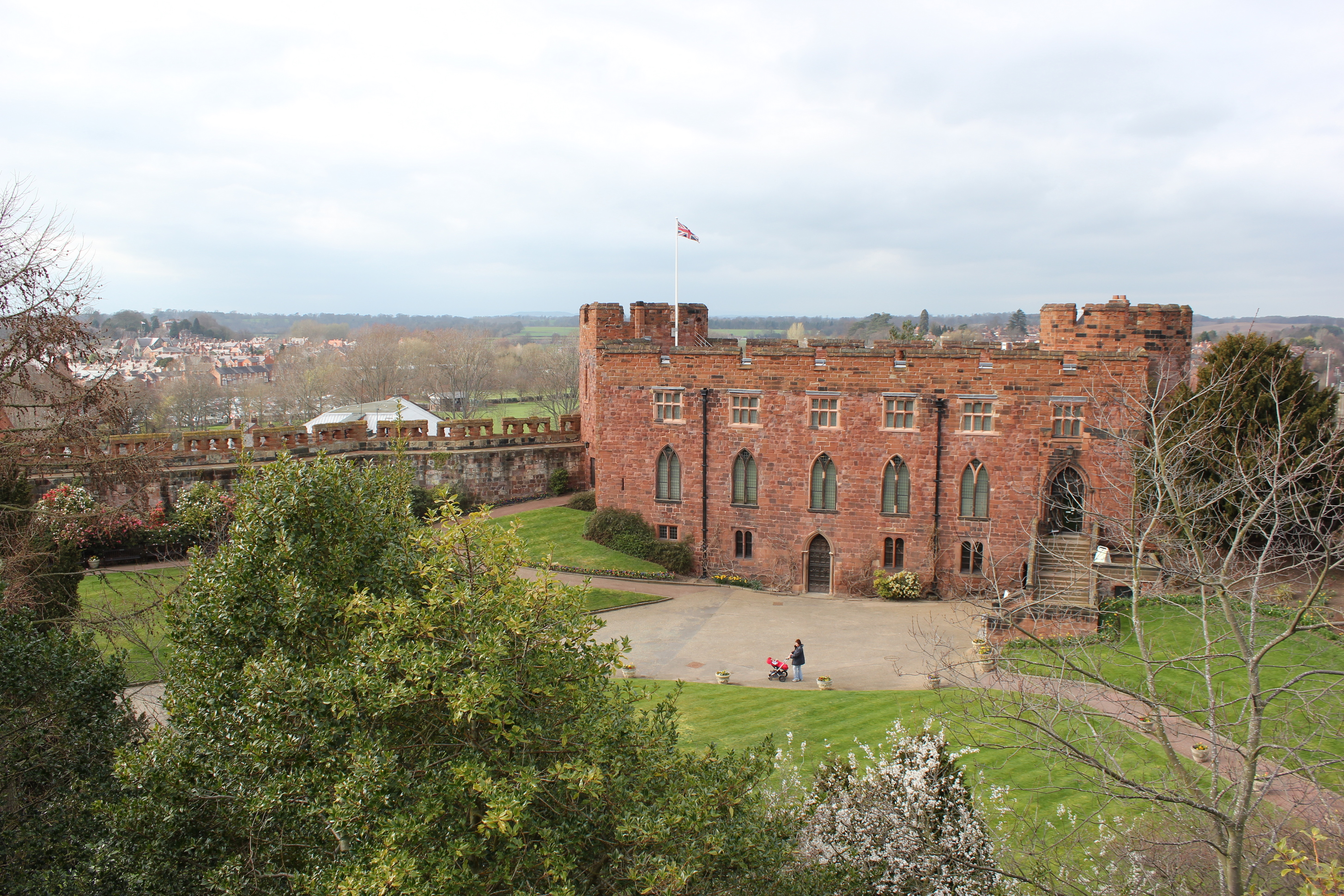
Shrewsbury Castle

Shrewsbury Castle is a red sandstone castle in Shrewsbury, Shropshire, England. It stands on a hill in the neck of the meander of the River Severn on which...

Nearby Amenities

Located within 500m of 52.715851,-2.749647
Mini Roundabout
Direction: clockwise
Lat/Long: 52.7173968/-2.7520893
Traffic Signals
Lat/Long: 52.7161613/-2.7529959
Cycleway: asl
Lat/Long: 52.712863/-2.7511638
Crossing
Crossing: traffic_signals
Crossing Island: yes
Crossing Ref: toucan
Tactile Paving: yes
Lat/Long: 52.7127228/-2.7510837
Traffic Signals
Lat/Long: 52.7127585/-2.7500335
Post Box
Brand: Royal Mail
Brand Wikidata: Q638098
Brand Wikipedia: en:Royal Mail
Collection Plate: CP5
Collection Times: Mo-Fr 17:45; Sa 11:00
Collection Times Checked: 2020-01-21
Operator: Royal Mail
Operator Wikidata: Q638098
Post Box Type: wall
Postal Code: SY1
Ref: SY1 10
Royal Cypher: VR
Royal Cypher Wikidata: Q33102356
Lat/Long: 52.7116732/-2.7496281
Crossing
Button Operated: yes
Crossing: traffic_signals
Crossing Island: no
Crossing Ref: toucan
Tactile Paving: yes
Traffic Signals Sound: no
Lat/Long: 52.7114273/-2.7505226
Bus Stop
Railway Station Castle Foregate
Bus: yes
Naptan AtcoCode: 3500B306300
Naptan NaptanCode: shrawmpt
Public Transport: platform
Lat/Long: 52.7121259/-2.7501822
Crossing
Bicycle: yes
Crossing: traffic_signals
Crossing Island: no
Crossing Ref: toucan
Kerb: flush
Survey Date: 2021-05-14
Tactile Paving: yes
Wheelchair: yes
Wikimedia Commons: File:Road junction at entrance to Shrewsbury railway station - geograph.org.uk - 1998280.jpg
Lat/Long: 52.7115861/-2.7504379
Cycleway: asl
Direction: backward
Lat/Long: 52.711554/-2.7506729
Traffic Signals
Lat/Long: 52.7115203/-2.7504745
Barrier: bollard
Lat/Long: 52.7174735/-2.7459699
Railway: level_crossing
Lat/Long: 52.7174597/-2.7483577
Post Office
Castlefields Post Office
Addr City: Shrewsbury
Addr Country: GB
Addr Housenumber: 63
Addr Postcode: SY1 2LE
Addr Street: New Park Street
Addr Village: Castlefields
Brand: Post Office
Brand Wikidata: Q1783168
Check Date: 2022-05-27
Check Date Opening Hours: 2022-05-27
Contact Website: https://www.postoffice.co.uk/branch-finder/1004581/castlefields
Opening Hours: Mo-Su 07:00-22:00
Ref Pol Id: 117537
Lat/Long: 52.7148042/-2.7435846
Barrier: cycle_barrier
Foot: yes
Lat/Long: 52.7154269/-2.7537123
Bus Stop
Bus: yes
Public Transport: platform
Route Ref: 576;7
Source: knowledge
Lat/Long: 52.7163355/-2.7544084
Bus Stop
Bus: yes
Public Transport: platform
Route Ref: 576;7
Source: knowledge
Lat/Long: 52.7161742/-2.7544599
Post Box
Post Box Type: pillar
Postal Code: SY1
Ref: SY1 381
Royal Cypher: GR
Royal Cypher Wikidata: Q33102273
Lat/Long: 52.7171171/-2.75617
Pub
The Woodman
Addr City: Shrewsbury
Addr Country: GB
Addr Housenumber: 32
Addr Postcode: SY1 2DZ
Addr Street: Coton Hill
Fhrs Authority: Shropshire
Fhrs Id: 103448
Fhrs Local Authority Id: 34767
Opening Hours: Mo-Fr 14:00-24:00; Sa,Su 12:00-24:00
Wheelchair: no
Lat/Long: 52.7161722/-2.7532835
Pub
The Royal Oak
Addr City: Shrewsbury
Addr Country: GB
Addr Postcode: SY1 2DZ
Addr Street: Coton Hill
Fhrs Authority: Shropshire
Fhrs Id: 1556165
Fhrs Local Authority Id: 22/00751/COMM
Opening Hours: Mo-Su 12:00-23:00
Wheelchair: limited
Wikidata: Q26561060
Lat/Long: 52.7159411/-2.7533696
Post Box
Post Box Type: pillar
Postal Code: SY1
Ref: SY1 800
Lat/Long: 52.7131902/-2.7497666
Post Box
Brand: Royal Mail
Brand Wikidata: Q638098
Operator: Royal Mail
Operator Wikidata: Q638098
Post Box Type: pillar
Postal Code: SY1
Ref: SY1 159
Lat/Long: 52.7149918/-2.7442651
Post Box
Post Box Type: meter
Postal Code: SY1
Ref: SY1 799
Lat/Long: 52.7132143/-2.7497481
Pub
The Britannia
Lat/Long: 52.7134835/-2.7495012
Taxi
Shrewsbury Railway Station Taxi Rank
Lat/Long: 52.7116432/-2.7498822
Fire Station
Shropshire Fire and Rescue HQ
Lat/Long: 52.7169204/-2.7471381
Barrier: bollard
Lat/Long: 52.7174446/-2.7459033
Pub
The Tumbledown Hotel And Albion Inn
Addr City: Shrewsbury
Addr Country: GB
Addr Housenumber: 12
Addr Postcode: SY1 2DJ
Addr Street: Castle Foregate
Fhrs Authority: Shropshire
Fhrs Id: 1410654
Fhrs Local Authority Id: 21/00691/COMM
Source Addr: FHRS Open Data
Wheelchair: no
Lat/Long: 52.7120507/-2.7504331
Access: no
Barrier: kissing_gate
Foot: designated
Material: wood
Lat/Long: 52.7145427/-2.7538168
Post Box
Ref: SY1 18
Lat/Long: 52.7194301/-2.7512357
Crossing
Crossing: unmarked
Crossing Island: no
Crossing Markings: no
Kerb: flush
Tactile Paving: yes
Lat/Long: 52.7115056/-2.7504066
Telephone
Booth: KX100
Covered: booth
Operator: BT
Operator Wikidata: Q593786
Source: survey
Lat/Long: 52.7114468/-2.7503075
Greenfields
Place: suburb
Lat/Long: 52.7187453/-2.749997
Addr City: Shrewsbury
Addr Housenumber: 41
Addr Street: Wood Street
Removed Amenity: post_box
Lat/Long: 52.7180854/-2.7518641
Fast Food
Greenfields Spice
Addr City: Shrewsbury
Addr Country: GB
Addr Housenumber: 48
Addr Postcode: SY1 2PR
Addr Street: Ellesmere Road
Cuisine: indian
Diet Vegan: yes
Diet Vegetarian: yes
Fhrs Authority: Shropshire
Fhrs Id: 1693406
Fhrs Local Authority Id: 24/00086/COMM
Opening Hours: Mo-Su 17:00-23:00
Lat/Long: 52.7190324/-2.7520528
Robsons Stores Greenfields
Addr City: Shrewsbury
Addr Country: GB
Addr Housenumber: 46
Addr Postcode: SY1 2PR
Addr Street: Ellesmere Road
Fhrs Authority: Shropshire
Fhrs Id: 121019
Fhrs Local Authority Id: 49816
Shop: convenience
Lat/Long: 52.7189544/-2.7519509
Maestro's Blade
Addr City: Shrewsbury
Addr Housenumber: 41
Addr Street: Wood Street
Facebook: maestrosblade
Shop: hairdresser
Website: https://maestrosblade.co.uk/
Lat/Long: 52.7180876/-2.7517681
Bicycle Parking
Access: yes
Bicycle Parking: stands
Capacity: 16
Covered: yes
Fee: no
Indoor: no
Level: 0
Lat/Long: 52.7117021/-2.7498495
Bicycle Parking
Bicycle Parking: stands
Capacity: 4
Covered: no
Lat/Long: 52.7114763/-2.7503337
Sydney House B&B
Tourism: guest_house
Lat/Long: 52.7164353/-2.7531609
Railway: switch
Lat/Long: 52.7140674/-2.750045
Railway: switch
Lat/Long: 52.712432/-2.7502557
Railway: switch
Lat/Long: 52.7124211/-2.7503119
Railway: railway_crossing
Lat/Long: 52.7127293/-2.7504901
Railway: switch
Lat/Long: 52.7137497/-2.7511238
Fast Food
Rominos Express
Addr Housenumber: 50
Addr Postcode: SY1 1NA
Addr Street: Chester Street
Cuisine: burger;pizza;kebab
Website: https://rominosexpresspizzakebab.co.uk/
Lat/Long: 52.7118691/-2.7507305
Station Hotel
Addr Housenumber: 4
Addr Postcode: SY1 2DJ
Addr Street: Castle Foregate
Fhrs Authority: Shropshire
Fhrs Id: 81676
Fhrs Local Authority Id: 199440
Source Addr: FHRS Open Data
Tourism: hotel
Lat/Long: 52.7118508/-2.7504925
Railway: buffer_stop
Lat/Long: 52.7118983/-2.7490558
Railway: switch
Lat/Long: 52.7136854/-2.7502018
Railway: switch
Lat/Long: 52.7175969/-2.7529955
Railway: derail
Lat/Long: 52.7143049/-2.7513431
Railway: switch
Lat/Long: 52.7139523/-2.7501223
Railway: switch
Lat/Long: 52.717671/-2.752918
Railway: switch
Lat/Long: 52.7133401/-2.7509703
Railway: switch
Lat/Long: 52.7134846/-2.750367
Railway: switch
Lat/Long: 52.7131307/-2.7507909
Railway: switch
Lat/Long: 52.713899/-2.7512
Railway: switch
Lat/Long: 52.7171955/-2.7527858
Railway: switch
Lat/Long: 52.7173887/-2.7528868
Railway: switch
Lat/Long: 52.7122234/-2.7496028
Railway: switch
Lat/Long: 52.7136609/-2.751131
Railway: switch
Lat/Long: 52.7122949/-2.7498005
Railway: derail
Lat/Long: 52.7166898/-2.7481254
Railway: switch
Lat/Long: 52.7145312/-2.7497368
Railway: derail
Lat/Long: 52.7144706/-2.7498319
Railway: switch
Lat/Long: 52.7140197/-2.7500229
Railway: switch
Lat/Long: 52.7140811/-2.7499825
Cycleway: asl
Lat/Long: 52.712684/-2.7511334
Railway: switch
Lat/Long: 52.7162016/-2.7485577
Crossing
Crossing: unmarked
Crossing Island: no
Crossing Markings: no
Kerb: flush
Mapillary: 327473452096087
Survey Date: 2020-07-13
Tactile Paving: yes
Wheelchair: yes
Lat/Long: 52.7117077/-2.7511093
Barrier: bollard
Bicycle: yes
Foot: yes
Motor Vehicle: no
Lat/Long: 52.7152203/-2.7428774
Cafe
Starbucks
Addr City: Shrewsbury
Addr Housename: Platforms 4-7 Shrewsbury railway station
Addr Postcode: SY1 2DQ
Addr Street: Castle Foregate
Brand: Starbucks
Brand Wikidata: Q37158
Brand Wikipedia: en:Starbucks
Cuisine: coffee_shop
Fhrs Authority: Shropshire
Fhrs Id: 81158
Fhrs Local Authority Id: 197775
Official Name: Starbucks Coffee
Opening Hours: Mo-Th 06:00-19:30; Fr 06:00-20:00; Sa 07:00-20:00; Su 09:00-17:00; PH 09:00-18:00
Operator: Select Service Partner (SSP) UK plc
Smoking: no
Takeaway: yes
Website: https://www.starbucks.com/store-locator/store/1011745/shrewsbury-station-platform-shrewsbury-railway-stn-castle-foregate-platform-5-
Lat/Long: 52.7116316/-2.7490695
Railway: railway_crossing
Lat/Long: 52.7128631/-2.7504623
Railway: railway_crossing
Lat/Long: 52.7129451/-2.7505383
Railway: switch
Lat/Long: 52.7126922/-2.7502822
Entrance: main
Lat/Long: 52.7128086/-2.7515852
Crossing
Bicycle: yes
Button Operated: yes
Crossing: traffic_signals
Crossing Island: no
Crossing Ref: toucan
Tactile Paving: yes
Traffic Signals Sound: yes
Lat/Long: 52.7115441/-2.7506119
Shrewsbury
Name Cy: Yr Amwythig
Naptan AtcoCode: 9100SHRWBY
Network: National Rail
Network Website: https://www.nationalrail.co.uk/stations/shr/
Network Wikidata: Q26334
Old Name: Shrewsbury General
Operator: Trafnidiaeth Cymru
Operator Cy: Trafnidiaeth Cymru
Operator En: Transport for Wales
Operator Website: https://tfw.wales/places/stations/shrewsbury
Operator Wikidata: Q104878180
Public Transport: station
Railway: station
Railway Etcs: 2
Ref Crs: SHR
Train: yes
Wheelchair: yes
Wikidata: Q1911181
Wikipedia: en:Shrewsbury railway station
Lat/Long: 52.7118509/-2.7494043
Entrance: yes
Lat/Long: 52.7116602/-2.7495828
Entrance: yes
Lat/Long: 52.7116558/-2.7498046
Elevator
Lat/Long: 52.71188/-2.7498941
Entrance: yes
Lat/Long: 52.7118205/-2.7500347
Elevator
Lat/Long: 52.711997/-2.7495841
Entrance: main
Level: 0
Lat/Long: 52.7117561/-2.7499498
Crewe Junction
Railway: junction
Lat/Long: 52.7124817/-2.7501279
Bus Stop
Bench: no
Bin: no
Bus: yes
Departures Board: no
Naptan AtcoCode: 3500B077802
Network: Arriva
Network Wikidata: Q680991
Note: Has a timetable which lists numerous services but none of the buses listed actually go past this stop except Oxon and Meole Brace Park and Ride
Operator: Arriva
Public Transport: platform
Shelter: yes
Lat/Long: 52.7116377/-2.7507715
Bus Stop
The Gateway Chester Street
Bus: yes
Network: Arriva
Network Wikidata: Q680991
Network Wikipedia: en:Arriva
Note: Both country services and some town services pass this stop but because town services are in opposite lane they may not be willing to stop
Operator: Arriva
Public Transport: platform
Shelter: no
Lat/Long: 52.7122285/-2.7511327
Crossing
Crossing: traffic_signals
Crossing Island: yes
Crossing Light: traffic_lights
Crossing Ref: toucan
Tactile Paving: yes
Lat/Long: 52.7128435/-2.7511149
Crossing
Crossing: traffic_signals
Crossing Island: yes
Crossing Ref: toucan
Tactile Paving: yes
Lat/Long: 52.7127734/-2.7512479
Generator Method: photovoltaic
Generator Output Electricity: yes
Generator Source: solar
Generator Type: solar_photovoltaic_panel
Location: roof
Power: generator
Lat/Long: 52.7138255/-2.747156
Generator Method: photovoltaic
Generator Output Electricity: yes
Generator Source: solar
Generator Type: solar_photovoltaic_panel
Location: roof
Power: generator
Lat/Long: 52.7149206/-2.7525097
Generator Method: photovoltaic
Generator Output Electricity: yes
Generator Source: solar
Generator Type: solar_photovoltaic_panel
Location: roof
Power: generator
Lat/Long: 52.7149677/-2.7525285
Generator Method: photovoltaic
Generator Output Electricity: yes
Generator Source: solar
Generator Type: solar_photovoltaic_panel
Location: roof
Power: generator
Lat/Long: 52.7150213/-2.7525741
Generator Method: photovoltaic
Generator Output Electricity: yes
Generator Source: solar
Generator Type: solar_photovoltaic_panel
Location: roof
Power: generator
Lat/Long: 52.715088/-2.7525955
Generator Method: photovoltaic
Generator Output Electricity: yes
Generator Source: solar
Generator Type: solar_photovoltaic_panel
Location: roof
Power: generator
Lat/Long: 52.7151367/-2.7526251
Generator Method: photovoltaic
Generator Output Electricity: yes
Generator Source: solar
Generator Type: solar_photovoltaic_panel
Location: roof
Power: generator
Lat/Long: 52.7151952/-2.752676
Generator Method: photovoltaic
Generator Output Electricity: yes
Generator Source: solar
Generator Type: solar_photovoltaic_panel
Location: roof
Power: generator
Lat/Long: 52.7149937/-2.7529764
Generator Method: photovoltaic
Generator Output Electricity: yes
Generator Source: solar
Generator Type: solar_photovoltaic_panel
Location: roof
Power: generator
Lat/Long: 52.7162026/-2.7564392
Generator Method: photovoltaic
Generator Output Electricity: yes
Generator Source: solar
Generator Type: solar_photovoltaic_panel
Location: roof
Power: generator
Lat/Long: 52.7162448/-2.7565947
Generator Method: photovoltaic
Generator Output Electricity: yes
Generator Source: solar
Generator Type: solar_photovoltaic_panel
Location: roof
Power: generator
Lat/Long: 52.7167696/-2.7554521
Entrance: yes
Lat/Long: 52.714181/-2.7523784
Entrance: yes
Lat/Long: 52.7141265/-2.7524133
Entrance: yes
Lat/Long: 52.714041/-2.752329
Crossing
Crossing: unmarked
Crossing Island: no
Crossing Markings: no
Kerb: flush
Mapillary: 327473452096087
Survey Date: 2020-07-13
Tactile Paving: yes
Wheelchair: yes
Lat/Long: 52.7116807/-2.7509301
Crossing
Crossing: unmarked
Crossing Island: yes
Crossing Markings: no
Tactile Paving: yes
Lat/Long: 52.7116015/-2.7511098
Cycleway: asl
Direction: forward
Lat/Long: 52.7116156/-2.7504231
Crossing
Crossing: traffic_signals
Crossing Island: no
Crossing Ref: toucan
Kerb: flush
Mapillary: 140671908046452
Survey Date: 2020-06-12
Tactile Paving: yes
Wheelchair: yes
Lat/Long: 52.7127951/-2.7500111
Cycleway: asl
Direction: forward
Lat/Long: 52.7128604/-2.7499837
Crossing
Crossing: traffic_signals
Crossing Island: no
Crossing Ref: toucan
Kerb: flush
Mapillary: 481835039594110
Survey Date: 2020-07-13
Tactile Paving: yes
Wheelchair: yes
Lat/Long: 52.7126966/-2.7499513
Bench: yes
Covered: no
Leisure: picnic_table
Lit: no
Material: wood
Lat/Long: 52.7159386/-2.7558239
Bench: yes
Covered: no
Leisure: picnic_table
Lit: no
Material: wood
Lat/Long: 52.7159069/-2.7552293
Waste Basket
Colour: black
Material: metal
Waste: trash
Lat/Long: 52.7159157/-2.7551083
Give Way
Direction: backward
Lat/Long: 52.7120675/-2.7489907
Stop
Direction: backward
Lat/Long: 52.7147046/-2.7486726
Bicycle Parking
Access: private
Bicycle Parking: stands
Covered: no
Fee: no
Lat/Long: 52.7130593/-2.7521077
Stop
Direction: forward
Lat/Long: 52.7194949/-2.7522361
Give Way
Direction: forward
Lat/Long: 52.7162105/-2.7428665
Give Way
Direction: backward
Lat/Long: 52.7158052/-2.7433486
Turning Circle
Description: Road-rail maintenance vehicle access
Lat/Long: 52.7176295/-2.7473466
Turning Circle
Description: Road-rail maintenance vehicle access
Lat/Long: 52.7176131/-2.7473001
Railway: railway_crossing
Lat/Long: 52.7125002/-2.7500277
Give Way
Direction: forward
Lat/Long: 52.7171715/-2.7551791
Give Way
Direction: backward
Lat/Long: 52.7172185/-2.7551968
Give Way
Direction: forward
Lat/Long: 52.7179584/-2.7553965
Give Way
Direction: forward
Lat/Long: 52.7139057/-2.743288
Bus Stop
Bus: yes
Public Transport: platform
Lat/Long: 52.7144146/-2.7451331
Barrier: bollard
Bicycle: dismount
Foot: designated
Horse: no
Motor Vehicle: no
Lat/Long: 52.7140926/-2.7450549
Severn Hospice Superstore
Operator: Severn Hospice Limited
Shop: charity
Website: https://www.severnhospice.org.uk/
Lat/Long: 52.7139608/-2.7464821
Barrier: yes
Lat/Long: 52.7145708/-2.7484804
Bench
Backrest: yes
Lat/Long: 52.7126658/-2.7456278
Fast Food
Bamboo House
Addr City: Shrewsbury
Addr Housenumber: 46
Addr Postcode: SY1 2RS
Addr Street: New Park Road
Cuisine: chinese
Delivery: yes
Drive Through: no
Fhrs Authority: Shropshire
Fhrs Id: 81304
Fhrs Local Authority Id: 198266
Opening Hours: Su-Th 17:00-22:00; Tu off
Website: https://bamboohouseshrewsbury.co.uk/
Lat/Long: 52.7149658/-2.7441931
Crossing
Crossing: unmarked
Crossing Island: no
Crossing Markings: no
Kerb: flush
Tactile Paving: yes
Lat/Long: 52.7162443/-2.74568
Give Way
Direction: backward
Lat/Long: 52.717174/-2.7461324
Cycleway: asl
Direction: backward
Lat/Long: 52.7162984/-2.7528286
Crossing
Crossing: traffic_signals
Crossing Island: no
Crossing Markings: dots
Crossing Ref: pelican
Kerb: flush
Tactile Paving: yes
Lat/Long: 52.7162394/-2.7529006
Crossing
Crossing: traffic_signals
Crossing Island: no
Crossing Markings: dots
Crossing Ref: pelican
Kerb: flush
Tactile Paving: yes
Lat/Long: 52.7162071/-2.7530681
Cycleway: asl
Direction: forward
Lat/Long: 52.7160339/-2.7531343
Crossing
Crossing: marked
Crossing Island: no
Crossing Markings: yes
Crossing Ref: pelican
Kerb: flush
Tactile Paving: yes
Lat/Long: 52.7160597/-2.7531063
Give Way
Direction: forward
Lat/Long: 52.7163511/-2.7533329
Bus Stop
Bus: yes
Layer: 1
Public Transport: platform
Shelter: no
Lat/Long: 52.7165881/-2.752641
Bus Stop
Bus: yes
Layer: 1
Public Transport: platform
Shelter: no
Lat/Long: 52.7167645/-2.7523745
Shop: vacant
Lat/Long: 52.7161953/-2.7528022
Cycleway: asl
Lat/Long: 52.7127354/-2.7512263
Barrier: bollard
Bicycle: yes
Bollard: fixed
Foot: designated
Motor Vehicle: no
Lat/Long: 52.71297/-2.7446488
Barrier: cycle_barrier
Cycle Barrier: double
Cycle Barrier Installation: fixed
Foot: yes
Motor Vehicle: no
Lat/Long: 52.7131458/-2.7448
Barrier: cycle_barrier
Foot: yes
Motor Vehicle: no
Lat/Long: 52.7139587/-2.7453929
Barrier: kerb
Tactile Paving: no
Lat/Long: 52.714124/-2.7454231
Give Way
Lat/Long: 52.7117397/-2.7509233
Salon Services
Addr City: Shrewsbury
Addr Housename: Castle Business Park
Addr Postcode: SY1 2EG
Addr Unit: 7
Fhrs Authority: Shropshire
Fhrs Id: 1452614
Fhrs Local Authority Id: 21/00724/COMM
Note: Wholesale supplier for hairdressers
Opening Hours: Mo-Fr 08:00-17:00; Sa 08:30-14:30; Su 10:00-14:00
Shop: trade
Trade: salon
Website: https://www.salon-services.com/
Lat/Long: 52.71374/-2.7507404
Events Venue
The Studio
Addr City: Shrewsbury
Addr Housename: Castle Business Park
Addr Postcode: SY1 2EG
Addr Unit: 11
Leisure: fitness_centre
Sport: fitness
Website: https://thestudioshrewsbury.com/
Lat/Long: 52.7143751/-2.7510626
Bey Barbers
Shop: hairdresser
Lat/Long: 52.7131211/-2.750085
Fast Food
Efes Kebab & Burger House
Addr City: Shrewsbury
Addr Housenumber: 8
Addr Postcode: SY1 2EE
Addr Street: Castle Foregate
Cuisine: turkish
Fhrs Authority: Shropshire
Fhrs Id: 117720
Fhrs Local Authority Id: 46976
Opening Hours: 16:00-24:00
Website: http://efesshrewsbury.co.uk/
Lat/Long: 52.7130539/-2.7501095
Fresh Supermarket
Addr City: Shrewsbury
Addr Country: GB
Addr Housenumber: 16
Addr Postcode: SY1 2EE
Addr Street: Castle Foregate
Fhrs Authority: Shropshire
Fhrs Id: 1454018
Fhrs Local Authority Id: 22/00145/COMM
Shop: convenience
Lat/Long: 52.7131798/-2.7500418
Bus Stop
Bus: yes
Naptan AtcoCode: 3500B070000
Naptan NaptanCode: shragmpw
Public Transport: platform
Shelter: yes
Lat/Long: 52.7131637/-2.7499871
Restaurant
Bird & Beer
Addr City: Shrewsbury
Addr Housename: Chronicle House
Addr Housenumber: 6
Addr Postcode: SY1 2DJ
Addr Street: Castle Foregate
Cuisine: fried_chicken
Fhrs Authority: Shropshire
Fhrs Id: 1407310
Fhrs Local Authority Id: 21/00881/COMM
Opening Hours: We-Fr 16:00-22:00; Sa 12:00-22:00; Su 12:00-16:00; PH off
Website: https://www.birdandbeer.co.uk/
Lat/Long: 52.7119308/-2.7504757
Dentist
Winchester House Dental Practice
Addr City: Shrewsbury
Addr Housenumber: 76
Addr Postcode: SY1 2DP
Addr Street: Coton Hill
Email: info@winchesterhousedental.co.uk
Healthcare: dentist
Opening Hours: Mo-Fr 08:15-17:00; Th 08:15-19:30; PH off
Phone: +441743 362326
Website: https://winchesterhousedental.co.uk/
Lat/Long: 52.7136534/-2.7521004
Barrier: lift_gate
Lat/Long: 52.7135358/-2.7521287
Telephone
Booth: KX100
Covered: booth
Operator: BT
Operator Wikidata: Q593786
Source: survey
Lat/Long: 52.7114476/-2.7502941
Give Way
Lat/Long: 52.7118878/-2.7485324
Cafe
Cafe on the Severn
Addr City: Shrewsbury
Addr Country: GB
Addr Housename: The Gateway Centre
Addr Postcode: SY1 1NB
Addr Street: Chester Street
Fhrs Authority: Shropshire
Fhrs Id: 1535617
Fhrs Local Authority Id: 22/00589/COMM
Lat/Long: 52.7126521/-2.7518176
Bicycle Parking
Access: customers
Bicycle Parking: stands
Capacity: 36
Covered: yes
Fee: no
Layer: 1
Operator: Transport for Wales
Lat/Long: 52.7122228/-2.7497825
Addr City: Shrewsbury
Addr Housenumber: 48
Addr Postcode: SY1 2HL
Addr Street: Saint Michaels Gate
Lat/Long: 52.715751/-2.7450859
Addr City: Shrewsbury
Addr Housenumber: 49
Addr Postcode: SY1 2HL
Addr Street: Saint Michaels Gate
Lat/Long: 52.715774/-2.7451393
Addr City: Shrewsbury
Addr Housenumber: 50
Addr Postcode: SY1 2HL
Addr Street: Saint Michaels Gate
Lat/Long: 52.7157981/-2.7452234
Addr City: Shrewsbury
Addr Housenumber: 51
Addr Postcode: SY1 2HL
Addr Street: Saint Michaels Gate
Lat/Long: 52.7158206/-2.7452703
Addr City: Shrewsbury
Addr Housenumber: 52
Addr Postcode: SY1 2HL
Addr Street: Saint Michaels Gate
Lat/Long: 52.7158362/-2.745326
Addr City: Shrewsbury
Addr Housenumber: 53
Addr Postcode: SY1 2HL
Addr Street: Saint Michaels Gate
Lat/Long: 52.7158533/-2.7453782
Addr City: Shrewsbury
Addr Housenumber: 54
Addr Postcode: SY1 2HL
Addr Street: Saint Michaels Gate
Lat/Long: 52.7158716/-2.7454693
Addr City: Shrewsbury
Addr Housenumber: 55
Addr Postcode: SY1 2HL
Addr Street: Saint Michaels Gate
Lat/Long: 52.7158925/-2.7455251
Addr City: Shrewsbury
Addr Housenumber: 56
Addr Postcode: SY1 2HL
Addr Street: Saint Michaels Gate
Lat/Long: 52.7159123/-2.7455782
Addr City: Shrewsbury
Addr Housenumber: 57
Addr Postcode: SY1 2HL
Addr Street: Saint Michaels Gate
Lat/Long: 52.7159316/-2.7456543
Addr City: Shrewsbury
Addr Housenumber: 58
Addr Postcode: SY1 2HL
Addr Street: Saint Michaels Gate
Lat/Long: 52.7159504/-2.7457003
Addr City: Shrewsbury
Addr Housenumber: 59
Addr Postcode: SY1 2HL
Addr Street: Saint Michaels Gate
Lat/Long: 52.7159664/-2.745756
Give Way
Direction: backward
Lat/Long: 52.7156188/-2.7475424
Bus: yes
Direction: backward
Public Transport: stop_position
Lat/Long: 52.7115608/-2.7507442
Bus: yes
Public Transport: stop_position
Lat/Long: 52.7121513/-2.750227
Crossing
Crossing: unmarked
Crossing Island: yes
Crossing Markings: no
Tactile Paving: yes
Lat/Long: 52.7116404/-2.7510734
Fishing: permit
Leisure: fishing
Lat/Long: 52.7154726/-2.7565111
Fishing: permit
Leisure: fishing
Lat/Long: 52.7154721/-2.7558676
Board Type: history
Information: board
Tourism: information
Lat/Long: 52.7141411/-2.7535478
Man Made: charge_point
Lat/Long: 52.7163437/-2.7472181
Give Way
Direction: forward
Lat/Long: 52.7161865/-2.7470789
Barrier: cycle_barrier
Lat/Long: 52.7133703/-2.7437471
Bicycle Parking
Access: yes
Bicycle Parking: stands
Capacity: 4
Covered: yes
Fee: no
Level: 0
Lat/Long: 52.7150879/-2.7440004
Waste Basket
Lat/Long: 52.7149973/-2.7437994
Bench
Lat/Long: 52.7150167/-2.7438111
Bicycle Parking
Access: yes
Bicycle Parking: stands
Capacity: 4
Covered: yes
Fee: no
Level: 0
Lat/Long: 52.7148432/-2.7436951
Social Facility
Castlefields Community Hub
Addr City: Shrewsbury
Addr Housenumber: 69
Addr Postcode: SY1 2LE
Addr Street: New Park Road
Note: Homes Plus service, not clear if they're the operator
Social Facility: advice
Lat/Long: 52.7149762/-2.7439502
Social Facility
North Shrewsbury Friendly Neighbours
Addr City: Shrewsbury
Addr Housenumber: 67
Addr Postcode: SY1 2LE
Addr Street: New Park Street
Opening Hours: Mo-Th 10:00-14:00; PH off
Social Facility For: senior
Website: https://www.nsfn.org.uk/
Lat/Long: 52.7149471/-2.7438747
Addr City: Shrewsbury
Addr Housenumber: 65
Addr Postcode: SY1 2LE
Addr Street: New Park Street
Note: Used to be "Style Studio" hairdressers but closed now
Shop: vacant
Lat/Long: 52.714907/-2.7437777
Shop: vacant
Lat/Long: 52.7150554/-2.7440411
Bicycle Parking
Access: yes
Bicycle Parking: stands
Capacity: 4
Covered: no
Fee: no
Lat/Long: 52.7148836/-2.7435481
Crossing
Button Operated: yes
Crossing: traffic_signals
Crossing Island: no
Tactile Paving: yes
Lat/Long: 52.717861/-2.7520246
Barrier: kerb
Kerb: regular
Lat/Long: 52.718091/-2.7520469
Give Way
Direction: backward
Lat/Long: 52.7181668/-2.7519366
Crossing
Crossing: unmarked
Crossing Island: no
Crossing Markings: no
Tactile Paving: yes
Lat/Long: 52.7173742/-2.7519351
Barrier: bollard
Bollard: removable
Lat/Long: 52.7173702/-2.7516034
Crossing
Crossing: unmarked
Crossing Island: no
Crossing Markings: no
Tactile Paving: yes
Lat/Long: 52.7170271/-2.7513151
Give Way
Direction: forward
Lat/Long: 52.7170464/-2.7514686
Albion Mini Market
Addr City: Shrewsbury
Addr Country: GB
Addr Housenumber: 35-36
Addr Postcode: SY1 2EH
Addr Street: Castle Foregate
Fhrs Authority: Shropshire
Fhrs Id: 1680345
Fhrs Local Authority Id: 23/00777/COMM
Shop: convenience
Lat/Long: 52.7137873/-2.749633
Fast Food
Frydays Fish Bar / Tasty Pizza
Addr City: Shrewsbury
Addr Country: GB
Addr Housenumber: 34
Addr Postcode: SY1 2EH
Addr Street: Castle Foregate
Fhrs Authority: Shropshire
Fhrs Id: 1582019
Fhrs Local Authority Id: 22/00859/COMM
Lat/Long: 52.713719/-2.7496599
Fast Food
Pizza 1 Stop
Addr City: Shrewsbury
Addr Country: GB
Addr Housenumber: 33
Addr Postcode: SY1 2EH
Addr Street: Castle Foregate
Fhrs Authority: Shropshire
Fhrs Id: 119329
Fhrs Local Authority Id: 48529
Lat/Long: 52.7136808/-2.7496853
Restaurant
The Shrewsbury Ark
Addr City: Shrewsbury
Addr Country: GB
Addr Housenumber: 32
Addr Postcode: SY1 2EH
Addr Street: Castle Foregate
Fhrs Authority: Shropshire
Fhrs Id: 1452626
Fhrs Local Authority Id: 22/00089/COMM
Lat/Long: 52.713585/-2.7497739
Bar
Boujee Lounge
Addr City: Shrewsbury
Addr Country: GB
Addr Housenumber: 13
Addr Postcode: SY1 2DJ
Addr Street: Castle Foregate
Fhrs Authority: Shropshire
Fhrs Id: 1577347
Fhrs Local Authority Id: 22/00806/COMM
Lat/Long: 52.7121599/-2.7504171
Dentist
Shrewsbury Community Dental Care
Lat/Long: 52.7137044/-2.749397
Fast Food
Peking Aroma
Addr City: Shrewsbury
Addr Country: GB
Addr Housenumber: 74
Addr Postcode: SY1 2EJ
Addr Street: Castle Foregate
Fhrs Authority: Shropshire
Fhrs Id: 371373
Fhrs Local Authority Id: 199939
Lat/Long: 52.7136459/-2.7494091
Fast Food
Hyper
Addr City: Shrewsbury
Addr Country: GB
Addr Housenumber: 75
Addr Postcode: SY1 2EJ
Addr Street: Castle Foregate
Fhrs Authority: Shropshire
Fhrs Id: 1652243
Fhrs Local Authority Id: 23/00634/COMM
Lat/Long: 52.7135963/-2.7494346
The data included in this document is from www.openstreetmap.org. The data is made available under ODbL.

Have you been to Shrewsbury?

Leave your review of Shrewsbury below (or comments, questions and feedback).