Gunwalloe

Civil Parish in Cornwall

England

Gunwalloe

Heavy sea at Poldhu Cove, near Mullion, Cornwall The building on the cliff top is a care home (Hope I'll be able to afford to go there when the time comes).
Heavy sea at Poldhu Cove, near Mullion, Cornwall Credit: Derek Voller

Gunwalloe is a civil parish located on the Lizard Peninsula in Cornwall, England. It is situated approximately 12 miles southwest of Helston and 17 miles southeast of Falmouth. The parish covers an area of about 2 square miles and is bordered by the Atlantic Ocean to the south and Mullion parish to the east.

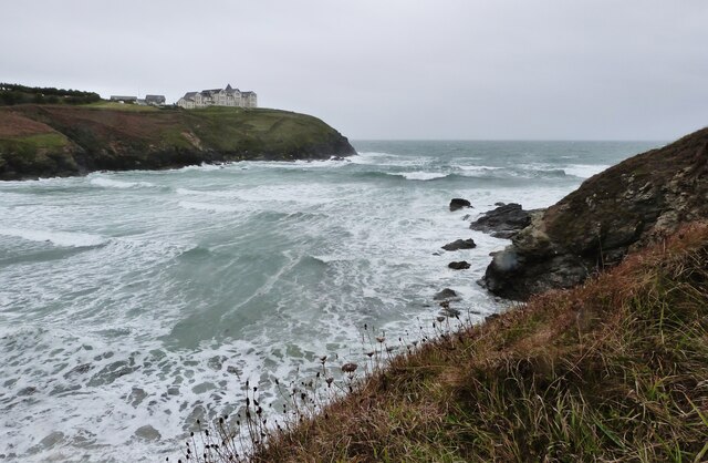
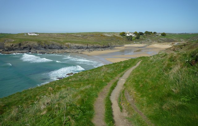
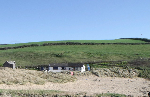
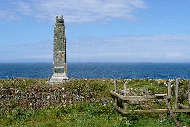
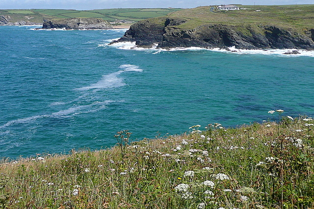
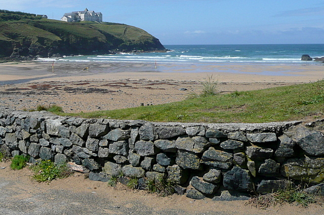
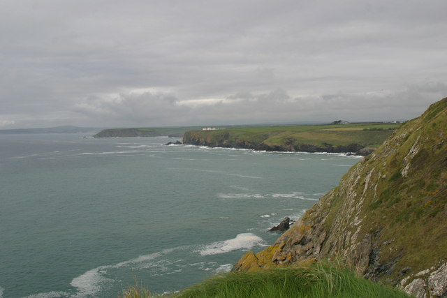
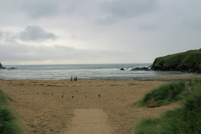
Gunwalloe is known for its stunning coastline, which features beautiful sandy beaches and rugged cliffs. The most famous beach in the area is Church Cove, which is home to the historic St. Winwaloe Church. This picturesque location attracts many visitors throughout the year who come to enjoy the peaceful surroundings and explore the rich history of the area.

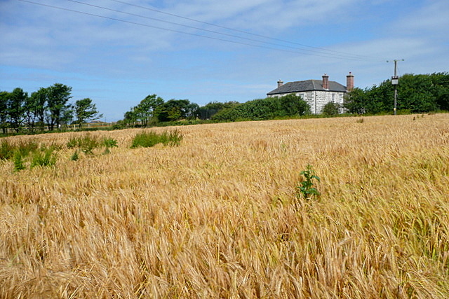
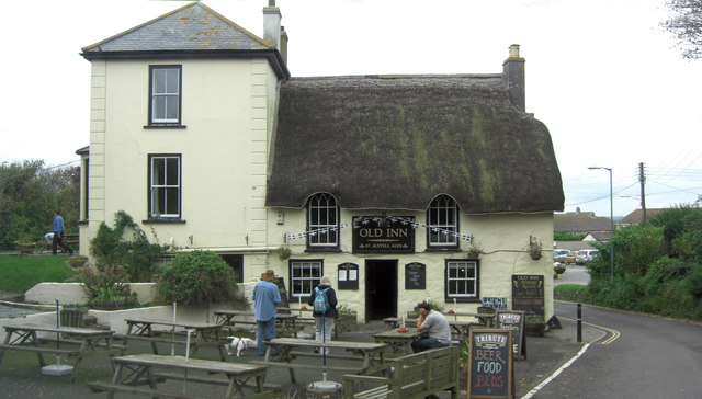
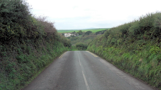
In addition to its natural beauty, Gunwalloe has a rich agricultural heritage. The parish is primarily rural and is characterized by rolling farmland and small hamlets. Agriculture, particularly dairy farming, plays a significant role in the local economy.

The parish also offers a range of recreational activities for residents and visitors alike. The South West Coast Path, which passes through Gunwalloe, provides excellent opportunities for hiking and enjoying panoramic views of the coastline. The nearby Lizard Point, the southernmost point of mainland Britain, is a popular destination for birdwatching and wildlife enthusiasts.

Gunwalloe is a peaceful and idyllic location, offering a perfect retreat for those seeking a tranquil escape in the heart of Cornwall's natural beauty.

If you have any feedback on the listing, please let us know in the comments section below.
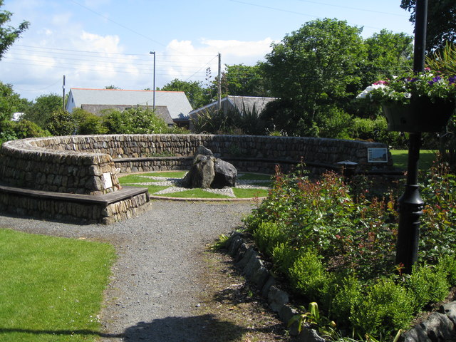
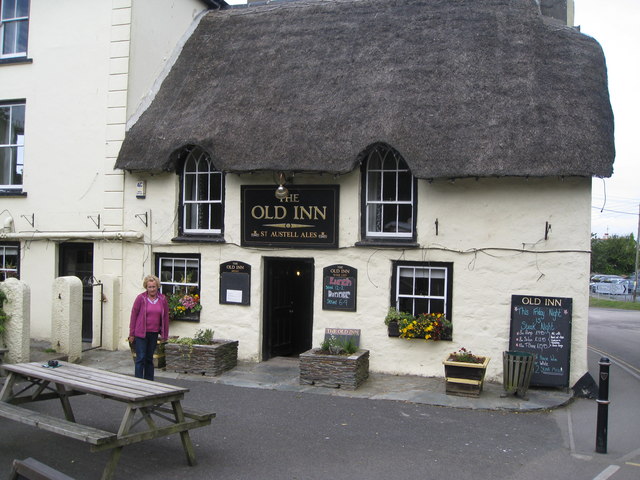
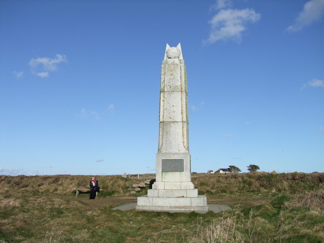
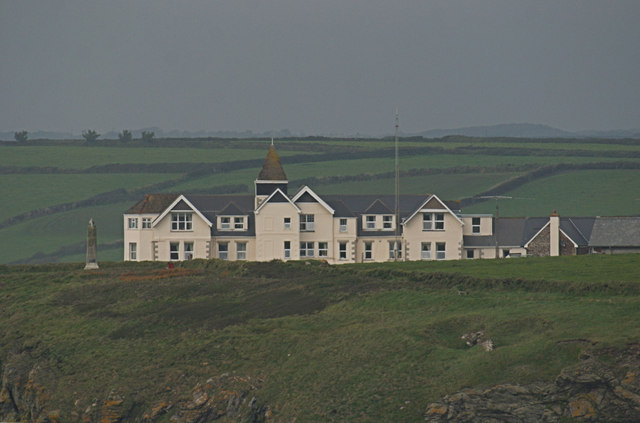
Gunwalloe Images

Images are sourced within 2km of 50.042303/-5.258648 or Grid Reference SW6620. Thanks to Geograph Open Source API. All images are credited.

Heavy sea at Poldhu Cove, near Mullion, Cornwall The building on the cliff top is a care home (Hope I'll be able to afford to go there when the time comes).
Heavy sea at Poldhu Cove, near Mullion, Cornwall
The building on the cliff top is a care home (Hope I'll be able to afford to go there when the time comes).
St Melaine's Church
St Melaine's Church
Poldhu Cove
Poldhu Cove
Beach cafe at Poldhu, Cornwall
Mullion Garden - with compass rose and water feature In the year 2000, Mullion village underwent various forms of regeneration. One of improvements involved taking over an overgrown and neglected village green and transforming it into 'Mullion Garden'. 

This area is now a peaceful and beautiful community garden. It is an ideal location for relaxing in the sun. As a feature it has a water fountain set at the centre of a compass rose and surrounded by a long typical Cornish stone  wall which is designed to incorporate a long bench.

'Mullion Garden' was formally opened on 4 July 2002.
Mullion Garden - with compass rose and water feature
In the year 2000, Mullion village underwent various forms of regeneration. One of improvements involved taking over an overgrown and neglected village green and transforming it into 'Mullion Garden'. This area is now a peaceful and beautiful community garden. It is an ideal location for relaxing in the sun. As a feature it has a water fountain set at the centre of a compass rose and surrounded by a long typical Cornish stone wall which is designed to incorporate a long bench. 'Mullion Garden' was formally opened on 4 July 2002.
The Old Inn - Mullion This photo with a person outside the thatched building gives some indication of the scale of this old 16th century building now used as a public house.

There is newer building alongside and now all part of the pub. When seen side-by-side the difference in scale of the two buildings from different time periods can be seen very clearly. To see the size comparison follow the link: <a href="https://www.geograph.org.uk/photo/2242772">SW6719 : The Old Inn</a>
The Old Inn - Mullion
This photo with a person outside the thatched building gives some indication of the scale of this old 16th century building now used as a public house. There is newer building alongside and now all part of the pub. When seen side-by-side the difference in scale of the two buildings from different time periods can be seen very clearly. To see the size comparison follow the link: SW6719 : The Old Inn
Marconi Monument - top feature This is a close up of the stone feature on the top of the monument to Marconi's success in trans-Atlantic communications. No doubt that is reflected in the choice of the stone globe on the top of the monument represents the Earth. <a href="https://www.geograph.org.uk/photo/468670">SW6619 : The Marconi Monument</a>
Marconi Monument - top feature
This is a close up of the stone feature on the top of the monument to Marconi's success in trans-Atlantic communications. No doubt that is reflected in the choice of the stone globe on the top of the monument represents the Earth. SW6619 : The Marconi Monument
Marconi Monument, Poldhu Cove, Cornwall
Towards Angrouse Farm We had started, only 10 minuts earlier, in rain, but the sun came out quickly after the rain stopped and the barley here was glistening.  At the far end of this footpath, near Angrouse Farm, John Wesley preached a sermon on 7th September 1762.  There is a stone marking the location, which is a listed structure.
Towards Angrouse Farm
We had started, only 10 minuts earlier, in rain, but the sun came out quickly after the rain stopped and the barley here was glistening. At the far end of this footpath, near Angrouse Farm, John Wesley preached a sermon on 7th September 1762. There is a stone marking the location, which is a listed structure.
Wild flowers at Angrouse Lane The lane from Angrouse Farm towards the Marconi monument was full of wild hedgerow plants.  Here is one of them, which hopefully someone will identify for me.
Wild flowers at Angrouse Lane
The lane from Angrouse Farm towards the Marconi monument was full of wild hedgerow plants. Here is one of them, which hopefully someone will identify for me.
Marconi monument This monument is close to the spot where, in 1901, Marconi sent the first radio signal across the Atlantic.  Nearby is the location of Poldhu Wireless Station, which operated between 1900 and 1933.  In the foreground is a typical Cornish wall, of stones laid one end.
Marconi monument
This monument is close to the spot where, in 1901, Marconi sent the first radio signal across the Atlantic. Nearby is the location of Poldhu Wireless Station, which operated between 1900 and 1933. In the foreground is a typical Cornish wall, of stones laid one end.
Poldhu Cove Coming from the south this is the first view of Poldhu Cove, a deep but narrow inlet.  Beyond, in <a href="https://www.geograph.org.uk/gridref/SW6620">SW6620</a> is Church Cove, which we will get to later.
Poldhu Cove
Coming from the south this is the first view of Poldhu Cove, a deep but narrow inlet. Beyond, in SW6620 is Church Cove, which we will get to later.
Poldhu Cove This is a popular cove, because the length of the cove means that there is a nice section of relatively sheltered water before the open sea.  On the far cliff top is Poldhu Point Hotel.
Poldhu Cove
This is a popular cove, because the length of the cove means that there is a nice section of relatively sheltered water before the open sea. On the far cliff top is Poldhu Point Hotel.
Polurrian Cove from Henscath Poldu Point is in the mid distance (with Poldu Care Home showing up as a white building) and to its right Angrouse Cliff. To the left of Poldu is Halzephron Cliff and beyond that Penzance.
Polurrian Cove from Henscath
Poldu Point is in the mid distance (with Poldu Care Home showing up as a white building) and to its right Angrouse Cliff. To the left of Poldu is Halzephron Cliff and beyond that Penzance.
The Old Inn This pub is Grade II listed and may date from the 17th C. It has English Heritage Building ID: 64663.
The Old Inn
This pub is Grade II listed and may date from the 17th C. It has English Heritage Building ID: 64663.
Poldhu Road descends towards the cove
Poldhu Care Home and Marconi Monument Taken from Henscath Head one mile to the south!
Poldhu Care Home and Marconi Monument
Taken from Henscath Head one mile to the south!
Poldhu Beach The car park is across the road and bestrewn by litter as well as being expensive to park. Access to the beach is via this grubby boardwalk.
Poldhu Beach
The car park is across the road and bestrewn by litter as well as being expensive to park. Access to the beach is via this grubby boardwalk.
Show me another place!

Gunwalloe is located at Grid Ref: SW6620 (Lat: 50.042303, Lng: -5.258648)

Unitary Authority: Cornwall

Police Authority: Devon & Cornwall

What 3 Words

///longer.wedge.prepped. Near Mullion, Cornwall

Related Wikis

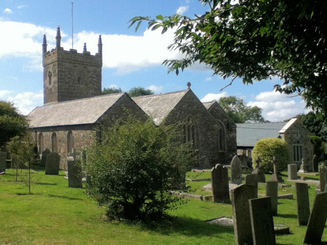
St Winwaloe's Church, Gunwalloe

The Church of Saint Winwaloe is the Grade I listed parish church of Gunwalloe in Cornwall, England. == History == The church is in the Church of England...

Baulk Head to Mullion

Baulk Head to Mullion is a coastal Site of Special Scientific Interest (SSSI) in Cornwall, England, UK, noted for both its biological and geological characteristics...

Poldhu

Poldhu is a small area in south Cornwall, England, UK, situated on the Lizard Peninsula; it comprises Poldhu Point and Poldhu Cove. Poldhu means "black...

St Corentine's Church, Cury

St Corentine's Church, Cury is a Grade I listed parish church in the Church of England in Cury, Cornwall, England, UK. == History == The parish church...

Nearby Amenities

Located within 500m of 50.042303,-5.258648
Direction: S
Generator Method: photovoltaic
Generator Output Electricity: small_installation
Generator Source: solar
Generator Type: solar_photovoltaic_panel
Location: roof
Power: generator
Source: bing
Lat/Long: 50.0417223/-5.2578042
Direction: W
Generator Method: photovoltaic
Generator Output Electricity: small_installation
Generator Source: solar
Generator Type: solar_photovoltaic_panel
Location: roof
Power: generator
Source: bing
Lat/Long: 50.0418102/-5.2578552
The data included in this document is from www.openstreetmap.org. The data is made available under ODbL.

Have you been to Gunwalloe?

Leave your review of Gunwalloe below (or comments, questions and feedback).