Carrag-a-pilez Cliff

Cliff, Slope in Cornwall

England

Carrag-a-pilez Cliff

Heavy sea at Poldhu Cove, near Mullion, Cornwall The building on the cliff top is a care home (Hope I'll be able to afford to go there when the time comes).
Heavy sea at Poldhu Cove, near Mullion, Cornwall Credit: Derek Voller

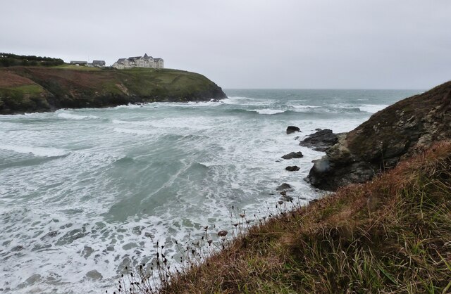
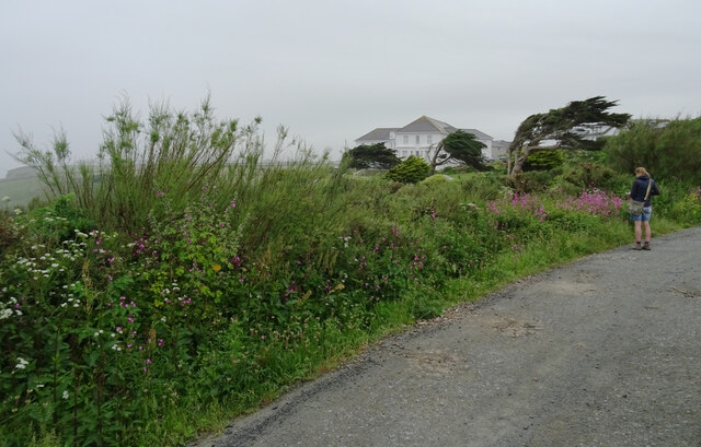
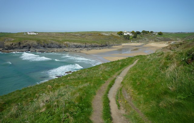
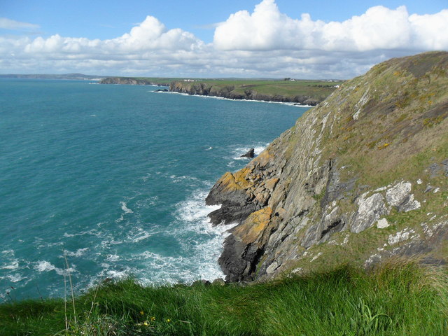
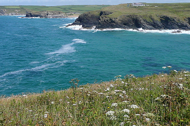
Carrag-a-pilez Cliff is a prominent natural landmark located in Cornwall, England. It is a stunning cliff formation that stretches along the coastline, offering breathtaking views of the Atlantic Ocean.

The cliff is characterized by its rugged and steep slopes, which make it an ideal spot for hiking and rock climbing enthusiasts. The height of the cliff varies along its length, with some sections reaching up to 100 meters above sea level. The rock composition of the cliff is predominantly granite, giving it a distinctive appearance and adding to its appeal.

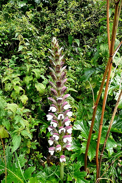
Carrag-a-pilez Cliff is known for its rich biodiversity and is home to a variety of plant and animal species. The cliff face provides nesting sites for seabirds such as gulls, fulmars, and razorbills. Rare plant species like sea thrift and heather can also be found growing in the nooks and crannies of the cliff.

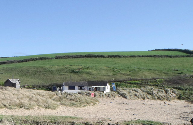
The area surrounding the cliff is a designated Area of Outstanding Natural Beauty, and it attracts both locals and tourists alike. Visitors can enjoy picturesque walks along the cliff-top paths, taking in the stunning coastal views and spotting wildlife along the way. The cliff also offers a vantage point for watching the dramatic waves crashing against the rocks during stormy weather.

Carrag-a-pilez Cliff is not only a natural wonder but also holds historical significance. It is believed to have been formed during the last Ice Age and has witnessed centuries of human activity. The cliff and its surroundings are dotted with remnants of ancient settlements, including a Bronze Age burial site.

Overall, Carrag-a-pilez Cliff is a must-visit destination for nature lovers, adventure seekers, and history enthusiasts alike, offering a unique blend of scenic beauty, wildlife, and cultural heritage.

If you have any feedback on the listing, please let us know in the comments section below.

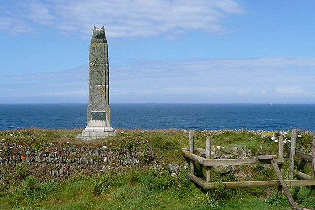
Carrag-a-pilez Cliff Images

Images are sourced within 2km of 50.036158/-5.2663247 or Grid Reference SW6620. Thanks to Geograph Open Source API. All images are credited.

Heavy sea at Poldhu Cove, near Mullion, Cornwall The building on the cliff top is a care home (Hope I'll be able to afford to go there when the time comes).
Heavy sea at Poldhu Cove, near Mullion, Cornwall
The building on the cliff top is a care home (Hope I'll be able to afford to go there when the time comes).
Church now YMCA
Church now YMCA
St Melaine's Church
St Melaine's Church
The South West Coast Path above Polurrian Cove The South West Coast Path National Trail - 630 miles of superb coastal walking. From Minehead on the edge of the Exmoor National Park to the shores of Poole Harbour in Dorset. It is the longest of all Britain's National Trails.
Website: <span class="nowrap"><a title="http://www.southwestcoastpath.com/" rel="nofollow ugc noopener" href="http://www.southwestcoastpath.com/">Link</a><img style="margin-left:2px;" alt="External link" title="External link - shift click to open in new window" src="https://s1.geograph.org.uk/img/external.png" width="10" height="10"/></span>
The South West Coast Path above Polurrian Cove
The South West Coast Path National Trail - 630 miles of superb coastal walking. From Minehead on the edge of the Exmoor National Park to the shores of Poole Harbour in Dorset. It is the longest of all Britain's National Trails. Website: LinkExternal link
The Polurrian Hotel seen from The South West Coast Path above Polurrian Cove The South West Coast Path National Trail - 630 miles of superb coastal walking. From Minehead on the edge of the Exmoor National Park to the shores of Poole Harbour in Dorset. It is the longest of all Britain's National Trails.
Website: <span class="nowrap"><a title="http://www.southwestcoastpath.com/" rel="nofollow ugc noopener" href="http://www.southwestcoastpath.com/">Link</a><img style="margin-left:2px;" alt="External link" title="External link - shift click to open in new window" src="https://s1.geograph.org.uk/img/external.png" width="10" height="10"/></span>
The Polurrian Hotel seen from The South West Coast Path above Polurrian Cove
The South West Coast Path National Trail - 630 miles of superb coastal walking. From Minehead on the edge of the Exmoor National Park to the shores of Poole Harbour in Dorset. It is the longest of all Britain's National Trails. Website: LinkExternal link
Poldhu Cove
Poldhu Cove
Nansmellyon Road, Mullion
Beach cafe at Poldhu, Cornwall
Cliffs north of Mullion Cove
Street furniture and signs in Mullion Village An unusual street scene taken from within Janet's pasty shop (called 'Munchies'). The clutter of street furniture and signs on this street corner is all too obvious and it is clear that the street is very narrow for cars and pedestrians alike. It is a view which is rather characteristic of such Cornish villages.

The photo includes the view of a traditional and very tasty pasty being hand-made by the owner. <a href="https://www.geograph.org.uk/photo/2423885">SW6719 : Traditional Cornish Pasty Shop</a>

The area from the Lizard around to Newlyn is where you can find some really excellent, high quality and tasty traditional pasties and all freshly made on the premises.<a href="https://www.geograph.org.uk/photo/2174447">SW4629 : The Coombe - Aunty May's Pasty Shop</a> <a href="https://www.geograph.org.uk/photo/2423854">SW7012 : Ann's Pasties - a view inside the kitchen/shop</a>
Street furniture and signs in Mullion Village
An unusual street scene taken from within Janet's pasty shop (called 'Munchies'). The clutter of street furniture and signs on this street corner is all too obvious and it is clear that the street is very narrow for cars and pedestrians alike. It is a view which is rather characteristic of such Cornish villages. The photo includes the view of a traditional and very tasty pasty being hand-made by the owner. SW6719 : Traditional Cornish Pasty Shop The area from the Lizard around to Newlyn is where you can find some really excellent, high quality and tasty traditional pasties and all freshly made on the premises.SW4629 : The Coombe - Aunty May's Pasty Shop SW7012 : Ann's Pasties - a view inside the kitchen/shop
Mullion Garden - with compass rose and water feature In the year 2000, Mullion village underwent various forms of regeneration. One of improvements involved taking over an overgrown and neglected village green and transforming it into 'Mullion Garden'. 

This area is now a peaceful and beautiful community garden. It is an ideal location for relaxing in the sun. As a feature it has a water fountain set at the centre of a compass rose and surrounded by a long typical Cornish stone  wall which is designed to incorporate a long bench.

'Mullion Garden' was formally opened on 4 July 2002.
Mullion Garden - with compass rose and water feature
In the year 2000, Mullion village underwent various forms of regeneration. One of improvements involved taking over an overgrown and neglected village green and transforming it into 'Mullion Garden'. This area is now a peaceful and beautiful community garden. It is an ideal location for relaxing in the sun. As a feature it has a water fountain set at the centre of a compass rose and surrounded by a long typical Cornish stone wall which is designed to incorporate a long bench. 'Mullion Garden' was formally opened on 4 July 2002.
The Old Inn - Mullion This photo with a person outside the thatched building gives some indication of the scale of this old 16th century building now used as a public house.

There is newer building alongside and now all part of the pub. When seen side-by-side the difference in scale of the two buildings from different time periods can be seen very clearly. To see the size comparison follow the link: <a href="https://www.geograph.org.uk/photo/2242772">SW6719 : The Old Inn</a>
The Old Inn - Mullion
This photo with a person outside the thatched building gives some indication of the scale of this old 16th century building now used as a public house. There is newer building alongside and now all part of the pub. When seen side-by-side the difference in scale of the two buildings from different time periods can be seen very clearly. To see the size comparison follow the link: SW6719 : The Old Inn
Marconi Monument - top feature This is a close up of the stone feature on the top of the monument to Marconi's success in trans-Atlantic communications. No doubt that is reflected in the choice of the stone globe on the top of the monument represents the Earth. <a href="https://www.geograph.org.uk/photo/468670">SW6619 : The Marconi Monument</a>
Marconi Monument - top feature
This is a close up of the stone feature on the top of the monument to Marconi's success in trans-Atlantic communications. No doubt that is reflected in the choice of the stone globe on the top of the monument represents the Earth. SW6619 : The Marconi Monument
Marconi Monument, Poldhu Cove, Cornwall
Towards Angrouse Farm We had started, only 10 minuts earlier, in rain, but the sun came out quickly after the rain stopped and the barley here was glistening.  At the far end of this footpath, near Angrouse Farm, John Wesley preached a sermon on 7th September 1762.  There is a stone marking the location, which is a listed structure.
Towards Angrouse Farm
We had started, only 10 minuts earlier, in rain, but the sun came out quickly after the rain stopped and the barley here was glistening. At the far end of this footpath, near Angrouse Farm, John Wesley preached a sermon on 7th September 1762. There is a stone marking the location, which is a listed structure.
Wild flowers at Angrouse Lane The lane from Angrouse Farm towards the Marconi monument was full of wild hedgerow plants.  Here is one of them, which hopefully someone will identify for me.
Wild flowers at Angrouse Lane
The lane from Angrouse Farm towards the Marconi monument was full of wild hedgerow plants. Here is one of them, which hopefully someone will identify for me.
Marconi monument This monument is close to the spot where, in 1901, Marconi sent the first radio signal across the Atlantic.  Nearby is the location of Poldhu Wireless Station, which operated between 1900 and 1933.  In the foreground is a typical Cornish wall, of stones laid one end.
Marconi monument
This monument is close to the spot where, in 1901, Marconi sent the first radio signal across the Atlantic. Nearby is the location of Poldhu Wireless Station, which operated between 1900 and 1933. In the foreground is a typical Cornish wall, of stones laid one end.
Poldhu Cove Coming from the south this is the first view of Poldhu Cove, a deep but narrow inlet.  Beyond, in <a href="https://www.geograph.org.uk/gridref/SW6620">SW6620</a> is Church Cove, which we will get to later.
Poldhu Cove
Coming from the south this is the first view of Poldhu Cove, a deep but narrow inlet. Beyond, in SW6620 is Church Cove, which we will get to later.
Show me another place!

Carrag-a-pilez Cliff is located at Grid Ref: SW6620 (Lat: 50.036158, Lng: -5.2663247)

Unitary Authority: Cornwall

Police Authority: Devon and Cornwall

What 3 Words

///drawn.escorting.perform. Near Mullion, Cornwall

Related Wikis

Baulk Head to Mullion

Baulk Head to Mullion is a coastal Site of Special Scientific Interest (SSSI) in Cornwall, England, UK, noted for both its biological and geological characteristics...

St Winwaloe's Church, Gunwalloe

The Church of Saint Winwaloe is the Grade I listed parish church of Gunwalloe in Cornwall, England. == History == The church is in the Church of England...

Poldhu

Poldhu is a small area in south Cornwall, England, UK, situated on the Lizard Peninsula; it comprises Poldhu Point and Poldhu Cove. Poldhu means "black...

St Corentine's Church, Cury

St Corentine's Church, Cury is a Grade I listed parish church in the Church of England in Cury, Cornwall, England, UK. == History == The parish church...

Nearby Amenities

Located within 500m of 50.036158,-5.2663247
Source: PGS
Lat/Long: 50.0392252/-5.2707286
Source: PGS
Lat/Long: 50.0380722/-5.2686085
Source: PGS
Lat/Long: 50.0371256/-5.2672456
Source: PGS
Lat/Long: 50.0339275/-5.2644658
Source: PGS
Lat/Long: 50.0339298/-5.2632894
Source: PGS
Lat/Long: 50.0341308/-5.2629608
Source: PGS
Lat/Long: 50.0342077/-5.2609749
Source: PGS
Lat/Long: 50.0332097/-5.2616462
Source: PGS
Lat/Long: 50.0331542/-5.26161
Source: PGS
Lat/Long: 50.0328678/-5.2619064
Source: PGS
Lat/Long: 50.0325227/-5.2629959
Source: PGS
Lat/Long: 50.0323533/-5.2635469
Source: PGS
Lat/Long: 50.032011/-5.2641953
Source: PGS
Lat/Long: 50.03884/-5.2673759
Bench
Backrest: no
Survey Date: 2023-10-08
Lat/Long: 50.0396844/-5.2697282
Life Ring
Emergency: life_ring
Survey Date: 2023-10-08
Lat/Long: 50.039115/-5.2684418
Bench
Backrest: no
Survey Date: 2023-10-08
Lat/Long: 50.0394529/-5.2673426
Bench
Backrest: no
Survey Date: 2023-10-08
Lat/Long: 50.0371288/-5.2659192
Life Ring
Emergency: life_ring
Survey Date: 2023-10-08
Lat/Long: 50.0345681/-5.2608294
Life Ring
Emergency: life_ring
Survey Date: 2023-10-08
Lat/Long: 50.0339402/-5.2602825
The data included in this document is from www.openstreetmap.org. The data is made available under ODbL.

Have you been to Carrag-a-pilez Cliff?

Leave your review of Carrag-a-pilez Cliff below (or comments, questions and feedback).