Angrouse Cliff

Cliff, Slope in Cornwall

England

Angrouse Cliff

Heavy sea at Poldhu Cove, near Mullion, Cornwall The building on the cliff top is a care home (Hope I'll be able to afford to go there when the time comes).
Heavy sea at Poldhu Cove, near Mullion, Cornwall Credit: Derek Voller

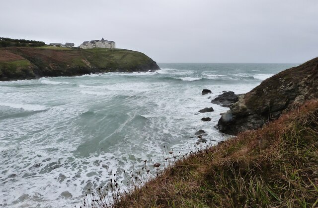
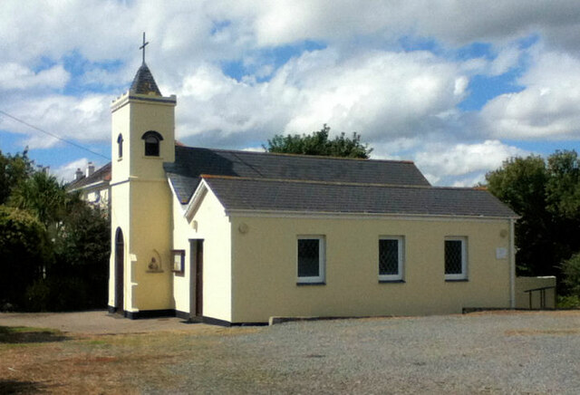
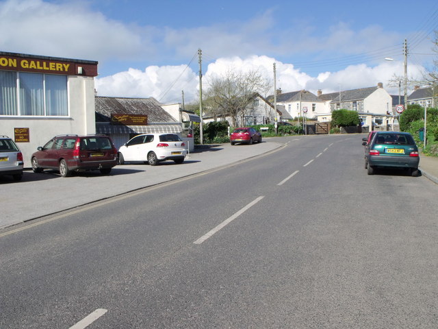
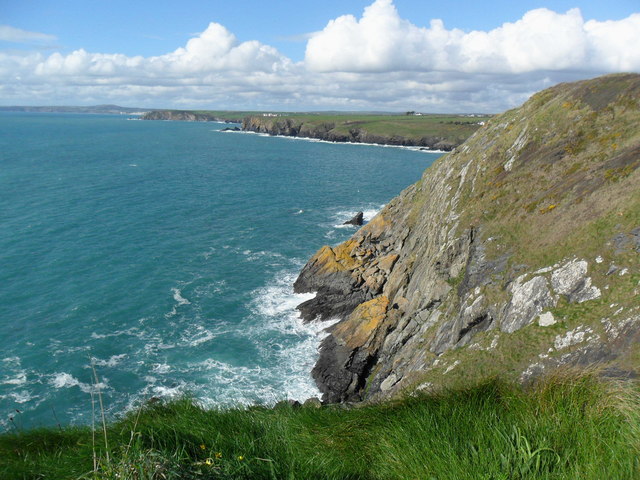
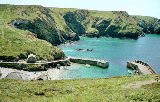
Angrouse Cliff is a prominent geological feature located along the coastline of Cornwall, England. It is part of the rugged and picturesque landscape that characterizes this region. The cliff is situated near the village of Angrouse and is a popular destination for tourists and locals alike.

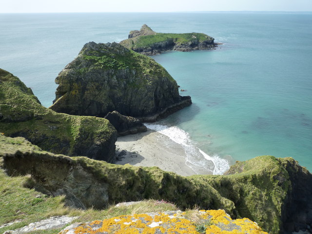
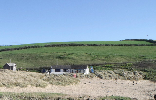
Rising to a height of approximately 150 meters, Angrouse Cliff offers breathtaking views of the surrounding area and the vast expanse of the Atlantic Ocean. Its sheer slopes are composed of sedimentary rocks, primarily consisting of sandstone and shale. These rocks have been shaped and carved by the forces of weathering and erosion over millions of years, resulting in the striking cliffs that we see today.

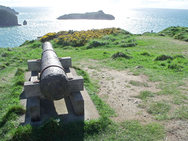
The cliff is known for its distinctive geological formations, including natural arches and caves, which have been created by the relentless pounding of the waves against the rock face. These features add to the allure of Angrouse Cliff and make it a popular spot for photographers and nature enthusiasts.

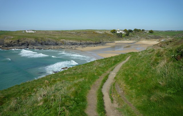
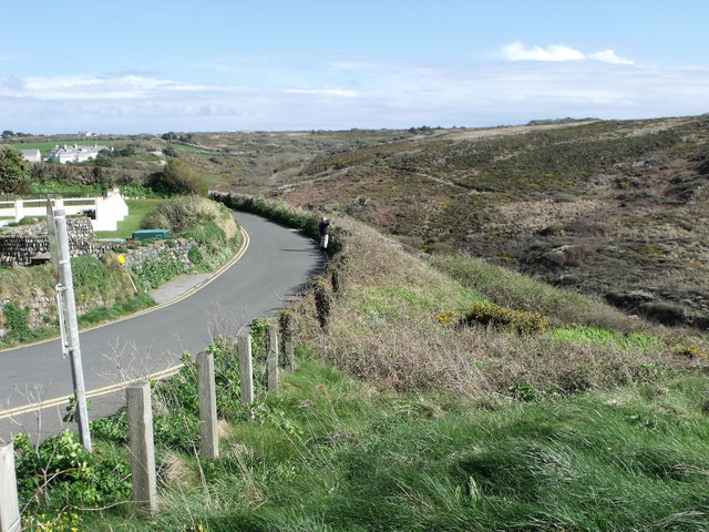
Visitors to Angrouse Cliff can explore the area by following well-maintained footpaths that wind their way along the cliff edge. These paths offer panoramic views of the surrounding countryside and provide opportunities for birdwatching and wildlife spotting. However, caution is advised when venturing close to the cliff edge, as it can be unstable and dangerous.

Overall, Angrouse Cliff is a stunning example of the natural beauty that Cornwall has to offer. Its dramatic slopes, geological formations, and breathtaking views make it a must-visit destination for anyone exploring the region.

If you have any feedback on the listing, please let us know in the comments section below.

Angrouse Cliff Images

Images are sourced within 2km of 50.027821/-5.2630215 or Grid Reference SW6619. Thanks to Geograph Open Source API. All images are credited.

Heavy sea at Poldhu Cove, near Mullion, Cornwall The building on the cliff top is a care home (Hope I'll be able to afford to go there when the time comes).
Heavy sea at Poldhu Cove, near Mullion, Cornwall
The building on the cliff top is a care home (Hope I'll be able to afford to go there when the time comes).
Church now YMCA
Church now YMCA
Mullion Methodist Church
St Melaine's Church
St Melaine's Church
St Michael's RC Church
Former Wesleyan Chapel
Coastline and islands at Mullion Cliff
Poldhu Cove
Poldhu Cove
Nansmellyon Road, Mullion
Cannon above Mullion Cove
Minor road above Mullion Cove
Beach cafe at Poldhu, Cornwall
Cliffs north of Mullion Cove
Street furniture and signs in Mullion Village An unusual street scene taken from within Janet's pasty shop (called 'Munchies'). The clutter of street furniture and signs on this street corner is all too obvious and it is clear that the street is very narrow for cars and pedestrians alike. It is a view which is rather characteristic of such Cornish villages.

The photo includes the view of a traditional and very tasty pasty being hand-made by the owner. <a href="https://www.geograph.org.uk/photo/2423885">SW6719 : Traditional Cornish Pasty Shop</a>

The area from the Lizard around to Newlyn is where you can find some really excellent, high quality and tasty traditional pasties and all freshly made on the premises.<a href="https://www.geograph.org.uk/photo/2174447">SW4629 : The Coombe - Aunty May's Pasty Shop</a> <a href="https://www.geograph.org.uk/photo/2423854">SW7012 : Ann's Pasties - a view inside the kitchen/shop</a>
Street furniture and signs in Mullion Village
An unusual street scene taken from within Janet's pasty shop (called 'Munchies'). The clutter of street furniture and signs on this street corner is all too obvious and it is clear that the street is very narrow for cars and pedestrians alike. It is a view which is rather characteristic of such Cornish villages. The photo includes the view of a traditional and very tasty pasty being hand-made by the owner. SW6719 : Traditional Cornish Pasty Shop The area from the Lizard around to Newlyn is where you can find some really excellent, high quality and tasty traditional pasties and all freshly made on the premises.SW4629 : The Coombe - Aunty May's Pasty Shop SW7012 : Ann's Pasties - a view inside the kitchen/shop
Traditional Cornish Pasty Shop The area abounds with small shops and other outlets producing traditional Cornish pasties.  

This building is rather modern by comparison to the other buildings in and around the church in the middle of Mullion village. Janet the owner certainly produces excellent pasties and well worth a visit and a chat.

<a href="https://www.geograph.org.uk/photo/2423854">SW7012 : Ann's Pasties - a view inside the kitchen/shop</a>
Traditional Cornish Pasty Shop
The area abounds with small shops and other outlets producing traditional Cornish pasties. This building is rather modern by comparison to the other buildings in and around the church in the middle of Mullion village. Janet the owner certainly produces excellent pasties and well worth a visit and a chat. SW7012 : Ann's Pasties - a view inside the kitchen/shop
Clock and barometer - 1897  Jubilee presentation Detail of the RNLI presentation to the "People of Mullion" in the year of Queen Victoria's Diamond Jubilee 1897. Many towns and village had various street features presented to mark this significant event. <a href="https://www.geograph.org.uk/photo/2242785">SW6719 : Clock and weather station in Mullion Churchtown</a>

The mercury barometer on the right below the clock would give an indication of weather trends at a time when weather forecasts were limited in availablity.
Clock and barometer - 1897 Jubilee presentation
Detail of the RNLI presentation to the "People of Mullion" in the year of Queen Victoria's Diamond Jubilee 1897. Many towns and village had various street features presented to mark this significant event. SW6719 : Clock and weather station in Mullion Churchtown The mercury barometer on the right below the clock would give an indication of weather trends at a time when weather forecasts were limited in availablity.
Mullion Garden - with compass rose and water feature In the year 2000, Mullion village underwent various forms of regeneration. One of improvements involved taking over an overgrown and neglected village green and transforming it into 'Mullion Garden'. 

This area is now a peaceful and beautiful community garden. It is an ideal location for relaxing in the sun. As a feature it has a water fountain set at the centre of a compass rose and surrounded by a long typical Cornish stone  wall which is designed to incorporate a long bench.

'Mullion Garden' was formally opened on 4 July 2002.
Mullion Garden - with compass rose and water feature
In the year 2000, Mullion village underwent various forms of regeneration. One of improvements involved taking over an overgrown and neglected village green and transforming it into 'Mullion Garden'. This area is now a peaceful and beautiful community garden. It is an ideal location for relaxing in the sun. As a feature it has a water fountain set at the centre of a compass rose and surrounded by a long typical Cornish stone wall which is designed to incorporate a long bench. 'Mullion Garden' was formally opened on 4 July 2002.
The Old Inn - Mullion This photo with a person outside the thatched building gives some indication of the scale of this old 16th century building now used as a public house.

There is newer building alongside and now all part of the pub. When seen side-by-side the difference in scale of the two buildings from different time periods can be seen very clearly. To see the size comparison follow the link: <a href="https://www.geograph.org.uk/photo/2242772">SW6719 : The Old Inn</a>
The Old Inn - Mullion
This photo with a person outside the thatched building gives some indication of the scale of this old 16th century building now used as a public house. There is newer building alongside and now all part of the pub. When seen side-by-side the difference in scale of the two buildings from different time periods can be seen very clearly. To see the size comparison follow the link: SW6719 : The Old Inn
Show me another place!

Angrouse Cliff is located at Grid Ref: SW6619 (Lat: 50.027821, Lng: -5.2630215)

Unitary Authority: Cornwall

Police Authority: Devon and Cornwall

What 3 Words

///songbird.logo.diner. Near Mullion, Cornwall

Related Wikis

Poldhu

Poldhu is a small area in south Cornwall, England, UK, situated on the Lizard Peninsula; it comprises Poldhu Point and Poldhu Cove. Poldhu means "black...

Baulk Head to Mullion

Baulk Head to Mullion is a coastal Site of Special Scientific Interest (SSSI) in Cornwall, England, UK, noted for both its biological and geological characteristics...

Mullion F.C.

Mullion Football Club is a football club based in Mullion, Cornwall. They are currently members of the South West Peninsula League Premier Division West...

St Winwaloe's Church, Gunwalloe

The Church of Saint Winwaloe is the Grade I listed parish church of Gunwalloe in Cornwall, England. == History == The church is in the Church of England...

Mullion Cove

Mullion Cove, or Porth Mellin, is a small community on the West Coast of the Lizard Peninsula in Cornwall, England, and on the eastern side of Mount's...

Mullion, Cornwall

Mullion (Cornish: Eglosvelyan) is a civil parish and village on the Lizard Peninsula in south Cornwall, England, United Kingdom. The nearest town is Helston...

Mullion Island

Mullion Island (Cornish: Enys Pryven, meaning worm island) is an uninhabited island on the eastern side of Mount's Bay, Cornwall, in the United Kingdom...

Mullion School

Mullion School is a coeducational secondary school located in Mullion, which is on the Lizard Peninsula in Cornwall, England. The year groups are seven...

Nearby Amenities

Located within 500m of 50.027821,-5.2630215
Source: PGS
Lat/Long: 50.032011/-5.2641953
Created By: almien_coastlines
Source: PGS
Lat/Long: 50.030831/-5.265841
Marconi Monument
Historic: monument
Wikidata: Q26434679
Lat/Long: 50.0289008/-5.2641985
Bench
Backrest: no
Survey Date: 2023-10-08
Lat/Long: 50.0282928/-5.2634347
Man Made: mast
Lat/Long: 50.0299798/-5.2648579
Man Made: mast
Lat/Long: 50.0299845/-5.2642056
Wireless Field, Poldhu
Board Type: history
Information: board
Tourism: information
Lat/Long: 50.0302617/-5.263694
Power: pole
Lat/Long: 50.030357/-5.2573738
Material: wood
Power: pole
Transformer: distribution
Lat/Long: 50.0303553/-5.2584493
Material: wood
Power: pole
Lat/Long: 50.0303536/-5.2600935
Material: wood
Power: pole
Lat/Long: 50.0307671/-5.2614319
Material: wood
Power: pole
Lat/Long: 50.0309144/-5.2624927
Material: wood
Power: pole
Transformer: distribution
Lat/Long: 50.0310626/-5.2635187
Bench
Backrest: no
Survey Date: 2023-10-08
Lat/Long: 50.0290143/-5.2641386
Bench
Backrest: no
Survey Date: 2023-10-08
Lat/Long: 50.0257777/-5.2597232
Bench
Backrest: no
Survey Date: 2023-10-08
Lat/Long: 50.024924/-5.2587243
Meres Cliff
Natural: cliff
Lat/Long: 50.0249301/-5.2592512
The data included in this document is from www.openstreetmap.org. The data is made available under ODbL.

Have you been to Angrouse Cliff?

Leave your review of Angrouse Cliff below (or comments, questions and feedback).