Men-y-grib Point

Coastal Feature, Headland, Point in Cornwall

England

Men-y-grib Point

Mullion Cove in Cornwall Looking south-west.

The image has been scanned from a Kodak Gold 100 negative dating from August 1990.
Mullion Cove in Cornwall Credit: Roger D Kidd

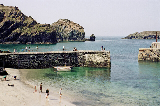
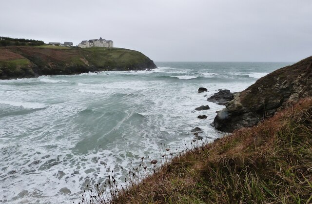
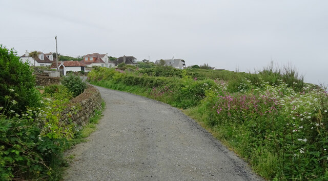
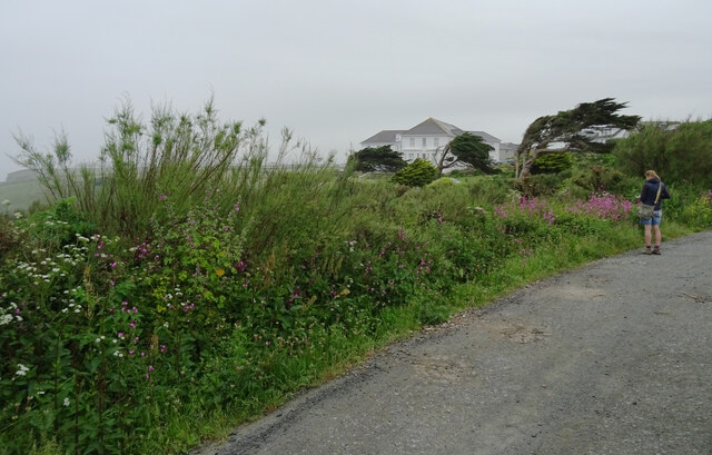
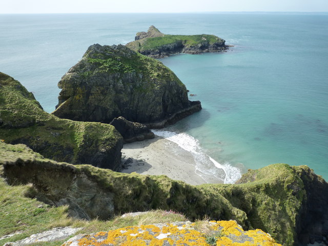
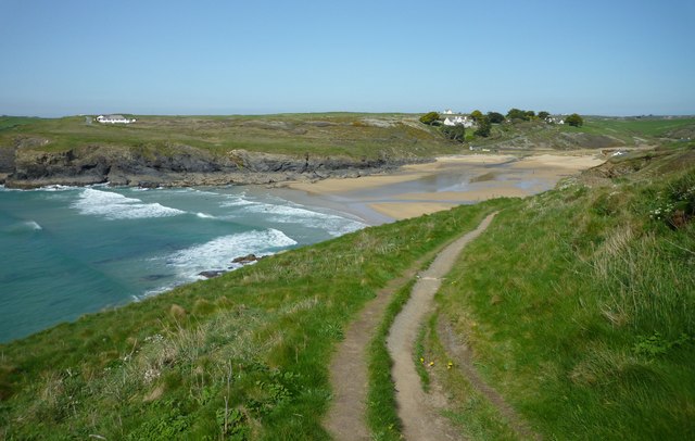
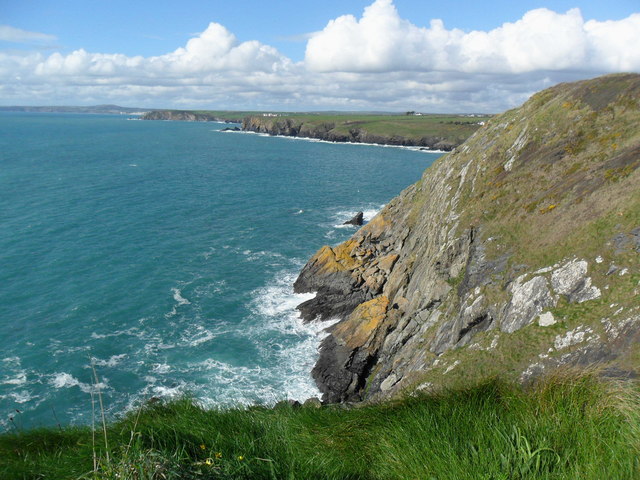
Men-y-grib Point is a prominent headland located on the north coast of Cornwall, England. It is known for its rugged cliffs, stunning coastal views, and rich biodiversity. The point juts out into the Atlantic Ocean, offering panoramic vistas of the surrounding coastline and sea.

The headland is formed of rocky outcrops and is a popular destination for hikers, birdwatchers, and nature enthusiasts. The area is home to a variety of seabirds, including gulls, cormorants, and puffins, making it a prime spot for birdwatching.

Men-y-grib Point is also a popular fishing spot, with anglers often seen trying their luck from the cliffs or the rocky shoreline. The waters around the headland are teeming with marine life, providing ample opportunities for fishing and exploring.

Visitors to Men-y-grib Point can enjoy walking along the cliffs, taking in the breathtaking views of the ocean, and spotting wildlife along the way. The headland is easily accessible by foot and is a must-visit destination for anyone looking to experience the natural beauty of Cornwall's rugged coastline.

If you have any feedback on the listing, please let us know in the comments section below.

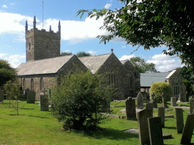
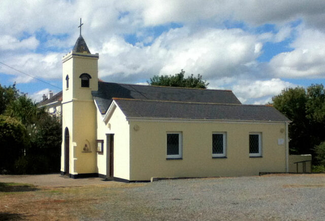
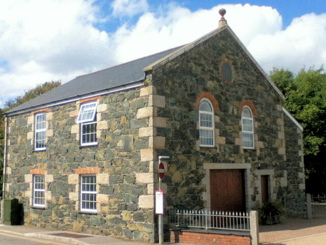
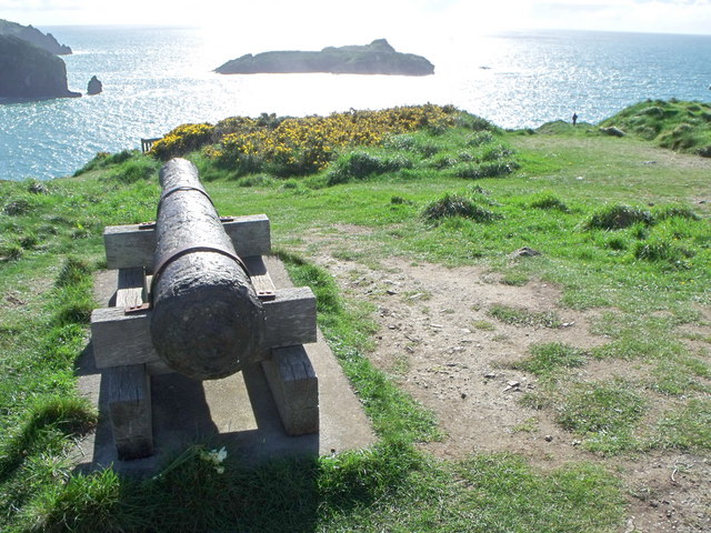
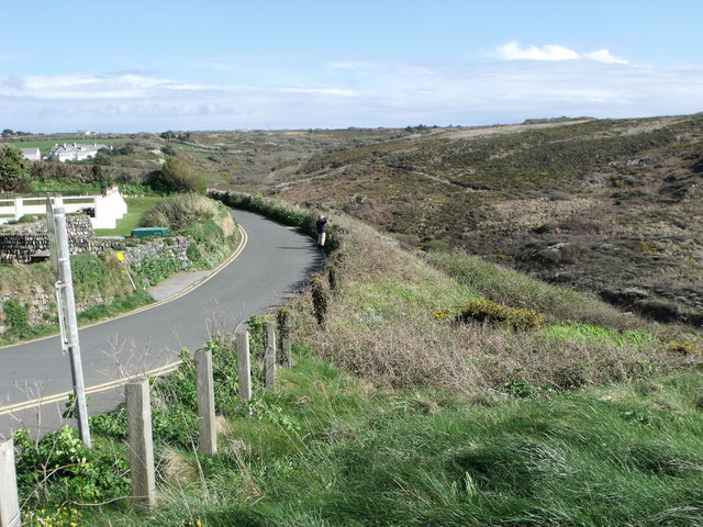
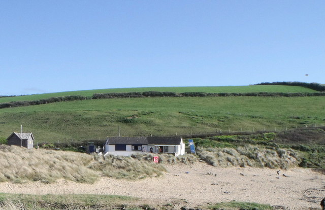
Men-y-grib Point Images

Images are sourced within 2km of 50.029841/-5.2650997 or Grid Reference SW6619. Thanks to Geograph Open Source API. All images are credited.

Mullion Cove in Cornwall Looking south-west.

The image has been scanned from a Kodak Gold 100 negative dating from August 1990.
Mullion Cove in Cornwall
Looking south-west. The image has been scanned from a Kodak Gold 100 negative dating from August 1990.
Heavy sea at Poldhu Cove, near Mullion, Cornwall The building on the cliff top is a care home (Hope I'll be able to afford to go there when the time comes).
Heavy sea at Poldhu Cove, near Mullion, Cornwall
The building on the cliff top is a care home (Hope I'll be able to afford to go there when the time comes).
Church now YMCA
Church now YMCA
Mullion Methodist Church
St Melaine's Church
St Melaine's Church
St Michael's RC Church
Former Wesleyan Chapel
The South West Coast Path above Polurrian Cove The South West Coast Path National Trail - 630 miles of superb coastal walking. From Minehead on the edge of the Exmoor National Park to the shores of Poole Harbour in Dorset. It is the longest of all Britain's National Trails.
Website: <span class="nowrap"><a title="http://www.southwestcoastpath.com/" rel="nofollow ugc noopener" href="http://www.southwestcoastpath.com/">Link</a><img style="margin-left:2px;" alt="External link" title="External link - shift click to open in new window" src="https://s1.geograph.org.uk/img/external.png" width="10" height="10"/></span>
The South West Coast Path above Polurrian Cove
The South West Coast Path National Trail - 630 miles of superb coastal walking. From Minehead on the edge of the Exmoor National Park to the shores of Poole Harbour in Dorset. It is the longest of all Britain's National Trails. Website: LinkExternal link
The Polurrian Hotel seen from The South West Coast Path above Polurrian Cove The South West Coast Path National Trail - 630 miles of superb coastal walking. From Minehead on the edge of the Exmoor National Park to the shores of Poole Harbour in Dorset. It is the longest of all Britain's National Trails.
Website: <span class="nowrap"><a title="http://www.southwestcoastpath.com/" rel="nofollow ugc noopener" href="http://www.southwestcoastpath.com/">Link</a><img style="margin-left:2px;" alt="External link" title="External link - shift click to open in new window" src="https://s1.geograph.org.uk/img/external.png" width="10" height="10"/></span>
The Polurrian Hotel seen from The South West Coast Path above Polurrian Cove
The South West Coast Path National Trail - 630 miles of superb coastal walking. From Minehead on the edge of the Exmoor National Park to the shores of Poole Harbour in Dorset. It is the longest of all Britain's National Trails. Website: LinkExternal link
Mullion Island seen from South West Coast Path near The Mullion Cove Hotel The South West Coast Path National Trail - 630 miles of superb coastal walking. From Minehead on the edge of the Exmoor National Park to the shores of Poole Harbour in Dorset. It is the longest of all Britain's National Trails.
Website: <span class="nowrap"><a title="http://www.southwestcoastpath.com/" rel="nofollow ugc noopener" href="http://www.southwestcoastpath.com/">Link</a><img style="margin-left:2px;" alt="External link" title="External link - shift click to open in new window" src="https://s1.geograph.org.uk/img/external.png" width="10" height="10"/></span>
Mullion Island seen from South West Coast Path near The Mullion Cove Hotel
The South West Coast Path National Trail - 630 miles of superb coastal walking. From Minehead on the edge of the Exmoor National Park to the shores of Poole Harbour in Dorset. It is the longest of all Britain's National Trails. Website: LinkExternal link
Coastline and islands at Mullion Cliff
Poldhu Cove
Poldhu Cove
Nansmellyon Road, Mullion
Cannon above Mullion Cove
Minor road above Mullion Cove
Beach cafe at Poldhu, Cornwall
Cliffs north of Mullion Cove
Street furniture and signs in Mullion Village An unusual street scene taken from within Janet's pasty shop (called 'Munchies'). The clutter of street furniture and signs on this street corner is all too obvious and it is clear that the street is very narrow for cars and pedestrians alike. It is a view which is rather characteristic of such Cornish villages.

The photo includes the view of a traditional and very tasty pasty being hand-made by the owner. <a href="https://www.geograph.org.uk/photo/2423885">SW6719 : Traditional Cornish Pasty Shop</a>

The area from the Lizard around to Newlyn is where you can find some really excellent, high quality and tasty traditional pasties and all freshly made on the premises.<a href="https://www.geograph.org.uk/photo/2174447">SW4629 : The Coombe - Aunty May's Pasty Shop</a> <a href="https://www.geograph.org.uk/photo/2423854">SW7012 : Ann's Pasties - a view inside the kitchen/shop</a>
Street furniture and signs in Mullion Village
An unusual street scene taken from within Janet's pasty shop (called 'Munchies'). The clutter of street furniture and signs on this street corner is all too obvious and it is clear that the street is very narrow for cars and pedestrians alike. It is a view which is rather characteristic of such Cornish villages. The photo includes the view of a traditional and very tasty pasty being hand-made by the owner. SW6719 : Traditional Cornish Pasty Shop The area from the Lizard around to Newlyn is where you can find some really excellent, high quality and tasty traditional pasties and all freshly made on the premises.SW4629 : The Coombe - Aunty May's Pasty Shop SW7012 : Ann's Pasties - a view inside the kitchen/shop
Show me another place!

Men-y-grib Point is located at Grid Ref: SW6619 (Lat: 50.029841, Lng: -5.2650997)

Unitary Authority: Cornwall

Police Authority: Devon and Cornwall

What 3 Words

///structure.levels.family. Near Mullion, Cornwall

Related Wikis

Poldhu

Poldhu is a small area in south Cornwall, England, UK, situated on the Lizard Peninsula; it comprises Poldhu Point and Poldhu Cove. Poldhu means "black...

Baulk Head to Mullion

Baulk Head to Mullion is a coastal Site of Special Scientific Interest (SSSI) in Cornwall, England, UK, noted for both its biological and geological characteristics...

St Winwaloe's Church, Gunwalloe

The Church of Saint Winwaloe is the Grade I listed parish church of Gunwalloe in Cornwall, England. == History == The church is in the Church of England...

Mullion F.C.

Mullion Football Club is a football club based in Mullion, Cornwall. They are currently members of the South West Peninsula League Premier Division West...

Nearby Amenities

Located within 500m of 50.029841,-5.2650997
Source: PGS
Lat/Long: 50.0339275/-5.2644658
Source: PGS
Lat/Long: 50.0339298/-5.2632894
Source: PGS
Lat/Long: 50.0332097/-5.2616462
Source: PGS
Lat/Long: 50.0331542/-5.26161
Source: PGS
Lat/Long: 50.0328678/-5.2619064
Source: PGS
Lat/Long: 50.0325227/-5.2629959
Source: PGS
Lat/Long: 50.0323533/-5.2635469
Source: PGS
Lat/Long: 50.032011/-5.2641953
Created By: almien_coastlines
Source: PGS
Lat/Long: 50.030831/-5.265841
Marconi Monument
Historic: monument
Wikidata: Q26434679
Lat/Long: 50.0289008/-5.2641985
Bench
Backrest: no
Survey Date: 2023-10-08
Lat/Long: 50.0283304/-5.2633739
Man Made: mast
Lat/Long: 50.0299798/-5.2648579
Man Made: mast
Lat/Long: 50.0299845/-5.2642056
Wireless Field, Poldhu
Board Type: history
Information: board
Tourism: information
Lat/Long: 50.0302617/-5.263694
Material: wood
Power: pole
Transformer: distribution
Lat/Long: 50.0303553/-5.2584493
Material: wood
Power: pole
Lat/Long: 50.0303536/-5.2600935
Material: wood
Power: pole
Lat/Long: 50.0307671/-5.2614319
Material: wood
Power: pole
Lat/Long: 50.0309144/-5.2624927
Material: wood
Power: pole
Transformer: distribution
Lat/Long: 50.0310626/-5.2635187
Bench
Backrest: no
Survey Date: 2023-10-08
Lat/Long: 50.0290143/-5.2641386
The data included in this document is from www.openstreetmap.org. The data is made available under ODbL.

Have you been to Men-y-grib Point?

Leave your review of Men-y-grib Point below (or comments, questions and feedback).