Pol Glâs

Sea, Estuary, Creek in Cornwall

England

Pol Glâs

Heavy sea at Poldhu Cove, near Mullion, Cornwall The building on the cliff top is a care home (Hope I'll be able to afford to go there when the time comes).
Heavy sea at Poldhu Cove, near Mullion, Cornwall Credit: Derek Voller

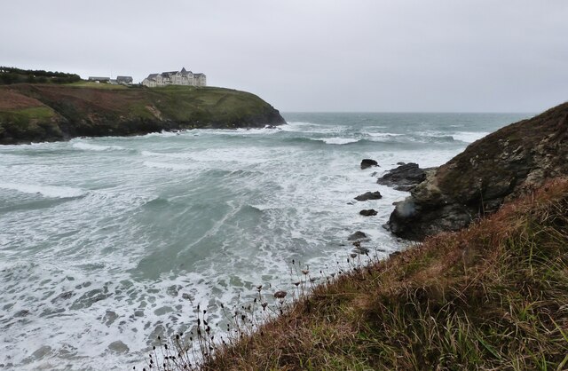
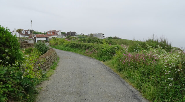
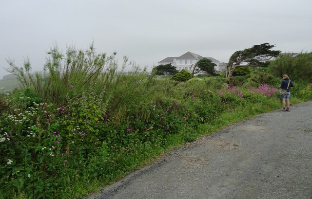
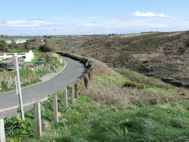
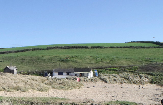
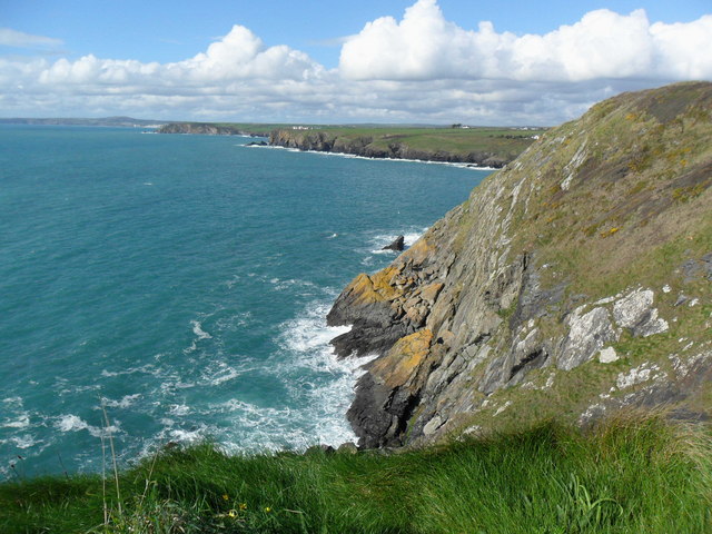
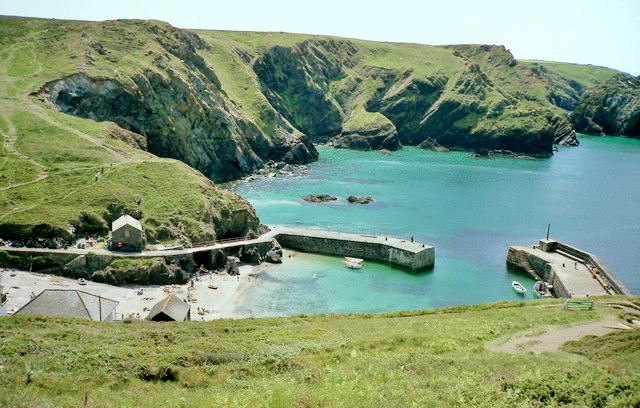
Pol Glâs is a picturesque coastal village located in Cornwall, England. Situated along the southeastern coast of the county, Pol Glâs is known for its stunning sea views, estuary, and creek. The village is nestled between rolling green hills and the glistening waters of the English Channel, creating a breathtaking backdrop.

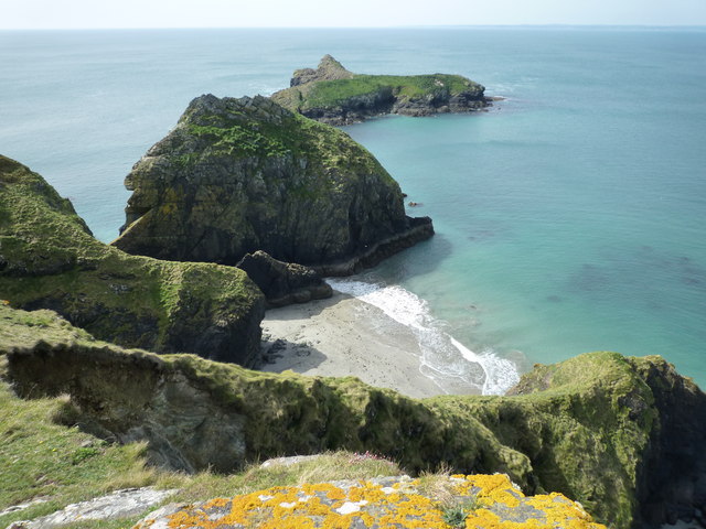
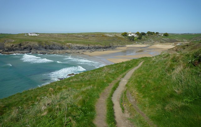
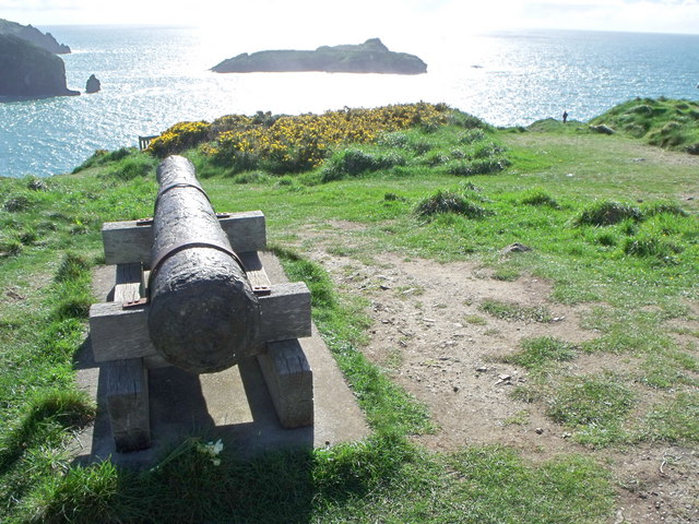
The sea at Pol Glâs is a prominent feature, attracting visitors from near and far. Its crystal-clear waters and pristine sandy beaches make it an ideal spot for swimming, sunbathing, and various water sports such as surfing and sailing. The sea is also home to a diverse range of marine life, making it a popular destination for snorkeling and scuba diving enthusiasts.

The estuary at Pol Glâs is a tranquil and idyllic spot where the river meets the sea. It provides a haven for a variety of bird species and is a paradise for birdwatchers. Visitors can explore the estuary by kayak or take leisurely walks along its shores to admire the peaceful surroundings.

Nestled within the village is a charming creek, which adds to the beauty and charm of Pol Glâs. The creek is a narrow inlet of water that winds its way through the village, providing a peaceful and scenic setting for leisurely strolls and picnics. It is also a popular spot for fishing, attracting anglers looking to catch a variety of fish species.

Overall, Pol Glâs is a coastal gem, offering visitors the perfect blend of natural beauty, outdoor activities, and a peaceful atmosphere. Whether it's enjoying the sea, exploring the estuary, or relaxing by the creek, there is something for everyone in this enchanting village.

If you have any feedback on the listing, please let us know in the comments section below.
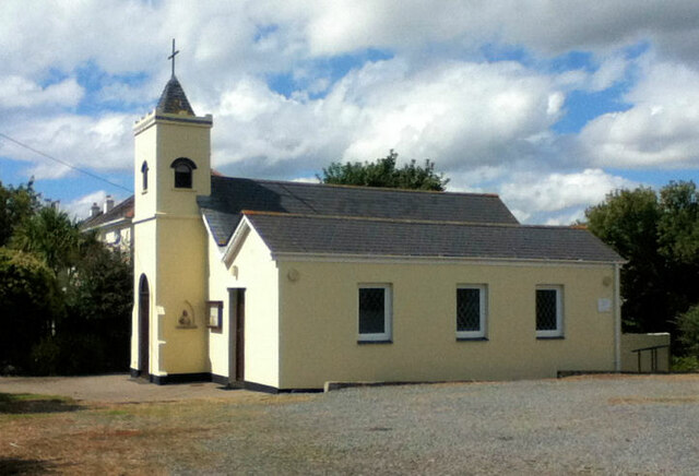
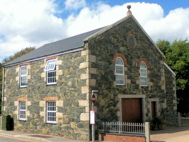
Pol Glâs Images

Images are sourced within 2km of 50.025848/-5.261198 or Grid Reference SW6619. Thanks to Geograph Open Source API. All images are credited.

Heavy sea at Poldhu Cove, near Mullion, Cornwall The building on the cliff top is a care home (Hope I'll be able to afford to go there when the time comes).
Heavy sea at Poldhu Cove, near Mullion, Cornwall
The building on the cliff top is a care home (Hope I'll be able to afford to go there when the time comes).
Church now YMCA
Church now YMCA
Mullion Methodist Church
St Melaine's Church
St Melaine's Church
St Michael's RC Church
Former Wesleyan Chapel
The South West Coast Path above Polurrian Cove The South West Coast Path National Trail - 630 miles of superb coastal walking. From Minehead on the edge of the Exmoor National Park to the shores of Poole Harbour in Dorset. It is the longest of all Britain's National Trails.
Website: <span class="nowrap"><a title="http://www.southwestcoastpath.com/" rel="nofollow ugc noopener" href="http://www.southwestcoastpath.com/">Link</a><img style="margin-left:2px;" alt="External link" title="External link - shift click to open in new window" src="https://s1.geograph.org.uk/img/external.png" width="10" height="10"/></span>
The South West Coast Path above Polurrian Cove
The South West Coast Path National Trail - 630 miles of superb coastal walking. From Minehead on the edge of the Exmoor National Park to the shores of Poole Harbour in Dorset. It is the longest of all Britain's National Trails. Website: LinkExternal link
The Polurrian Hotel seen from The South West Coast Path above Polurrian Cove The South West Coast Path National Trail - 630 miles of superb coastal walking. From Minehead on the edge of the Exmoor National Park to the shores of Poole Harbour in Dorset. It is the longest of all Britain's National Trails.
Website: <span class="nowrap"><a title="http://www.southwestcoastpath.com/" rel="nofollow ugc noopener" href="http://www.southwestcoastpath.com/">Link</a><img style="margin-left:2px;" alt="External link" title="External link - shift click to open in new window" src="https://s1.geograph.org.uk/img/external.png" width="10" height="10"/></span>
The Polurrian Hotel seen from The South West Coast Path above Polurrian Cove
The South West Coast Path National Trail - 630 miles of superb coastal walking. From Minehead on the edge of the Exmoor National Park to the shores of Poole Harbour in Dorset. It is the longest of all Britain's National Trails. Website: LinkExternal link
Mullion Island seen from South West Coast Path near The Mullion Cove Hotel The South West Coast Path National Trail - 630 miles of superb coastal walking. From Minehead on the edge of the Exmoor National Park to the shores of Poole Harbour in Dorset. It is the longest of all Britain's National Trails.
Website: <span class="nowrap"><a title="http://www.southwestcoastpath.com/" rel="nofollow ugc noopener" href="http://www.southwestcoastpath.com/">Link</a><img style="margin-left:2px;" alt="External link" title="External link - shift click to open in new window" src="https://s1.geograph.org.uk/img/external.png" width="10" height="10"/></span>
Mullion Island seen from South West Coast Path near The Mullion Cove Hotel
The South West Coast Path National Trail - 630 miles of superb coastal walking. From Minehead on the edge of the Exmoor National Park to the shores of Poole Harbour in Dorset. It is the longest of all Britain's National Trails. Website: LinkExternal link
Coastline and islands at Mullion Cliff
Poldhu Cove
Poldhu Cove
Nansmellyon Road, Mullion
Cannon above Mullion Cove
Minor road above Mullion Cove
Beach cafe at Poldhu, Cornwall
Cliffs north of Mullion Cove
Street furniture and signs in Mullion Village An unusual street scene taken from within Janet's pasty shop (called 'Munchies'). The clutter of street furniture and signs on this street corner is all too obvious and it is clear that the street is very narrow for cars and pedestrians alike. It is a view which is rather characteristic of such Cornish villages.

The photo includes the view of a traditional and very tasty pasty being hand-made by the owner. <a href="https://www.geograph.org.uk/photo/2423885">SW6719 : Traditional Cornish Pasty Shop</a>

The area from the Lizard around to Newlyn is where you can find some really excellent, high quality and tasty traditional pasties and all freshly made on the premises.<a href="https://www.geograph.org.uk/photo/2174447">SW4629 : The Coombe - Aunty May's Pasty Shop</a> <a href="https://www.geograph.org.uk/photo/2423854">SW7012 : Ann's Pasties - a view inside the kitchen/shop</a>
Street furniture and signs in Mullion Village
An unusual street scene taken from within Janet's pasty shop (called 'Munchies'). The clutter of street furniture and signs on this street corner is all too obvious and it is clear that the street is very narrow for cars and pedestrians alike. It is a view which is rather characteristic of such Cornish villages. The photo includes the view of a traditional and very tasty pasty being hand-made by the owner. SW6719 : Traditional Cornish Pasty Shop The area from the Lizard around to Newlyn is where you can find some really excellent, high quality and tasty traditional pasties and all freshly made on the premises.SW4629 : The Coombe - Aunty May's Pasty Shop SW7012 : Ann's Pasties - a view inside the kitchen/shop
Traditional Cornish Pasty Shop The area abounds with small shops and other outlets producing traditional Cornish pasties.  

This building is rather modern by comparison to the other buildings in and around the church in the middle of Mullion village. Janet the owner certainly produces excellent pasties and well worth a visit and a chat.

<a href="https://www.geograph.org.uk/photo/2423854">SW7012 : Ann's Pasties - a view inside the kitchen/shop</a>
Traditional Cornish Pasty Shop
The area abounds with small shops and other outlets producing traditional Cornish pasties. This building is rather modern by comparison to the other buildings in and around the church in the middle of Mullion village. Janet the owner certainly produces excellent pasties and well worth a visit and a chat. SW7012 : Ann's Pasties - a view inside the kitchen/shop
Show me another place!

Pol Glâs is located at Grid Ref: SW6619 (Lat: 50.025848, Lng: -5.261198)

Unitary Authority: Cornwall

Police Authority: Devon and Cornwall

What 3 Words

///vanish.engaging.surpasses. Near Mullion, Cornwall

Related Wikis

Mullion F.C.

Mullion Football Club is a football club based in Mullion, Cornwall. They are currently members of the South West Peninsula League Premier Division West...

Poldhu

Poldhu is a small area in south Cornwall, England, UK, situated on the Lizard Peninsula; it comprises Poldhu Point and Poldhu Cove. Poldhu means "black...

Baulk Head to Mullion

Baulk Head to Mullion is a coastal Site of Special Scientific Interest (SSSI) in Cornwall, England, UK, noted for both its biological and geological characteristics...

Mullion Cove

Mullion Cove, or Porth Mellin, is a small community on the West Coast of the Lizard Peninsula in Cornwall, England, and on the eastern side of Mount's...

Nearby Amenities

Located within 500m of 50.025848,-5.261198
Polurrian Cove
Natural: bay
Source: OD Streetview
Lat/Long: 50.0227199/-5.2584164
Marconi Monument
Historic: monument
Wikidata: Q26434679
Lat/Long: 50.0289008/-5.2641985
Bench
Backrest: no
Survey Date: 2023-10-08
Lat/Long: 50.0283304/-5.2633739
Material: wood
Power: pole
Transformer: distribution
Lat/Long: 50.0266817/-5.2548149
Material: wood
Power: pole
Lat/Long: 50.0264711/-5.2544304
Material: wood
Power: pole
Lat/Long: 50.0261747/-5.2548657
Bench
Backrest: no
Survey Date: 2023-10-08
Lat/Long: 50.0290143/-5.2641386
Bench
Backrest: no
Survey Date: 2023-10-08
Lat/Long: 50.0257777/-5.2597232
Bench
Backrest: no
Survey Date: 2023-10-08
Lat/Long: 50.024924/-5.2587243
Bench
Backrest: yes
Survey Date: 2023-10-08
Lat/Long: 50.0242854/-5.2572035
Phone
Emergency: phone
Survey Date: 2023-10-08
Lat/Long: 50.0243324/-5.256132
Life Ring
Emergency: life_ring
Survey Date: 2023-10-08
Lat/Long: 50.0243386/-5.2561219
Waste Basket
Survey Date: 2023-10-08
Waste: dog_excrement
Lat/Long: 50.0241749/-5.255837
Bench
Backrest: yes
Survey Date: 2023-10-08
Waste: dog_excrement
Lat/Long: 50.0237991/-5.2554124
Bench
Backrest: yes
Survey Date: 2023-10-08
Lat/Long: 50.0235566/-5.2553519
Meres Cliff
Natural: cliff
Lat/Long: 50.0249301/-5.2592512
The data included in this document is from www.openstreetmap.org. The data is made available under ODbL.

Have you been to Pol Glâs?

Leave your review of Pol Glâs below (or comments, questions and feedback).