Lower Predannack Cliff

Cliff, Slope in Cornwall

England

Lower Predannack Cliff

Mullion Island seen from South West Coast Path near The Mullion Cove Hotel The South West Coast Path National Trail - 630 miles of superb coastal walking. From Minehead on the edge of the Exmoor National Park to the shores of Poole Harbour in Dorset. It is the longest of all Britain's National Trails.
Website: <span class="nowrap"><a title="http://www.southwestcoastpath.com/" rel="nofollow ugc noopener" href="http://www.southwestcoastpath.com/">Link</a><img style="margin-left:2px;" alt="External link" title="External link - shift click to open in new window" src="https://s1.geograph.org.uk/img/external.png" width="10" height="10"/></span>
Mullion Island seen from South West Coast Path near The Mullion Cove Hotel Credit: habiloid

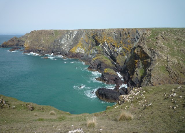
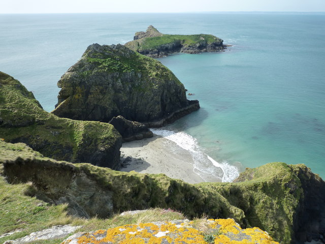
Lower Predannack Cliff is a stunning natural feature located along the southern coast of Cornwall, England. Situated near the village of Mullion, it is part of the larger Predannack Cliffs which stretch for several miles along the coastline. This particular section of the cliffs, known as Lower Predannack Cliff, is characterized by its dramatic cliffs and sloping landscape.

The cliff face at Lower Predannack Cliff is composed of rugged, dark rock formations that have been shaped by the relentless pounding of the Atlantic Ocean. The cliffs rise to an impressive height, offering breathtaking views of the surrounding sea and coastline. The sheer vertical drop and jagged edges of the cliffs make them an awe-inspiring sight for visitors.

The sloping terrain around the cliffs is covered in lush green vegetation, including grasses, heather, and wildflowers. This creates a striking contrast against the dark rock, adding to the beauty of the landscape. The cliff-top is also home to a variety of bird species, including seabirds such as fulmars and kittiwakes, making it a popular spot for birdwatching enthusiasts.

Lower Predannack Cliff is easily accessible to visitors, with a walking trail that runs along the cliff-top, offering panoramic views of the coastline. However, caution is advised when exploring the area, as the cliff edges can be unstable and dangerous. It is also important to respect the natural environment and wildlife that inhabit the area.

Overall, Lower Predannack Cliff is a magnificent natural wonder, showcasing the raw power and beauty of the Cornish coastline. Its towering cliffs, sloping landscape, and diverse flora and fauna make it a must-see destination for nature lovers and outdoor enthusiasts.

If you have any feedback on the listing, please let us know in the comments section below.

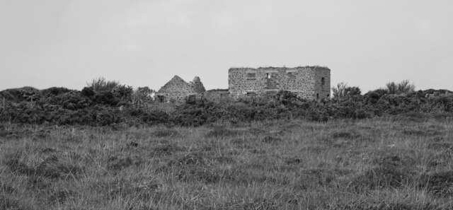
Lower Predannack Cliff Images

Images are sourced within 2km of 49.997111/-5.2603541 or Grid Reference SW6615. Thanks to Geograph Open Source API. All images are credited.

Mullion Island seen from South West Coast Path near The Mullion Cove Hotel The South West Coast Path National Trail - 630 miles of superb coastal walking. From Minehead on the edge of the Exmoor National Park to the shores of Poole Harbour in Dorset. It is the longest of all Britain's National Trails.
Website: <span class="nowrap"><a title="http://www.southwestcoastpath.com/" rel="nofollow ugc noopener" href="http://www.southwestcoastpath.com/">Link</a><img style="margin-left:2px;" alt="External link" title="External link - shift click to open in new window" src="https://s1.geograph.org.uk/img/external.png" width="10" height="10"/></span>
Mullion Island seen from South West Coast Path near The Mullion Cove Hotel
The South West Coast Path National Trail - 630 miles of superb coastal walking. From Minehead on the edge of the Exmoor National Park to the shores of Poole Harbour in Dorset. It is the longest of all Britain's National Trails. Website: LinkExternal link
Derelict buildings near Kynance Farm on The Lizard
Coastline and islands at Mullion Cliff
Harbour at Mullion Cove,  Cornwall Rough seas whipped up by the remnants of  hurricane Katia which blew around the top of the Atlantic and battered Britain.
Harbour at Mullion Cove, Cornwall
Rough seas whipped up by the remnants of hurricane Katia which blew around the top of the Atlantic and battered Britain.
Mullion Cove, Cornwall A lone spectator risks a soaking, ( or worse ) from the heavy seas whipped up by the tail end of Hurricane Katia which brought much devastation to America's coast
Mullion Cove, Cornwall
A lone spectator risks a soaking, ( or worse ) from the heavy seas whipped up by the tail end of Hurricane Katia which brought much devastation to America's coast
Mullion Cove
Mullion Cove
Ghost Hill Road passes Isle of Wight Cottage Opposite the cottage is a barred entrance to Predannack Airfield.
Ghost Hill Road passes Isle of Wight Cottage
Opposite the cottage is a barred entrance to Predannack Airfield.
Unnamed lane northeast of Teneriffe Farm
Unnamed lane passes Teneriffe Farm
Higher Predannack Wollas farm buildings These buildings are on the opposite side of the lane to Windyridge Farm and it's difficult to know if they belong to it or not.
Higher Predannack Wollas farm buildings
These buildings are on the opposite side of the lane to Windyridge Farm and it's difficult to know if they belong to it or not.
Lower Predannack Wollas pasture
Mullion Cove and Island Lord Robartes of Lanhydrock financed the two existing stone piers between 1887 & 1895. He also considered a further breakwater across this cove but it proved too expensive.
Mullion Cove and Island
Lord Robartes of Lanhydrock financed the two existing stone piers between 1887 & 1895. He also considered a further breakwater across this cove but it proved too expensive.
Mullion Cove and Harbour (2)
The coastal path on Predannack Cliff The stepping stones suggest that this route can become wet and muddy, but it is perfectly dry at the moment. The coastline ahead is around Mullion Cove, with the Mullion Cove Hotel visible on top of the cliff.
The coastal path on Predannack Cliff
The stepping stones suggest that this route can become wet and muddy, but it is perfectly dry at the moment. The coastline ahead is around Mullion Cove, with the Mullion Cove Hotel visible on top of the cliff.
Corner of a wall on Predannack Cliff Cornish stone walls are often complete microhabitats, and the stones themselves are not always visible.
Corner of a wall on Predannack Cliff
Cornish stone walls are often complete microhabitats, and the stones themselves are not always visible.
Trig point on Predannack Cliff The trig point on the skyline is away from the coastal path and is not directly accessible. On the right is an example of wind-blasted tamarisk.
Trig point on Predannack Cliff
The trig point on the skyline is away from the coastal path and is not directly accessible. On the right is an example of wind-blasted tamarisk.
The coastal path on Predannack Cliff Looking south from Predannack Head towards Vellan Head.
The coastal path on Predannack Cliff
Looking south from Predannack Head towards Vellan Head.
Show me another place!

Lower Predannack Cliff is located at Grid Ref: SW6615 (Lat: 49.997111, Lng: -5.2603541)

Unitary Authority: Cornwall

Police Authority: Devon and Cornwall

What 3 Words

///surfer.scaffold.crystal. Near Mullion, Cornwall

Related Wikis

Ogo-dour Cove

Ogo-dour Cove is a small cove located at grid reference SW 667 157. Its name comes from the Cornish words 'ogo' meaning a 'cave' and 'dour' meaning 'water...

Mullion Island

Mullion Island (Cornish: Enys Pryven, meaning worm island) is an uninhabited island on the eastern side of Mount's Bay, Cornwall, in the United Kingdom...
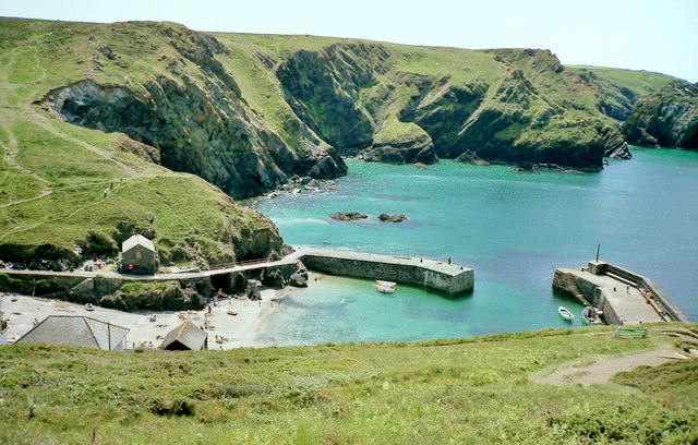
Mullion Cove

Mullion Cove, or Porth Mellin, is a small community on the West Coast of the Lizard Peninsula in Cornwall, England, and on the eastern side of Mount's...
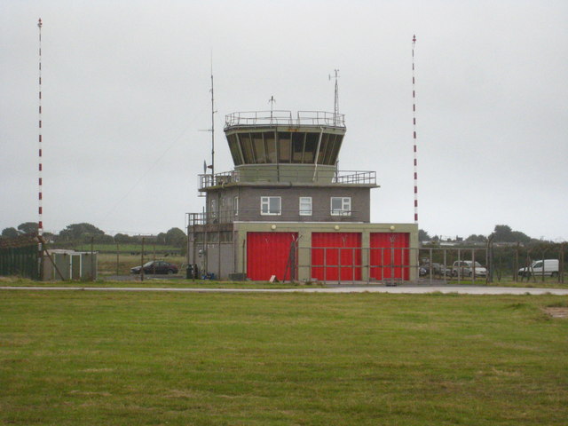
Predannack Airfield

Predannack Airfield (ICAO: EGDO) is an aerodrome near Mullion on The Lizard peninsula of Cornwall in the United Kingdom. The runways are operated by the...

Nearby Amenities

Located within 500m of 49.997111,-5.2603541
Source: PGS
Lat/Long: 49.9972536/-5.255523
Pol Cornick
Natural: bay
Source: NPE
Lat/Long: 49.9935945/-5.2570655
Parc Bean Cove
Natural: bay
Source: OS Historic
Lat/Long: 49.9951472/-5.2572814
Barrier: stile
Material: wood
Source: survey;gps
Stile: stepover
Lat/Long: 49.9978401/-5.257882
Barrier: stile
Material: wood
Source: survey;gps
Stile: stepover
Lat/Long: 49.9996683/-5.2561306
Waterway: waterfall
Lat/Long: 49.997357/-5.255574
Ogo Dour
Description: Ogo Dour - 'watery cave' in Cornish for the adjacent waterfall.
Natural: cave_entrance
Lat/Long: 49.9974812/-5.2553353
The data included in this document is from www.openstreetmap.org. The data is made available under ODbL.

Have you been to Lower Predannack Cliff?

Leave your review of Lower Predannack Cliff below (or comments, questions and feedback).