Gunthwaite and Ingbirchworth

Civil Parish in Yorkshire Barnsley

England

Gunthwaite and Ingbirchworth

Permissive footpath at Ingbirchworth Reservoir Looking north-westward.
Permissive footpath at Ingbirchworth Reservoir Credit: Peter Wood

Gunthwaite and Ingbirchworth is a civil parish located in the metropolitan borough of Barnsley, in South Yorkshire, England. It is situated approximately 10 miles northwest of the town of Barnsley, near the border with West Yorkshire. The parish covers an area of around 7.5 square miles and is home to a small population of residents.

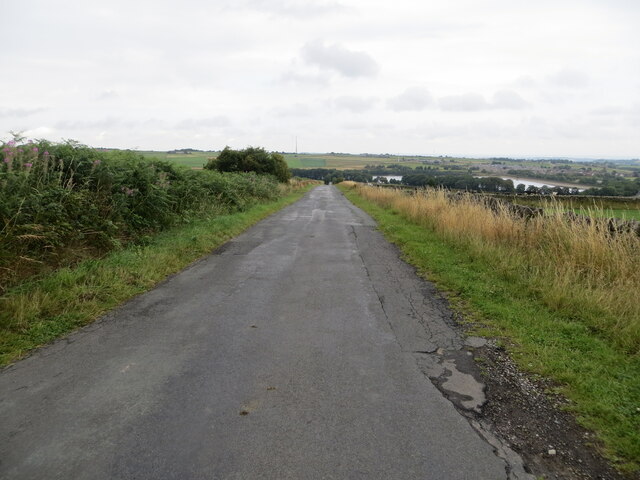
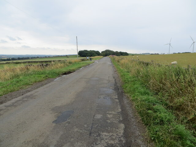
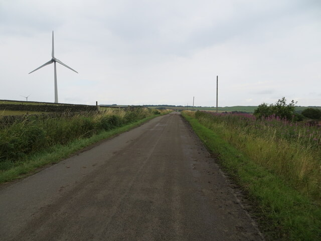
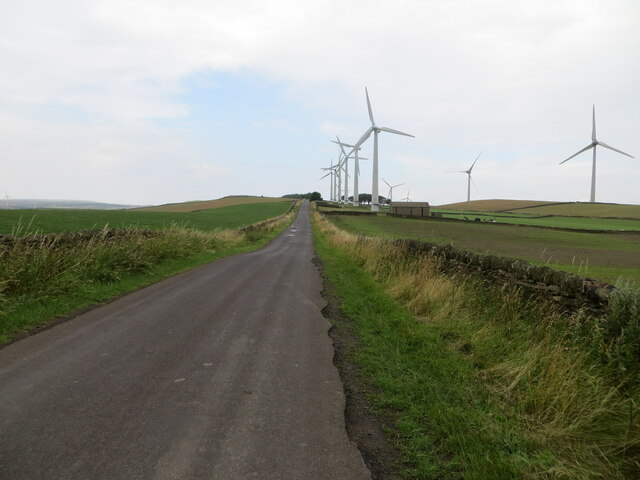
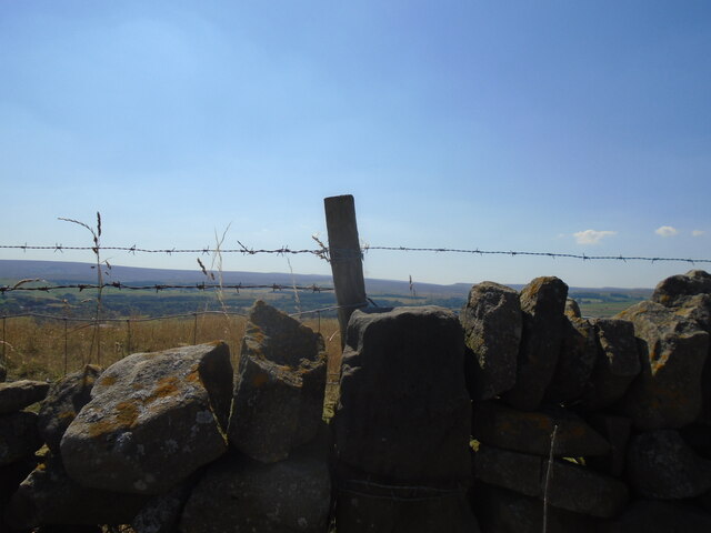
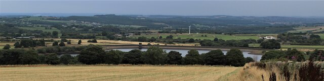
The area is characterized by its picturesque rural setting, with rolling hills, open fields, and scattered farmhouses. The landscape is primarily agricultural, with farming playing a significant role in the local economy. Traditional livestock farming, particularly sheep and cattle rearing, is prevalent in the area.

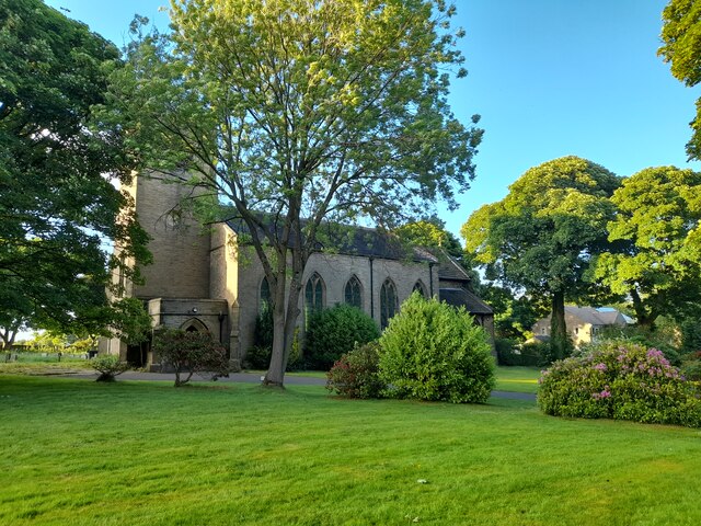
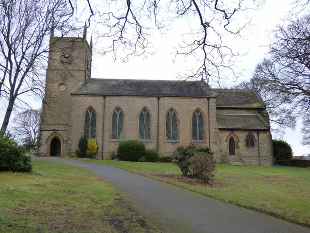
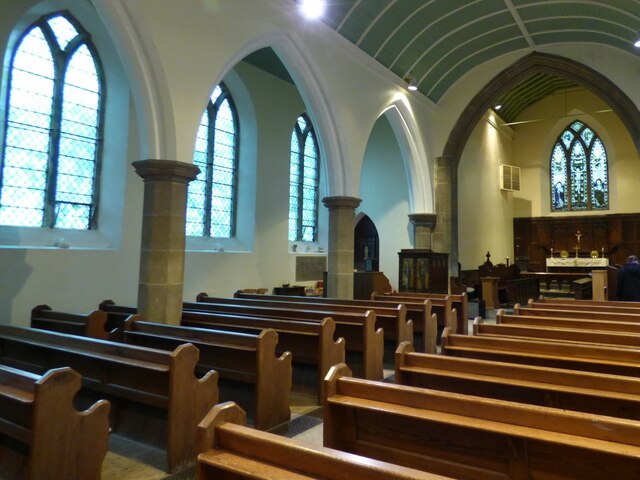
The two villages, Gunthwaite and Ingbirchworth, are small and quaint, with a handful of houses and amenities. Gunthwaite is the larger of the two and is centered around a small village green. Ingbirchworth is situated to the northeast and is known for its charming stone cottages and All Saints Church, which dates back to the 12th century.

The parish is well-connected to surrounding areas by road, with the A629 running through the area, providing easy access to Barnsley and nearby towns. Despite its rural location, the parish benefits from proximity to amenities, with shops, schools, and healthcare facilities available in nearby towns.

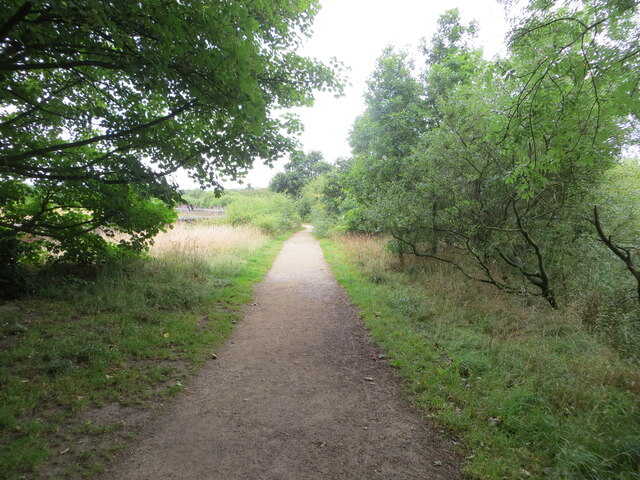
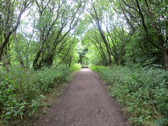
Gunthwaite and Ingbirchworth is a tranquil and close-knit community, offering a peaceful countryside lifestyle for its residents, while still being within reach of urban amenities. It is a popular destination for nature lovers and outdoor enthusiasts, with numerous walking and cycling routes weaving through the scenic countryside.

If you have any feedback on the listing, please let us know in the comments section below.

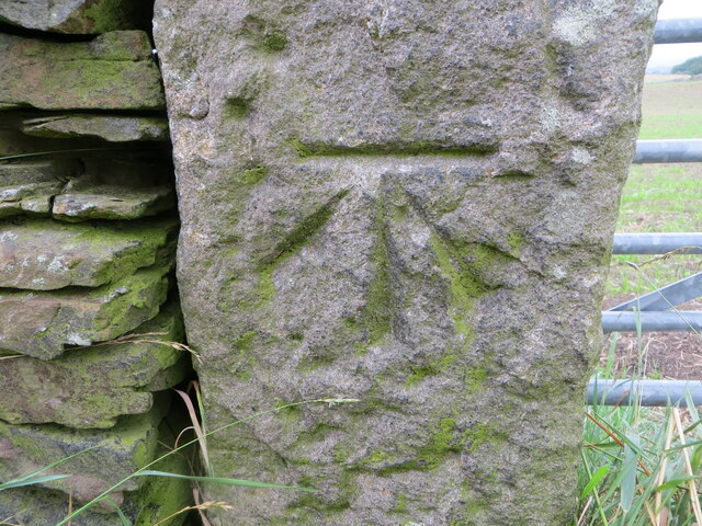
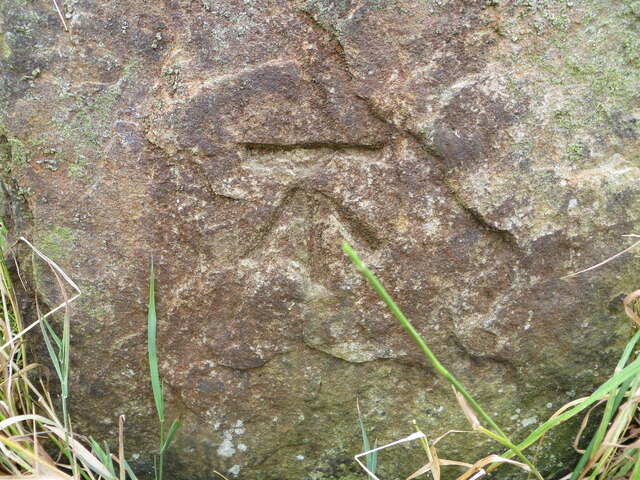
Gunthwaite and Ingbirchworth Images

Images are sourced within 2km of 53.546805/-1.678792 or Grid Reference SE2105. Thanks to Geograph Open Source API. All images are credited.

Permissive footpath at Ingbirchworth Reservoir Looking north-westward.
Permissive footpath at Ingbirchworth Reservoir
Looking north-westward.
Annat Royd Lane, Ingbirchworth Moor Looking north-eastward, Ingbirchworth Reservoir can be seen in the far distance.
Annat Royd Lane, Ingbirchworth Moor
Looking north-eastward, Ingbirchworth Reservoir can be seen in the far distance.
Spicer House Lane near Annat Royd Farm Looking south-eastward.
Spicer House Lane near Annat Royd Farm
Looking south-eastward.
Spicer House Lane beside a Wind Turbine on Spicer Hill Looking north-westward.
Spicer House Lane beside a Wind Turbine on Spicer Hill
Looking north-westward.
Whitley Road and Wind Turbines on Spicer Hill Looking north-westward.
Whitley Road and Wind Turbines on Spicer Hill
Looking north-westward.
Woodland footpath giving access to Royd Moor Reservoir Looking north-westward.
Woodland footpath giving access to Royd Moor Reservoir
Looking north-westward.
St John the Evangelist Church, Upper Denby A handsome building.
St John the Evangelist Church, Upper Denby
A handsome building.
Old milestone The milestone on High Bank Lane which is probably about 250 years old.   It is the stone with the fence post at its left corner.   The large stone to the left can be moved to see the legend on that face, (P)enistone/(?) mile.   It still has barbed wire wrapped round it, 3 strands now.   In the distance is the eastern edge of the Pennines.   Grade II listed 1315076.
Old milestone
The milestone on High Bank Lane which is probably about 250 years old. It is the stone with the fence post at its left corner. The large stone to the left can be moved to see the legend on that face, (P)enistone/(?) mile. It still has barbed wire wrapped round it, 3 strands now. In the distance is the eastern edge of the Pennines. Grade II listed 1315076.
Royd Moor Reservoir
Royd Moor Reservoir
Royd Moor wind farm
Royd Moor wind farm
Ordnance Survey Cut Mark This mark can be found on a gatepost at the footpath entrance to Ingbirchworth Reservoir.
The recorded details give a height of 255.8613 metres above sea level.
For more detail see : <span class="nowrap"><a title="https://www.bench-marks.org.uk/bm52601" rel="nofollow ugc noopener" href="https://www.bench-marks.org.uk/bm52601">Link</a><img style="margin-left:2px;" alt="External link" title="External link - shift click to open in new window" src="https://s1.geograph.org.uk/img/external.png" width="10" height="10"/></span>
Ordnance Survey Cut Mark
This mark can be found on a gatepost at the footpath entrance to Ingbirchworth Reservoir. The recorded details give a height of 255.8613 metres above sea level. For more detail see : LinkExternal link
Ordnance Survey Cut Mark This mark can be found on a gatepost beside Spicer House Land, Royd Moor.
The recorded detail s give a height of 322.7649 metres above sea level.
For more detail see : <span class="nowrap"><a title="https://www.bench-marks.org.uk/bm91191" rel="nofollow ugc noopener" href="https://www.bench-marks.org.uk/bm91191">Link</a><img style="margin-left:2px;" alt="External link" title="External link - shift click to open in new window" src="https://s1.geograph.org.uk/img/external.png" width="10" height="10"/></span>
Ordnance Survey Cut Mark
This mark can be found on a gatepost beside Spicer House Land, Royd Moor. The recorded detail s give a height of 322.7649 metres above sea level. For more detail see : LinkExternal link
Ordnance Survey Cut Mark This mark can be found on a gatepost beside Whitley Road, Spicer Hill.
The recorded details give a height of 329.5163 metres above sea level.
For more detail see : <span class="nowrap"><a title="https://www.bench-marks.org.uk/bm91229" rel="nofollow ugc noopener" href="https://www.bench-marks.org.uk/bm91229">Link</a><img style="margin-left:2px;" alt="External link" title="External link - shift click to open in new window" src="https://s1.geograph.org.uk/img/external.png" width="10" height="10"/></span>
Ordnance Survey Cut Mark
This mark can be found on a gatepost beside Whitley Road, Spicer Hill. The recorded details give a height of 329.5163 metres above sea level. For more detail see : LinkExternal link
Ordnance Survey Cut Mark This mark can be found on a gatepost beside Royd Moor Road, Royd Moor.
The recorded details give a height of 261.5855 metres above sea level.
For more detail see : <span class="nowrap"><a title="https://www.bench-marks.org.uk/bm91414" rel="nofollow ugc noopener" href="https://www.bench-marks.org.uk/bm91414">Link</a><img style="margin-left:2px;" alt="External link" title="External link - shift click to open in new window" src="https://s1.geograph.org.uk/img/external.png" width="10" height="10"/></span>
Ordnance Survey Cut Mark
This mark can be found on a gatepost beside Royd Moor Road, Royd Moor. The recorded details give a height of 261.5855 metres above sea level. For more detail see : LinkExternal link
St John the Evangelist, Denby - south side The church was built in 1842-3, typically for its time with galleries but no chancel. Equally typical of its time was the removal of the galleries and addition of a chancel and porch in 1900. Grade II listed (list entry 1313363).
St John the Evangelist, Denby - south side
The church was built in 1842-3, typically for its time with galleries but no chancel. Equally typical of its time was the removal of the galleries and addition of a chancel and porch in 1900. Grade II listed (list entry 1313363).
St John the Evangelist, Denby - nave The church was built in 1842-3, typically for its time with galleries but no chancel. Equally typical of its time was the removal of the galleries and addition of a chancel and porch in 1900. Grade II listed (list entry 1313363).
St John the Evangelist, Denby - nave
The church was built in 1842-3, typically for its time with galleries but no chancel. Equally typical of its time was the removal of the galleries and addition of a chancel and porch in 1900. Grade II listed (list entry 1313363).
St John the Evangelist, Denby - chancel The church was built in 1842-3, but this narrow chancel was only added in 1900. Grade II listed (list entry 1313363).
St John the Evangelist, Denby - chancel
The church was built in 1842-3, but this narrow chancel was only added in 1900. Grade II listed (list entry 1313363).
St John the Evangelist, Denby - war memorial The war memorial takes the form of wooden panelling between the tower and nave, bearing the names of twenty-four men who died in the First World War, and two in the Second. Beneath the names is written 'While they sleep, Lord Jesus, look on them. When they rise, receive them'.
St John the Evangelist, Denby - war memorial
The war memorial takes the form of wooden panelling between the tower and nave, bearing the names of twenty-four men who died in the First World War, and two in the Second. Beneath the names is written 'While they sleep, Lord Jesus, look on them. When they rise, receive them'.
Show me another place!

Gunthwaite and Ingbirchworth is located at Grid Ref: SE2105 (Lat: 53.546805, Lng: -1.678792)

Division: West Riding

Administrative County: South Yorkshire

District: Barnsley

Police Authority: South Yorkshire

What 3 Words

///brimmed.useful.rope. Near Denby Dale, West Yorkshire

Related Wikis

Ingbirchworth

Ingbirchworth is a village and former civil parish, now in the parish of Gunthwaite and Ingbirchworth, in the Barnsley district, in the county of South...
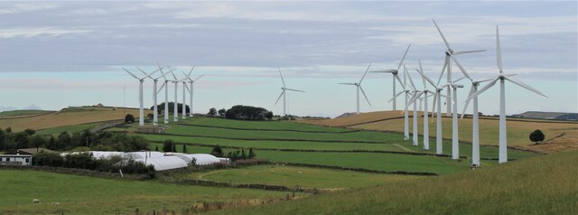
Royd Moor Wind Farm

The Royd Moor Wind Farm is located at Penistone, Barnsley, South Yorkshire, England, and consists of thirteen 450 kW turbines. The site is located approximately...

Gunthwaite and Ingbirchworth

Gunthwaite and Ingbirchworth is a civil parish in the Barnsley district, in the county of South Yorkshire, England. It contains the hamlet of Gunthwaite...

Upper Denby

Upper Denby is a small village within the civil parish of Denby Dale, and the borough of Kirklees in West Yorkshire, England. Lying 11 miles (17 km) to...

Catshaw

Catshaw is a hamlet in the western parts of Penistone, in the Barnsley district, in the county of South Yorkshire, England. It lies about 0.9 miles (1...

Millhouse Green

Millhouse Green is a village on the north banks of the River Don on the A628 road west of Penistone in the English county of South Yorkshire. Administratively...

Birdsedge

Birdsedge (or Birds Edge) is a small village in the borough of Kirklees in West Yorkshire, England, on the edge of Yorkshire's Pennine Hills, standing...

Denby Dale Viaduct

Denby Dale Viaduct is a grade II listed railway viaduct in Denby Dale, West Yorkshire, England. The curving viaduct carries the Penistone line over the...

Nearby Amenities

Located within 500m of 53.546805,-1.678792
Bench
Backrest: no
Lat/Long: 53.5475102/-1.674531
Flow Control: sluice_gate
Man Made: tower
Tower Construction: stone
Tower Type: monitoring
Waterway: flow_control
Lat/Long: 53.5501445/-1.6747327
Content: water
Man Made: storage_tank
Lat/Long: 53.5498407/-1.6735217
Give Way
Direction: forward
Lat/Long: 53.5473036/-1.6752503
Waste Basket
Lat/Long: 53.5475288/-1.6745099
Barrier: stile
Material: stone
Stile: squeezer
Lat/Long: 53.5472287/-1.6753591
Waste Basket
Colour: black
Material: metal
Source: survey
Survey Date: 2022-01-05
Waste: litter
Lat/Long: 53.5495545/-1.6807896
Noexit: yes
Lat/Long: 53.5488877/-1.6733272
Camera Direction: 225
Camera Mount: pole
Camera Type: fixed
Man Made: surveillance
Source: survey
Surveillance: outdoor
Surveillance Type: camera
Surveillance Zone: entrance
Lat/Long: 53.5488687/-1.6734884
Parking
Capacity: 15
Parking: street_side
Lat/Long: 53.5480252/-1.681418
Parking
Capacity: 10
Parking: street_side
Lat/Long: 53.5486736/-1.679313
Waste Basket
Colour: red
Material: metal
Operator: Barnsley Metropolitan Borough Council
Ref: 1867
Source: survey
Survey Date: 2023-07-30
Waste: litter;dog_excrement
Lat/Long: 53.5472147/-1.6753814
The data included in this document is from www.openstreetmap.org. The data is made available under ODbL.

Have you been to Gunthwaite and Ingbirchworth?

Leave your review of Gunthwaite and Ingbirchworth below (or comments, questions and feedback).