Drayton
Civil Parish in Norfolk Broadland
England
Drayton
Drayton is a civil parish located in the county of Norfolk, England. Situated about 5 miles northwest of Norwich, it is a thriving village with a population of approximately 6,000 residents. The parish covers an area of around 1.8 square miles and is predominantly residential.
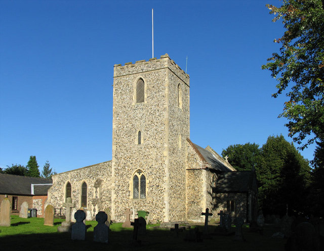
The village of Drayton has a rich history, dating back to the medieval period. It was mentioned in the Domesday Book of 1086 and has since evolved into a vibrant community with a mix of old and new buildings. The parish church, St. Margaret's, is a notable landmark and dates back to the 14th century. It features a beautiful perpendicular tower and is known for its stained glass windows.
Drayton offers a range of amenities and services to its residents. The village has a primary school, several shops, including a supermarket, post office, and a pharmacy. Additionally, there are several pubs and restaurants that cater to both locals and visitors.
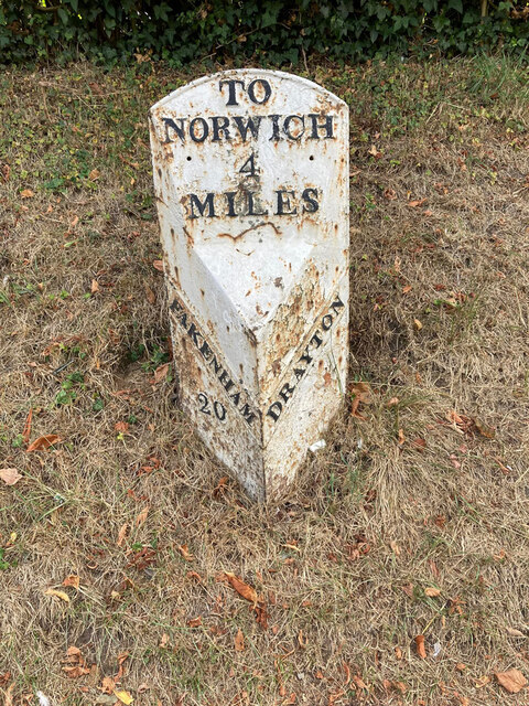
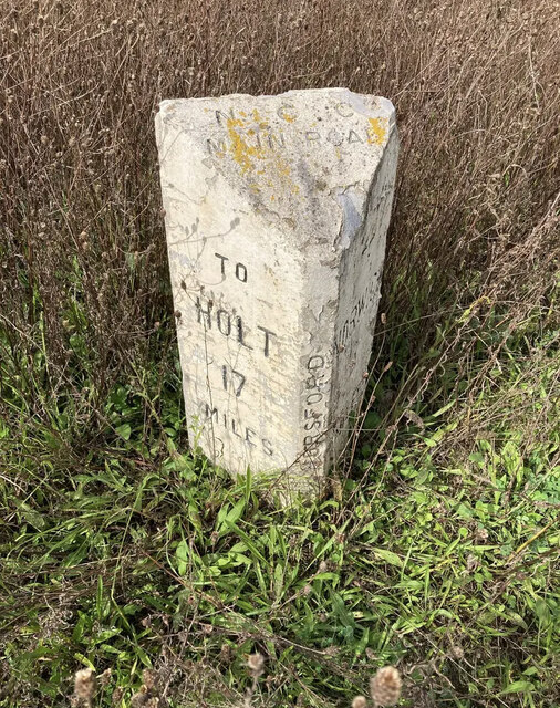
The village is well-connected in terms of transportation. It is located near the A1067 road, which provides easy access to Norwich and other nearby towns. There is also a regular bus service that operates in the area, providing convenient links for those who prefer public transport.
Drayton is surrounded by picturesque countryside, making it an ideal location for outdoor enthusiasts. The nearby Marriott's Way, a former railway track, offers scenic walking and cycling routes, while the Norfolk Broads and the Norfolk Coast are within easy reach for those looking to explore the natural beauty of the region.
Overall, Drayton is a charming village with a close-knit community, a rich history, and a range of amenities that cater to the needs of its residents.
If you have any feedback on the listing, please let us know in the comments section below.
Drayton Images
Images are sourced within 2km of 52.678925/1.226563 or Grid Reference TG1813. Thanks to Geograph Open Source API. All images are credited.


Drayton is located at Grid Ref: TG1813 (Lat: 52.678925, Lng: 1.226563)
Administrative County: Norfolk
District: Broadland
Police Authority: Norfolk
What 3 Words
///suggested.echo.developer. Near Costessey, Norfolk
Nearby Locations
Related Wikis
Drayton, Norfolk
Drayton, Norfolk, is a suburban village in the English county of Norfolk. The village is located in the district of Broadland, 4.3 miles (6.9 km) north...

Drayton railway station
Drayton railway station is a former station in Norfolk, England. Constructed by the Midland and Great Northern Joint Railway in the 1880s, on the line...

Thorpe Marriott
Thorpe Marriott is a residential area in Norfolk, England covering part of Taverham and Drayton parishes. Much of the housing was built in the latter part...

Taverham
Taverham is a village and civil parish in Norfolk, in England. It is approximately 5 miles (8 km) north-west of Norwich. Taverham sits on the River Wensum...
Marriott's Way
The Marriott's Way is a footpath, cycle-path and bridleway in north Norfolk, England, between Norwich and Aylsham via Themelthorpe. It forms part of the...

Dussindale & Hellesdon Rovers F.C.
Dussindale & Hellesdon Rovers Football Club is a football club based in Norwich, England. They are currently members of the Eastern Counties League Division...

Costessey
Costessey ( KOSS-ee) is a town and civil parish in the South Norfolk district of Norfolk, England, and is 4 miles (6.4 km) north west of Norwich. The...

Manor Park, Horsford
Manor Park is a cricket ground in Horsford, Norfolk. The ground is the main home ground of Norfolk County Cricket Club. The first recorded match on the...
Nearby Amenities
Located within 500m of 52.678925,1.226563Have you been to Drayton?
Leave your review of Drayton below (or comments, questions and feedback).