Lawn Plantation

Wood, Forest in Norfolk Broadland

England

Lawn Plantation

Old Milestone, Drayton On the South side of the A1067, 20yds W of junction with Taverham Road, in the parish of Drayton. Alternative views are <a href="https://www.geograph.org.uk/photo/1391707">TG1713 : Drayton Milestone</a> & <a href="https://www.geograph.org.uk/photo/1558894">TG1713 : Old Milepost</a>.

Inscription: To / Norwich / 4 / Miles // Fakenham / 20 // Drayton

Milestone Society National ID: NO_NF04
Old Milestone, Drayton Credit: Alan Lake

Lawn Plantation, located in Norfolk, is a sprawling woodland area known for its diverse vegetation and serene atmosphere. Spanning over several acres, this lush forest is a popular destination for nature enthusiasts, hikers, and birdwatchers alike.

The plantation is primarily characterized by its dense growth of deciduous trees, including oak, beech, and maple, which provide a vibrant display of colors throughout the year. The forest floor is carpeted with an array of wildflowers, ferns, and mosses, adding to the enchanting beauty of the landscape.

Trails wind their way through the woodland, offering visitors an opportunity to explore the plantation at their own pace. The paths are well-maintained and provide access to various viewpoints, picnic areas, and resting spots. Along the way, nature enthusiasts can encounter an abundance of wildlife, such as deer, squirrels, and a wide variety of birds.

Lawn Plantation is also home to a small lake, which further enhances its natural charm. The tranquil waters attract various waterfowl and serve as a habitat for numerous aquatic species.

In addition to its recreational value, the plantation plays a crucial role in conservation efforts. The woodland serves as a haven for rare and endangered plant and animal species, contributing to the preservation of Norfolk's biodiversity.

Overall, Lawn Plantation offers a peaceful retreat from the hustle and bustle of city life. Its idyllic setting, diverse flora and fauna, and well-maintained trails make it a popular destination for outdoor enthusiasts seeking solace in nature.

If you have any feedback on the listing, please let us know in the comments section below.

Lawn Plantation Images

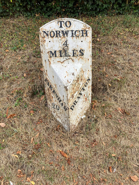
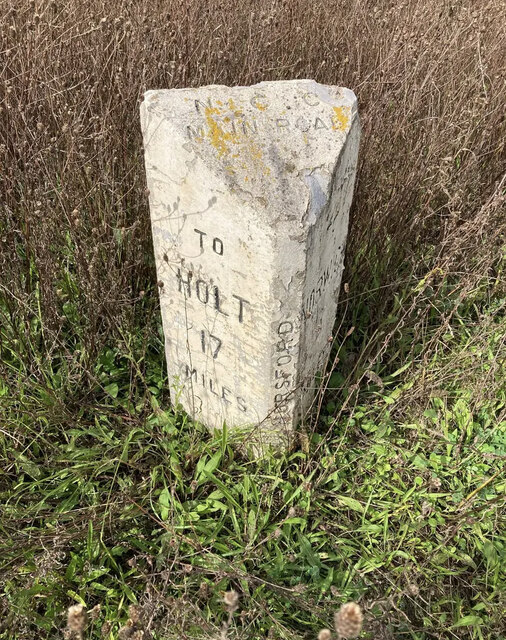
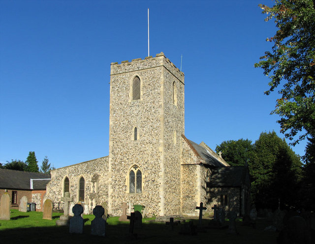
Images are sourced within 2km of 52.67671/1.2291543 or Grid Reference TG1813. Thanks to Geograph Open Source API. All images are credited.

Old Milestone, Drayton On the South side of the A1067, 20yds W of junction with Taverham Road, in the parish of Drayton. Alternative views are <a href="https://www.geograph.org.uk/photo/1391707">TG1713 : Drayton Milestone</a> & <a href="https://www.geograph.org.uk/photo/1558894">TG1713 : Old Milepost</a>.

Inscription: To / Norwich / 4 / Miles // Fakenham / 20 // Drayton

Milestone Society National ID: NO_NF04
Old Milestone, Drayton
On the South side of the A1067, 20yds W of junction with Taverham Road, in the parish of Drayton. Alternative views are TG1713 : Drayton Milestone & TG1713 : Old Milepost. Inscription: To / Norwich / 4 / Miles // Fakenham / 20 // Drayton Milestone Society National ID: NO_NF04
Bridge Cottage, River Wensum, Costessey Nestling close to the river and the site of an old Toll Bridge, this cottage would have been the toll keeper's residence. The bridge looks to have been collecting tolls as late as 1905, run by a private company. It was not part of the turnpike system and would originally obviated some turnpike miles to Norwich.

Milestone Society National ID: NO.COS
Bridge Cottage, River Wensum, Costessey
Nestling close to the river and the site of an old Toll Bridge, this cottage would have been the toll keeper's residence. The bridge looks to have been collecting tolls as late as 1905, run by a private company. It was not part of the turnpike system and would originally obviated some turnpike miles to Norwich. Milestone Society National ID: NO.COS
Barber, baker and beautician, Drayton On Taverham Road.
Barber, baker and beautician, Drayton
On Taverham Road.
Oops a Daisy, Drayton Florist on Fakenham Road.
Oops a Daisy, Drayton
Florist on Fakenham Road.
Village sign, Drayton Commemorating 50 years since the founding of Drayton 'afternoon W I'.
Village sign, Drayton
Commemorating 50 years since the founding of Drayton 'afternoon W I'.
The Red Lion public house, Drayton The building dates from 1678, becoming an inn in the mid 1700s. Damaged by enemy action in 1942.
The Red Lion public house, Drayton
The building dates from 1678, becoming an inn in the mid 1700s. Damaged by enemy action in 1942.
The Cock Inn, Drayton The present building replaced an 18th century inn in 1956. It was renovated  in 1998-1999. One of the Marston chain of brewers.
The Cock Inn, Drayton
The present building replaced an 18th century inn in 1956. It was renovated in 1998-1999. One of the Marston chain of brewers.
Children's play area, Drayton Playground on School Road, next to St. Margaret's church which can be seen in the background.
Children's play area, Drayton
Playground on School Road, next to St. Margaret's church which can be seen in the background.
St. Margaret's church, Drayton The church dates from 1198 with some medieval fabric but mainly rebuilt in the 19th century. Inside is a fragment of the 15th century rood screen stair by the pulpit.  Grade II* listed.
St. Margaret's church, Drayton
The church dates from 1198 with some medieval fabric but mainly rebuilt in the 19th century. Inside is a fragment of the 15th century rood screen stair by the pulpit. Grade II* listed.
Inside St. Margaret's church, Drayton Looking eastwards along the nave. The church dates from 1198 with some medieval fabric but mainly rebuilt in the 19th century. A fragment of the 15th century rood screen stair can be seen by the pulpit. A Grade II* listed building.
Inside St. Margaret's church, Drayton
Looking eastwards along the nave. The church dates from 1198 with some medieval fabric but mainly rebuilt in the 19th century. A fragment of the 15th century rood screen stair can be seen by the pulpit. A Grade II* listed building.
A poppyhead in St. Margaret's church, Drayton A poppyhead is a form of carving on the top of the end of a bench or a choir stall. Its name is unrelated to the poppy flower but derived by way of Old French, from the Latin word puppis, which means the poop or the figurehead of a ship.
A poppyhead in St. Margaret's church, Drayton
A poppyhead is a form of carving on the top of the end of a bench or a choir stall. Its name is unrelated to the poppy flower but derived by way of Old French, from the Latin word puppis, which means the poop or the figurehead of a ship.
East window, St. Margaret's church, Drayton The church dates from 1198 with some medieval fabric but mainly rebuilt in the 19th century.  A Grade II* listed building.
East window, St. Margaret's church, Drayton
The church dates from 1198 with some medieval fabric but mainly rebuilt in the 19th century. A Grade II* listed building.
18th century gravestone, St. Margaret's church, Drayton A child's grave, John, son of John and Elizabeth Cannell, who died in 1781 in the 6th year of his age.
18th century gravestone, St. Margaret's church, Drayton
A child's grave, John, son of John and Elizabeth Cannell, who died in 1781 in the 6th year of his age.
18th century gravestone, St. Margaret's church, Drayton A detail on a child's grave, John, son of John and Elizabeth Cannell, who died in 1781 in the 6th year of his age.
18th century gravestone, St. Margaret's church, Drayton
A detail on a child's grave, John, son of John and Elizabeth Cannell, who died in 1781 in the 6th year of his age.
Old Milepost by the A1067, Drayton High Road, Drayton Cast iron post by the A1067, in parish of DRAYTON (BROADLAND District), 150yds East of junction with Hurn Road. Just East of entrance to former David Rice Hospital, on the verge, near lamppost, on South side of road. Fakenham ci l-top, erected by the Norwich & Fakenham turnpike trust in the 19th century. An earlier photograph can be found here <a title="https://www.geograph.org.uk/photo/6617195" href="https://www.geograph.org.uk/photo/6617195">Link</a>.

Inscription reads:- : TO / FAKENHAM / 21 : : TO / NORWICH / 3 : : DRAYTON :

Listed.

Milestone Society National ID: NO_NF03.
Old Milepost by the A1067, Drayton High Road, Drayton
Cast iron post by the A1067, in parish of DRAYTON (BROADLAND District), 150yds East of junction with Hurn Road. Just East of entrance to former David Rice Hospital, on the verge, near lamppost, on South side of road. Fakenham ci l-top, erected by the Norwich & Fakenham turnpike trust in the 19th century. An earlier photograph can be found here Link. Inscription reads:- : TO / FAKENHAM / 21 : : TO / NORWICH / 3 : : DRAYTON : Listed. Milestone Society National ID: NO_NF03.
Old Milestone by the B1149, Holt Road, Horsford Parish Concrete post by the B1149, in parish of HORSFORD (BROADLAND District), 100m South of junction with Drayton Lane, near front of wide verge with wooden bollards, on West side of road. NCC concrete, erected by the County Council in the 19th/20th century. 

Inscription reads:-
: TO / HOLT / 17 / MILES : : N C C / MAIN ROAD / HORSFORD : : TO / NORWICH / 4 / MILES : 

Milestone Society National ID: NO_NH04.
Old Milestone by the B1149, Holt Road, Horsford Parish
Concrete post by the B1149, in parish of HORSFORD (BROADLAND District), 100m South of junction with Drayton Lane, near front of wide verge with wooden bollards, on West side of road. NCC concrete, erected by the County Council in the 19th/20th century. Inscription reads:- : TO / HOLT / 17 / MILES : : N C C / MAIN ROAD / HORSFORD : : TO / NORWICH / 4 / MILES : Milestone Society National ID: NO_NH04.
Spider web, Thorpe Marriott Covered in water droplets on a misty morning.
Spider web, Thorpe Marriott
Covered in water droplets on a misty morning.
Entering Hellesdon on Reepham Road Road no.C261
Entering Hellesdon on Reepham Road
Road no.C261
Show me another place!

Lawn Plantation is located at Grid Ref: TG1813 (Lat: 52.67671, Lng: 1.2291543)

Administrative County: Norfolk

District: Broadland

Police Authority: Norfolk

What 3 Words

///meanest.chucked.play. Near Costessey, Norfolk

Related Wikis

Drayton, Norfolk

Drayton, Norfolk, is a suburban village in the English county of Norfolk. The village is located in the district of Broadland, 4.3 miles (6.9 km) north...

Drayton railway station

Drayton railway station is a former station in Norfolk, England. Constructed by the Midland and Great Northern Joint Railway in the 1880s, on the line...

Thorpe Marriott

Thorpe Marriott is a residential area in Norfolk, England covering part of Taverham and Drayton parishes. Much of the housing was built in the latter part...

Marriott's Way

The Marriott's Way is a footpath, cycle-path and bridleway in north Norfolk, England, between Norwich and Aylsham via Themelthorpe. It forms part of the...

Dussindale & Hellesdon Rovers F.C.

Dussindale & Hellesdon Rovers Football Club is a football club based in Norwich, England. They are currently members of the Eastern Counties League Division...

Taverham

Taverham is a village and civil parish in Norfolk, in England. It is approximately 5 miles (8 km) north-west of Norwich. Taverham sits on the River Wensum...

Costessey

Costessey ( KOSS-ee) is a town and civil parish in the South Norfolk district of Norfolk, England, and is 4 miles (6.4 km) north west of Norwich. The...

Manor Park, Horsford

Manor Park is a cricket ground in Horsford, Norfolk. The ground is the main home ground of Norfolk County Cricket Club. The first recorded match on the...

Nearby Amenities

Located within 500m of 52.67671,1.2291543
Mini Roundabout
Direction: clockwise
Lat/Long: 52.6779481/1.2361101
Mini Roundabout
Direction: clockwise
Lat/Long: 52.6776272/1.2253986
Bus Stop
The Cock, adj
Bench: no
Bin: yes
Naptan AtcoCode: 2900D111
Naptan Bearing: E
Naptan CommonName: The Cock
Naptan Indicator: adj
Naptan Locality: Drayton
Naptan NaptanCode: nfoamjga
Naptan PlusbusZoneRef: NRCH
Naptan Street: Drayton High Road
Naptan Verified: no
Shelter: yes
Source: naptan_import
Lat/Long: 52.6755377/1.225669
Bus Stop
Carter Road, adj
Bench: no
Bin: yes
Naptan AtcoCode: 2900D1110
Naptan Bearing: SE
Naptan CommonName: Carter Road
Naptan Indicator: adj
Naptan Locality: Drayton
Naptan NaptanCode: nfoamjgd
Naptan PlusbusZoneRef: NRCH
Naptan Street: Drayton High Road
Naptan Verified: no
Shelter: yes
Source: naptan_import
Tactile Paving: yes
Lat/Long: 52.6736872/1.2315248
Bus Stop
Carter Road, opp
Bench: no
Naptan AtcoCode: 2900D1111
Naptan Bearing: NW
Naptan CommonName: Carter Road
Naptan Indicator: opp
Naptan Landmark: Carter Road
Naptan Locality: Drayton
Naptan NaptanCode: nfoamjgj
Naptan PlusbusZoneRef: NRCH
Naptan Street: Drayton High Road
Naptan Verified: no
Shelter: no
Source: naptan_import
Tactile Paving: yes
Lat/Long: 52.6736516/1.2311819
Bus Stop
Red Lion, adj
Naptan AtcoCode: 2900D1112
Naptan Bearing: NE
Naptan CommonName: Red Lion
Naptan Indicator: adj
Naptan Landmark: Red Lion PH
Naptan Locality: Drayton
Naptan NaptanCode: nfoamjgm
Naptan PlusbusZoneRef: NRCH
Naptan Street: School Road
Naptan Verified: no
Source: naptan_import
Lat/Long: 52.6764486/1.2242458
Bus Stop
Manor Farm Close, opp
Naptan AtcoCode: 2900D1113
Naptan Bearing: N
Naptan CommonName: Manor Farm Close
Naptan Indicator: opp
Naptan Landmark: Manor Farm Close
Naptan Locality: Drayton
Naptan NaptanCode: nfoamjgp
Naptan PlusbusZoneRef: NRCH
Naptan Street: School Road
Naptan Verified: no
Source: naptan_import
Lat/Long: 52.677994/1.2253026
Bus Stop
Manor Farm Close, adj
Naptan AtcoCode: 2900D1114
Naptan Bearing: S
Naptan CommonName: Manor Farm Close
Naptan Indicator: adj
Naptan Landmark: Manor Farm Close
Naptan Locality: Drayton
Naptan NaptanCode: nfoamjgt
Naptan PlusbusZoneRef: NRCH
Naptan Street: School Road
Naptan Verified: no
Source: naptan_import
Lat/Long: 52.6778357/1.2254981
Bus Stop
First School, adj
Naptan AtcoCode: 2900D1116
Naptan Bearing: SE
Naptan CommonName: First School
Naptan Indicator: adj
Naptan Locality: Drayton
Naptan NaptanCode: nfoamjma
Naptan PlusbusZoneRef: NRCH
Naptan Street: School Road
Naptan Verified: no
Source: naptan_import
Lat/Long: 52.6790909/1.223001
Bus Stop
No 31, opp
Naptan AtcoCode: 2900D1124
Naptan Bearing: E
Naptan CommonName: No 31
Naptan Indicator: opp
Naptan Locality: Drayton
Naptan NaptanCode: nfogpwdj
Naptan PlusbusZoneRef: NRCH
Naptan Street: Hall Lane
Naptan Verified: no
Source: naptan_import
Lat/Long: 52.6774899/1.2311662
Bus Stop
The Cock, opp
Naptan AtcoCode: 2900D116
Naptan Bearing: W
Naptan CommonName: The Cock
Naptan Indicator: opp
Naptan Landmark: Lodge Breck
Naptan Locality: Drayton
Naptan NaptanCode: nfoamjpg
Naptan PlusbusZoneRef: NRCH
Naptan Street: Drayton High Road
Naptan Verified: no
Source: naptan_import
Lat/Long: 52.6752213/1.2260599
Crossing
Crossing: unmarked
Crossing Island: yes
Tactile Paving: yes
Lat/Long: 52.6776352/1.2255672
Turning Circle
Lat/Long: 52.6802733/1.2259143
Crossing
Crossing: uncontrolled
Tactile Paving: yes
Lat/Long: 52.6789299/1.2227983
Turning Circle
Lat/Long: 52.6755893/1.2297825
Turning Circle
Lat/Long: 52.6757411/1.2329522
Traffic Signals
Lat/Long: 52.6759082/1.2239755
Crossing
Crossing: traffic_signals
Crossing Island: no
Crossing Ref: pelican
Tactile Paving: yes
Traffic Signals Sound: yes
Traffic Signals Vibration: yes
Lat/Long: 52.6759935/1.2240654
Crossing
Crossing: unmarked
Lat/Long: 52.676201/1.2237082
Crossing
Crossing: unmarked
Crossing Island: yes
Tactile Paving: yes
Lat/Long: 52.6738664/1.2308478
Bench
Backrest: yes
Lat/Long: 52.6743319/1.2297978
Grit Bin
Lat/Long: 52.6743869/1.2295942
Speed Camera
Speed Camera Type: dtruvelo
Lat/Long: 52.6751367/1.2264947
Crossing
Crossing: island
Tactile Paving: yes
Lat/Long: 52.6777531/1.2253894
Traffic Calming: cushion
Lat/Long: 52.6789211/1.2233572
Bench
Backrest: yes
Material: plastic
Lat/Long: 52.6789817/1.2233858
Grit Bin
Lat/Long: 52.6789829/1.2227541
Board Type: notice
Information: board
Lat/Long: 52.6752482/1.225981
Traffic Calming: bump
Lat/Long: 52.6763371/1.2362238
Traffic Calming: bump
Lat/Long: 52.6767359/1.2361975
Traffic Calming: bump
Lat/Long: 52.6774834/1.2362877
Give Way
Lat/Long: 52.6779445/1.2362128
Atm
Brand: Barclays
Lat/Long: 52.6762957/1.2245139
Entrance: main
Lat/Long: 52.676327/1.2245357
Access: private
Barrier: bollard
Lat/Long: 52.6763381/1.2249368
Crossing
Crossing: unmarked
Crossing Island: yes
Tactile Paving: no
Lat/Long: 52.6760768/1.2232961
Entrance: yes
Lat/Long: 52.67548/1.2250793
Entrance: main
Lat/Long: 52.675487/1.2249878
Crossing
Crossing: uncontrolled
Lat/Long: 52.6743836/1.2296822
Crossing
Crossing: unmarked
Crossing Island: no
Tactile Paving: no
Lat/Long: 52.6750096/1.2267771
Crossing
Crossing: traffic_signals
Crossing Ref: pelican
Tactile Paving: yes
Lat/Long: 52.6758825/1.2240582
Crossing
Crossing: unmarked
Crossing Island: no
Tactile Paving: no
Lat/Long: 52.6759252/1.2242458
Historic: memorial
Inscription: You who pray for the souls of William Beaumont and Joanna his wife saying a paternoster and an Ave Maria will earn a number of days pardon
Memorial: obelisk
Lat/Long: 52.676076/1.2239255
Crossing
Crossing: unmarked
Crossing Island: yes
Tactile Paving: no
Lat/Long: 52.676403/1.2220721
Crossing
Crossing: unmarked
Lat/Long: 52.6767877/1.2245875
Post Box
Collection Times: Mo-Fr 17:30; Sa 13:00
Operator: Royal Mail
Post Box Type: pillar
Ref: NR8 805
Royal Cypher: EIIR
Royal Cypher Wikidata: Q33102113
Lat/Long: 52.67618/1.2232854
Post Box
Collection Times: Mo-Fr 09:00; Sa 07:00
Operator: Royal Mail
Post Box Type: lamp
Ref: NR8 811D
Royal Cypher: EIIR
Royal Cypher Wikidata: Q33102113
Lat/Long: 52.6772536/1.2347151
Fast Food
Subway
Brand: Subway
Brand Wikidata: Q244457
Brand Wikipedia: en:Subway (restaurant)
Breakfast: yes
Contact Website: https://restaurants.subway.com/united-kingdom/en/norwich/fakenham-rd
Cuisine: sandwich
Email: pdeary@applegreen.ie
Indoor: yes
Opening Hours: Mo-Sa 07:00-19:00; Su 09:00-19:00
Phone: +44 1603 867226
Ref: 63310
Takeaway: yes
Lat/Long: 52.6757641/1.2232105
Crossing
Crossing: unmarked
Lat/Long: 52.6755405/1.2246972
Crossing
Crossing: unmarked
Crossing Island: no
Lat/Long: 52.6759416/1.2235299
Give Way
Lat/Long: 52.6756189/1.2247168
Board Type: notice
Information: board
Tourism: information
Lat/Long: 52.6768334/1.2244687
Entrance: main
Lat/Long: 52.6773783/1.2239484
Barrier: lych_gate
Foot: yes
Lat/Long: 52.6772863/1.2243144
Give Way
Direction: forward
Lat/Long: 52.6759579/1.2235391
Entrance: yes
Lat/Long: 52.6762626/1.2230719
Entrance: main
Lat/Long: 52.6762628/1.2230538
Entrance: main
Lat/Long: 52.6762161/1.2232878
Entrance: main
Lat/Long: 52.6762172/1.223153
Entrance: main
Lat/Long: 52.6763731/1.2233163
R. G. Carter
Alt Name: Carter Builder
Office: yes
Lat/Long: 52.6753319/1.2277943
Cafe
The Willows
Addr Housenumber: 6
Addr Postcode: NR8 6AF
Addr Street: Drayton High Road
Addr Village: Drayton
Cuisine: regional
Fhrs Id: 1606938
Source Addr: FHRS Open Data
Lat/Long: 52.6754167/1.2252865
Give Way
Lat/Long: 52.6776958/1.2253939
Give Way
Lat/Long: 52.6776356/1.2254951
Give Way
Lat/Long: 52.6775998/1.2253484
Drayton
Colour: black
Inscription: WI / 1918–1968
Man Made: village_sign
Material: metal
Old Name: Draituna
Start Date: 1968
Lat/Long: 52.6759068/1.2243409
Kerb: lowered
Lat/Long: 52.6761379/1.2234722
Crossing
Crossing: unmarked
Lat/Long: 52.6763721/1.2240545
Crossing
Crossing: unmarked
Crossing Island: no
Tactile Paving: yes
Lat/Long: 52.6772064/1.2250103
Entrance: main
Lat/Long: 52.6772215/1.2252129
Give Way
Lat/Long: 52.6790281/1.2229577
Give Way
Lat/Long: 52.6740272/1.2248254
Give Way
Lat/Long: 52.6758678/1.2242917
Give Way
Lat/Long: 52.6750778/1.2268245
Entrance: main
Lat/Long: 52.6758316/1.2231718
Air Compressor;pressure Washer
Lat/Long: 52.6757194/1.2232415
Vacuum Cleaner
Lat/Long: 52.6757064/1.223261
Crossing
Crossing: unmarked
Lat/Long: 52.6760873/1.222622
Give Way
Lat/Long: 52.6761789/1.2223162
Give Way
Lat/Long: 52.676275/1.2223417
Crossing
Crossing: uncontrolled;marked
Crossing Island: no
Crossing Ref: zebra
Lat/Long: 52.6764223/1.224702
Barrier: cycle_barrier
Bicycle: no
Lat/Long: 52.6770797/1.2250447
Barrier: bollard
Lat/Long: 52.6771962/1.2250589
Entrance: yes
Lat/Long: 52.6771402/1.2254145
Bicycle Parking
Bicycle Parking: stands
Capacity: 4
Covered: no
Lat/Long: 52.6770225/1.2252927
Bar
Internet Access: wlan
Internet Access Fee: no
Outdoor Seating: yes
Real Ale: 4
Start Date: 2020-07-04 12:00
Lat/Long: 52.6771291/1.2251916
Door: sliding
Entrance: main
Lat/Long: 52.6764844/1.2248145
Entrance: yes
Lat/Long: 52.677116/1.2254302
Entrance: exit
Lat/Long: 52.6771362/1.2254366
Give Way
Lat/Long: 52.674869/1.2266806
Give Way
Direction: backward
Lat/Long: 52.6762439/1.2242434
Give Way
Direction: forward
Lat/Long: 52.6763037/1.2241435
Drayton
Place: village
Postal Code: NR8
Wikipedia: en:Drayton, Norfolk
Lat/Long: 52.6752903/1.228823
Bench
Backrest: yes
Material: plastic
Lat/Long: 52.6790185/1.2228015
The data included in this document is from www.openstreetmap.org. The data is made available under ODbL.

Have you been to Lawn Plantation?

Leave your review of Lawn Plantation below (or comments, questions and feedback).