Cowfold

Civil Parish in Sussex Horsham

England

Cowfold

Greenhouse near Pict's Farm
Greenhouse near Pict's Farm Credit: Ian Cunliffe

Cowfold is a civil parish located in the Horsham District of West Sussex, England. Situated approximately 12 miles northwest of the county town of Horsham, the village is nestled in the beautiful countryside of the South Downs National Park.

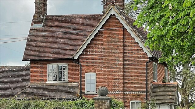
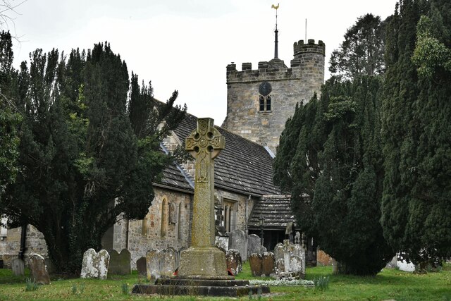
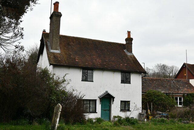
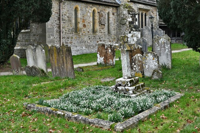
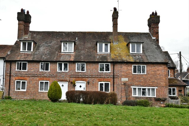
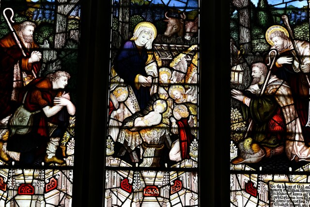
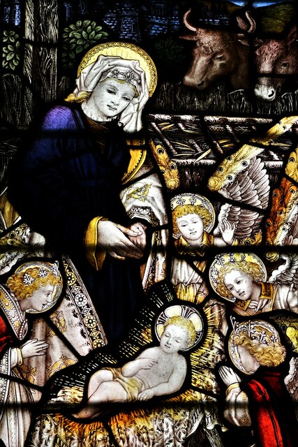
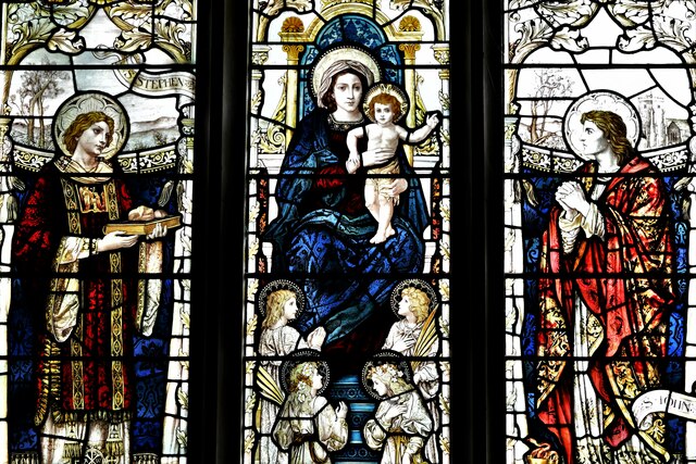
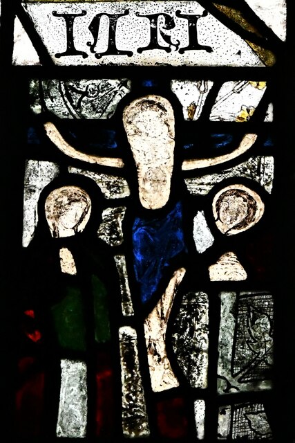
With a population of around 2,000 residents, Cowfold maintains a close-knit community feel. The village is known for its picturesque cottages and historic buildings, including St. Peter's Church, which dates back to the 12th century. The church's architecture showcases a mix of Norman and Early English Gothic styles, adding to the village's charm.

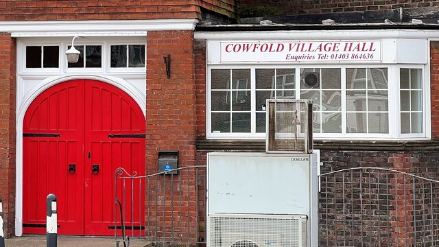
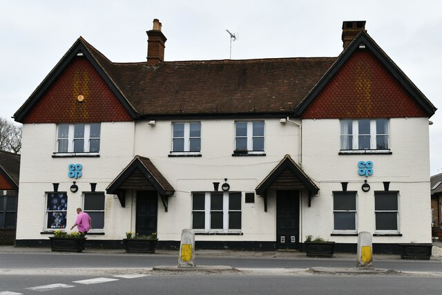
Cowfold offers essential amenities such as a primary school, a village hall, and a local shop, providing convenience for its residents. The village also boasts several traditional pubs, including The Bull and The Royal Oak, where locals and visitors can enjoy a pint of local ale or a hearty meal.

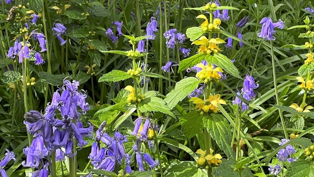
Nature enthusiasts can explore the surrounding countryside through various footpaths and bridleways that crisscross the area, offering stunning views and opportunities for outdoor activities. Cowfold is also home to the annual Cowfold Village Show, a popular event that showcases local produce, crafts, and entertainment.

Overall, Cowfold provides a peaceful and idyllic setting for its residents, offering a combination of rural charm, community spirit, and access to the natural beauty of the South Downs.

If you have any feedback on the listing, please let us know in the comments section below.
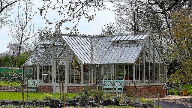
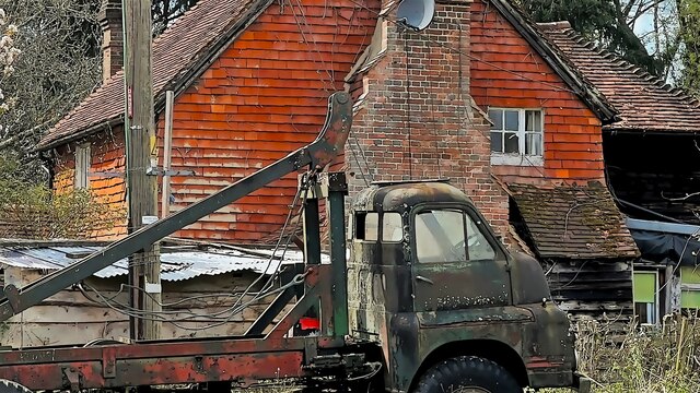
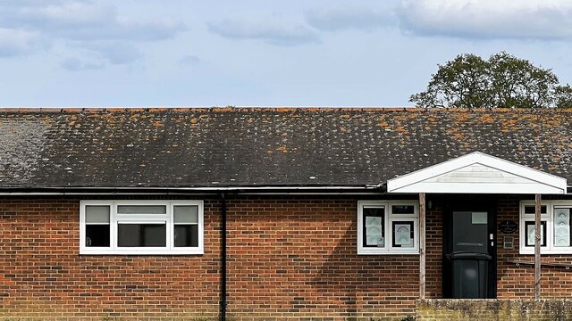
Cowfold Images

Images are sourced within 2km of 50.990575/-0.269958 or Grid Reference TQ2122. Thanks to Geograph Open Source API. All images are credited.

Greenhouse near Pict's Farm
Ashurst Cottage There was also a derelict phone box hereabouts.
Ashurst Cottage
There was also a derelict phone box hereabouts.
Scout hut
Scout hut
Cowfold Village Hall
Bluebells and Yellow Archangels in Harbour Wood
Oakfield Cottages
Oakfield Cottages
House on Burnthouse Lane According to the large-scale map this is called "Little Burnt House".
House on Burnthouse Lane
According to the large-scale map this is called "Little Burnt House".
Cowfold: The Street Co-op convenience store
Cowfold, St. Peter's Church: North eastern aspect
Cowfold: The Olde House
Cowfold, St. Peter's Church: North east part of the churchyard
Cowfold: Margaret Cottages
Cowfold, St. Peter's Church: Stained glass window 1
Cowfold, St. Peter's Church: Stained glass window 1 (detail)
Cowfold, St. Peter's Church: Stained glass window 2
Cowfold, St. Peter's Church: Stained glass window 3, memorial insert
Cowfold, St. Peter's Church: Stained glass window 4
Cowfold, St. Peter's Church: The Peirce and Heald memorial
Show me another place!

Cowfold is located at Grid Ref: TQ2122 (Lat: 50.990575, Lng: -0.269958)

Administrative County: West Sussex

District: Horsham

Police Authority: Sussex

What 3 Words

///startles.absorbing.spends. Near Cowfold, West Sussex

Related Wikis

Cowfold

Cowfold is a village and civil parish between Billingshurst and Haywards Heath in the Horsham District of West Sussex, England. The village is at the intersection...

St Hugh's Charterhouse

St Hugh's Charterhouse, Parkminster, is the only post-Reformation Carthusian monastery in the United Kingdom. It is located in the parish of Cowfold, West...

Crabtree, West Sussex

Crabtree is a hamlet in the parish of Lower Beeding and in Horsham District of West Sussex, England. It lies on the A281 road 4.4 miles (7.1 km) southeast...

West Grinstead railway station

West Grinstead was a railway station on the Steyning Line which served the village of West Grinstead. It had a goods yard with a cattle loading bay and...

Maplehurst, West Sussex

Maplehurst is a hamlet in the civil parish of Nuthurst, and the Horsham District of West Sussex, England. The hamlet is on the Copsale to Nuthurst road...

Littleworth, West Sussex

Littleworth is a hamlet in the Horsham District of West Sussex, England. It lies on the Partridge Green to Maplehurst road 2.9 miles (4.7 km) north of...

Leonardslee

Leonardslee is an English country house and English landscape garden and woodland garden in Lower Beeding, near Horsham, West Sussex, England. The Grade...

Colwood, West Sussex

Colwood is a village near Warninglid in West Sussex, England. It is the site of Colwood Manor. == References == The geographic coordinates are from the...

Nearby Amenities

Located within 500m of 50.990575,-0.269958
Mini Roundabout
Direction: clockwise
Lat/Long: 50.9906211/-0.2727909
Mini Roundabout
Direction: clockwise
Lat/Long: 50.9897995/-0.2725169
Crossing
Crossing: unmarked
Crossing Island: yes
Crossing Markings: no
Kerb: normal
Tactile Paving: incorrect
Lat/Long: 50.9899137/-0.2725684
Bus Stop
Village Hall
Bench: no
Bin: no
Bus: yes
Lit: yes
Naptan AtcoCode: 4400HR0446
Naptan Bearing: S
Naptan CommonName: Village Hall
Naptan Indicator: o/s Village Hall
Naptan Landmark: A272
Naptan NaptanCode: wsxawjpd
Naptan ShortCommonName: Cowfold Hall
Naptan Street: A281
Naptan Verified: no
Public Transport: platform
Shelter: yes
Source: naptan_import
Tactile Paving: no
Lat/Long: 50.989211/-0.2724922
Bus Stop
Village Hall
Bench: yes
Bin: yes
Bus: yes
Lit: yes
Naptan AtcoCode: 4400HR0447
Naptan Bearing: N
Naptan CommonName: Village Hall
Naptan Indicator: adj St Peters Close
Naptan Landmark: A272
Naptan NaptanCode: wsxawjpg
Naptan ShortCommonName: Cowfold Hall
Naptan Street: A281
Naptan Verified: no
Public Transport: platform
Shelter: yes
Source: naptan_import
Tactile Paving: no
Lat/Long: 50.9887726/-0.2726509
Bus Stop
South Leas
Bench: no
Bin: no
Bus: yes
Naptan AtcoCode: 4400HR0448
Naptan Bearing: N
Naptan CommonName: South Leas
Naptan Indicator: o/s pub
Naptan Landmark: South Leas
Naptan NaptanCode: wsxawjpj
Naptan Street: A281
Naptan Verified: no
Public Transport: platform
Shelter: no
Source: naptan_import
Tactile Paving: no
Lat/Long: 50.9868411/-0.2730425
Bus Stop
Sadlers Gallery
Bus: yes
Naptan AtcoCode: 4400HR0477
Naptan Bearing: W
Naptan CommonName: Sadlers Gallery
Naptan Indicator: o/s school
Naptan Landmark: A281
Naptan NaptanCode: wsxawmdp
Naptan Street: Station Road
Naptan Verified: no
Public Transport: platform
Source: naptan_import
Lat/Long: 50.9905857/-0.2754478
A272 Cowfold Road
Naptan AtcoCode: 4400HR1027
Naptan Bearing: E
Naptan BusStopType: CUS
Naptan CommonName: A272 Cowfold Road
Naptan Indicator: HAR
Naptan Landmark: Hail & Ride
Naptan NaptanCode: wsxgawaj
Naptan Street: A272 Cowfold Road
Naptan Verified: no
Source: naptan_import
Lat/Long: 50.9895391/-0.2648994
A272 Cowfold Road
Naptan AtcoCode: 4400HR1028
Naptan Bearing: W
Naptan BusStopType: CUS
Naptan CommonName: A272 Cowfold Road
Naptan Indicator: HAR
Naptan Landmark: Hail & Ride
Naptan NaptanCode: wsxgawam
Naptan Street: A272 Cowfold Road
Naptan Verified: no
Source: naptan_import
Lat/Long: 50.9894314/-0.2649176
Crossing
Button Operated: yes
Crossing: traffic_signals
Crossing Island: yes
Crossing Ref: pelican
Tactile Paving: yes
Traffic Signals: pedestrian_crossing
Traffic Signals Sound: yes
Lat/Long: 50.9906409/-0.2755401
Noexit: yes
Lat/Long: 50.9883795/-0.2710548
Crossing
Crossing: unmarked
Crossing Island: yes
Crossing Markings: no
Kerb: lowered
Tactile Paving: yes
Lat/Long: 50.9896963/-0.2725753
Crossing
Crossing: unmarked
Crossing Island: yes
Crossing Markings: no
Kerb: lowered
Tactile Paving: yes
Lat/Long: 50.989527/-0.2720678
Crossing
Crossing: unmarked
Crossing Island: yes
Crossing Markings: no
Kerb: lowered
Tactile Paving: no
Lat/Long: 50.9906393/-0.2729757
Crossing
Crossing: unmarked
Crossing Island: yes
Crossing Markings: no
Kerb: lowered
Tactile Paving: no
Lat/Long: 50.9907181/-0.2727627
Crossing
Crossing: unmarked
Crossing Island: yes
Crossing Markings: no
Kerb: lowered
Tactile Paving: yes
Lat/Long: 50.9897437/-0.2722834
Crossing
Crossing: traffic_signals
Crossing Island: no
Kerb: lowered
Lat/Long: 50.9901275/-0.2726189
Crossing
Crossing: unmarked
Crossing Island: yes
Crossing Markings: no
Kerb: lowered
Tactile Paving: yes
Lat/Long: 50.9888347/-0.2705877
Crossing
Crossing: unmarked
Crossing Island: yes
Crossing Markings: no
Kerb: normal
Tactile Paving: no
Lat/Long: 50.9905099/-0.2727152
Crossing
Button Operated: yes
Crossing: traffic_signals
Crossing Island: yes
Crossing Ref: pelican
Tactile Paving: yes
Traffic Signals: pedestrian_crossing
Traffic Signals Sound: yes
Lat/Long: 50.9907513/-0.2754072
Cowfold
Is In: West Sussex, England, UK
Place: village
Wikidata: Q2465956
Lat/Long: 50.989701/-0.2719704
Defibrillator
Defibrillator Location: outside Cowfold Village Hall - down right hand side of building
Emergency: defibrillator
Indoor: no
Ref GB The Circuit: 8B2A6A04-1BA7-4267-A2DE-B12C010E0FC6
Lat/Long: 50.9895691/-0.2723172
Barrier: kissing_gate
Foot: yes
Lat/Long: 50.9898/-0.2750328
Post Box
Collection Times: Mo-Fr 09:00; Sa 07:00
Operator: Royal Mail
Operator Wikidata: Q638098
Post Box Type: lamp
Ref: RH13 214D
Royal Cypher: EIIR
Royal Cypher Wikidata: Q33102113
Lat/Long: 50.9909091/-0.2758759
Power: pole
Lat/Long: 50.9895974/-0.2765411
Power: pole
Lat/Long: 50.9887363/-0.2751383
Noexit: yes
Lat/Long: 50.9921518/-0.2691489
Noexit: yes
Lat/Long: 50.9907809/-0.2708593
Power: pole
Lat/Long: 50.9893645/-0.2740195
Noexit: yes
Lat/Long: 50.9895931/-0.2737212
Noexit: yes
Lat/Long: 50.9896115/-0.2731604
Noexit: yes
Lat/Long: 50.9893067/-0.2735057
Crossing
Lat/Long: 50.9898046/-0.2726781
Crossing
Crossing: unmarked
Crossing Island: yes
Crossing Markings: no
Kerb: lowered
Tactile Paving: yes
Lat/Long: 50.9892014/-0.2716783
Crossing
Crossing: unmarked
Crossing Island: no
Crossing Markings: no
Kerb: lowered
Tactile Paving: yes
Lat/Long: 50.9893217/-0.271722
Post Box
Collection Times: Mo-Fr 09:00; Sa 07:00
Operator: Royal Mail
Operator Wikidata: Q638098
Post Box Mounting: pier
Post Box Type: lamp
Ref: RH13 124D
Royal Cypher: EIIR
Royal Cypher Wikidata: Q33102113
Lat/Long: 50.9868573/-0.2730348
Post Box
Collection Times: Mo-Fr 16:30; Sa 09:30
Operator: Royal Mail
Operator Wikidata: Q638098
Post Box Type: pillar
Ref: RH13 14
Royal Cypher: EIIR
Royal Cypher Wikidata: Q33102113
Lat/Long: 50.9897765/-0.2721621
Traffic Signals
Traffic Signals: pedestrian_crossing
Traffic Signals Direction: forward
Lat/Long: 50.9901581/-0.2726249
Traffic Signals
Traffic Signals: pedestrian_crossing
Traffic Signals Direction: backward
Lat/Long: 50.9900991/-0.272614
Traffic Signals
Traffic Signals: pedestrian_crossing
Traffic Signals Direction: forward
Lat/Long: 50.9907583/-0.2754665
Traffic Signals
Traffic Signals: pedestrian_crossing
Traffic Signals Direction: forward
Lat/Long: 50.990633/-0.2754657
The data included in this document is from www.openstreetmap.org. The data is made available under ODbL.

Have you been to Cowfold?

Leave your review of Cowfold below (or comments, questions and feedback).