Cowfold

Settlement in Sussex Horsham

England

Cowfold

Greenhouse near Pict's Farm
Greenhouse near Pict's Farm Credit: Ian Cunliffe

Cowfold is a small village located in the county of West Sussex, England. Situated approximately 40 miles south of London and 12 miles northwest of the coastal city of Brighton, it falls within the Horsham District. The village is positioned on the A281 road, which connects it to nearby towns such as Horsham and Burgess Hill.

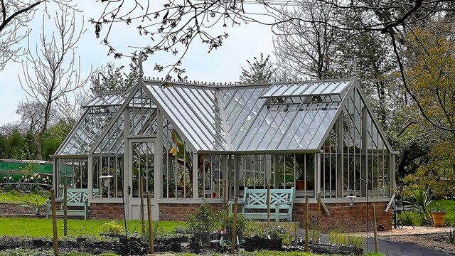
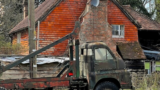
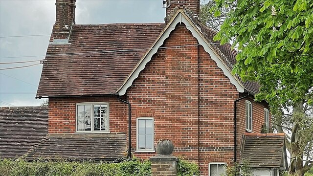
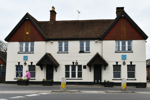
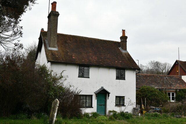
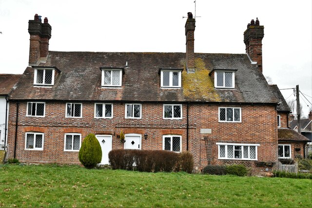
Cowfold is known for its picturesque rural setting, surrounded by rolling hills and farmland. The village itself has a charming and quintessentially English atmosphere, with a mix of historic buildings and modern amenities. The local community is close-knit and friendly, making it an appealing place to live or visit.

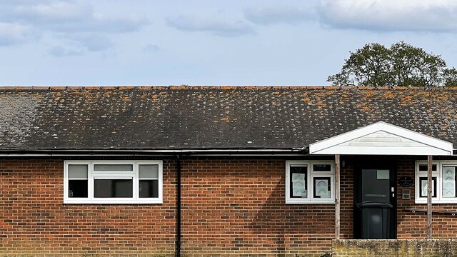
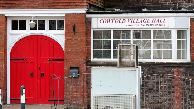
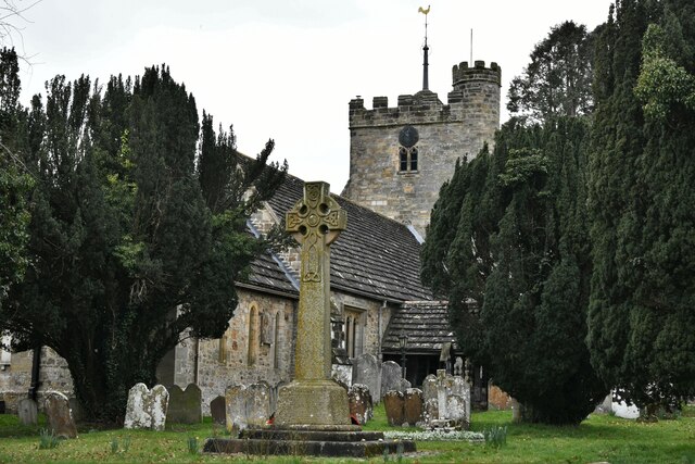
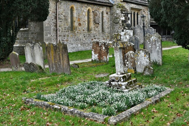
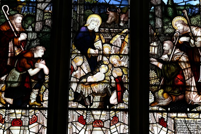
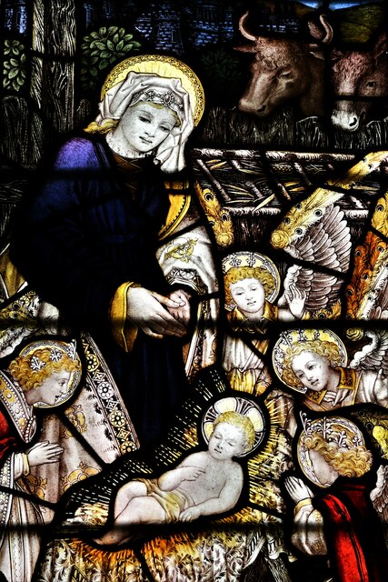
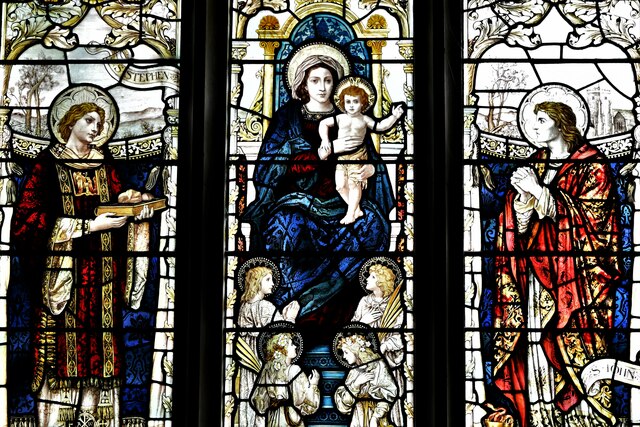
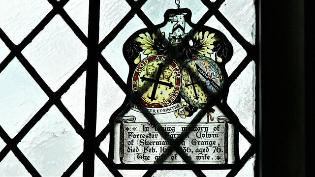
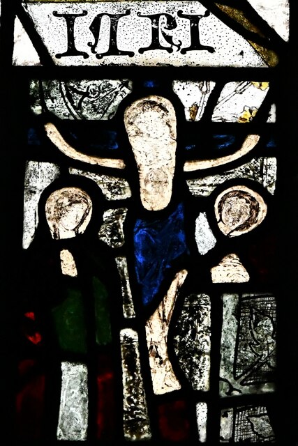
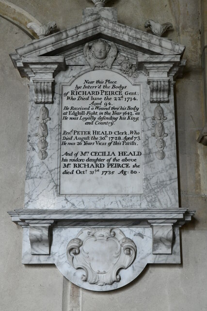
One of Cowfold's notable landmarks is the Holy Trinity Church, a Grade I listed building dating back to the 12th century. The church features stunning stained glass windows and a beautiful churchyard, adding to the village's historic character. Additionally, Cowfold has a primary school, a village hall, a pub, and a few small shops, providing essential services for residents.

The surrounding countryside offers plenty of opportunities for outdoor activities, including walking, cycling, and horse riding. Cowfold is also conveniently located near St Leonard's Forest and the South Downs National Park, both of which are popular destinations for nature enthusiasts.

In summary, Cowfold is a charming village in Sussex, offering a peaceful and picturesque setting, a close-knit community, and easy access to both rural and urban amenities.

If you have any feedback on the listing, please let us know in the comments section below.

Cowfold Images

Images are sourced within 2km of 50.989713/-0.272498 or Grid Reference TQ2122. Thanks to Geograph Open Source API. All images are credited.

Greenhouse near Pict's Farm
Ashurst Cottage There was also a derelict phone box hereabouts.
Ashurst Cottage
There was also a derelict phone box hereabouts.
Scout hut
Scout hut
Cowfold Village Hall
Oakfield Cottages
Oakfield Cottages
House on Burnthouse Lane According to the large-scale map this is called "Little Burnt House".
House on Burnthouse Lane
According to the large-scale map this is called "Little Burnt House".
Cowfold: The Street Co-op convenience store
Cowfold, St. Peter's Church: North eastern aspect
Cowfold: The Olde House
Cowfold, St. Peter's Church: North east part of the churchyard
Cowfold: Margaret Cottages
Cowfold, St. Peter's Church: Stained glass window 1
Cowfold, St. Peter's Church: Stained glass window 1 (detail)
Cowfold, St. Peter's Church: Stained glass window 2
Cowfold, St. Peter's Church: Stained glass window 3, memorial insert
Cowfold, St. Peter's Church: Stained glass window 4
Cowfold, St. Peter's Church: The Peirce and Heald memorial
Cowfold, St. Peter's Church: The Bruere Otter memorial
Show me another place!

Cowfold is located at Grid Ref: TQ2122 (Lat: 50.989713, Lng: -0.272498)

Administrative County: West Sussex

District: Horsham

Police Authority: Sussex

What 3 Words

///scare.wiggles.baguette. Near Cowfold, West Sussex

Related Wikis

Cowfold

Cowfold is a village and civil parish between Billingshurst and Haywards Heath in the Horsham District of West Sussex, England. The village is at the intersection...

St Hugh's Charterhouse

St Hugh's Charterhouse, Parkminster, is the only post-Reformation Carthusian monastery in the United Kingdom. It is located in the parish of Cowfold, West...

Crabtree, West Sussex

Crabtree is a hamlet in the parish of Lower Beeding and in Horsham District of West Sussex, England. It lies on the A281 road 4.4 miles (7.1 km) southeast...

West Grinstead railway station

West Grinstead was a railway station on the Steyning Line which served the village of West Grinstead. It had a goods yard with a cattle loading bay and...

Littleworth, West Sussex

Littleworth is a hamlet in the Horsham District of West Sussex, England. It lies on the Partridge Green to Maplehurst road 2.9 miles (4.7 km) north of...

Maplehurst, West Sussex

Maplehurst is a hamlet in the civil parish of Nuthurst, and the Horsham District of West Sussex, England. The hamlet is on the Copsale to Nuthurst road...

Henfield (electoral division)

Henfield is an electoral division of West Sussex in the United Kingdom and returns one member to sit on West Sussex County Council. The current County...

Shermanbury

Shermanbury is a village and civil parish in the Horsham District of West Sussex, England. It lies on the A281 road approximately 2 miles (3 km) north...

Nearby Amenities

Located within 500m of 50.989713,-0.272498
Mini Roundabout
Direction: clockwise
Lat/Long: 50.9906211/-0.2727909
Mini Roundabout
Direction: clockwise
Lat/Long: 50.9897995/-0.2725169
Crossing
Crossing: unmarked
Crossing Island: yes
Crossing Markings: no
Kerb: normal
Tactile Paving: incorrect
Lat/Long: 50.9899137/-0.2725684
Barrier: kissing_gate
Foot: yes
Lat/Long: 50.9882175/-0.2788992
Barrier: kissing_gate
Foot: yes
Lat/Long: 50.9882/-0.2768788
Bus Stop
Village Hall
Bench: no
Bin: no
Bus: yes
Lit: yes
Naptan AtcoCode: 4400HR0446
Naptan Bearing: S
Naptan CommonName: Village Hall
Naptan Indicator: o/s Village Hall
Naptan Landmark: A272
Naptan NaptanCode: wsxawjpd
Naptan ShortCommonName: Cowfold Hall
Naptan Street: A281
Naptan Verified: no
Public Transport: platform
Shelter: yes
Source: naptan_import
Tactile Paving: no
Lat/Long: 50.989211/-0.2724922
Bus Stop
Village Hall
Bench: yes
Bin: yes
Bus: yes
Lit: yes
Naptan AtcoCode: 4400HR0447
Naptan Bearing: N
Naptan CommonName: Village Hall
Naptan Indicator: adj St Peters Close
Naptan Landmark: A272
Naptan NaptanCode: wsxawjpg
Naptan ShortCommonName: Cowfold Hall
Naptan Street: A281
Naptan Verified: no
Public Transport: platform
Shelter: yes
Source: naptan_import
Tactile Paving: no
Lat/Long: 50.9887726/-0.2726509
Bus Stop
South Leas
Bench: no
Bin: no
Bus: yes
Naptan AtcoCode: 4400HR0448
Naptan Bearing: N
Naptan CommonName: South Leas
Naptan Indicator: o/s pub
Naptan Landmark: South Leas
Naptan NaptanCode: wsxawjpj
Naptan Street: A281
Naptan Verified: no
Public Transport: platform
Shelter: no
Source: naptan_import
Tactile Paving: no
Lat/Long: 50.9868411/-0.2730425
Bus Stop
South Leas
Bench: no
Bin: no
Bus: yes
Naptan AtcoCode: 4400HR0449
Naptan Bearing: S
Naptan CommonName: South Leas
Naptan Indicator: opp Woodfield Terrace
Naptan Landmark: South Leas
Naptan NaptanCode: wsxawjpm
Naptan Street: A281
Naptan Verified: no
Public Transport: platform
Shelter: no
Source: naptan_import
Tactile Paving: no
Lat/Long: 50.9862444/-0.2731865
Bus Stop
Sadlers Gallery
Bus: yes
Naptan AtcoCode: 4400HR0477
Naptan Bearing: W
Naptan CommonName: Sadlers Gallery
Naptan Indicator: o/s school
Naptan Landmark: A281
Naptan NaptanCode: wsxawmdp
Naptan Street: Station Road
Naptan Verified: no
Public Transport: platform
Source: naptan_import
Lat/Long: 50.9905857/-0.2754478
Crossing
Button Operated: yes
Crossing: traffic_signals
Crossing Island: yes
Crossing Ref: pelican
Tactile Paving: yes
Traffic Signals: pedestrian_crossing
Traffic Signals Sound: yes
Lat/Long: 50.9906409/-0.2755401
Noexit: yes
Lat/Long: 50.9883795/-0.2710548
Crossing
Crossing: unmarked
Crossing Island: yes
Crossing Markings: no
Kerb: lowered
Tactile Paving: yes
Lat/Long: 50.9896963/-0.2725753
Crossing
Crossing: unmarked
Crossing Island: yes
Crossing Markings: no
Kerb: lowered
Tactile Paving: yes
Lat/Long: 50.989527/-0.2720678
Crossing
Crossing: unmarked
Crossing Island: yes
Crossing Markings: no
Kerb: lowered
Tactile Paving: no
Lat/Long: 50.9906393/-0.2729757
Crossing
Crossing: unmarked
Crossing Island: yes
Crossing Markings: no
Kerb: lowered
Tactile Paving: no
Lat/Long: 50.9907181/-0.2727627
Crossing
Crossing: unmarked
Crossing Island: yes
Crossing Markings: no
Kerb: lowered
Tactile Paving: yes
Lat/Long: 50.9897437/-0.2722834
Crossing
Crossing: traffic_signals
Crossing Island: no
Kerb: lowered
Lat/Long: 50.9901275/-0.2726189
Crossing
Crossing: unmarked
Crossing Island: yes
Crossing Markings: no
Kerb: lowered
Tactile Paving: yes
Lat/Long: 50.9888347/-0.2705877
Crossing
Crossing: unmarked
Crossing Island: yes
Crossing Markings: no
Kerb: normal
Tactile Paving: no
Lat/Long: 50.9905099/-0.2727152
Crossing
Button Operated: yes
Crossing: traffic_signals
Crossing Island: yes
Crossing Ref: pelican
Tactile Paving: yes
Traffic Signals: pedestrian_crossing
Traffic Signals Sound: yes
Lat/Long: 50.9907513/-0.2754072
Cowfold
Is In: West Sussex, England, UK
Place: village
Wikidata: Q2465956
Lat/Long: 50.989701/-0.2719704
Defibrillator
Defibrillator Location: outside Cowfold Village Hall - down right hand side of building
Emergency: defibrillator
Indoor: no
Ref GB The Circuit: 8B2A6A04-1BA7-4267-A2DE-B12C010E0FC6
Lat/Long: 50.9895691/-0.2723172
Barrier: kissing_gate
Foot: yes
Lat/Long: 50.9898/-0.2750328
Post Box
Collection Times: Mo-Fr 09:00; Sa 07:00
Operator: Royal Mail
Operator Wikidata: Q638098
Post Box Type: lamp
Ref: RH13 214D
Royal Cypher: EIIR
Royal Cypher Wikidata: Q33102113
Lat/Long: 50.9909091/-0.2758759
Power: pole
Lat/Long: 50.9895974/-0.2765411
Power: pole
Lat/Long: 50.9887363/-0.2751383
Power: pole
Lat/Long: 50.988196/-0.276053
Power: pole
Lat/Long: 50.9876094/-0.2771104
Noexit: yes
Lat/Long: 50.9921518/-0.2691489
Noexit: yes
Lat/Long: 50.9907809/-0.2708593
Power: pole
Lat/Long: 50.9893645/-0.2740195
Noexit: yes
Lat/Long: 50.9895931/-0.2737212
Noexit: yes
Lat/Long: 50.9896115/-0.2731604
Noexit: yes
Lat/Long: 50.9893067/-0.2735057
Crossing
Lat/Long: 50.9898046/-0.2726781
Crossing
Crossing: unmarked
Crossing Island: yes
Crossing Markings: no
Kerb: lowered
Tactile Paving: yes
Lat/Long: 50.9892014/-0.2716783
Crossing
Crossing: unmarked
Crossing Island: no
Crossing Markings: no
Kerb: lowered
Tactile Paving: yes
Lat/Long: 50.9893217/-0.271722
Post Box
Collection Times: Mo-Fr 09:00; Sa 07:00
Operator: Royal Mail
Operator Wikidata: Q638098
Post Box Mounting: pier
Post Box Type: lamp
Ref: RH13 124D
Royal Cypher: EIIR
Royal Cypher Wikidata: Q33102113
Lat/Long: 50.9868573/-0.2730348
Post Box
Collection Times: Mo-Fr 16:30; Sa 09:30
Operator: Royal Mail
Operator Wikidata: Q638098
Post Box Type: pillar
Ref: RH13 14
Royal Cypher: EIIR
Royal Cypher Wikidata: Q33102113
Lat/Long: 50.9897765/-0.2721621
Traffic Signals
Traffic Signals: pedestrian_crossing
Traffic Signals Direction: forward
Lat/Long: 50.9901581/-0.2726249
Traffic Signals
Traffic Signals: pedestrian_crossing
Traffic Signals Direction: backward
Lat/Long: 50.9900991/-0.272614
Traffic Signals
Traffic Signals: pedestrian_crossing
Traffic Signals Direction: forward
Lat/Long: 50.9907583/-0.2754665
Traffic Signals
Traffic Signals: pedestrian_crossing
Traffic Signals Direction: forward
Lat/Long: 50.990633/-0.2754657
The data included in this document is from www.openstreetmap.org. The data is made available under ODbL.

Have you been to Cowfold?

Leave your review of Cowfold below (or comments, questions and feedback).