Bewdley

Civil Parish in Worcestershire Wyre Forest

England

Bewdley

Bewdley Bridge in 1987 The bridge carries the B4195 road over the River Severn. The large red brick house over the bridge on the left hand side stands in Severn Street South. The church tower is that of St Anne's.
Bewdley Bridge in 1987 Credit: John Baker

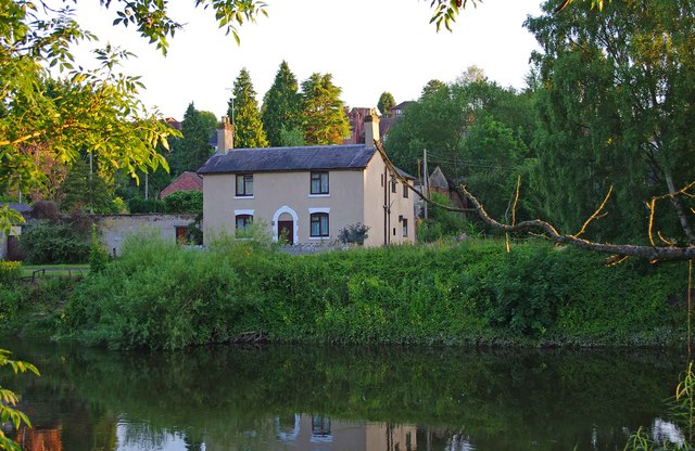
Bewdley is a civil parish located in the district of Wyre Forest in Worcestershire, England. Situated on the banks of the River Severn, it is a picturesque town with a rich history and stunning natural surroundings. The town has a population of around 9,900 people.

Bewdley has a long history dating back to the 13th century when it was granted a charter by King Edward IV. It was an important river port during the medieval period and played a significant role in the region's trade and commerce. Today, the town still retains its historic charm with many well-preserved buildings and narrow streets.

One of the notable landmarks in Bewdley is the Bewdley Bridge, which was built in the 18th century and is a Grade I listed structure. The town also boasts the Severn Valley Railway, a heritage railway that attracts thousands of visitors each year.

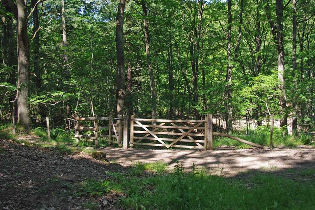
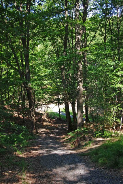
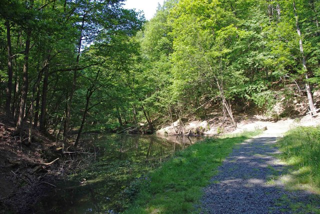
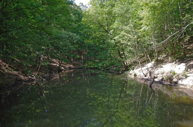
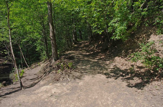
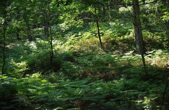
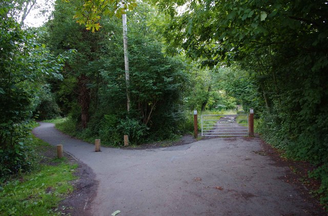
Nature lovers will appreciate Bewdley's proximity to the Wyre Forest, one of the largest ancient woodlands in England. The forest offers numerous walking and cycling trails, making it a popular destination for outdoor enthusiasts.

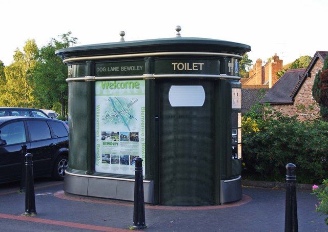
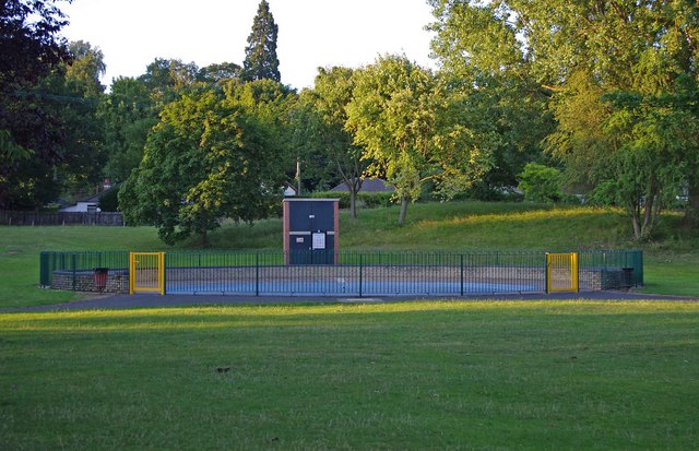
Bewdley also hosts various events and festivals throughout the year, including the Bewdley Festival, which showcases music, literature, and arts. The town has a vibrant community with a range of amenities, including shops, restaurants, and pubs.

Overall, Bewdley is a charming town with a rich history, stunning natural beauty, and a thriving community. It offers a perfect blend of heritage, culture, and outdoor activities for residents and visitors alike.

If you have any feedback on the listing, please let us know in the comments section below.

Bewdley Images

Images are sourced within 2km of 52.37316/-2.343687 or Grid Reference SO7675. Thanks to Geograph Open Source API. All images are credited.

Bewdley Bridge in 1987 The bridge carries the B4195 road over the River Severn. The large red brick house over the bridge on the left hand side stands in Severn Street South. The church tower is that of St Anne's.
Bewdley Bridge in 1987
The bridge carries the B4195 road over the River Severn. The large red brick house over the bridge on the left hand side stands in Severn Street South. The church tower is that of St Anne's.
2 new houses, Bewdley
Riverside Caravan Park, Bewdley
Car park off Dry Mill Lane This is a new car park for people walking in the Wyre Forest and is the recommended car park for visitors to Knowles Mill. A fellow collaborator has kindly confirmed my position and view direction.
Car park off Dry Mill Lane
This is a new car park for people walking in the Wyre Forest and is the recommended car park for visitors to Knowles Mill. A fellow collaborator has kindly confirmed my position and view direction.
Knowles Mill Preserved derelict flour mill on the Dowles Brook in the Wyre Forest. The remains of the overshot waterwheel are behind the curved wall in the foreground and the tail race is in a tunnel.
Knowles Mill
Preserved derelict flour mill on the Dowles Brook in the Wyre Forest. The remains of the overshot waterwheel are behind the curved wall in the foreground and the tail race is in a tunnel.
Knowles Mill - the remains of the waterwheel This was an overshot waterwheel with the leat coming in at high level on the left and the portal of the tail race tunnel visible to the right.
Knowles Mill - the remains of the waterwheel
This was an overshot waterwheel with the leat coming in at high level on the left and the portal of the tail race tunnel visible to the right.
Knowles Mill - machinery A nineteenth century watermill that went out of use in 1891 when it was damaged by a flood following a big freeze. It is the only recognisable mill in the Wyre Forest.

This somewhat sharpened (really!) shot shows the pit wheel, wallower, great spur wheel and crown wheel. There is a surviving stone nut and quant on the right with a bed stone on the floor above. The other stone nut and the other stones have gone. There is a fragmented French burr stone on the ground inside.
Knowles Mill - machinery
A nineteenth century watermill that went out of use in 1891 when it was damaged by a flood following a big freeze. It is the only recognisable mill in the Wyre Forest. This somewhat sharpened (really!) shot shows the pit wheel, wallower, great spur wheel and crown wheel. There is a surviving stone nut and quant on the right with a bed stone on the floor above. The other stone nut and the other stones have gone. There is a fragmented French burr stone on the ground inside.
Knowles Mill Nineteenth century watermill that has been out of use since 1891 and is now preserved by the National Trust. The bridge in the foreground crosses the Dowles Brook.
Knowles Mill
Nineteenth century watermill that has been out of use since 1891 and is now preserved by the National Trust. The bridge in the foreground crosses the Dowles Brook.
Gated entrance to track in Wyre Forest near Bewdley There is both a kissing gate here, and a gate wide enough to let a vehicle pass through. On the other side is a track, with a rough stone surface, which makes a steep descent down to a pond and a steam.

<a href="https://www.geograph.org.uk/photo/2487006">SO7676 : Track to pond in Wyre Forest, near Bewdley</a>.
<a href="https://www.geograph.org.uk/photo/2487032">SO7676 : Pond and track in the Wyre Forest near Bewdley</a>.
Gated entrance to track in Wyre Forest near Bewdley
There is both a kissing gate here, and a gate wide enough to let a vehicle pass through. On the other side is a track, with a rough stone surface, which makes a steep descent down to a pond and a steam. SO7676 : Track to pond in Wyre Forest, near Bewdley. SO7676 : Pond and track in the Wyre Forest near Bewdley.
Track to pond in Wyre Forest, near Bewdley The pond is at the bottom of the track, but not visible in this photograph.

<a href="https://www.geograph.org.uk/photo/2486986">SO7676 : Gated entrance to track in Wyre Forest near Bewdley</a>.
<a href="https://www.geograph.org.uk/photo/2487032">SO7676 : Pond and track in the Wyre Forest near Bewdley</a>.
Track to pond in Wyre Forest, near Bewdley
The pond is at the bottom of the track, but not visible in this photograph. SO7676 : Gated entrance to track in Wyre Forest near Bewdley. SO7676 : Pond and track in the Wyre Forest near Bewdley.
Pond and track in the Wyre Forest near Bewdley The pond is on the left but difficult to see, as its surface is reflecting the trees which hang overhead. It is one of several which are linked by a small stream, and appears to be either artificial or enlarged from the original.

<a href="https://www.geograph.org.uk/photo/2486986">SO7676 : Gated entrance to track in Wyre Forest near Bewdley</a>.
<a href="https://www.geograph.org.uk/photo/2487006">SO7676 : Track to pond in Wyre Forest, near Bewdley</a>.
<a href="https://www.geograph.org.uk/photo/2487054">SO7676 : Pond in Wyre Forest near Bewdley</a>.
Pond and track in the Wyre Forest near Bewdley
The pond is on the left but difficult to see, as its surface is reflecting the trees which hang overhead. It is one of several which are linked by a small stream, and appears to be either artificial or enlarged from the original. SO7676 : Gated entrance to track in Wyre Forest near Bewdley. SO7676 : Track to pond in Wyre Forest, near Bewdley. SO7676 : Pond in Wyre Forest near Bewdley.
Pond in Wyre Forest near Bewdley The pond may be artificial or artificially enlarged. It lies on a stream which runs through the forest.

<a href="https://www.geograph.org.uk/photo/2487032">SO7676 : Pond and track in the Wyre Forest near Bewdley</a>.
Pond in Wyre Forest near Bewdley
The pond may be artificial or artificially enlarged. It lies on a stream which runs through the forest. SO7676 : Pond and track in the Wyre Forest near Bewdley.
Junction of two paths in the Wyre Forest near Bewdley The lower path runs alongside a pond. The other path climbs steeply.

<a href="https://www.geograph.org.uk/photo/2487054">SO7676 : Pond in Wyre Forest near Bewdley</a>.
Junction of two paths in the Wyre Forest near Bewdley
The lower path runs alongside a pond. The other path climbs steeply. SO7676 : Pond in Wyre Forest near Bewdley.
Ferns in the Wyre Forest near Bewdley Ferns were flourishing in this area.
Ferns in the Wyre Forest near Bewdley
Ferns were flourishing in this area.
Public convenience, Dog Lane Car Park, Bewdley This is one of the modern type of pay to enter public conveniences, where you have various buttons to press, and the fear that making the wrong choice will result in a minor disaster.
Public convenience, Dog Lane Car Park, Bewdley
This is one of the modern type of pay to enter public conveniences, where you have various buttons to press, and the fear that making the wrong choice will result in a minor disaster.
Junction of paths, River Side North, Bewdley The path on the left runs near to the bank of the River Severn, and it also forms part of the Severn Way, a long distance footpath. The signs on the gateposts on the right, warn dog owners to remove dog waste.
Junction of paths, River Side North, Bewdley
The path on the left runs near to the bank of the River Severn, and it also forms part of the Severn Way, a long distance footpath. The signs on the gateposts on the right, warn dog owners to remove dog waste.
Children's paddling pool near River Severn, Bewdley The children's paddling pool is on the Wribbenhall side of the river, and is part of a children's play area, which includes other facilities. It forms part of Bewdley's Riverside Meadows, which are to be found on both sides of the river.

<a href="https://www.geograph.org.uk/photo/2500078">SO7875 : Recreation area by River Severn, Bewdley</a>.
Children's paddling pool near River Severn, Bewdley
The children's paddling pool is on the Wribbenhall side of the river, and is part of a children's play area, which includes other facilities. It forms part of Bewdley's Riverside Meadows, which are to be found on both sides of the river. SO7875 : Recreation area by River Severn, Bewdley.
Old house by the River Severn, Bewdley A public footpath runs in front of the house, but this photograph was taken from the Severn Way, which runs along the opposite bank of the river.
Old house by the River Severn, Bewdley
A public footpath runs in front of the house, but this photograph was taken from the Severn Way, which runs along the opposite bank of the river.
Show me another place!

Bewdley is located at Grid Ref: SO7675 (Lat: 52.37316, Lng: -2.343687)

Administrative County: Worcestershire

District: Wyre Forest

Police Authority: West Mercia

What 3 Words

///resembles.inspector.supporter. Near Bewdley, Worcestershire

Related Wikis

A456 road

Known as the Hagley Road in Birmingham, the A456 is a main road in England running between Central Birmingham and Woofferton, Shropshire, south of Ludlow...
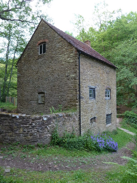
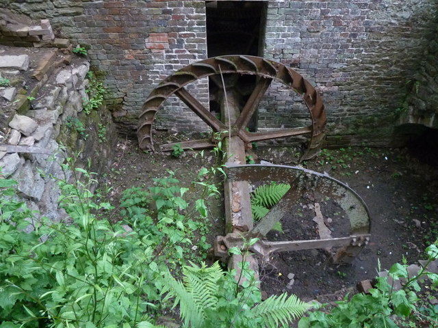
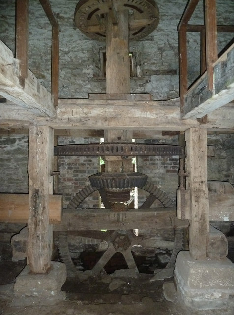
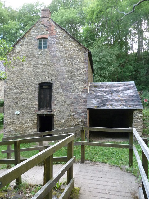
Knowles Mill

Knowles Mill is the remains of an eighteenth-century water-powered grain mill, located in the Wyre Forest in Worcestershire, England. The mill has been...

Dowles

Dowles is a hamlet in the civil parish of Upper Arley, in the Wyre Forest district, in the county of Worcestershire, England. It is about 3 miles from...

Tickenhill Palace

Tickenhill Palace (also known as Tickenhill House or Tickenhall Manor) is a historic building in Bewdley, Worcestershire, England. It is a grade II* listed...

Nearby Amenities

Located within 500m of 52.37316,-2.343687
Building: yes
Lat/Long: 52.3757078/-2.3427205
Building: yes
Lat/Long: 52.3735463/-2.340961
Restaurant
The Rustic Kitchen
Addr City: Bewdley
Addr Postcode: DY12 2QL
Addr Street: Cleobury Road
Brewery: yes
Cuisine: pizza;burger
Diet Gluten Free: yes
Diet Lactose Free: yes
Diet Meat: yes
Diet Non-vegetarian: yes
Diet Vegan: yes
Diet Vegetarian: yes
Internet Access: wlan
Opening Hours: We-Sa 16:00-22:00; Su 12:00-18:00
Outdoor Seating: yes
Phone: +44 1299 401004
Reservation: yes
Smoking: outside
Takeaway: yes
Website: https://hopleyscamping.co.uk/rustic/
Lat/Long: 52.3700466/-2.3400185
Hopley's Farm Shop
Addr City: Bewdley
Addr Postcode: DY12 2QL
Addr Street: Cleobury Road
Opening Hours: Mo-Sa 08:00-18:00; Su 10:00-16:00
Operator: Hopley's Farm Shop
Shop: farm
Wheelchair: yes
Lat/Long: 52.3700281/-2.3390973
The data included in this document is from www.openstreetmap.org. The data is made available under ODbL.

Have you been to Bewdley?

Leave your review of Bewdley below (or comments, questions and feedback).