Bewerley

Civil Parish in Yorkshire Harrogate

England

Bewerley

Greenhow Hill Top Greenhow Hill Top, the highest point around here at about 1390ft. The fence in the foreground surrounds the old East Engine Shaft which was sunk onto Banks Vein of the Sunside Lead Mines.
Greenhow Hill Top Credit: Malcolm Street

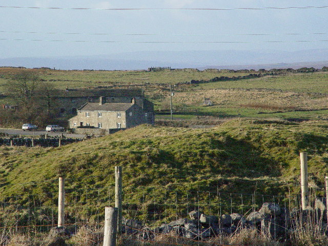
Bewerley is a charming civil parish located in the district of Harrogate, in the county of Yorkshire, England. Situated in the picturesque Nidderdale valley, Bewerley is surrounded by stunning natural beauty and offers a peaceful and idyllic setting.

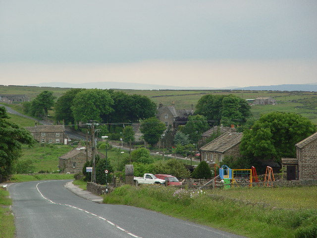
The village itself is small, with a population of around 300 residents. Its history can be traced back to medieval times, and it retains a traditional and quaint character. The parish includes the hamlets of Greenhow, How Stean, and Middlesmoor, each adding to the rural charm of the area.

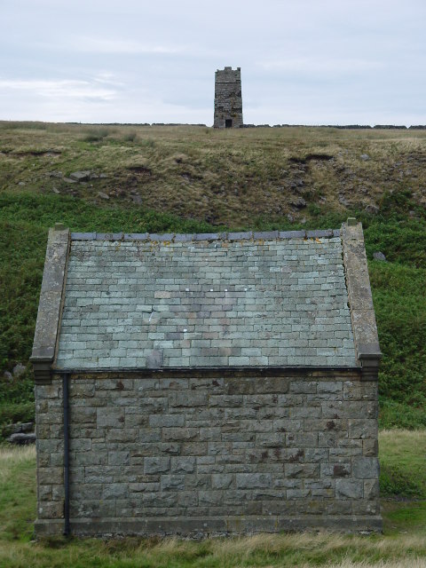
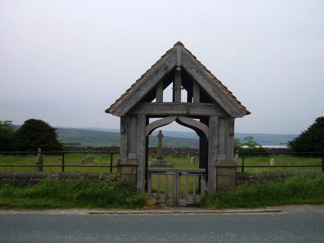
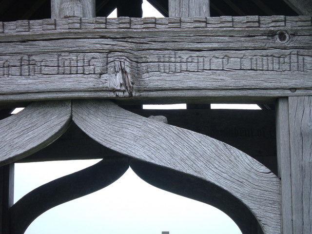
Bewerley boasts a rich heritage, with several historic landmarks and buildings. St Mary's Church, a Grade II listed structure, dates back to the 12th century and is a notable feature. The Bewerley Grange Chapel, a former monastery, is another fascinating piece of history.

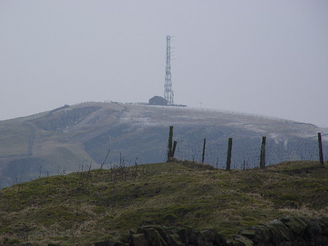
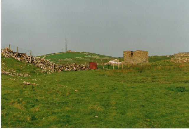
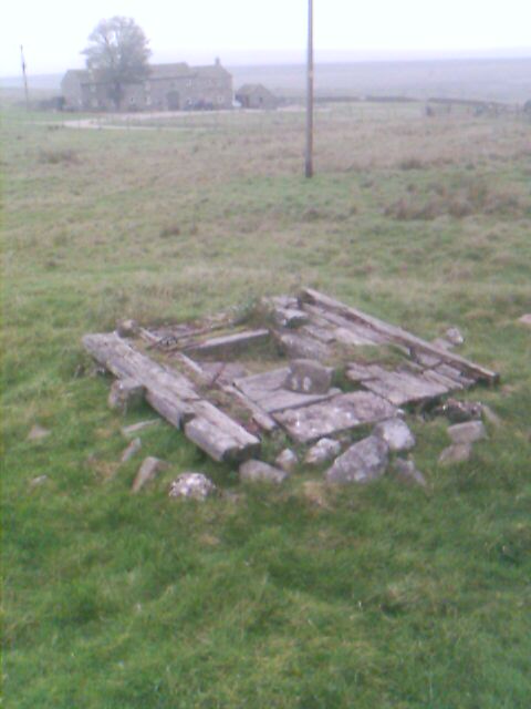
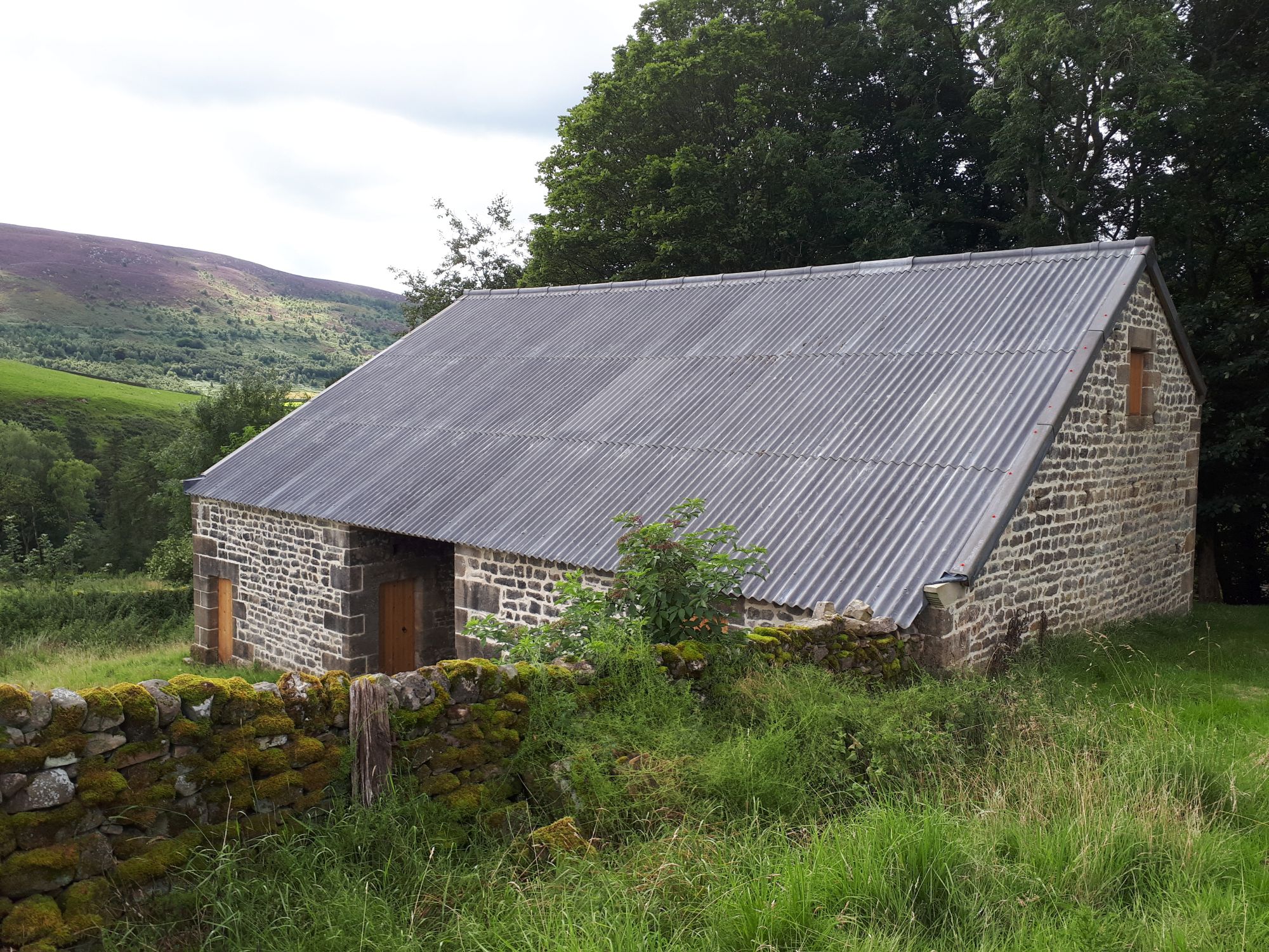
The area is renowned for its scenic beauty, with the Nidderdale Area of Outstanding Natural Beauty encompassing the village. The rolling hills, meandering rivers, and lush green fields provide ample opportunities for outdoor activities such as hiking, cycling, and wildlife spotting.

Despite its small size, Bewerley offers amenities for its residents and visitors. There is a local village hall, a primary school, and a traditional pub serving hearty Yorkshire meals. The nearby town of Pateley Bridge provides additional services, including shops, cafes, and a weekly market.

In conclusion, Bewerley is a charming and historic civil parish nestled in the beautiful Yorkshire countryside. With its rich heritage, stunning landscapes, and welcoming community, it is a hidden gem for those seeking a peaceful retreat.

If you have any feedback on the listing, please let us know in the comments section below.

Bewerley Images

Images are sourced within 2km of 54.071978/-1.843434 or Grid Reference SE1064. Thanks to Geograph Open Source API. All images are credited.

Greenhow Hill Top Greenhow Hill Top, the highest point around here at about 1390ft. The fence in the foreground surrounds the old East Engine Shaft which was sunk onto Banks Vein of the Sunside Lead Mines.
Greenhow Hill Top
Greenhow Hill Top, the highest point around here at about 1390ft. The fence in the foreground surrounds the old East Engine Shaft which was sunk onto Banks Vein of the Sunside Lead Mines.
Greenhow Village Named after the hill it sits under. Green - because this is a limestone area, the alkaline soil seems to produce very green grass.
Greenhow Village
Named after the hill it sits under. Green - because this is a limestone area, the alkaline soil seems to produce very green grass.
Surveying Tower, Hardcastle Moor The surveying tower was used in the driving of the aqueduct tunnel under Greenhow Hill abt 1900. The tunnel is part of a long aqueduct from Scar House Reservoir to Bradford. In the foreground is No1 Well Shaft, one of 3 access points in the tunnel which is 3.5 miles long and reaches its greatest depth below the ground surface at No2 Shaft, Craven Cross, Greenhow, where it is 600 feet down. This is deeper than any of the mines reached. For further information see <span class="nowrap"><a title="http://www.greenhow-hill.org.uk/mining/bcww.html" rel="nofollow ugc noopener" href="http://www.greenhow-hill.org.uk/mining/bcww.html">Link</a><img style="margin-left:2px;" alt="External link" title="External link - shift click to open in new window" src="https://s1.geograph.org.uk/img/external.png" width="10" height="10"/></span>
Surveying Tower, Hardcastle Moor
The surveying tower was used in the driving of the aqueduct tunnel under Greenhow Hill abt 1900. The tunnel is part of a long aqueduct from Scar House Reservoir to Bradford. In the foreground is No1 Well Shaft, one of 3 access points in the tunnel which is 3.5 miles long and reaches its greatest depth below the ground surface at No2 Shaft, Craven Cross, Greenhow, where it is 600 feet down. This is deeper than any of the mines reached. For further information see LinkExternal link
Craven Cross, Greenhow The square building in the middle surrounds No2 Shaft, sunk by Bradford Corporation Water Works abt 1900 as they drove the 3.5 mile long aqueduct tunnel under the hill. The depth to the tunnel from the surface is about 400 feet at this point
Craven Cross, Greenhow
The square building in the middle surrounds No2 Shaft, sunk by Bradford Corporation Water Works abt 1900 as they drove the 3.5 mile long aqueduct tunnel under the hill. The depth to the tunnel from the surface is about 400 feet at this point
Lily Green, Greenhow The mound in the foreground is an old mine shaft for the Prim or Prime Gap Vein which was worked for lead.
Lily Green, Greenhow
The mound in the foreground is an old mine shaft for the Prim or Prime Gap Vein which was worked for lead.
Mouseman lychgate at Greenhow Covered entry in carved oak to a small roadside cemetery about 1/2 mile outside of the village of Greenhow.  There are two carved "mice" in the curved trusses and following Biblical quotes on the outer and inner lintels:-
"I will lift up mine eyes unto the hills, from whence cometh my help."

"The sun shall not burn you by day, neither the moon by night"
Mouseman lychgate at Greenhow
Covered entry in carved oak to a small roadside cemetery about 1/2 mile outside of the village of Greenhow. There are two carved "mice" in the curved trusses and following Biblical quotes on the outer and inner lintels:- "I will lift up mine eyes unto the hills, from whence cometh my help." "The sun shall not burn you by day, neither the moon by night"
Mouseman mouse Detail of carving on Greenhow cemetery lychgate.
Mouseman mouse
Detail of carving on Greenhow cemetery lychgate.
Chimney Shaft, Greenhow Cover of a 300 ft mine shaft. In M C Gill's book there are photographs of a steam boiler underground below this point taken 30 years ago.
Chimney Shaft, Greenhow
Cover of a 300 ft mine shaft. In M C Gill's book there are photographs of a steam boiler underground below this point taken 30 years ago.
Greenhow Taken when travelling towards Grassington
Greenhow
Taken when travelling towards Grassington
Ford at Branstone Beck
House in Greenhow by the B6265 road
Ruined sheepfold on Catherine or Kitty White's Allotments A badly ruined sheepfold in the middle of the moor.  Some evidence of old peat cuttings nearby to the south east.
Ruined sheepfold on Catherine or Kitty White's Allotments
A badly ruined sheepfold in the middle of the moor. Some evidence of old peat cuttings nearby to the south east.
Round Hill Shooting Box
Round Hill Swamp from Hollin Crags
Hollin Crags gritstone outcrop
Ravenstone Moor Snow is approaching from the north.
Ravenstone Moor
Snow is approaching from the north.
Jackass Level Gets its name from its size, as "only a jackass could get in - rather than a pony". Pick marks can be seen at the entrance.
Jackass Level
Gets its name from its size, as "only a jackass could get in - rather than a pony". Pick marks can be seen at the entrance.
Cockhill Level This level goes South South East for about 300 yards, where it forks West, passing under Chimney Shaft (see photo) and South East, passing under the Miners Arms Pub.
Cockhill Level
This level goes South South East for about 300 yards, where it forks West, passing under Chimney Shaft (see photo) and South East, passing under the Miners Arms Pub.
Show me another place!

Bewerley is located at Grid Ref: SE1064 (Lat: 54.071978, Lng: -1.843434)

Division: West Riding

Administrative County: North Yorkshire

District: Harrogate

Police Authority: North Yorkshire

What 3 Words

///gladiator.fattening.blanked. Near Pateley Bridge, North Yorkshire

Related Wikis

Greenhow

Greenhow is a village in North Yorkshire, England, often referred to as Greenhow Hill. The term how derives from the Old Norse word haugr meaning a hill...

Stump Cross Caverns

Stump Cross Caverns is a limestone cave system between Wharfedale and Nidderdale in North Yorkshire, England. == Geography == The caverns at Stump Cross...

Trollers Gill

Trollers Gill is a limestone gill or gorge in North Yorkshire, England, close to the village of Skyreholme and 4.7 miles (7.5 km) south-east of Grassington...

Henry Simpson's Barn

Henry Simpson's Barn is a historic building in Appletreewick, a village in North Yorkshire in England. The barn was constructed in 1737, on the estate...

Nearby Amenities

Located within 500m of 54.071978,-1.843434
Historic: mine_shaft
Mineral: lead
Source: Bing
Lat/Long: 54.0728021/-1.8373132
Historic: mine_shaft
Mineral: lead
Source: Bing
Lat/Long: 54.0733277/-1.8371941
Historic: mine_shaft
Mineral: lead
Source: Bing
Lat/Long: 54.0734253/-1.8374098
Historic: mine_shaft
Mineral: lead
Source: Bing
Lat/Long: 54.0736617/-1.8369581
Historic: mine_shaft
Mineral: lead
Source: Bing
Lat/Long: 54.0731467/-1.836935
Historic: mine_shaft
Mineral: lead
Source: Bing
Lat/Long: 54.0731687/-1.836699
Historic: mine_shaft
Mineral: lead
Source: Bing
Lat/Long: 54.0735052/-1.8371521
Historic: mine_shaft
Mineral: lead
Source: Bing
Lat/Long: 54.072097/-1.8367822
Historic: mine_shaft
Mineral: lead
Source: Bing
Lat/Long: 54.071156/-1.8379229
Historic: mine_shaft
Mineral: lead
Source: Bing
Lat/Long: 54.0738234/-1.8369028
Historic: mine_shaft
Mineral: lead
Source: Bing
Lat/Long: 54.0735291/-1.836647
Historic: mine_shaft
Mineral: lead
Source: Bing
Lat/Long: 54.0704603/-1.83766
Historic: mine_shaft
Mineral: lead
Source: Bing
Lat/Long: 54.0729566/-1.8372156
Historic: mine_shaft
Mineral: lead
Source: Bing
Lat/Long: 54.0726163/-1.8378282
Historic: mine_shaft
Source: Bing
Lat/Long: 54.0715371/-1.8479114
Historic: mine_shaft
Source: Bing
Lat/Long: 54.0718581/-1.848083
Historic: mine_shaft
Source: Bing
Lat/Long: 54.0722201/-1.8481903
Historic: mine_shaft
Source: Bing
Lat/Long: 54.0720187/-1.8470589
Historic: mine_shaft
Source: Bing
Lat/Long: 54.0725727/-1.8504541
Historic: mine_shaft
Source: Bing
Lat/Long: 54.0711057/-1.8497513
Historic: mine_shaft
Source: Bing
Lat/Long: 54.0711657/-1.8488555
Historic: mine_shaft
Source: Bing
Lat/Long: 54.0712412/-1.8494295
Historic: mine_shaft
Source: Bing
Lat/Long: 54.0707879/-1.8503468
Historic: mine_shaft
Source: Bing
Lat/Long: 54.0723113/-1.8487375
Historic: mine_shaft
Source: Bing
Lat/Long: 54.0727175/-1.8505238
Historic: mine_shaft
Source: Bing
Lat/Long: 54.0733186/-1.8505828
Historic: mine_shaft
Mineral: lead
Source: Bing
Lat/Long: 54.0707439/-1.8365018
Historic: mine_shaft
Mineral: lead
Source: Bing
Lat/Long: 54.0722294/-1.8373298
Historic: mine_shaft
Mineral: lead
Source: Bing
Lat/Long: 54.0720248/-1.8369972
Post Box
Post Box Mounting: wooden_post
Post Box Type: lamp
Ref: HG3 237
Royal Cypher: EIIR
Royal Cypher Wikidata: Q33102113
Source: survey
Lat/Long: 54.0703258/-1.8404051
Historic: mine_shaft
Source: Bing
Lat/Long: 54.0699691/-1.8389496
Historic: mine_shaft
Source: Bing
Lat/Long: 54.069637/-1.838904
Historic: mine_shaft
Source: Bing
Lat/Long: 54.0712115/-1.8468448
Historic: mine_shaft
Source: Bing
Lat/Long: 54.0694435/-1.838912
Historic: mine_shaft
Source: Bing
Lat/Long: 54.0697929/-1.8389442
Golden Fleece Mine
Historic: mine
Mineral: lead
Source: Northern Mine Research Society;OS 1854 sheet 135
Lat/Long: 54.0716807/-1.8503508
Historic: mine_shaft
Mineral: lead
Source: Bing
Lat/Long: 54.0718876/-1.8376138
Historic: mine_shaft
Mineral: lead
Source: OS 1854
Source Mineral: OS 1854
Lat/Long: 54.0711981/-1.8445802
Historic: mine_shaft
Mineral: lead
Source: OS 1854
Source Mineral: OS 1854
Lat/Long: 54.0710659/-1.8444622
Historic: mine_shaft
Mineral: lead
Source: OS 1854
Source Mineral: OS 1854
Lat/Long: 54.0710423/-1.8447508
Historic: mine_shaft
Mineral: lead
Source: OS 1854
Source Mineral: OS 1854
Lat/Long: 54.0711855/-1.8443978
old lead mines
Historic: mine
Mineral: lead
Source: npe
Lat/Long: 54.0706625/-1.8482197
Historic: mine_shaft
Source: Bing
Lat/Long: 54.0703921/-1.8492497
Historic: mine_shaft
Source: Bing
Lat/Long: 54.0700962/-1.8492712
Historic: mine_shaft
Source: Bing
Lat/Long: 54.0698022/-1.849316
Historic: mine_shaft
Source: Bing
Lat/Long: 54.0695441/-1.8486187
Historic: mine_shaft
Source: Bing
Lat/Long: 54.0706518/-1.8489298
Historic: mine_shaft
Source: Bing
Lat/Long: 54.0704881/-1.8492946
Historic: mine_shaft
Source: Bing
Lat/Long: 54.070387/-1.8496486
Historic: mine_shaft
Source: Bing
Lat/Long: 54.0686246/-1.8483505
Historic: mine_shaft
Source: Bing
Lat/Long: 54.0704629/-1.8493912
Historic: mine_shaft
Source: Bing
Lat/Long: 54.0703811/-1.8497559
Historic: mine_shaft
Source: Bing
Lat/Long: 54.0693741/-1.8479428
Historic: mine_shaft
Source: Bing
Lat/Long: 54.0699715/-1.8475565
Historic: mine_shaft
Source: Bing
Lat/Long: 54.07045/-1.8494555
Historic: mine_shaft
Source: Bing
Lat/Long: 54.07011/-1.8484256
Historic: mine_shaft
Source: Bing
Lat/Long: 54.0704248/-1.8495521
Historic: mine_shaft
Source: Bing
Lat/Long: 54.0699029/-1.849359
Historic: mine_shaft
Source: Bing
Lat/Long: 54.0702204/-1.8485543
Historic: mine_shaft
Source: Bing
Lat/Long: 54.0704092/-1.8490156
Historic: mine_shaft
Mineral: lead
Source: Bing
Lat/Long: 54.0735227/-1.8369807
Historic: mine_shaft
Mineral: lead
Source: Bing
Lat/Long: 54.073573/-1.8371738
Historic: mine_shaft
Mineral: lead
Source: Bing
Lat/Long: 54.073455/-1.8373267
Post Box
Ref: HG3 237
Lat/Long: 54.0703579/-1.8403808
Power: pole
Lat/Long: 54.0724111/-1.8362898
Power: pole
Lat/Long: 54.0722098/-1.8369367
Power: pole
Lat/Long: 54.071947/-1.837759
Power: pole
Lat/Long: 54.0715137/-1.8391758
Power: pole
Lat/Long: 54.0712447/-1.8405796
Power: pole
Lat/Long: 54.0710311/-1.8417188
Power: pole
Lat/Long: 54.0713369/-1.8431539
Power: pole
Lat/Long: 54.0707084/-1.8412159
Power: pole
Lat/Long: 54.0704334/-1.8407184
Power: pole
Lat/Long: 54.0702367/-1.8404093
Power: pole
Lat/Long: 54.0695912/-1.839443
Power: pole
Lat/Long: 54.0693377/-1.8389768
The data included in this document is from www.openstreetmap.org. The data is made available under ODbL.

Have you been to Bewerley?

Leave your review of Bewerley below (or comments, questions and feedback).